Flight: 99-003-03
Date: April 30, 1999
Aircraft: DOE B-200 Kingair
Deployment: Baja 1999
Flight Location: Tres Virgenes, Baja Mexico
Principal Investigator: Stock (JPL)
Additional Sensors: RC-30 (CIR)
|
Data Evaluation
Navigation data gap affecting flight lines 9-26.
Liquid Nitrogen depletion in Port 3 (channels 26-40) affecting flight lines 30-33.
|
Processing Information
Level-1B Data in HDF format is available
Flight Line Summary
Spectral Band Configuration
Spectral Response Function Table
Spectral Response Function (text)
|
Browse Imagery
Flight Tracks: 33
Scanlines: 184049
|
Browse Imagery Table
|
Click a Flight Track number to view a quicklook image
Lat/Lon ranges are for the BEG-END scanline nadir pixels
|
Flight
Track |
Time Span
(UTC) |
Heading
(Deg) |
Lat Range
(Deg N) |
Lon Range
(Deg W) |
Length
(Scanlines) |
Altitude
(Meters) |
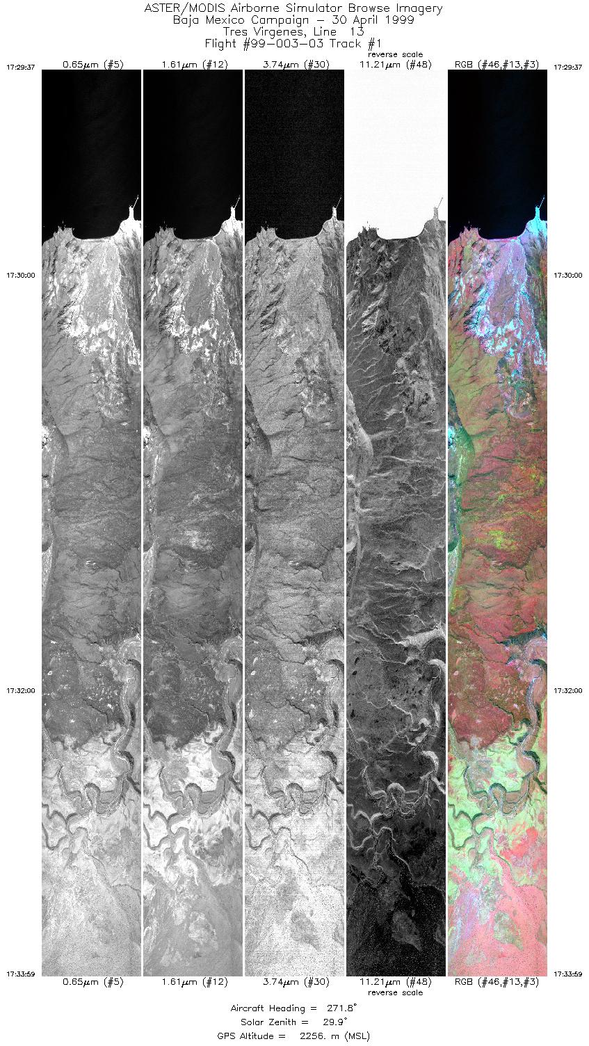
| 1 |
17:29 - 17:33 |
271.8 |
27.450 - 27.450 |
112.281 - 112.500 |
6518 |
2256 |
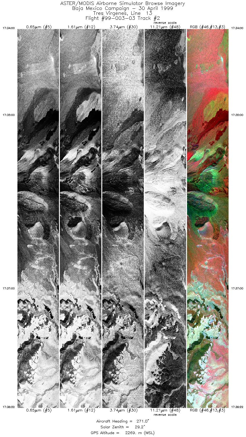
| 2 |
17:34 - 17:38 |
271.1 |
27.450 - 27.450 |
112.501 - 112.721 |
6520 |
2269 |
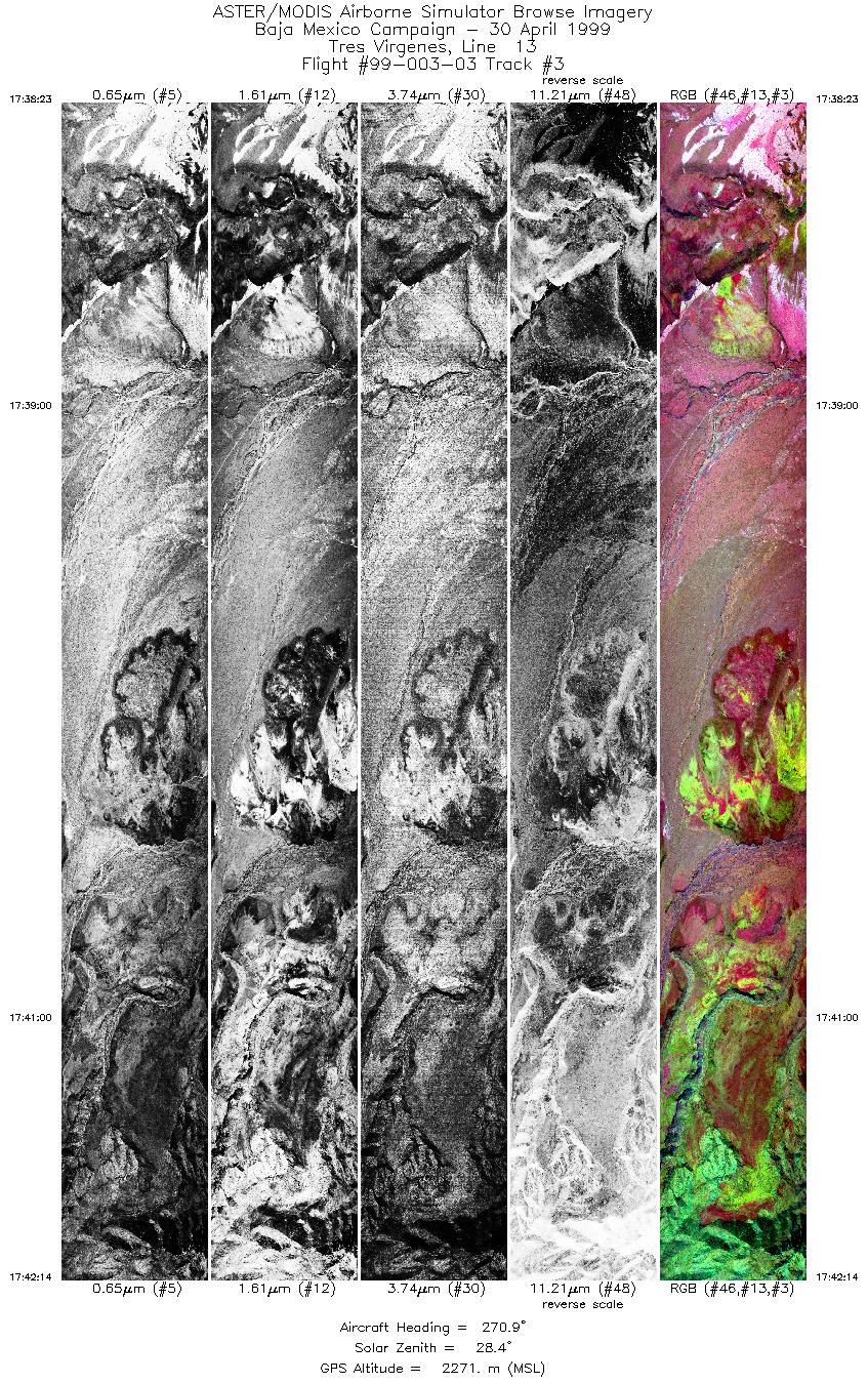
| 3 |
17:38 - 17:42 |
270.8 |
27.450 - 27.450 |
112.722 - 112.917 |
5747 |
2271 |
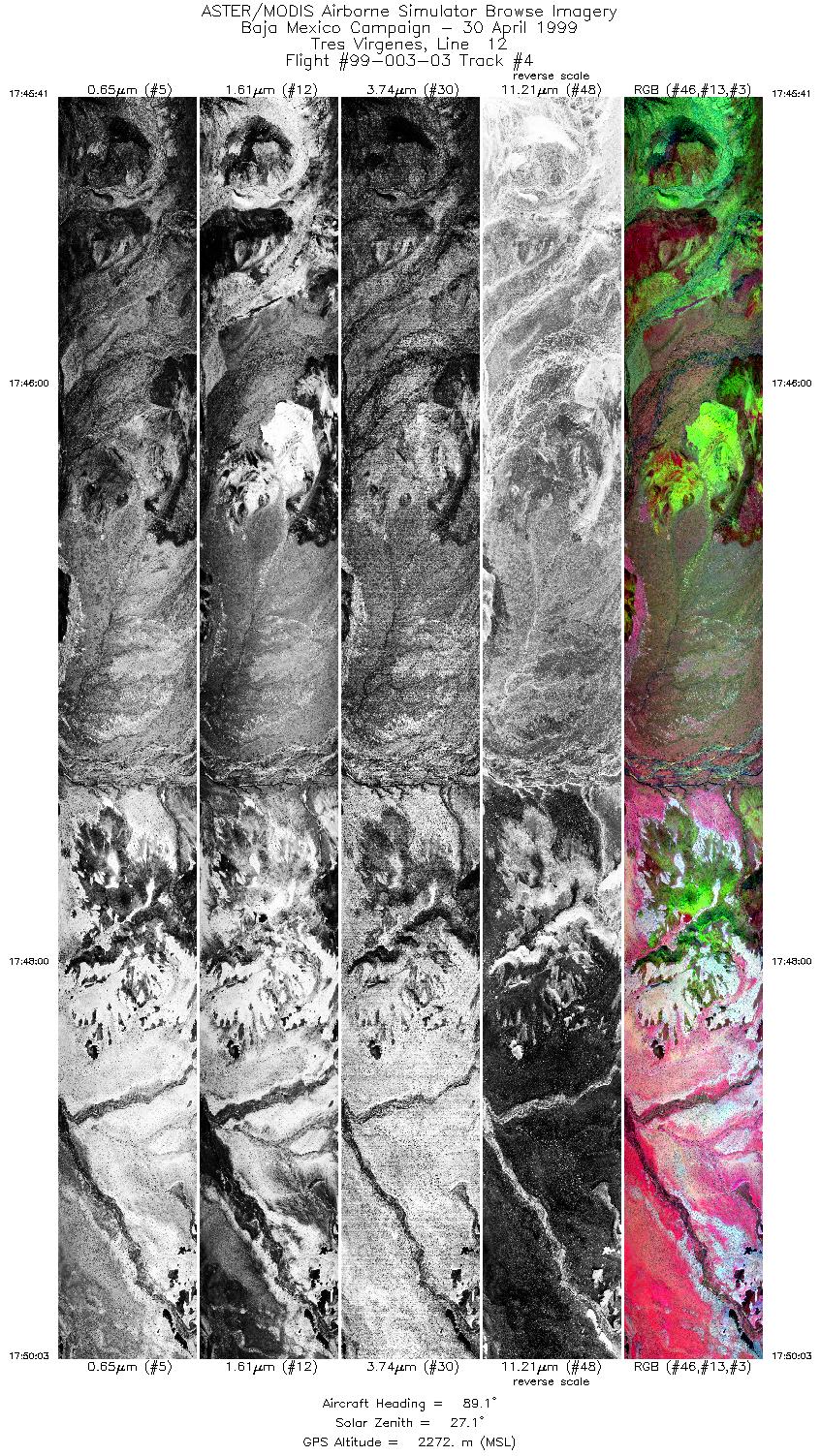
| 4 |
17:45 - 17:50 |
88.7 |
27.433 - 27.433 |
112.894 - 112.661 |
6518 |
2272 |
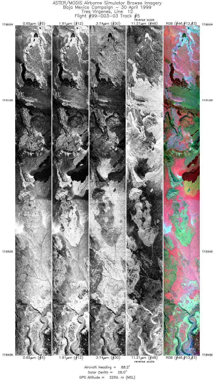
| 5 |
17:50 - 17:54 |
88.2 |
27.433 - 27.433 |
112.660 - 112.426 |
6518 |
2269 |
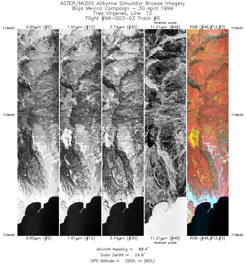
| 6 |
17:54 - 17:56 |
88.7 |
27.433 - 27.433 |
112.425 - 112.299 |
3554 |
2265 |
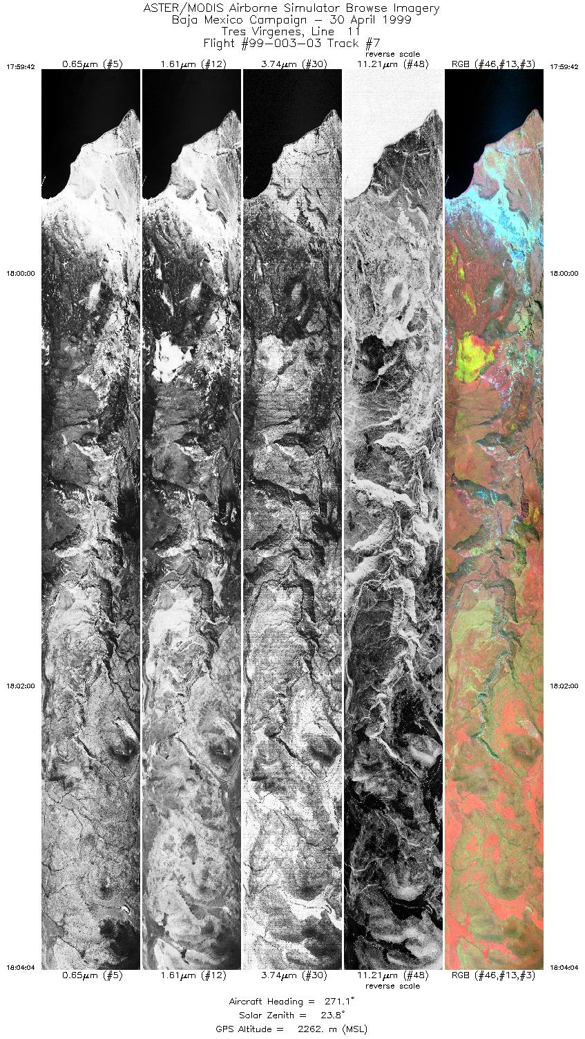
| 7 |
17:59 - 18:04 |
271.1 |
27.417 - 27.417 |
112.287 - 112.507 |
6516 |
2262 |
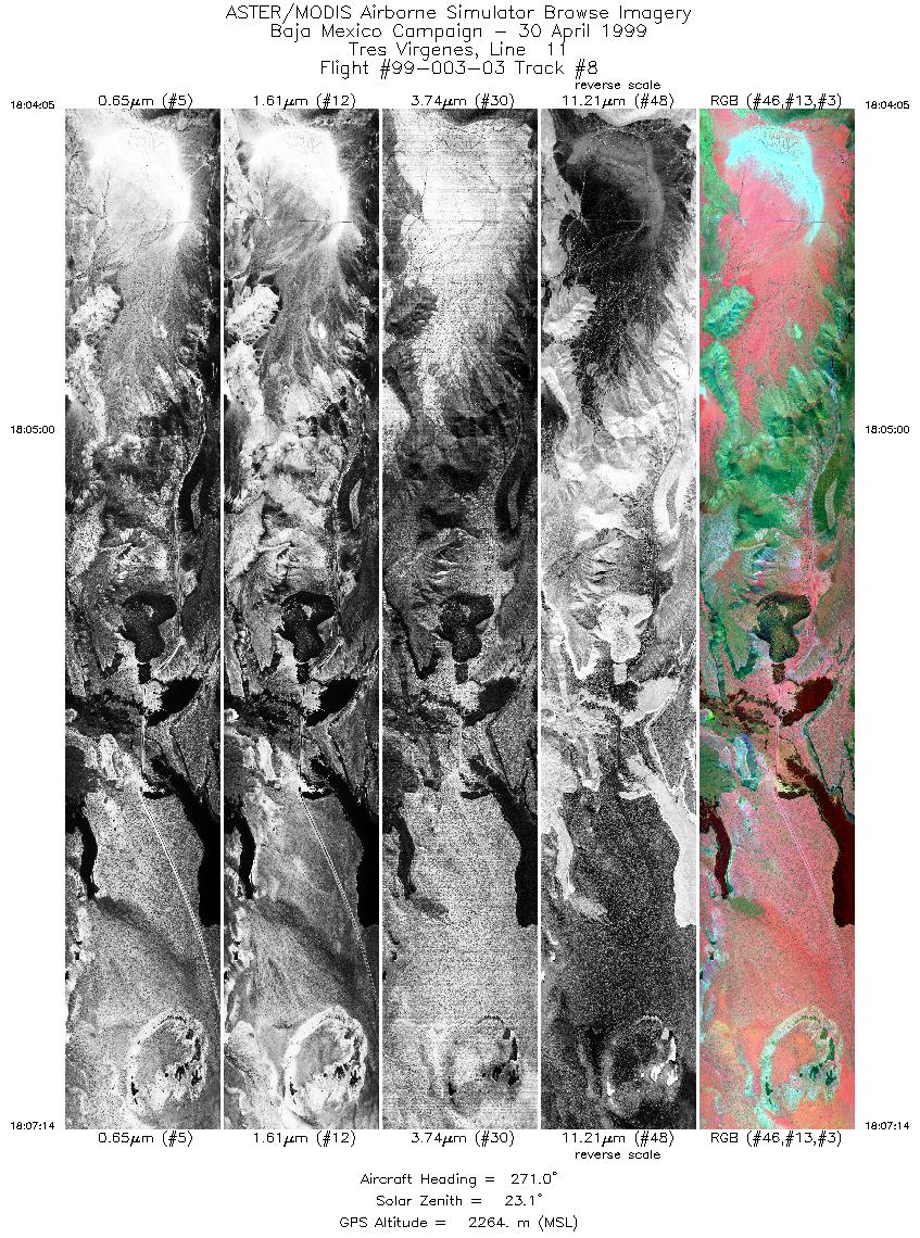
| 8 |
18:04 - 18:07 |
270.8 |
27.417 - 27.417 |
112.508 - 112.667 |
4700 |
2264 |
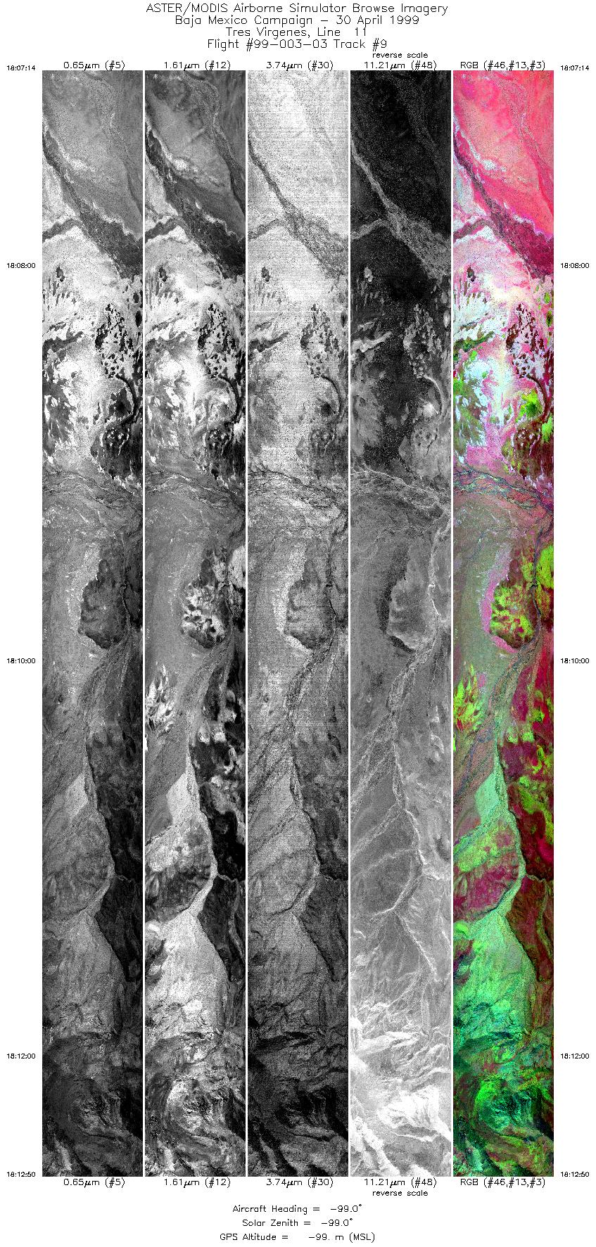
| 9 |
18:07 - 18:12 |
-99.0 |
27.417 - 27.417 |
112.655 - 112.917 |
7869 |
-99 |
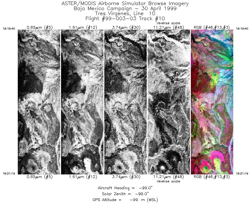
| 10 |
18:19 - 18:21 |
-99.0 |
27.400 - 27.400 |
112.917 - 112.833 |
2451 |
-99 |
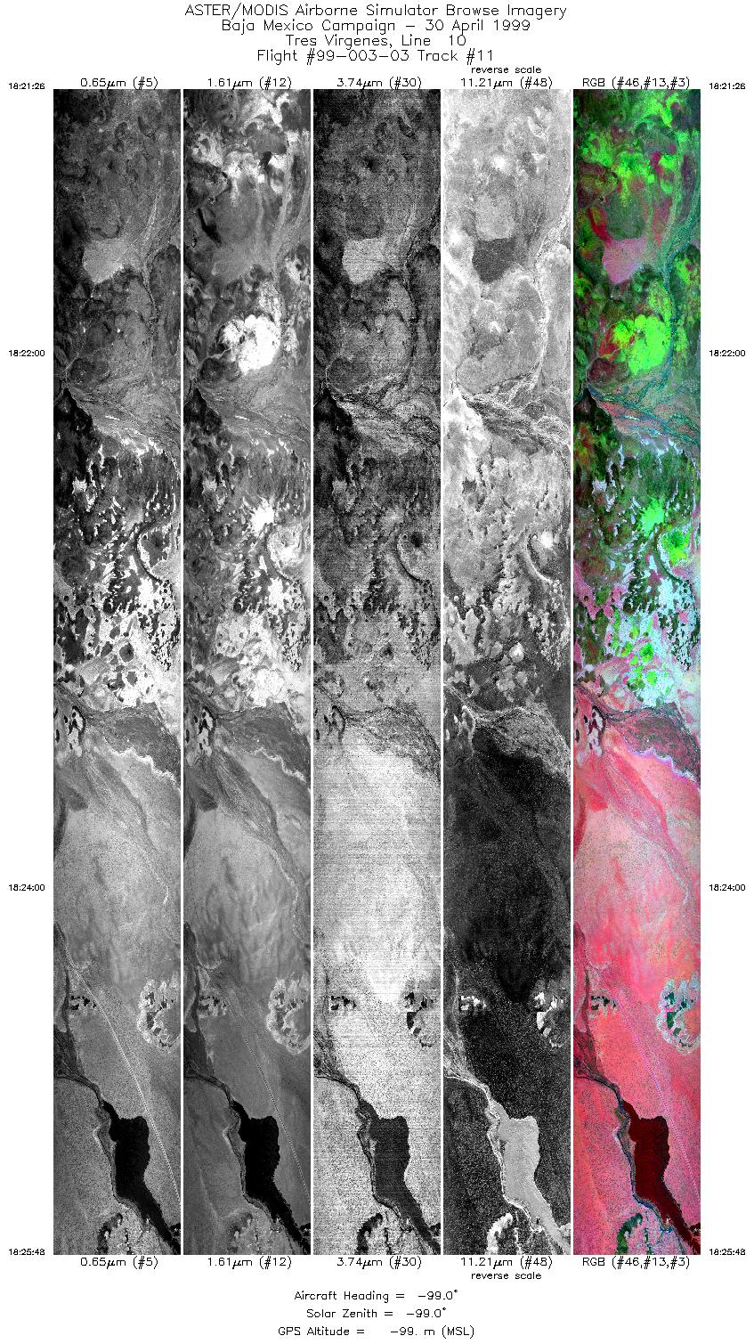
| 11 |
18:21 - 18:25 |
-99.0 |
27.400 - 27.400 |
112.832 - 112.623 |
6548 |
-99 |
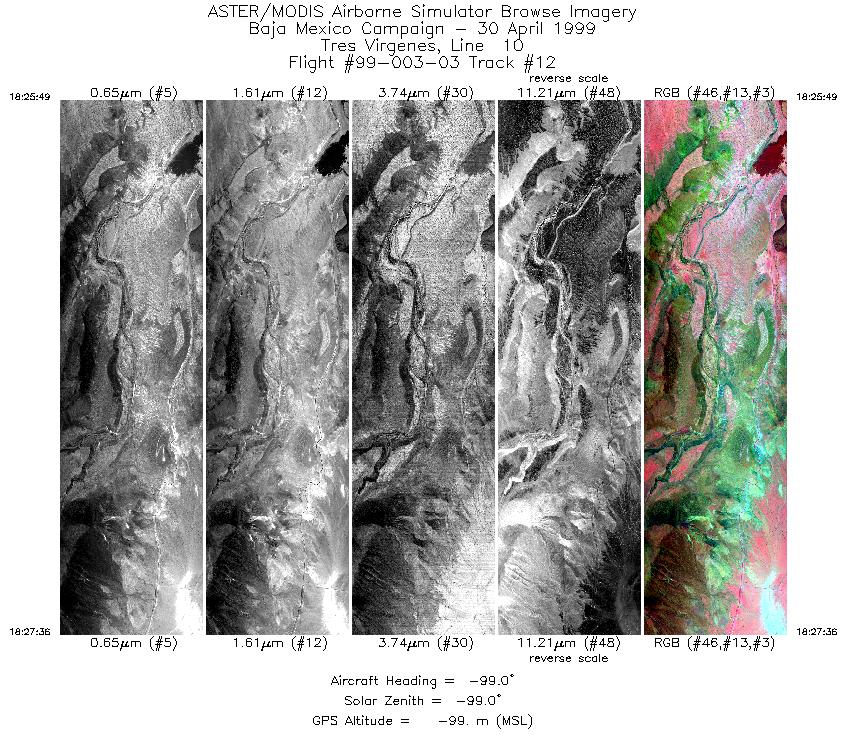
| 12 |
18:25 - 18:27 |
-99.0 |
27.400 - 27.400 |
112.622 - 112.532 |
2675 |
-99 |
| 13 |
18:27 - 18:32 |
-99.0 |
27.400 - 27.400 |
112.525 - 112.302 |
6394 |
-99 |
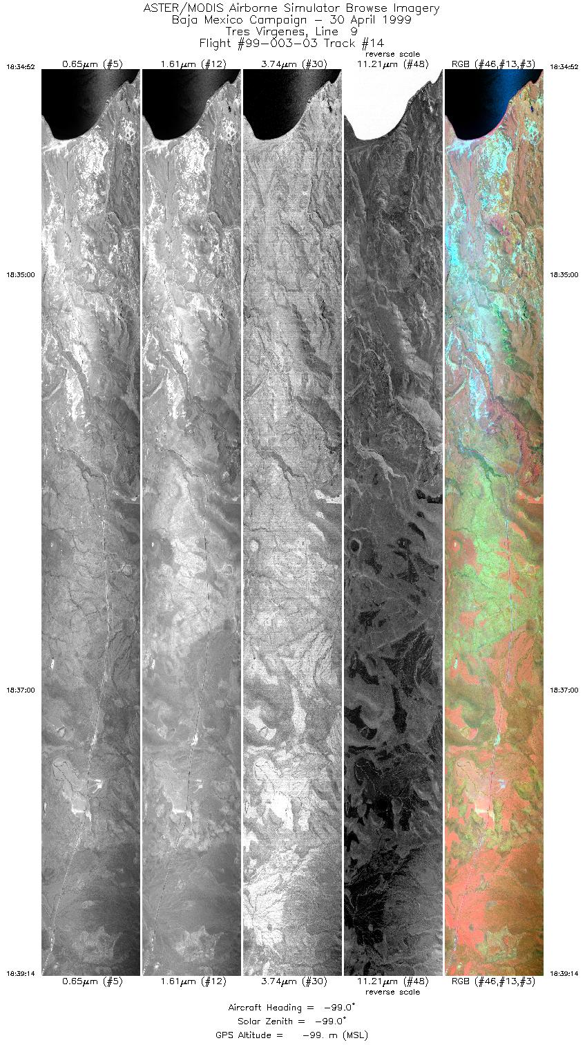
| 14 |
18:34 - 18:39 |
-99.0 |
27.383 - 27.383 |
112.302 - 112.455 |
6560 |
-99 |
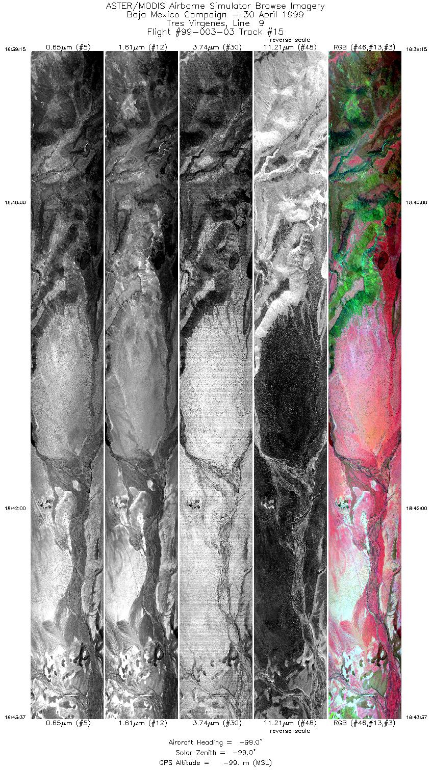
| 15 |
18:39 - 18:43 |
-99.0 |
27.383 - 27.383 |
112.457 - 112.668 |
6555 |
-99 |
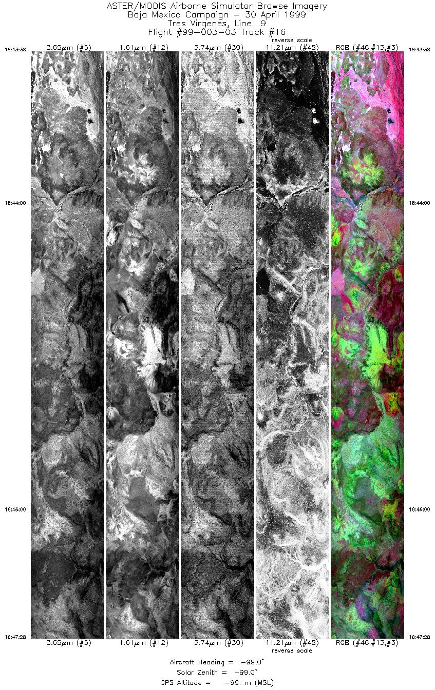
| 16 |
18:43 - 18:47 |
-99.0 |
27.383 - 27.383 |
112.668 - 112.917 |
5729 |
-99 |
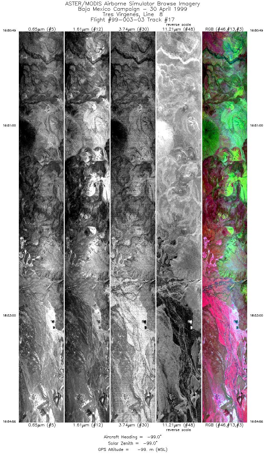
| 17 |
18:50 - 18:54 |
-99.0 |
27.367 - 27.367 |
112.917 - 112.705 |
6215 |
-99 |
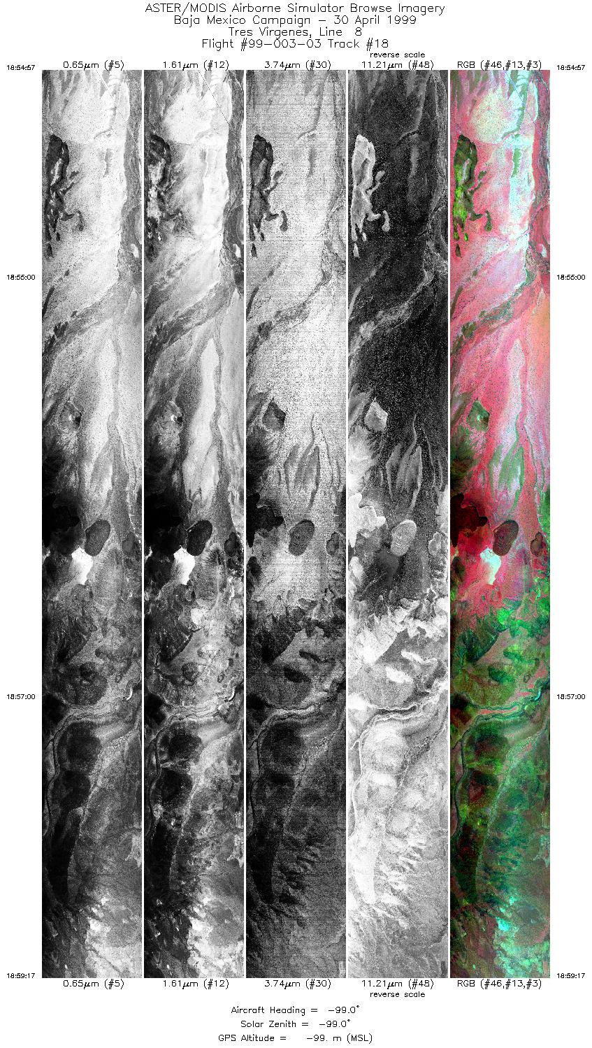
| 18 |
18:54 - 18:59 |
-99.0 |
27.367 - 27.367 |
112.705 - 112.485 |
6496 |
-99 |
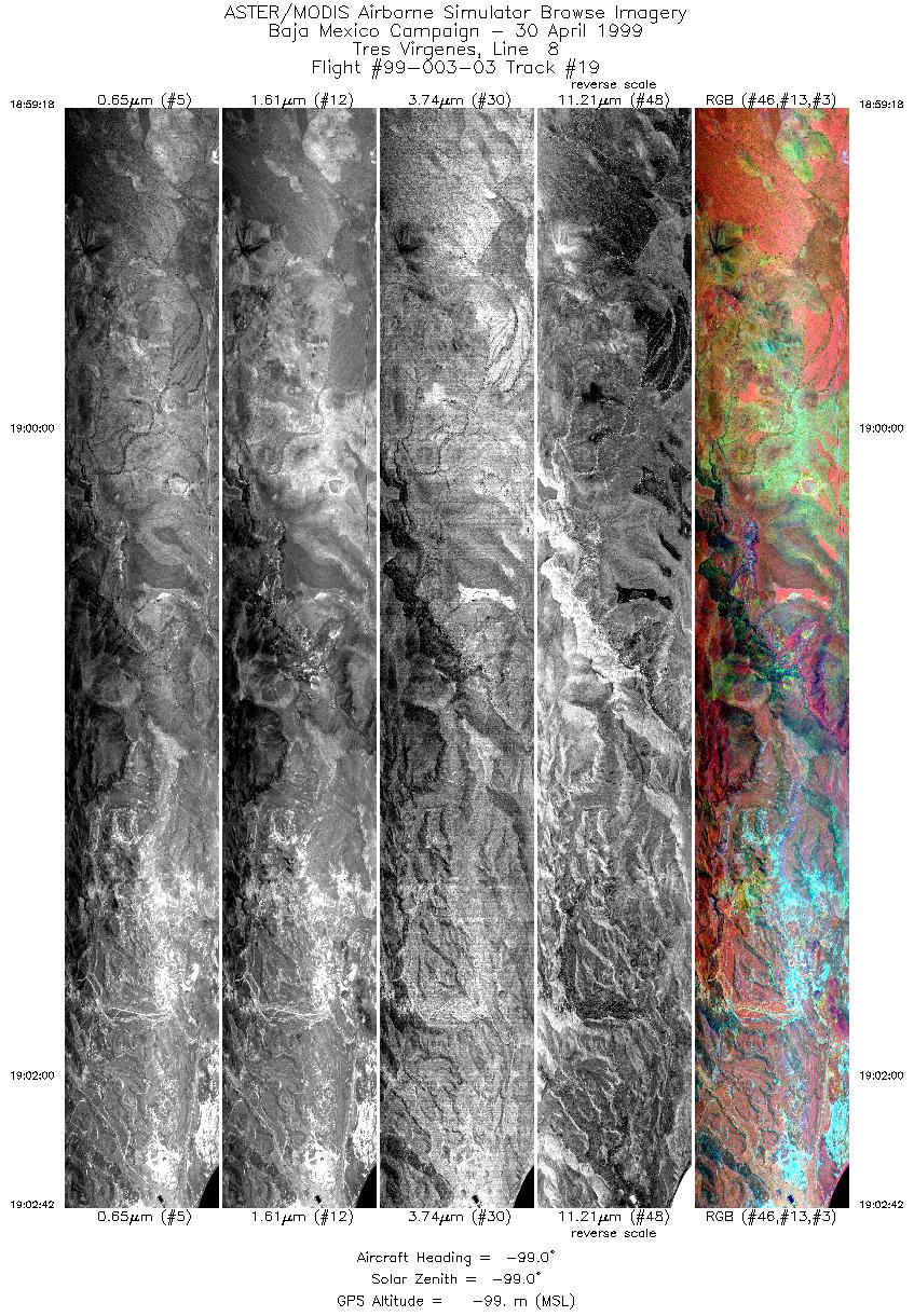
| 19 |
18:59 - 19:02 |
-99.0 |
27.367 - 27.367 |
112.483 - 112.312 |
5101 |
-99 |
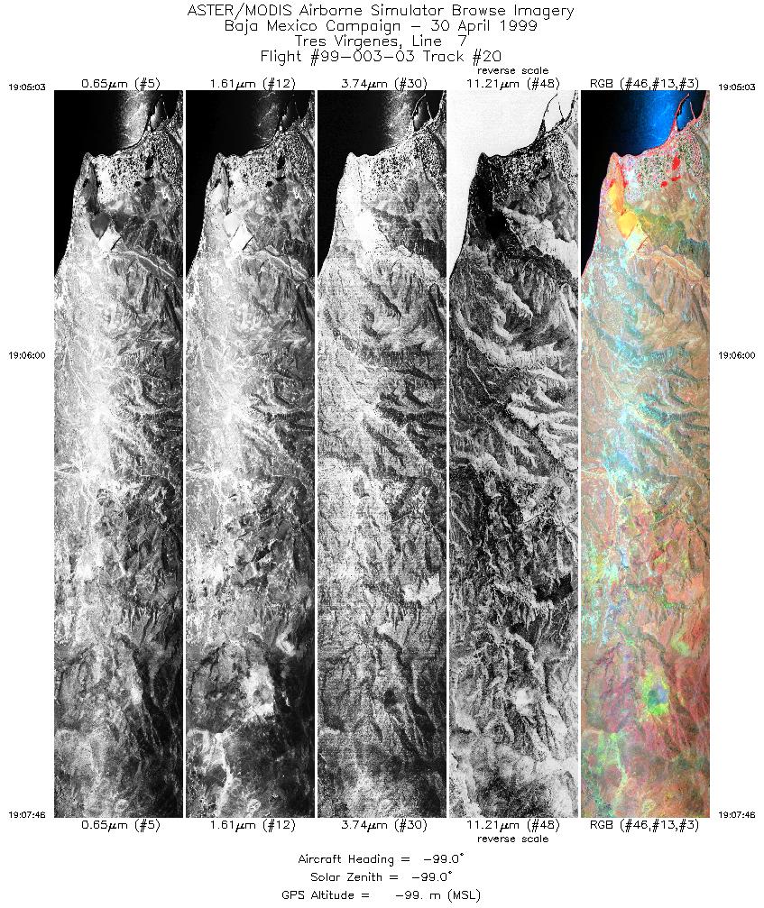
| 20 |
19:05 - 19:07 |
-99.0 |
27.350 - 27.350 |
112.302 - 112.437 |
4035 |
-99 |
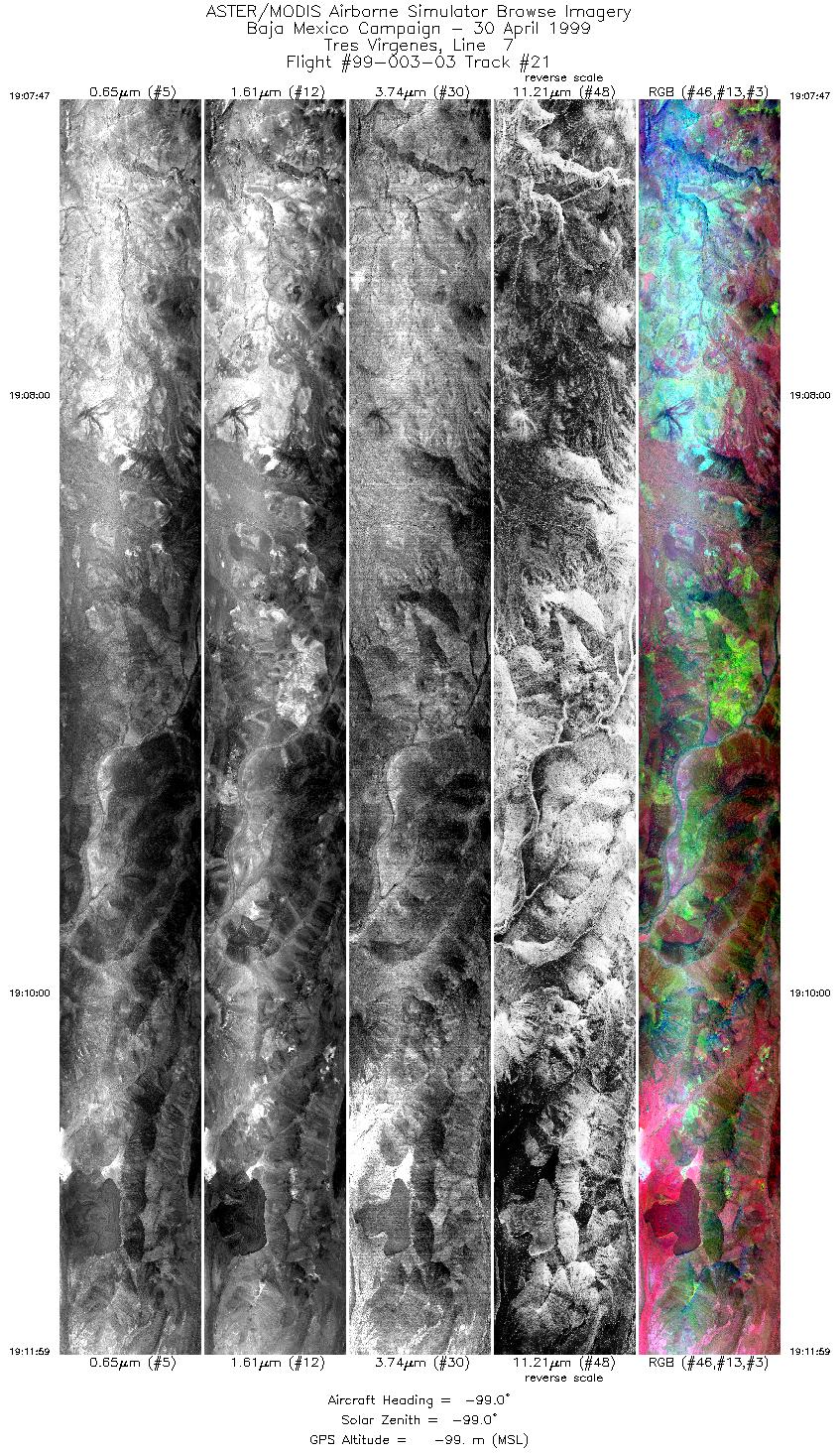
| 21 |
19:07 - 19:12 |
-99.0 |
27.350 - 27.350 |
112.438 - 112.600 |
6326 |
-99 |
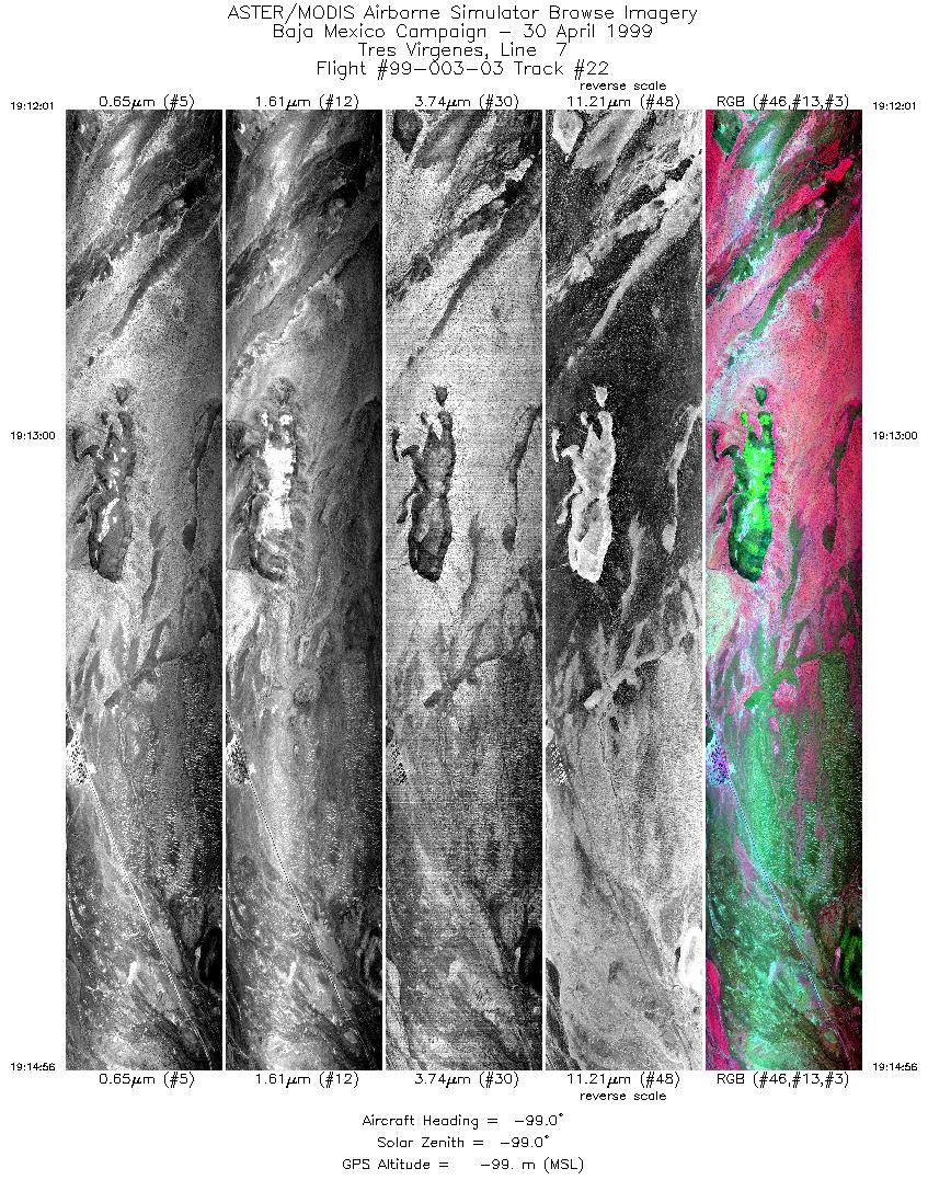
| 22 |
19:12 - 19:14 |
-99.0 |
27.350 - 27.350 |
112.600 - 112.743 |
4385 |
-99 |
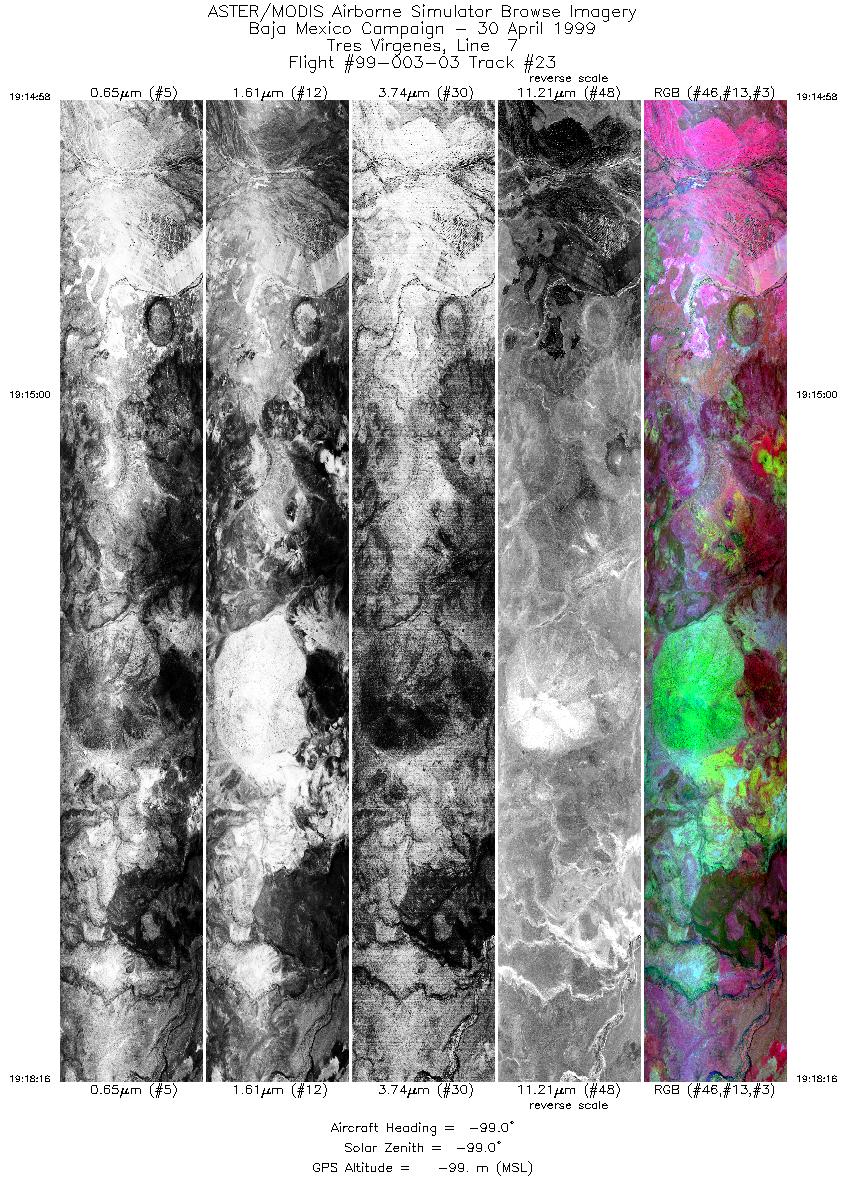
| 23 |
19:14 - 19:18 |
-99.0 |
27.350 - 27.350 |
112.743 - 112.917 |
4911 |
-99 |
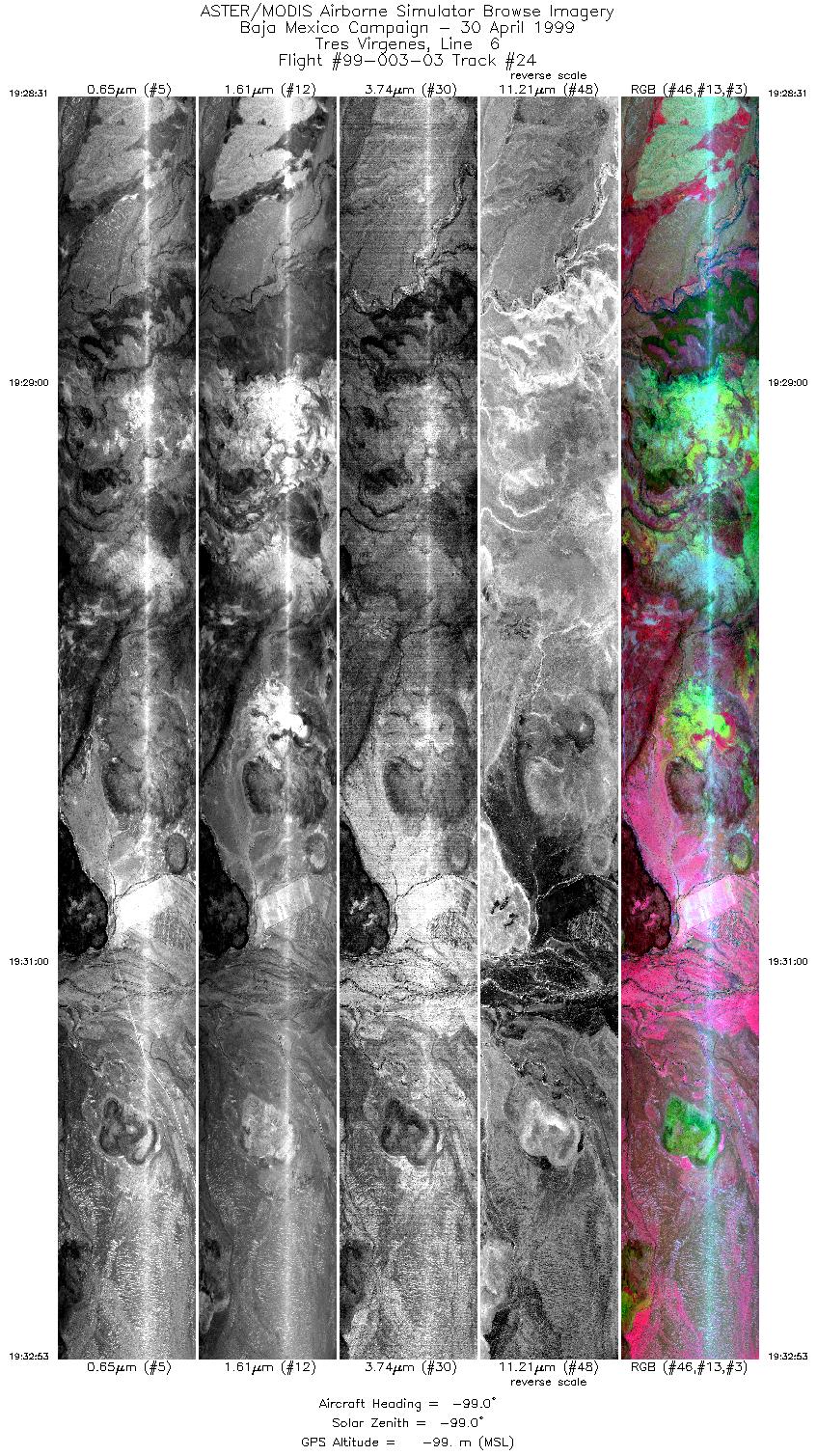
| 24 |
19:28 - 19:32 |
-99.0 |
27.333 - 27.333 |
112.917 - 112.695 |
6545 |
-99 |
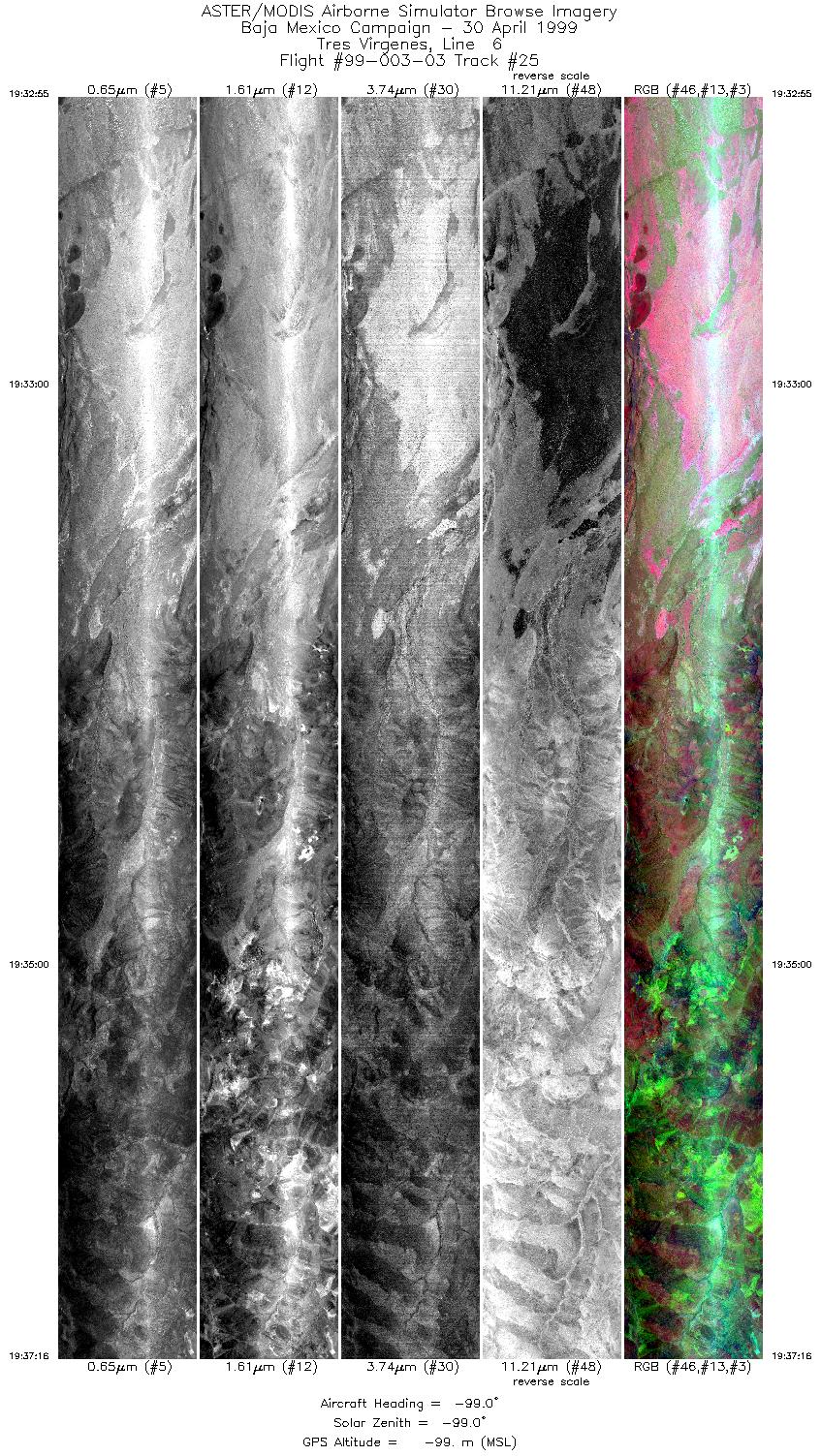
| 25 |
19:32 - 19:37 |
-99.0 |
27.333 - 27.333 |
112.693 - 112.475 |
6516 |
-99 |
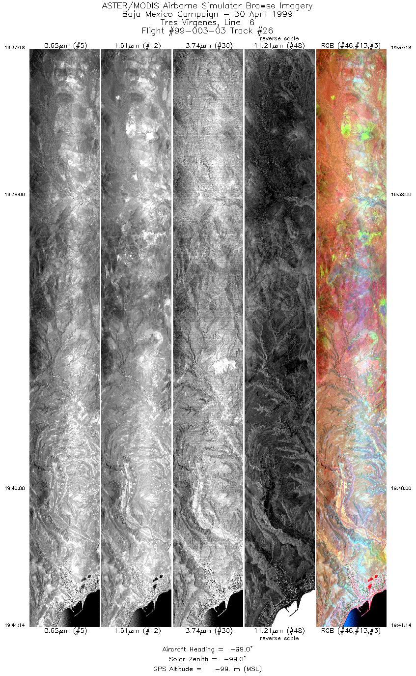
| 26 |
19:37 - 19:41 |
-99.0 |
27.333 - 27.333 |
112.473 - 112.272 |
5878 |
-99 |
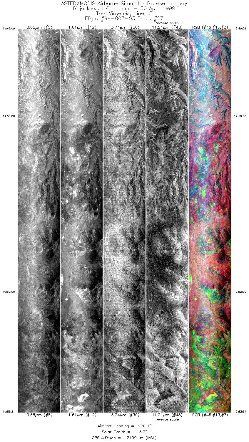
| 27 |
19:49 - 19:53 |
269.9 |
27.317 - 27.317 |
112.286 - 112.510 |
6505 |
2199 |
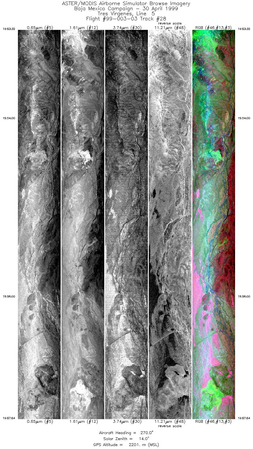
| 28 |
19:53 - 19:57 |
270.0 |
27.317 - 27.317 |
112.509 - 112.724 |
6515 |
2201 |
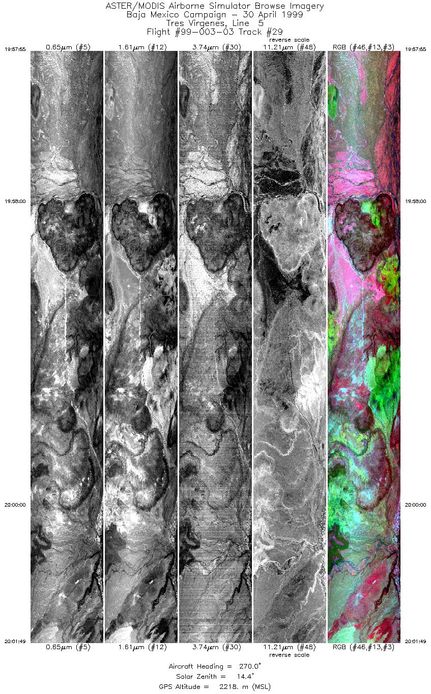
| 29 |
19:57 - 20:01 |
270.1 |
27.317 - 27.317 |
112.725 - 112.917 |
5819 |
2218 |
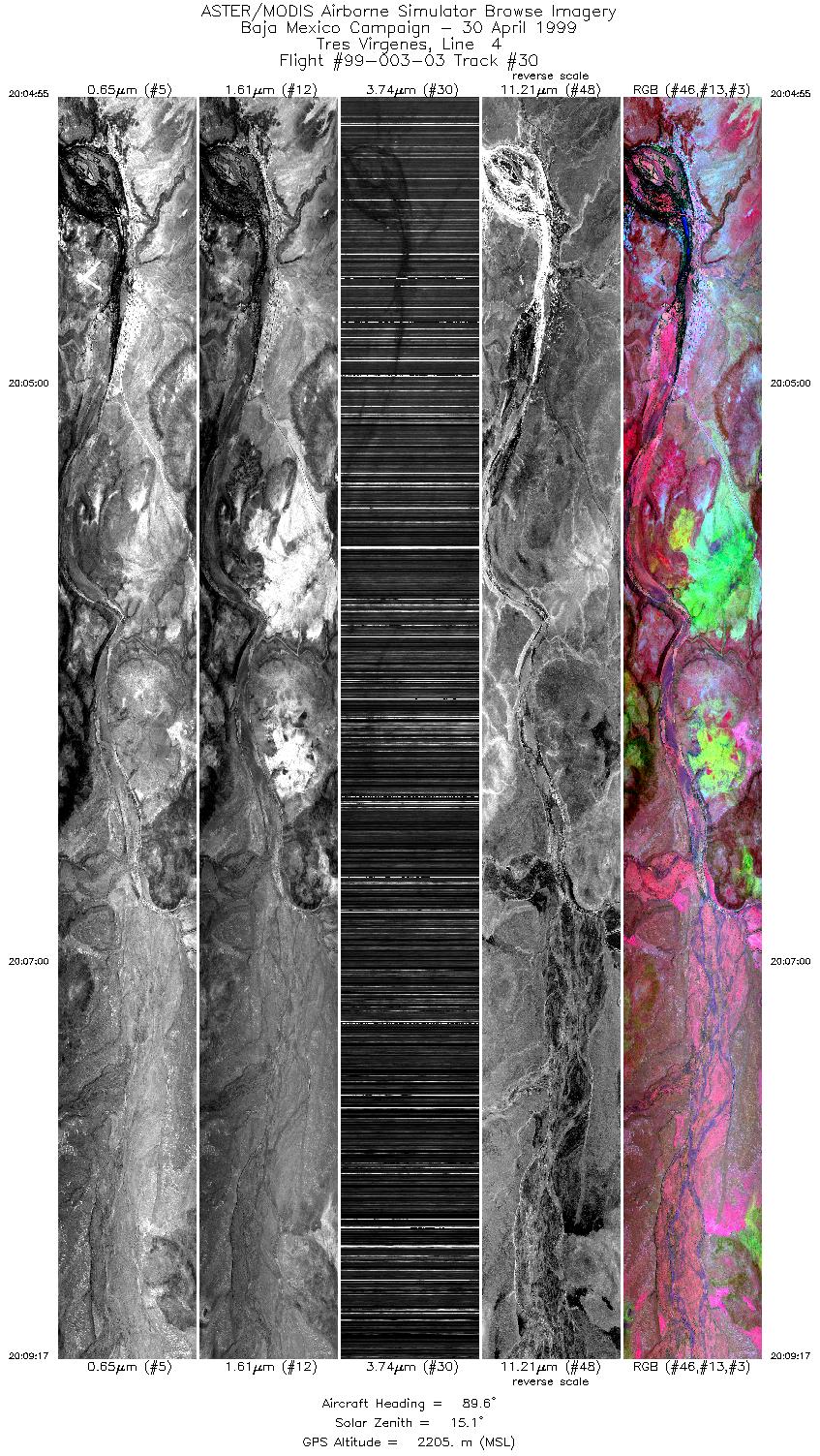
| 30 |
20:04 - 20:09 |
89.8 |
27.300 - 27.300 |
112.920 - 112.691 |
6515 |
2205 |
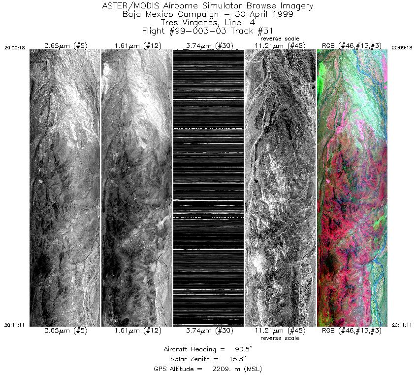
| 31 |
20:09 - 20:11 |
89.9 |
27.300 - 27.300 |
112.690 - 112.589 |
2810 |
2209 |
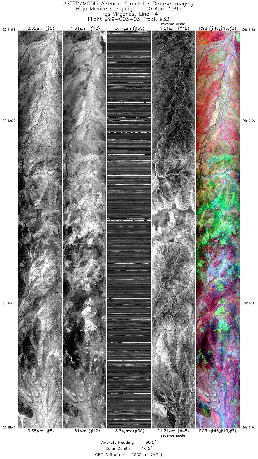
| 32 |
20:11 - 20:15 |
90.1 |
27.300 - 27.300 |
112.583 - 112.355 |
6513 |
2205 |
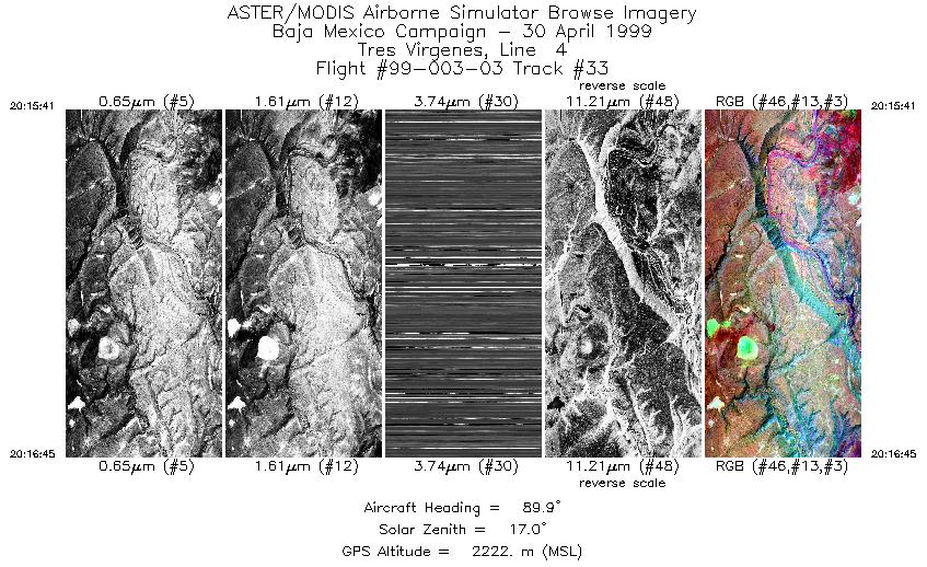
| 33 |
20:15 - 20:16 |
90.1 |
27.300 - 27.300 |
112.355 - 112.301 |
1592 |
2222 |
|


