


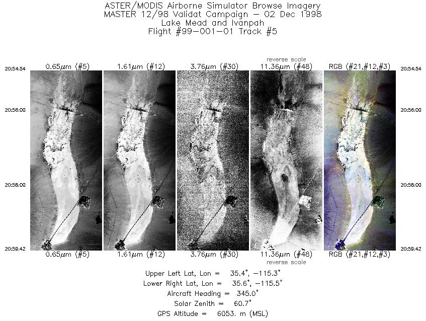
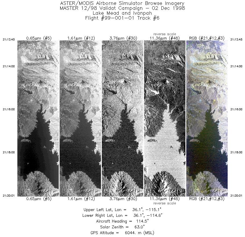
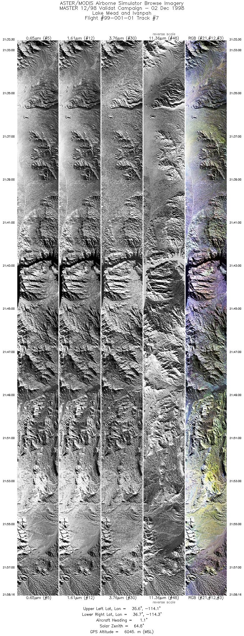
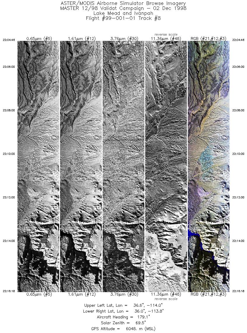
FLIGHT SUMMARY INFORMATION
Flight Track Map


|
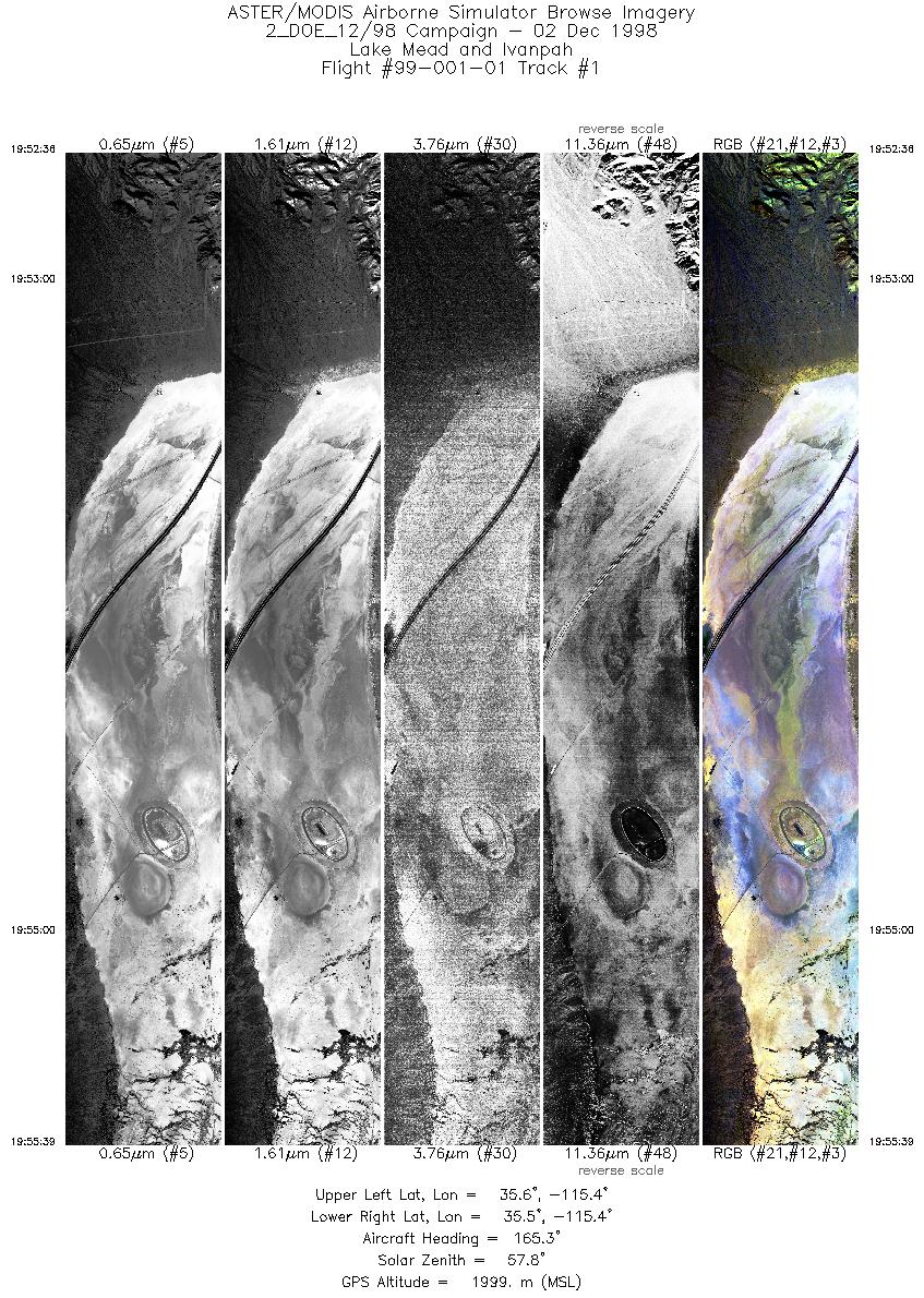
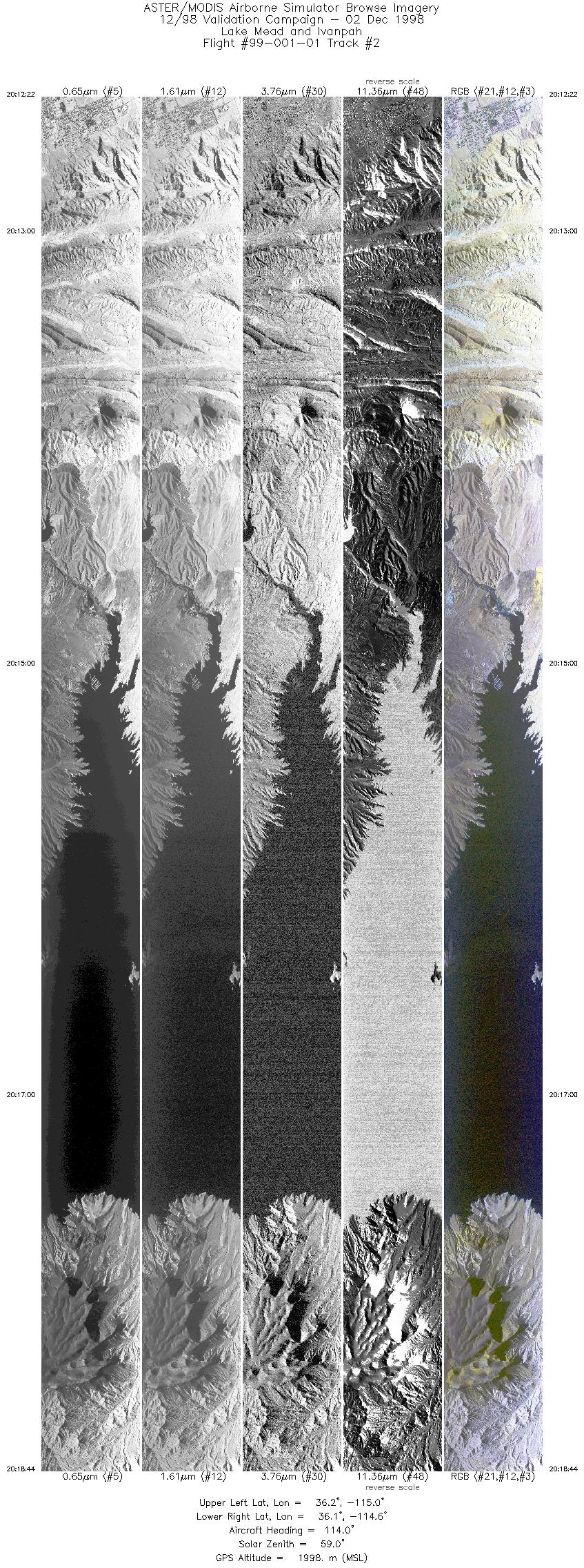
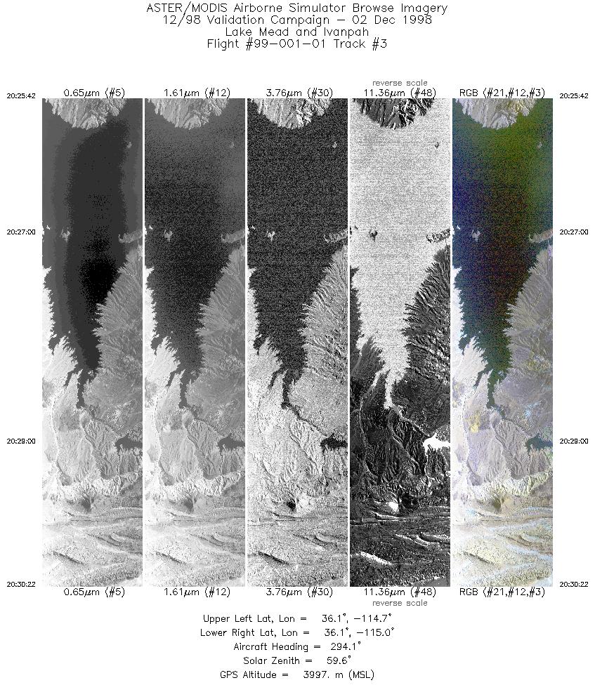
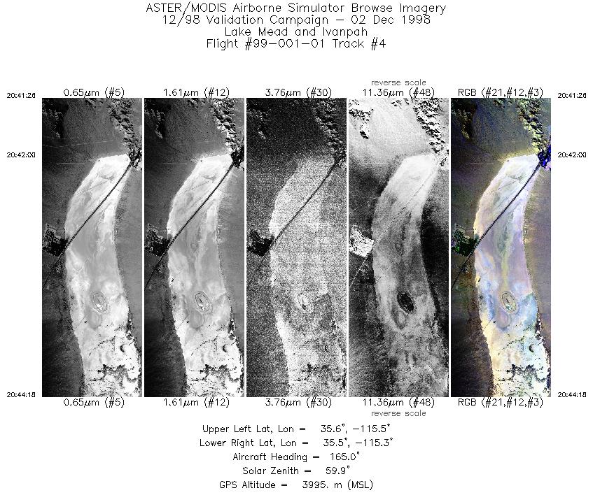
Flight: 99-001-01 Date: December 2, 1998 Aircraft: DOE B-200 Kingair Deployment: RSL December 1998 Flight Location: Lake Mead, NV / Ivanpah, CA Principal Investigator: Hook (JPL) Additional Sensors: |
||||||||||||||||||||||||||||||||||||||||||||||||||||||||||||||||||||||||||||||||||||
|
Data Evaluation N/A |
||||||||||||||||||||||||||||||||||||||||||||||||||||||||||||||||||||||||||||||||||||
|
Processing Information Level-1B Data in HDF format is available Flight Line Summary Spectral Band Configuration Spectral Response Function Table Spectral Response Function (text) |
||||||||||||||||||||||||||||||||||||||||||||||||||||||||||||||||||||||||||||||||||||
|
Browse Imagery Flight Tracks: 8 Scanlines: 38551 |
||||||||||||||||||||||||||||||||||||||||||||||||||||||||||||||||||||||||||||||||||||
|
||||||||||||||||||||||||||||||||||||||||||||||||||||||||||||||||||||||||||||||||||||


