Flight: 25-801-07
Date: 18 Apr 2025
Aircraft: NASA B-200
Deployment: FireSense 2025
Flight Location: Fort Stewart, GA
Principal Investigators: NASA SMD
Additional Sensors: FireTIRS
|
Data Evaluation
Overall quality is good
Channel 35 offline
Fort Stewart Prescribed Burn (Unit 3)
|
Processing Information
Level-1B Data in HDF format is available
Flight Line Summary
Spectral Band Configuration
Spectral Response Function Table
Spectral Response Function (text)
|
Browse Imagery
Flight Tracks: 29
Scanlines: 90958
|
Browse Imagery Table
|
Click a Flight Track number to view a quicklook image
Lat/Lon ranges are for the BEG-END scanline nadir pixels
|
Flight
Track |
Time Span
(UTC) |
Heading
(Deg) |
Lat Range
(Deg N) |
Lon Range
(Deg W) |
Length
(Scanlines) |
Altitude
(Meters) |
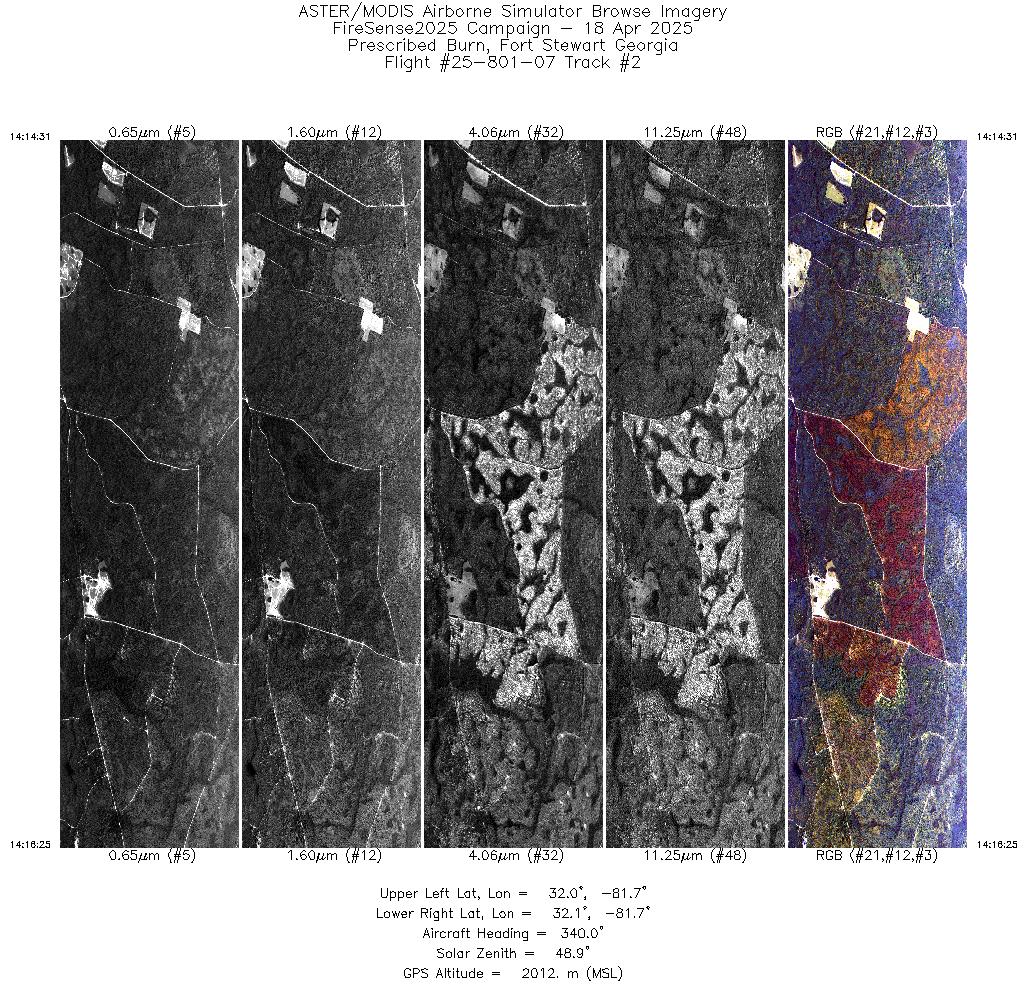
| 1 |
14:08 - 14:10 |
341.6 |
31.982 - 32.069 |
81.689 - 81.725 |
3287 |
2010 |
| 2 |
14:14 - 14:16 |
340.9 |
31.994 - 32.069 |
81.696 - 81.725 |
2832 |
2012 |
| 3 |
14:21 - 14:23 |
341.0 |
31.970 - 32.069 |
81.687 - 81.725 |
3734 |
2013 |
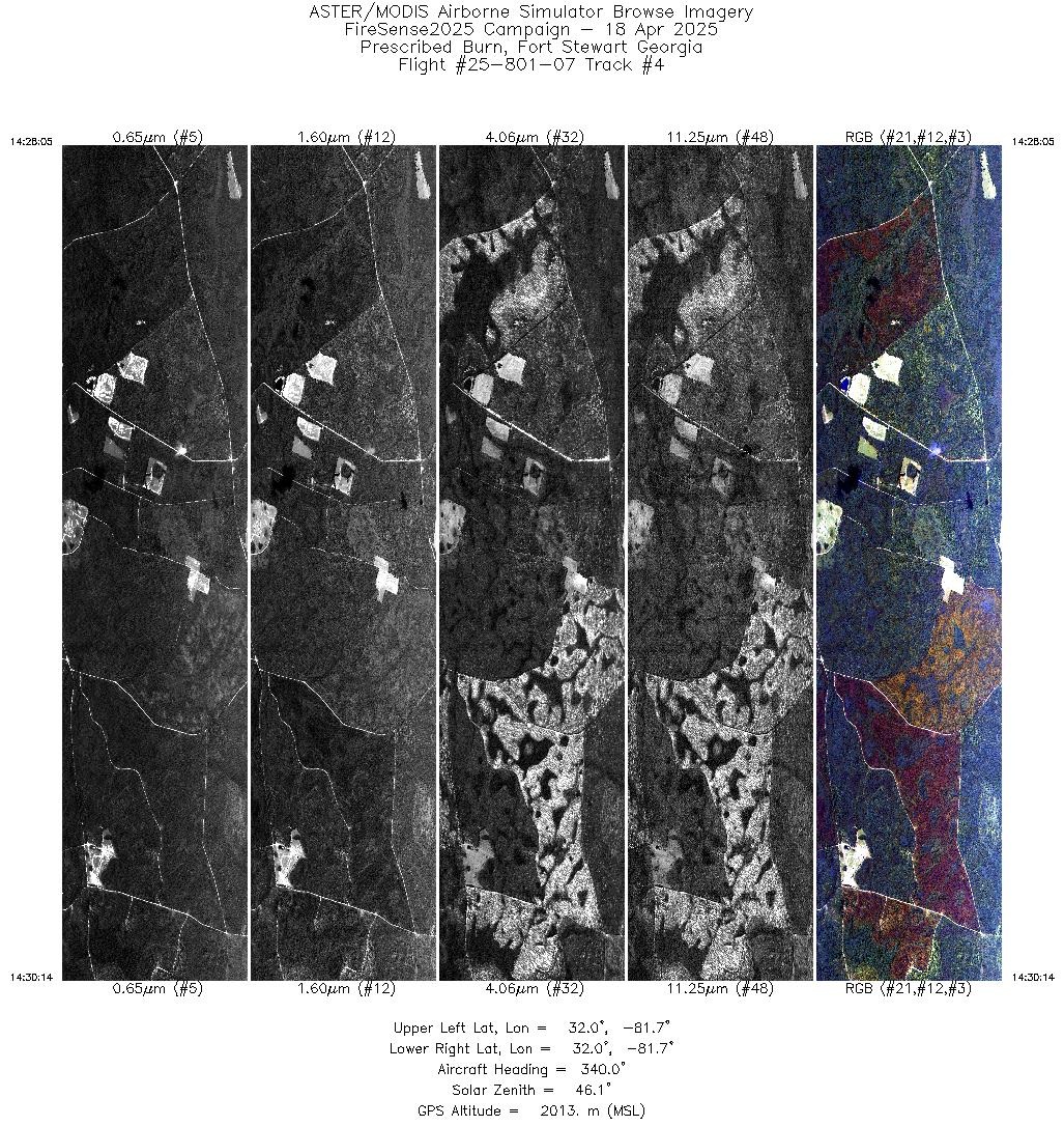
| 4 |
14:28 - 14:30 |
341.1 |
31.969 - 32.055 |
81.687 - 81.719 |
3225 |
2014 |
| 5 |
14:34 - 14:36 |
344.1 |
31.970 - 32.052 |
81.686 - 81.713 |
3020 |
2015 |
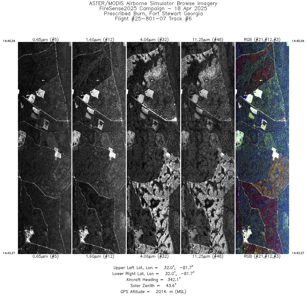
| 6 |
14:40 - 14:42 |
342.2 |
31.974 - 32.049 |
81.686 - 81.716 |
2835 |
2014 |
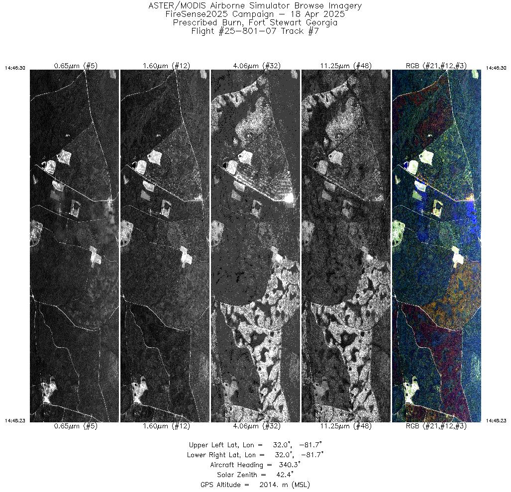
| 7 |
14:46 - 14:48 |
341.3 |
31.973 - 32.049 |
81.688 - 81.716 |
2838 |
2015 |
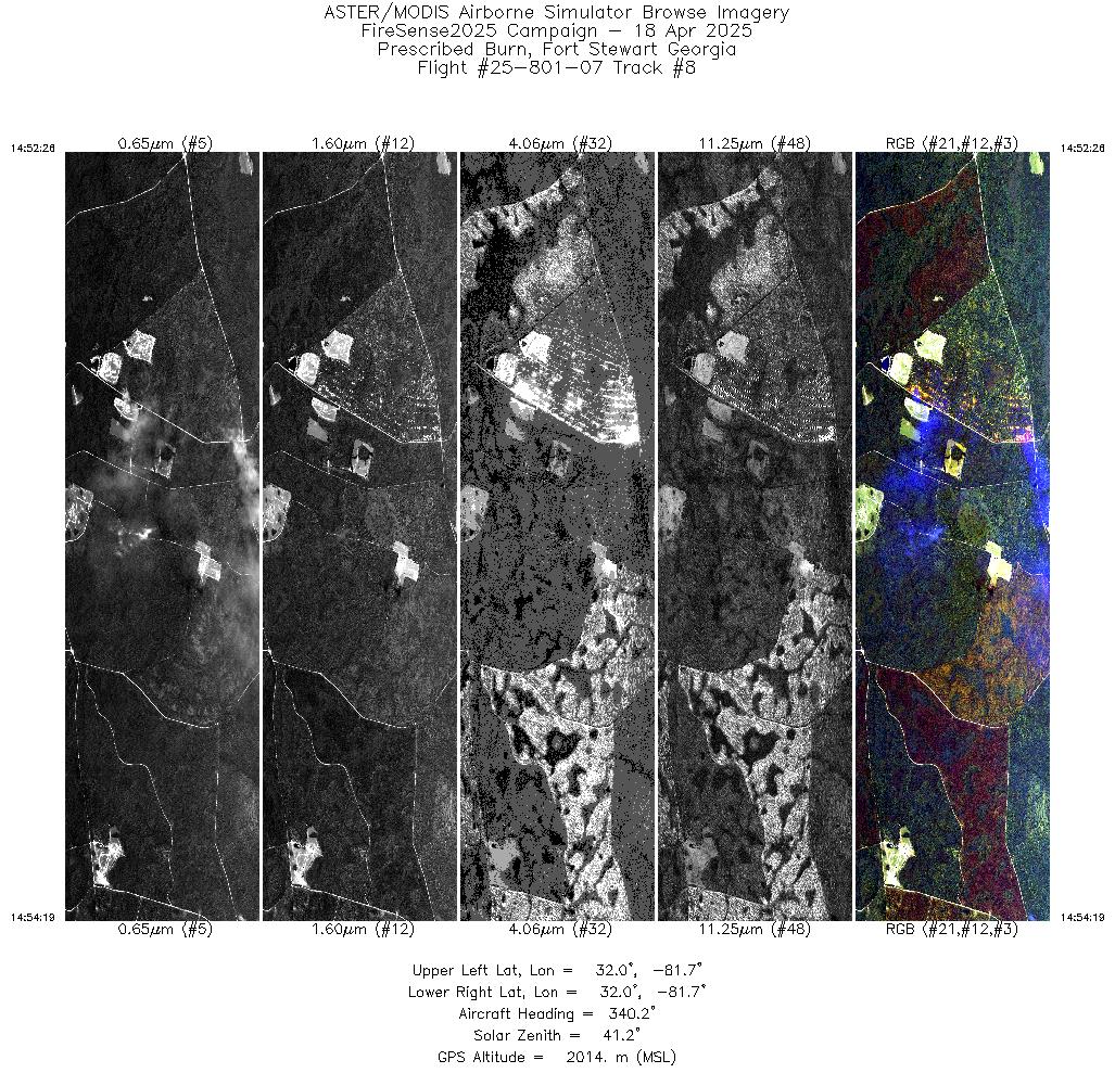
| 8 |
14:52 - 14:54 |
341.4 |
31.973 - 32.049 |
81.688 - 81.716 |
2839 |
2015 |
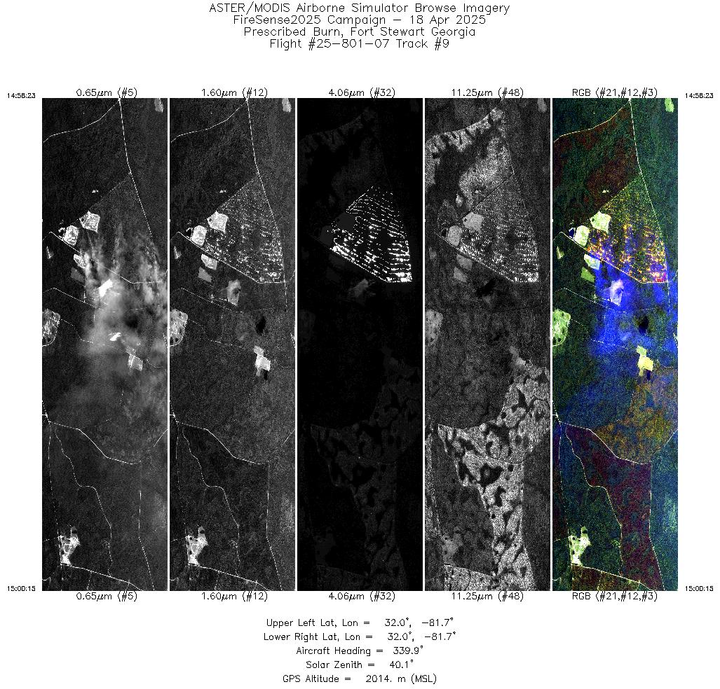
| 9 |
14:58 - 15:00 |
341.2 |
31.973 - 32.049 |
81.688 - 81.716 |
2816 |
2015 |
| 10 |
15:04 - 15:06 |
341.2 |
31.973 - 32.049 |
81.688 - 81.716 |
2832 |
2015 |
| 11 |
15:10 - 15:12 |
341.0 |
31.974 - 32.049 |
81.688 - 81.716 |
2777 |
2015 |
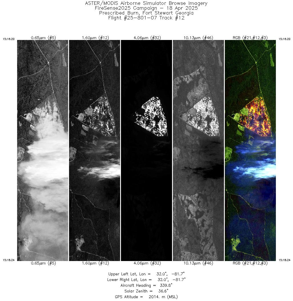
| 12 |
15:16 - 15:18 |
341.0 |
31.965 - 32.049 |
81.685 - 81.716 |
3096 |
2014 |
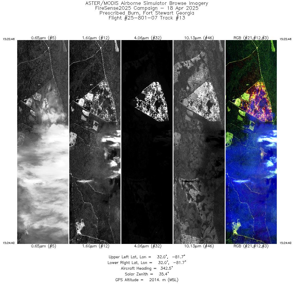
| 13 |
15:22 - 15:24 |
342.5 |
31.970 - 32.049 |
81.687 - 81.716 |
2850 |
2014 |
| 14 |
15:28 - 15:30 |
342.2 |
31.969 - 32.049 |
81.687 - 81.716 |
2879 |
2015 |
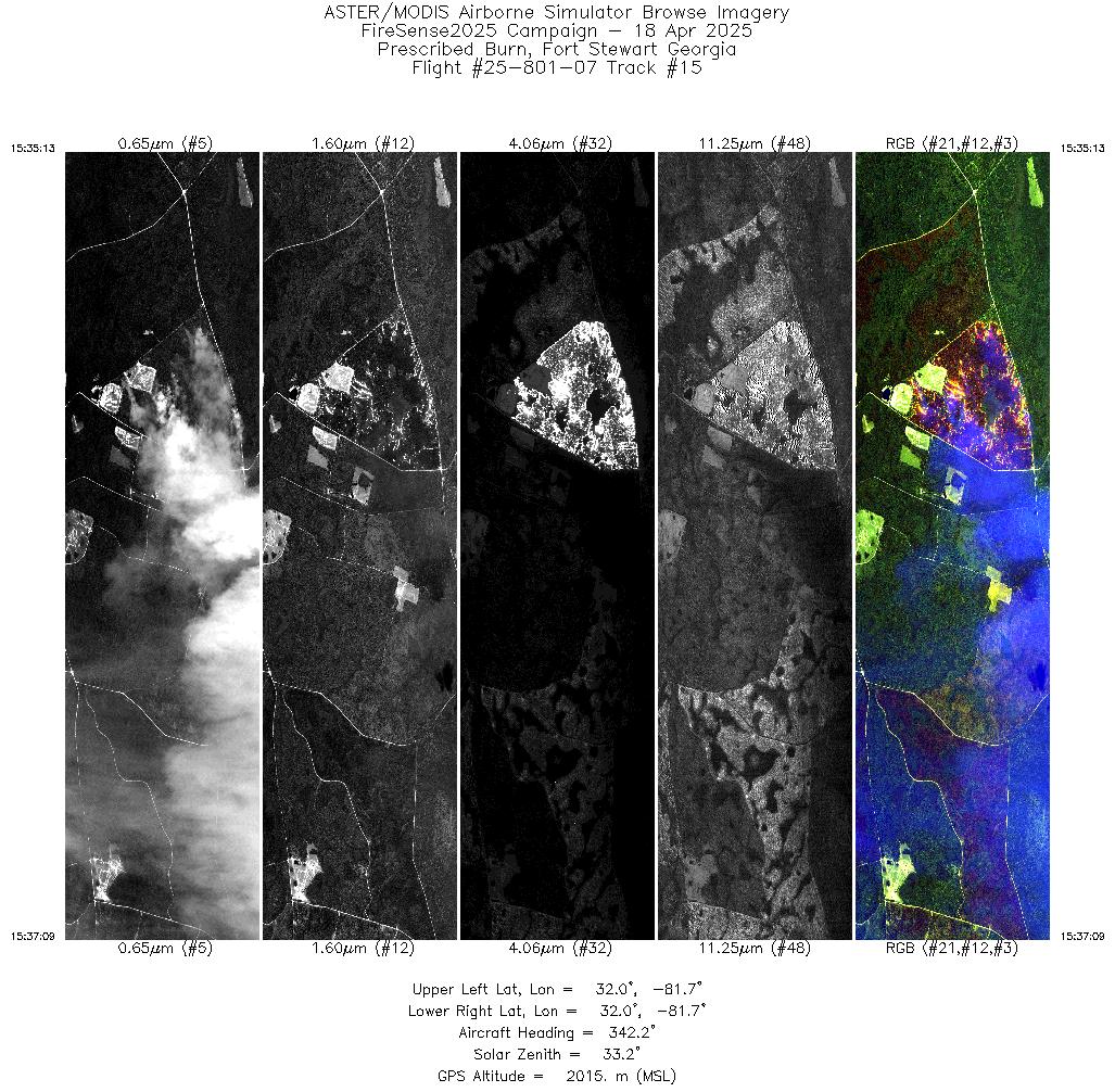
| 15 |
15:35 - 15:37 |
342.1 |
31.969 - 32.049 |
81.687 - 81.716 |
2905 |
2015 |
| 16 |
15:41 - 15:43 |
342.5 |
31.970 - 32.049 |
81.687 - 81.716 |
2859 |
2014 |
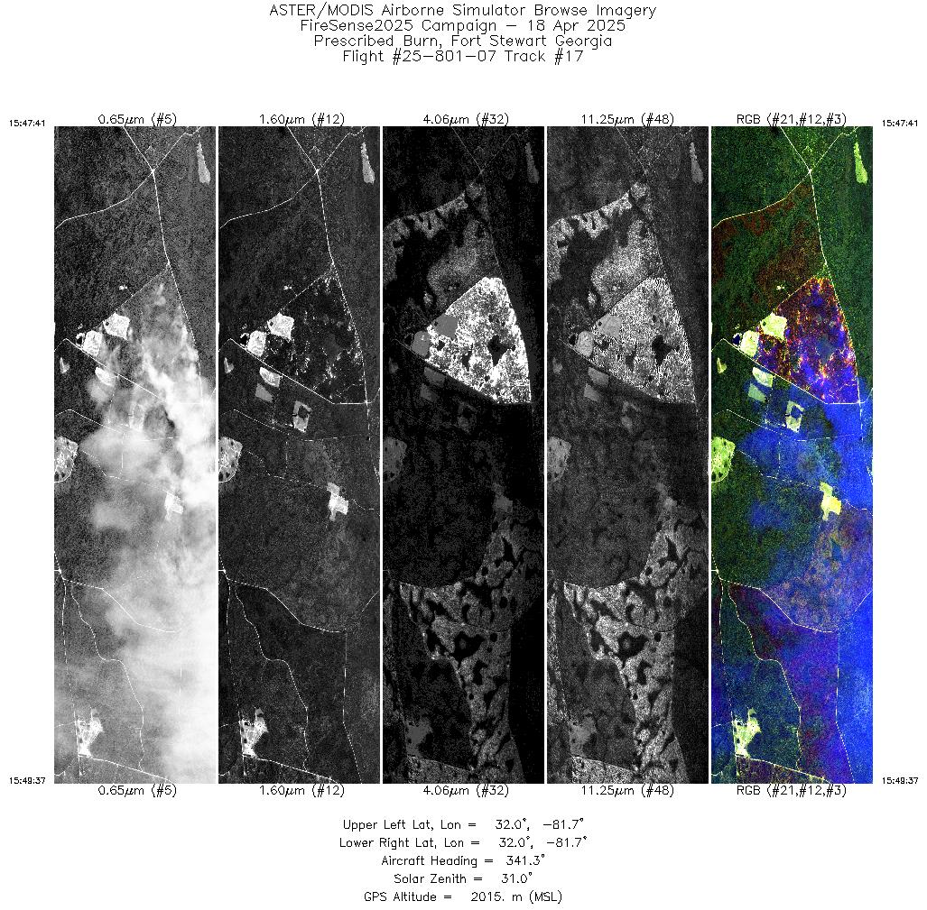
| 17 |
15:47 - 15:49 |
341.8 |
31.968 - 32.049 |
81.686 - 81.716 |
2918 |
2015 |
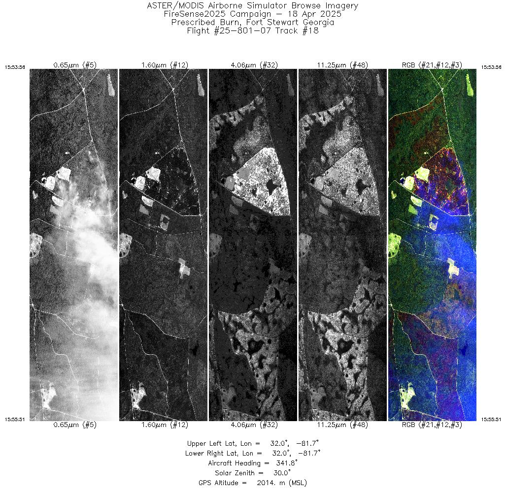
| 18 |
15:53 - 15:55 |
342.1 |
31.969 - 32.048 |
81.686 - 81.716 |
2864 |
2014 |
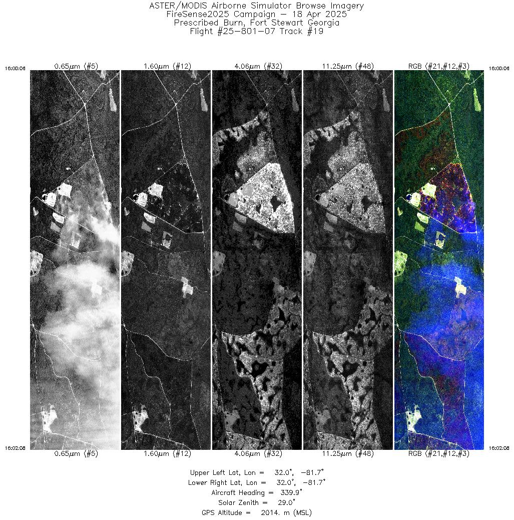
| 19 |
16:00 - 16:02 |
340.9 |
31.966 - 32.049 |
81.685 - 81.716 |
3032 |
2015 |
| 20 |
16:06 - 16:08 |
341.7 |
31.968 - 32.048 |
81.686 - 81.716 |
2904 |
2014 |
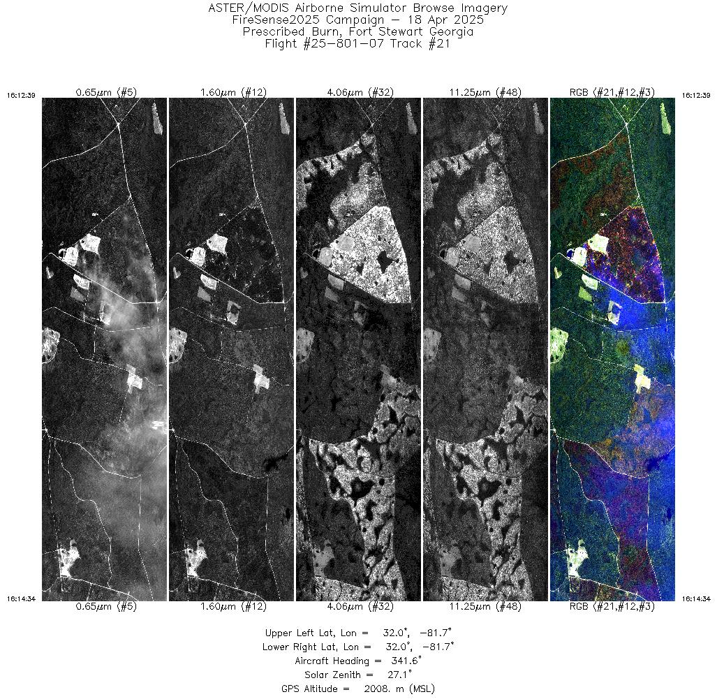
| 21 |
16:12 - 16:14 |
341.8 |
31.969 - 32.049 |
81.687 - 81.716 |
2884 |
2008 |
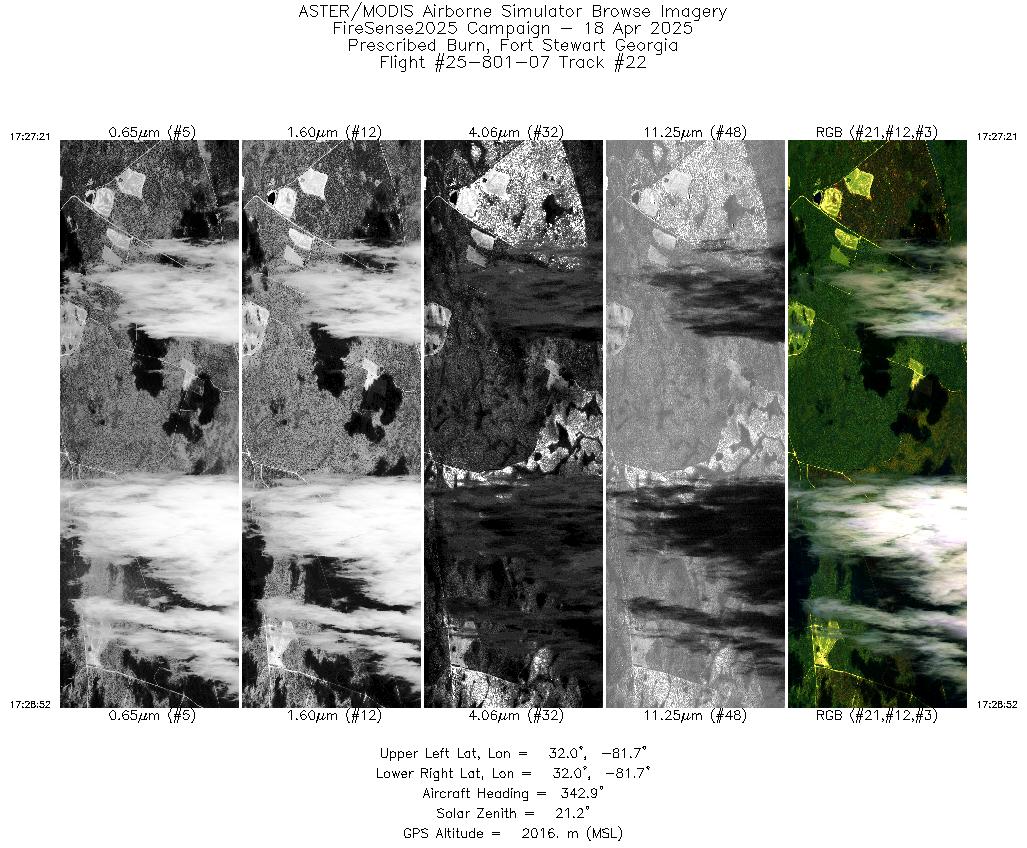
| 22 |
17:27 - 17:28 |
341.9 |
31.987 - 32.049 |
81.693 - 81.716 |
2274 |
2016 |
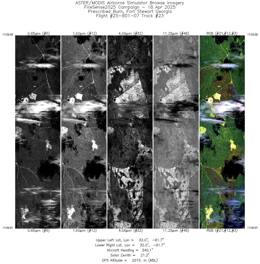
| 23 |
17:33 - 17:35 |
340.7 |
31.965 - 32.049 |
81.684 - 81.716 |
3059 |
2017 |
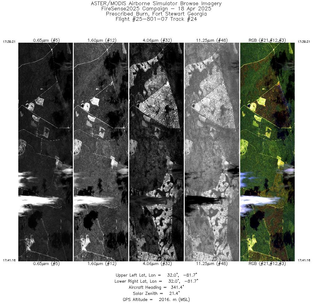
| 24 |
17:39 - 17:41 |
341.5 |
31.970 - 32.049 |
81.687 - 81.716 |
2871 |
2015 |
| 25 |
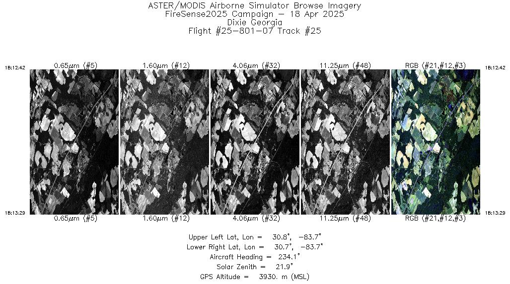
18:12 - 18:13 |
234.4 |
30.808 - 30.775 |
83.640 - 83.688 |
1174 |
3930 |
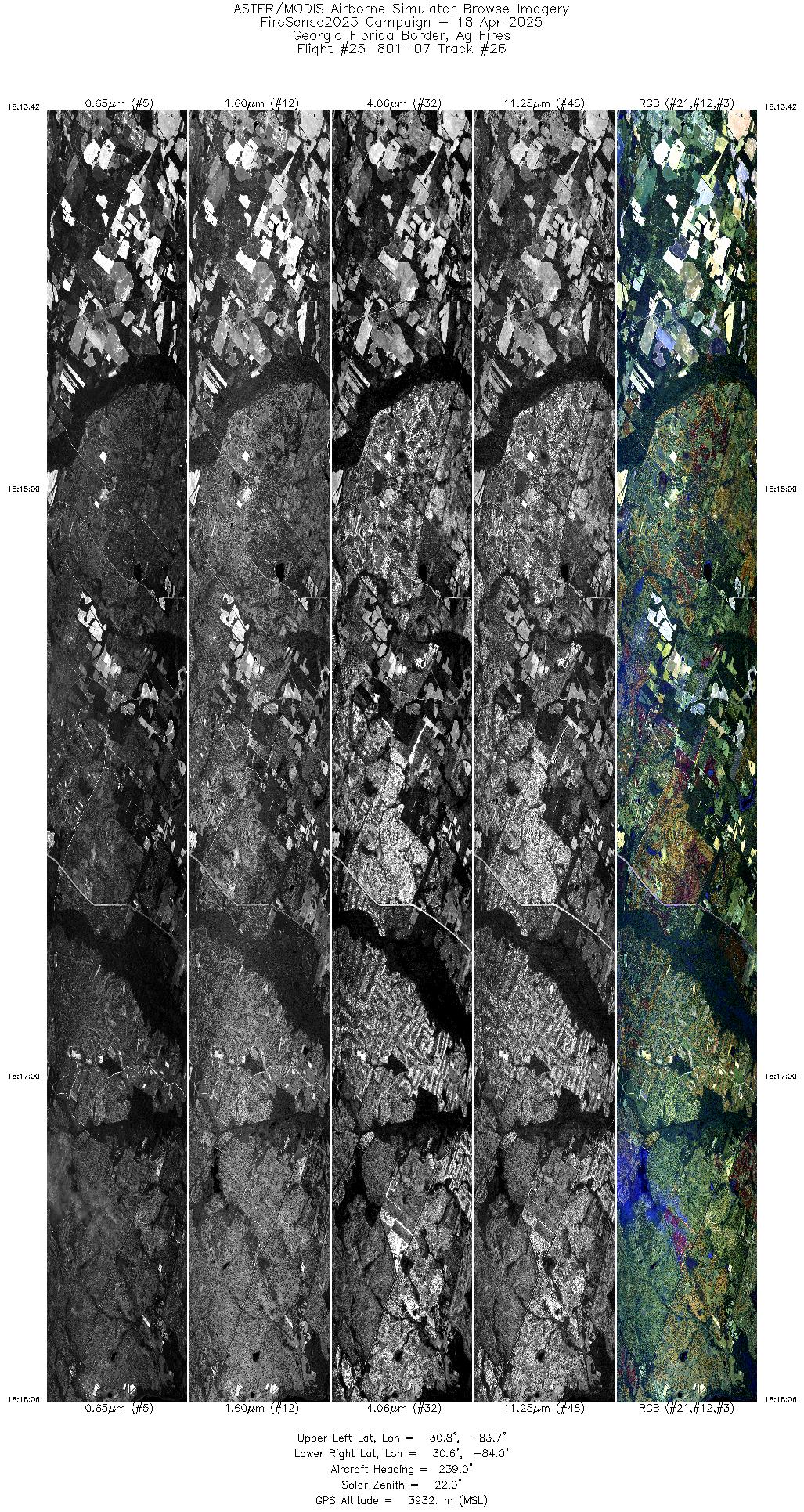
| 26 |
18:13 - 18:18 |
240.0 |
30.766 - 30.605 |
83.702 - 83.998 |
6607 |
3931 |
| 27 |
18:24 - 18:26 |
218.7 |
30.343 - 30.257 |
84.339 - 84.429 |
3668 |
2073 |
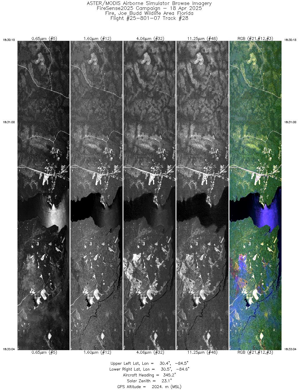
| 28 |
18:30 - 18:33 |
345.4 |
30.386 - 30.506 |
84.497 - 84.533 |
4240 |
2024 |
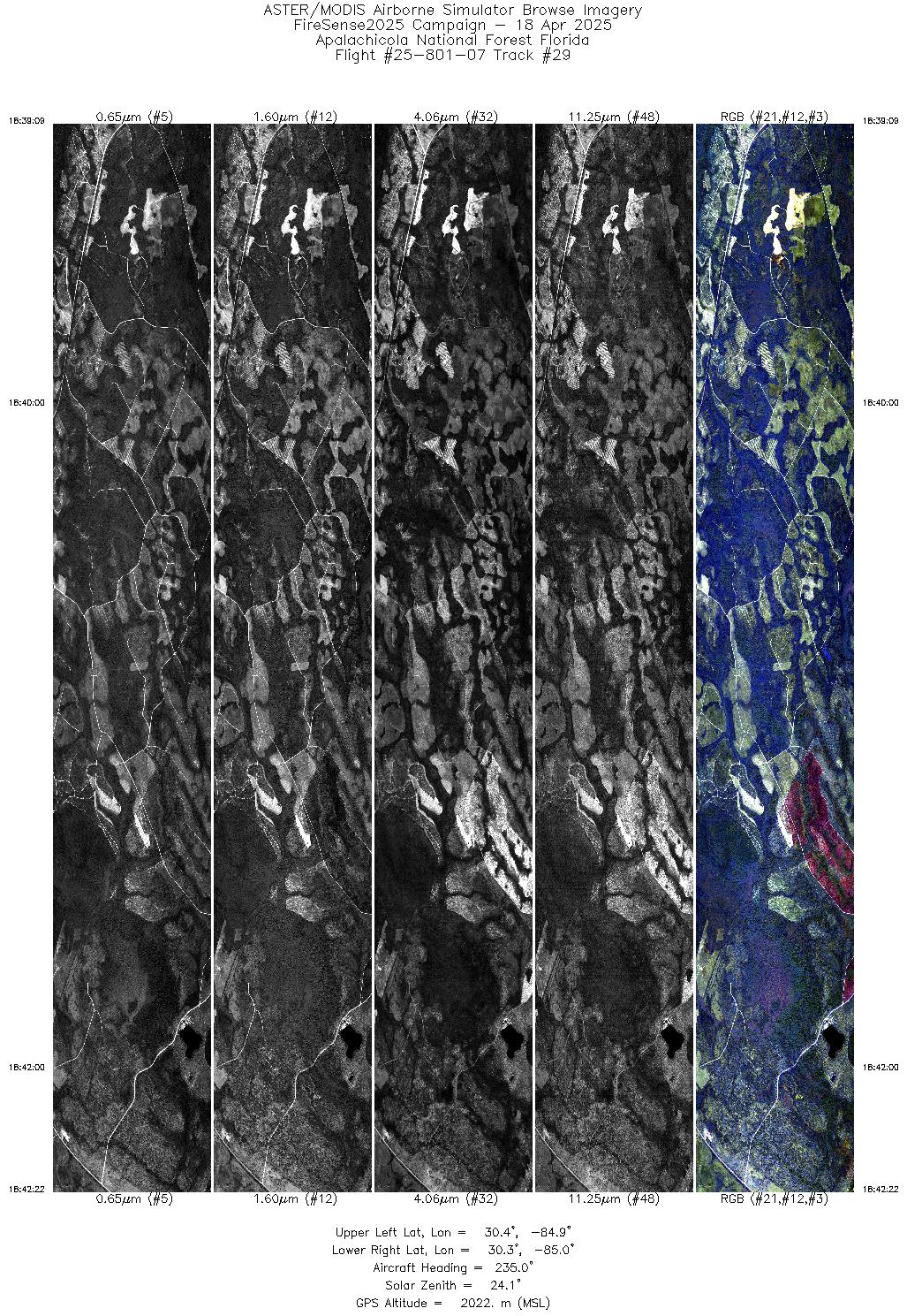
| 29 |
18:39 - 18:42 |
235.0 |
30.349 - 30.273 |
84.873 - 85.017 |
4839 |
2020 |
|


