Flight: 25-801-06
Date: 16 Apr 2025
Aircraft: NASA B-200
Deployment: FireSense 2025
Flight Location: Fort Stewart, GA
Principal Investigators: NASA SMD
Additional Sensors: FireTIRS
|
Data Evaluation
Overall quality is good
Channel 35 offline
Fort Stewart Prescribed Burn (Unit 6)
|
Processing Information
Level-1B Data in HDF format is available
Flight Line Summary
Spectral Band Configuration
Spectral Response Function Table
Spectral Response Function (text)
|
Browse Imagery
Flight Tracks: 44
Scanlines: 95639
|
Browse Imagery Table
|
Click a Flight Track number to view a quicklook image
Lat/Lon ranges are for the BEG-END scanline nadir pixels
|
Flight
Track |
Time Span
(UTC) |
Heading
(Deg) |
Lat Range
(Deg N) |
Lon Range
(Deg W) |
Length
(Scanlines) |
Altitude
(Meters) |
| 1 |
14:09 - 14:10 |
338.3 |
32.015 - 32.070 |
81.703 - 81.725 |
1606 |
1962 |
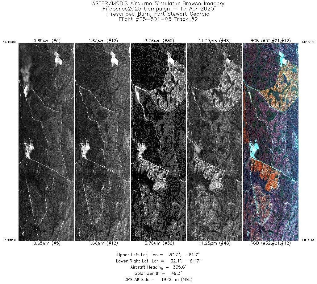
| 2 |
14:14 - 14:16 |
335.5 |
32.009 - 32.070 |
81.702 - 81.725 |
2570 |
1972 |
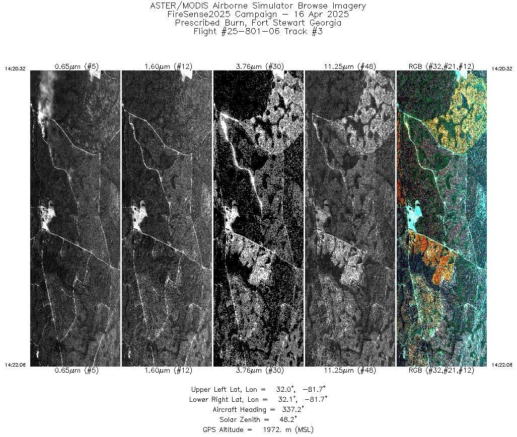
| 3 |
14:20 - 14:22 |
336.6 |
32.014 - 32.070 |
81.704 - 81.725 |
2358 |
1972 |
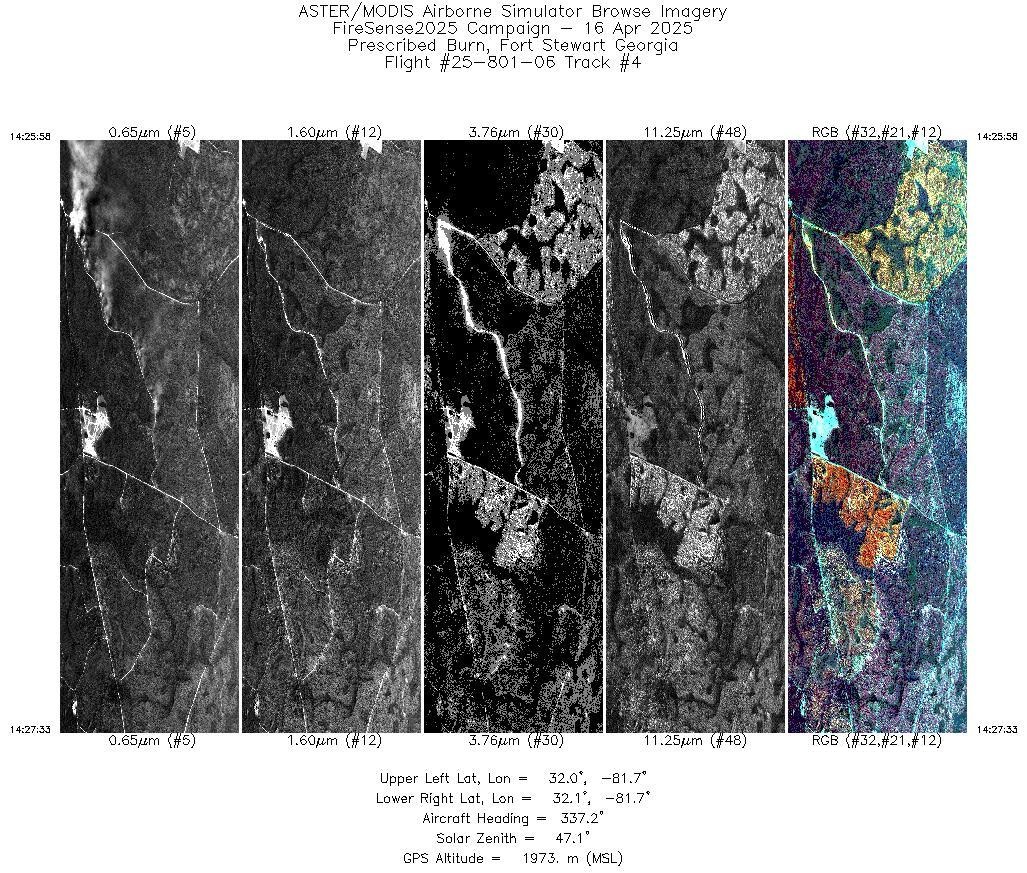
| 4 |
14:25 - 14:27 |
336.5 |
32.014 - 32.070 |
81.704 - 81.725 |
2372 |
1973 |
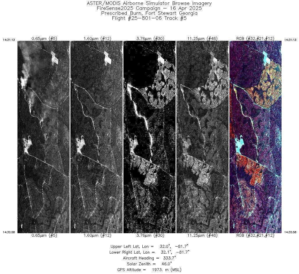
| 5 |
14:31 - 14:32 |
334.7 |
32.008 - 32.070 |
81.702 - 81.725 |
2643 |
1973 |
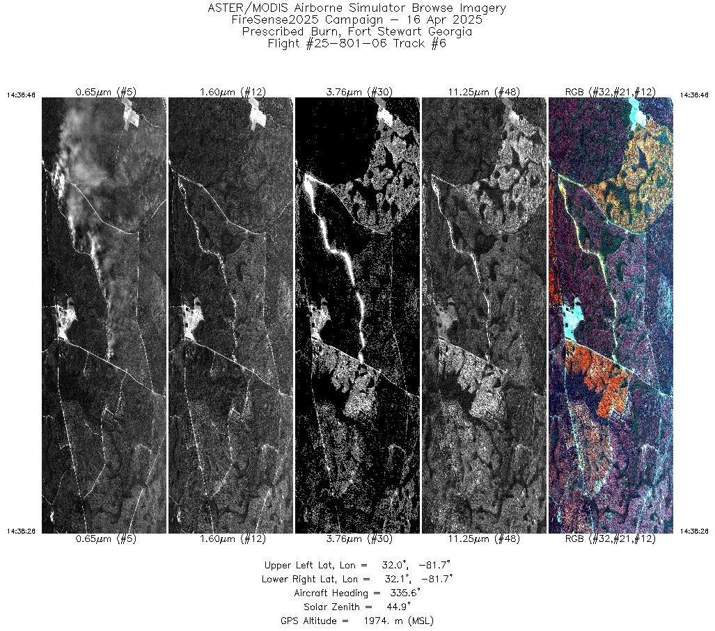
| 6 |
14:36 - 14:38 |
335.7 |
32.012 - 32.070 |
81.703 - 81.725 |
2510 |
1974 |
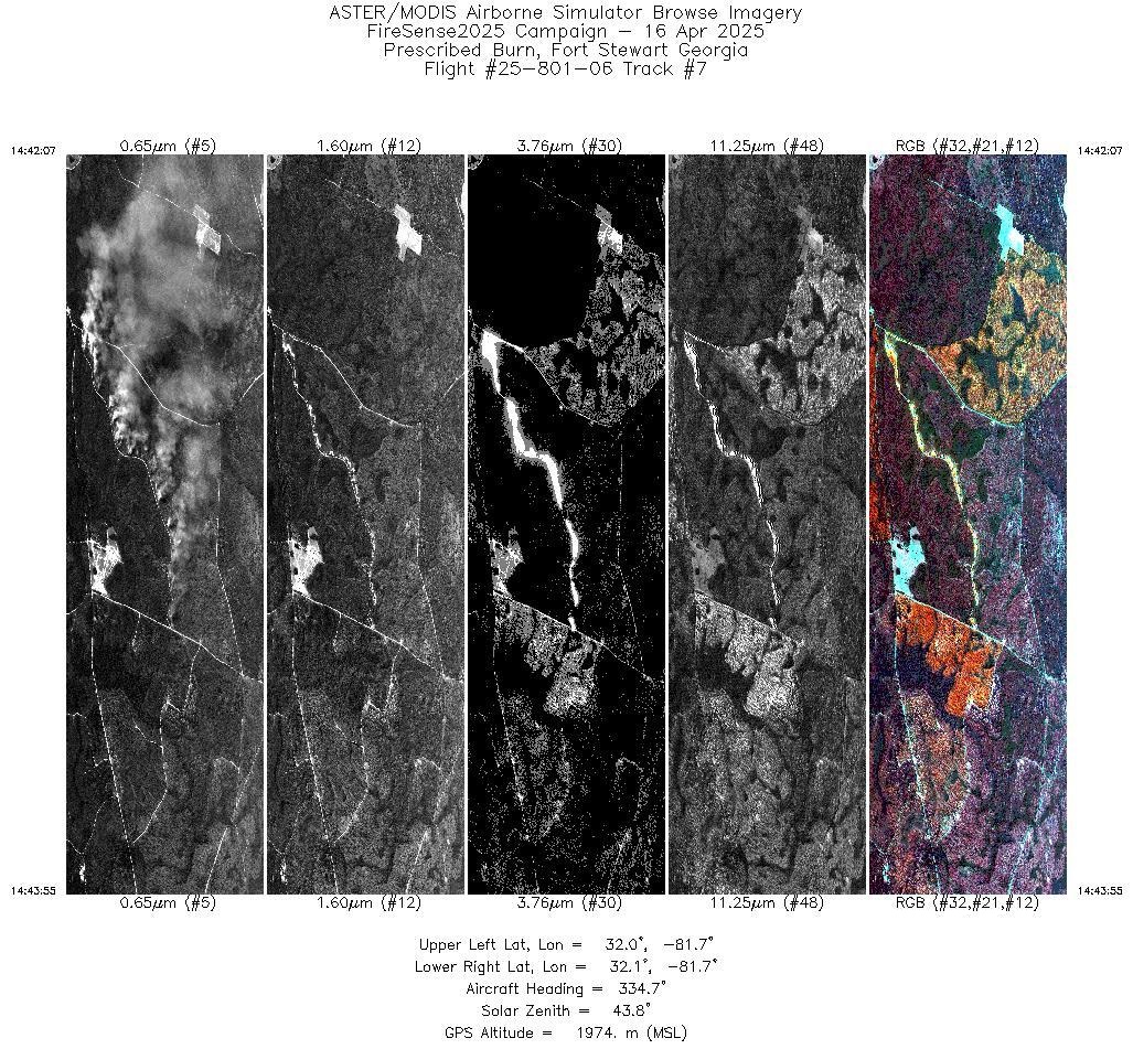
| 7 |
14:42 - 14:43 |
335.5 |
32.007 - 32.070 |
81.701 - 81.725 |
2686 |
1974 |
| 8 |
14:47 - 14:49 |
335.7 |
32.010 - 32.070 |
81.703 - 81.725 |
2570 |
1975 |
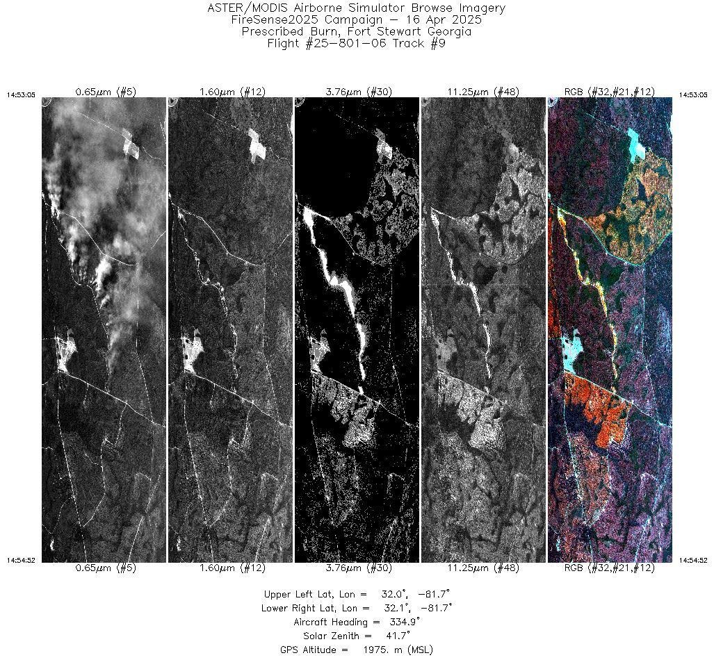
| 9 |
14:53 - 14:54 |
335.7 |
32.007 - 32.070 |
81.701 - 81.725 |
2681 |
1975 |
| 10 |
14:58 - 15:00 |
336.3 |
32.011 - 32.070 |
81.703 - 81.725 |
2520 |
1976 |
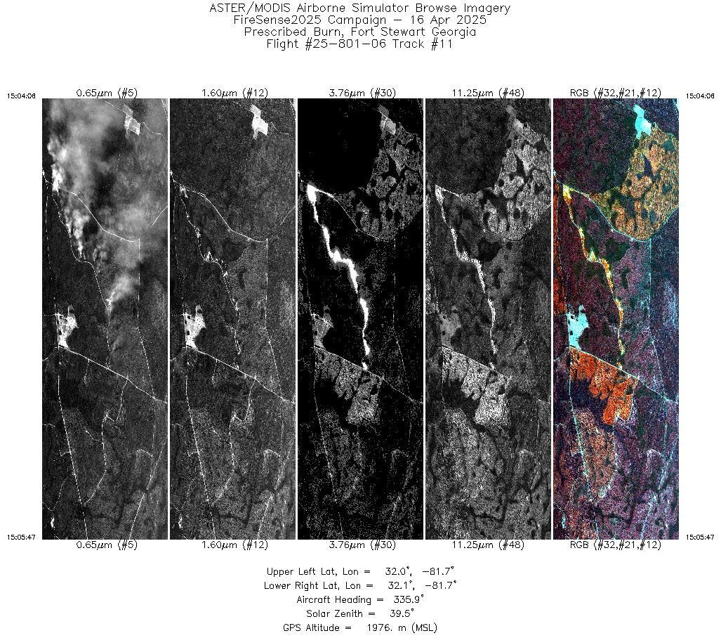
| 11 |
15:04 - 15:05 |
336.1 |
32.011 - 32.070 |
81.703 - 81.725 |
2513 |
1976 |
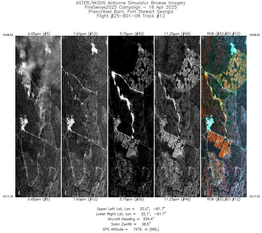
| 12 |
15:09 - 15:11 |
335.5 |
32.009 - 32.070 |
81.702 - 81.725 |
2533 |
1977 |
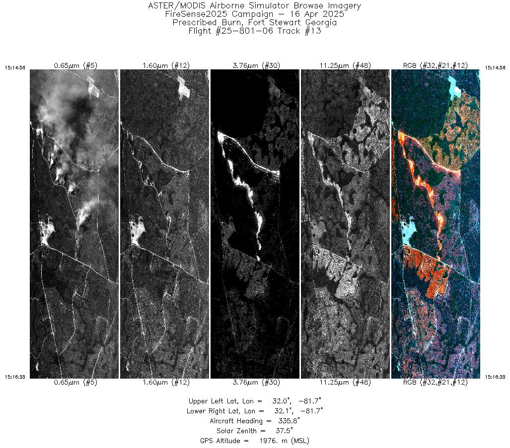
| 13 |
15:14 - 15:16 |
336.0 |
32.010 - 32.070 |
81.703 - 81.725 |
2497 |
1976 |
| 14 |
15:20 - 15:21 |
336.5 |
32.012 - 32.070 |
81.703 - 81.725 |
2417 |
1976 |
| 15 |
15:25 - 15:27 |
336.6 |
32.012 - 32.070 |
81.703 - 81.725 |
2394 |
1976 |
| 16 |
15:31 - 15:32 |
336.6 |
32.013 - 32.070 |
81.704 - 81.725 |
2392 |
1977 |
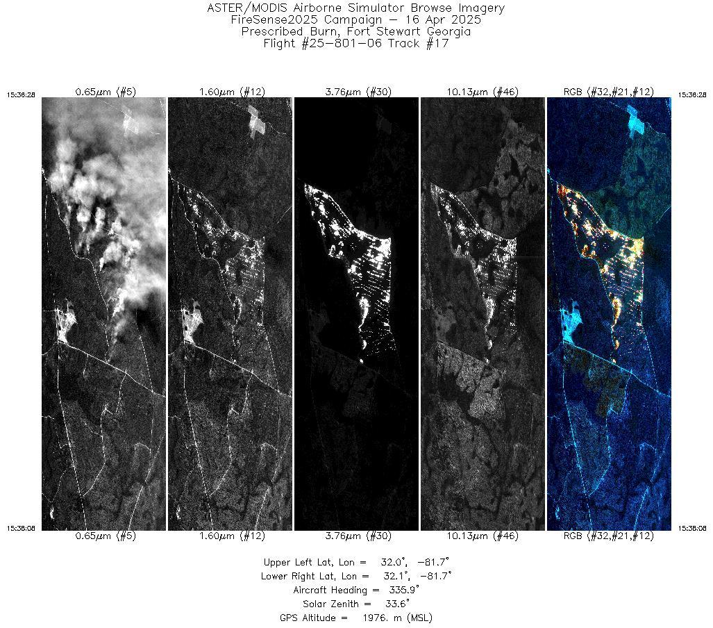
| 17 |
15:36 - 15:38 |
335.9 |
32.010 - 32.070 |
81.703 - 81.725 |
2498 |
1977 |
| 18 |
15:41 - 15:43 |
334.8 |
32.010 - 32.070 |
81.703 - 81.725 |
1663 |
2601 |
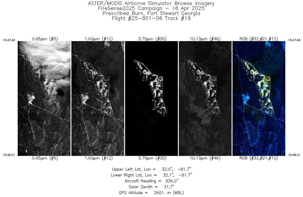
| 19 |
15:47 - 15:49 |
335.7 |
32.013 - 32.070 |
81.704 - 81.725 |
1567 |
2601 |
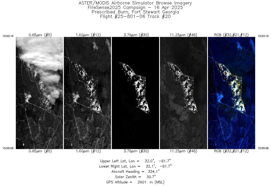
| 20 |
15:53 - 15:55 |
334.8 |
32.009 - 32.070 |
81.702 - 81.725 |
1701 |
2602 |
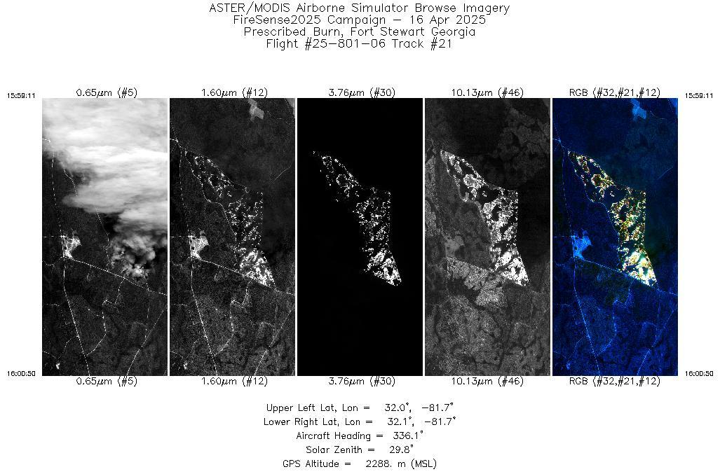
| 21 |
15:59 - 16:00 |
335.8 |
32.011 - 32.070 |
81.703 - 81.725 |
1588 |
2288 |
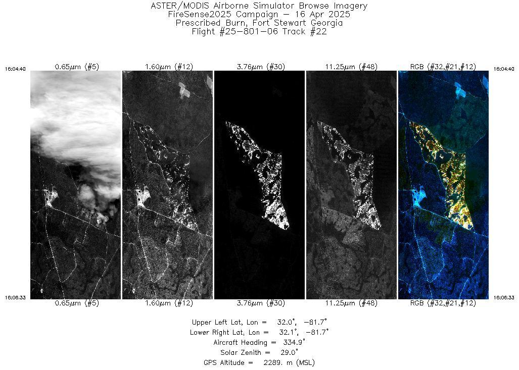
| 22 |
16:04 - 16:06 |
335.0 |
32.008 - 32.070 |
81.702 - 81.725 |
1815 |
2290 |
| 23 |
16:10 - 16:12 |
335.0 |
32.009 - 32.070 |
81.702 - 81.725 |
1753 |
2289 |
| 24 |
16:15 - 16:17 |
335.7 |
32.011 - 32.070 |
81.703 - 81.725 |
1664 |
2288 |
| 25 |
16:21 - 16:23 |
335.1 |
32.010 - 32.070 |
81.702 - 81.725 |
1672 |
2288 |
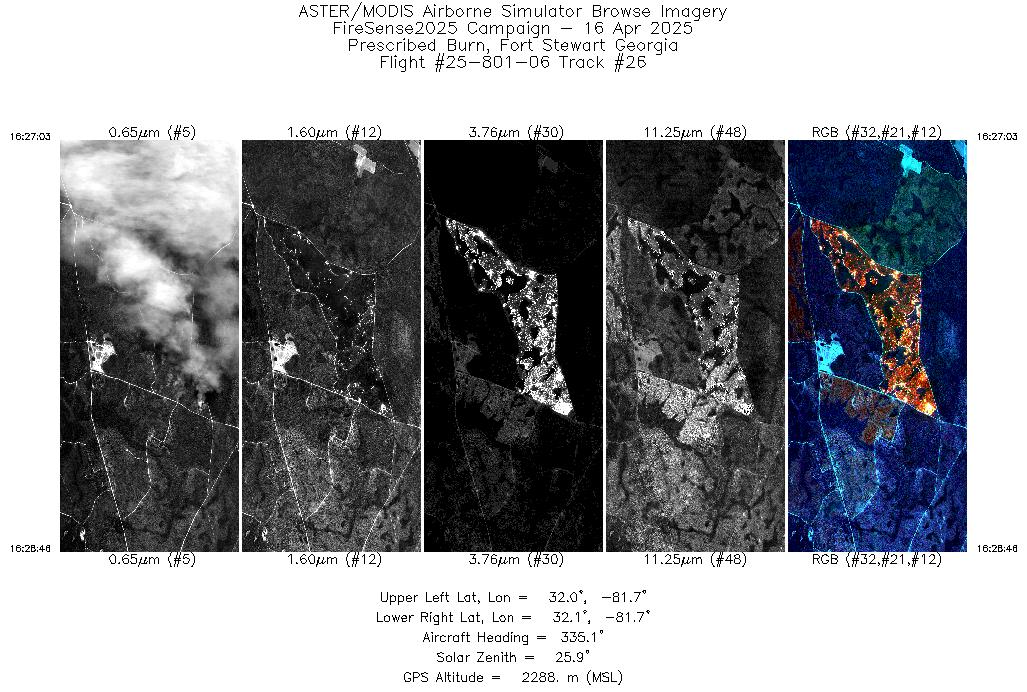
| 26 |
16:27 - 16:28 |
335.3 |
32.011 - 32.070 |
81.703 - 81.725 |
1650 |
2287 |
| 27 |
16:32 - 16:34 |
334.6 |
32.009 - 32.070 |
81.702 - 81.725 |
1701 |
2288 |
| 28 |
16:38 - 16:39 |
334.7 |
32.009 - 32.070 |
81.702 - 81.725 |
1728 |
2288 |
| 29 |
16:43 - 16:45 |
335.1 |
32.010 - 32.070 |
81.702 - 81.725 |
1708 |
2288 |
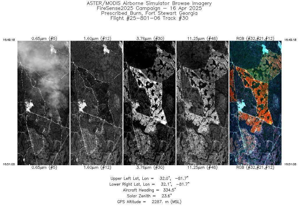
| 30 |
16:49 - 16:51 |
334.8 |
32.010 - 32.070 |
81.702 - 81.725 |
1710 |
2287 |
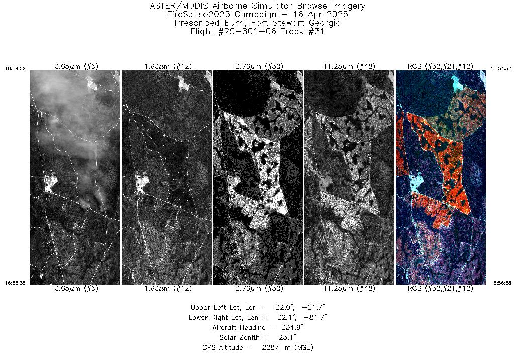
| 31 |
16:54 - 16:56 |
335.2 |
32.010 - 32.070 |
81.703 - 81.725 |
1709 |
2287 |
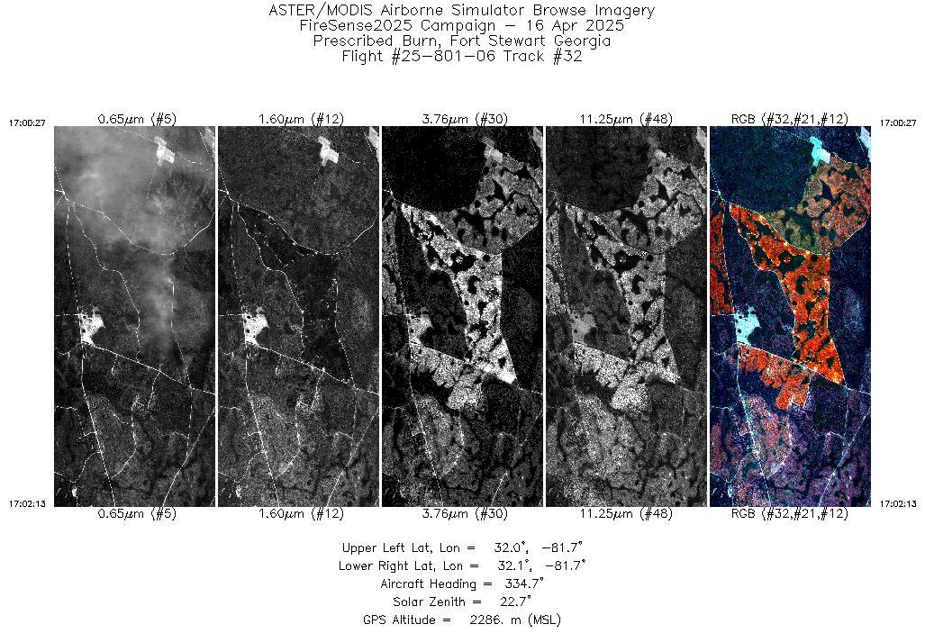
| 32 |
17:00 - 17:02 |
335.1 |
32.010 - 32.070 |
81.703 - 81.725 |
1694 |
2286 |
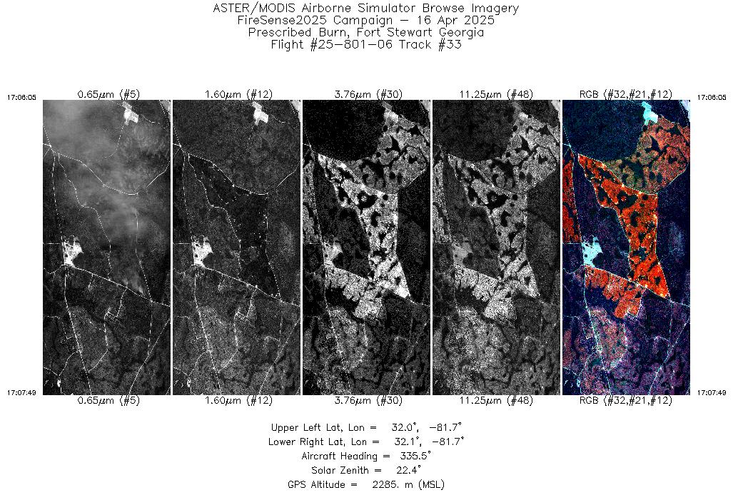
| 33 |
17:06 - 17:07 |
335.5 |
32.011 - 32.070 |
81.703 - 81.725 |
1657 |
2285 |
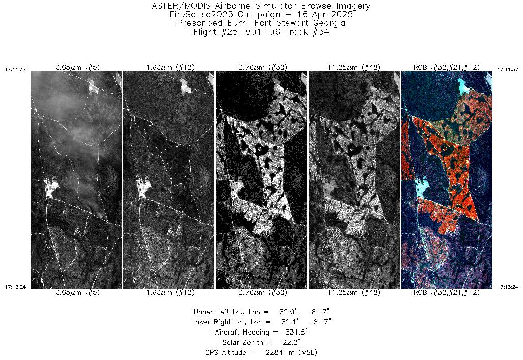
| 34 |
17:11 - 17:13 |
335.2 |
32.009 - 32.070 |
81.702 - 81.725 |
1709 |
2285 |
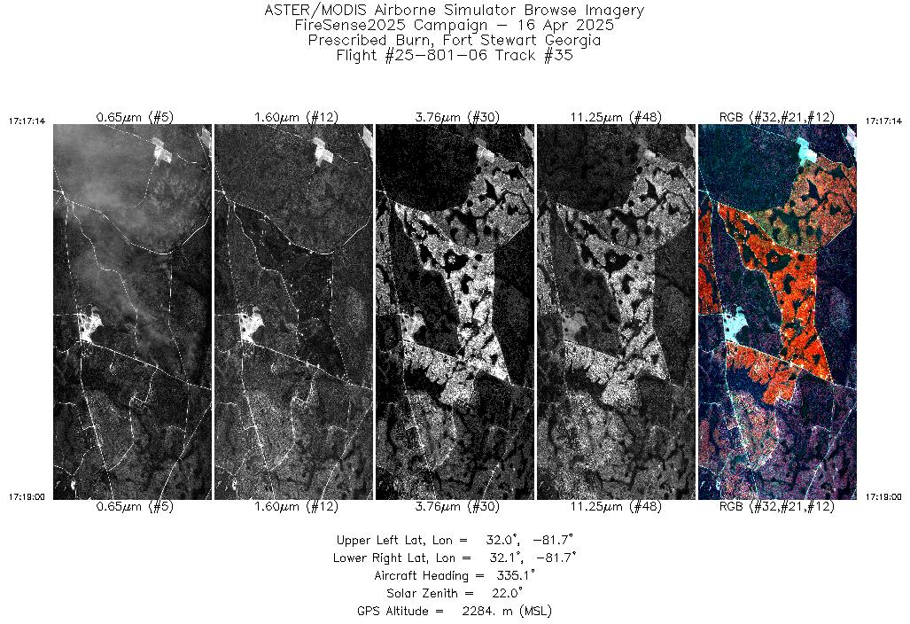
| 35 |
17:17 - 17:18 |
335.4 |
32.009 - 32.070 |
81.702 - 81.725 |
1698 |
2284 |
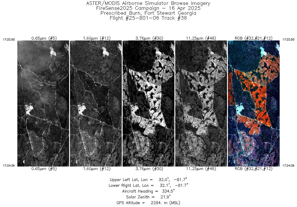
| 36 |
17:22 - 17:24 |
335.0 |
32.008 - 32.070 |
81.702 - 81.725 |
1745 |
2284 |
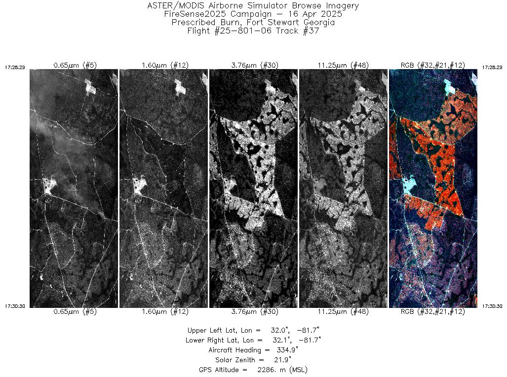
| 37 |
17:28 - 17:30 |
335.7 |
32.009 - 32.077 |
81.702 - 81.727 |
1939 |
2286 |
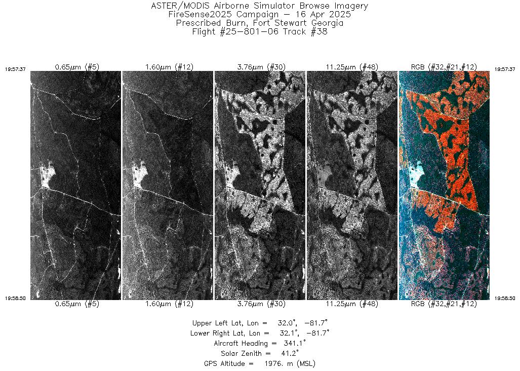
| 38 |
19:57 - 19:58 |
340.6 |
32.019 - 32.070 |
81.706 - 81.725 |
1810 |
1976 |
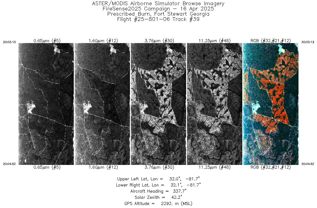
| 39 |
20:03 - 20:04 |
337.9 |
32.011 - 32.070 |
81.703 - 81.725 |
1584 |
2292 |
| 40 |
20:08 - 20:10 |
338.2 |
32.010 - 32.070 |
81.702 - 81.725 |
2489 |
1980 |
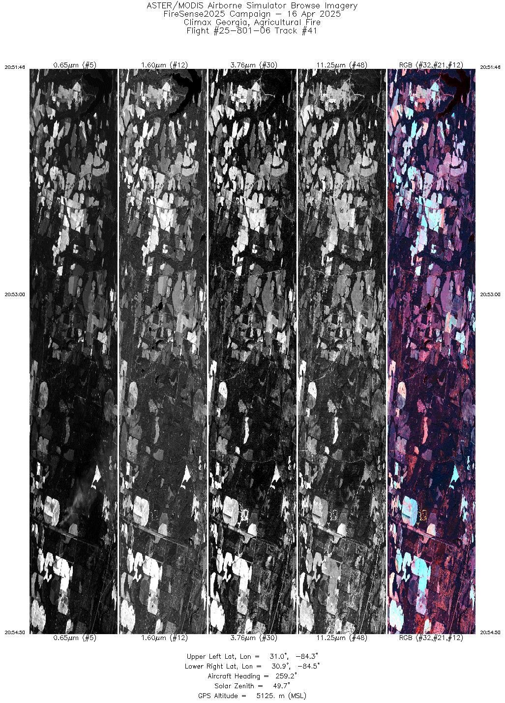
| 41 |
20:51 - 20:54 |
259.3 |
30.958 - 30.900 |
84.265 - 84.481 |
4597 |
5125 |
| 42 |
20:55 - 20:58 |
271.1 |
30.898 - 30.882 |
84.501 - 84.756 |
5400 |
5129 |
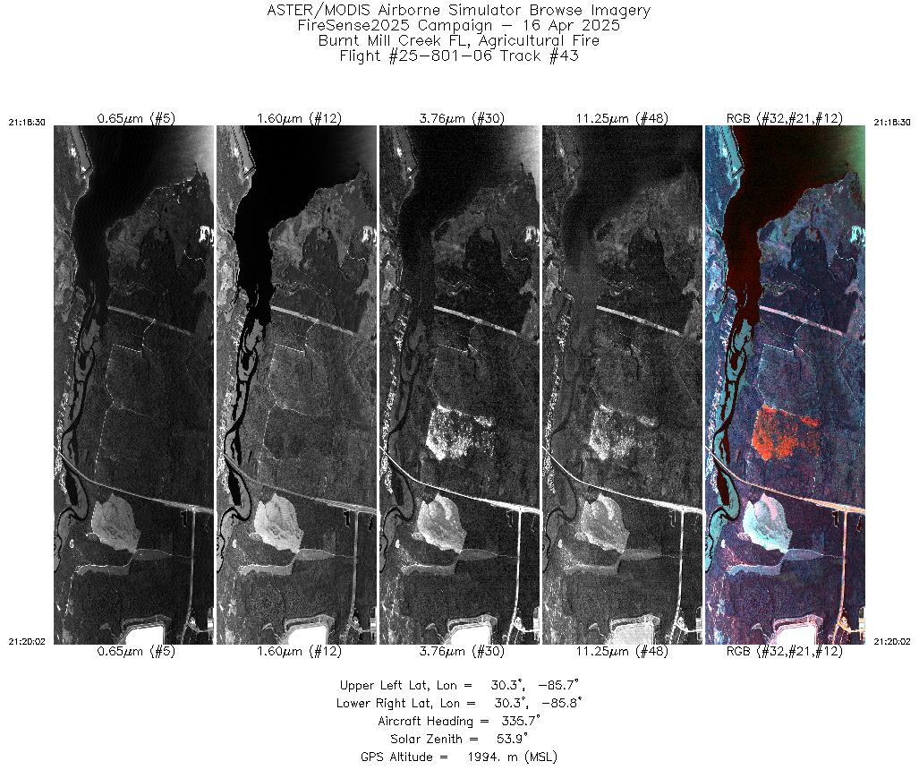
| 43 |
21:18 - 21:20 |
335.8 |
30.288 - 30.342 |
85.763 - 85.788 |
2320 |
1996 |
| 44 |
21:24 - 21:25 |
333.8 |
30.299 - 30.338 |
85.765 - 85.785 |
1608 |
1994 |
|


