Flight: 25-801-05
Date: 14 Apr 2025
Aircraft: NASA B-200
Deployment: FireSense 2025
Flight Location: Fort Stewart, GA
Principal Investigators: NASA SMD
Additional Sensors: FireTIRS
|
Data Evaluation
Overall quality is good
Channel 35 offline
Fort Stewart Prescribed Burn (Unit 8)
|
Processing Information
Level-1B Data in HDF format is available
Flight Line Summary
Spectral Band Configuration
Spectral Response Function Table
Spectral Response Function (text)
|
Browse Imagery
Flight Tracks: 35
Scanlines: 125100
|
Browse Imagery Table
|
Click a Flight Track number to view a quicklook image
Lat/Lon ranges are for the BEG-END scanline nadir pixels
|
Flight
Track |
Time Span
(UTC) |
Heading
(Deg) |
Lat Range
(Deg N) |
Lon Range
(Deg W) |
Length
(Scanlines) |
Altitude
(Meters) |
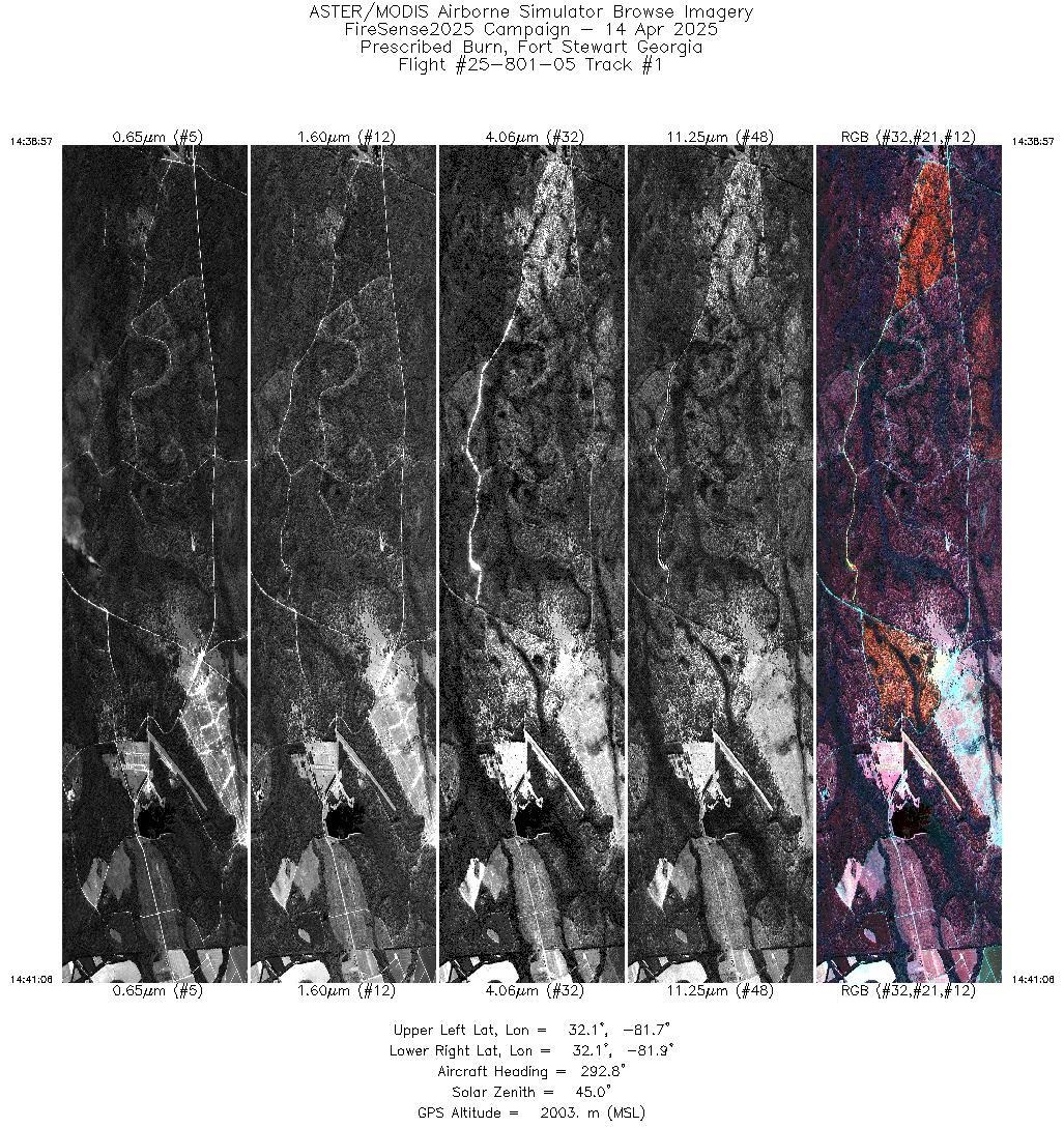
| 1 |
14:38 - 14:41 |
295.8 |
32.035 - 32.086 |
81.755 - 81.841 |
3238 |
2002 |
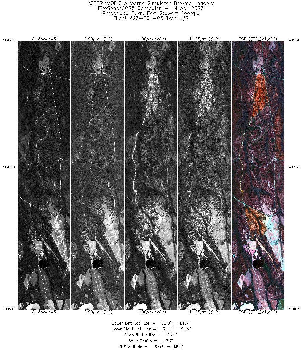
| 2 |
14:45 - 14:48 |
298.9 |
32.026 - 32.086 |
81.747 - 81.841 |
3656 |
2003 |
| 3 |
14:53 - 14:55 |
299.4 |
32.029 - 32.086 |
81.751 - 81.841 |
3382 |
2075 |
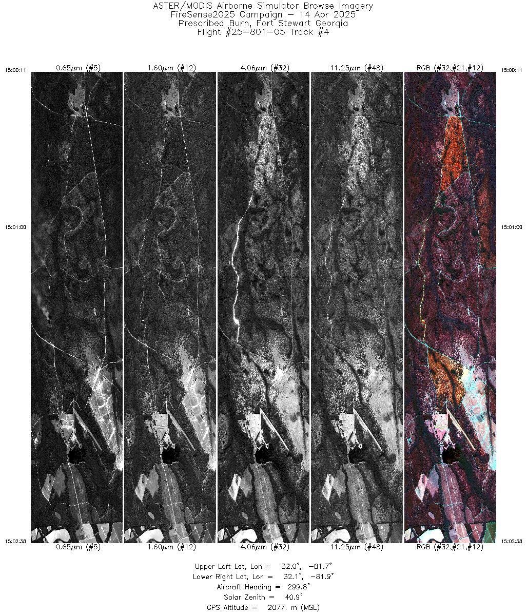
| 4 |
15:00 - 15:02 |
299.0 |
32.027 - 32.087 |
81.749 - 81.841 |
3675 |
2076 |
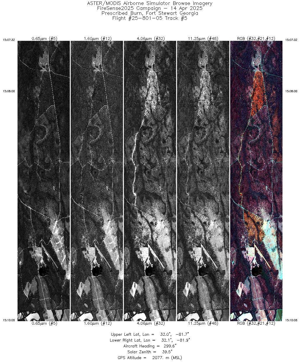
| 5 |
15:07 - 15:10 |
298.8 |
32.027 - 32.086 |
81.748 - 81.841 |
3844 |
2077 |
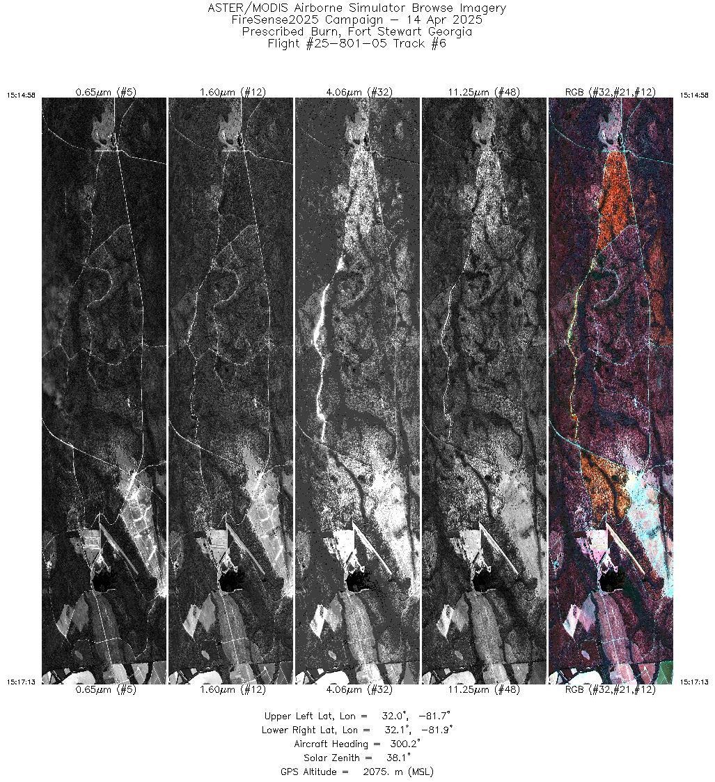
| 6 |
15:14 - 15:17 |
299.6 |
32.028 - 32.086 |
81.750 - 81.841 |
3369 |
2075 |
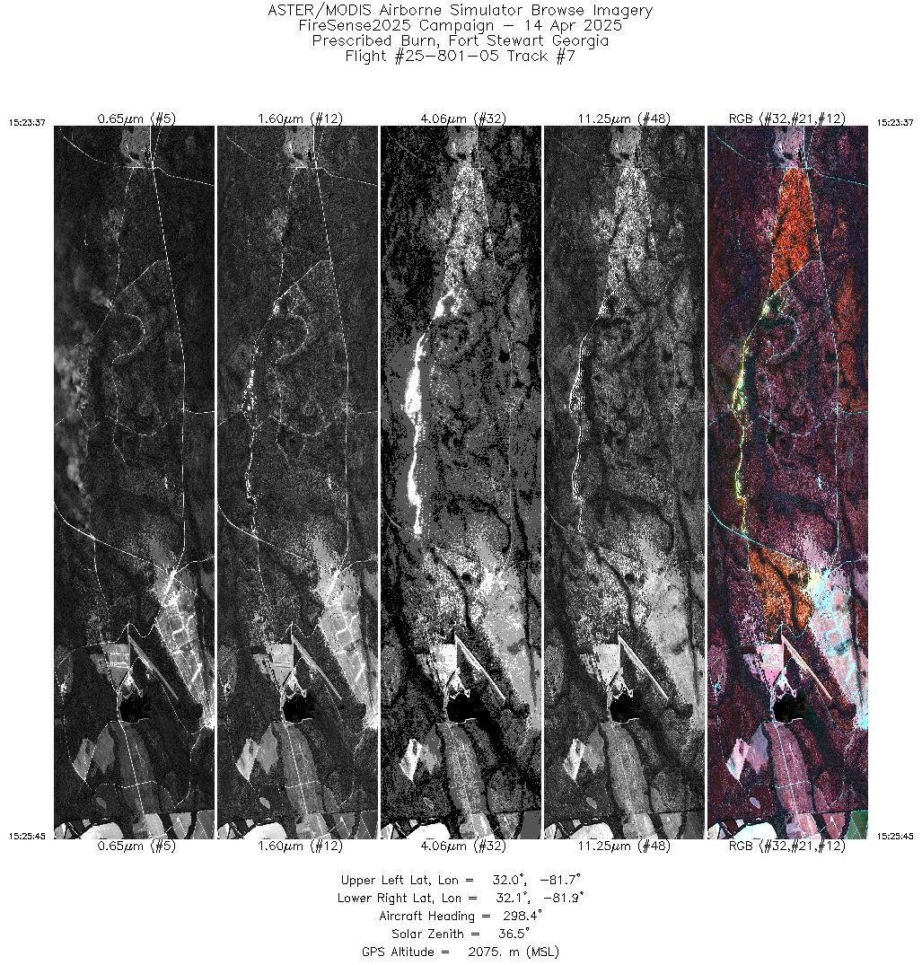
| 7 |
15:23 - 15:25 |
298.7 |
32.030 - 32.086 |
81.753 - 81.841 |
3183 |
2075 |
| 8 |
15:30 - 15:32 |
300.1 |
32.032 - 32.086 |
81.756 - 81.841 |
3077 |
2075 |
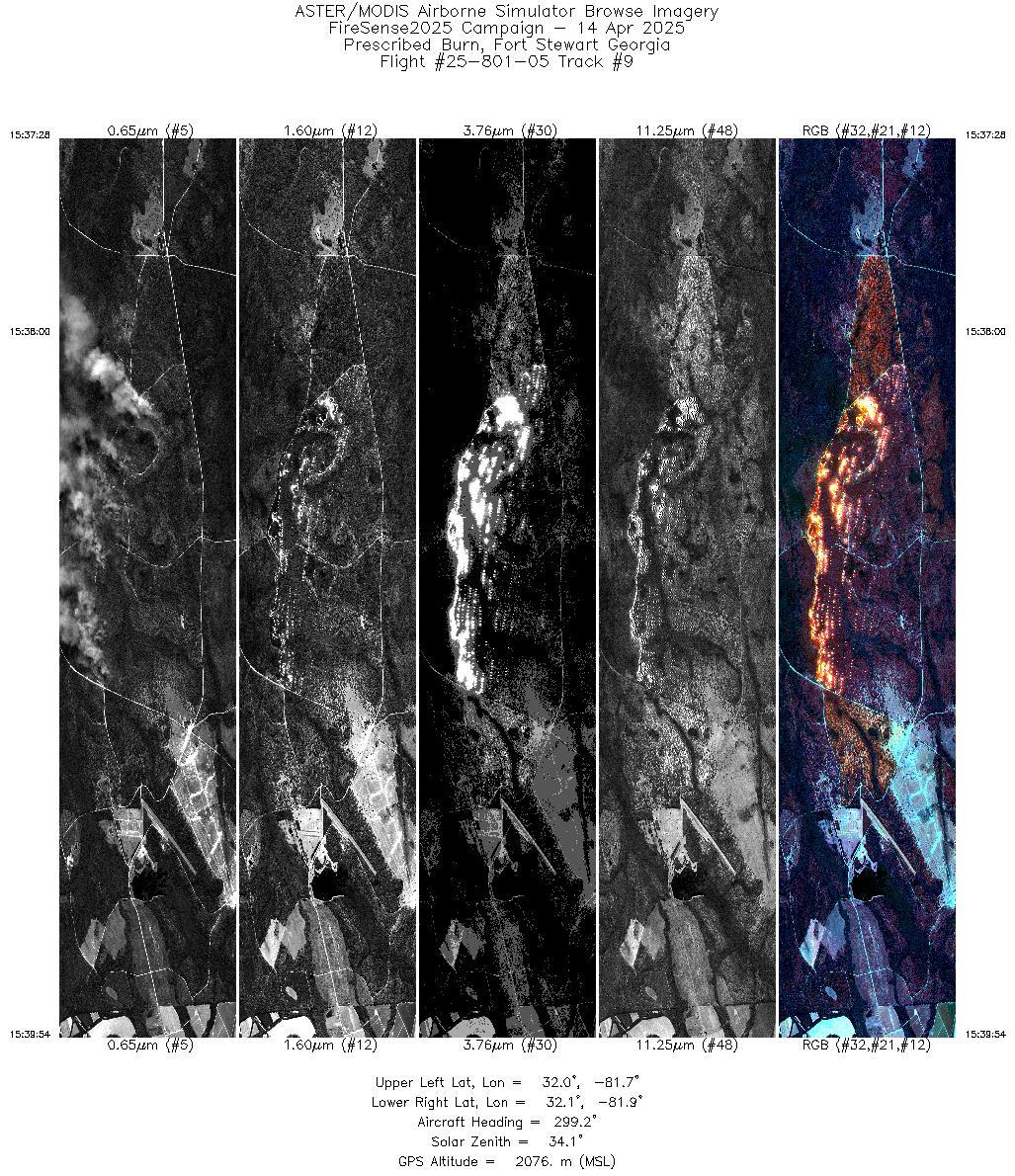
| 9 |
15:37 - 15:39 |
299.1 |
32.026 - 32.086 |
81.746 - 81.841 |
3640 |
2076 |
| 10 |
15:44 - 15:46 |
299.5 |
32.026 - 32.086 |
81.747 - 81.841 |
3507 |
2075 |
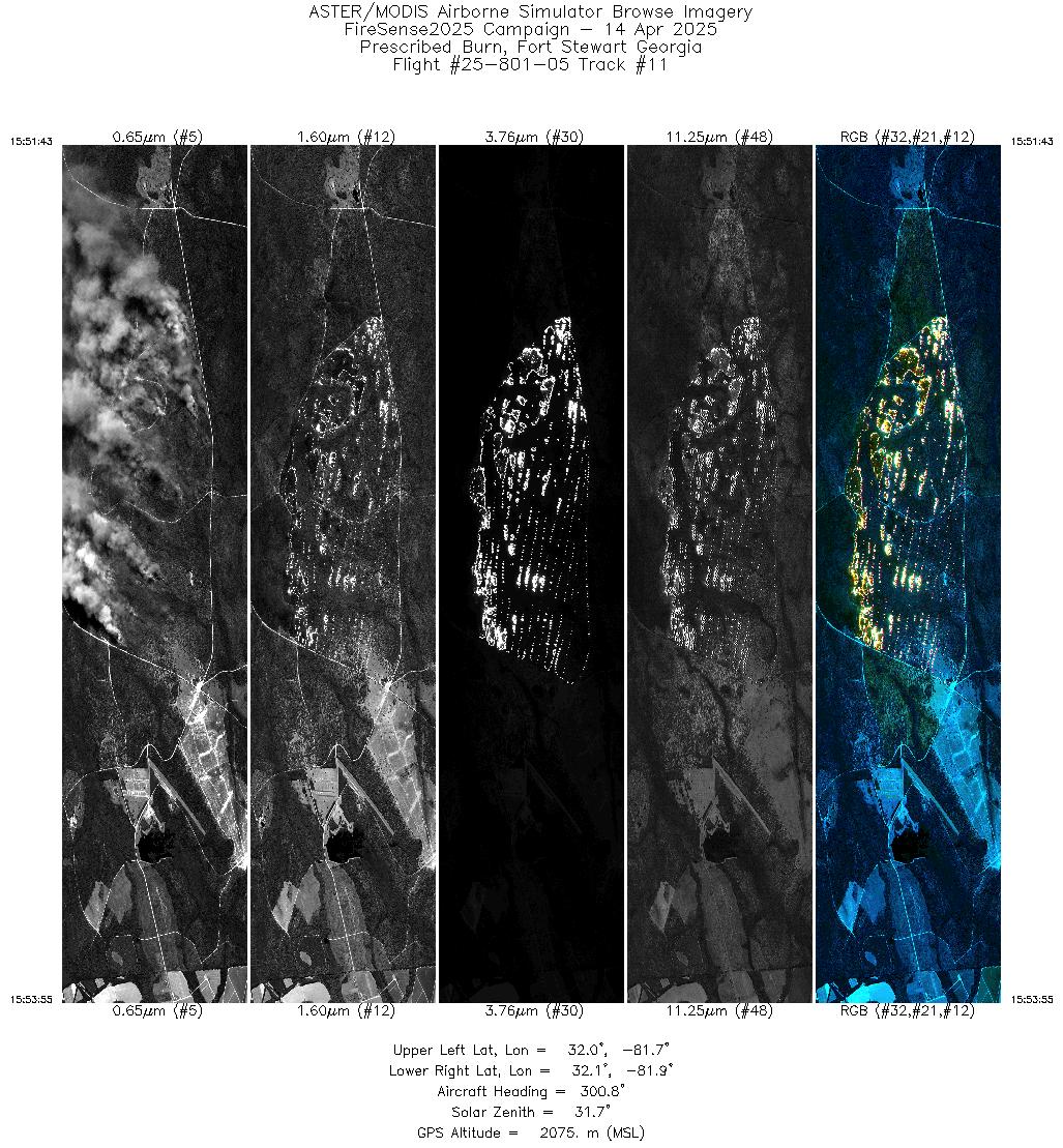
| 11 |
15:51 - 15:53 |
300.0 |
32.029 - 32.086 |
81.752 - 81.841 |
3317 |
2075 |
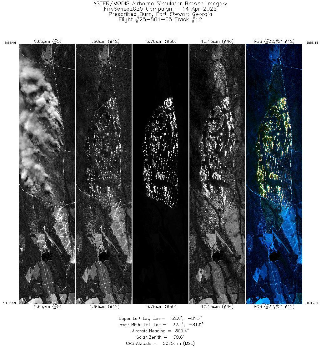
| 12 |
15:58 - 16:00 |
299.9 |
32.029 - 32.086 |
81.751 - 81.841 |
3332 |
2075 |
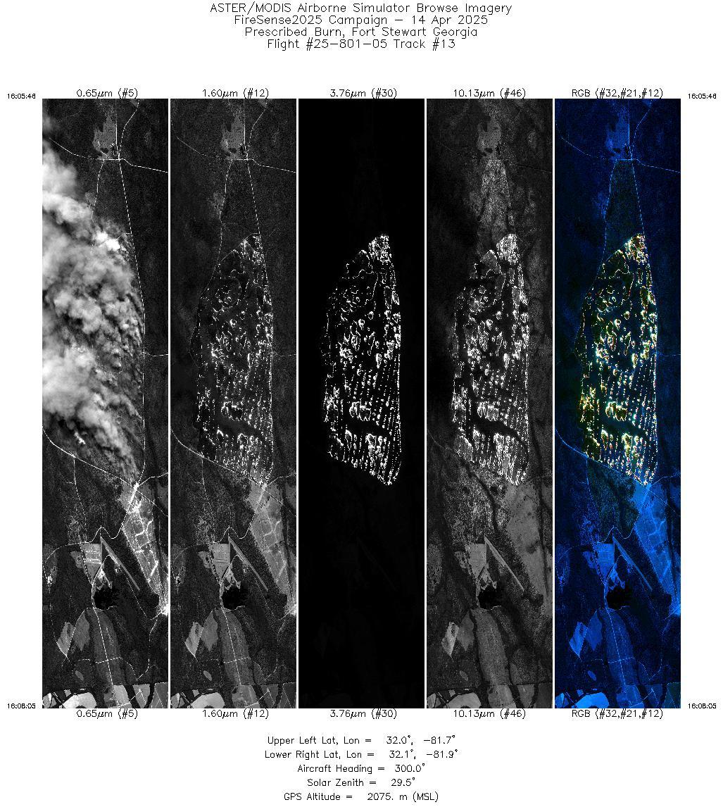
| 13 |
16:05 - 16:08 |
299.4 |
32.027 - 32.087 |
81.749 - 81.841 |
3467 |
2075 |
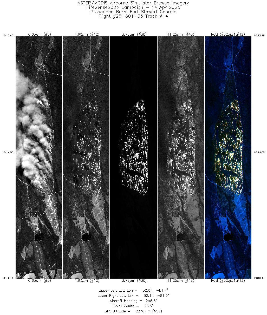
| 14 |
16:12 - 16:15 |
298.6 |
32.025 - 32.086 |
81.745 - 81.841 |
3731 |
2076 |
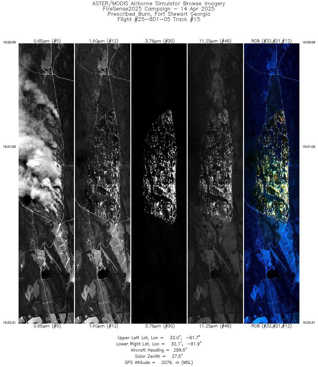
| 15 |
16:20 - 16:22 |
298.9 |
32.027 - 32.086 |
81.748 - 81.841 |
3622 |
2076 |
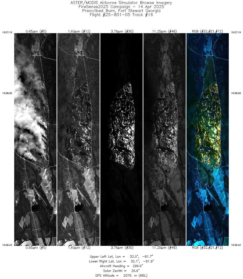
| 16 |
16:27 - 16:29 |
299.1 |
32.027 - 32.086 |
81.749 - 81.841 |
3593 |
2076 |
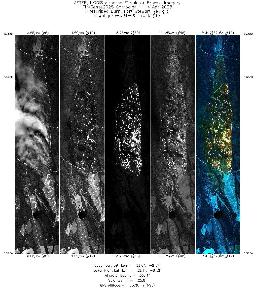
| 17 |
16:34 - 16:36 |
299.3 |
32.028 - 32.087 |
81.750 - 81.841 |
3536 |
2077 |
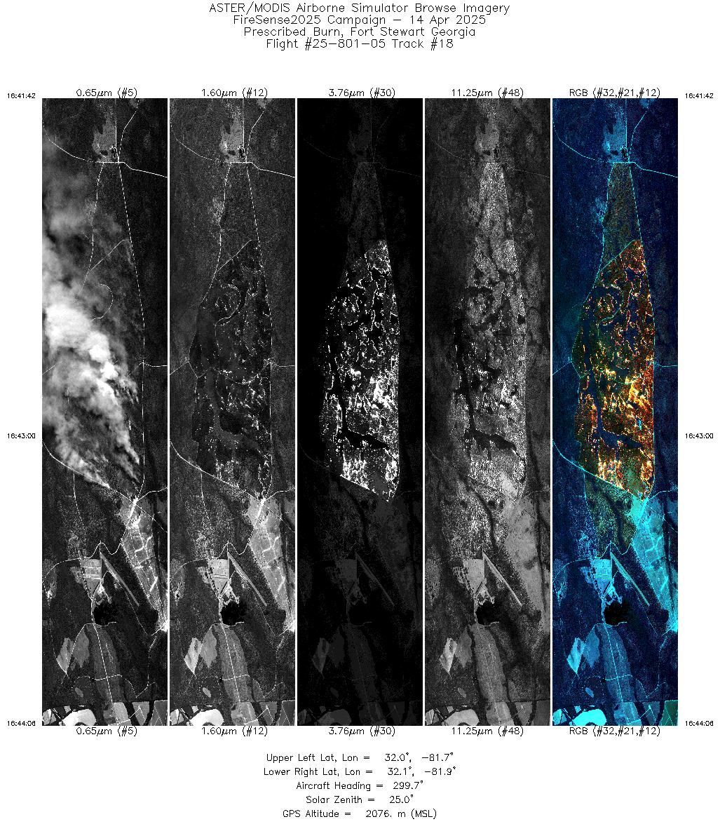
| 18 |
16:41 - 16:44 |
299.0 |
32.027 - 32.087 |
81.749 - 81.841 |
3582 |
2076 |
| 19 |
16:48 - 16:51 |
298.5 |
32.027 - 32.086 |
81.748 - 81.841 |
3626 |
2076 |
| 20 |
16:56 - 16:58 |
298.2 |
32.028 - 32.086 |
81.749 - 81.841 |
3583 |
2075 |
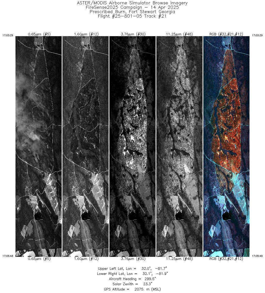
| 21 |
17:03 - 17:05 |
298.5 |
32.030 - 32.086 |
81.753 - 81.841 |
3418 |
2075 |
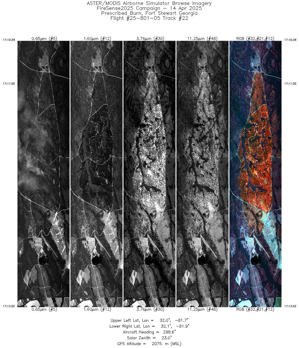
| 22 |
17:10 - 17:13 |
298.0 |
32.026 - 32.087 |
81.747 - 81.841 |
3653 |
2075 |
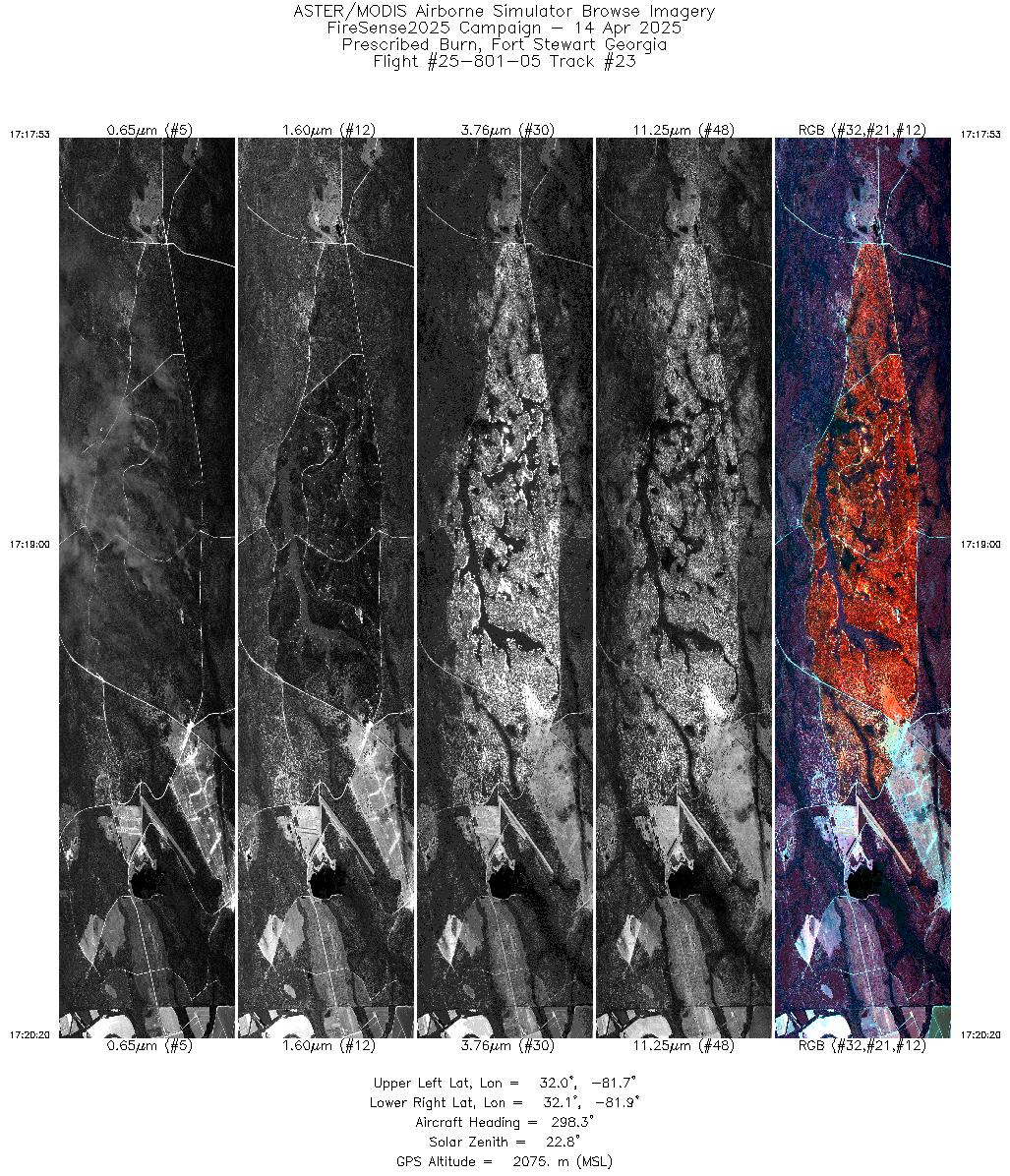
| 23 |
17:17 - 17:20 |
297.9 |
32.026 - 32.086 |
81.747 - 81.841 |
3665 |
2074 |
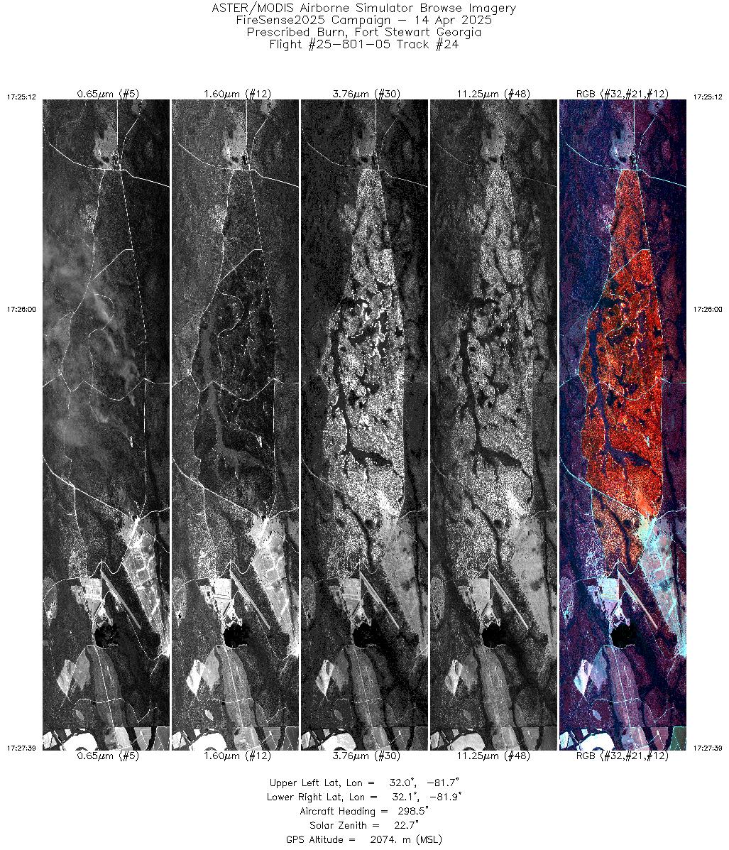
| 24 |
17:25 - 17:27 |
297.9 |
32.027 - 32.087 |
81.748 - 81.841 |
3670 |
2074 |
| 25 |
17:32 - 17:34 |
298.1 |
32.028 - 32.087 |
81.750 - 81.841 |
3610 |
2073 |
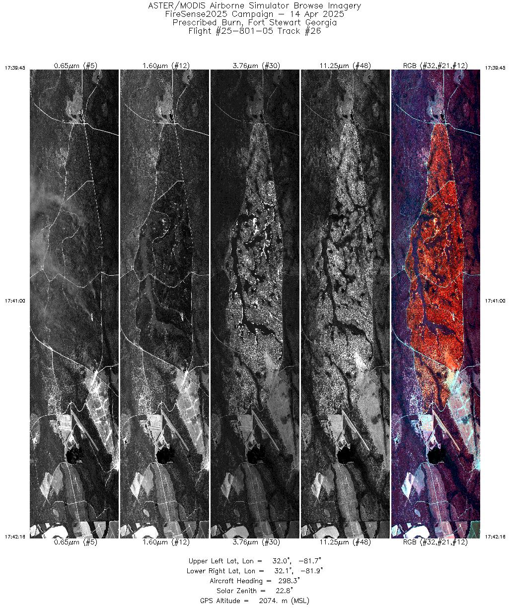
| 26 |
17:39 - 17:42 |
297.8 |
32.027 - 32.087 |
81.748 - 81.841 |
3777 |
2073 |
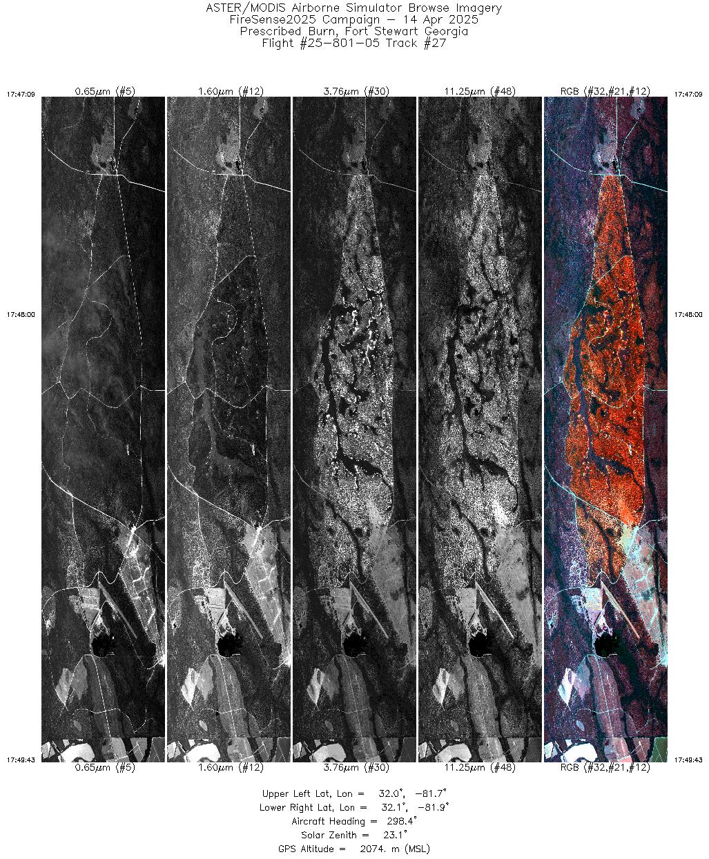
| 27 |
17:47 - 17:49 |
297.7 |
32.026 - 32.087 |
81.747 - 81.841 |
3858 |
2074 |
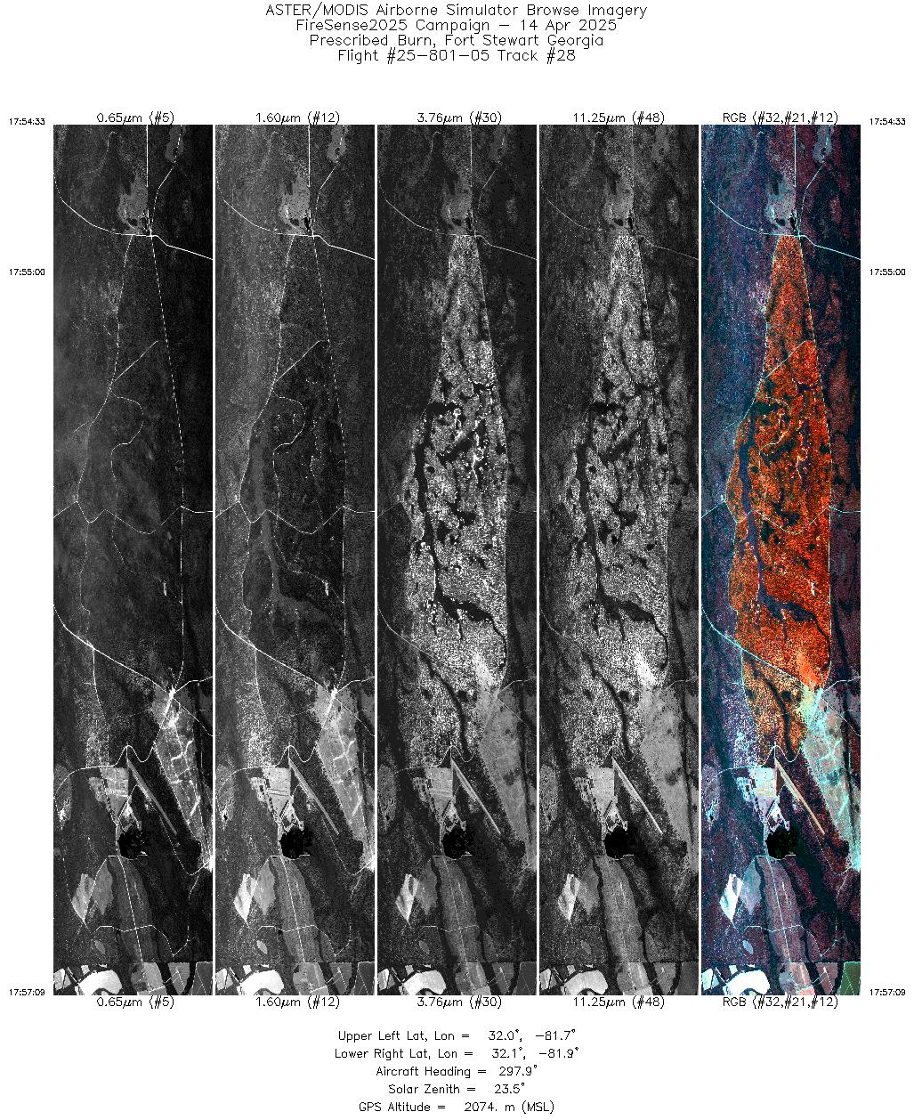
| 28 |
17:54 - 17:57 |
297.6 |
32.026 - 32.087 |
81.746 - 81.841 |
3912 |
2074 |
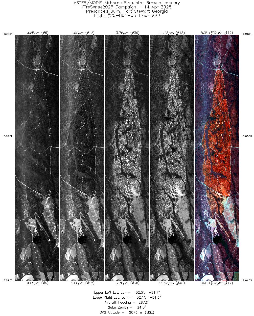
| 29 |
18:01 - 18:04 |
297.2 |
32.025 - 32.087 |
81.744 - 81.841 |
3973 |
2074 |
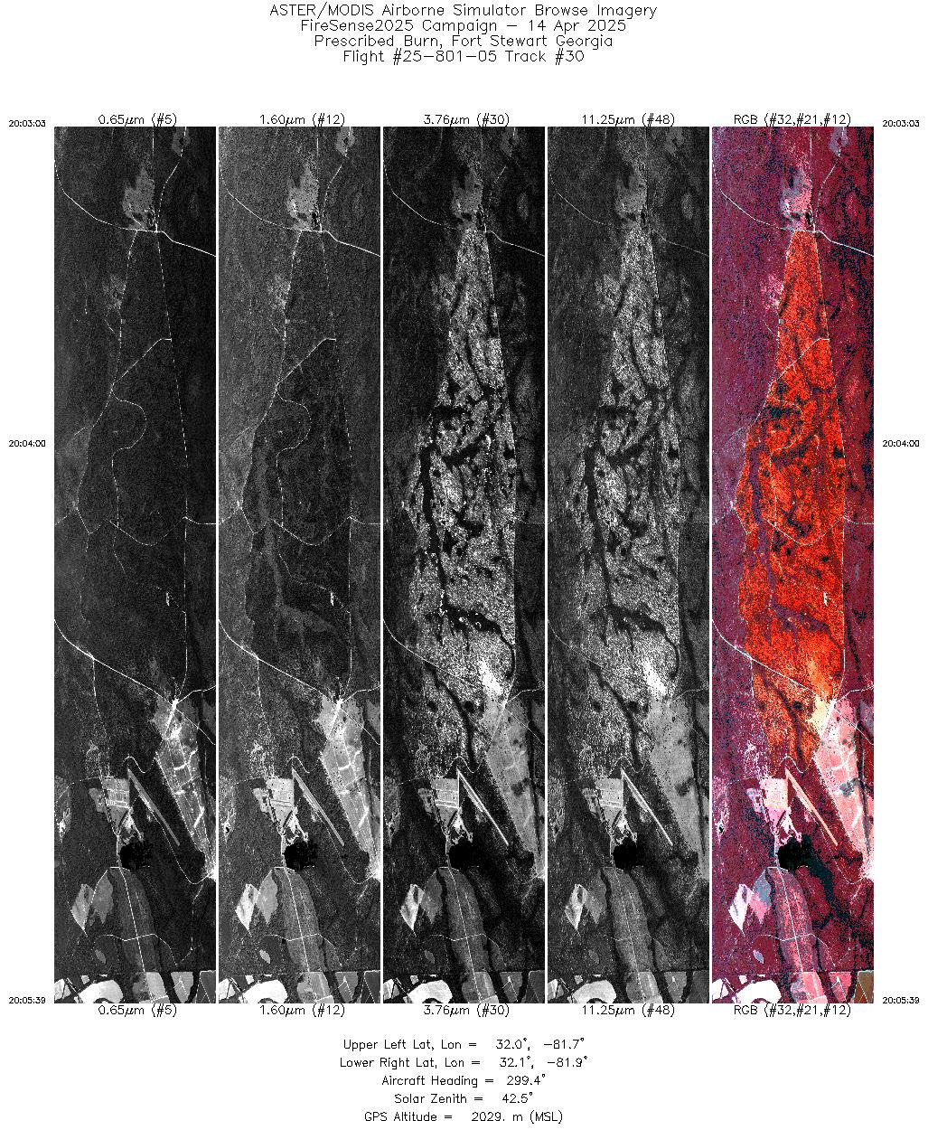
| 30 |
20:03 - 20:05 |
298.5 |
32.027 - 32.087 |
81.747 - 81.841 |
3881 |
2028 |
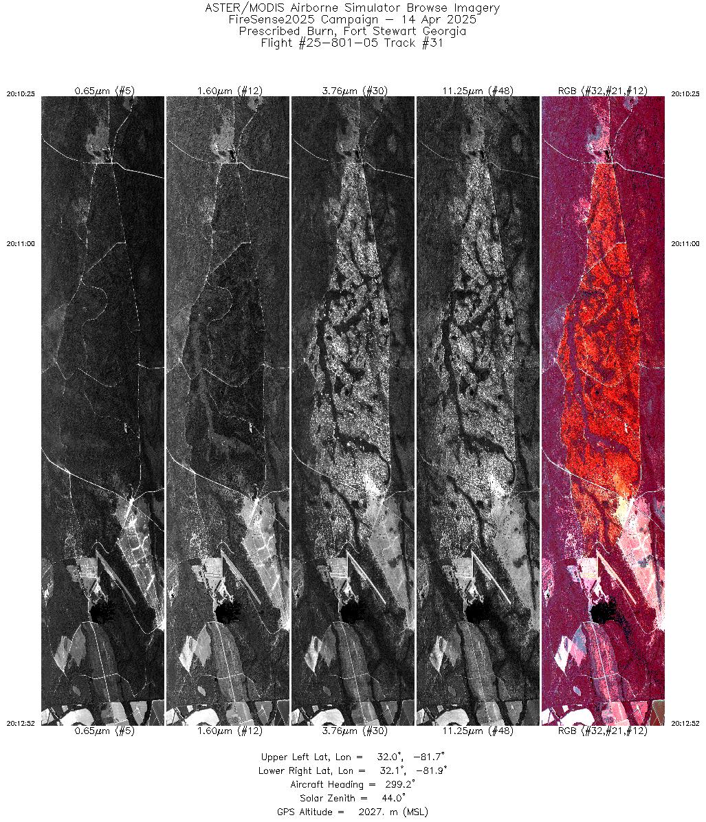
| 31 |
20:10 - 20:12 |
298.8 |
32.026 - 32.087 |
81.749 - 81.841 |
3664 |
2027 |
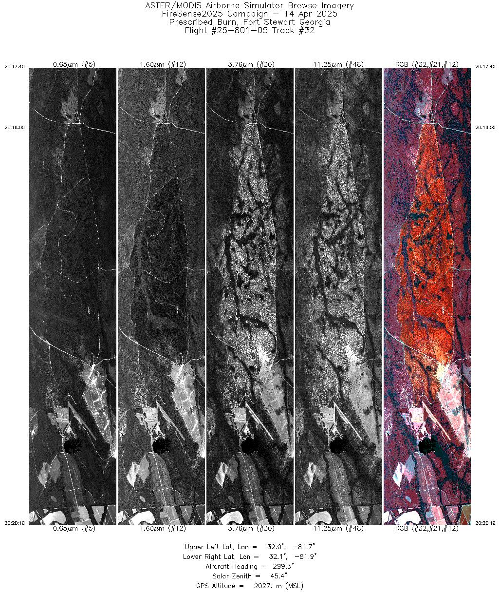
| 32 |
20:17 - 20:20 |
298.8 |
32.025 - 32.087 |
81.747 - 81.841 |
3750 |
2027 |
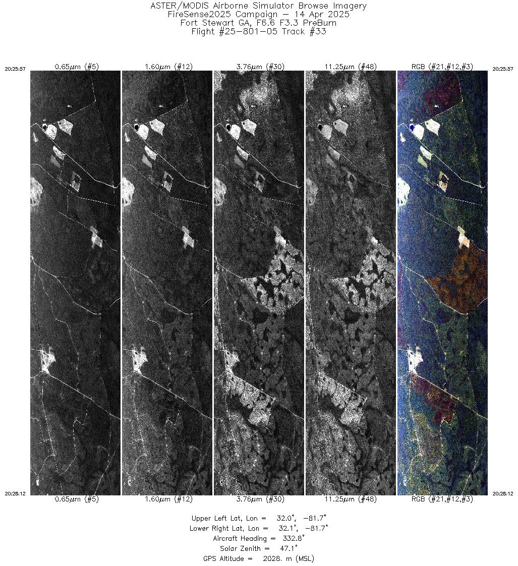
| 33 |
20:25 - 20:28 |
331.8 |
31.979 - 32.069 |
81.690 - 81.725 |
3369 |
2029 |
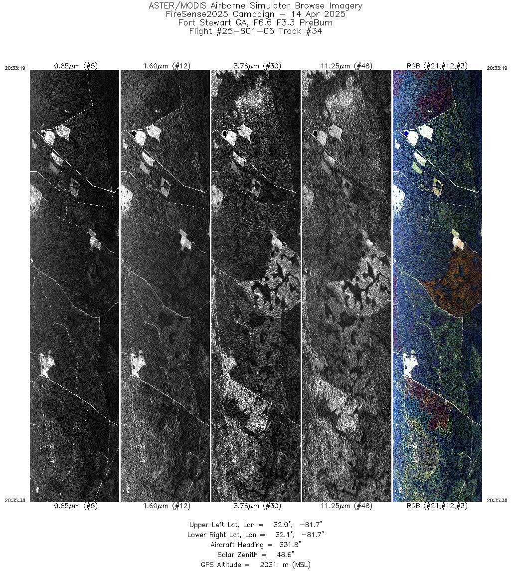
| 34 |
20:33 - 20:35 |
331.2 |
31.978 - 32.069 |
81.690 - 81.725 |
3465 |
2030 |
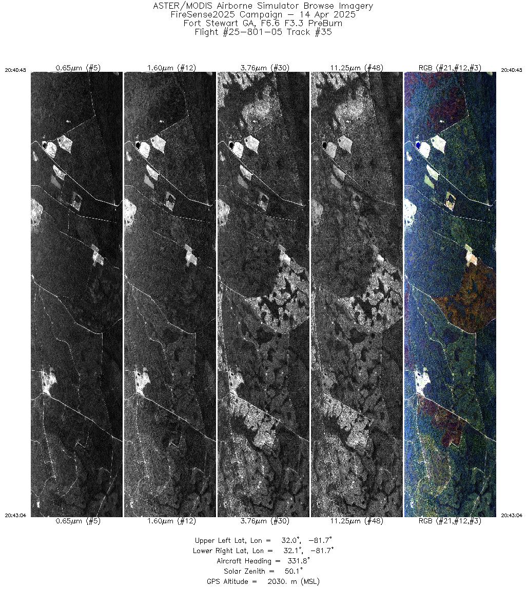
| 35 |
20:40 - 20:43 |
331.2 |
31.976 - 32.069 |
81.690 - 81.725 |
3475 |
2030 |
|


