Flight: 25-801-03
Date: 27 Mar 2025
Aircraft: NASA B-200
Deployment: FireSense 2025
Flight Location: Alabama
Principal Investigators: NASA SMD
Additional Sensors: FireTIRS
|
Data Evaluation
Overall quality is good
Channel 35 offline
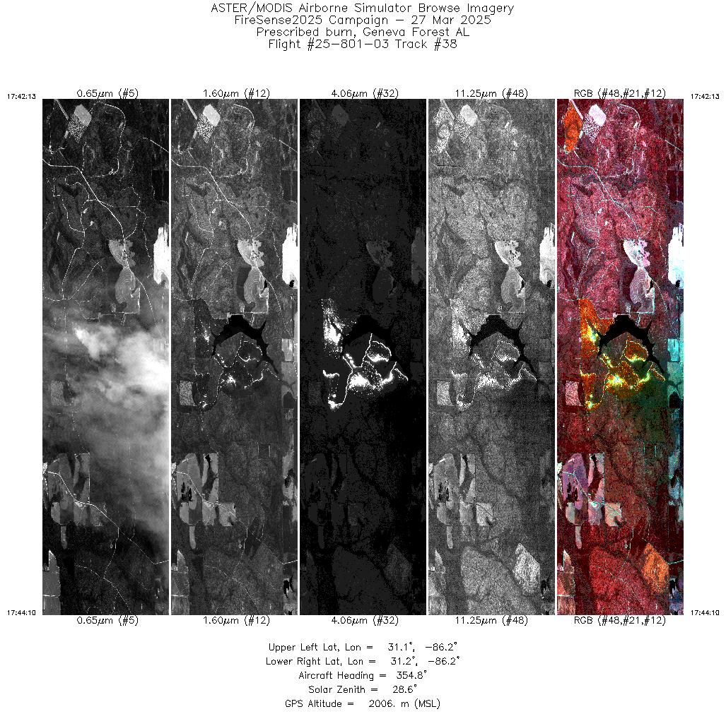
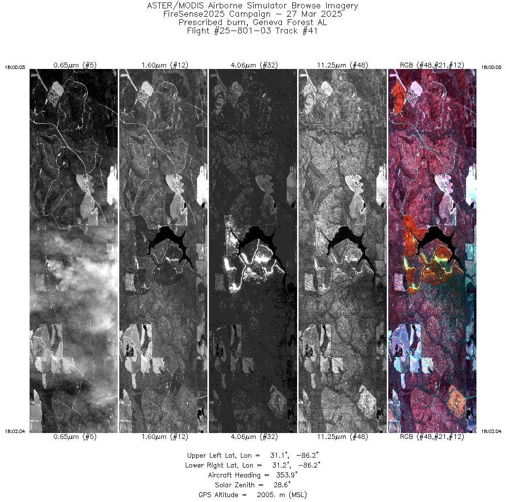
Geneva State Forest Lake Prescribed Burn
|
Processing Information
Level-1B Data in HDF format is available
Flight Line Summary
Spectral Band Configuration
Spectral Response Function Table
Spectral Response Function (text)
|
Browse Imagery
Flight Tracks: 42
Scanlines: 115968
|
Browse Imagery Table
|
Click a Flight Track number to view a quicklook image
Lat/Lon ranges are for the BEG-END scanline nadir pixels
|
Flight
Track |
Time Span
(UTC) |
Heading
(Deg) |
Lat Range
(Deg N) |
Lon Range
(Deg W) |
Length
(Scanlines) |
Altitude
(Meters) |
| 1 |
14:06 - 14:08 |
0.5 |
31.117 - 31.188 |
86.187 - 86.180 |
2054 |
1996 |
| 2 |
14:12 - 14:14 |
355.4 |
31.106 - 31.188 |
86.181 - 86.180 |
2891 |
2001 |
| 3 |
14:18 - 14:19 |
355.0 |
31.109 - 31.188 |
86.181 - 86.180 |
2762 |
2000 |
| 4 |
14:23 - 14:25 |
355.6 |
31.110 - 31.188 |
86.181 - 86.180 |
2771 |
2001 |
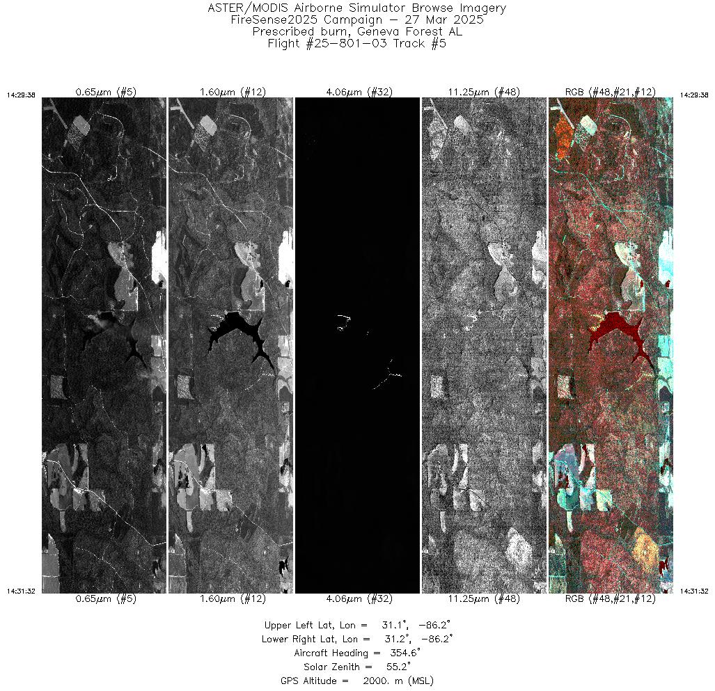
| 5 |
14:29 - 14:31 |
355.5 |
31.107 - 31.188 |
86.181 - 86.180 |
2855 |
2001 |
| 6 |
14:35 - 14:37 |
356.7 |
31.114 - 31.187 |
86.181 - 86.180 |
2553 |
2001 |
| 7 |
14:41 - 14:43 |
355.9 |
31.110 - 31.188 |
86.181 - 86.180 |
2727 |
2002 |
| 8 |
14:47 - 14:48 |
355.7 |
31.107 - 31.186 |
86.181 - 86.180 |
2825 |
2003 |
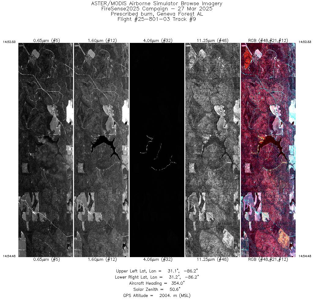
| 9 |
14:52 - 14:54 |
355.1 |
31.108 - 31.188 |
86.181 - 86.180 |
2796 |
2005 |
| 10 |
14:58 - 15:00 |
356.0 |
31.111 - 31.188 |
86.181 - 86.180 |
2698 |
2005 |
| 11 |
15:04 - 15:06 |
355.6 |
31.109 - 31.188 |
86.181 - 86.180 |
2768 |
2006 |
| 12 |
15:10 - 15:12 |
355.5 |
31.109 - 31.188 |
86.181 - 86.180 |
2800 |
2007 |
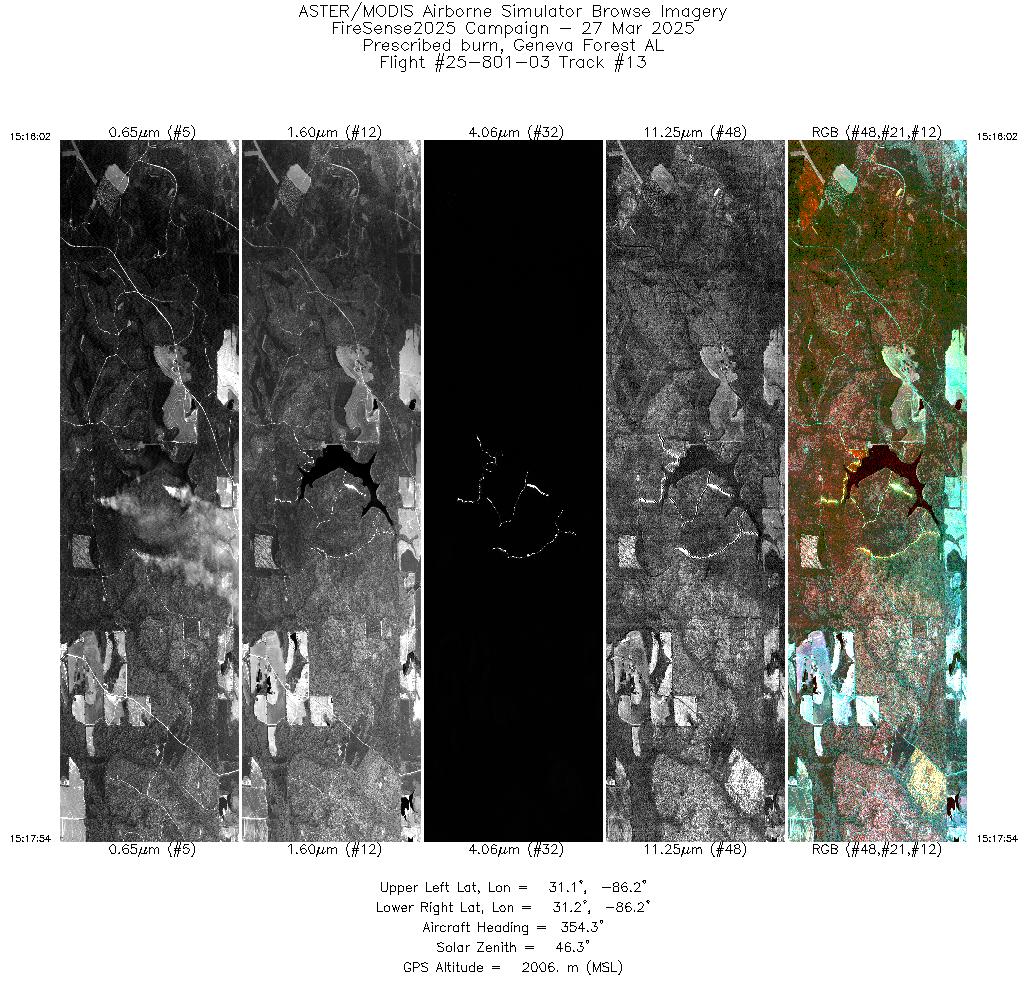
| 13 |
15:16 - 15:17 |
355.4 |
31.108 - 31.188 |
86.181 - 86.180 |
2808 |
2007 |
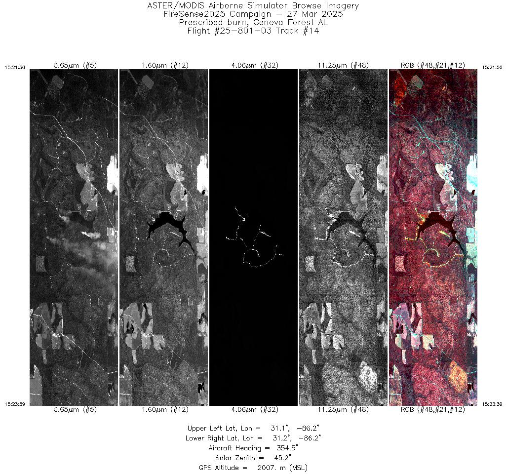
| 14 |
15:21 - 15:23 |
355.4 |
31.109 - 31.188 |
86.181 - 86.180 |
2729 |
2008 |
| 15 |
15:27 - 15:29 |
355.6 |
31.111 - 31.188 |
86.181 - 86.180 |
2666 |
2008 |
| 16 |
15:33 - 15:35 |
355.3 |
31.108 - 31.186 |
86.181 - 86.180 |
2688 |
2009 |
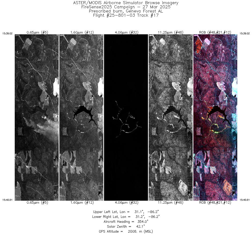
| 17 |
15:39 - 15:40 |
355.2 |
31.109 - 31.187 |
86.181 - 86.180 |
2716 |
2009 |
| 18 |
15:44 - 15:46 |
355.2 |
31.108 - 31.186 |
86.181 - 86.180 |
2676 |
2010 |
| 19 |
15:50 - 15:52 |
356.0 |
31.113 - 31.188 |
86.181 - 86.180 |
2741 |
2009 |
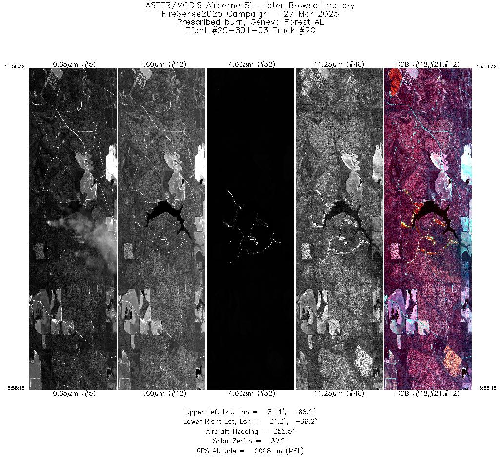
| 20 |
15:56 - 15:58 |
355.9 |
31.111 - 31.188 |
86.181 - 86.180 |
2637 |
2009 |
| 21 |
16:02 - 16:03 |
355.4 |
31.108 - 31.186 |
86.181 - 86.180 |
2649 |
2009 |
| 22 |
16:08 - 16:09 |
355.6 |
31.112 - 31.187 |
86.181 - 86.180 |
2584 |
2008 |
| 23 |
16:13 - 16:15 |
355.4 |
31.109 - 31.188 |
86.181 - 86.180 |
2684 |
2009 |
| 24 |
16:19 - 16:21 |
355.1 |
31.108 - 31.188 |
86.181 - 86.180 |
2735 |
2009 |
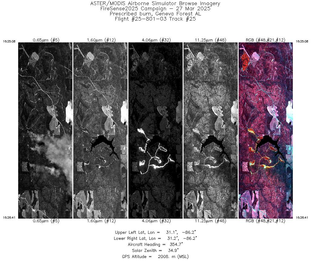
| 25 |
16:25 - 16:26 |
355.6 |
31.107 - 31.174 |
86.181 - 86.180 |
2331 |
2008 |
| 26 |
16:30 - 16:32 |
355.5 |
31.110 - 31.188 |
86.181 - 86.180 |
2677 |
2007 |
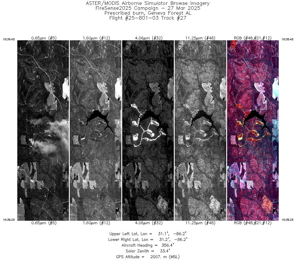
| 27 |
16:36 - 16:38 |
356.4 |
31.114 - 31.188 |
86.181 - 86.180 |
2511 |
2007 |
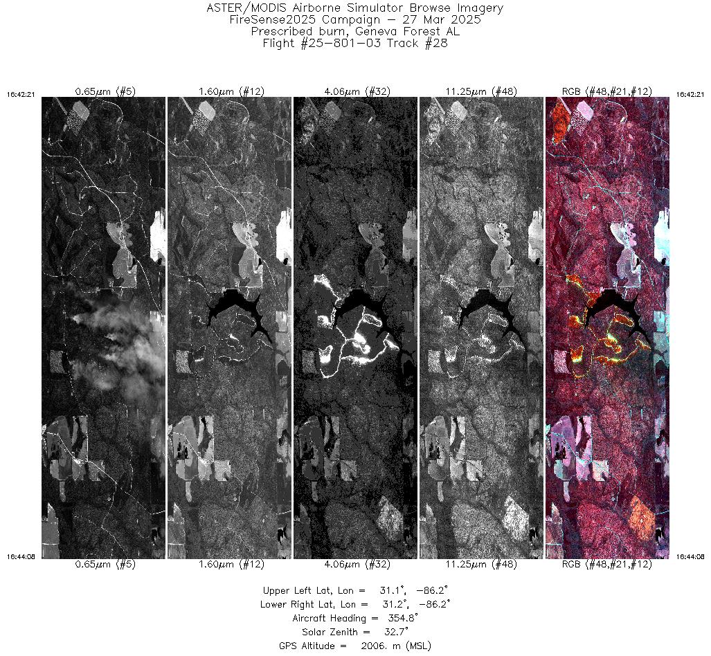
| 28 |
16:42 - 16:44 |
355.7 |
31.110 - 31.188 |
86.181 - 86.180 |
2674 |
2007 |
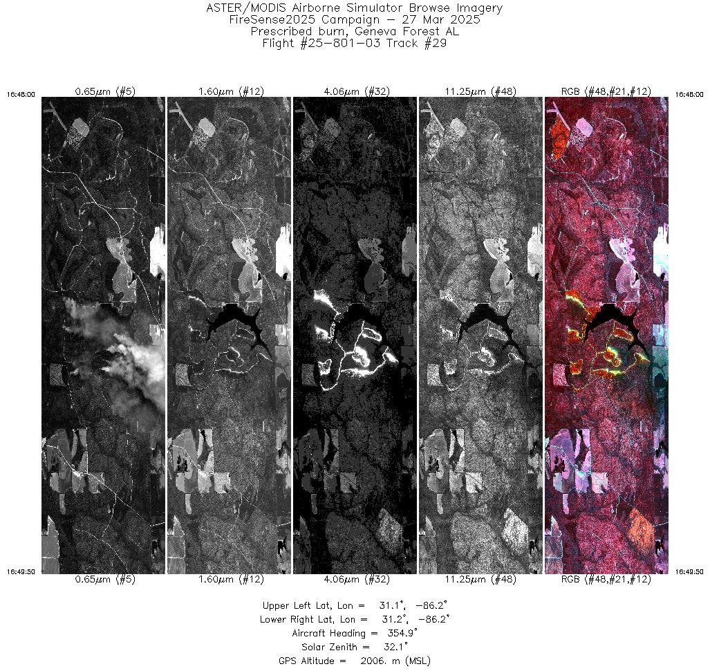
| 29 |
16:47 - 16:49 |
355.7 |
31.107 - 31.188 |
86.181 - 86.180 |
2760 |
2007 |
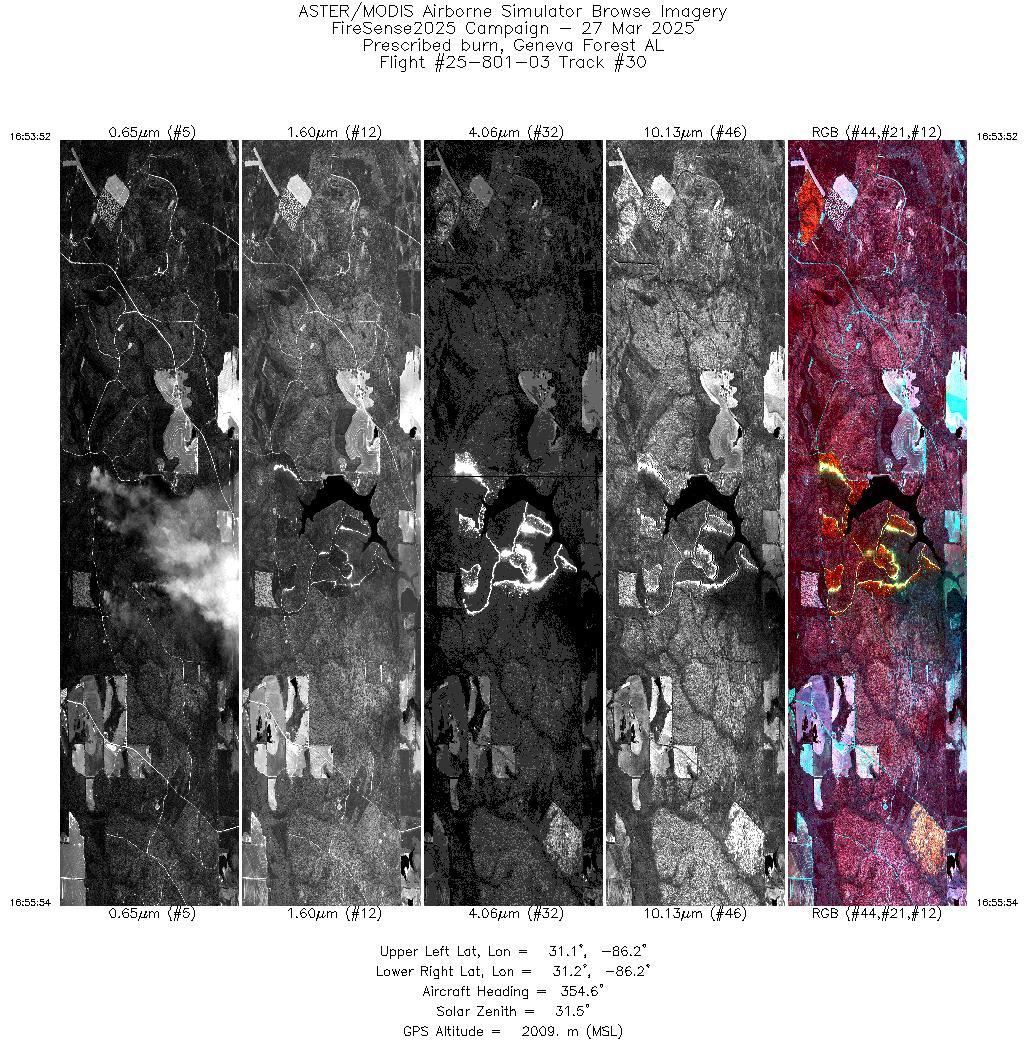
| 30 |
16:53 - 16:55 |
355.5 |
31.106 - 31.188 |
86.180 - 86.180 |
3065 |
2009 |
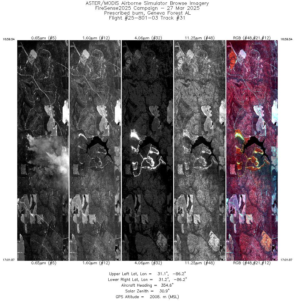
| 31 |
16:59 - 17:01 |
355.5 |
31.107 - 31.188 |
86.180 - 86.180 |
3075 |
2009 |
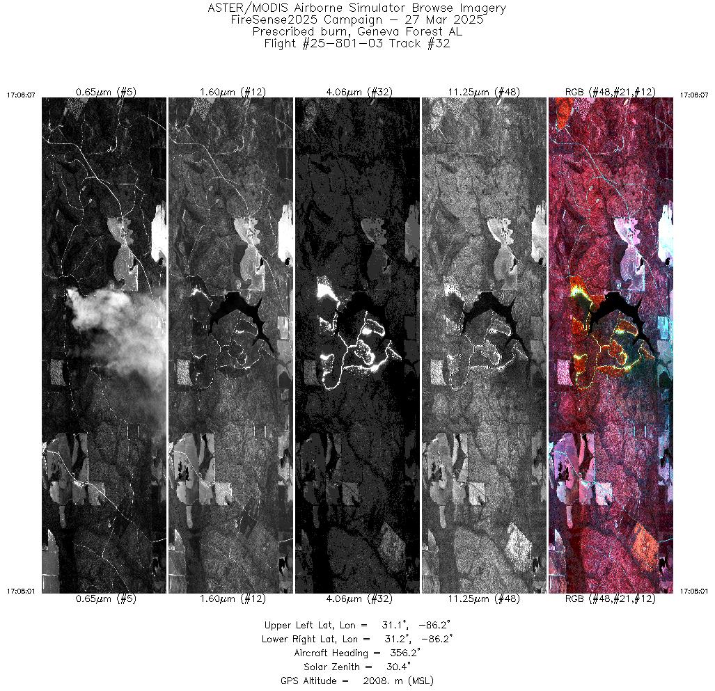
| 32 |
17:06 - 17:08 |
356.4 |
31.112 - 31.188 |
86.181 - 86.180 |
2854 |
2008 |
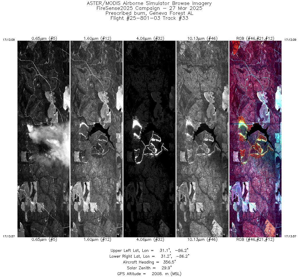
| 33 |
17:12 - 17:13 |
356.6 |
31.112 - 31.183 |
86.181 - 86.180 |
2707 |
2008 |
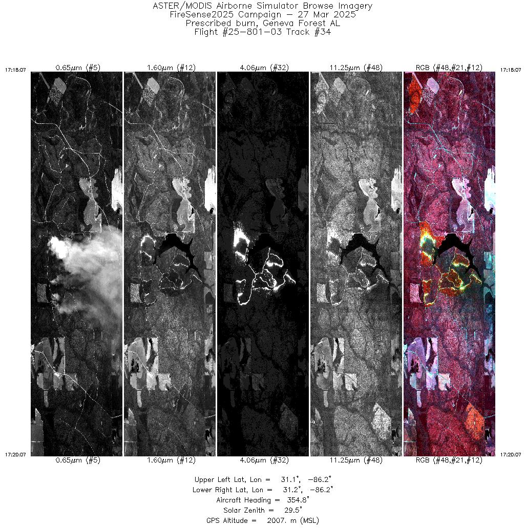
| 34 |
17:18 - 17:20 |
355.6 |
31.109 - 31.188 |
86.181 - 86.180 |
3010 |
2008 |
| 35 |
17:24 - 17:26 |
355.6 |
31.109 - 31.188 |
86.181 - 86.180 |
2960 |
2008 |
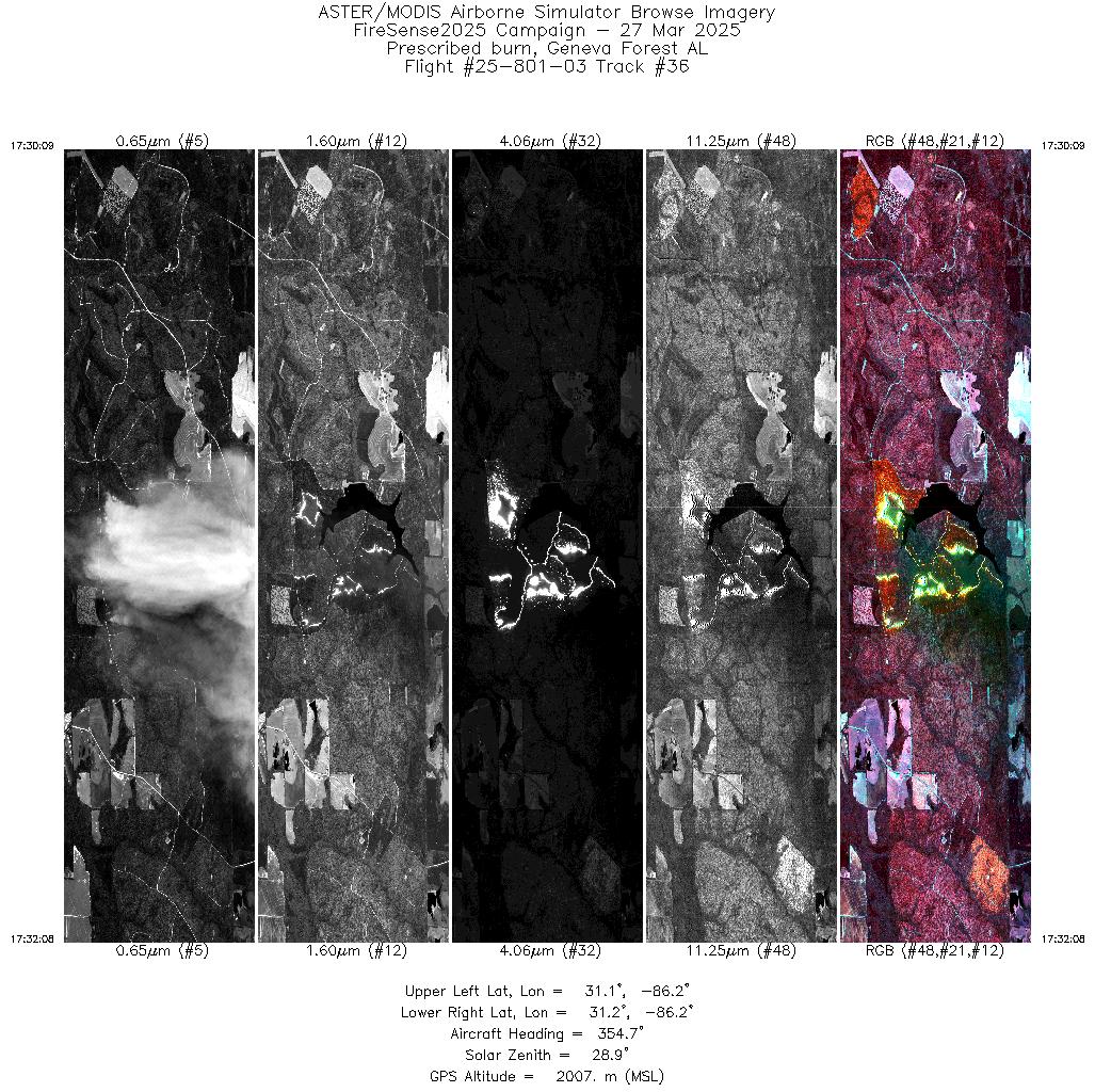
| 36 |
17:30 - 17:32 |
355.6 |
31.109 - 31.187 |
86.181 - 86.180 |
2976 |
2007 |
| 37 |
17:36 - 17:38 |
355.4 |
31.108 - 31.188 |
86.181 - 86.180 |
2980 |
2007 |
| 38 |
17:42 - 17:44 |
355.4 |
31.109 - 31.188 |
86.181 - 86.180 |
2924 |
2007 |
| 39 |
17:48 - 17:50 |
355.3 |
31.108 - 31.188 |
86.181 - 86.180 |
2968 |
2006 |
| 40 |
17:54 - 17:56 |
355.2 |
31.109 - 31.188 |
86.181 - 86.180 |
2864 |
2006 |
| 41 |
18:00 - 18:02 |
355.2 |
31.107 - 31.188 |
86.180 - 86.180 |
2959 |
2006 |
| 42 |
18:06 - 18:08 |
355.2 |
31.108 - 31.188 |
86.181 - 86.180 |
2860 |
2006 |
|


