Flight: 24-801-07
Date: 21 Oct 2023
Aircraft: NASA B-200 #801
Deployment: FireSense 2023
Flight Location: USFS Blowdown/Lakes Prescribed Burns, Kaibab Plateau, AZ
Principal Investigators: NASA HQ
Additional Sensors: SWIS
|
Data Evaluation
Overall quality is good
|
Processing Information
Level-1B Data in HDF format is available
Flight Line Summary
Spectral Band Configuration
Spectral Response Function Table
Spectral Response Function (text)
|
Browse Imagery
Flight Tracks: 32
Scanlines: 104011
|
Browse Imagery Table
|
Click a Flight Track number to view a quicklook image
Lat/Lon ranges are for the BEG-END scanline nadir pixels
|
Flight
Track |
Time Span
(UTC) |
Heading
(Deg) |
Lat Range
(Deg N) |
Lon Range
(Deg W) |
Length
(Scanlines) |
Altitude
(Meters) |
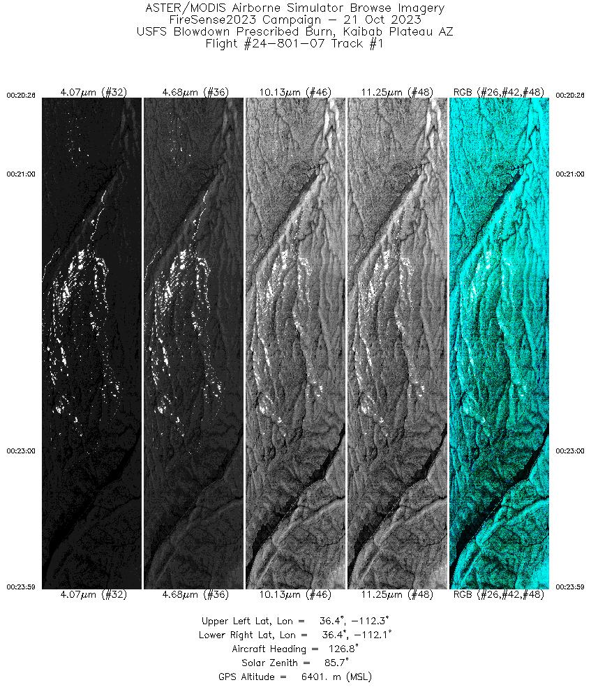
| 1 |
00:20 - 00:23 |
125.9 |
36.474 - 36.389 |
112.287 - 112.096 |
3528 |
6401 |
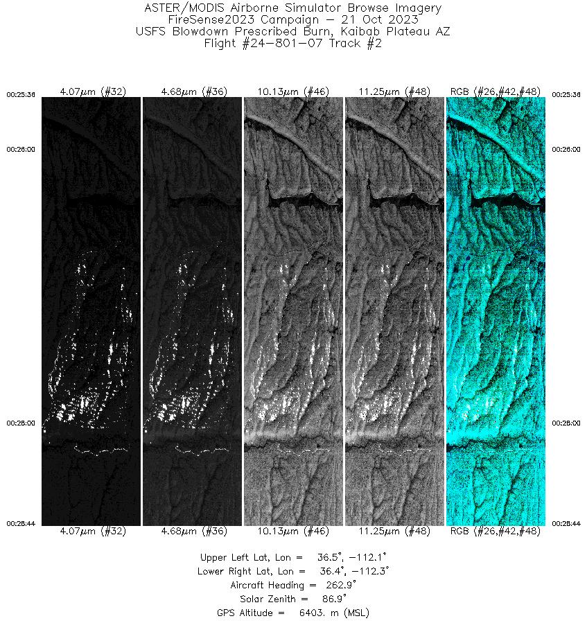
| 2 |
00:25 - 00:28 |
261.9 |
36.434 - 36.422 |
112.091 - 112.273 |
3095 |
6406 |
| 3 |
00:31 - 00:34 |
120.5 |
36.450 - 36.379 |
112.309 - 112.112 |
3413 |
6405 |
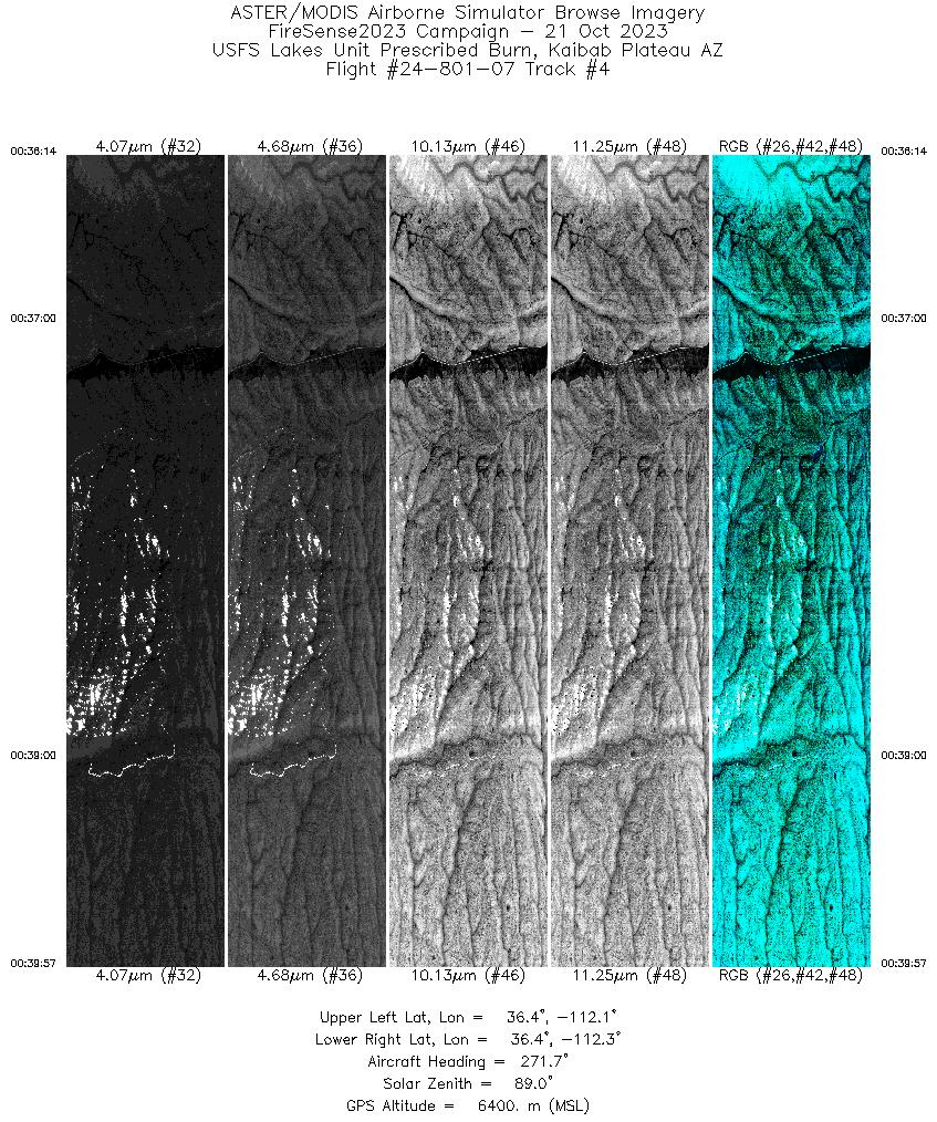
| 4 |
00:36 - 00:39 |
269.9 |
36.402 - 36.415 |
112.075 - 112.293 |
3674 |
6402 |
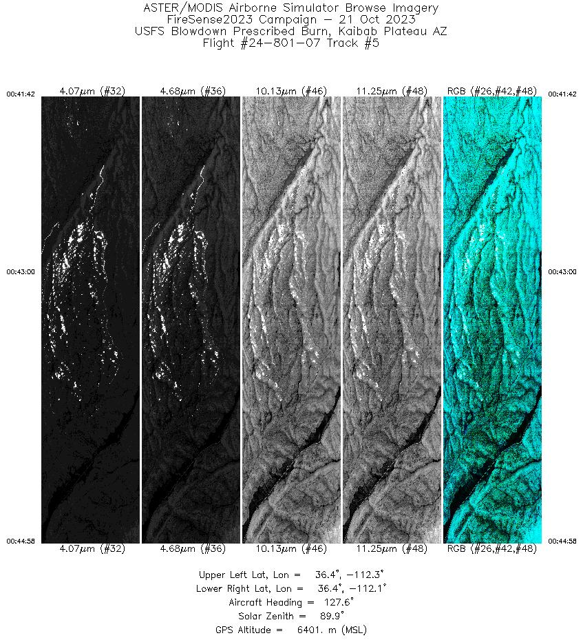
| 5 |
00:41 - 00:44 |
126.2 |
36.470 - 36.390 |
112.277 - 112.098 |
3246 |
6404 |
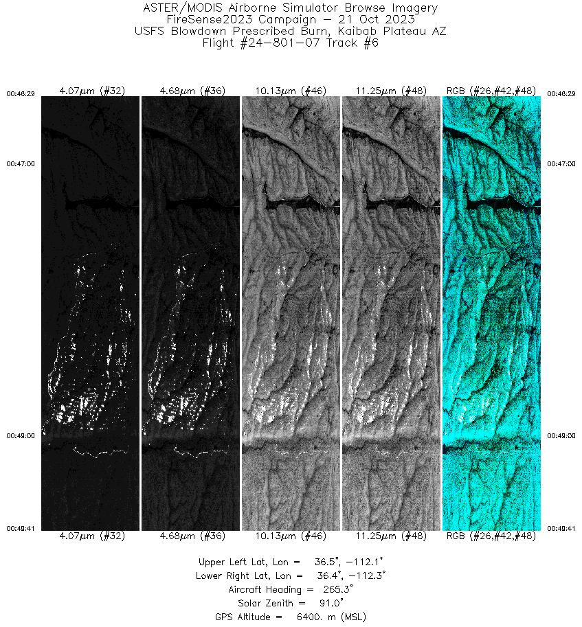
| 6 |
00:46 - 00:49 |
262.7 |
36.432 - 36.422 |
112.088 - 112.274 |
3168 |
6402 |
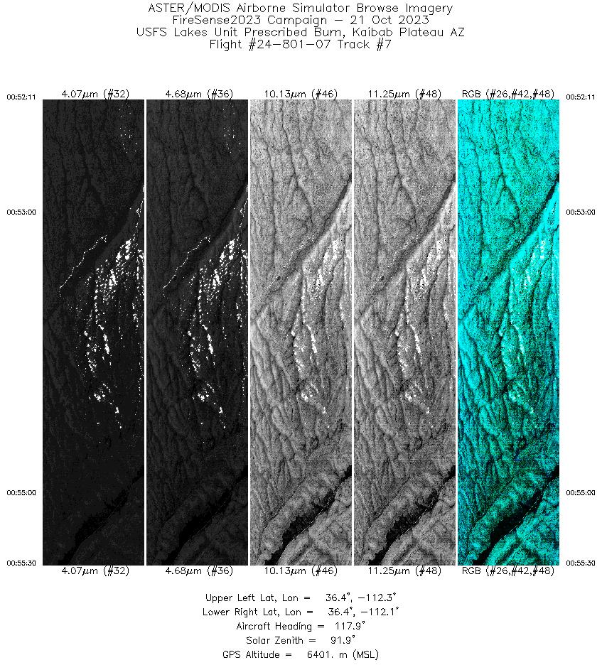
| 7 |
00:52 - 00:55 |
119.3 |
36.447 - 36.379 |
112.299 - 112.112 |
3280 |
6400 |
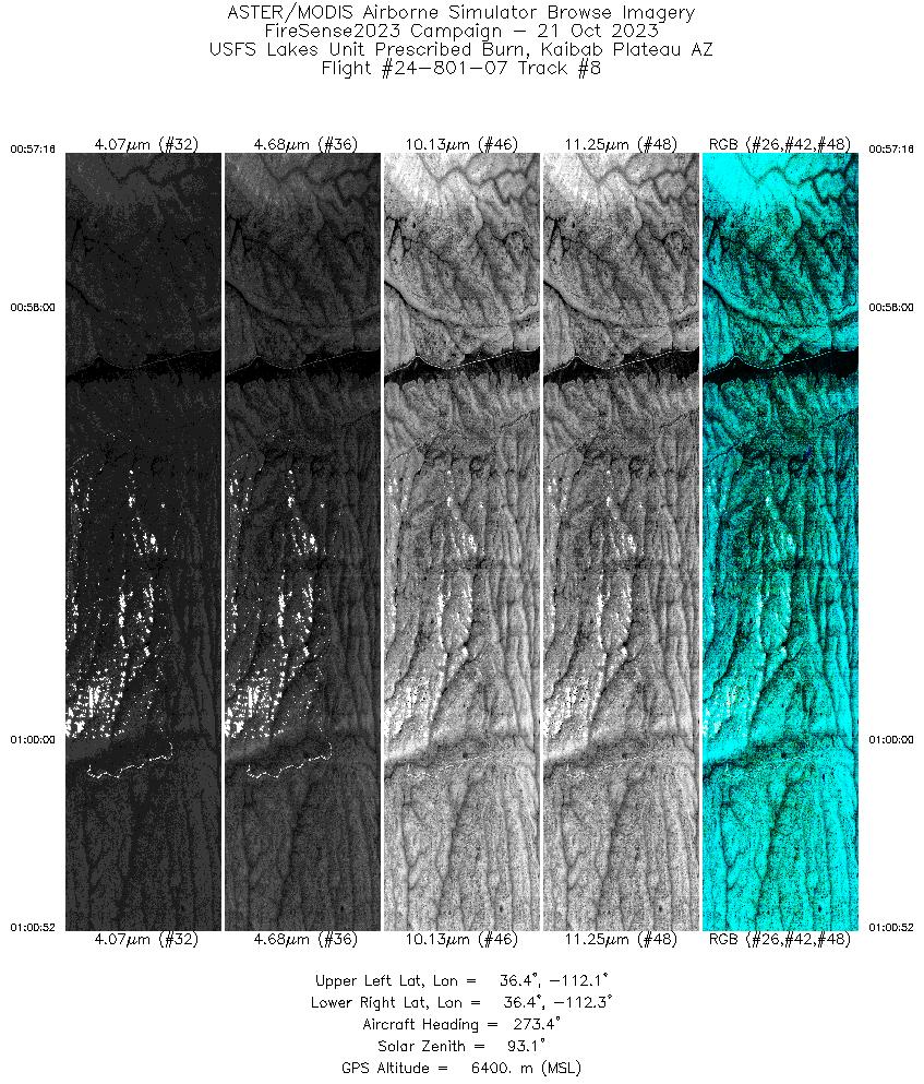
| 8 |
00:57 - 01:00 |
270.8 |
36.401 - 36.414 |
112.074 - 112.284 |
3567 |
6402 |
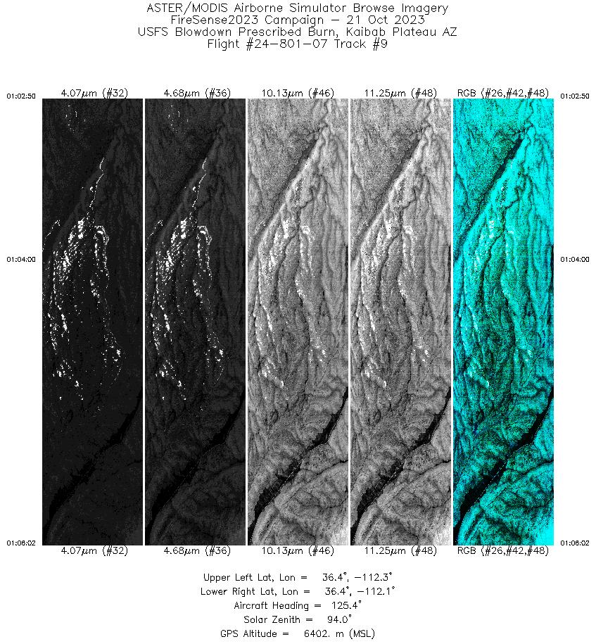
| 9 |
01:02 - 01:06 |
125.3 |
36.469 - 36.390 |
112.272 - 112.098 |
3176 |
6404 |
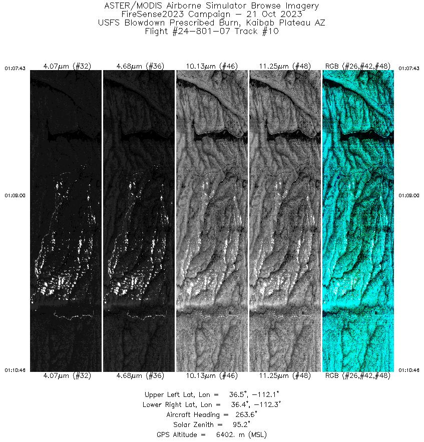
| 10 |
01:07 - 01:10 |
262.1 |
36.432 - 36.422 |
112.097 - 112.274 |
3016 |
6401 |
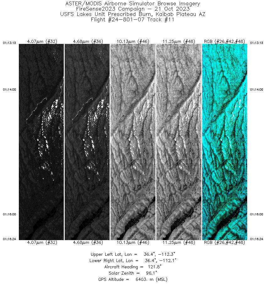
| 11 |
01:13 - 01:16 |
121.3 |
36.445 - 36.379 |
112.294 - 112.112 |
3130 |
6402 |
| 12 |
01:18 - 01:21 |
268.0 |
36.404 - 36.415 |
112.080 - 112.288 |
3500 |
6403 |
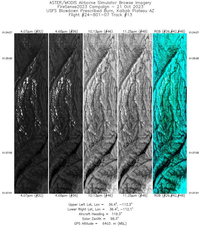
| 13 |
01:24 - 01:27 |
122.0 |
36.469 - 36.387 |
112.278 - 112.091 |
3379 |
6403 |
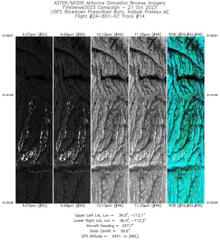
| 14 |
01:29 - 01:33 |
264.3 |
36.433 - 36.421 |
112.089 - 112.279 |
3207 |
6402 |
| 15 |
01:36 - 01:39 |
121.4 |
36.443 - 36.376 |
112.284 - 112.105 |
3067 |
6402 |
| 16 |
01:41 - 01:44 |
270.9 |
36.404 - 36.415 |
112.074 - 112.287 |
3552 |
6400 |
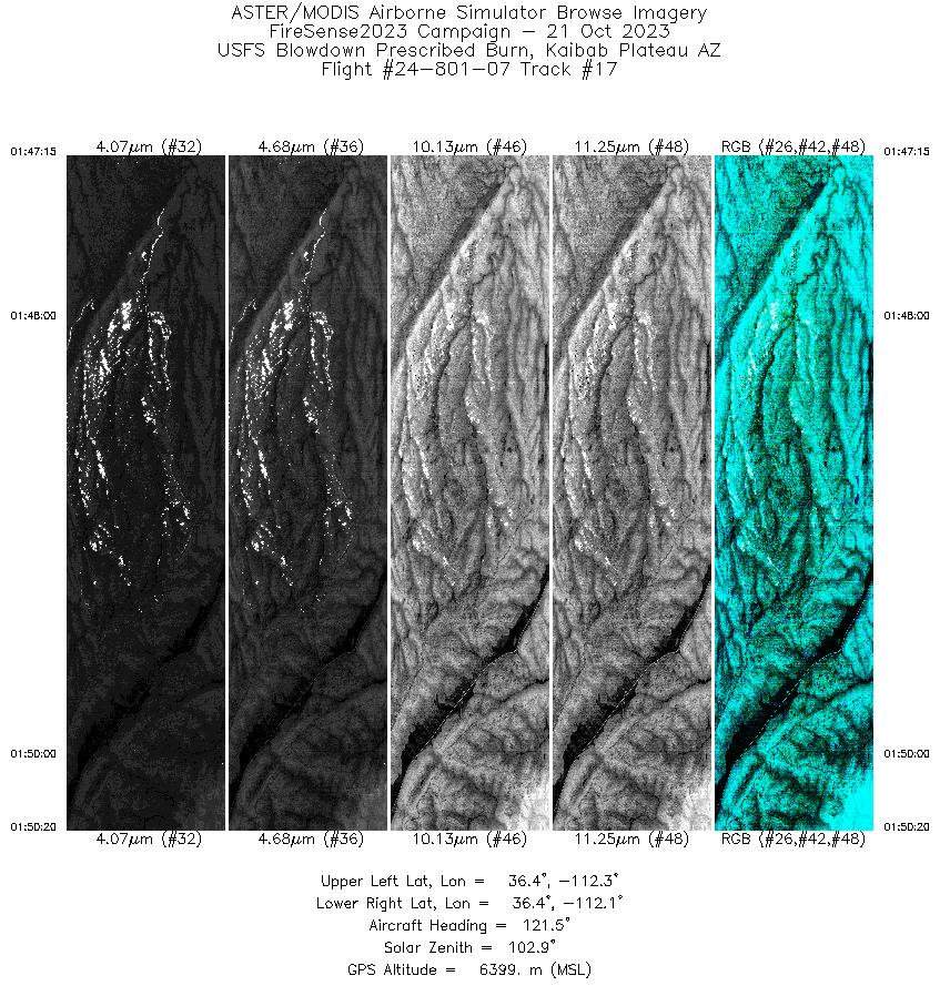
| 17 |
01:47 - 01:50 |
123.5 |
36.464 - 36.388 |
112.262 - 112.093 |
3047 |
6398 |
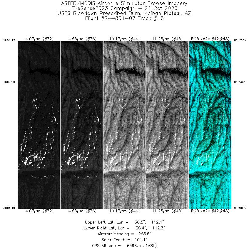
| 18 |
01:52 - 01:55 |
262.3 |
36.435 - 36.422 |
112.106 - 112.275 |
2854 |
6398 |
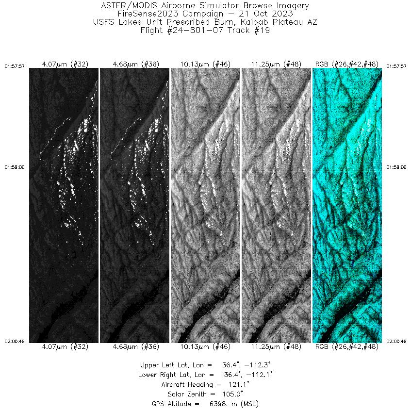
| 19 |
01:57 - 02:00 |
120.9 |
36.440 - 36.377 |
112.272 - 112.108 |
2837 |
6398 |
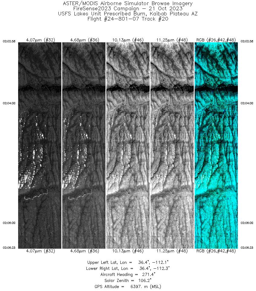
| 20 |
02:02 - 02:06 |
270.5 |
36.406 - 36.415 |
112.087 - 112.292 |
3417 |
6398 |
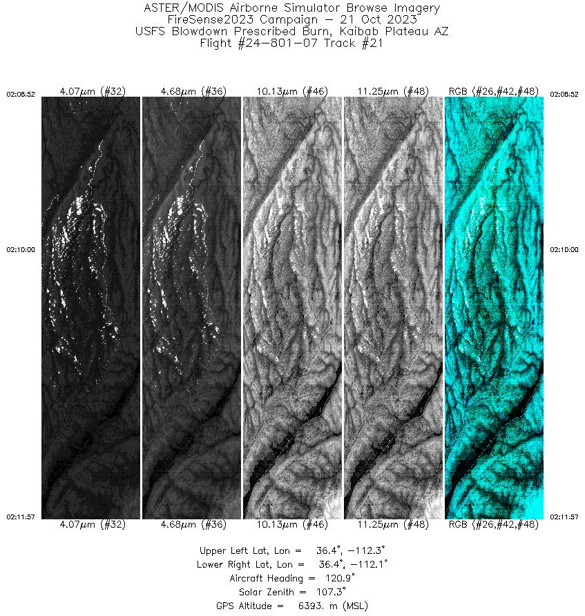
| 21 |
02:08 - 02:11 |
122.8 |
36.465 - 36.389 |
112.267 - 112.095 |
3061 |
6393 |
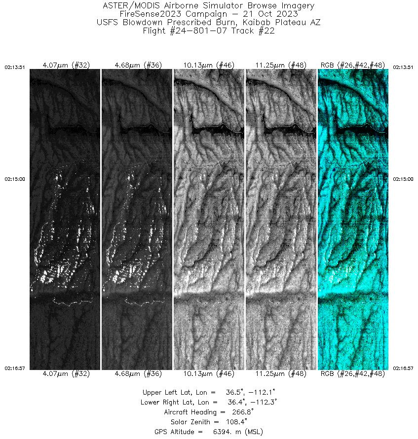
| 22 |
02:13 - 02:16 |
263.8 |
36.432 - 36.421 |
112.099 - 112.283 |
3059 |
6394 |
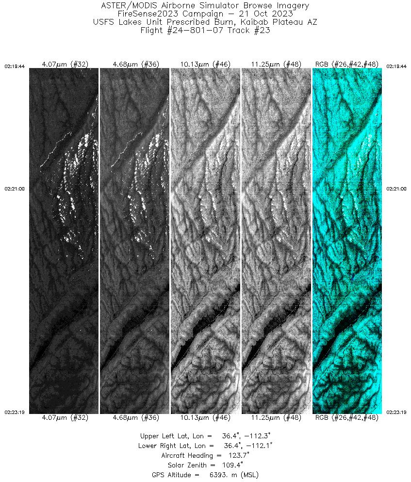
| 23 |
02:19 - 02:23 |
122.2 |
36.443 - 36.364 |
112.281 - 112.072 |
3564 |
6393 |
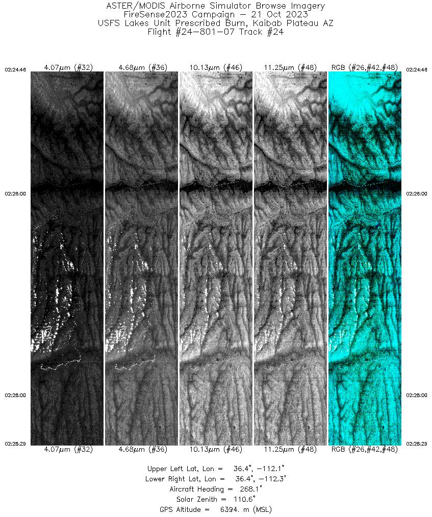
| 24 |
02:24 - 02:28 |
268.6 |
36.404 - 36.415 |
112.064 - 112.289 |
3667 |
6394 |
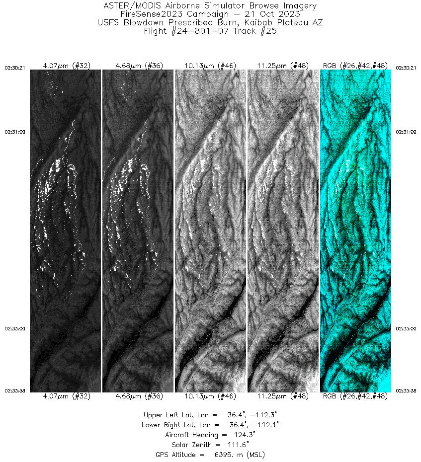
| 25 |
02:30 - 02:33 |
125.1 |
36.469 - 36.389 |
112.277 - 112.096 |
3251 |
6396 |
| 26 |
02:35 - 02:38 |
263.9 |
36.431 - 36.421 |
112.080 - 112.276 |
3310 |
6395 |
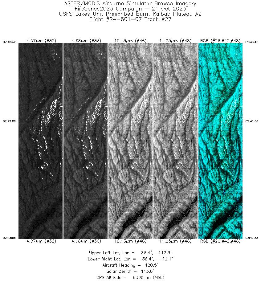
| 27 |
02:40 - 02:43 |
121.1 |
36.445 - 36.379 |
112.295 - 112.112 |
3178 |
6390 |
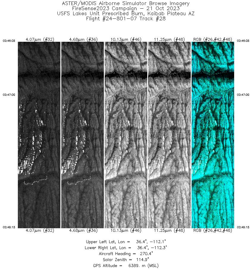
| 28 |
02:46 - 02:49 |
269.6 |
36.405 - 36.415 |
112.100 - 112.287 |
3127 |
6389 |
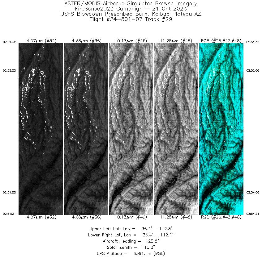
| 29 |
02:51 - 02:54 |
125.8 |
36.459 - 36.389 |
112.247 - 112.096 |
2783 |
6390 |
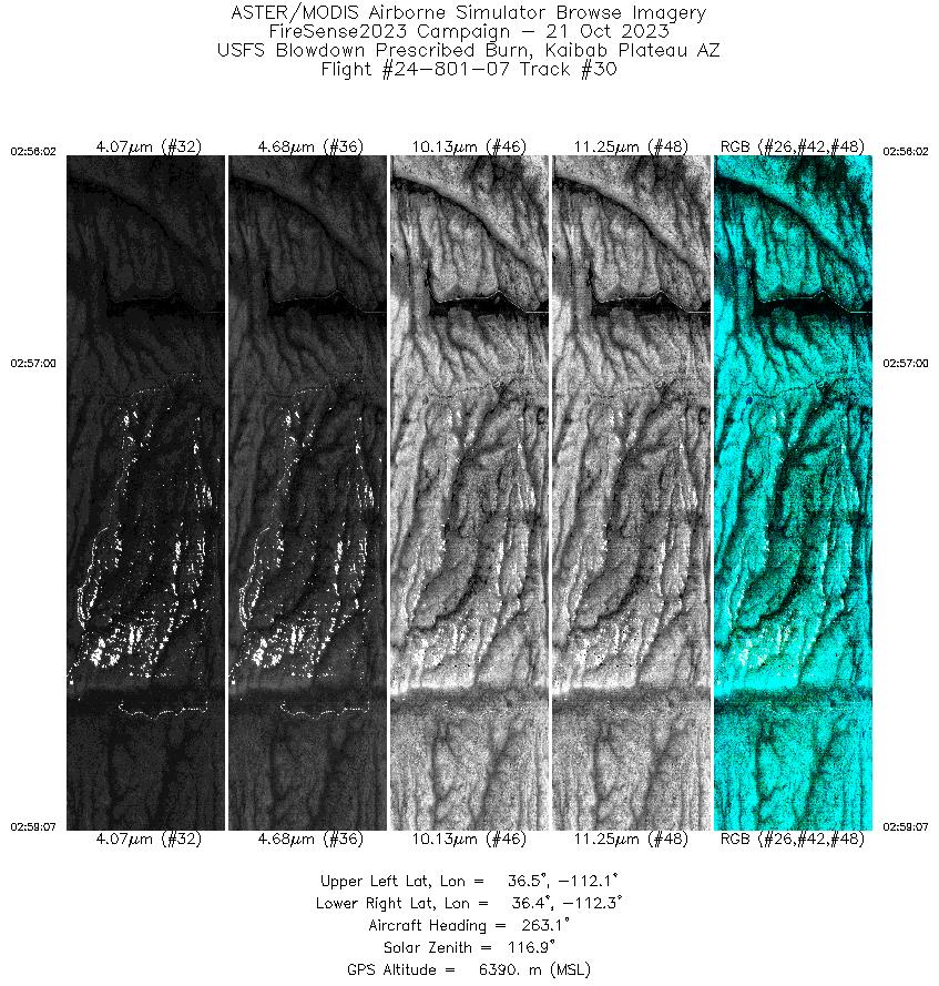
| 30 |
02:56 - 02:59 |
261.6 |
36.433 - 36.422 |
112.096 - 112.274 |
3049 |
6390 |
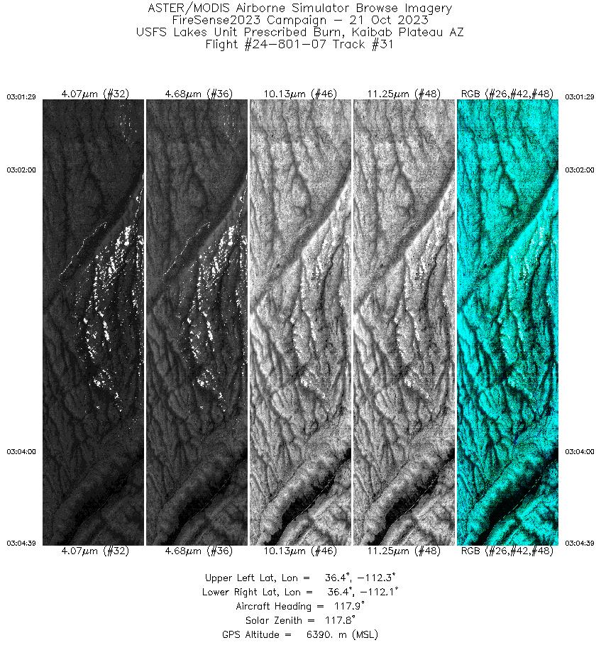
| 31 |
03:01 - 03:04 |
119.5 |
36.445 - 36.379 |
112.295 - 112.112 |
3148 |
6390 |
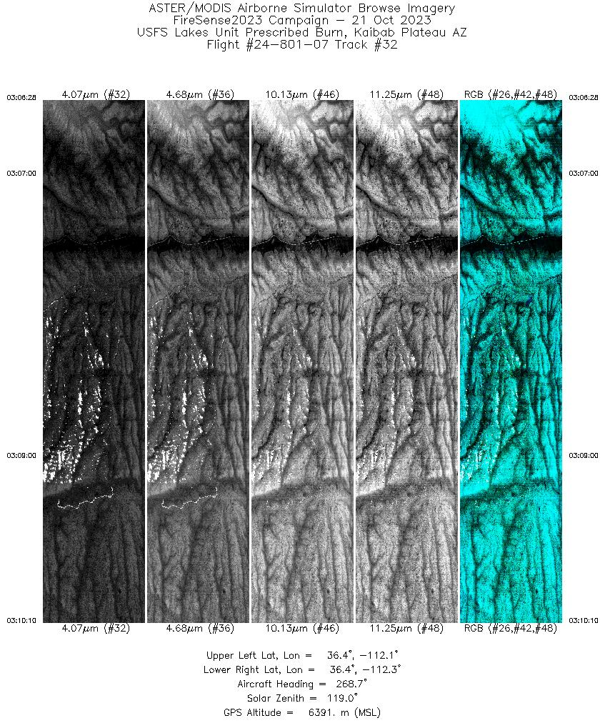
| 32 |
03:06 - 03:10 |
268.7 |
36.403 - 36.415 |
112.073 - 112.291 |
3661 |
6392 |
|


