


FLIGHT SUMMARY INFORMATION
Flight Track Map


|
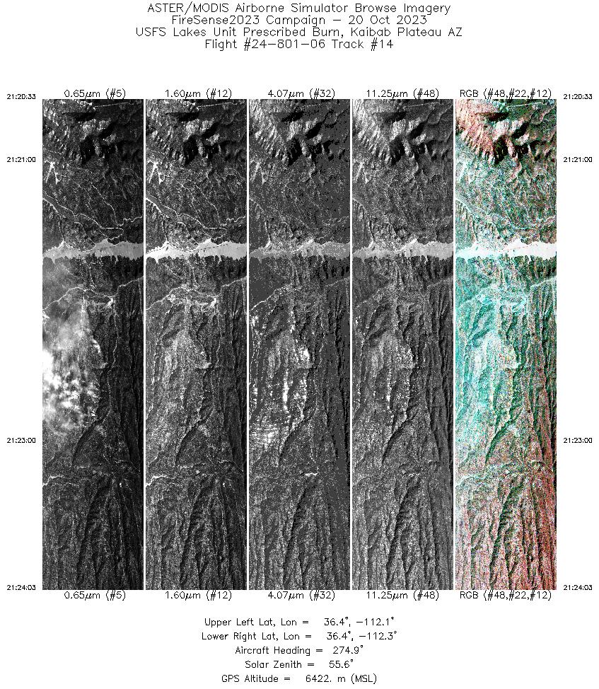
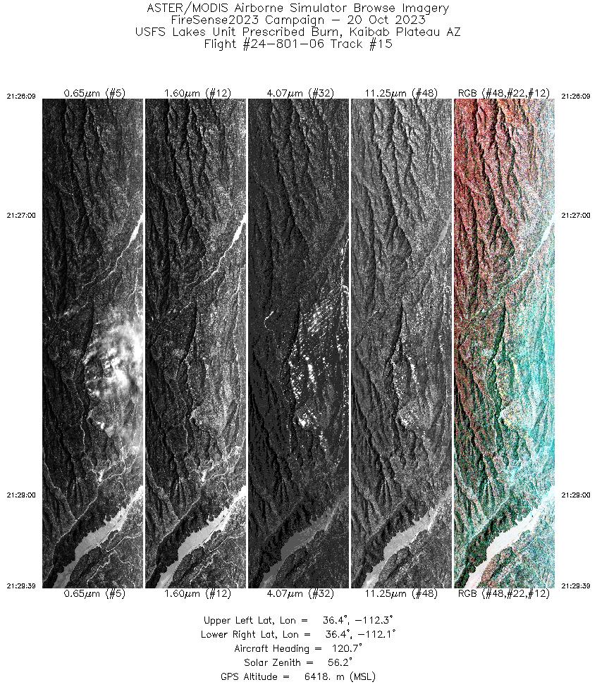
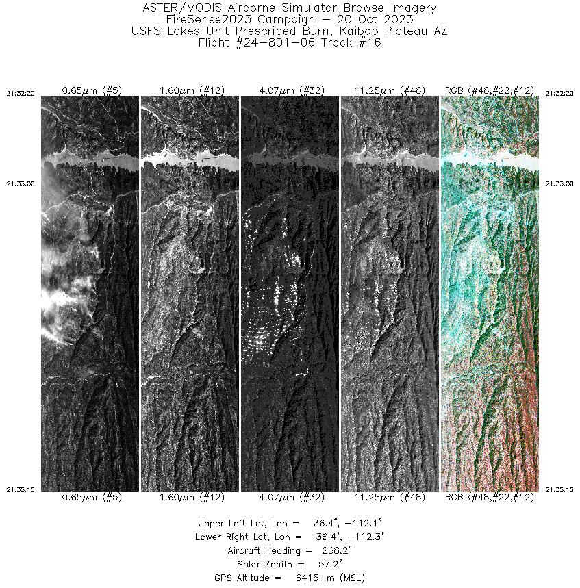
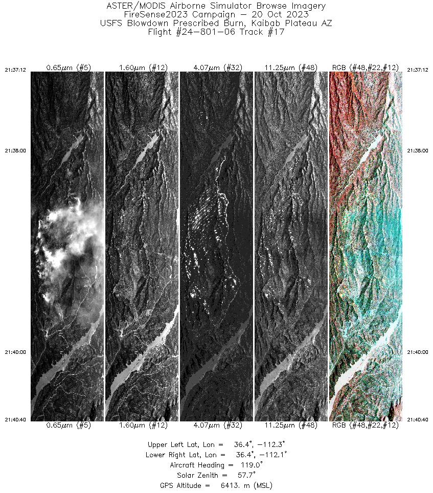
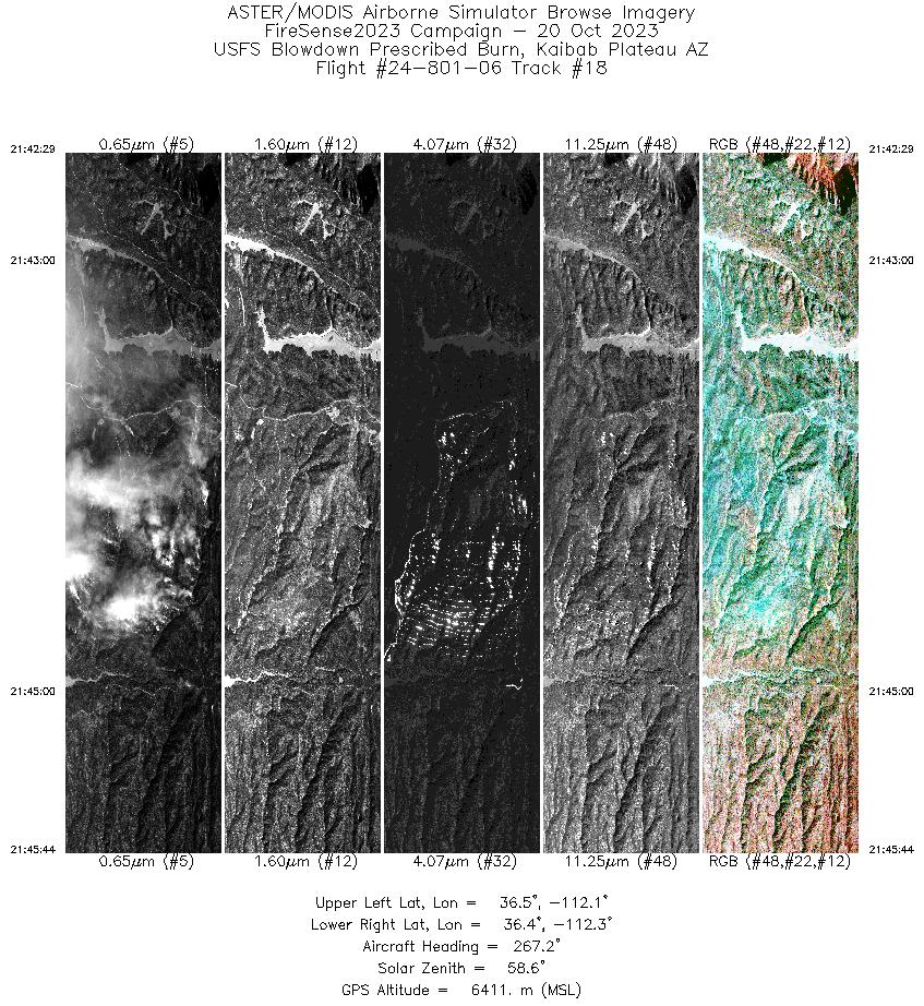
Flight: 24-801-06 Date: 20 Oct 2023 Aircraft: NASA B-200 #801 Deployment: FireSense 2023 Flight Location: USFS Blowdown/Lakes Prescribed Burns, Kaibab Plateau, AZ Principal Investigators: NASA HQ Additional Sensors: SWIS |
||||||||||||||||||||||||||||||||||||||||||||||||||||||||||||||||||||||||||||||||||||||||||||||||||||||||||||||||||||||||||||||||||||||||||||||||||||||||||
|
Data Evaluation Overall quality is good |
||||||||||||||||||||||||||||||||||||||||||||||||||||||||||||||||||||||||||||||||||||||||||||||||||||||||||||||||||||||||||||||||||||||||||||||||||||||||||
|
Processing Information Level-1B Data in HDF format is available Flight Line Summary Spectral Band Configuration Spectral Response Function Table Spectral Response Function (text) |
||||||||||||||||||||||||||||||||||||||||||||||||||||||||||||||||||||||||||||||||||||||||||||||||||||||||||||||||||||||||||||||||||||||||||||||||||||||||||
|
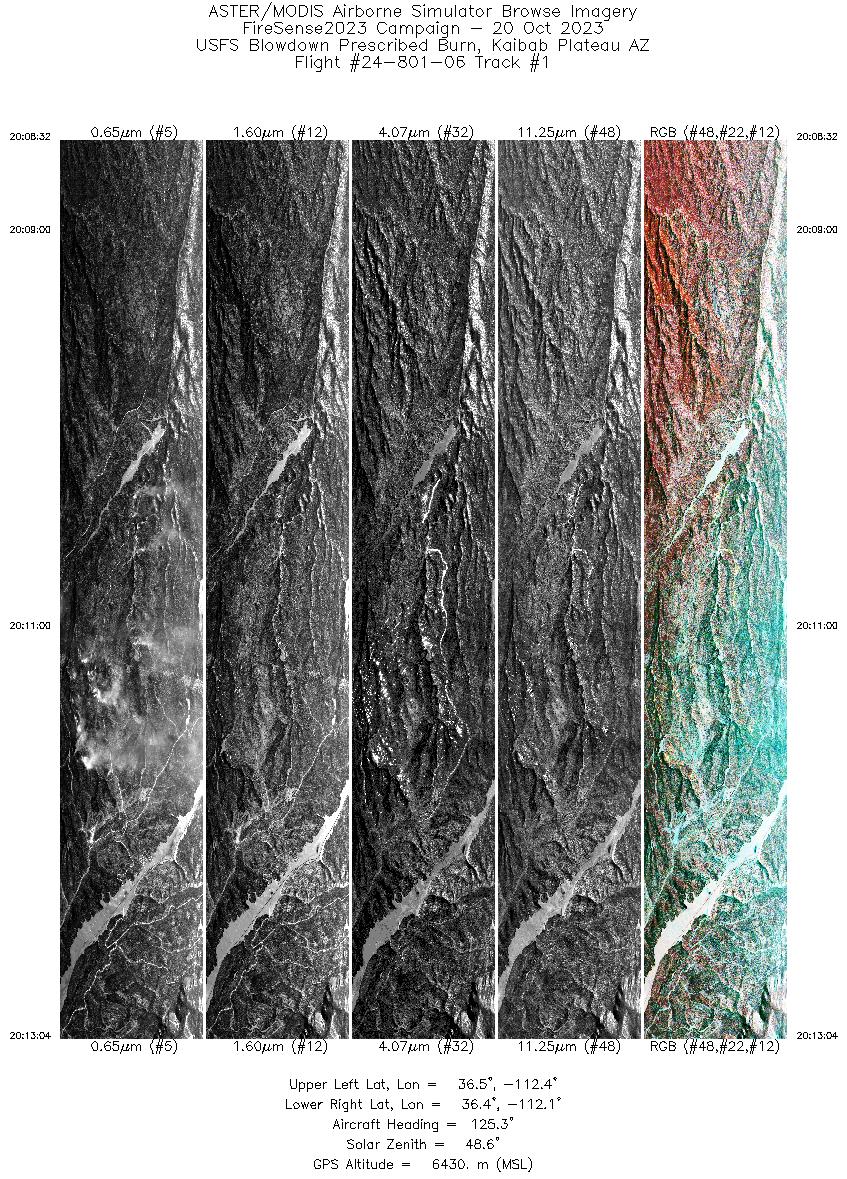
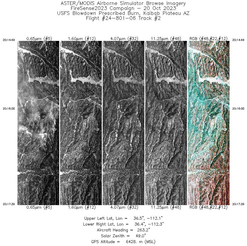
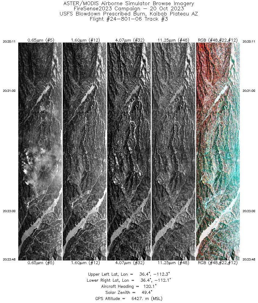
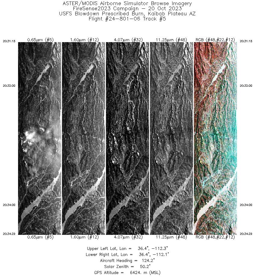
Browse Imagery Flight Tracks: 18 Scanlines: 59330 |
||||||||||||||||||||||||||||||||||||||||||||||||||||||||||||||||||||||||||||||||||||||||||||||||||||||||||||||||||||||||||||||||||||||||||||||||||||||||||
|
||||||||||||||||||||||||||||||||||||||||||||||||||||||||||||||||||||||||||||||||||||||||||||||||||||||||||||||||||||||||||||||||||||||||||||||||||||||||||

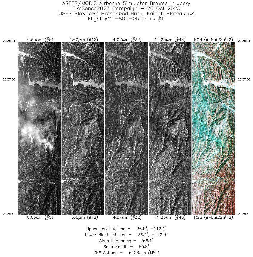
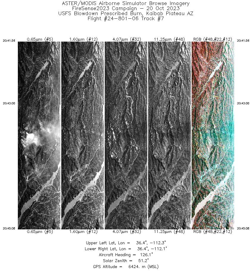
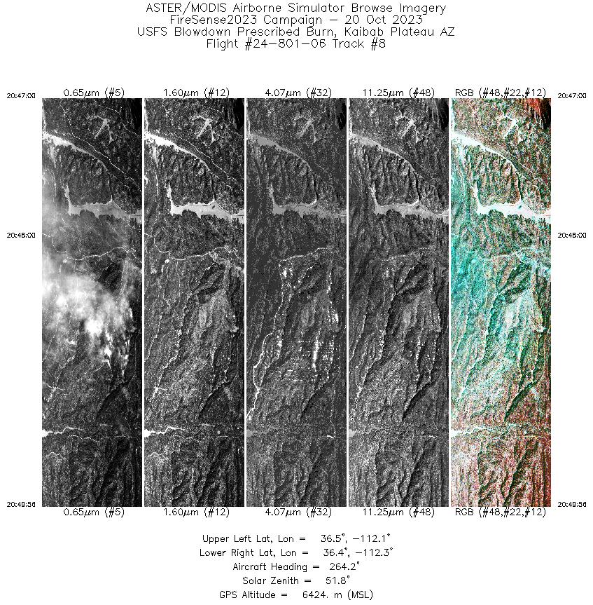
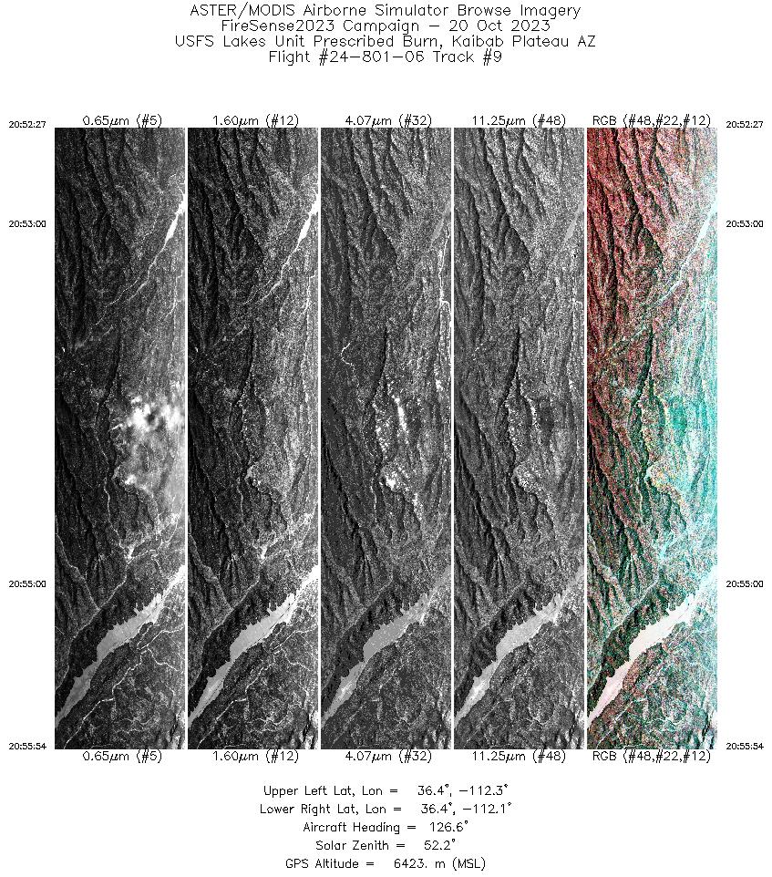
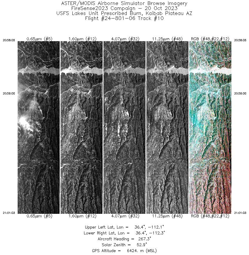
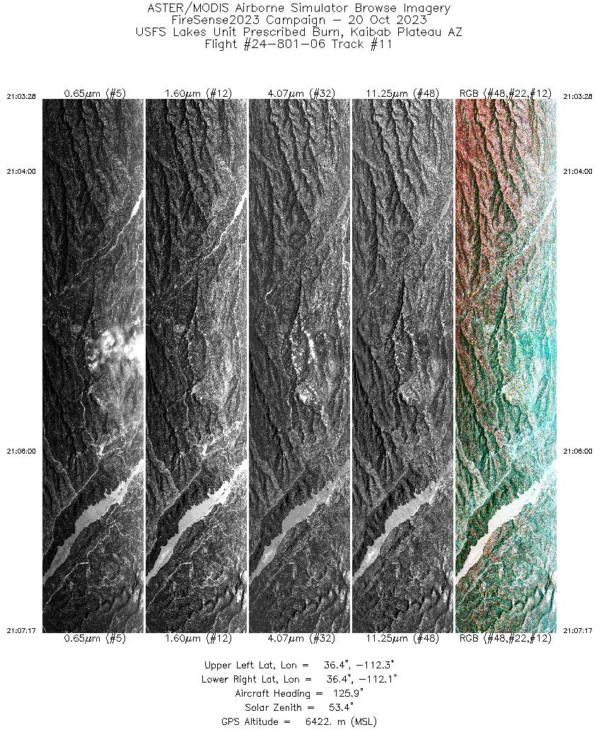
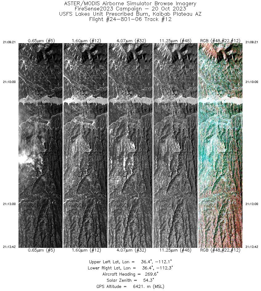
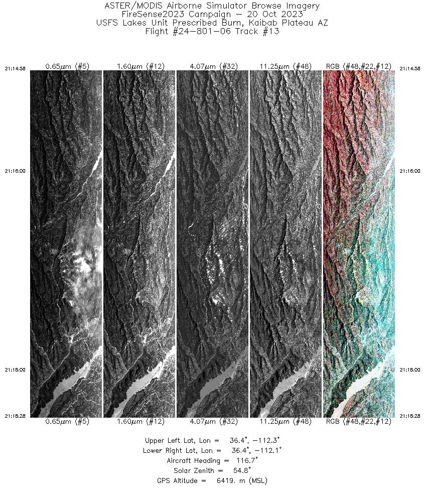
Flight 24-801-06


| Sample Imagery |
| Click image for full resolution |
|
Track: #10 USFS Lakes Unit Prescribed Burn Kaibab Plateau, AZ |


|
|
R: 2.13µm G: 1.61µm B: 0.47µm |


