Flight: 24-801-04
Date: 19 Oct 2023
Aircraft: NASA B-200 #801
Deployment: FireSense 2023
Flight Location: USFS Blowdown/Lakes Prescribed Burns, Kaibab Plateau, AZ
Principal Investigators: NASA HQ
Additional Sensors: SWIS
|
Data Evaluation
Overall quality is good
|
Processing Information
Level-1B Data in HDF format is available
Flight Line Summary
Spectral Band Configuration
Spectral Response Function Table
Spectral Response Function (text)
|
Browse Imagery
Flight Tracks: 40
Scanlines: 129678
|
Browse Imagery Table
|
Click a Flight Track number to view a quicklook image
Lat/Lon ranges are for the BEG-END scanline nadir pixels
|
Flight
Track |
Time Span
(UTC) |
Heading
(Deg) |
Lat Range
(Deg N) |
Lon Range
(Deg W) |
Length
(Scanlines) |
Altitude
(Meters) |
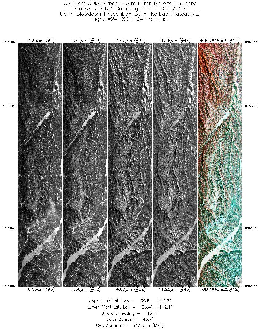
| 1 |
18:51 - 18:55 |
118.9 |
36.488 - 36.388 |
112.321 - 112.093 |
3975 |
6476 |
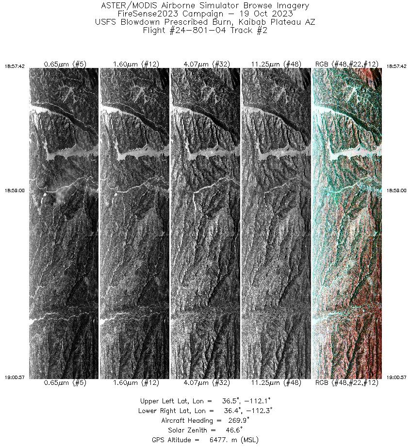
| 2 |
18:57 - 19:00 |
268.5 |
36.434 - 36.421 |
112.080 - 112.282 |
3209 |
6478 |
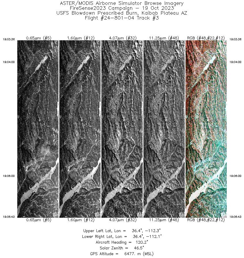
| 3 |
19:03 - 19:06 |
119.3 |
36.467 - 36.390 |
112.272 - 112.097 |
3087 |
6475 |
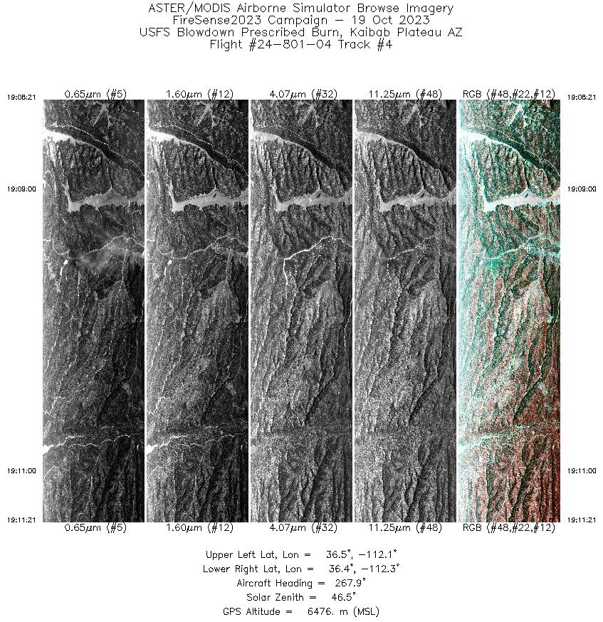
| 4 |
19:08 - 19:11 |
267.6 |
36.433 - 36.421 |
112.091 - 112.278 |
2971 |
6478 |
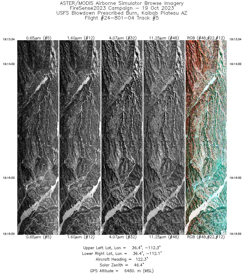
| 5 |
19:13 - 19:16 |
120.2 |
36.476 - 36.390 |
112.292 - 112.098 |
3385 |
6482 |
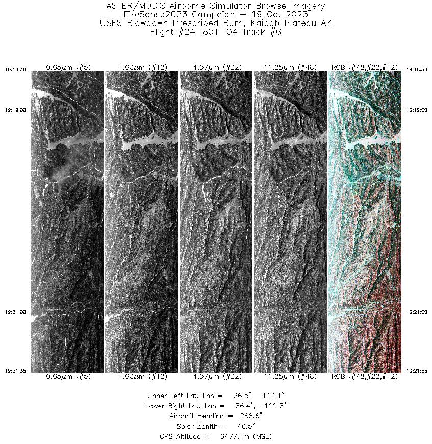
| 6 |
19:18 - 19:21 |
267.0 |
36.433 - 36.421 |
112.092 - 112.279 |
2951 |
6478 |
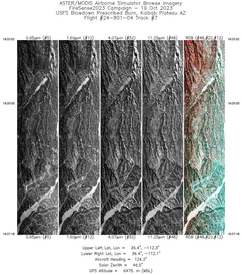
| 7 |
19:23 - 19:27 |
121.1 |
36.477 - 36.390 |
112.292 - 112.099 |
3403 |
6481 |
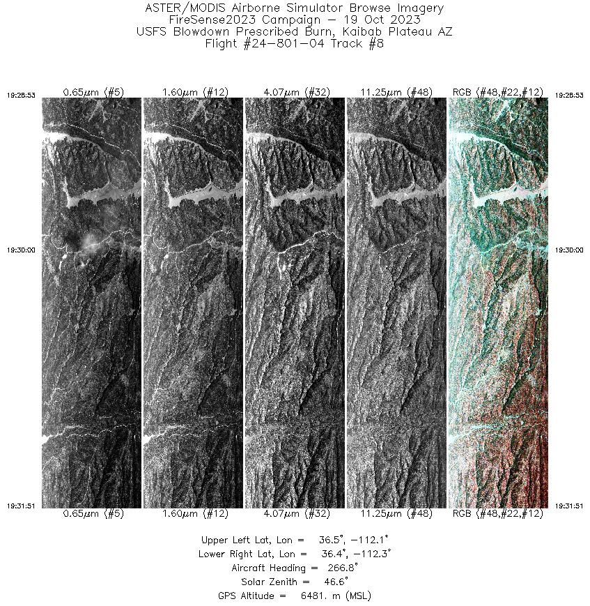
| 8 |
19:28 - 19:31 |
266.9 |
36.432 - 36.421 |
112.091 - 112.276 |
2946 |
6482 |
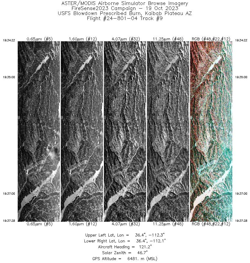
| 9 |
19:34 - 19:37 |
119.5 |
36.466 - 36.390 |
112.270 - 112.098 |
3062 |
6481 |
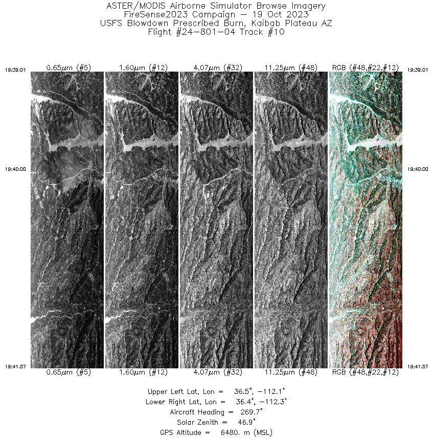
| 10 |
19:39 - 19:41 |
268.4 |
36.432 - 36.422 |
112.091 - 112.275 |
2902 |
6481 |
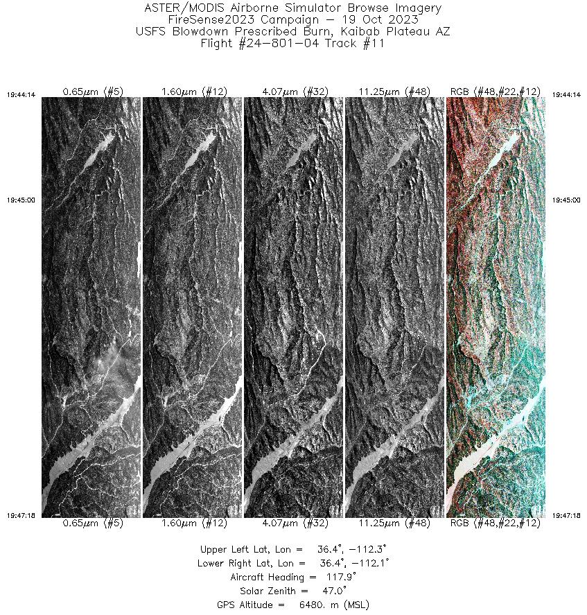
| 11 |
19:44 - 19:47 |
117.7 |
36.466 - 36.390 |
112.271 - 112.097 |
3037 |
6480 |
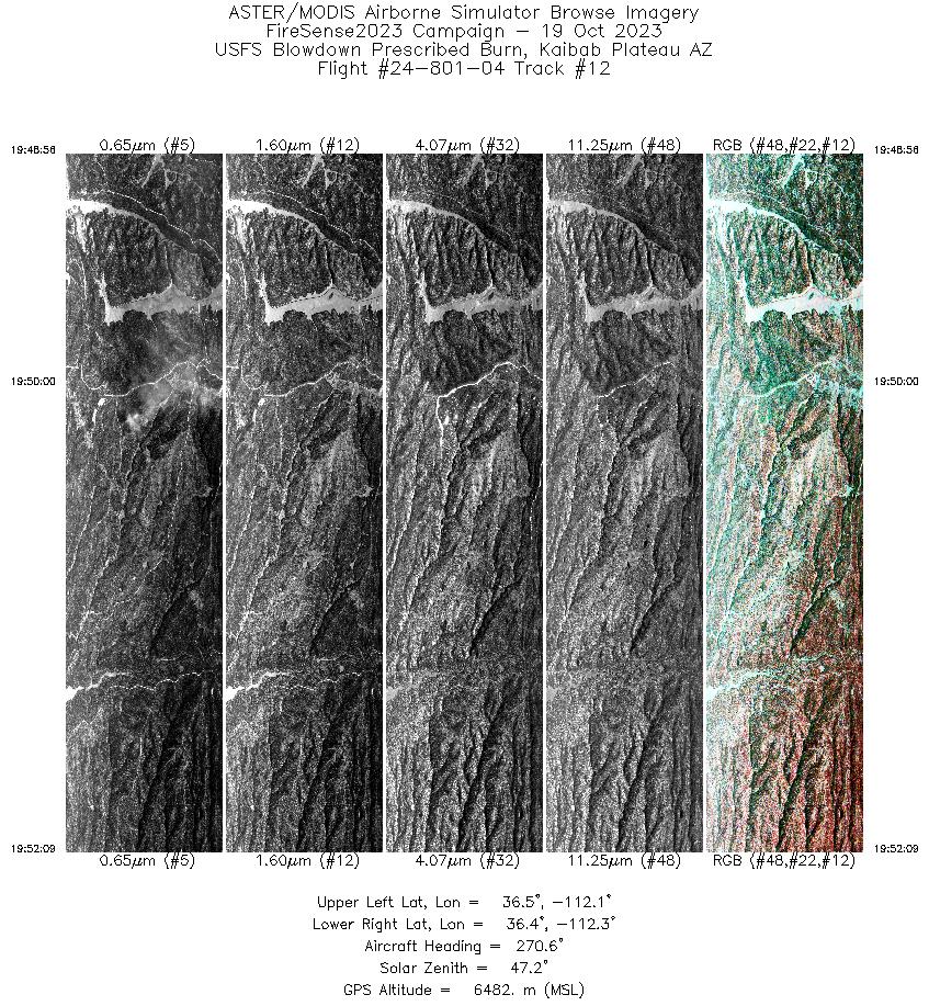
| 12 |
19:48 - 19:52 |
268.7 |
36.432 - 36.421 |
112.092 - 112.290 |
3188 |
6482 |
| 13 |
19:54 - 19:57 |
114.2 |
36.463 - 36.389 |
112.266 - 112.096 |
3076 |
6480 |
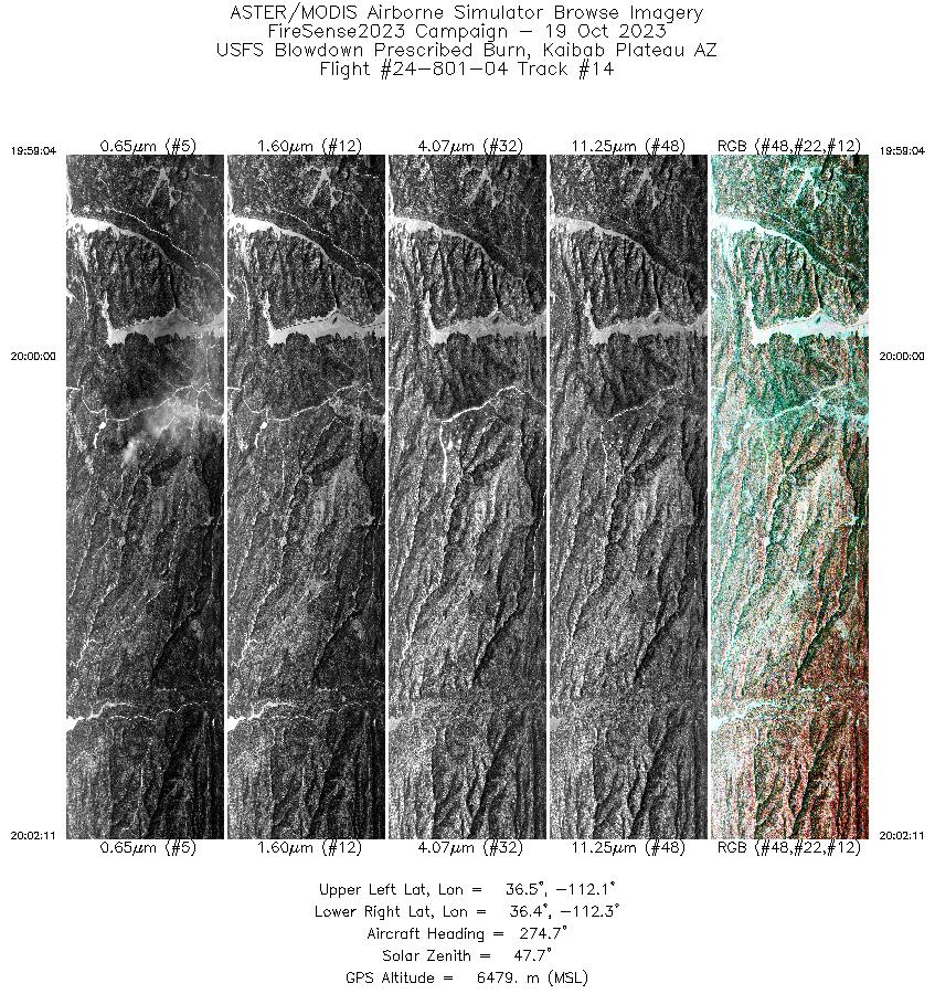
| 14 |
19:59 - 20:02 |
270.8 |
36.434 - 36.421 |
112.088 - 112.276 |
3102 |
6480 |
| 15 |
20:04 - 20:07 |
117.7 |
36.467 - 36.388 |
112.265 - 112.094 |
3114 |
6480 |
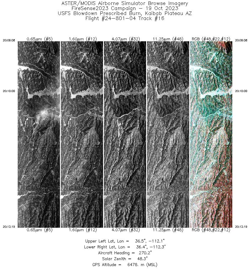
| 16 |
20:09 - 20:12 |
268.6 |
36.432 - 36.421 |
112.079 - 112.278 |
3164 |
6478 |
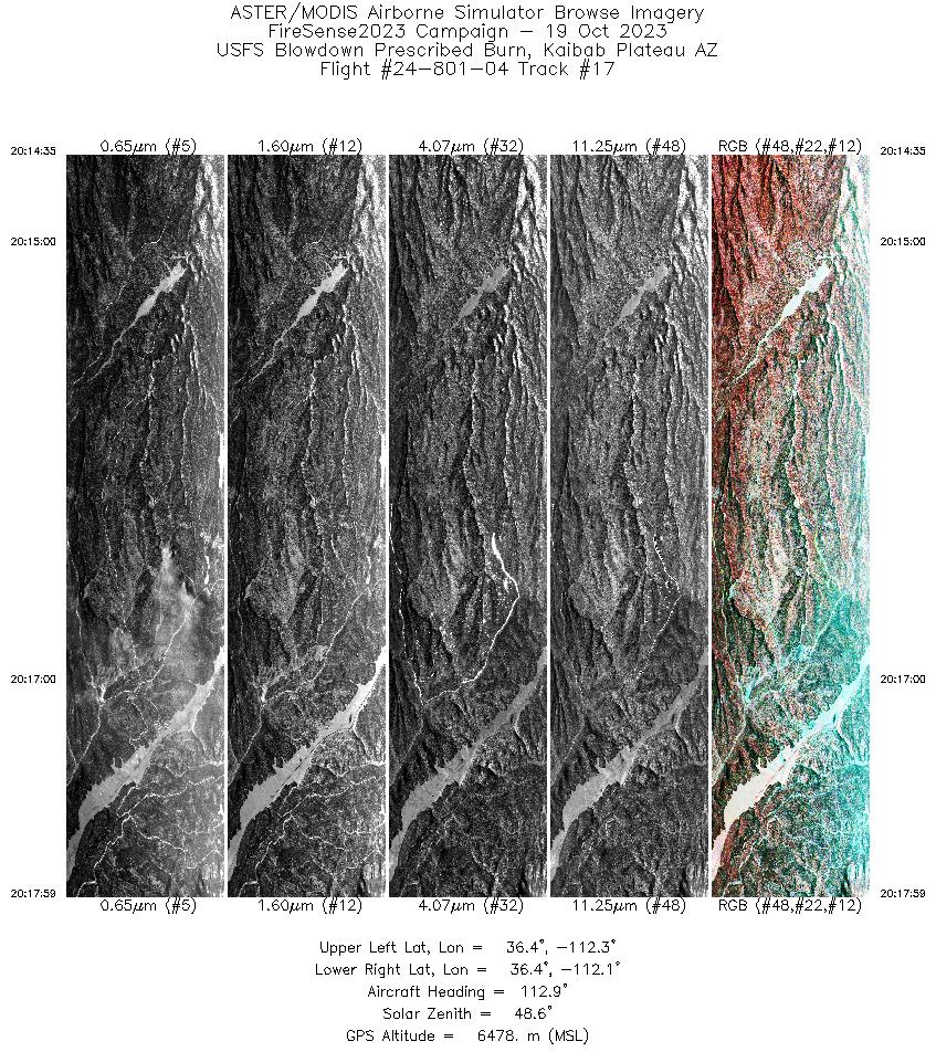
| 17 |
20:14 - 20:17 |
115.8 |
36.470 - 36.389 |
112.285 - 112.095 |
3362 |
6478 |
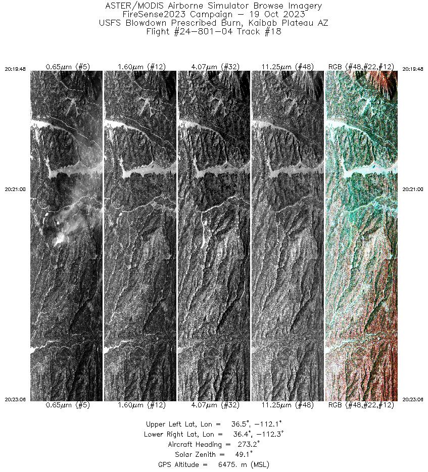
| 18 |
20:19 - 20:23 |
270.2 |
36.433 - 36.422 |
112.075 - 112.275 |
3270 |
6475 |
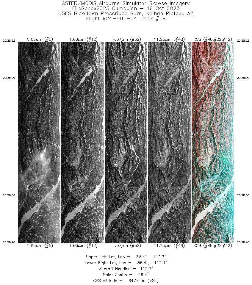
| 19 |
20:25 - 20:28 |
115.8 |
36.469 - 36.388 |
112.281 - 112.093 |
3393 |
6476 |
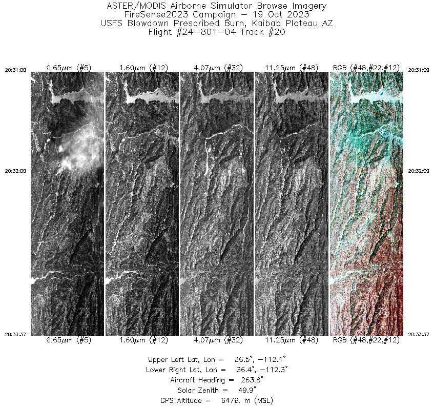
| 20 |
20:31 - 20:33 |
265.1 |
36.434 - 36.421 |
112.121 - 112.277 |
2583 |
6476 |
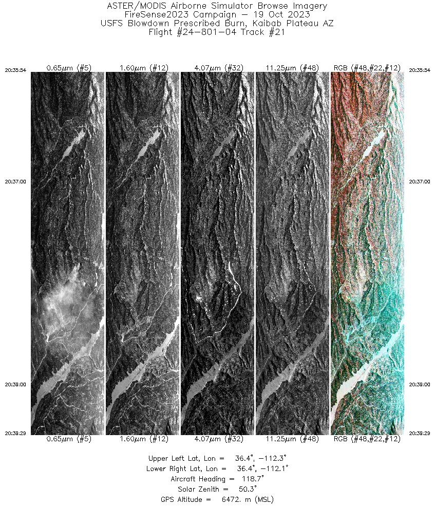
| 21 |
20:35 - 20:39 |
118.8 |
36.473 - 36.388 |
112.287 - 112.094 |
3536 |
6473 |
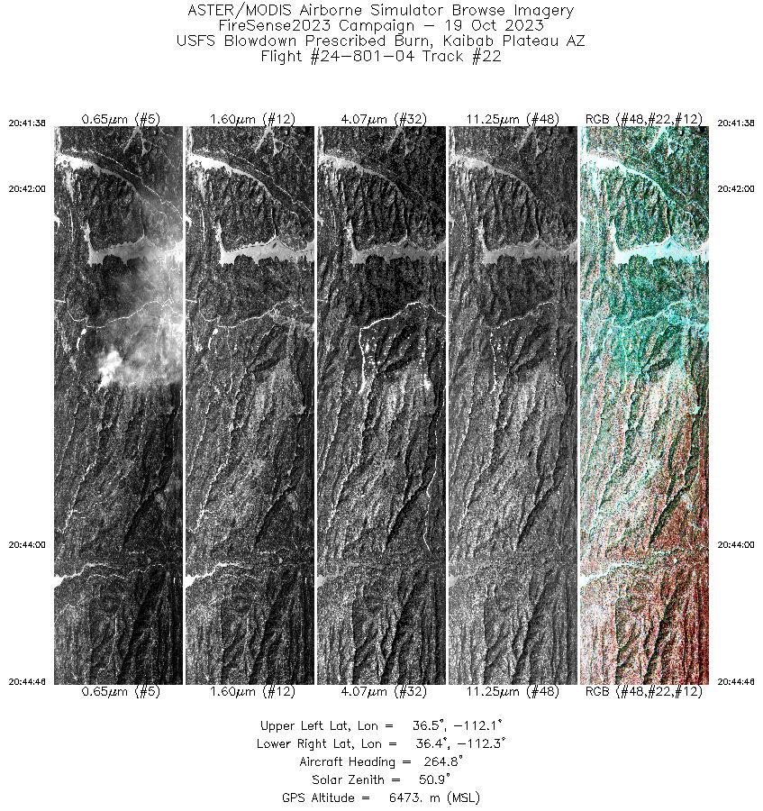
| 22 |
20:41 - 20:44 |
265.8 |
36.436 - 36.421 |
112.094 - 112.279 |
3103 |
6473 |
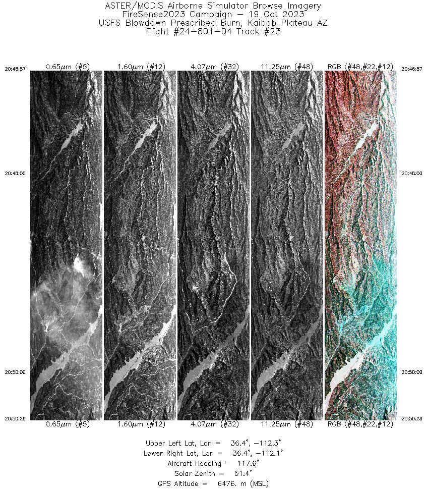
| 23 |
20:46 - 20:50 |
118.3 |
36.472 - 36.389 |
112.284 - 112.095 |
3467 |
6475 |
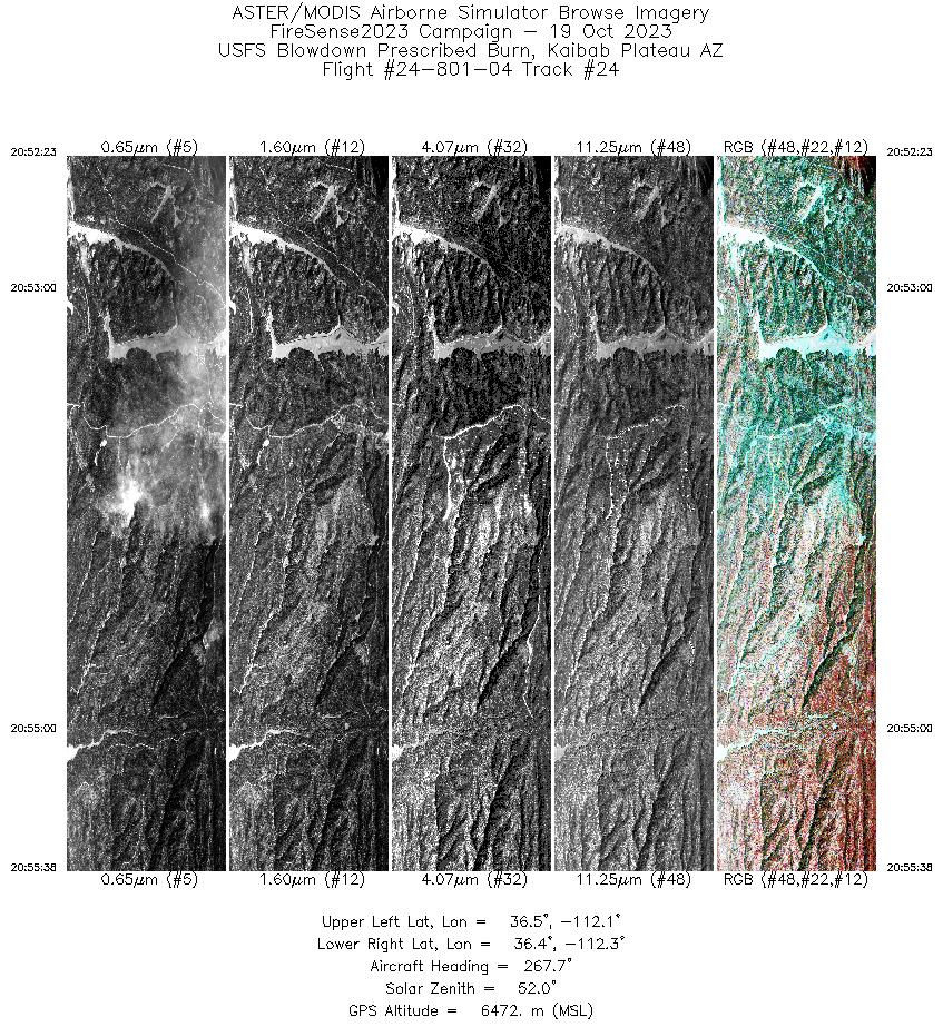
| 24 |
20:52 - 20:55 |
267.4 |
36.436 - 36.422 |
112.084 - 112.276 |
3217 |
6473 |
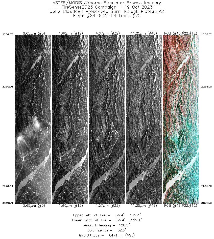
| 25 |
20:57 - 21:01 |
119.8 |
36.470 - 36.390 |
112.278 - 112.097 |
3344 |
6471 |
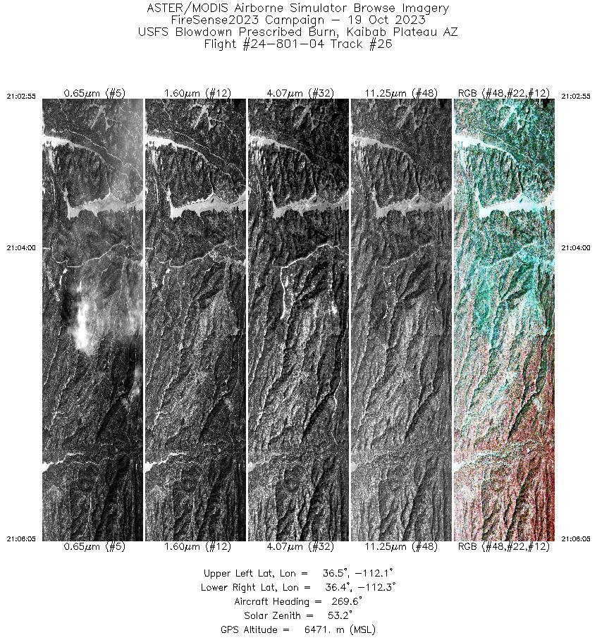
| 26 |
21:02 - 21:06 |
268.2 |
36.433 - 36.422 |
112.089 - 112.276 |
3141 |
6472 |
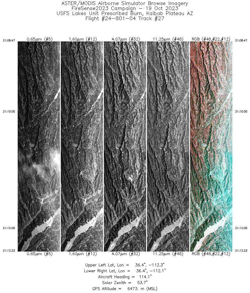
| 27 |
21:08 - 21:12 |
114.5 |
36.451 - 36.377 |
112.310 - 112.107 |
3553 |
6471 |
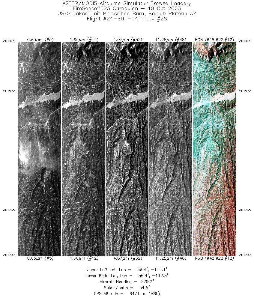
| 28 |
21:14 - 21:17 |
277.1 |
36.401 - 36.415 |
112.074 - 112.288 |
3571 |
6472 |
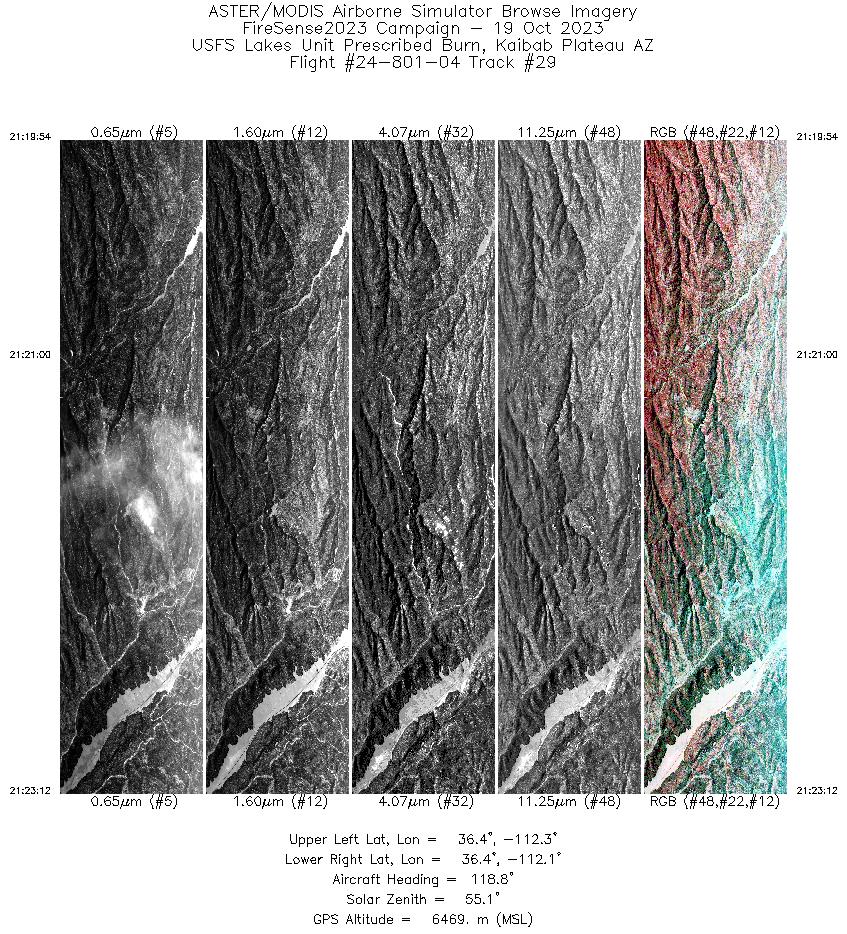
| 29 |
21:19 - 21:23 |
117.2 |
36.443 - 36.375 |
112.287 - 112.102 |
3270 |
6469 |
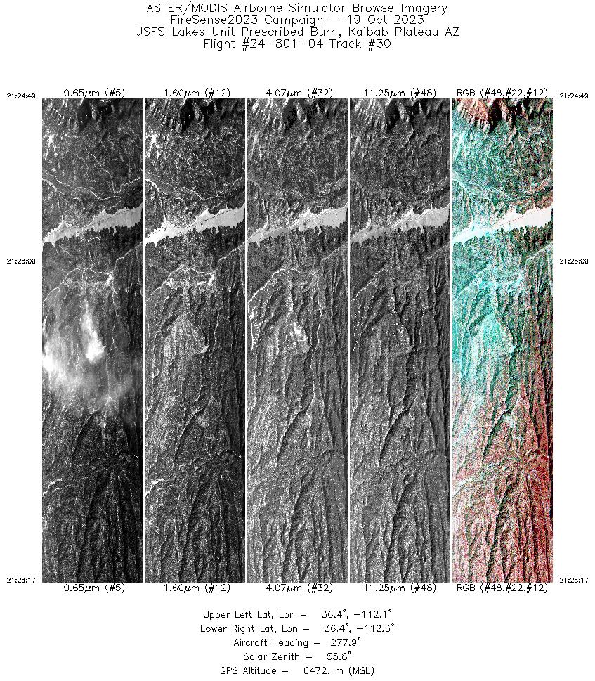
| 30 |
21:24 - 21:28 |
276.7 |
36.402 - 36.415 |
112.078 - 112.286 |
3448 |
6472 |
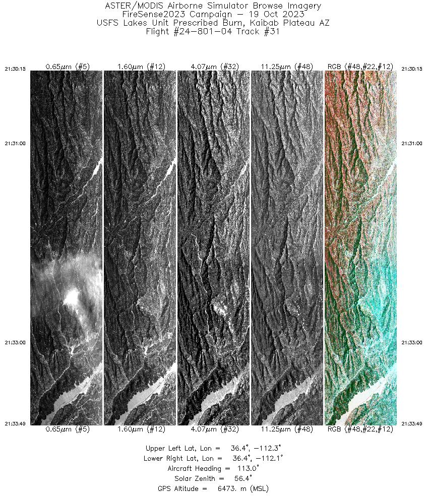
| 31 |
21:30 - 21:33 |
113.9 |
36.451 - 36.379 |
112.313 - 112.113 |
3524 |
6475 |
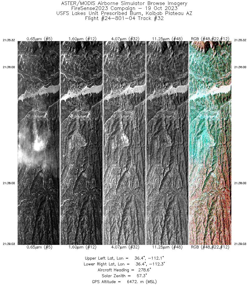
| 32 |
21:35 - 21:39 |
277.2 |
36.402 - 36.415 |
112.080 - 112.289 |
3471 |
6473 |
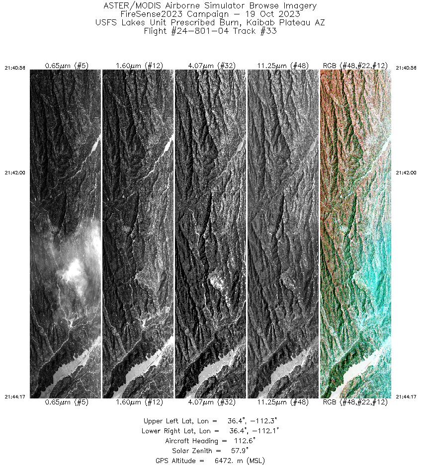
| 33 |
21:40 - 21:44 |
113.7 |
36.447 - 36.379 |
112.302 - 112.112 |
3312 |
6471 |
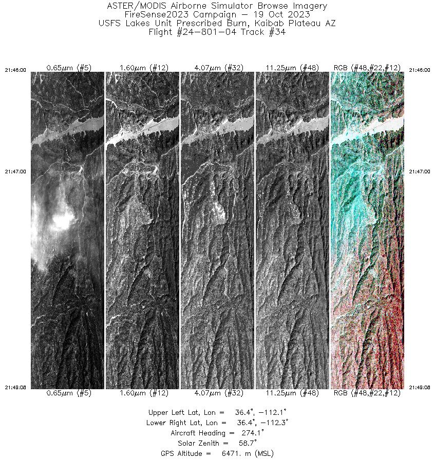
| 34 |
21:46 - 21:49 |
274.7 |
36.404 - 36.415 |
112.097 - 112.285 |
3095 |
6471 |
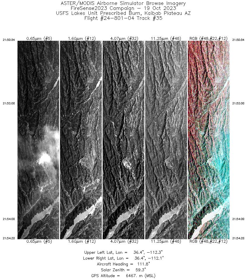
| 35 |
21:50 - 21:54 |
113.1 |
36.446 - 36.377 |
112.299 - 112.107 |
3405 |
6470 |
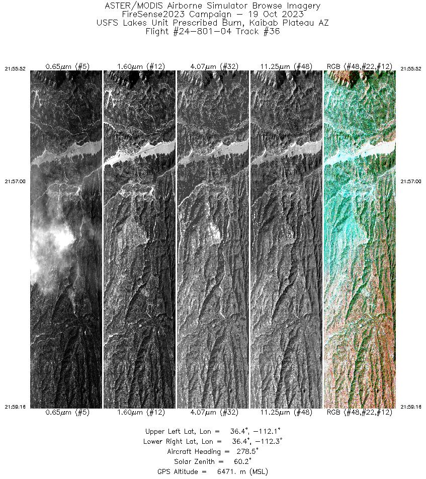
| 36 |
21:55 - 21:59 |
277.0 |
36.402 - 36.415 |
112.082 - 112.287 |
3362 |
6472 |
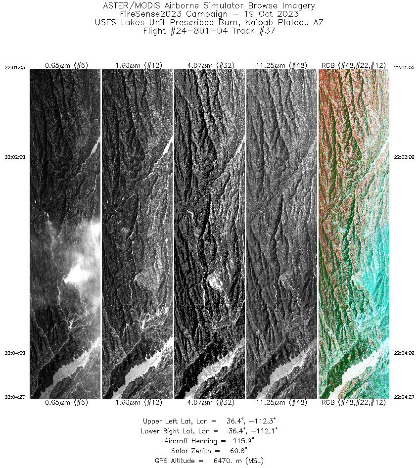
| 37 |
22:01 - 22:04 |
115.1 |
36.448 - 36.379 |
112.303 - 112.112 |
3331 |
6472 |
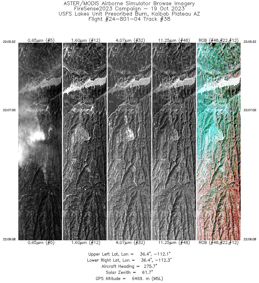
| 38 |
22:05 - 22:09 |
275.5 |
36.403 - 36.415 |
112.090 - 112.288 |
3235 |
6470 |
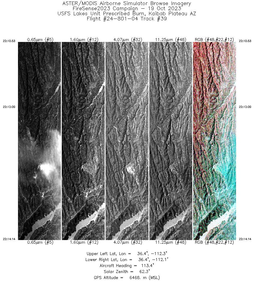
| 39 |
22:10 - 22:14 |
113.7 |
36.448 - 36.379 |
112.302 - 112.112 |
3309 |
6470 |
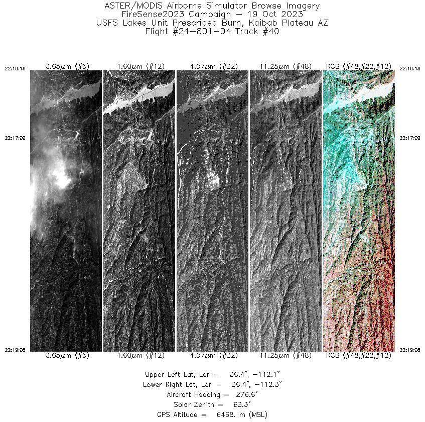
| 40 |
22:16 - 22:19 |
276.1 |
36.403 - 36.415 |
112.116 - 112.286 |
2804 |
6468 |
|


