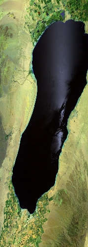
Flight: 23-650-00
Date: 26 Apr 2023
Aircraft:
Deployment: WDTS 2023 Spring
Flight Location: Southern California
Principal Investigators: Hook / Green (JPL)
Additional Sensors: AVIRIS / PICARD / AirMSPI2
|
Data Evaluation
Overall quality is good
Port 3 not installed, no MWIR channels
Port 4 TIR data affected by LN2 loss @ 21:23Z
|
Processing Information
Level-1B Data in HDF format is available
Flight Line Summary
Spectral Band Configuration
Spectral Response Function Table
Spectral Response Function (text)
|
Browse Imagery
Flight Tracks: 10
Scanlines: 121812
|
Browse Imagery Table
|
Click a Flight Track number to view a quicklook image
Lat/Lon ranges are for the BEG-END scanline nadir pixels
|
Flight
Track |
Time Span
(UTC) |
Heading
(Deg) |
Lat Range
(Deg N) |
Lon Range
(Deg W) |
Length
(Scanlines) |
Altitude
(Meters) |
| 1 |
17:00 - 17:15 |
294.0 |
34.189 - 34.794 |
117.098 - 118.882 |
5605 |
19334 |
| 2 |
17:19 - 17:53 |
111.8 |
34.767 - 33.287 |
119.097 - 114.868 |
12878 |
19602 |
| 3 |
17:58 - 18:32 |
292.7 |
33.147 - 34.636 |
114.739 - 118.962 |
13009 |
19780 |
| 4 |
18:38 - 19:12 |
108.7 |
34.591 - 33.126 |
119.139 - 114.950 |
12676 |
19804 |
| 5 |
19:16 - 19:52 |
293.9 |
32.969 - 34.530 |
114.799 - 119.218 |
13548 |
19816 |
| 6 |
19:57 - 20:32 |
111.7 |
34.513 - 32.992 |
119.458 - 115.112 |
13253 |
19814 |
| 7 |
20:37 - 21:11 |
294.6 |
32.899 - 34.365 |
115.107 - 119.295 |
12795 |
19858 |
| 8 |
21:16 - 21:51 |
110.6 |
34.341 - 32.840 |
119.529 - 115.227 |
13196 |
19794 |
| 9 |
21:57 - 22:31 |
293.4 |
32.745 - 34.199 |
115.305 - 119.381 |
12505 |
19841 |
| 10 |
22:35 - 23:08 |
111.1 |
34.175 - 32.782 |
119.610 - 115.598 |
12347 |
19856 |
|


