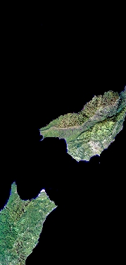
Flight: 23-648-00
Date: 21 Apr 2023
Aircraft: ER-2 #806
Deployment: WDTS 2023 Spring
Flight Location: Santa Barbara, CA
Principal Investigators: Hook / Green (JPL)
Additional Sensors: AVIRIS / PICARD / AirMSPI2
|
Data Evaluation
Overall quality is good
Port 3 not installed, no MWIR channels
|
Processing Information
Level-1B Data in HDF format is available
Flight Line Summary
Spectral Band Configuration
Spectral Response Function Table
Spectral Response Function (text)
|
Browse Imagery
Flight Tracks: 11
Scanlines: 75441
|
Browse Imagery Table
|
Click a Flight Track number to view a quicklook image
Lat/Lon ranges are for the BEG-END scanline nadir pixels
|
Flight
Track |
Time Span
(UTC) |
Heading
(Deg) |
Lat Range
(Deg N) |
Lon Range
(Deg W) |
Length
(Scanlines) |
Altitude
(Meters) |
| 1 |
18:25 - 18:43 |
31.1 |
34.114 - 35.752 |
120.713 - 119.401 |
6868 |
19782 |
| 2 |
18:47 - 19:05 |
216.5 |
35.789 - 34.104 |
119.237 - 120.590 |
6581 |
19706 |
| 3 |
19:10 - 19:29 |
32.7 |
33.909 - 35.652 |
120.615 - 119.218 |
7297 |
19955 |
| 4 |
19:33 - 19:51 |
217.0 |
35.738 - 34.001 |
119.013 - 120.413 |
6807 |
19838 |
| 5 |
19:56 - 20:15 |
30.5 |
33.788 - 35.551 |
120.446 - 119.038 |
7310 |
19866 |
| 6 |
20:20 - 20:38 |
216.0 |
35.599 - 33.906 |
118.863 - 120.234 |
6610 |
19852 |
| 7 |
20:42 - 21:02 |
31.0 |
33.682 - 35.454 |
120.278 - 118.857 |
7402 |
19935 |
| 8 |
21:06 - 21:24 |
215.3 |
35.506 - 33.812 |
118.685 - 120.053 |
6622 |
19836 |
| 9 |
21:28 - 21:48 |
32.6 |
33.600 - 35.361 |
120.098 - 118.676 |
7430 |
19849 |
| 10 |
21:52 - 22:08 |
216.3 |
35.421 - 33.905 |
118.492 - 119.732 |
5951 |
19956 |
| 11 |
22:12 - 22:30 |
36.1 |
33.710 - 35.271 |
119.768 - 118.495 |
6563 |
19950 |
|


