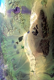
Flight: 23-647-00
Date: 20 Apr 2023
Aircraft: ER-2 #806
Deployment: WDTS 2023 Spring
Flight Location: Ivanpah / Mtn. Pass, CA
Principal Investigators: Hook / Green (JPL)
Additional Sensors: AVIRIS / PICARD / AirMSPI2
|
Data Evaluation
Overall quality is good
Port 3 not installed, no MWIR channels
|
Processing Information
Level-1B Data in HDF format is available
Flight Line Summary
Spectral Band Configuration
Spectral Response Function Table
Spectral Response Function (text)
|
Browse Imagery
Flight Tracks: 10
Scanlines: 16017
|
Browse Imagery Table
|
Click a Flight Track number to view a quicklook image
Lat/Lon ranges are for the BEG-END scanline nadir pixels
|
Flight
Track |
Time Span
(UTC) |
Heading
(Deg) |
Lat Range
(Deg N) |
Lon Range
(Deg W) |
Length
(Scanlines) |
Altitude
(Meters) |
| 1 |
17:04 - 17:07 |
179.5 |
35.727 - 35.428 |
115.397 - 115.396 |
1012 |
20186 |
| 2 |
17:14 - 17:17 |
0.0 |
35.334 - 35.715 |
115.414 - 115.393 |
1380 |
20245 |
| 3 |
17:24 - 17:27 |
180.7 |
35.727 - 35.416 |
115.389 - 115.394 |
1061 |
20020 |
| 4 |
17:33 - 17:37 |
354.7 |
35.260 - 35.716 |
115.382 - 115.394 |
1654 |
20200 |
| 5 |
17:43 - 17:47 |
180.7 |
35.844 - 35.398 |
115.389 - 115.395 |
1512 |
20110 |
| 6 |
17:53 - 17:59 |
330.7 |
35.227 - 35.778 |
115.348 - 115.667 |
2235 |
20179 |
| 7 |
18:05 - 18:11 |
155.5 |
35.805 - 35.197 |
115.793 - 115.467 |
2250 |
20382 |
| 8 |
18:15 - 18:22 |
332.6 |
35.116 - 35.795 |
115.201 - 115.563 |
2705 |
20187 |
| 9 |
18:28 - 18:30 |
89.8 |
35.553 - 35.550 |
115.518 - 115.229 |
803 |
20375 |
| 10 |
18:38 - 18:41 |
269.1 |
35.601 - 35.601 |
115.099 - 115.572 |
1405 |
20063 |
|


