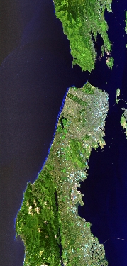
Flight: 23-645-00
Date: 12 Apr 2023
Aircraft: ER-2 #806
Deployment: WDTS 2023 Spring
Flight Location: San Francisco Bay Area, CA
Principal Investigators: Hook / Green (JPL)
Additional Sensors: AVIRIS / PICARD / AirMSPI2
|
Data Evaluation
Overall quality is good
Port 3 not installed, no MWIR channels
|
Processing Information
Level-1B Data in HDF format is available
Flight Line Summary
Spectral Band Configuration
Spectral Response Function Table
Spectral Response Function (text)
|
Browse Imagery
Flight Tracks: 12
Scanlines: 94362
|
Browse Imagery Table
|
Click a Flight Track number to view a quicklook image
Lat/Lon ranges are for the BEG-END scanline nadir pixels
|
Flight
Track |
Time Span
(UTC) |
Heading
(Deg) |
Lat Range
(Deg N) |
Lon Range
(Deg W) |
Length
(Scanlines) |
Altitude
(Meters) |
| 1 |
17:22 - 17:38 |
325.9 |
37.315 - 38.889 |
121.039 - 122.112 |
6005 |
19460 |
| 2 |
17:45 - 18:03 |
155.6 |
39.156 - 37.307 |
122.422 - 121.176 |
6831 |
19723 |
| 3 |
18:08 - 18:28 |
327.0 |
37.167 - 39.080 |
121.210 - 122.506 |
7357 |
19746 |
| 4 |
18:32 - 18:53 |
155.9 |
39.219 - 37.142 |
122.711 - 121.321 |
7657 |
19698 |
| 5 |
18:58 - 19:18 |
325.3 |
36.951 - 38.957 |
121.310 - 122.686 |
7787 |
19634 |
| 6 |
19:24 - 19:44 |
157.2 |
39.006 - 36.987 |
122.845 - 121.475 |
7409 |
19746 |
| 7 |
19:49 - 20:10 |
327.8 |
36.808 - 38.867 |
121.484 - 122.888 |
8011 |
19784 |
| 8 |
20:15 - 20:36 |
155.0 |
38.994 - 36.827 |
123.099 - 121.628 |
7955 |
19851 |
| 9 |
20:40 - 21:03 |
327.9 |
36.654 - 38.850 |
121.640 - 123.144 |
8448 |
19835 |
| 10 |
21:07 - 21:30 |
156.6 |
38.959 - 36.661 |
123.341 - 121.774 |
8425 |
19875 |
| 11 |
21:35 - 22:00 |
330.8 |
36.457 - 38.846 |
121.771 - 123.411 |
9384 |
19834 |
| 12 |
22:04 - 22:29 |
156.0 |
38.944 - 36.485 |
123.610 - 121.918 |
9093 |
19874 |
|


