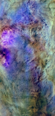
Flight: 23-642-00
Date: 05 Apr 2023
Aircraft: ER-2 #806
Deployment: WDTS Spring 2023
Flight Location: California / Pacific Ocean
Principal Investigators: Platnick (GSFC)
Additional Sensors: AVIRIS / PICARD / AirMSPI2
|
Data Evaluation
Overall quality is good
Port 3 not installed, no MWIR channels
Terra Overpass @ 19:09UTC
|
Processing Information
Level-1B Data in HDF format is available
Flight Line Summary
Spectral Band Configuration
Spectral Response Function Table
Spectral Response Function (text)
|
Browse Imagery
Flight Tracks: 12
Scanlines: 47454
|
Browse Imagery Table
|
Click a Flight Track number to view a quicklook image
Lat/Lon ranges are for the BEG-END scanline nadir pixels
|
Flight
Track |
Time Span
(UTC) |
Heading
(Deg) |
Lat Range
(Deg N) |
Lon Range
(Deg W) |
Length
(Scanlines) |
Altitude
(Meters) |
| 1 |
17:44 - 18:11 |
294.9 |
38.085 - 39.264 |
121.134 - 124.220 |
9801 |
19628 |
| 2 |
18:12 - 18:25 |
294.7 |
39.318 - 39.830 |
124.392 - 126.000 |
4815 |
19679 |
| 3 |
18:25 - 18:39 |
291.3 |
39.830 - 40.388 |
126.001 - 127.854 |
5478 |
19761 |
| 4 |
18:43 - 18:55 |
9.0 |
40.595 - 41.876 |
128.197 - 127.792 |
4564 |
19783 |
| 5 |
19:02 - 19:09 |
193.9 |
41.962 - 41.157 |
127.757 - 128.016 |
2803 |
19784 |
| 6 |
19:09 - 19:15 |
195.5 |
41.133 - 40.483 |
128.024 - 128.223 |
2338 |
19695 |
| 7 |
19:17 - 19:19 |
88.8 |
40.361 - 40.351 |
128.102 - 127.809 |
790 |
19898 |
| 8 |
19:21 - 19:33 |
108.7 |
40.314 - 39.833 |
127.600 - 126.000 |
4495 |
19843 |
| 9 |
19:33 - 19:46 |
113.3 |
39.833 - 39.279 |
125.999 - 124.263 |
4817 |
19912 |
| 10 |
19:49 - 19:55 |
113.0 |
39.095 - 38.789 |
123.848 - 123.002 |
2435 |
19800 |
| 11 |
19:59 - 20:05 |
106.7 |
38.545 - 38.405 |
122.682 - 121.807 |
2352 |
19773 |
| 12 |
20:05 - 20:13 |
116.4 |
38.381 - 37.949 |
121.726 - 120.818 |
2766 |
20105 |
|


