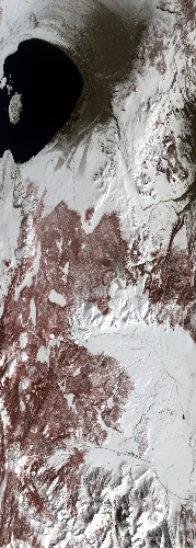
Flight: 23-641-00
Date: 31 Mar 2023
Aircraft: ER-2 #806
Deployment: WDTS 2023 Spring
Flight Location: Yosemite / Soda Straw, CA
Principal Investigators: Hook / Green (JPL)
Additional Sensors: AVIRIS / PICARD / AirMSPI2
|
Data Evaluation
Overall quality is good
Port 3 not installed, no MWIR channels
|
Processing Information
Level-1B Data in HDF format is available
Flight Line Summary
Spectral Band Configuration
Spectral Response Function Table
Spectral Response Function (text)
|
Browse Imagery
Flight Tracks: 12
Scanlines: 76165
|
Browse Imagery Table
|
Click a Flight Track number to view a quicklook image
Lat/Lon ranges are for the BEG-END scanline nadir pixels
|
Flight
Track |
Time Span
(UTC) |
Heading
(Deg) |
Lat Range
(Deg N) |
Lon Range
(Deg W) |
Length
(Scanlines) |
Altitude
(Meters) |
| 1 |
17:53 - 18:07 |
187.3 |
38.196 - 36.647 |
118.883 - 118.909 |
5409 |
19451 |
| 2 |
18:12 - 18:26 |
357.1 |
36.485 - 38.105 |
119.004 - 118.987 |
5350 |
19656 |
| 3 |
18:32 - 18:47 |
185.4 |
38.318 - 36.648 |
119.081 - 119.105 |
5780 |
19789 |
| 4 |
18:52 - 19:06 |
356.2 |
36.483 - 38.106 |
119.205 - 119.187 |
5350 |
19709 |
| 5 |
19:12 - 19:27 |
185.0 |
38.202 - 36.649 |
119.283 - 119.300 |
5272 |
19700 |
| 6 |
19:32 - 19:48 |
357.7 |
36.356 - 38.108 |
119.405 - 119.387 |
5777 |
19719 |
| 7 |
19:53 - 20:11 |
184.6 |
38.265 - 36.284 |
119.487 - 119.509 |
6711 |
19813 |
| 8 |
20:15 - 20:33 |
357.6 |
36.127 - 38.109 |
119.604 - 119.596 |
6559 |
19694 |
| 9 |
20:38 - 20:53 |
187.3 |
38.307 - 36.652 |
119.701 - 119.709 |
5616 |
19719 |
| 10 |
20:57 - 21:11 |
357.5 |
36.487 - 38.109 |
119.813 - 119.811 |
5357 |
19732 |
| 11 |
21:16 - 21:31 |
187.8 |
38.297 - 36.646 |
119.916 - 119.923 |
5651 |
19766 |
| 12 |
21:51 - 22:26 |
195.8 |
38.202 - 34.378 |
119.026 - 119.924 |
13333 |
19707 |
|


