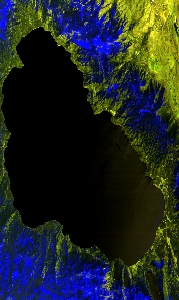
Flight: 21-938-00
Date: 30 Mar 2021
Aircraft: ER-2 #809
Deployment: WDTS Spring 2021
Flight Location: Lake Tahoe / Soda Straw, CA
Principal Investigators: Hook / Green (JPL)
Additional Sensors: AVIRIS
|
Data Evaluation
Overall quality is good
|
Processing Information
Level-1B Data in HDF format is available
Flight Line Summary
Spectral Band Configuration
Spectral Response Function Table
Spectral Response Function (text)
|
Browse Imagery
Flight Tracks: 12
Scanlines: 70430
|
Browse Imagery Table
|
Click a Flight Track number to view a quicklook image
Lat/Lon ranges are for the BEG-END scanline nadir pixels
|
Flight
Track |
Time Span
(UTC) |
Heading
(Deg) |
Lat Range
(Deg N) |
Lon Range
(Deg W) |
Length
(Scanlines) |
Altitude
(Meters) |
| 1 |
17:56 - 18:09 |
231.2 |
38.927 - 37.890 |
119.292 - 120.609 |
5095 |
18903 |
| 2 |
18:14 - 18:27 |
33.2 |
37.814 - 38.939 |
120.825 - 119.441 |
5153 |
19036 |
| 3 |
18:32 - 18:46 |
226.3 |
39.068 - 38.013 |
119.419 - 120.747 |
5103 |
19155 |
| 4 |
18:50 - 19:04 |
34.7 |
37.947 - 39.054 |
120.953 - 119.591 |
5156 |
19252 |
| 5 |
19:08 - 19:22 |
226.4 |
39.230 - 38.128 |
119.509 - 120.895 |
5282 |
19398 |
| 6 |
19:27 - 19:40 |
39.5 |
38.095 - 39.166 |
121.081 - 119.746 |
4945 |
19495 |
| 7 |
19:45 - 20:00 |
228.6 |
39.373 - 38.244 |
119.623 - 121.046 |
5564 |
19599 |
| 8 |
20:04 - 20:18 |
35.7 |
38.166 - 39.284 |
121.273 - 119.896 |
5010 |
19713 |
| 9 |
20:22 - 20:37 |
230.8 |
39.483 - 38.363 |
119.781 - 121.195 |
5493 |
19848 |
| 10 |
20:41 - 20:54 |
34.4 |
38.292 - 39.411 |
121.410 - 120.039 |
5053 |
19841 |
| 11 |
20:59 - 21:13 |
229.6 |
39.599 - 38.476 |
119.928 - 121.354 |
5528 |
19795 |
| 12 |
21:31 - 22:06 |
196.1 |
38.190 - 34.379 |
119.023 - 119.924 |
13048 |
19842 |
|


