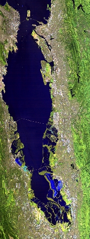
Flight: 21-936-00
Date: 26 Mar 2021
Aircraft: ER-2 #809
Deployment: WDTS Spring 2021
Flight Location: San Francisco Bay Area, CA
Principal Investigators: Hook / Green (JPL)
Additional Sensors: AVIRIS
|
Data Evaluation
Overall quality is good
|
Processing Information
Level-1B Data in HDF format is available
Flight Line Summary
Spectral Band Configuration
Spectral Response Function Table
Spectral Response Function (text)
|
Browse Imagery
Flight Tracks: 12
Scanlines: 97029
|
Browse Imagery Table
|
Click a Flight Track number to view a quicklook image
Lat/Lon ranges are for the BEG-END scanline nadir pixels
|
Flight
Track |
Time Span
(UTC) |
Heading
(Deg) |
Lat Range
(Deg N) |
Lon Range
(Deg W) |
Length
(Scanlines) |
Altitude
(Meters) |
| 1 |
17:05 - 17:22 |
331.5 |
37.335 - 38.898 |
121.065 - 122.118 |
6450 |
18557 |
| 2 |
17:28 - 17:45 |
149.4 |
39.102 - 37.303 |
122.391 - 121.174 |
6366 |
18846 |
| 3 |
17:50 - 18:13 |
331.4 |
37.055 - 39.082 |
121.137 - 122.510 |
8409 |
18935 |
| 4 |
18:17 - 18:37 |
150.3 |
39.191 - 37.140 |
122.710 - 121.320 |
7347 |
19089 |
| 5 |
18:42 - 19:05 |
331.5 |
36.901 - 38.955 |
121.280 - 122.685 |
8471 |
19166 |
| 6 |
19:09 - 19:30 |
150.7 |
39.058 - 36.986 |
122.886 - 121.474 |
7616 |
19352 |
| 7 |
19:35 - 19:57 |
333.3 |
36.751 - 38.862 |
121.449 - 122.884 |
8411 |
19497 |
| 8 |
20:01 - 20:23 |
149.4 |
38.962 - 36.818 |
123.077 - 121.621 |
8056 |
19604 |
| 9 |
20:28 - 20:51 |
330.4 |
36.620 - 38.870 |
121.623 - 123.159 |
8731 |
19778 |
| 10 |
20:56 - 21:19 |
153.1 |
38.900 - 36.659 |
123.304 - 121.773 |
8517 |
19704 |
| 11 |
21:23 - 21:47 |
330.2 |
36.491 - 38.857 |
121.791 - 123.418 |
9184 |
19833 |
| 12 |
21:52 - 22:17 |
152.2 |
38.959 - 36.487 |
123.629 - 121.919 |
9471 |
19770 |
|


