Flight: 19-817-33
Date: September 03, 2019
Aircraft: NASA DC-8, #817
Deployment: FIREX-AQ
Flight Location: Louisiana / Mississippi / Arkansas / Missouri (Ag Fires)
Principal Investigator: Crawford (NASA), Warneke (CIRES), Schwarz (NOAA)
Additional Sensors: DC-8 Payload
|
Data Evaluation
Overall data quality is good.
All data collected @25Hz; many flight lines underscanned due to low altitude data collection.
Significant VIS/SWIR reponse degradation during campaign.
Saturated fire pixels due to new optics.
|
Processing Information
Level-1B Data in HDF format is available
Flight Line Summary
Spectral Band Configuration
Spectral Response Function Table
Spectral Response Function (text)
|
Browse Imagery
Flight Tracks: 35
Scanlines: 162487
|
Browse Imagery Table
|
Click a Flight Track number to view a quicklook image
Lat/Lon ranges are for the BEG-END scanline nadir pixels
|
Flight
Track |
Time Span
(UTC) |
Heading
(Deg) |
Lat Range
(Deg N) |
Lon Range
(Deg W) |
Length
(Scanlines) |
Altitude
(Meters) |
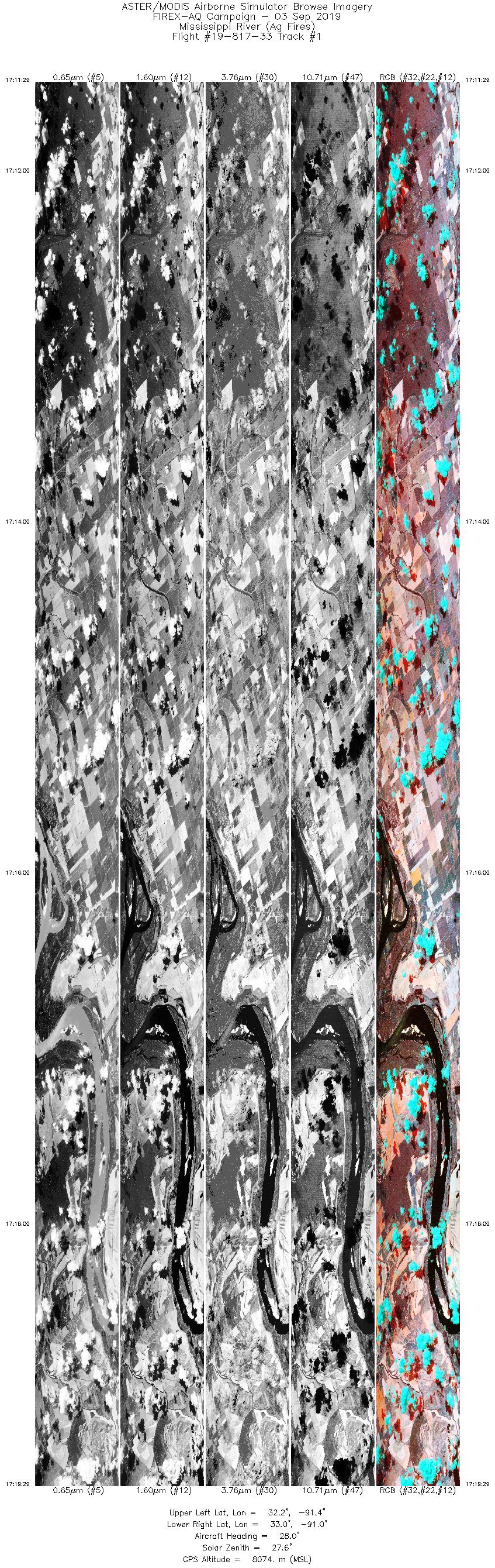
| 1 |
17:11 - 17:19 |
27.7 |
32.218 - 33.010 |
91.470 - 90.973 |
12000 |
8077 |
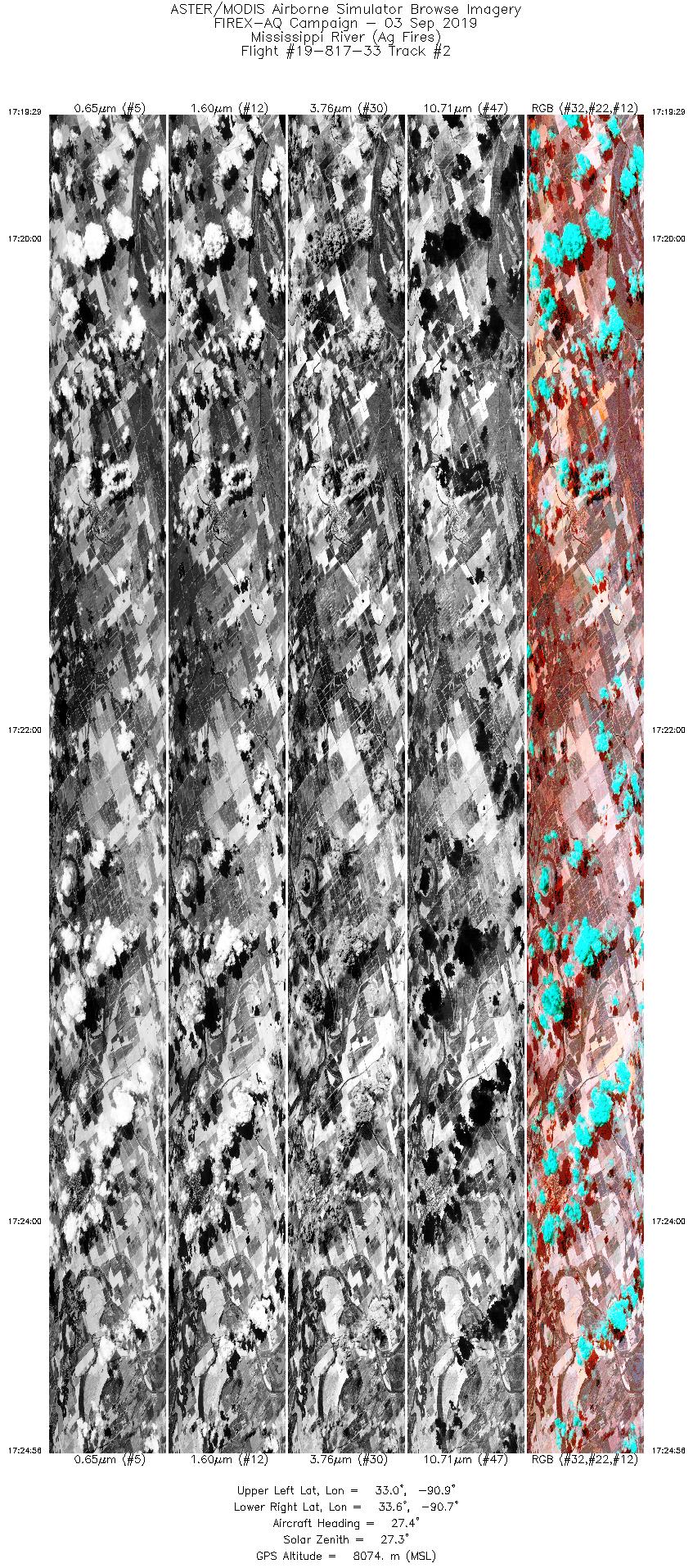
| 2 |
17:19 - 17:24 |
27.1 |
33.010 - 33.575 |
90.973 - 90.616 |
8176 |
8073 |
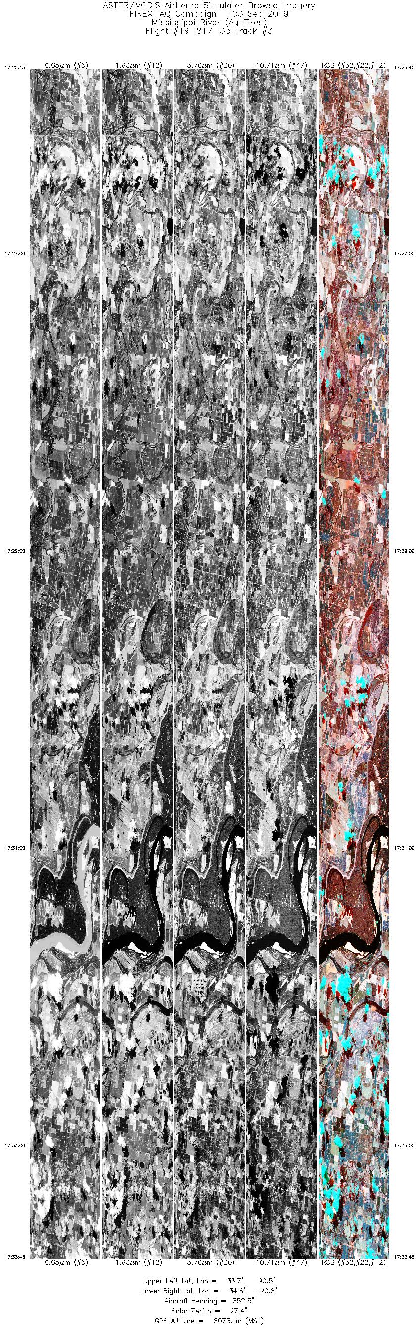
| 3 |
17:25 - 17:33 |
352.4 |
33.670 - 34.605 |
90.611 - 90.757 |
12000 |
8076 |
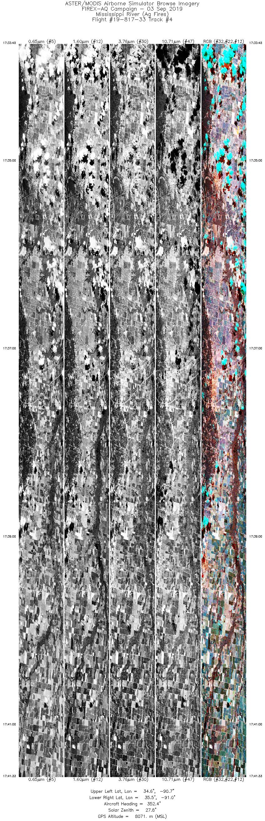
| 4 |
17:33 - 17:41 |
352.3 |
34.605 - 35.464 |
90.757 - 90.894 |
11692 |
8070 |
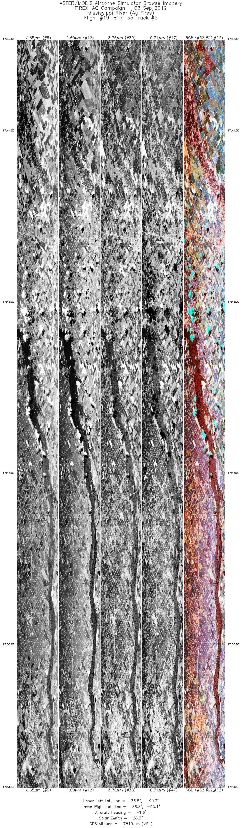
| 5 |
17:42 - 17:51 |
40.6 |
35.589 - 36.304 |
90.803 - 90.000 |
13089 |
7939 |
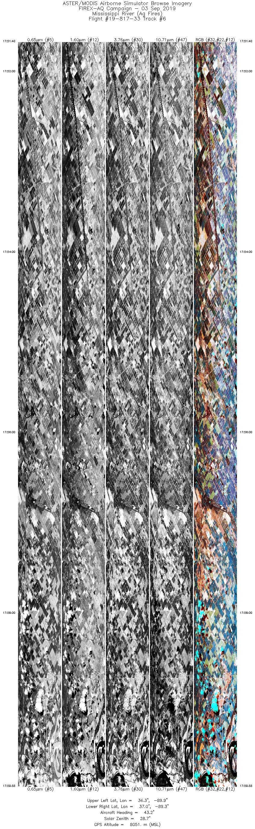
| 6 |
17:51 - 17:59 |
42.4 |
36.304 - 37.000 |
90.000 - 89.198 |
12372 |
7935 |
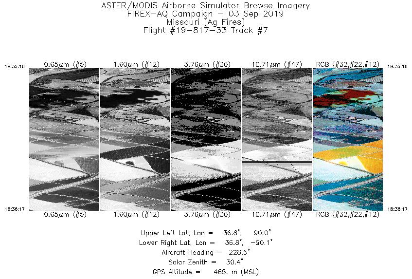
| 7 |
18:35 - 18:36 |
225.7 |
36.839 - 36.795 |
90.009 - 90.072 |
1469 |
474 |
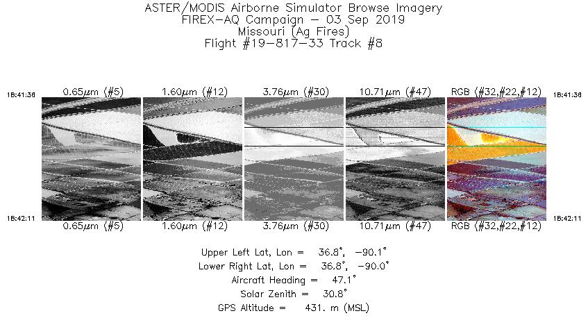
| 8 |
18:41 - 18:42 |
47.9 |
36.802 - 36.830 |
90.065 - 90.027 |
891 |
500 |
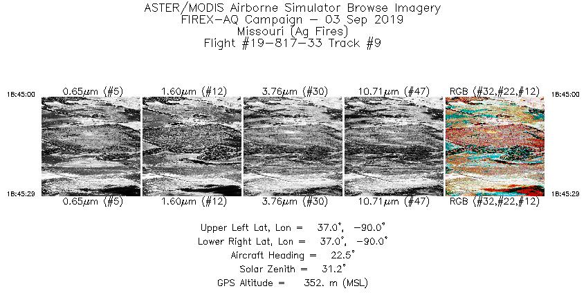
| 9 |
18:44 - 18:45 |
25.2 |
36.985 - 37.013 |
90.016 - 89.999 |
721 |
361 |
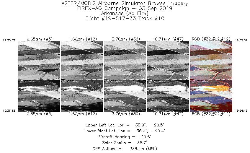
| 10 |
19:35 - 19:36 |
21.7 |
35.916 - 35.966 |
90.464 - 90.434 |
1194 |
364 |
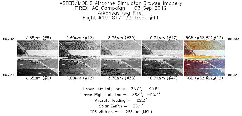
| 11 |
19:38 - 19:39 |
103.7 |
35.953 - 35.948 |
90.461 - 90.427 |
631 |
310 |
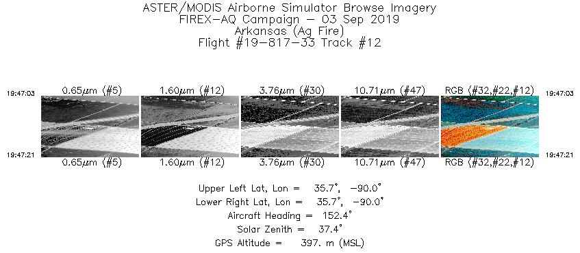
| 12 |
19:47 - 19:47 |
153.3 |
35.751 - 35.732 |
90.024 - 90.014 |
452 |
393 |
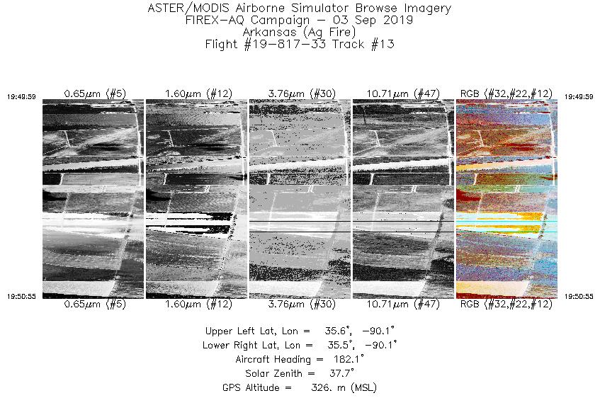
| 13 |
19:49 - 19:50 |
178.5 |
35.554 - 35.489 |
90.074 - 90.073 |
1411 |
332 |
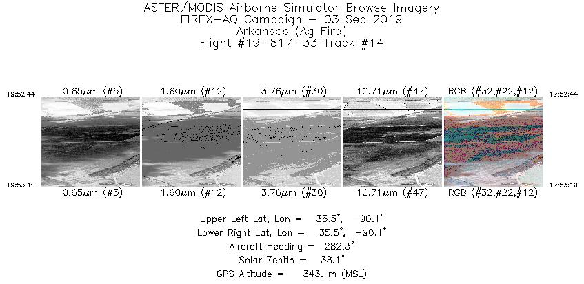
| 14 |
19:52 - 19:53 |
283.0 |
35.511 - 35.518 |
90.071 - 90.109 |
664 |
361 |
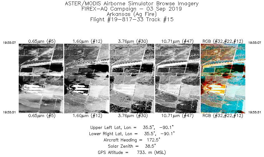
| 15 |
19:55 - 19:55 |
174.2 |
35.547 - 35.494 |
90.076 - 90.072 |
1117 |
710 |
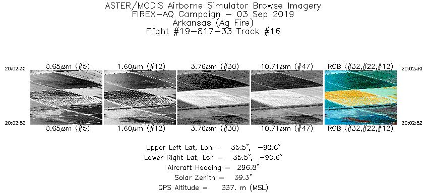
| 16 |
20:02 - 20:02 |
296.4 |
35.513 - 35.525 |
90.609 - 90.636 |
544 |
346 |
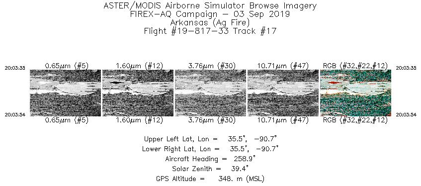
| 17 |
20:03 - 20:03 |
258.4 |
35.526 - 35.523 |
90.693 - 90.717 |
470 |
347 |
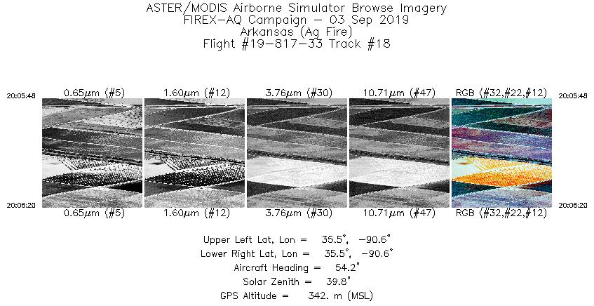
| 18 |
20:05 - 20:06 |
51.7 |
35.504 - 35.525 |
90.646 - 90.612 |
781 |
369 |
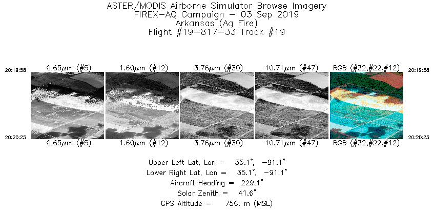
| 19 |
20:19 - 20:20 |
231.0 |
35.121 - 35.100 |
91.099 - 91.130 |
655 |
807 |
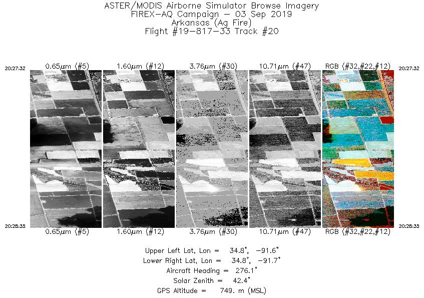
| 20 |
20:27 - 20:28 |
276.8 |
34.821 - 34.830 |
91.632 - 91.714 |
1576 |
780 |
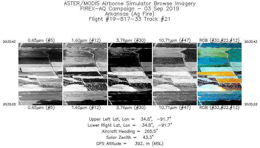
| 21 |
20:32 - 20:33 |
273.3 |
34.826 - 34.830 |
91.652 - 91.709 |
1027 |
400 |
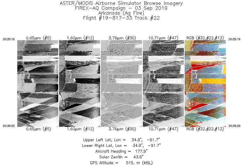
| 22 |
20:35 - 20:36 |
152.5 |
34.844 - 34.783 |
91.694 - 91.673 |
1514 |
573 |
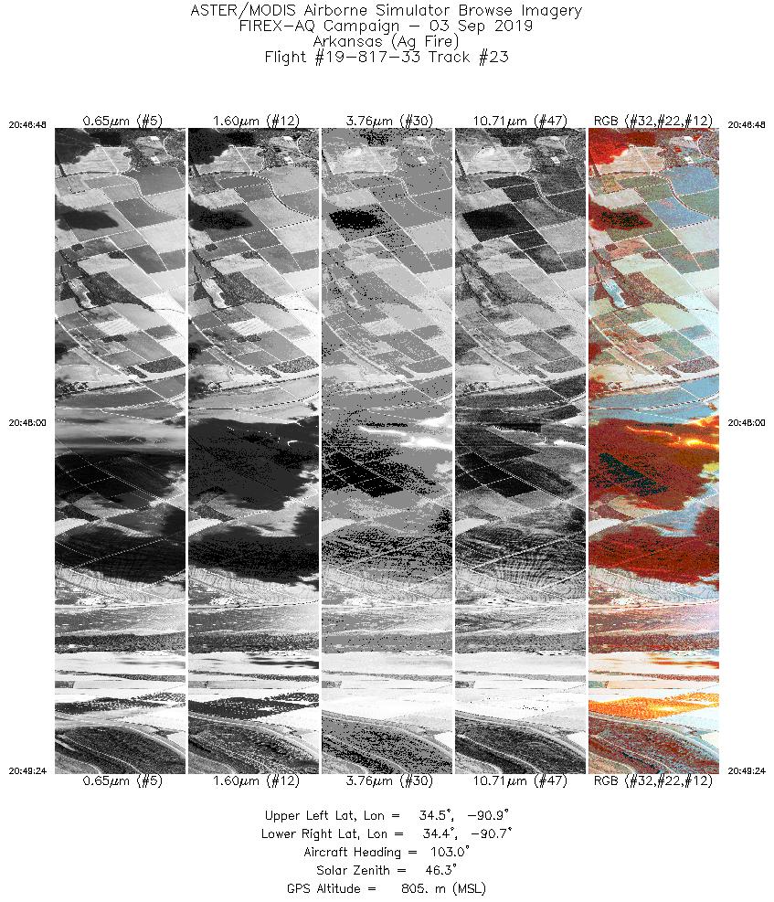
| 23 |
20:46 - 20:49 |
120.7 |
34.493 - 34.382 |
90.852 - 90.684 |
3891 |
727 |
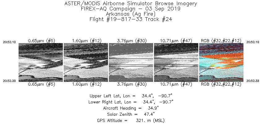
| 24 |
20:52 - 20:52 |
33.0 |
34.387 - 34.409 |
90.704 - 90.684 |
630 |
322 |
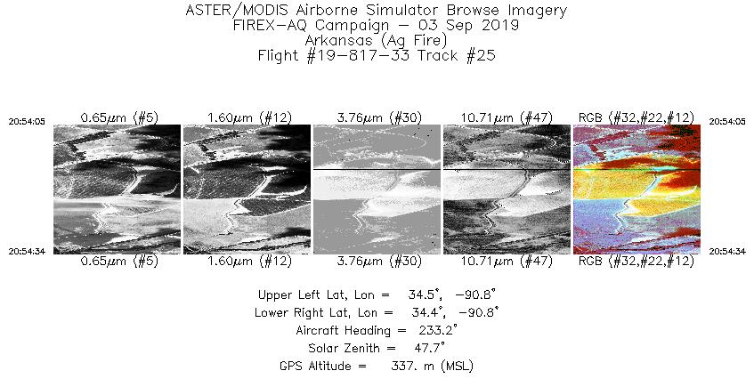
| 25 |
20:54 - 20:54 |
232.3 |
34.472 - 34.451 |
90.749 - 90.783 |
733 |
361 |
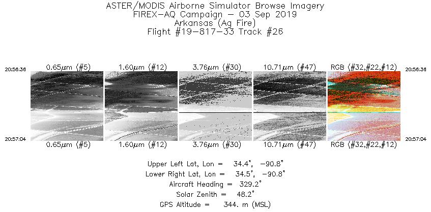
| 26 |
20:56 - 20:57 |
327.3 |
34.444 - 34.470 |
90.758 - 90.778 |
687 |
356 |
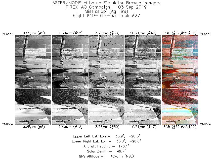
| 27 |
21:05 - 21:07 |
179.8 |
33.928 - 33.846 |
90.770 - 90.775 |
1790 |
428 |
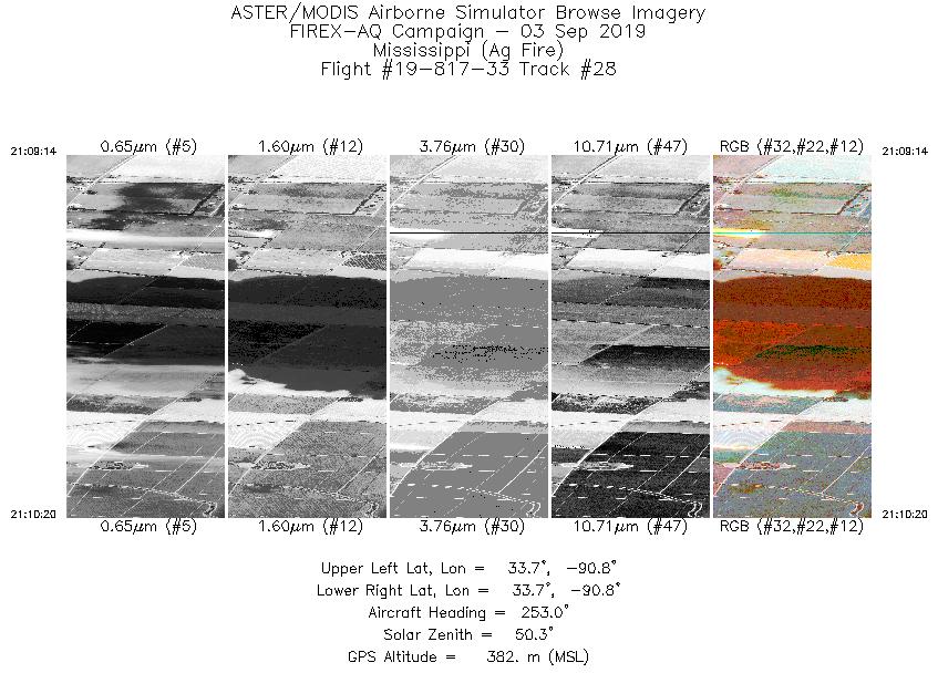
| 28 |
21:09 - 21:10 |
255.1 |
33.703 - 33.686 |
90.758 - 90.845 |
1643 |
410 |
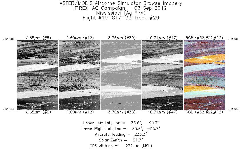
| 29 |
21:16 - 21:16 |
228.3 |
33.603 - 33.565 |
90.695 - 90.745 |
1229 |
277 |
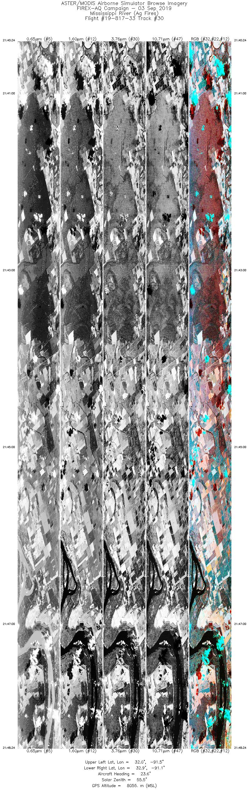
| 30 |
21:40 - 21:48 |
25.4 |
32.037 - 32.871 |
91.570 - 91.061 |
12000 |
8055 |
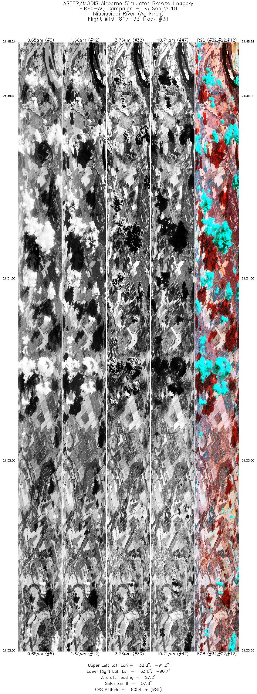
| 31 |
21:48 - 21:55 |
26.8 |
32.871 - 33.574 |
91.061 - 90.617 |
10037 |
8053 |
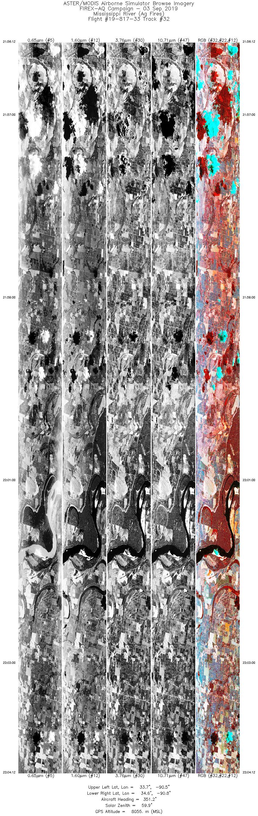
| 32 |
21:56 - 22:04 |
351.1 |
33.704 - 34.654 |
90.616 - 90.765 |
12000 |
8055 |
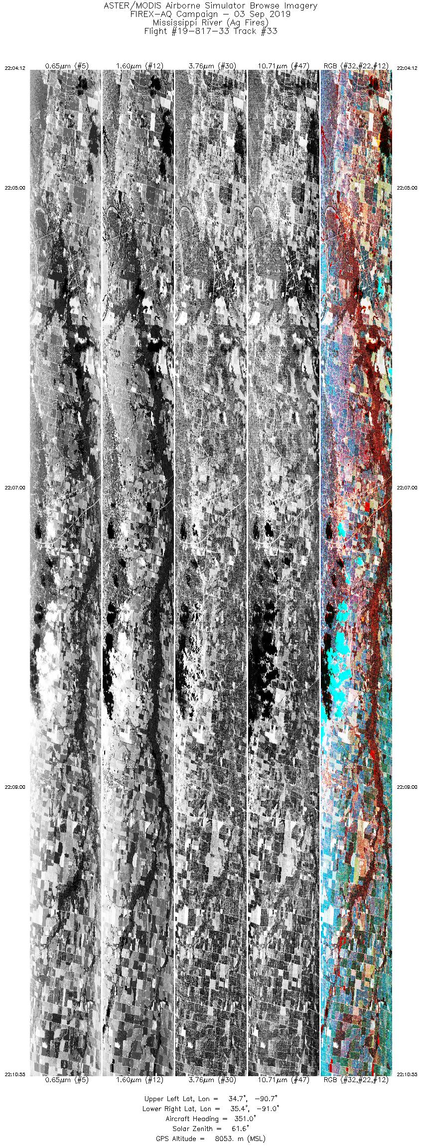
| 33 |
22:04 - 22:10 |
351.2 |
34.654 - 35.455 |
90.765 - 90.893 |
10089 |
8052 |
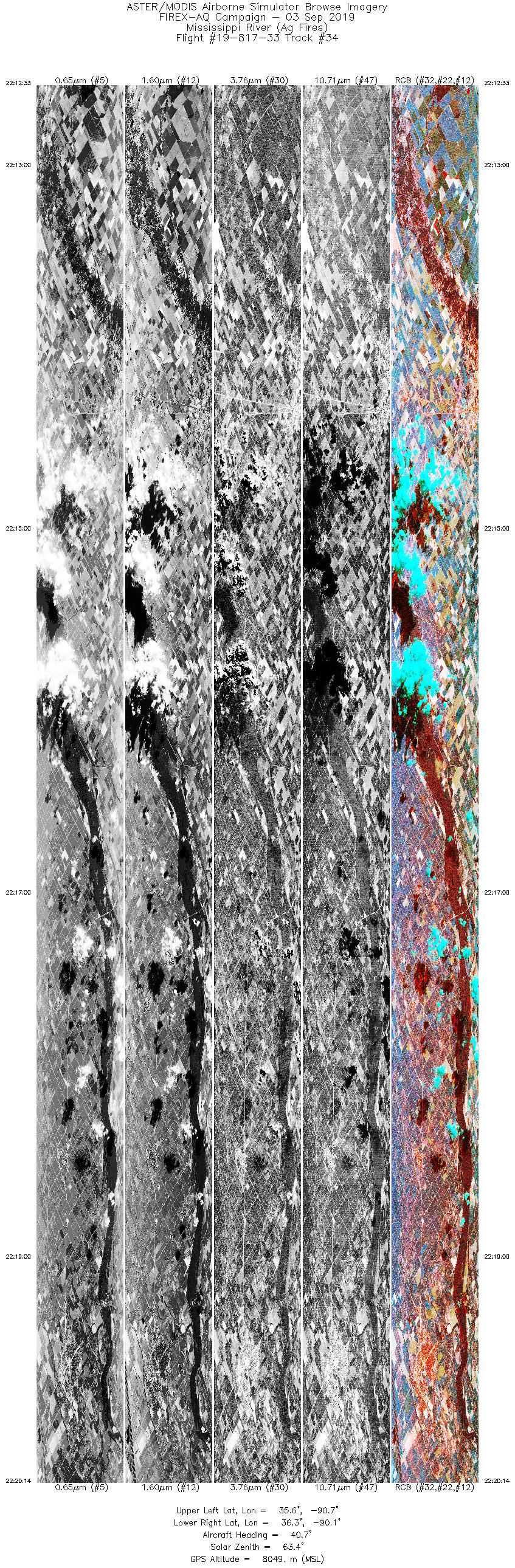
| 34 |
22:12 - 22:20 |
39.8 |
35.617 - 36.304 |
90.771 - 90.000 |
11504 |
8049 |
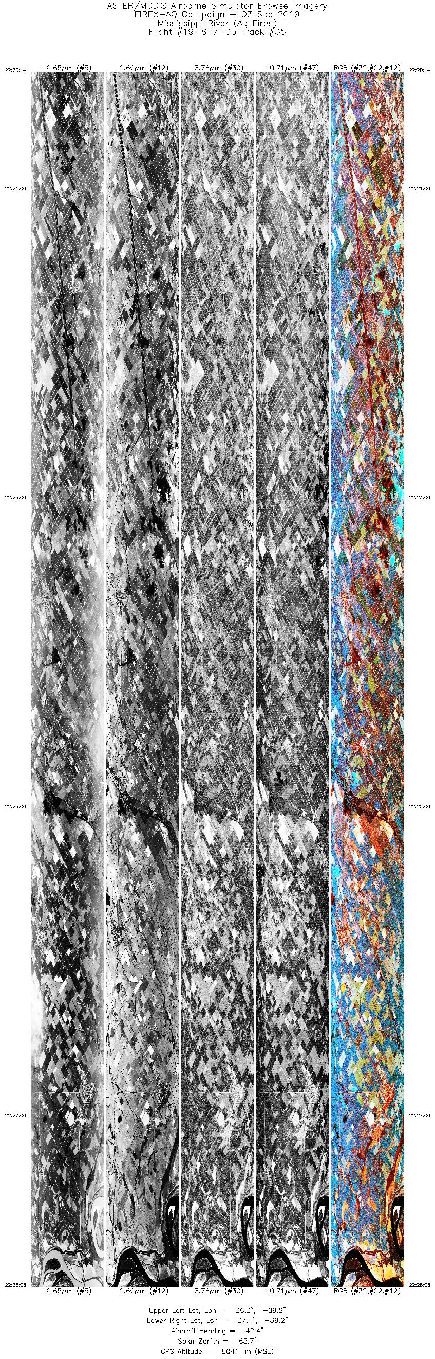
| 35 |
22:20 - 22:28 |
41.5 |
36.305 - 37.008 |
90.000 - 89.186 |
11808 |
8041 |
|


