Flight: 19-817-32
Date: August 31, 2019
Aircraft: NASA DC-8, #817
Deployment: FIREX-AQ
Flight Location: Mississippi / Arkansas / Louisiana (Ag Fires)
Principal Investigator: Crawford (NASA), Warneke (CIRES), Schwarz (NOAA)
Additional Sensors: DC-8 Payload
|
Data Evaluation
Overall data quality is good.
All data collected @25Hz; many flight lines underscanned due to low altitude data collection.
Significant VIS/SWIR reponse degradation during campaign.
Saturated fire pixels due to new optics.
|
Processing Information
Level-1B Data in HDF format is available
Flight Line Summary
Spectral Band Configuration
Spectral Response Function Table
Spectral Response Function (text)
|
Browse Imagery
Flight Tracks: 38
Scanlines: 40125
|
Browse Imagery Table
|
Click a Flight Track number to view a quicklook image
Lat/Lon ranges are for the BEG-END scanline nadir pixels
|
Flight
Track |
Time Span
(UTC) |
Heading
(Deg) |
Lat Range
(Deg N) |
Lon Range
(Deg W) |
Length
(Scanlines) |
Altitude
(Meters) |
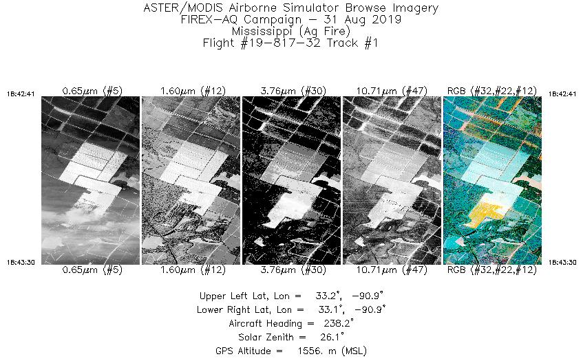
| 1 |
18:42 - 18:43 |
241.4 |
33.155 - 33.128 |
90.881 - 90.944 |
1228 |
1539 |
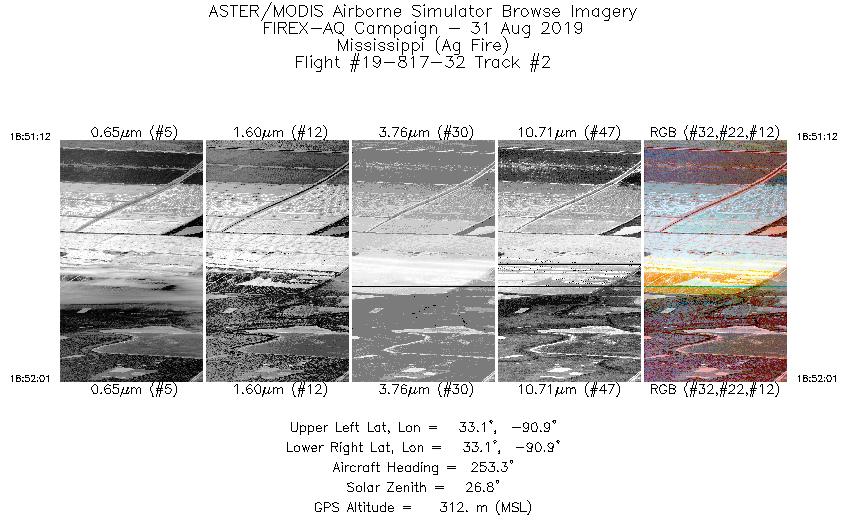
| 2 |
18:51 - 18:52 |
249.4 |
33.145 - 33.127 |
90.887 - 90.947 |
1211 |
313 |
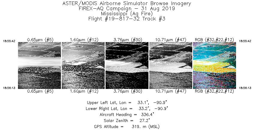
| 3 |
18:55 - 18:56 |
334.9 |
33.121 - 33.151 |
90.916 - 90.934 |
783 |
320 |
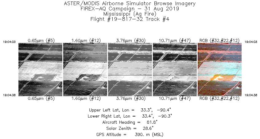
| 4 |
19:04 - 19:04 |
79.1 |
33.345 - 33.352 |
90.367 - 90.317 |
873 |
423 |
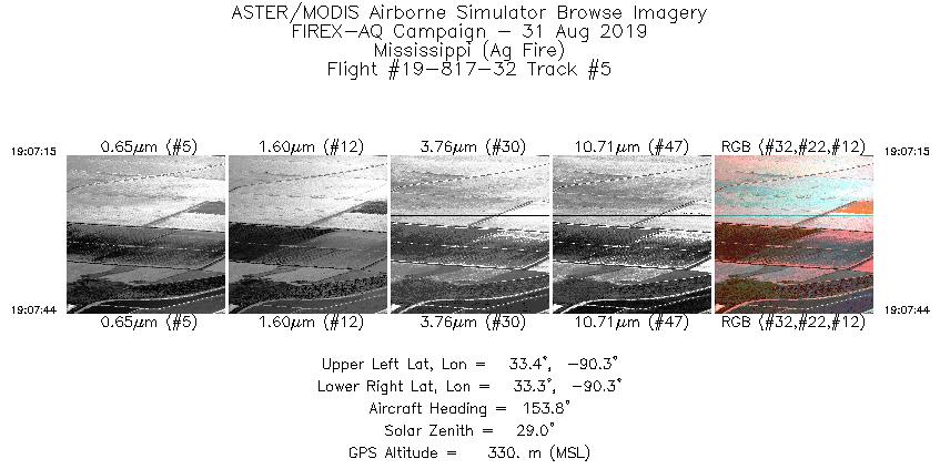
| 5 |
19:07 - 19:07 |
154.1 |
33.359 - 33.329 |
90.344 - 90.329 |
719 |
338 |
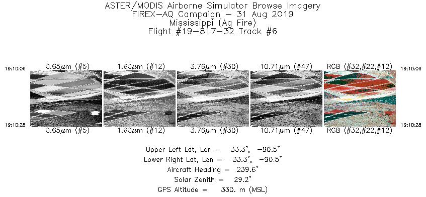
| 6 |
19:10 - 19:10 |
235.4 |
33.307 - 33.294 |
90.489 - 90.515 |
561 |
342 |
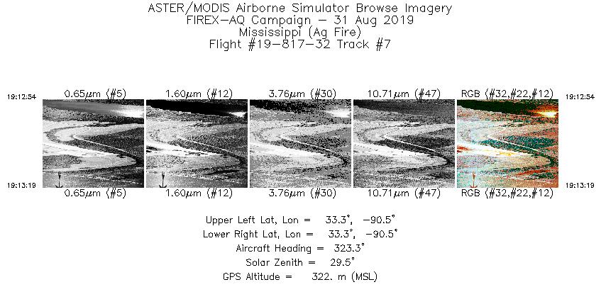
| 7 |
19:12 - 19:13 |
319.5 |
33.288 - 33.310 |
90.491 - 90.512 |
626 |
324 |
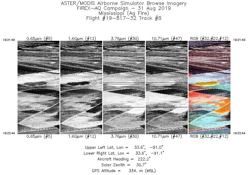
| 8 |
19:21 - 19:22 |
220.9 |
33.634 - 33.583 |
90.995 - 91.053 |
1600 |
334 |
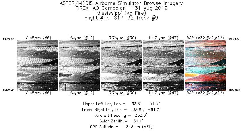
| 9 |
19:24 - 19:25 |
329.4 |
33.587 - 33.620 |
91.009 - 91.032 |
887 |
370 |
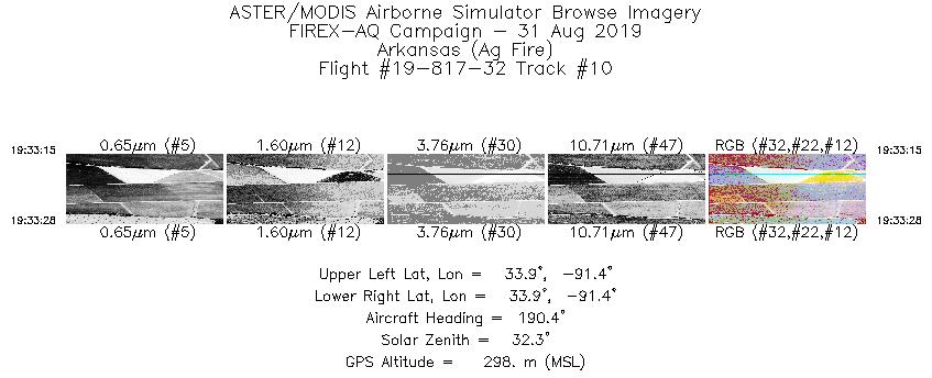
| 10 |
19:33 - 19:33 |
189.7 |
33.939 - 33.925 |
91.421 - 91.424 |
320 |
293 |
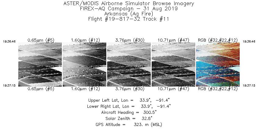
| 11 |
19:36 - 19:37 |
299.1 |
33.925 - 33.940 |
91.410 - 91.443 |
725 |
354 |
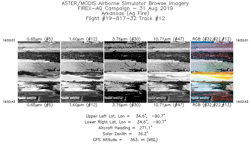
| 12 |
19:53 - 19:53 |
269.4 |
34.580 - 34.580 |
90.670 - 90.726 |
1042 |
359 |
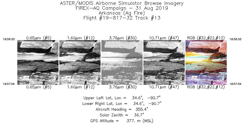
| 13 |
19:56 - 19:57 |
357.7 |
34.568 - 34.602 |
90.705 - 90.708 |
784 |
403 |
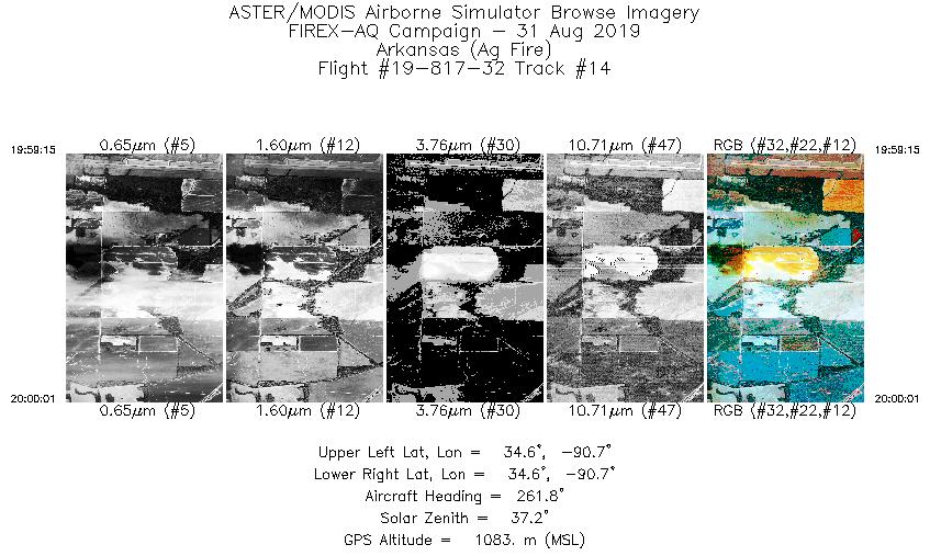
| 14 |
19:59 - 20:00 |
265.2 |
34.581 - 34.580 |
90.674 - 90.737 |
1137 |
1075 |
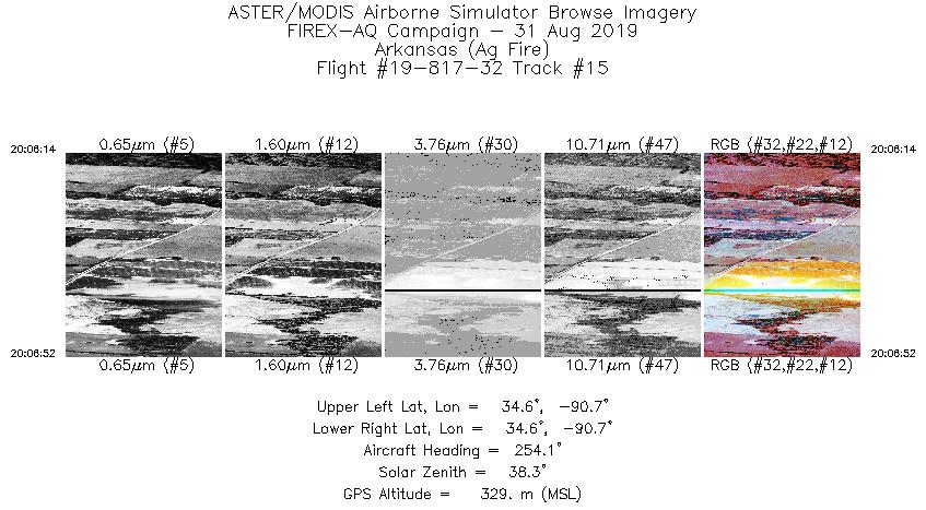
| 15 |
20:06 - 20:06 |
252.1 |
34.589 - 34.577 |
90.672 - 90.721 |
938 |
336 |
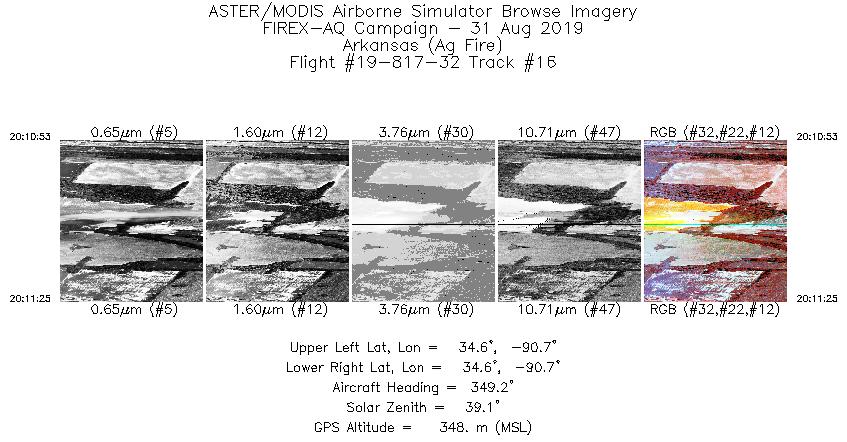
| 16 |
20:10 - 20:11 |
349.5 |
34.564 - 34.598 |
90.703 - 90.710 |
812 |
357 |
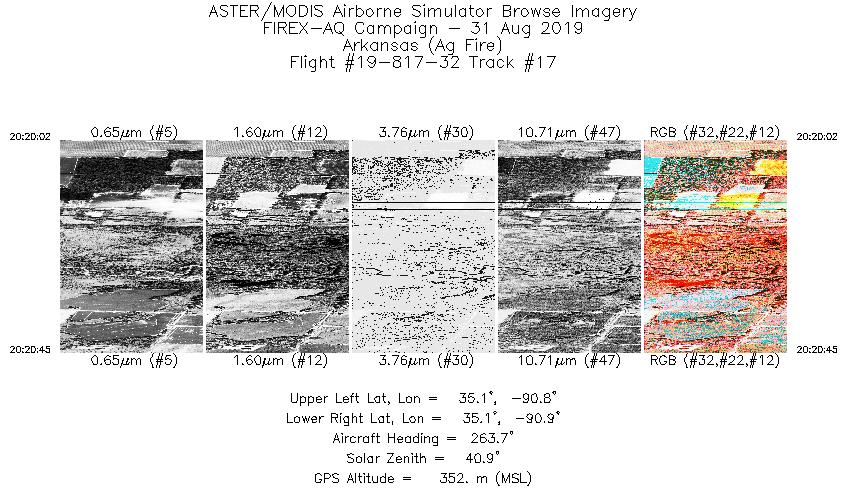
| 17 |
20:20 - 20:20 |
260.6 |
35.094 - 35.089 |
90.838 - 90.894 |
1068 |
343 |
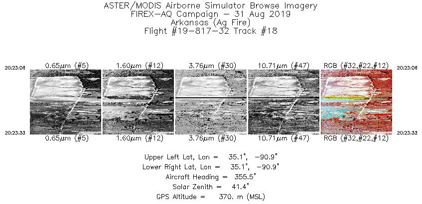
| 18 |
20:23 - 20:23 |
357.3 |
35.080 - 35.108 |
90.854 - 90.857 |
655 |
364 |
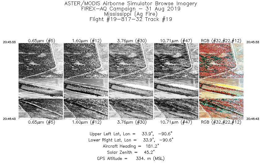
| 19 |
20:45 - 20:46 |
179.9 |
33.926 - 33.870 |
90.608 - 90.610 |
1249 |
340 |
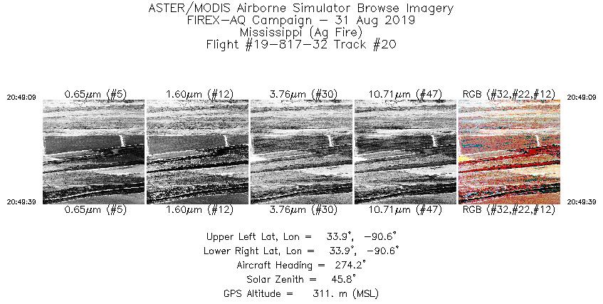
| 20 |
20:49 - 20:49 |
274.2 |
33.890 - 33.891 |
90.585 - 90.624 |
738 |
321 |
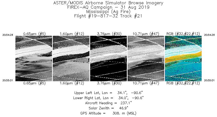
| 21 |
20:54 - 20:55 |
232.9 |
34.071 - 34.049 |
90.556 - 90.593 |
890 |
311 |
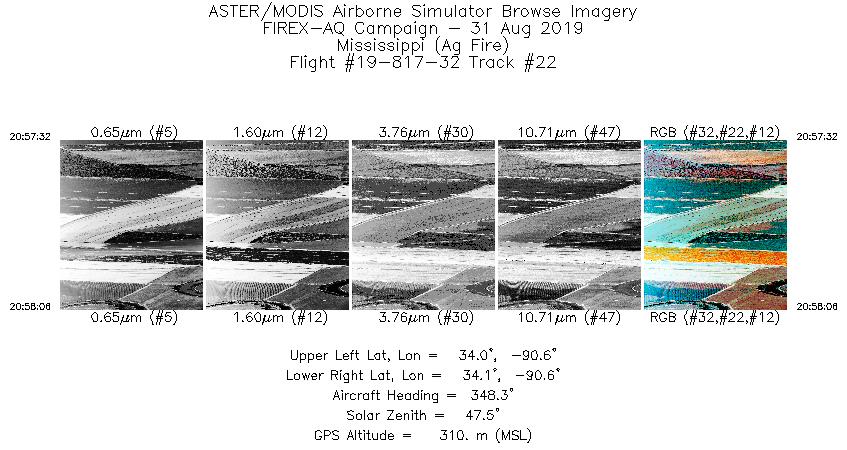
| 22 |
20:57 - 20:58 |
345.1 |
34.037 - 34.072 |
90.568 - 90.578 |
854 |
324 |
| 23 |
21:10 - 21:12 |
237.1 |
33.635 - 33.589 |
90.977 - 91.061 |
1856 |
312 |
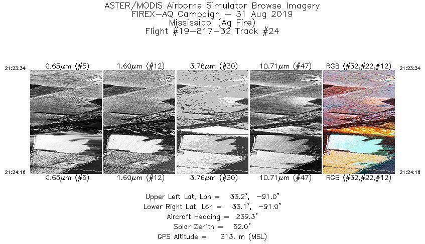
| 24 |
21:23 - 21:24 |
236.9 |
33.168 - 33.143 |
90.998 - 91.045 |
1044 |
312 |
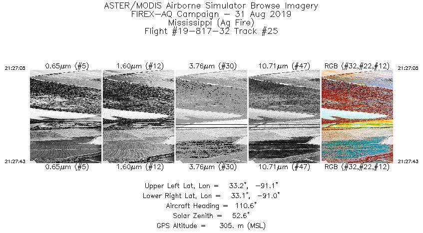
| 25 |
21:27 - 21:27 |
103.6 |
33.161 - 33.146 |
91.052 - 91.007 |
939 |
323 |
| 26 |
21:29 - 21:29 |
84.2 |
33.149 - 33.152 |
90.870 - 90.835 |
712 |
315 |
| 27 |
21:32 - 21:33 |
129.2 |
33.156 - 33.135 |
90.871 - 90.845 |
722 |
306 |
| 28 |
21:34 - 21:34 |
219.1 |
33.088 - 33.057 |
90.809 - 90.842 |
939 |
296 |
| 29 |
21:37 - 21:38 |
340.7 |
33.053 - 33.111 |
90.812 - 90.840 |
1460 |
307 |
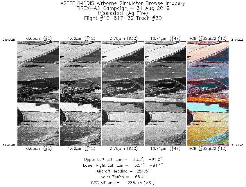
| 30 |
21:40 - 21:41 |
249.0 |
33.167 - 33.140 |
90.973 - 91.064 |
1820 |
309 |
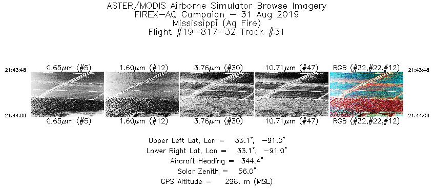
| 31 |
21:43 - 21:44 |
344.3 |
33.130 - 33.149 |
91.026 - 91.032 |
447 |
301 |
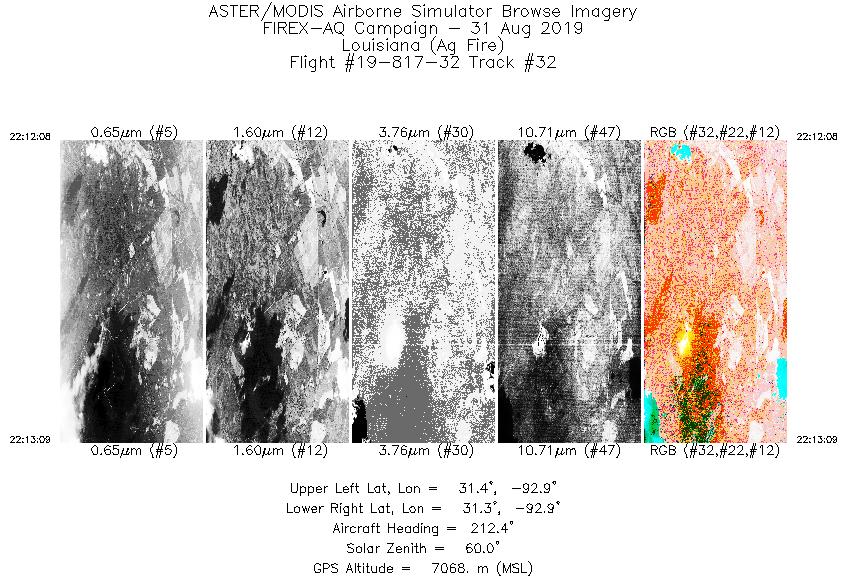
| 32 |
22:12 - 22:13 |
213.7 |
31.408 - 31.330 |
92.887 - 92.948 |
1517 |
7068 |
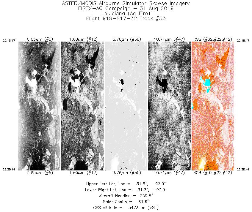
| 33 |
22:19 - 22:20 |
211.9 |
31.449 - 31.351 |
92.858 - 92.933 |
2171 |
5473 |
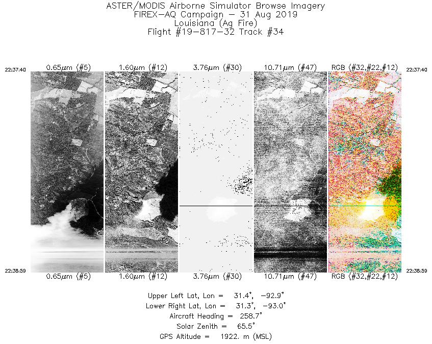
| 34 |
22:37 - 22:38 |
252.3 |
31.390 - 31.354 |
92.869 - 92.982 |
1970 |
1968 |
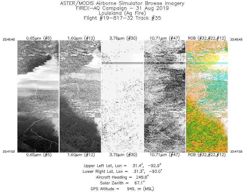
| 35 |
22:45 - 22:47 |
255.4 |
31.376 - 31.350 |
92.935 - 93.032 |
1943 |
947 |
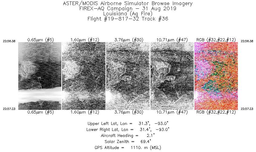
| 36 |
22:56 - 22:57 |
4.1 |
31.325 - 31.374 |
92.961 - 92.964 |
1129 |
1144 |
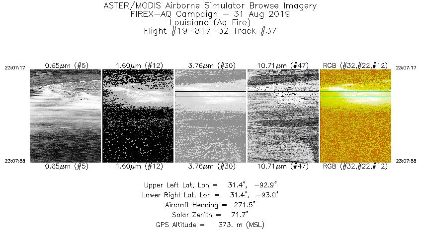
| 37 |
23:07 - 23:07 |
272.9 |
31.366 - 31.368 |
92.936 - 92.986 |
942 |
369 |
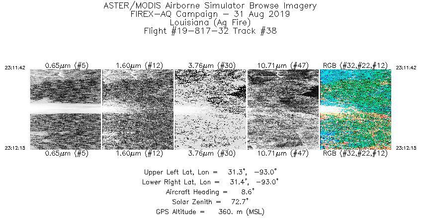
| 38 |
23:11 - 23:12 |
8.7 |
31.348 - 31.383 |
92.958 - 92.954 |
814 |
377 |
|


