Flight: 19-817-31
Date: August 30, 2019
Aircraft: NASA DC-8, #817
Deployment: FIREX-AQ
Flight Location: Florida (Prescribed Burn) / Georgia / Alabama (Ag Fires)
Principal Investigator: Crawford (NASA), Warneke (CIRES), Schwarz (NOAA)
Additional Sensors: DC-8 Payload
|
Data Evaluation
Overall data quality is good.
All data collected @25Hz; many flight lines underscanned due to low altitude data collection.
Significant VIS/SWIR reponse degradation during campaign.
Saturated fire pixels due to new optics.
|
Processing Information
Level-1B Data in HDF format is available
Flight Line Summary
Spectral Band Configuration
Spectral Response Function Table
Spectral Response Function (text)
|
Browse Imagery
Flight Tracks: 34
Scanlines: 42477
|
Browse Imagery Table
|
Click a Flight Track number to view a quicklook image
Lat/Lon ranges are for the BEG-END scanline nadir pixels
|
Flight
Track |
Time Span
(UTC) |
Heading
(Deg) |
Lat Range
(Deg N) |
Lon Range
(Deg W) |
Length
(Scanlines) |
Altitude
(Meters) |
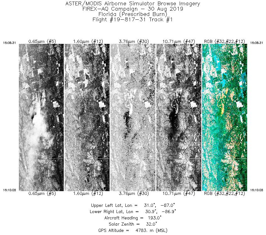
| 1 |
16:08 - 16:10 |
193.5 |
31.037 - 30.894 |
86.906 - 86.948 |
2354 |
4783 |
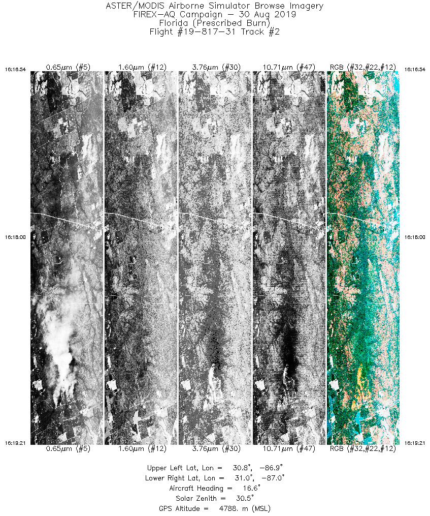
| 2 |
16:16 - 16:19 |
16.4 |
30.796 - 31.014 |
86.992 - 86.919 |
3678 |
4788 |
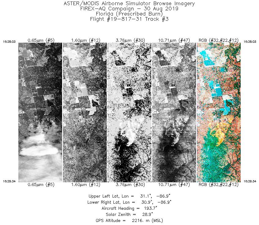
| 3 |
16:28 - 16:29 |
191.3 |
31.061 - 30.936 |
86.911 - 86.936 |
2292 |
2219 |
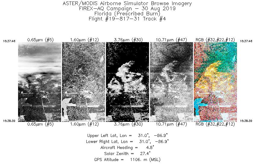
| 4 |
16:37 - 16:38 |
5.3 |
30.954 - 31.013 |
86.932 - 86.925 |
1326 |
1110 |
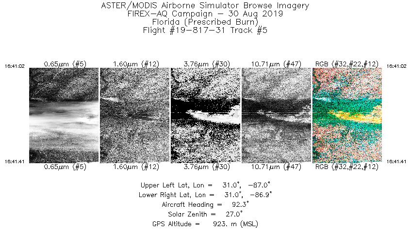
| 5 |
16:41 - 16:41 |
92.8 |
30.973 - 30.968 |
86.957 - 86.903 |
988 |
923 |
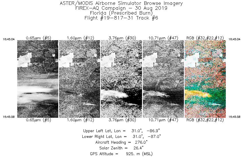
| 6 |
16:45 - 16:45 |
276.1 |
30.966 - 30.970 |
86.877 - 86.951 |
1351 |
922 |
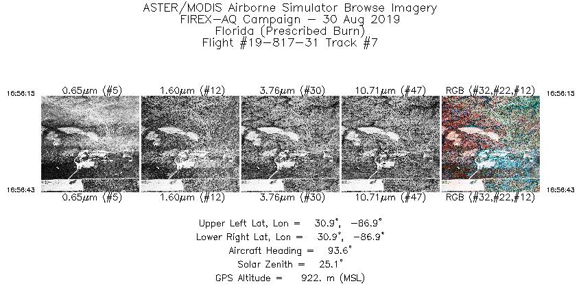
| 7 |
16:56 - 16:56 |
93.1 |
30.943 - 30.940 |
86.918 - 86.883 |
709 |
922 |
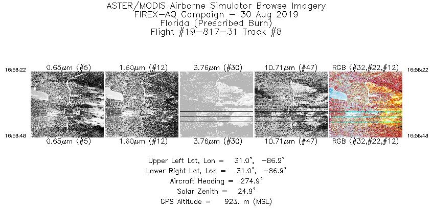
| 8 |
16:58 - 16:58 |
273.8 |
30.991 - 30.992 |
86.907 - 86.941 |
649 |
926 |
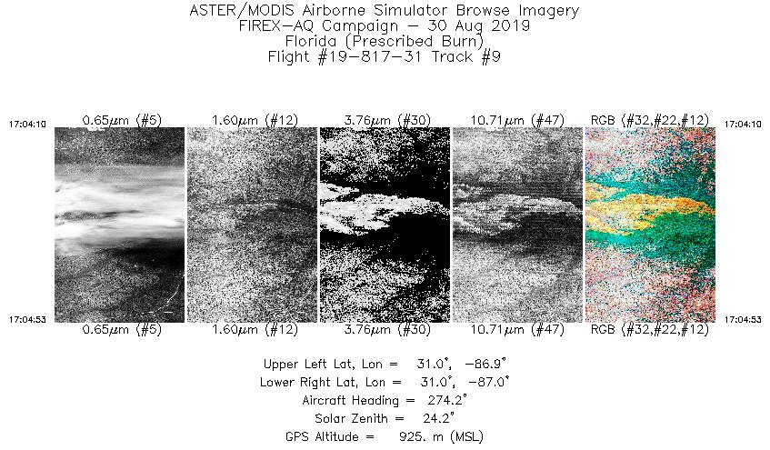
| 9 |
17:04 - 17:04 |
274.2 |
30.975 - 30.978 |
86.905 - 86.960 |
1078 |
923 |
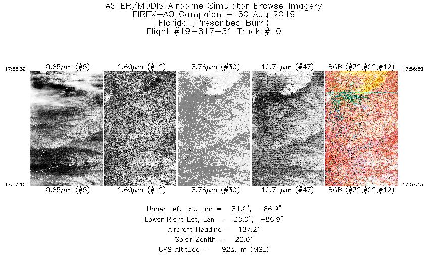
| 10 |
17:56 - 17:57 |
186.9 |
30.978 - 30.927 |
86.930 - 86.937 |
1141 |
921 |
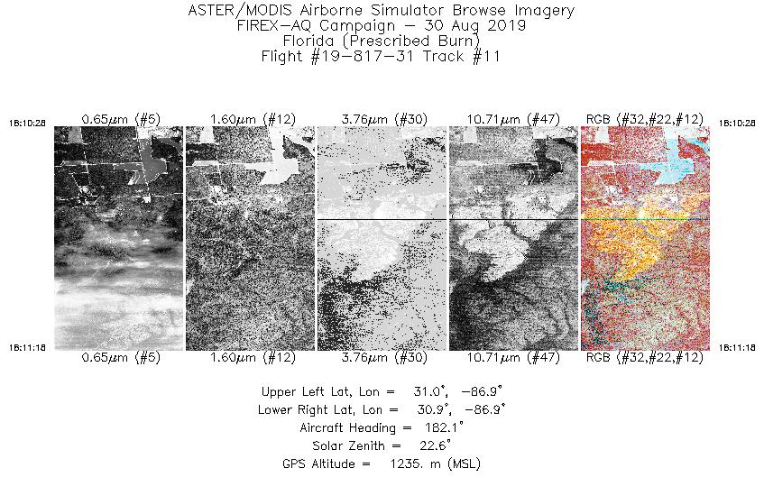
| 11 |
18:10 - 18:11 |
185.1 |
31.012 - 30.948 |
86.922 - 86.931 |
1245 |
1235 |
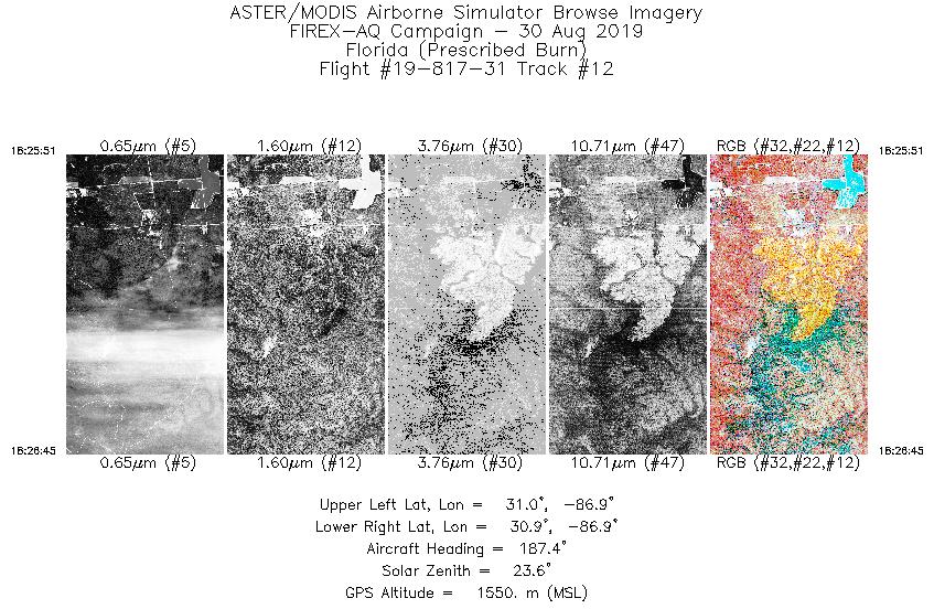
| 12 |
18:25 - 18:26 |
187.1 |
31.007 - 30.944 |
86.928 - 86.936 |
1362 |
1550 |
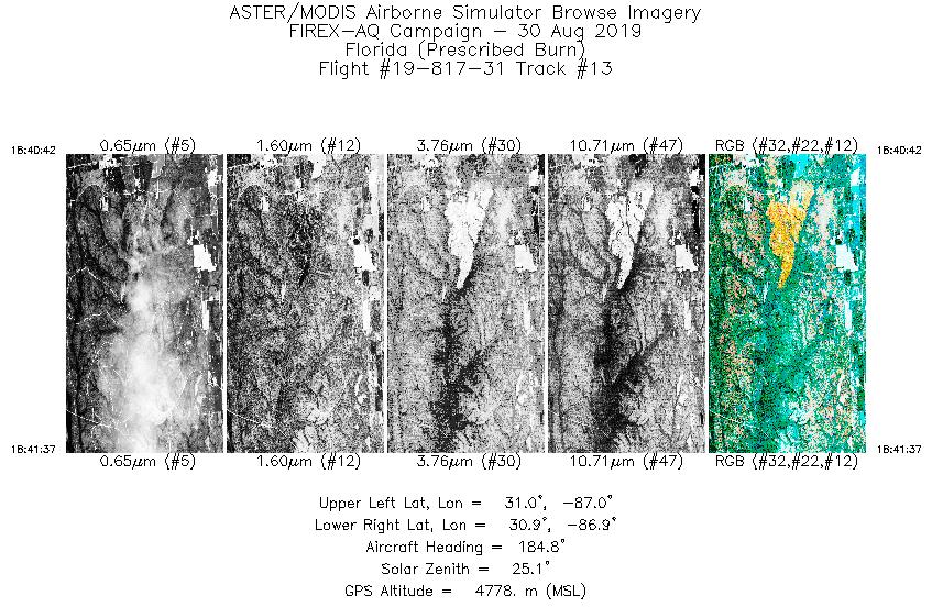
| 13 |
18:40 - 18:41 |
184.9 |
31.003 - 30.927 |
86.924 - 86.932 |
1363 |
4776 |
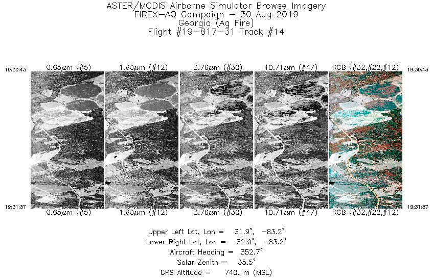
| 14 |
19:30 - 19:31 |
355.9 |
31.922 - 31.986 |
83.185 - 83.198 |
1348 |
730 |
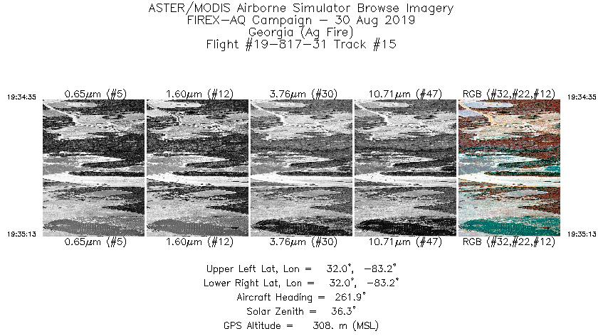
| 15 |
19:34 - 19:35 |
264.0 |
31.968 - 31.963 |
83.159 - 83.211 |
967 |
313 |
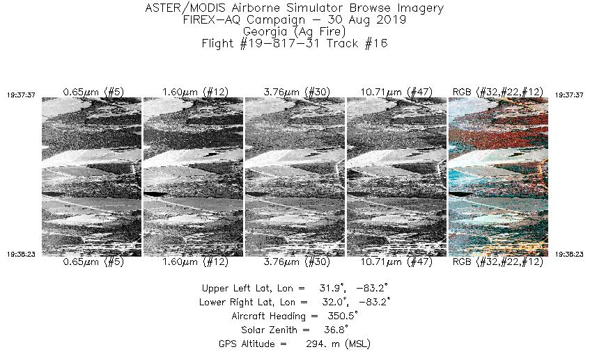
| 16 |
19:37 - 19:38 |
346.0 |
31.946 - 31.992 |
83.184 - 83.200 |
1149 |
313 |
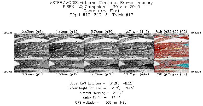
| 17 |
19:42 - 19:43 |
209.6 |
31.894 - 31.862 |
83.501 - 83.523 |
816 |
325 |
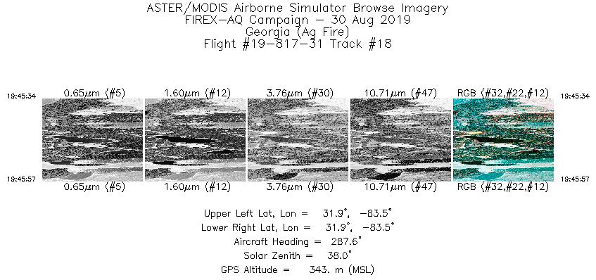
| 18 |
19:45 - 19:45 |
286.2 |
31.878 - 31.884 |
83.498 - 83.527 |
591 |
355 |
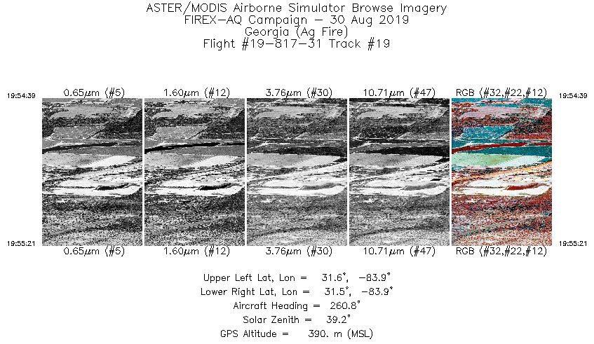
| 19 |
19:54 - 19:55 |
258.7 |
31.548 - 31.536 |
83.851 - 83.905 |
1059 |
403 |
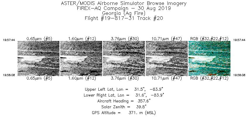
| 20 |
19:57 - 19:58 |
359.5 |
31.528 - 31.554 |
83.884 - 83.887 |
601 |
384 |
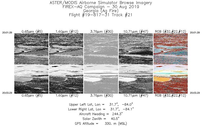
| 21 |
20:01 - 20:02 |
238.6 |
31.731 - 31.700 |
84.044 - 84.106 |
1269 |
358 |
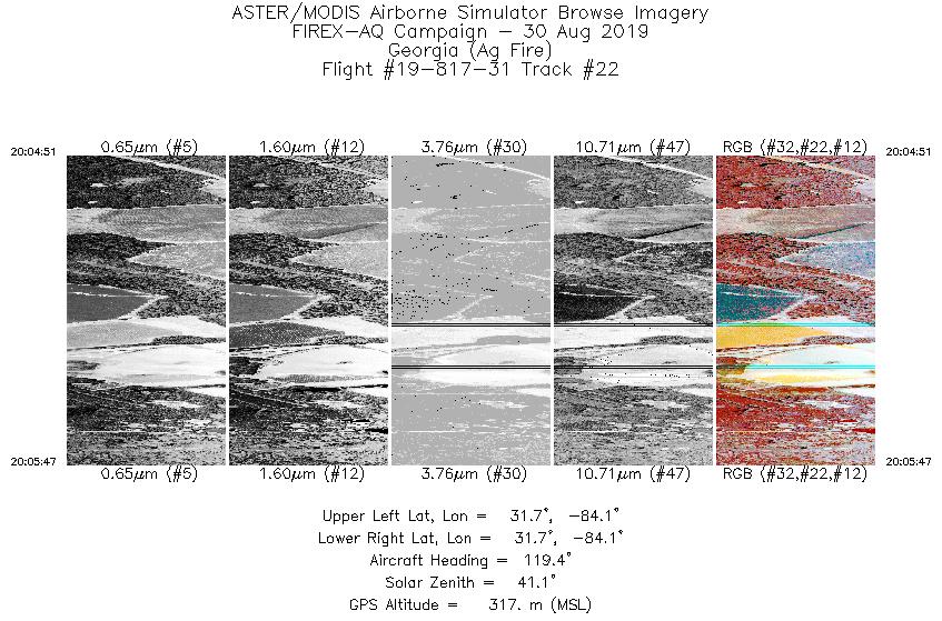
| 22 |
20:04 - 20:05 |
118.9 |
31.733 - 31.701 |
84.126 - 84.068 |
1398 |
343 |
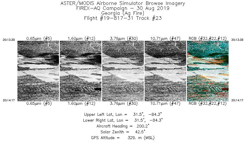
| 23 |
20:13 - 20:14 |
200.0 |
31.524 - 31.481 |
84.310 - 84.331 |
1042 |
339 |
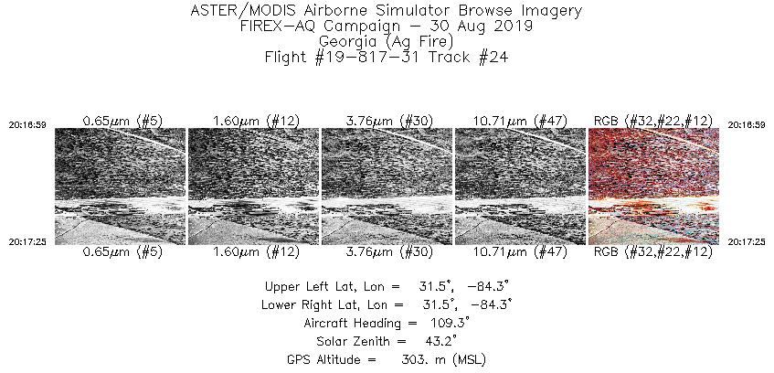
| 24 |
20:16 - 20:17 |
112.2 |
31.504 - 31.493 |
84.341 - 84.311 |
644 |
320 |
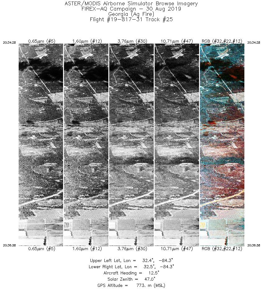
| 25 |
20:34 - 20:36 |
6.3 |
32.378 - 32.527 |
84.283 - 84.253 |
3257 |
867 |
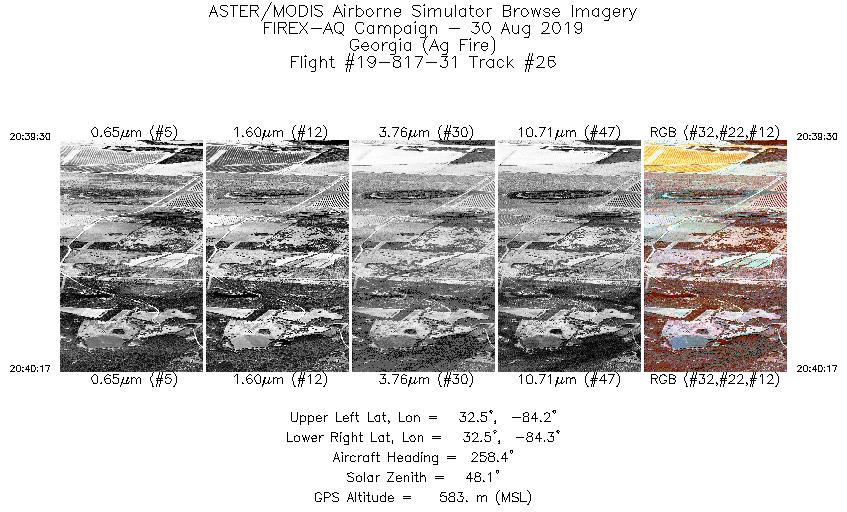
| 26 |
20:39 - 20:40 |
255.6 |
32.511 - 32.497 |
84.242 - 84.303 |
1163 |
622 |
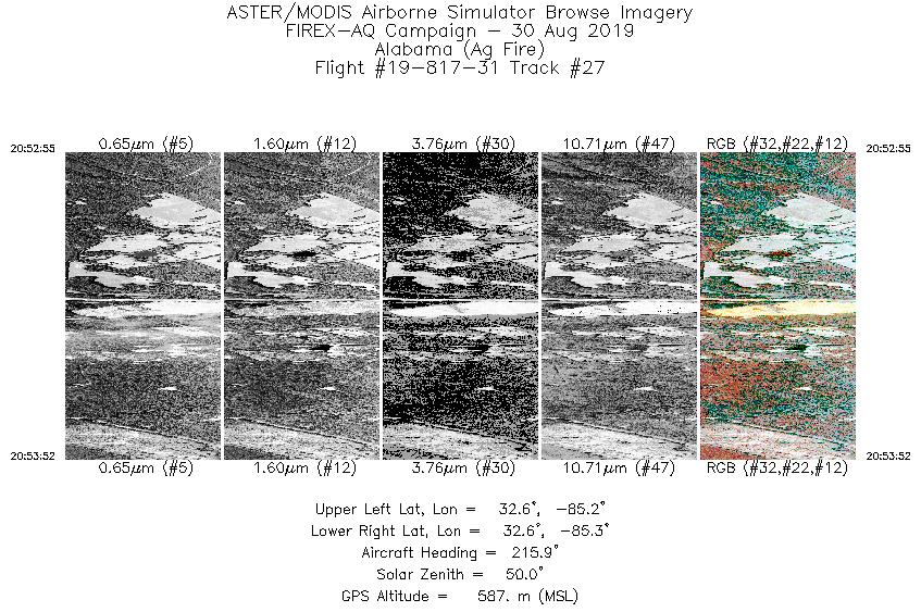
| 27 |
20:52 - 20:53 |
214.9 |
32.638 - 32.578 |
85.230 - 85.281 |
1418 |
637 |
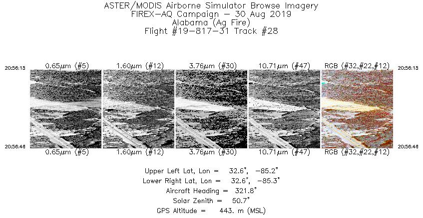
| 28 |
20:56 - 20:56 |
320.9 |
32.593 - 32.621 |
85.245 - 85.272 |
790 |
463 |
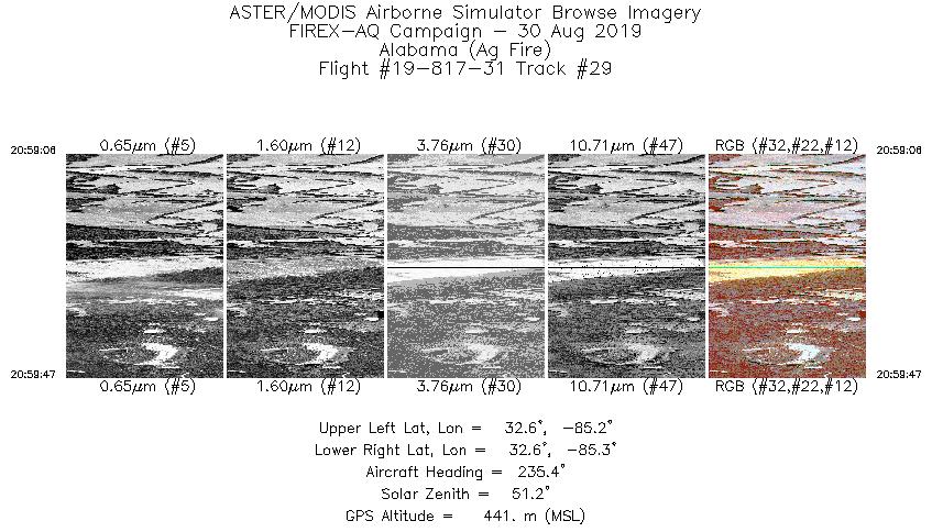
| 29 |
20:59 - 20:59 |
234.4 |
32.619 - 32.594 |
85.231 - 85.276 |
1023 |
479 |
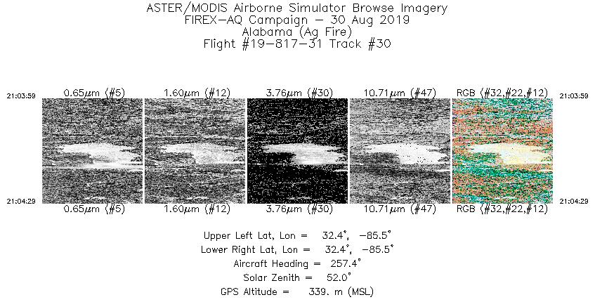
| 30 |
21:03 - 21:04 |
255.9 |
32.374 - 32.366 |
85.496 - 85.534 |
750 |
357 |
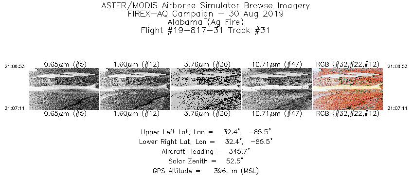
| 31 |
21:06 - 21:07 |
344.5 |
32.360 - 32.379 |
85.515 - 85.521 |
433 |
400 |
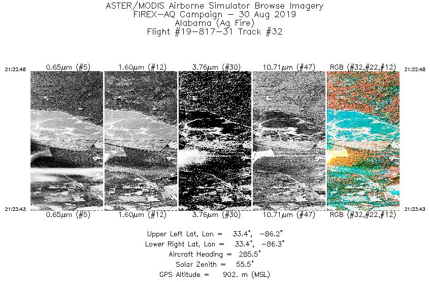
| 32 |
21:22 - 21:23 |
281.5 |
33.362 - 33.373 |
86.176 - 86.251 |
1377 |
899 |
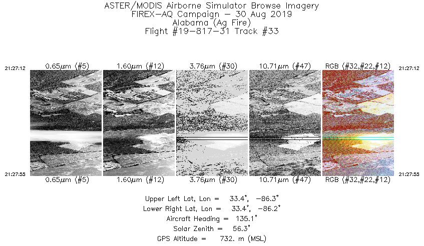
| 33 |
21:27 - 21:27 |
136.8 |
33.398 - 33.362 |
86.247 - 86.209 |
1062 |
742 |
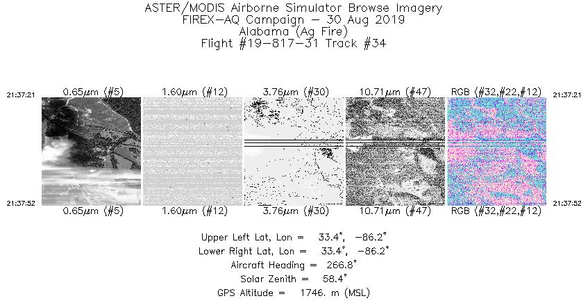
| 34 |
21:37 - 21:37 |
269.8 |
33.367 - 33.367 |
86.200 - 86.246 |
784 |
1748 |
|


