Flight: 19-817-29
Date: August 26, 2019
Aircraft: NASA DC-8, #817
Deployment: FIREX-AQ
Flight Location: Oklahoma / Arkansas / Texas / Louisiana (Ag Fires)
Principal Investigator: Crawford (NASA), Warneke (CIRES), Schwarz (NOAA)
Additional Sensors: DC-8 Payload
|
Data Evaluation
Overall data quality is good.
All data collected @25Hz; many flight lines underscanned due to low altitude data collection.
Significant VIS/SWIR reponse degradation during campaign.
Saturated fire pixels due to new optics.
|
Processing Information
Level-1B Data in HDF format is available
Flight Line Summary
Spectral Band Configuration
Spectral Response Function Table
Spectral Response Function (text)
|
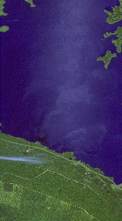
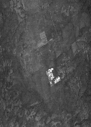
Browse Imagery
Flight Tracks: 25
Scanlines: 36554
|
Browse Imagery Table
|
Click a Flight Track number to view a quicklook image
Lat/Lon ranges are for the BEG-END scanline nadir pixels
|
Flight
Track |
Time Span
(UTC) |
Heading
(Deg) |
Lat Range
(Deg N) |
Lon Range
(Deg W) |
Length
(Scanlines) |
Altitude
(Meters) |
| 1 |
17:37 - 17:38 |
175.1 |
34.675 - 34.617 |
95.377 - 95.367 |
1288 |
1583 |
| 2 |
17:48 - 17:48 |
3.6 |
34.147 - 34.183 |
95.313 - 95.310 |
727 |
468 |
| 3 |
18:06 - 18:07 |
359.0 |
34.141 - 34.186 |
95.313 - 95.315 |
988 |
628 |
| 4 |
18:41 - 18:41 |
339.1 |
34.057 - 34.112 |
94.049 - 94.081 |
1281 |
413 |
| 5 |
18:48 - 18:49 |
340.1 |
34.043 - 34.107 |
94.043 - 94.077 |
1518 |
417 |
| 6 |
19:15 - 19:16 |
342.9 |
33.297 - 33.376 |
95.461 - 95.494 |
1819 |
393 |
| 7 |
19:24 - 19:24 |
231.9 |
33.365 - 33.341 |
95.474 - 95.513 |
893 |
410 |
| 8 |
19:50 - 19:50 |
167.9 |
32.010 - 31.962 |
95.151 - 95.129 |
1111 |
611 |
| 9 |
19:54 - 19:54 |
320.6 |
31.982 - 32.007 |
95.123 - 95.147 |
691 |
408 |
| 10 |
20:29 - 20:30 |
83.8 |
32.439 - 32.440 |
91.785 - 91.697 |
1633 |
457 |
| 11 |
20:33 - 20:34 |
219.5 |
32.455 - 32.420 |
91.708 - 91.741 |
1072 |
276 |
| 12 |
20:37 - 20:38 |
97.7 |
32.453 - 32.449 |
91.855 - 91.803 |
992 |
322 |
| 13 |
20:44 - 20:45 |
334.1 |
32.435 - 32.473 |
91.821 - 91.842 |
911 |
284 |
| 14 |
20:46 - 20:48 |
28.8 |
32.540 - 32.662 |
91.835 - 91.762 |
3108 |
283 |
| 15 |
20:50 - 20:51 |
278.3 |
32.631 - 32.637 |
91.765 - 91.805 |
784 |
299 |
| 16 |
20:52 - 20:52 |
171.2 |
32.582 - 32.540 |
91.831 - 91.824 |
986 |
276 |
| 17 |
20:59 - 21:00 |
160.3 |
32.650 - 32.607 |
91.784 - 91.767 |
1033 |
301 |
| 18 |
22:14 - 22:14 |
74.5 |
32.758 - 32.765 |
91.354 - 91.319 |
666 |
314 |
| 19 |
22:16 - 22:17 |
180.2 |
32.784 - 32.736 |
91.348 - 91.350 |
1118 |
312 |
| 20 |
22:20 - 22:20 |
88.8 |
32.757 - 32.758 |
91.373 - 91.330 |
901 |
294 |
| 21 |
22:27 - 22:27 |
3.1 |
32.751 - 32.786 |
91.348 - 91.345 |
913 |
264 |
| 22 |
23:14 - 23:18 |
295.6 |
34.088 - 34.235 |
95.099 - 95.529 |
5743 |
4655 |
| 23 |
23:22 - 23:24 |
10.3 |
34.116 - 34.267 |
95.469 - 95.449 |
3246 |
4658 |
| 24 |
23:37 - 23:38 |
345.3 |
34.163 - 34.255 |
95.434 - 95.465 |
2136 |
445 |
| 25 |
23:53 - 23:53 |
346.6 |
34.208 - 34.251 |
95.447 - 95.462 |
996 |
432 |
|


