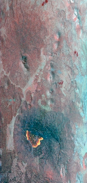
Flight: 19-817-23
Date: August 13, 2019
Aircraft: NASA DC-8, #817
Deployment: FIREX-AQ
Flight Location: Arizona (Trumbull, Castle Fires)
Principal Investigator: Crawford (NASA), Warneke (CIRES), Schwarz (NOAA)
Additional Sensors: DC-8 Payload
|
Data Evaluation
Overall data quality is good.
All data collected @25Hz.
Significant VIS/SWIR reponse degradation during campaign.
Saturated fire pixels due to new optics.
|
Processing Information
Level-1B Data in HDF format is available
Flight Line Summary
Spectral Band Configuration
Spectral Response Function Table
Spectral Response Function (text)
|
Browse Imagery
Flight Tracks: 11
Scanlines: 62974
|
Browse Imagery Table
|
Click a Flight Track number to view a quicklook image
Lat/Lon ranges are for the BEG-END scanline nadir pixels
|
Flight
Track |
Time Span
(UTC) |
Heading
(Deg) |
Lat Range
(Deg N) |
Lon Range
(Deg W) |
Length
(Scanlines) |
Altitude
(Meters) |
| 1 |
22:23 - 22:25 |
182.1 |
36.604 - 36.379 |
113.138 - 113.131 |
2746 |
8046 |
| 2 |
22:30 - 22:37 |
40.0 |
36.435 - 36.978 |
112.338 - 111.773 |
9516 |
8042 |
| 3 |
22:43 - 22:52 |
231.8 |
37.041 - 36.455 |
111.510 - 112.330 |
13250 |
7743 |
| 4 |
23:01 - 23:03 |
143.5 |
36.585 - 36.421 |
112.406 - 112.242 |
3697 |
4738 |
| 5 |
23:08 - 23:10 |
313.4 |
36.429 - 36.577 |
112.181 - 112.354 |
3641 |
4591 |
| 6 |
23:14 - 23:17 |
128.1 |
36.621 - 36.463 |
112.401 - 112.175 |
4287 |
4587 |
| 7 |
01:04 - 01:08 |
218.3 |
36.758 - 36.433 |
112.020 - 112.310 |
6508 |
7094 |
| 8 |
01:15 - 01:17 |
153.8 |
36.544 - 36.381 |
112.340 - 112.232 |
3419 |
4590 |
| 9 |
01:23 - 01:27 |
314.8 |
36.432 - 36.610 |
112.188 - 112.409 |
5015 |
4587 |
| 10 |
01:31 - 01:34 |
133.2 |
36.620 - 36.466 |
112.376 - 112.160 |
4418 |
4592 |
| 11 |
03:18 - 03:22 |
224.2 |
36.751 - 36.436 |
111.983 - 112.351 |
6477 |
7767 |
|


