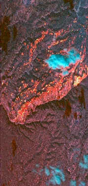
Flight: 19-817-22
Date: August 12, 2019
Aircraft: NASA DC-8, #817
Deployment: FIREX-AQ
Flight Location: California / Arizona (Spring, Castle Fires)
Principal Investigator: Crawford (NASA), Warneke (CIRES), Schwarz (NOAA)
Additional Sensors: DC-8 Payload
|
Data Evaluation
Overall data quality is good.
All data collected @25Hz.
Significant VIS/SWIR reponse degradation during campaign.
Saturated fire pixels due to new optics.
|
Processing Information
Level-1B Data in HDF format is available
Flight Line Summary
Spectral Band Configuration
Spectral Response Function Table
Spectral Response Function (text)
|
Browse Imagery
Flight Tracks: 14
Scanlines: 76589
|
Browse Imagery Table
|
Click a Flight Track number to view a quicklook image
Lat/Lon ranges are for the BEG-END scanline nadir pixels
|
Flight
Track |
Time Span
(UTC) |
Heading
(Deg) |
Lat Range
(Deg N) |
Lon Range
(Deg W) |
Length
(Scanlines) |
Altitude
(Meters) |
| 1 |
21:52 - 21:54 |
207.6 |
39.440 - 39.253 |
119.883 - 119.995 |
3191 |
5518 |
| 2 |
21:55 - 21:58 |
180.8 |
39.222 - 38.910 |
120.003 - 119.992 |
5337 |
5421 |
| 3 |
22:12 - 22:18 |
68.8 |
37.820 - 38.060 |
118.933 - 118.155 |
9181 |
7711 |
| 4 |
22:22 - 22:23 |
263.9 |
37.960 - 37.941 |
118.233 - 118.464 |
2950 |
7714 |
| 5 |
22:24 - 22:28 |
252.6 |
37.938 - 37.832 |
118.539 - 118.955 |
5265 |
7714 |
| 6 |
23:12 - 23:13 |
77.5 |
36.319 - 36.355 |
113.431 - 113.265 |
1691 |
8040 |
| 7 |
23:13 - 23:15 |
63.0 |
36.371 - 36.464 |
113.217 - 113.004 |
2375 |
8040 |
| 8 |
23:19 - 23:26 |
64.4 |
36.461 - 36.794 |
112.419 - 111.646 |
10086 |
8046 |
| 9 |
23:36 - 23:43 |
241.9 |
36.809 - 36.488 |
111.568 - 112.345 |
10417 |
8044 |
| 10 |
23:51 - 23:52 |
336.0 |
36.294 - 36.408 |
112.272 - 112.332 |
1930 |
4704 |
| 11 |
00:06 - 00:07 |
158.1 |
36.400 - 36.318 |
112.323 - 112.276 |
1525 |
4730 |
| 12 |
00:10 - 00:12 |
333.7 |
36.414 - 36.610 |
112.216 - 112.333 |
3511 |
4724 |
| 13 |
02:40 - 02:49 |
239.1 |
36.902 - 36.428 |
111.488 - 112.447 |
13853 |
7716 |
| 14 |
03:00 - 03:04 |
155.9 |
36.640 - 36.349 |
112.326 - 112.143 |
5277 |
4725 |
|


