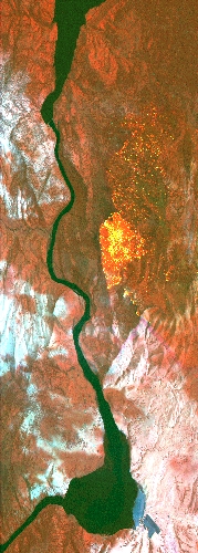
Flight: 19-817-15
Date: July 29, 2019
Aircraft: NASA DC-8, #817
Deployment: FIREX-AQ
Flight Location: Montana / California (North Hills, Tucker Fires)
Principal Investigator: Crawford (NASA), Warneke (CIRES), Schwarz (NOAA)
Additional Sensors: DC-8 Payload
|
Data Evaluation
Overall data quality is good.
All data collected @25Hz.
Significant VIS/SWIR reponse degradation during campaign.
Saturated fire pixels due to new optics.
|
Processing Information
Level-1B Data in HDF format is available
Flight Line Summary
Spectral Band Configuration
Spectral Response Function Table
Spectral Response Function (text)
|
Browse Imagery
Flight Tracks: 19
Scanlines: 89924
|
Browse Imagery Table
|
Click a Flight Track number to view a quicklook image
Lat/Lon ranges are for the BEG-END scanline nadir pixels
|
Flight
Track |
Time Span
(UTC) |
Heading
(Deg) |
Lat Range
(Deg N) |
Lon Range
(Deg W) |
Length
(Scanlines) |
Altitude
(Meters) |
| 1 |
22:15 - 22:17 |
347.0 |
44.505 - 44.629 |
116.075 - 116.097 |
2026 |
4796 |
| 2 |
22:46 - 22:51 |
85.8 |
46.776 - 46.863 |
111.976 - 111.081 |
8754 |
7941 |
| 3 |
22:52 - 22:53 |
95.7 |
46.862 - 46.848 |
111.059 - 110.834 |
2089 |
7930 |
| 4 |
23:02 - 23:03 |
278.0 |
46.834 - 46.855 |
110.876 - 111.063 |
2057 |
7934 |
| 5 |
23:03 - 23:07 |
264.0 |
46.856 - 46.833 |
111.113 - 111.584 |
4866 |
7932 |
| 6 |
23:07 - 23:11 |
257.1 |
46.831 - 46.750 |
111.603 - 112.093 |
5897 |
7930 |
| 7 |
23:17 - 23:18 |
160.3 |
46.786 - 46.708 |
112.195 - 112.149 |
1480 |
3825 |
| 8 |
23:20 - 23:21 |
27.2 |
46.738 - 46.816 |
111.986 - 111.920 |
1617 |
3820 |
| 9 |
23:27 - 23:30 |
331.5 |
46.669 - 46.869 |
111.844 - 111.978 |
4045 |
4375 |
| 10 |
01:00 - 01:02 |
302.8 |
46.896 - 46.981 |
110.678 - 110.848 |
2249 |
6983 |
| 11 |
01:02 - 01:03 |
281.9 |
46.999 - 47.013 |
110.901 - 110.978 |
876 |
6986 |
| 12 |
01:03 - 01:04 |
261.9 |
47.015 - 47.007 |
111.044 - 111.128 |
956 |
6975 |
| 13 |
01:06 - 01:08 |
256.6 |
46.927 - 46.856 |
111.308 - 111.665 |
4288 |
6988 |
| 14 |
01:09 - 01:11 |
280.4 |
46.855 - 46.900 |
111.758 - 112.054 |
3016 |
7153 |
| 15 |
02:19 - 02:31 |
229.1 |
42.454 - 41.696 |
120.322 - 121.459 |
17350 |
7913 |
| 16 |
02:38 - 02:43 |
129.2 |
41.955 - 41.725 |
121.344 - 120.970 |
6443 |
3791 |
| 17 |
02:52 - 02:55 |
131.8 |
41.960 - 41.755 |
121.322 - 120.998 |
5393 |
4745 |
| 18 |
04:07 - 04:13 |
217.1 |
42.124 - 41.776 |
120.811 - 121.199 |
8522 |
4028 |
| 19 |
04:20 - 04:25 |
42.2 |
41.771 - 42.278 |
121.192 - 120.621 |
8000 |
8416 |
|


