Flight: #18-658-00
Date: June 21, 2018
Aircraft: NASA ER-2, #806
Flight Number: 18-658-00
Deployment: HyspIRI Summer 2018
Flight Location: Lake Tahoe Box / Soda Straw
Principal Investigator: Hook / Green (JPL)
Additional Sensors: AVIRIS
|
Data Evaluation
Overall quality is good.
All data collected @6.25Hz
|
Processing Information
Level-1B Data in HDF format is available
Flight Line Summary
Spectral Band Configuration
Spectral Response Function Table
Spectral Response Function (text)
|
Browse Imagery
Flight Tracks: 12
Scanlines: 67971
|
Browse Imagery Table
|
Click a Flight Track number to view a quicklook image
Lat/Lon ranges are for the BEG-END scanline nadir pixels
|
Flight
Track |
Time Span
(UTC) |
Heading
(Deg) |
Lat Range
(Deg N) |
Lon Range
(Deg W) |
Length
(Scanlines) |
Altitude
(Meters) |
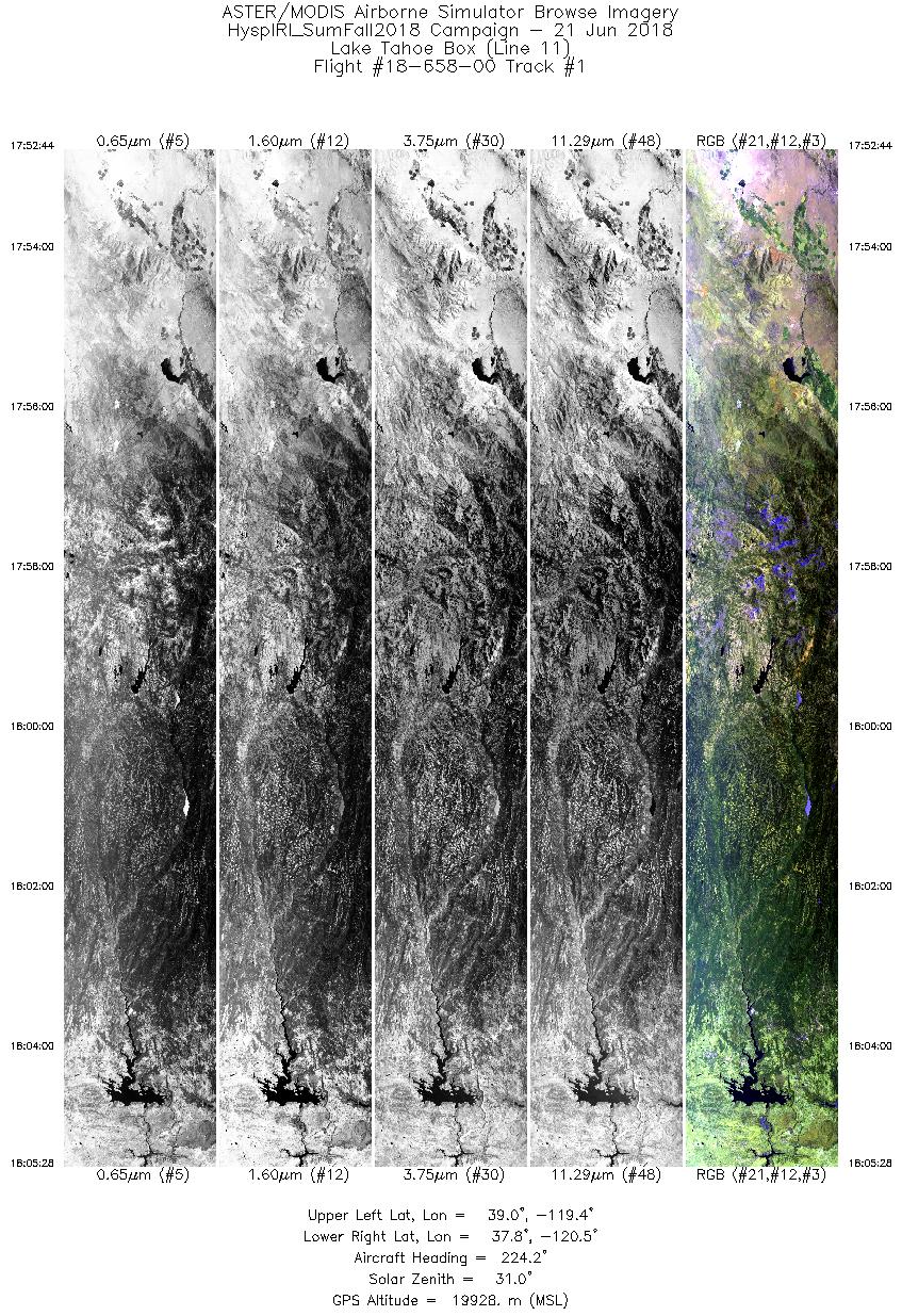
| 1 |
17:52 - 18:05 |
224.7 |
38.933 - 37.893 |
119.294 - 120.607 |
4776 |
19930 |
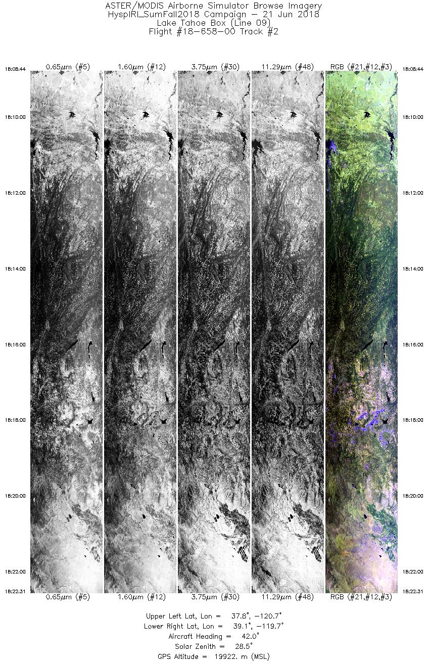
| 2 |
18:08 - 18:22 |
42.9 |
37.928 - 38.992 |
120.841 - 119.521 |
5167 |
19934 |
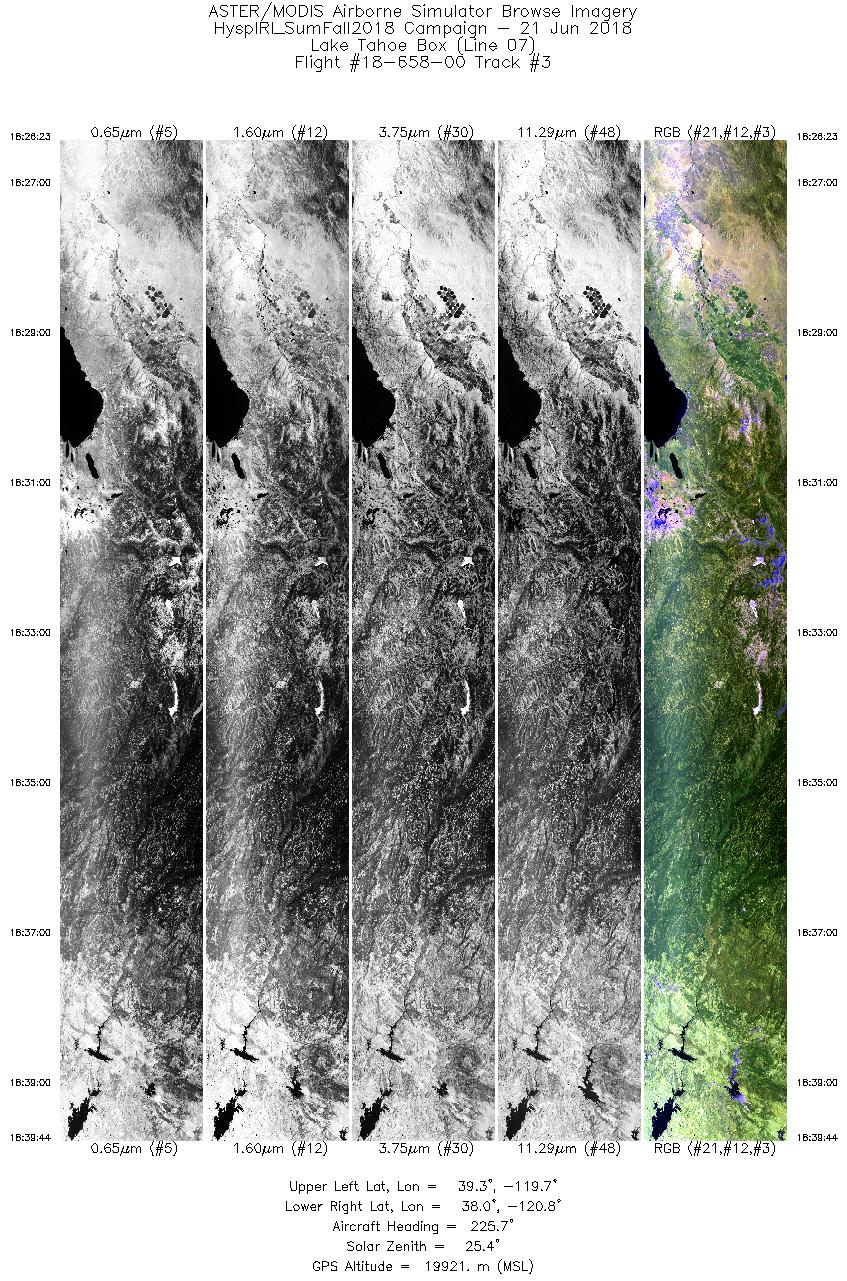
| 3 |
18:26 - 18:39 |
223.3 |
39.195 - 38.123 |
119.551 - 120.901 |
5009 |
19921 |
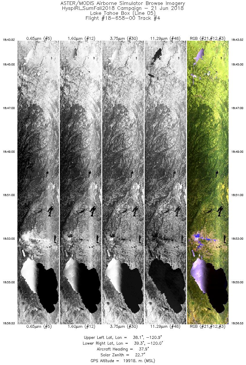
| 4 |
18:43 - 18:56 |
40.5 |
38.208 - 39.225 |
121.083 - 119.820 |
4879 |
19901 |
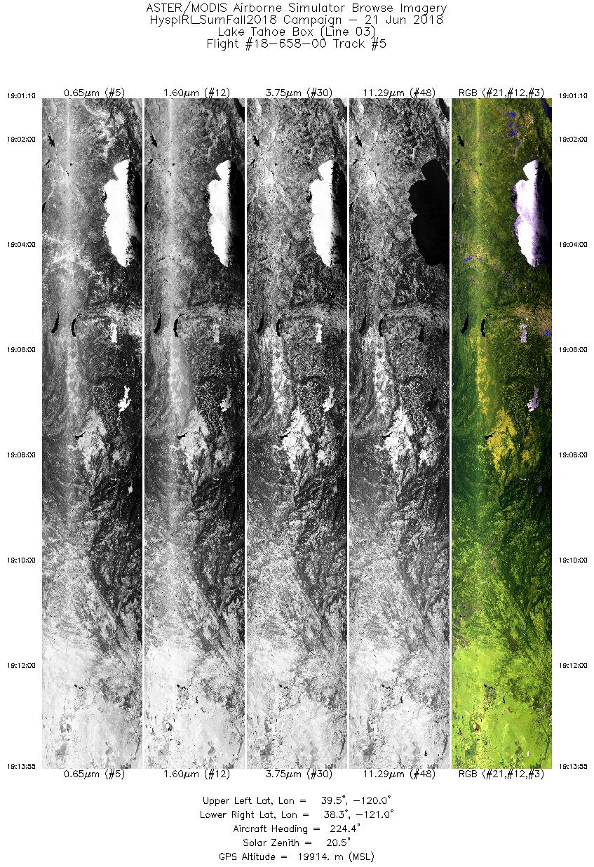
| 5 |
19:01 - 19:13 |
222.5 |
39.388 - 38.362 |
119.904 - 121.196 |
4782 |
19915 |
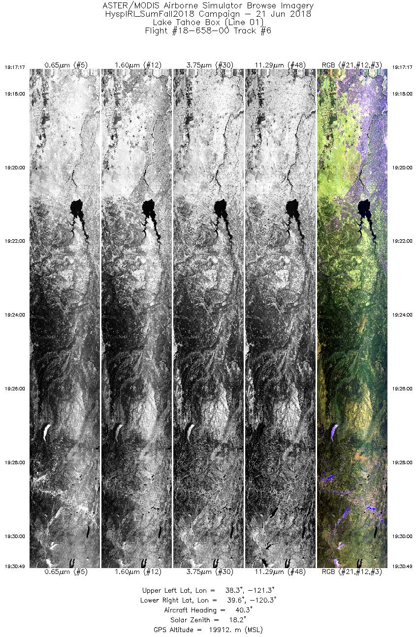
| 6 |
19:17 - 19:30 |
42.0 |
38.395 - 39.459 |
121.447 - 120.131 |
5072 |
19913 |
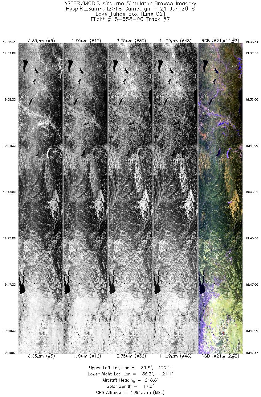
| 7 |
19:36 - 19:49 |
219.4 |
39.484 - 38.407 |
119.953 - 121.290 |
5038 |
19910 |
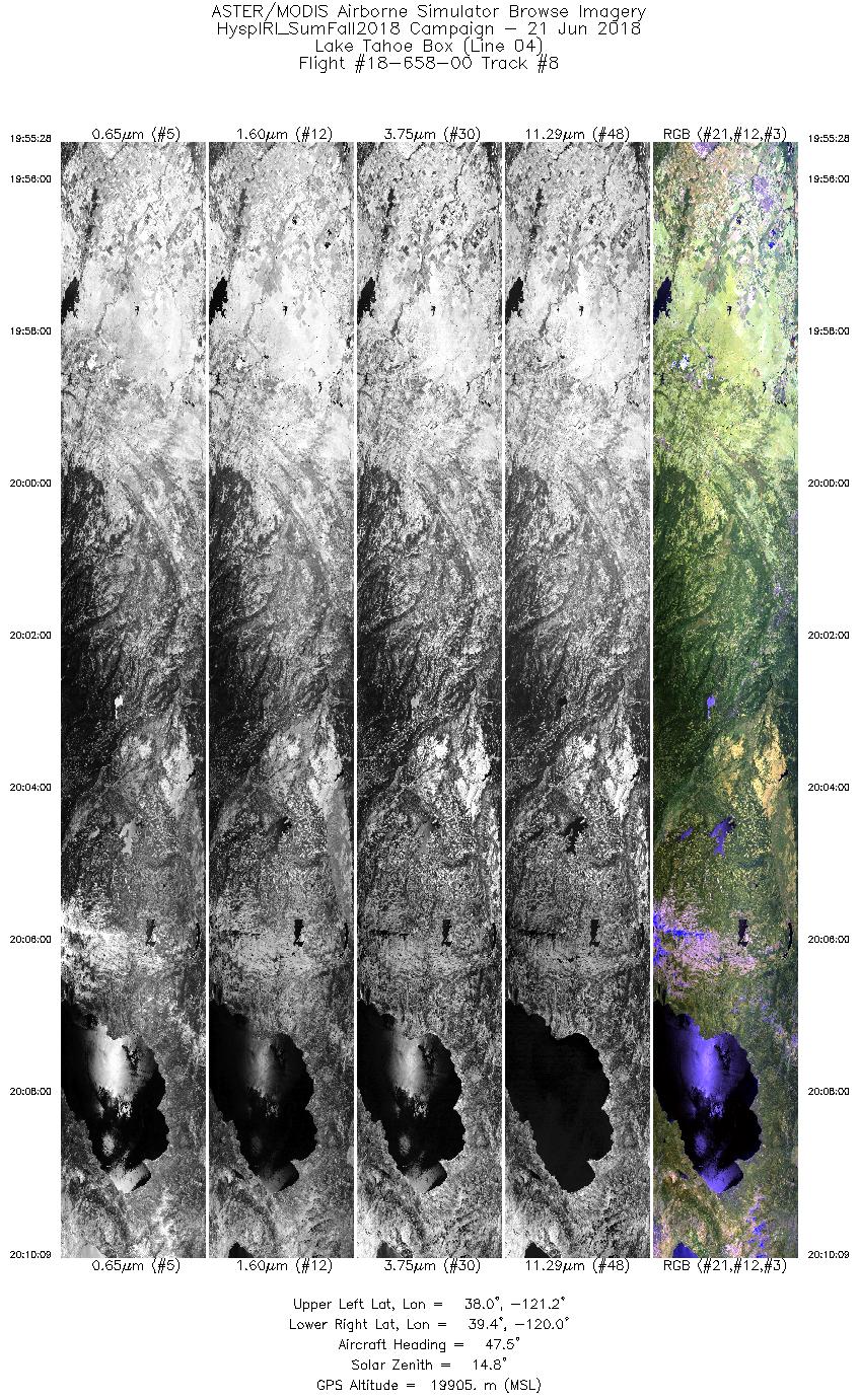
| 8 |
19:55 - 20:10 |
45.4 |
38.163 - 39.310 |
121.300 - 119.860 |
5505 |
19907 |
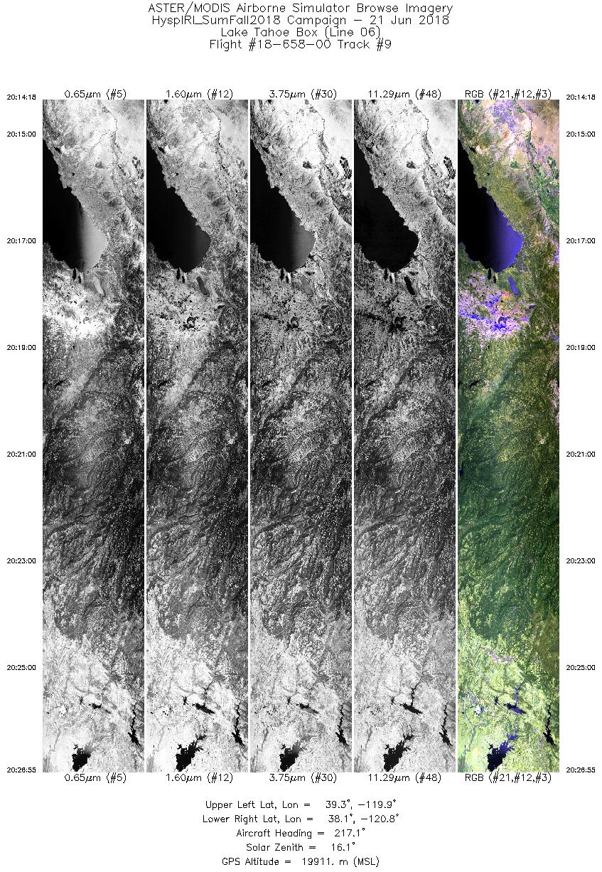
| 9 |
20:14 - 20:26 |
218.5 |
39.184 - 38.179 |
119.723 - 120.979 |
4731 |
19909 |
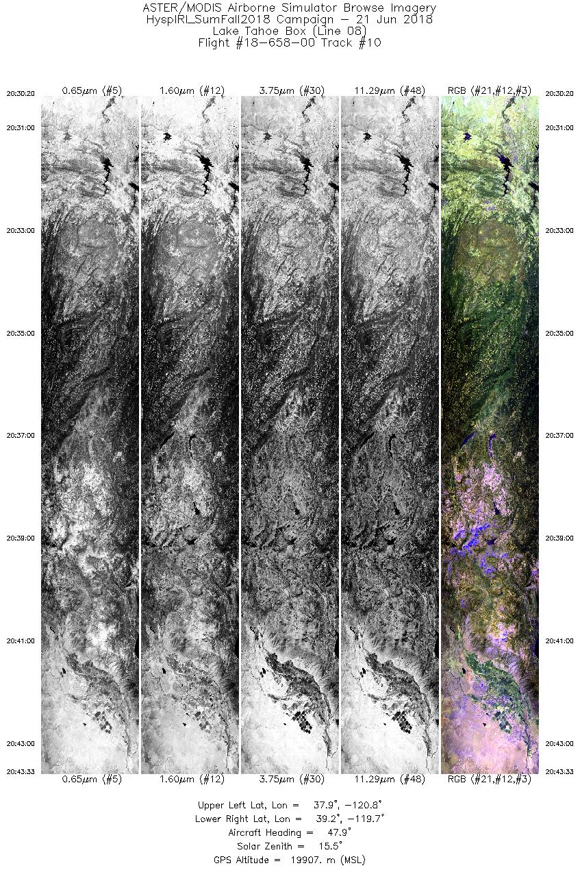
| 10 |
20:30 - 20:43 |
45.7 |
38.023 - 39.051 |
120.887 - 119.594 |
4954 |
19904 |
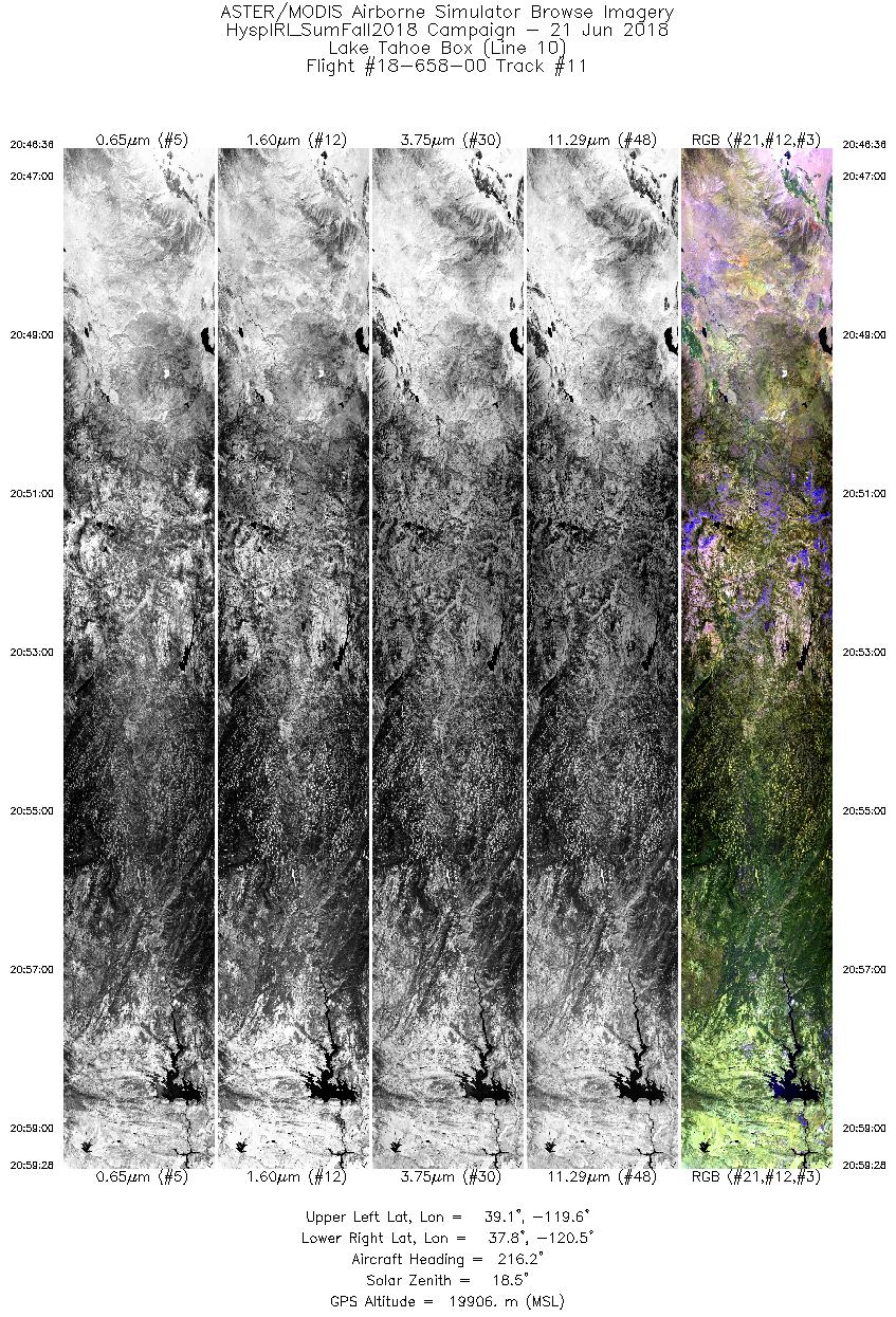
| 11 |
20:46 - 20:59 |
218.3 |
38.963 - 37.944 |
119.414 - 120.688 |
4826 |
19923 |
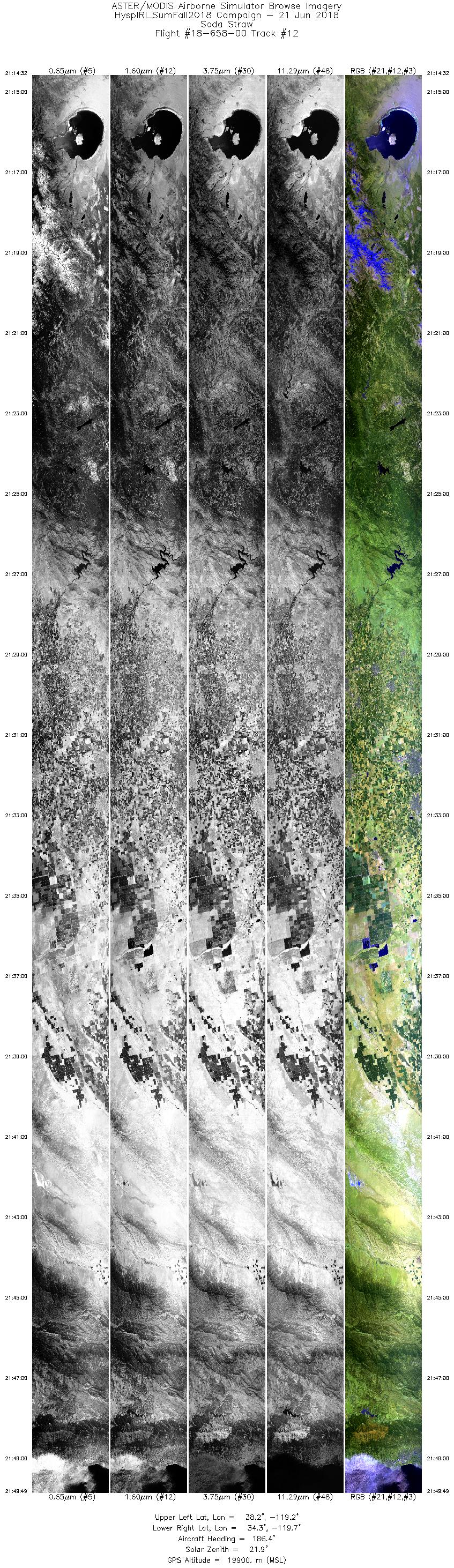
| 12 |
21:14 - 21:49 |
188.0 |
38.175 - 34.349 |
119.028 - 119.932 |
13232 |
19907 |
|


