Flight: 18-627-00
Date: January 30, 2018
Aircraft: NASA ER-2, #806
Deployment: HyspIRI HyTES Hawaii (H3C)
Flight Location: Big Island Hawaii / Maui / Lanai
Principal Investigator: Simon Hook / Rob Green (JPL)
Additional Sensors: HyTES / AVIRIS / PRISM
|
Data Evaluation
New Digitizer and Blackbody Controller
Overall data quality is good; digital noise in MWIR channels
|
Processing Information
Level-1B Data in HDF format is available
Flight Line Summary
Spectral Band Configuration
Spectral Response Function Table
Spectral Response Function (text)
|
Browse Imagery
Flight Tracks: 19
Scanlines: 47100
|
Browse Imagery Table
|
Click a Flight Track number to view a quicklook image
Lat/Lon ranges are for the BEG-END scanline nadir pixels
|
Flight
Track |
Time Span
(UTC) |
Heading
(Deg) |
Lat Range
(Deg N) |
Lon Range
(Deg W) |
Length
(Scanlines) |
Altitude
(Meters) |
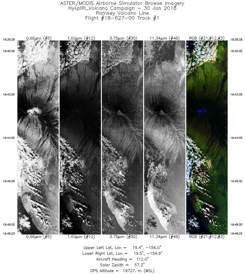
| 1 |
19:39 - 19:48 |
108.8 |
19.576 - 19.338 |
155.946 - 154.950 |
3358 |
19701 |
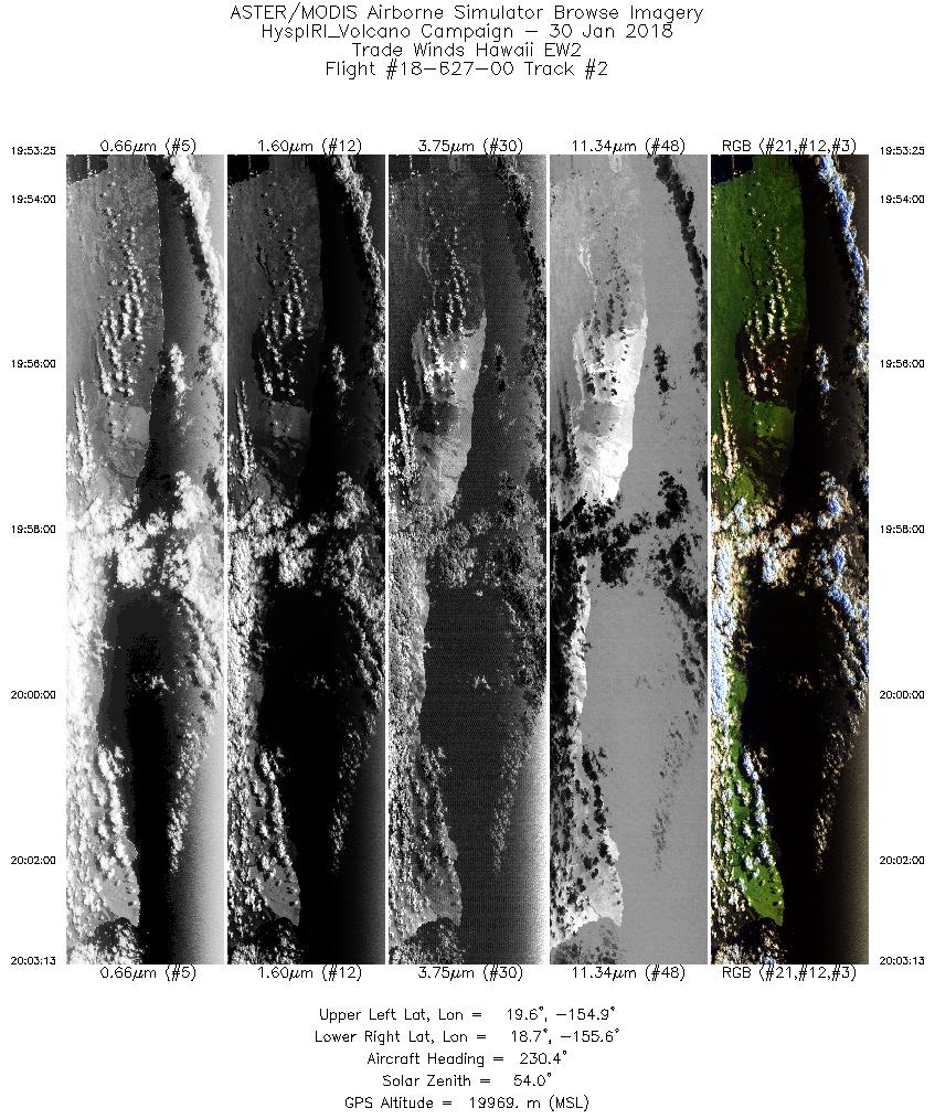
| 2 |
19:53 - 20:03 |
231.8 |
19.505 - 18.868 |
154.808 - 155.715 |
3674 |
19957 |
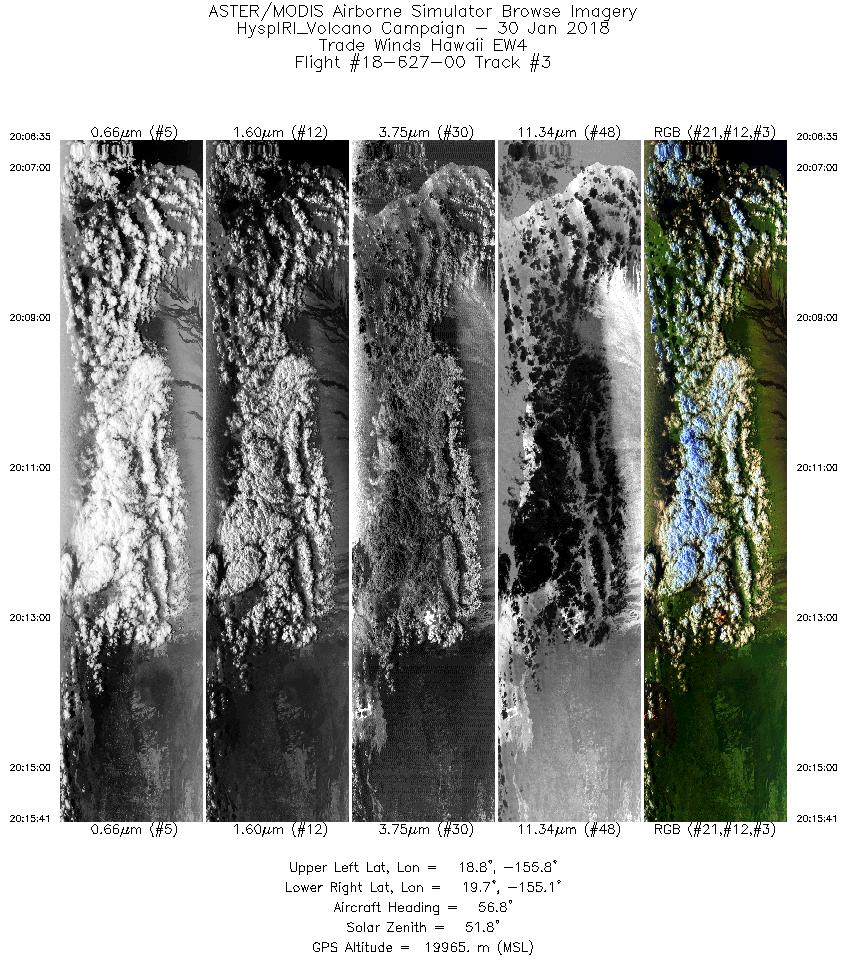
| 3 |
20:06 - 20:15 |
55.9 |
18.975 - 19.576 |
155.871 - 155.016 |
3412 |
19966 |
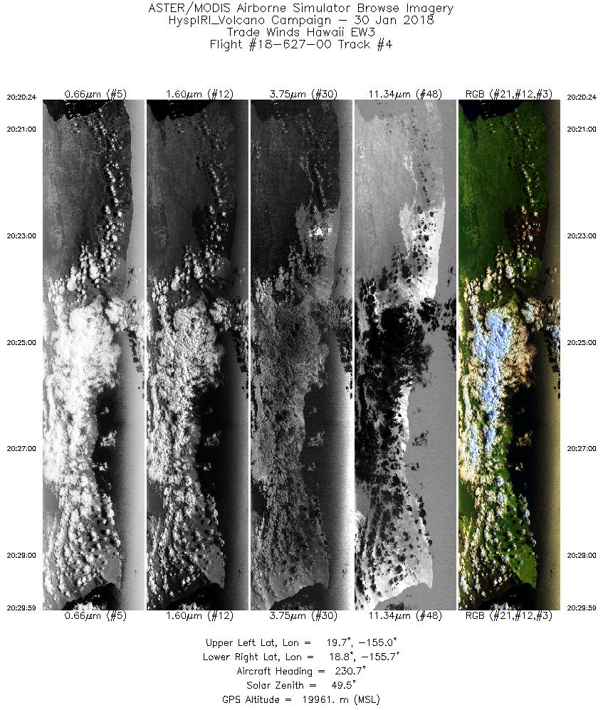
| 4 |
20:20 - 20:29 |
232.2 |
19.575 - 18.939 |
154.867 - 155.767 |
3593 |
19967 |
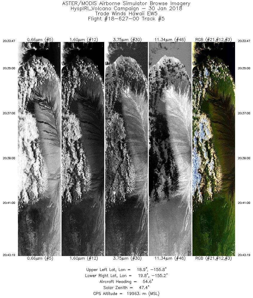
| 5 |
20:33 - 20:43 |
54.5 |
19.023 - 19.648 |
155.954 - 155.067 |
3573 |
19965 |
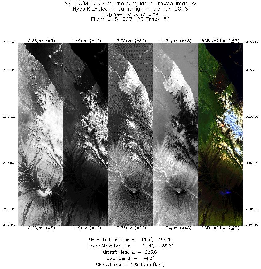
| 6 |
20:53 - 21:01 |
284.0 |
19.324 - 19.528 |
154.884 - 155.751 |
2958 |
19951 |
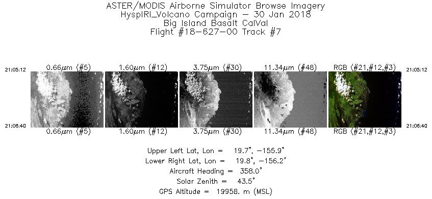
| 7 |
21:05 - 21:06 |
358.5 |
19.668 - 19.827 |
156.041 - 156.039 |
554 |
19956 |
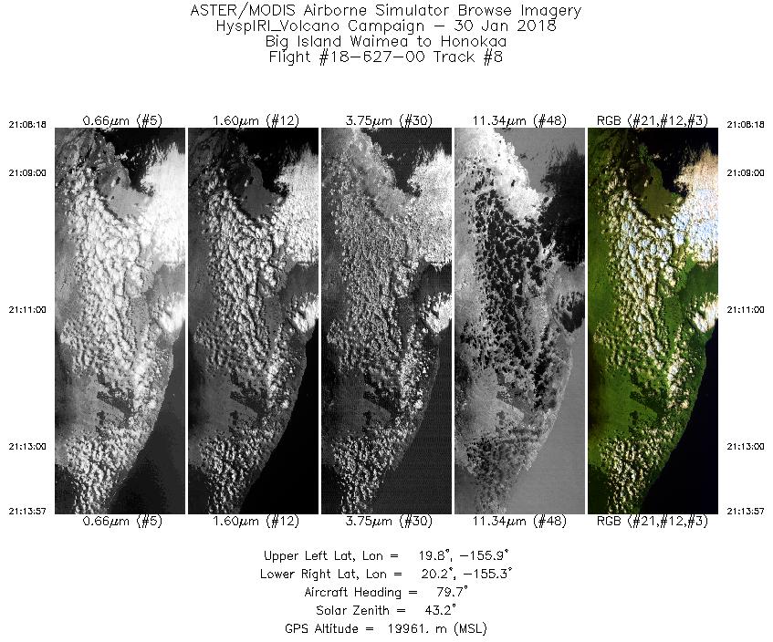
| 8 |
21:08 - 21:13 |
80.6 |
19.938 - 20.047 |
155.923 - 155.275 |
2121 |
19964 |
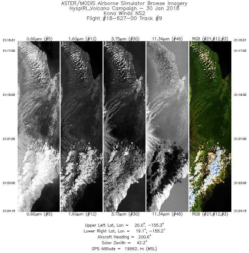
| 9 |
21:16 - 21:24 |
199.8 |
19.928 - 19.135 |
155.110 - 155.390 |
2906 |
19954 |
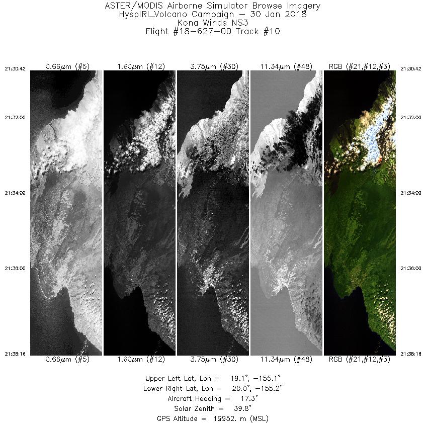
| 10 |
21:30 - 21:38 |
18.3 |
19.139 - 19.916 |
155.294 - 155.020 |
2839 |
19957 |
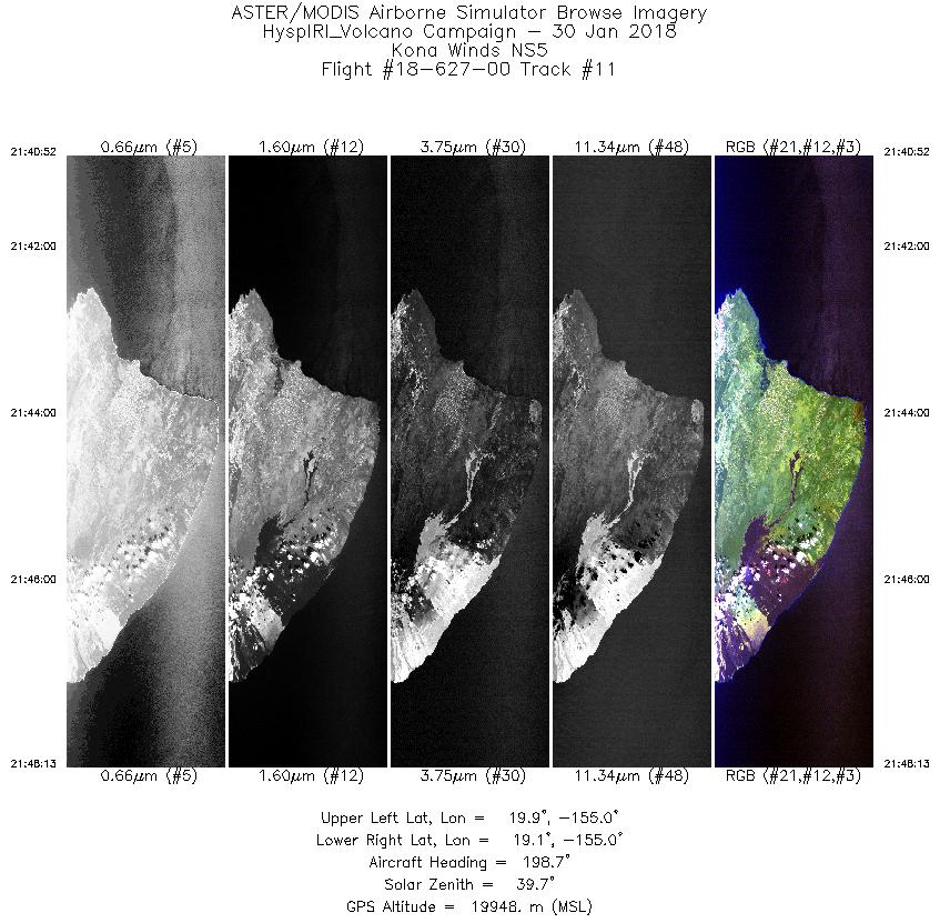
| 11 |
21:40 - 21:48 |
198.6 |
19.870 - 19.107 |
154.846 - 155.113 |
2756 |
19955 |
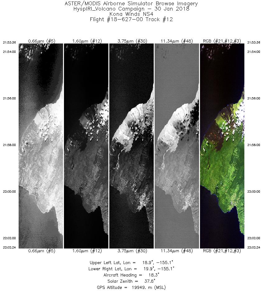
| 12 |
21:53 - 22:02 |
19.1 |
18.985 - 19.889 |
155.245 - 154.931 |
3301 |
19964 |
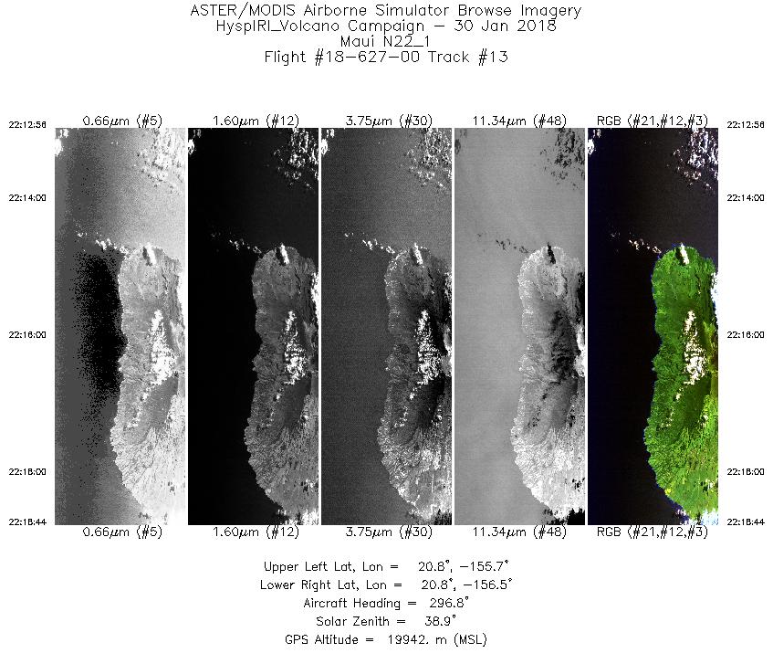
| 13 |
22:12 - 22:18 |
296.7 |
20.675 - 20.986 |
155.783 - 156.384 |
2176 |
19958 |
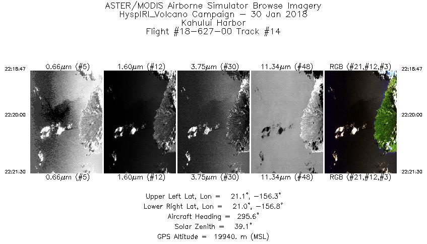
| 14 |
22:18 - 22:21 |
295.5 |
20.988 - 21.125 |
156.388 - 156.677 |
1021 |
19940 |
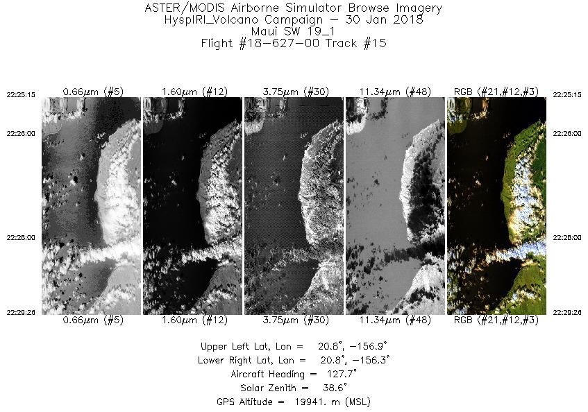
| 15 |
22:25 - 22:29 |
127.7 |
20.928 - 20.649 |
156.796 - 156.426 |
1571 |
19923 |
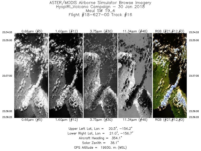
| 16 |
22:34 - 22:39 |
353.3 |
20.452 - 20.981 |
156.424 - 156.486 |
1795 |
19938 |
| 17 |
22:45 - 22:53 |
269.5 |
20.906 - 20.935 |
156.246 - 157.101 |
2805 |
19944 |
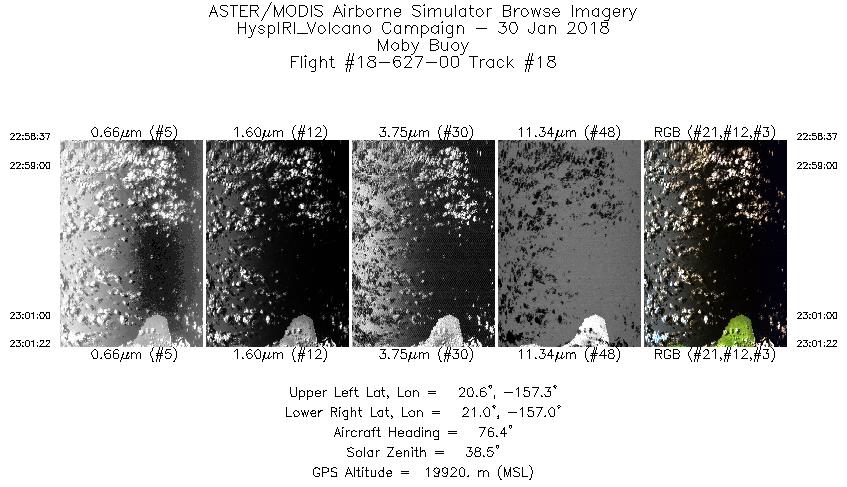
| 18 |
22:58 - 23:01 |
77.1 |
20.789 - 20.851 |
157.316 - 157.000 |
1037 |
19942 |
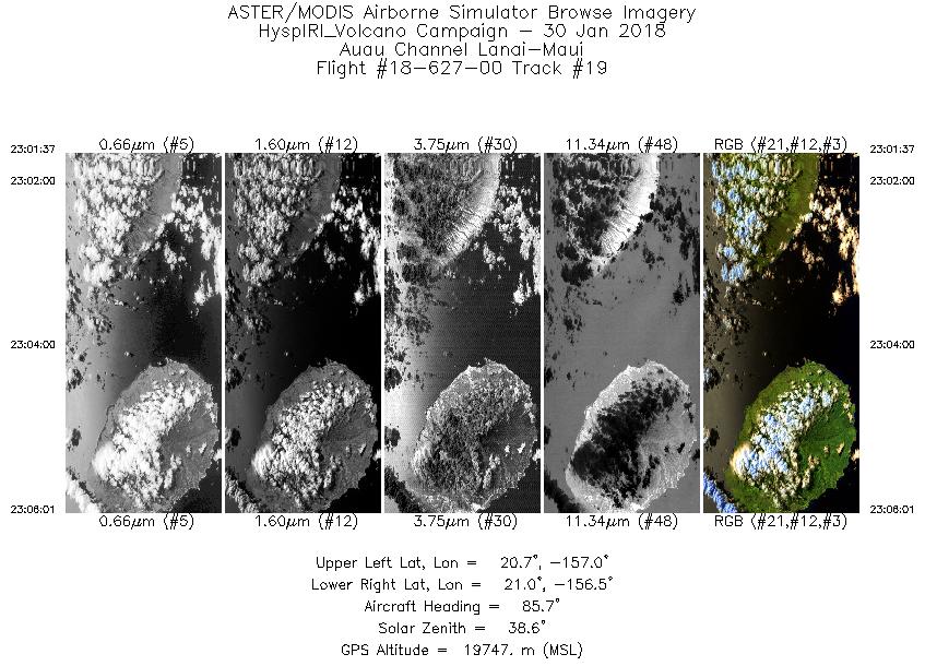
| 19 |
23:01 - 23:06 |
85.8 |
20.855 - 20.887 |
156.973 - 156.481 |
1650 |
19640 |
|


