Flight: 18-624-00
Date: January 18, 2018
Aircraft: NASA ER-2, #806
Deployment: HyspIRI HyTES Hawaii (H3C)
Flight Location: Big Island Hawaii / Oahu
Principal Investigator: Simon Hook / Rob Green (JPL)
Additional Sensors: HyTES / AVIRIS / PRISM
|
Data Evaluation
New Digitizer and Blackbody Controller
Overall data quality is good; coherent noise issues in the MWIR spectrometer.
|
Processing Information
Level-1B Data in HDF format is available
Flight Line Summary
Spectral Band Configuration
Spectral Response Function Table
Spectral Response Function (text)
|
Browse Imagery
Flight Tracks: 18
Scanlines: 55278
|
Browse Imagery Table
|
Click a Flight Track number to view a quicklook image
Lat/Lon ranges are for the BEG-END scanline nadir pixels
|
Flight
Track |
Time Span
(UTC) |
Heading
(Deg) |
Lat Range
(Deg N) |
Lon Range
(Deg W) |
Length
(Scanlines) |
Altitude
(Meters) |
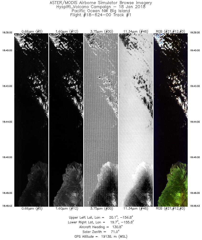
| 1 |
18:39 - 18:48 |
127.0 |
20.175 - 19.567 |
156.737 - 155.854 |
3643 |
19007 |
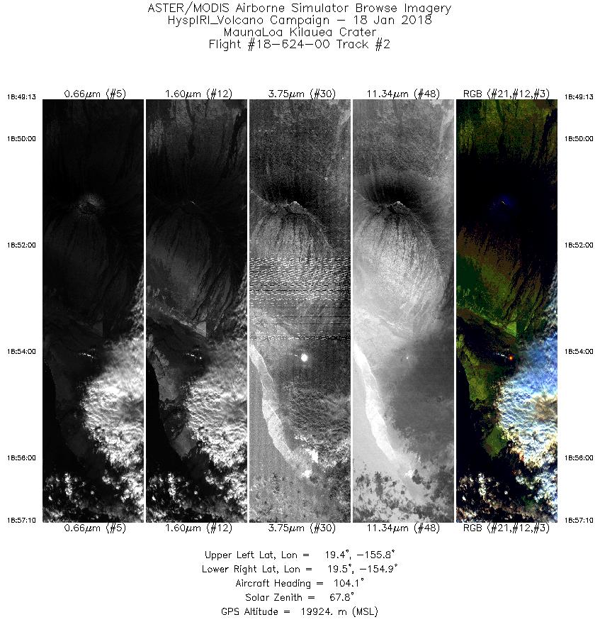
| 2 |
18:49 - 18:57 |
105.0 |
19.544 - 19.301 |
155.806 - 154.948 |
2986 |
19930 |
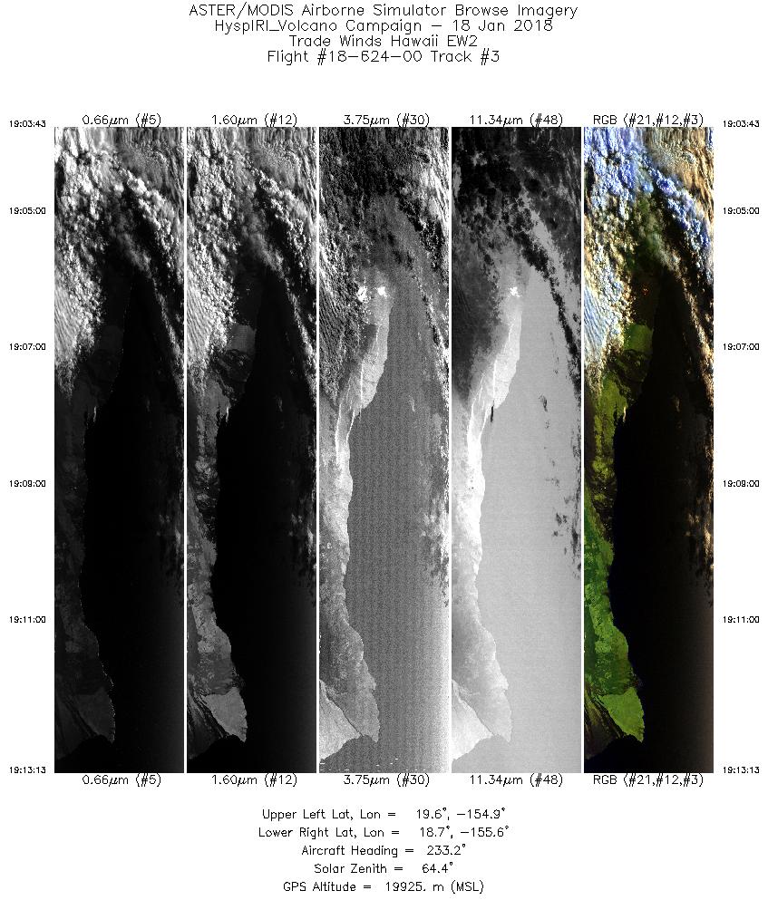
| 3 |
19:03 - 19:13 |
233.5 |
19.501 - 18.867 |
154.813 - 155.717 |
3568 |
19903 |
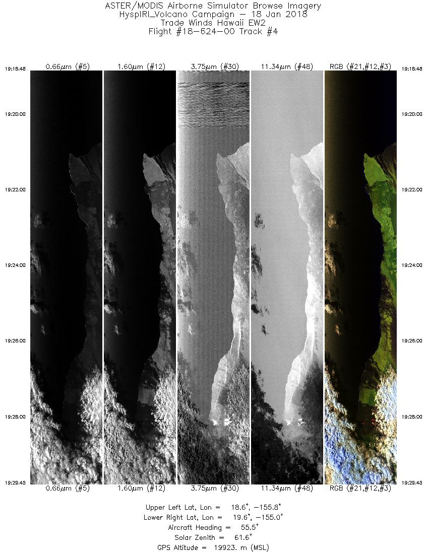
| 4 |
19:18 - 19:29 |
55.5 |
18.763 - 19.446 |
155.863 - 154.895 |
4111 |
19917 |
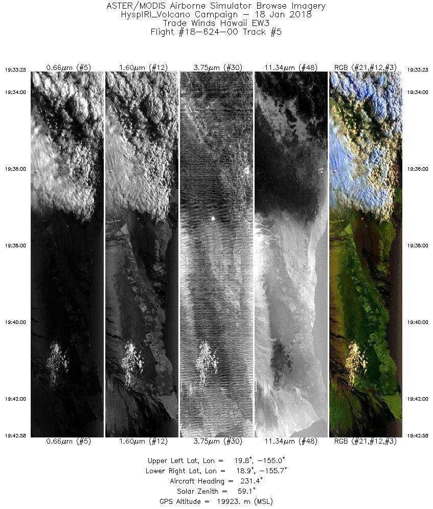
| 5 |
19:33 - 19:42 |
232.1 |
19.650 - 19.008 |
154.917 - 155.822 |
3582 |
19931 |
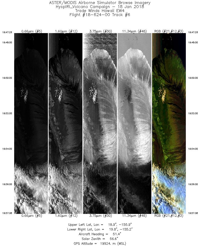
| 6 |
19:47 - 19:57 |
53.8 |
19.007 - 19.646 |
155.969 - 155.068 |
3826 |
19913 |
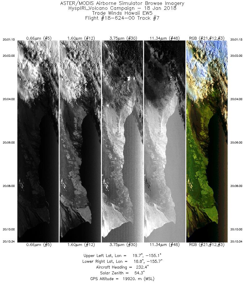
| 7 |
20:01 - 20:10 |
232.2 |
19.524 - 18.908 |
154.939 - 155.810 |
3492 |
19905 |
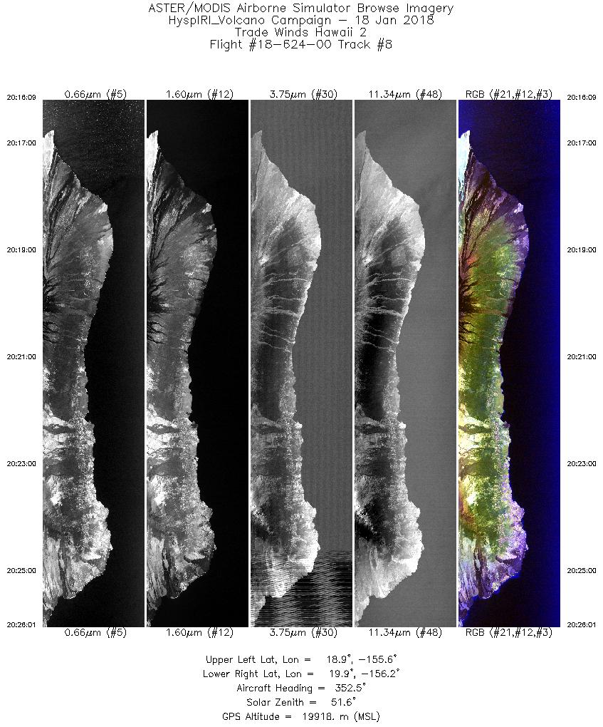
| 8 |
20:16 - 20:26 |
351.0 |
18.830 - 19.897 |
155.793 - 156.047 |
3701 |
19913 |
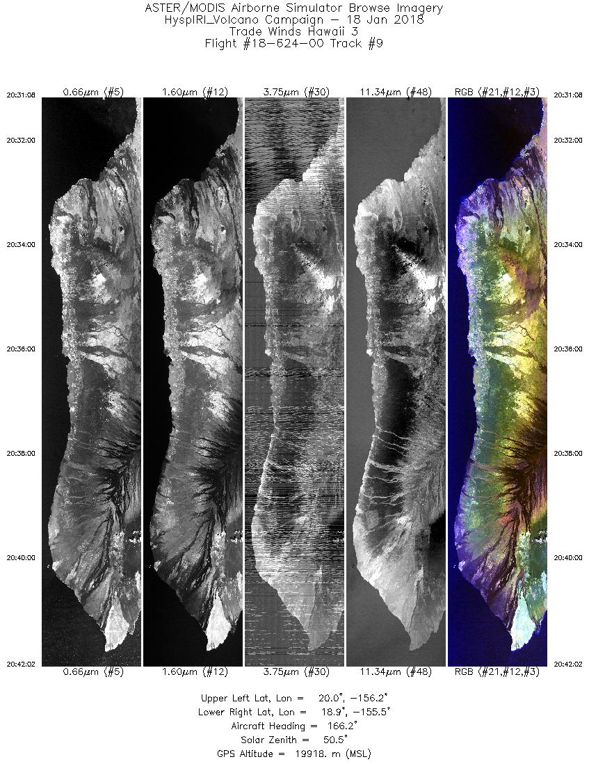
| 9 |
20:31 - 20:42 |
165.8 |
20.017 - 18.868 |
155.981 - 155.711 |
4090 |
19898 |
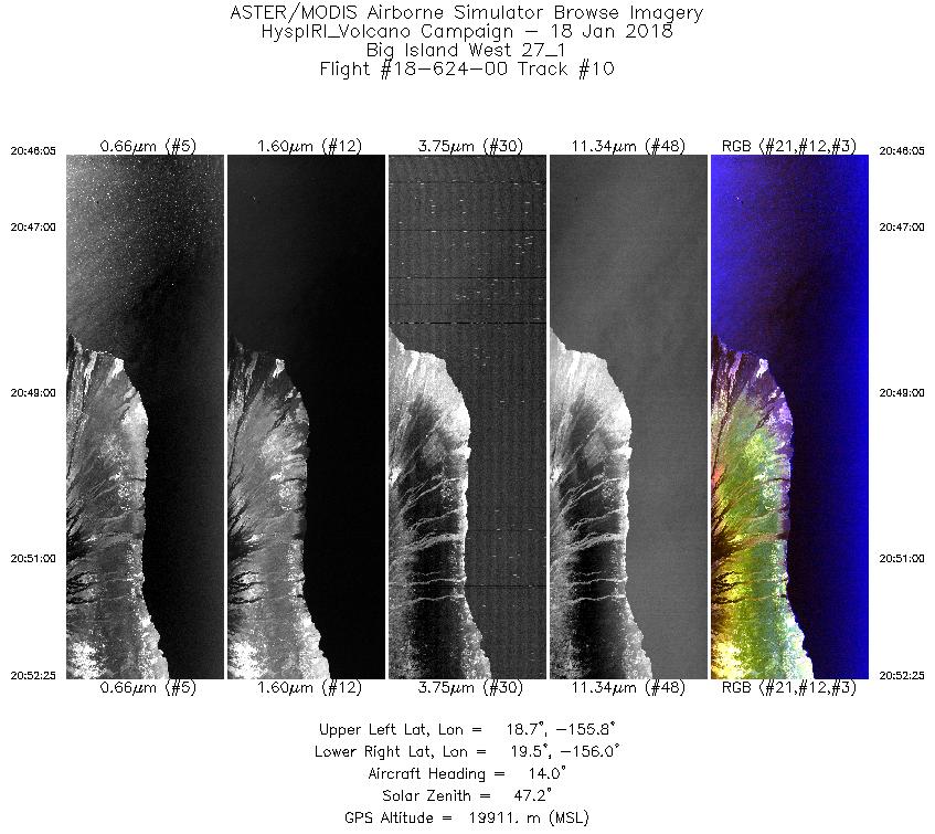
| 10 |
20:46 - 20:52 |
11.2 |
18.776 - 19.453 |
155.953 - 155.879 |
2375 |
19920 |
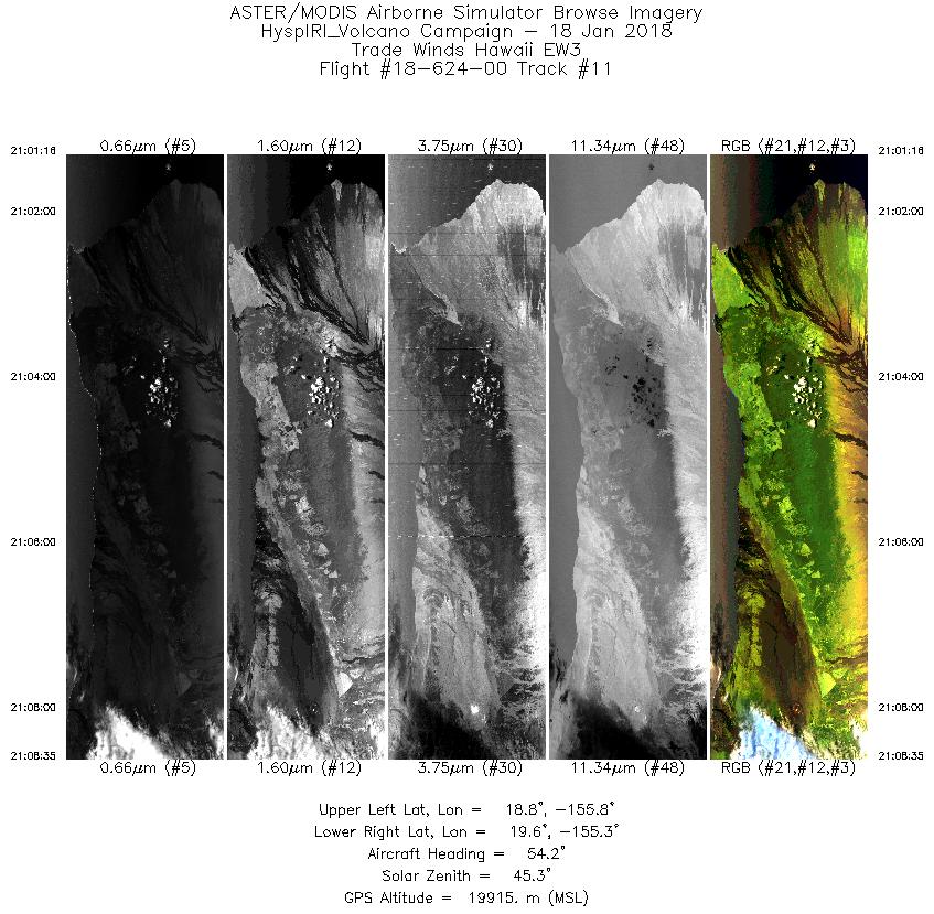
| 11 |
21:01 - 21:08 |
55.3 |
18.975 - 19.435 |
155.873 - 155.218 |
2746 |
19919 |
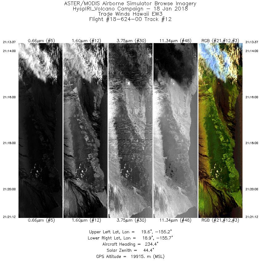
| 12 |
21:13 - 21:21 |
233.4 |
19.513 - 19.008 |
155.117 - 155.823 |
2841 |
19925 |
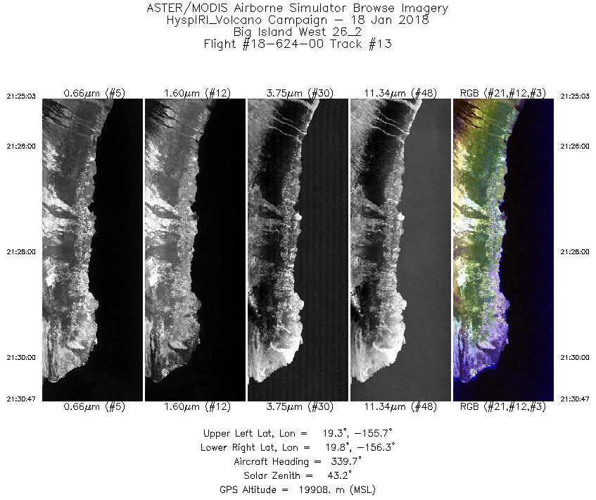
| 13 |
21:25 - 21:30 |
339.8 |
19.260 - 19.845 |
155.841 - 156.099 |
2152 |
19908 |
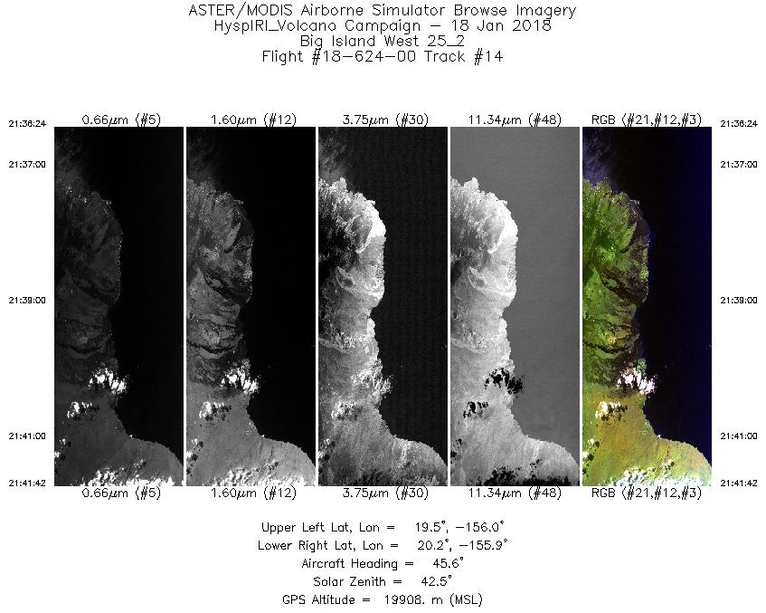
| 14 |
21:36 - 21:41 |
45.2 |
19.656 - 20.073 |
156.158 - 155.749 |
1987 |
19914 |
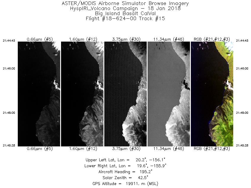
| 15 |
21:44 - 21:49 |
194.7 |
20.162 - 19.667 |
155.912 - 156.055 |
1769 |
19928 |
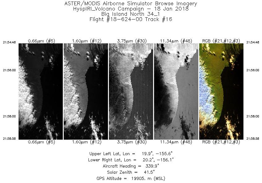
| 16 |
21:54 - 21:58 |
339.3 |
19.884 - 20.299 |
155.768 - 155.957 |
1558 |
19908 |
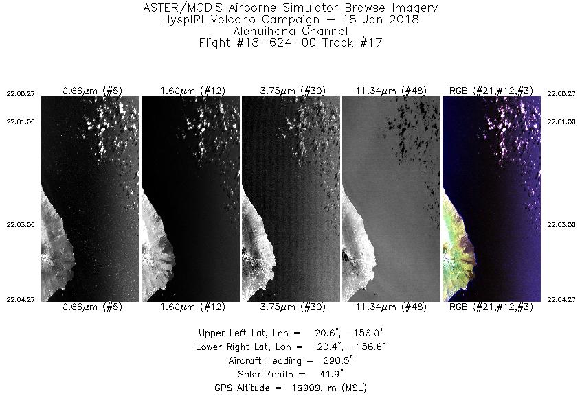
| 17 |
22:00 - 22:04 |
292.0 |
20.400 - 20.578 |
156.083 - 156.513 |
1500 |
19916 |
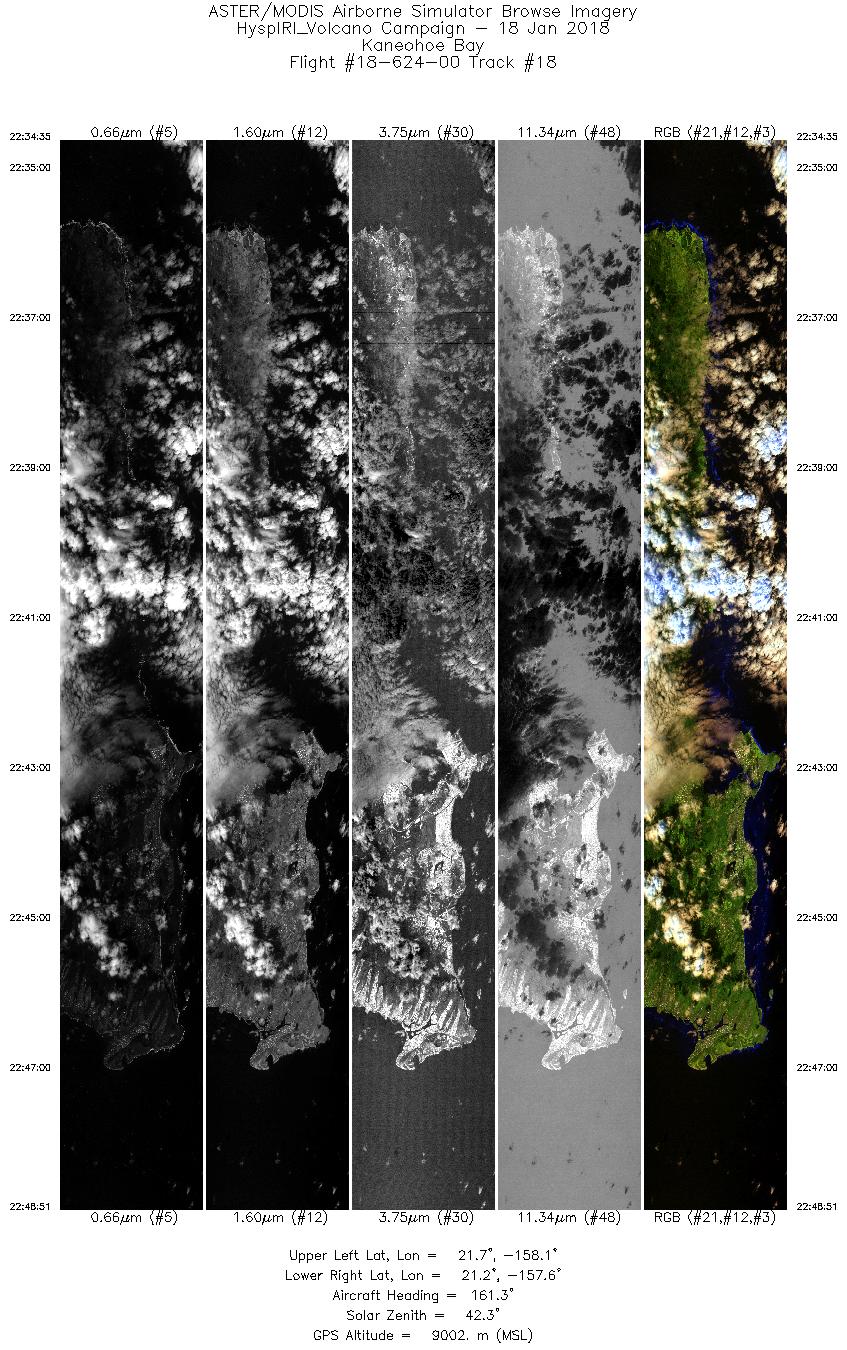
| 18 |
22:34 - 22:48 |
159.1 |
21.769 - 21.193 |
157.986 - 157.640 |
5351 |
8994 |
|


