Flight: 16-910-00
Date: October 26, 2015
Aircraft: NASA ER-2, #809
Flight Number: 16-910-00
Deployment: HyspIRI Fall 2015
Flight Location: PRISM / Ivanpah / Mtn. Pass / Yosemite
Principal Investigator: Rob Green / Simon Hook (JPL)
Additional Sensors: AVIRIS
|
Data Evaluation
Overall data quality is good.
All data collected @6.25Hz
|
Processing Information
Level-1B Data in HDF format is available
Flight Line Summary
Spectral Band Configuration
Spectral Response Function Table
Spectral Response Function (text)
|
Browse Imagery
Flight Tracks: 21
Scanlines: 62228
|
Browse Imagery Table
|
Click a Flight Track number to view a quicklook image
Lat/Lon ranges are for the BEG-END scanline nadir pixels
|
Flight
Track |
Time Span
(UTC) |
Heading
(Deg) |
Lat Range
(Deg N) |
Lon Range
(Deg W) |
Length
(Scanlines) |
Altitude
(Meters) |
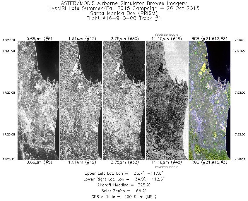
| 1 |
17:20 - 17:26 |
325.8 |
33.616 - 34.136 |
118.001 - 118.430 |
2038 |
20049 |
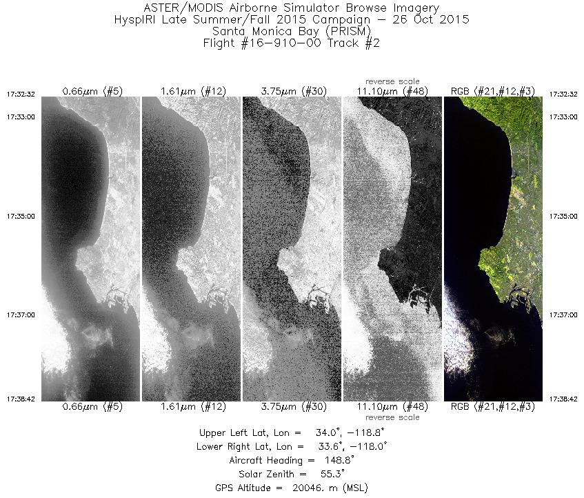
| 2 |
17:32 - 17:38 |
147.2 |
34.090 - 33.501 |
118.628 - 118.149 |
2211 |
20065 |
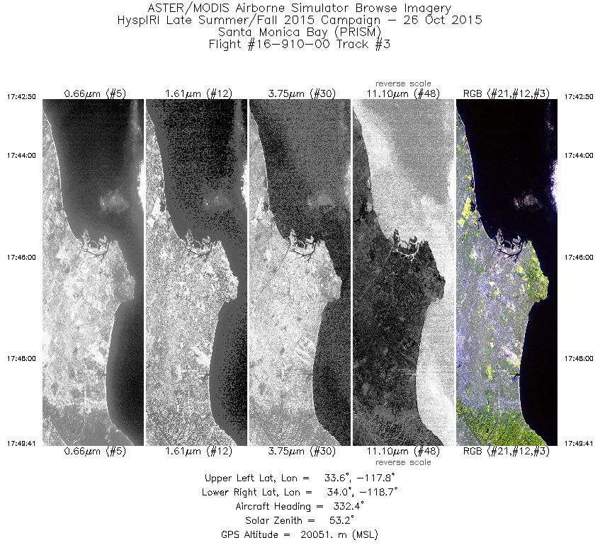
| 3 |
17:42 - 17:49 |
329.0 |
33.486 - 34.110 |
118.025 - 118.531 |
2453 |
20045 |
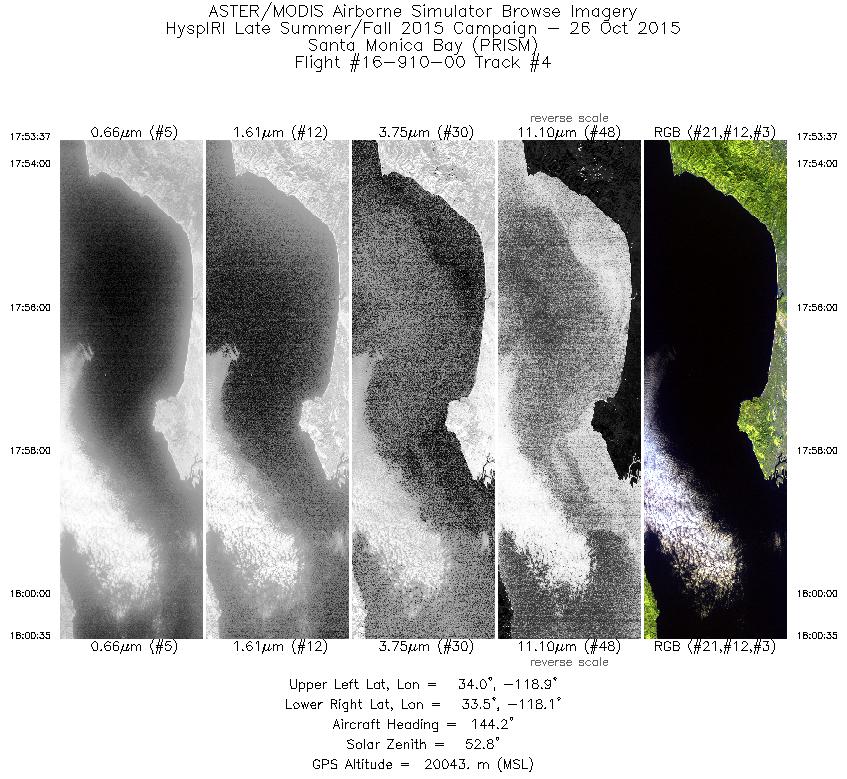
| 4 |
17:53 - 18:00 |
145.5 |
34.094 - 33.438 |
118.758 - 118.219 |
2495 |
20045 |
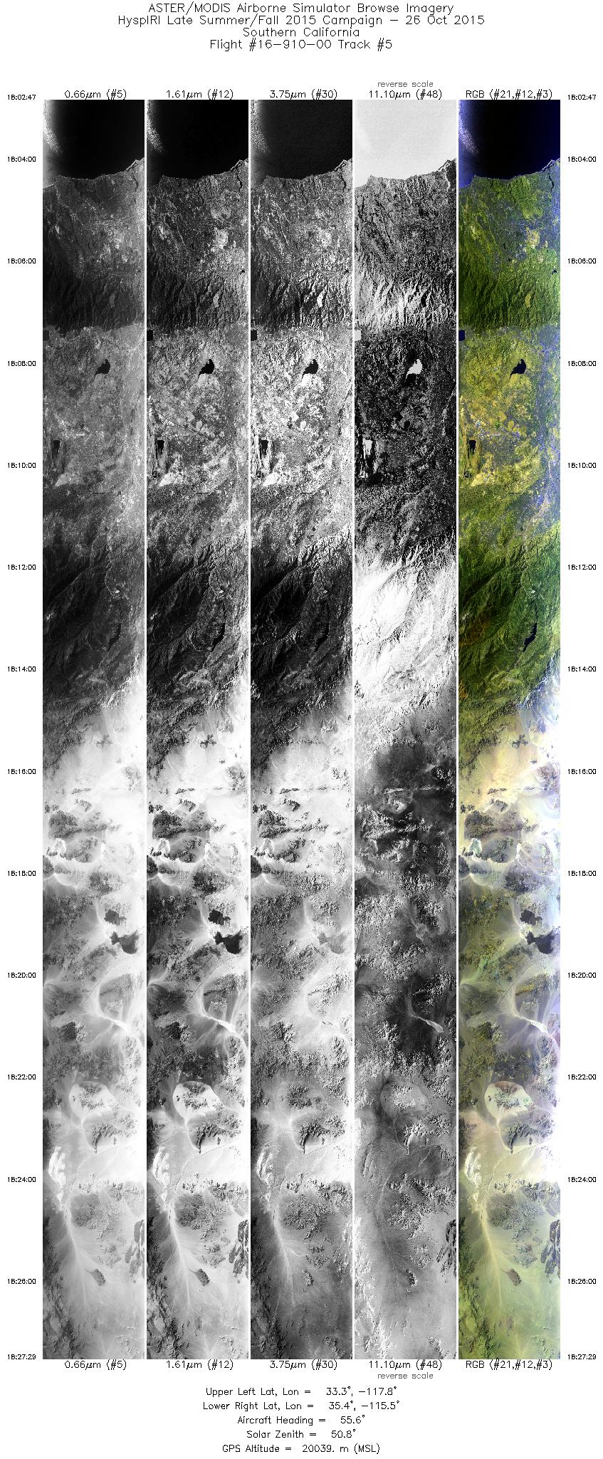
| 5 |
18:02 - 18:27 |
50.9 |
33.430 - 35.279 |
117.950 - 115.420 |
8846 |
20033 |
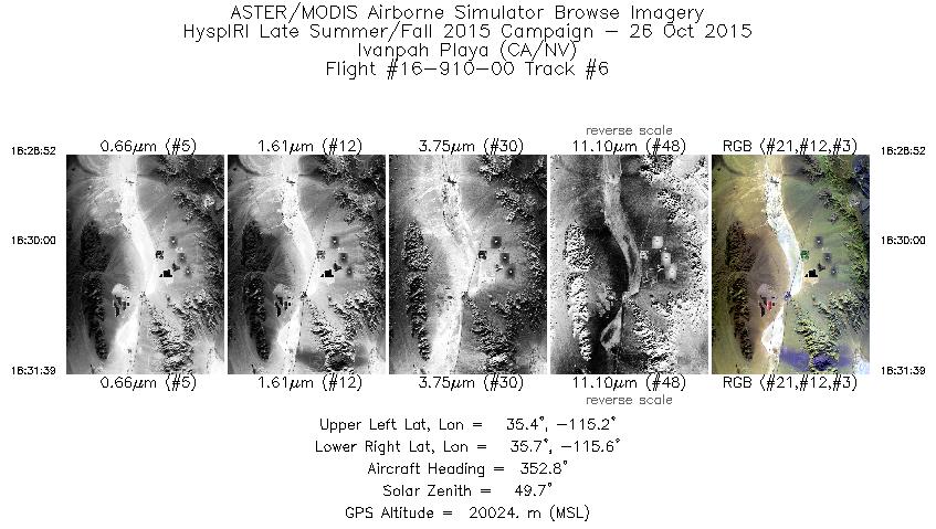
| 6 |
18:28 - 18:31 |
354.8 |
35.419 - 35.716 |
115.395 - 115.394 |
997 |
20023 |
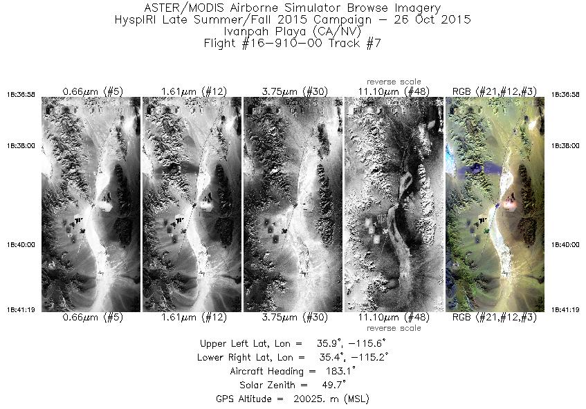
| 7 |
18:36 - 18:41 |
181.8 |
35.859 - 35.365 |
115.389 - 115.394 |
1558 |
20019 |
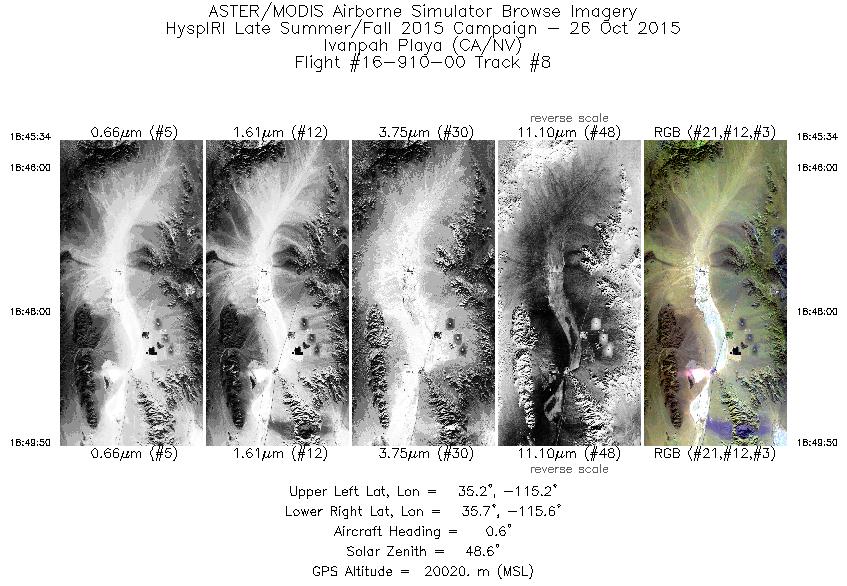
| 8 |
18:45 - 18:49 |
358.0 |
35.252 - 35.722 |
115.391 - 115.393 |
1531 |
20028 |
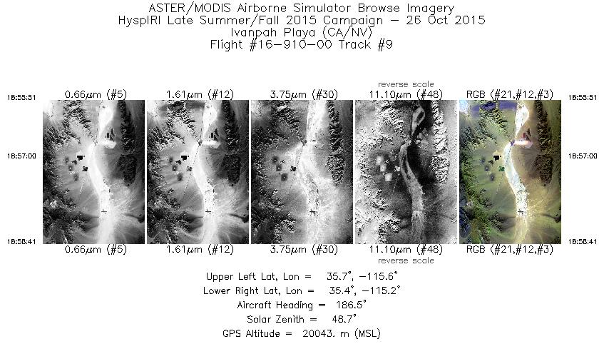
| 9 |
18:55 - 18:58 |
183.7 |
35.705 - 35.384 |
115.390 - 115.395 |
1013 |
20048 |
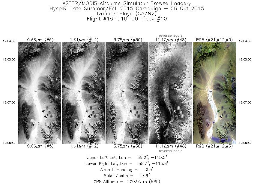
| 10 |
19:04 - 19:08 |
358.0 |
35.208 - 35.717 |
115.395 - 115.395 |
1690 |
20041 |
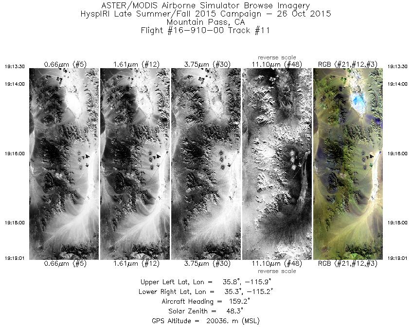
| 11 |
19:13 - 19:19 |
157.5 |
35.812 - 35.229 |
115.680 - 115.372 |
1971 |
20041 |
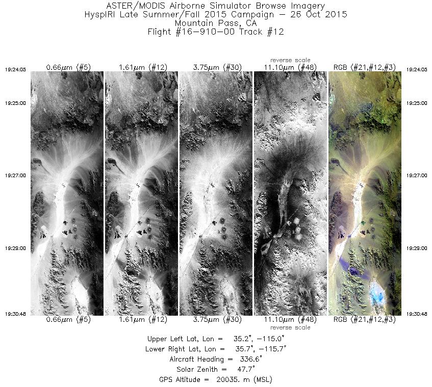
| 12 |
19:24 - 19:30 |
334.6 |
35.145 - 35.798 |
115.218 - 115.565 |
2400 |
20039 |
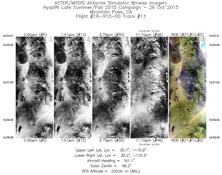
| 13 |
19:34 - 19:39 |
158.5 |
35.730 - 35.153 |
115.756 - 115.444 |
1943 |
20029 |
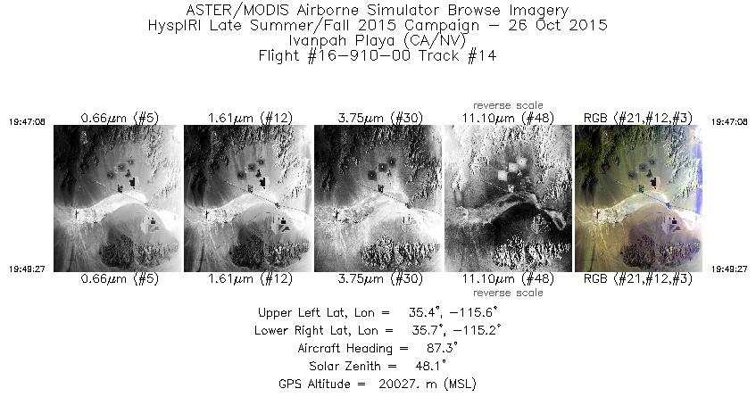
| 14 |
19:47 - 19:49 |
87.2 |
35.548 - 35.549 |
115.563 - 115.236 |
827 |
20039 |
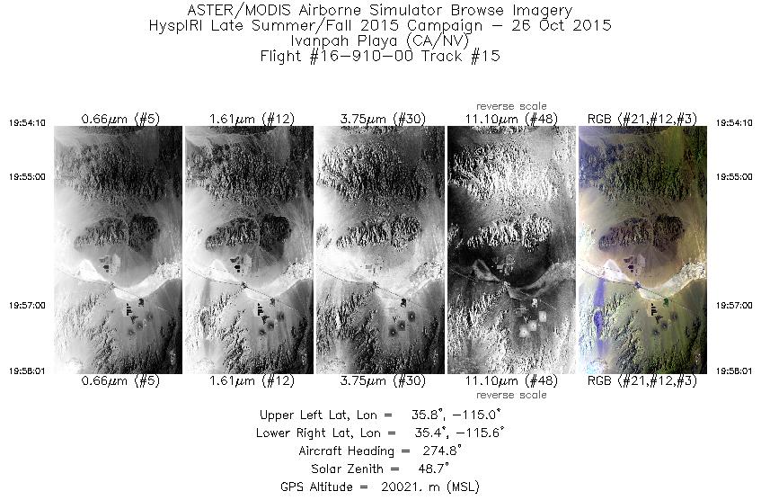
| 15 |
19:54 - 19:58 |
272.1 |
35.597 - 35.600 |
115.064 - 115.569 |
1381 |
20023 |
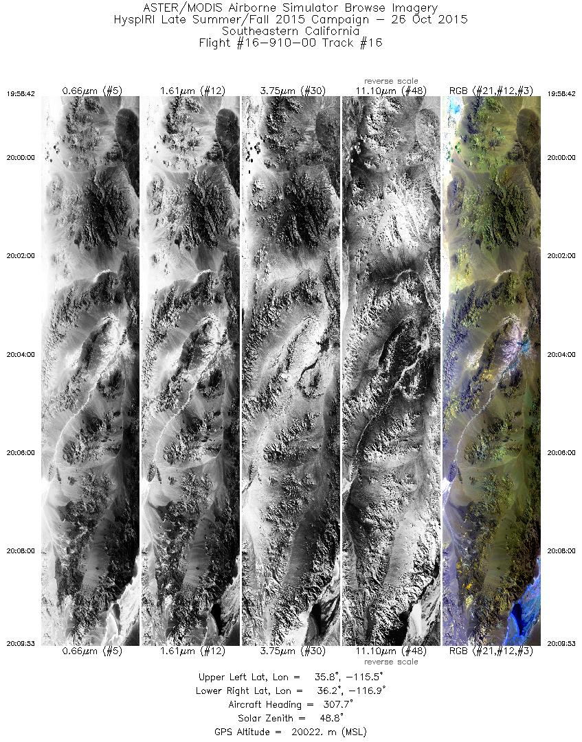
| 16 |
19:58 - 20:09 |
306.3 |
35.625 - 36.340 |
115.649 - 116.817 |
4006 |
20037 |
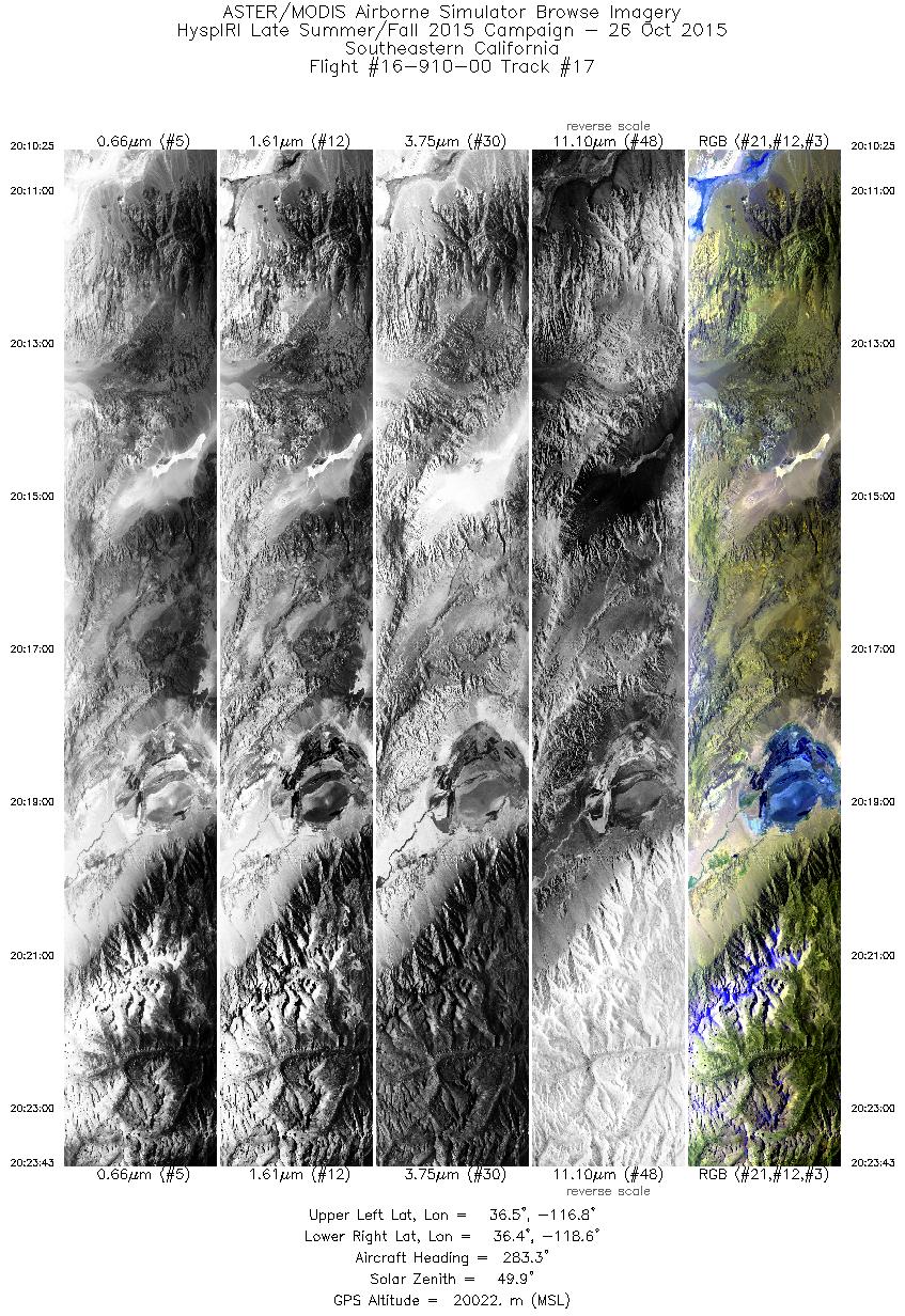
| 17 |
20:10 - 20:23 |
280.8 |
36.362 - 36.574 |
116.880 - 118.597 |
4762 |
20025 |
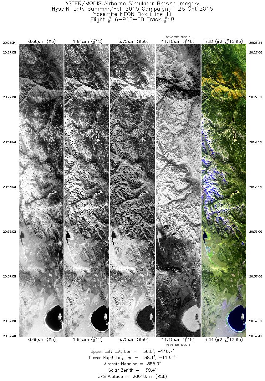
| 18 |
20:26 - 20:39 |
358.3 |
36.634 - 38.108 |
118.905 - 118.889 |
4692 |
20011 |
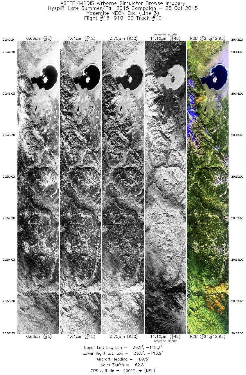
| 19 |
20:43 - 20:57 |
186.7 |
38.207 - 36.642 |
119.075 - 119.107 |
5063 |
20011 |
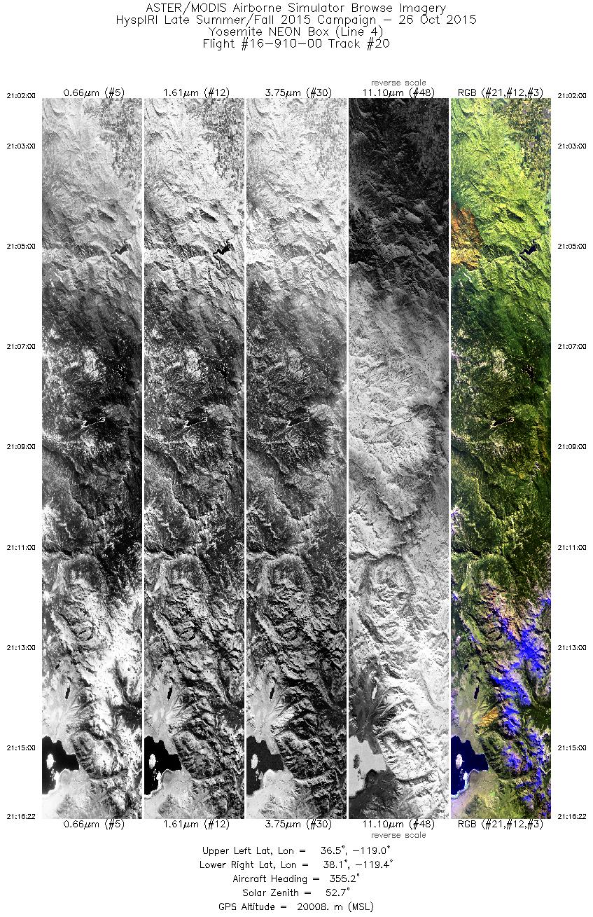
| 20 |
21:01 - 21:16 |
357.1 |
36.520 - 38.121 |
119.209 - 119.186 |
5149 |
20013 |
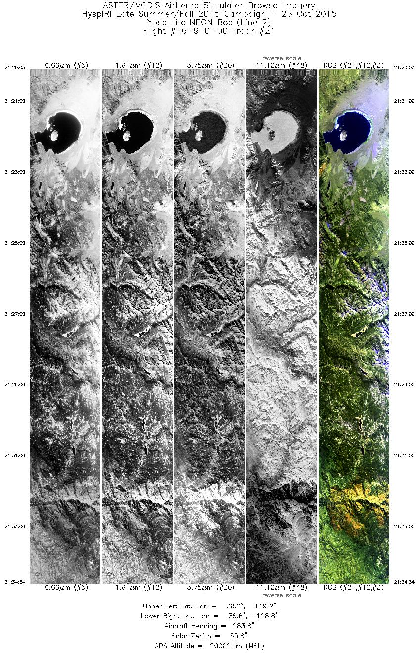
| 21 |
21:20 - 21:34 |
183.9 |
38.203 - 36.599 |
118.982 - 119.006 |
5202 |
20002 |
|


