Flight: 15-952-00
Date: August 24, 2015
Aircraft: NASA ER-2, #809
Flight Number: 15-952-00
Deployment: HyspIRI Fall 2015
Flight Location: Santa Barbara, CA
Principal Investigator: Rob Green / Simon Hook (JPL)
Additional Sensors: AVIRIS
|
Data Evaluation
Overall data quality is good.
All data collected @6.25Hz
|
Processing Information
Level-1B Data in HDF format is available
Flight Line Summary
Spectral Band Configuration
Spectral Response Function Table
Spectral Response Function (text)
|
Browse Imagery
Flight Tracks: 14
Scanlines: 71911
|
Browse Imagery Table
|
Click a Flight Track number to view a quicklook image
Lat/Lon ranges are for the BEG-END scanline nadir pixels
|
Flight
Track |
Time Span
(UTC) |
Heading
(Deg) |
Lat Range
(Deg N) |
Lon Range
(Deg W) |
Length
(Scanlines) |
Altitude
(Meters) |
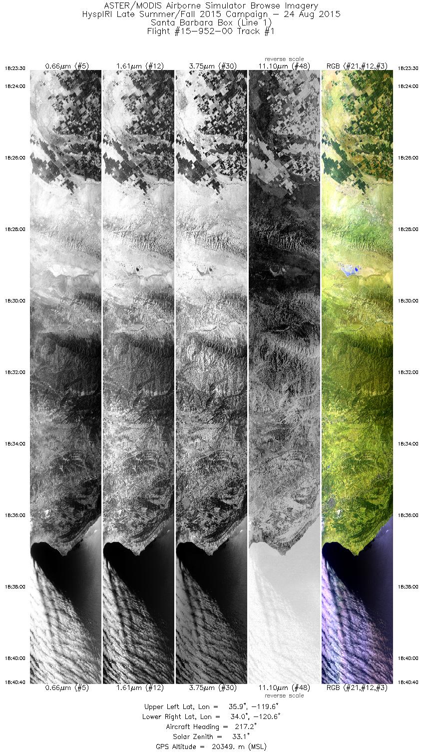
| 1 |
18:23 - 18:40 |
214.4 |
35.750 - 34.089 |
119.398 - 120.731 |
6142 |
20340 |
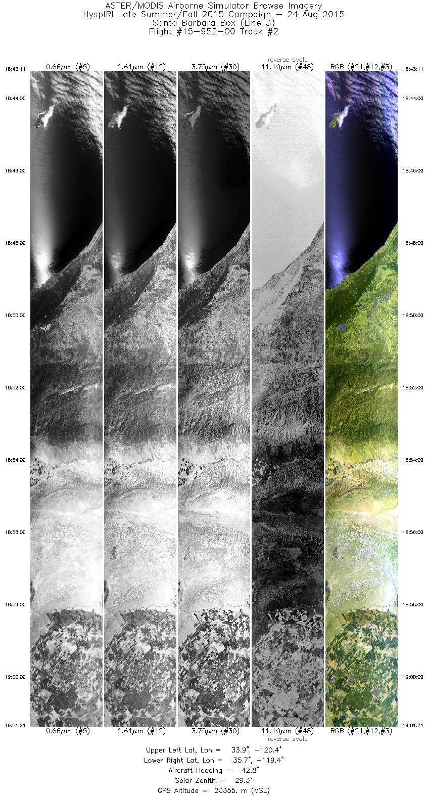
| 2 |
18:43 - 19:01 |
40.1 |
33.983 - 35.651 |
120.573 - 119.217 |
6492 |
20354 |
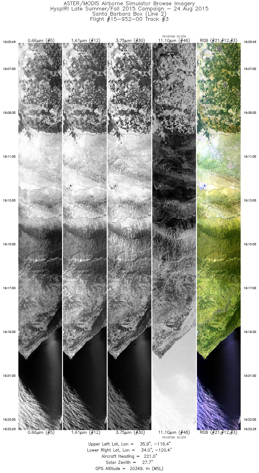
| 3 |
19:05 - 19:23 |
218.1 |
35.796 - 34.077 |
119.219 - 120.611 |
6317 |
20355 |
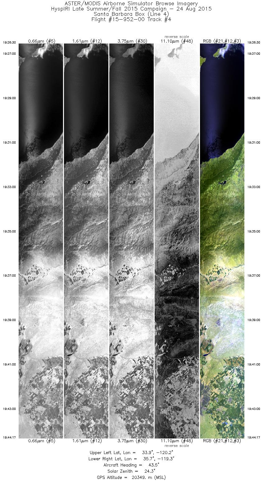
| 4 |
19:26 - 19:44 |
40.6 |
34.012 - 35.632 |
120.411 - 119.102 |
6359 |
20347 |
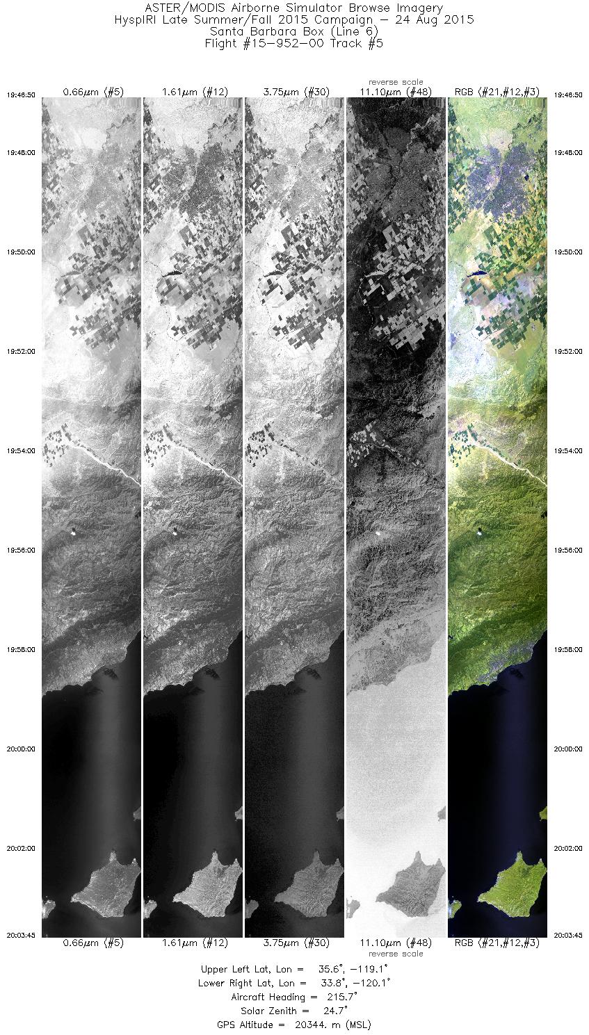
| 5 |
19:46 - 20:03 |
215.1 |
35.532 - 33.898 |
118.925 - 120.240 |
6048 |
20352 |
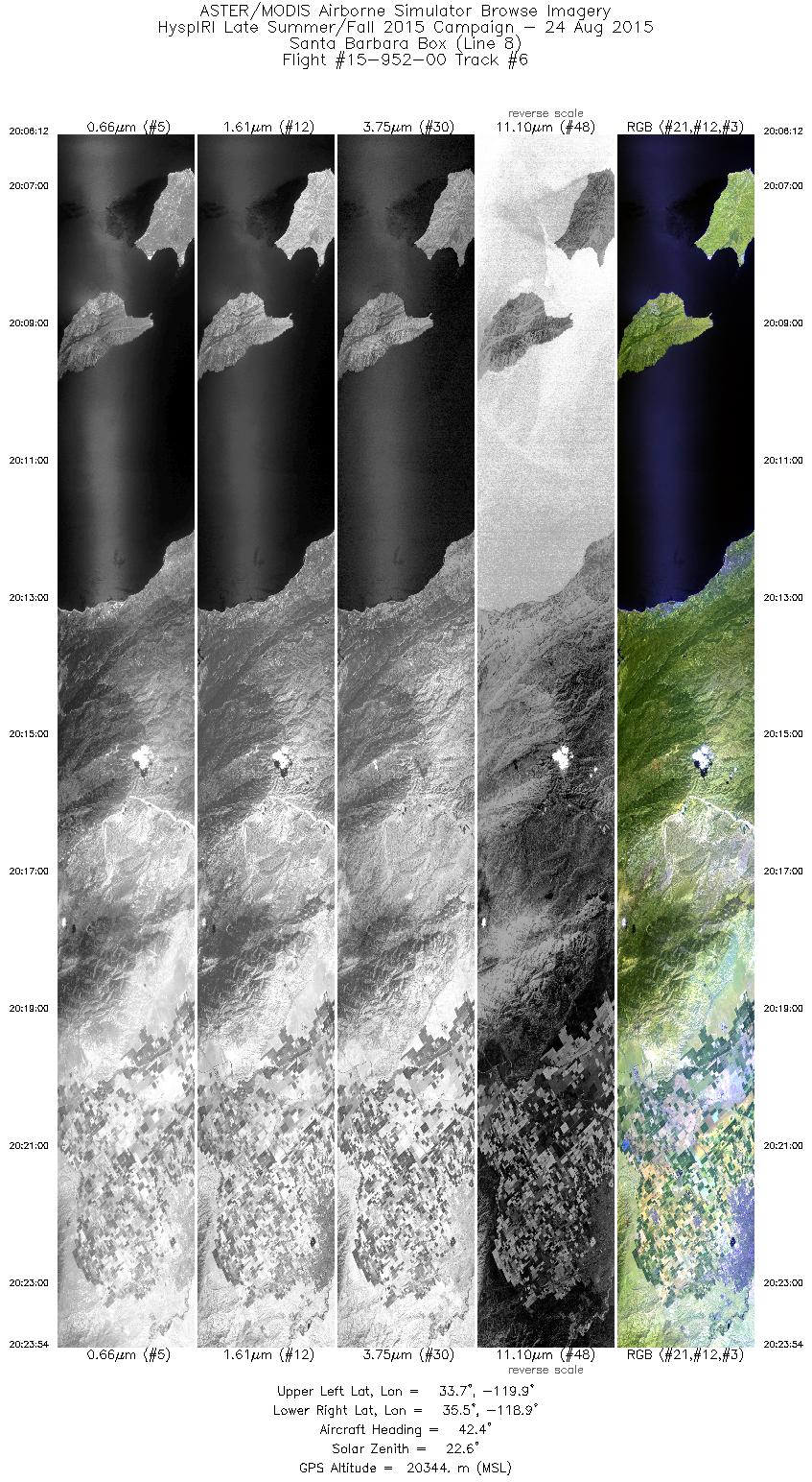
| 6 |
20:06 - 20:23 |
40.3 |
33.791 - 35.419 |
120.078 - 118.755 |
6323 |
20348 |
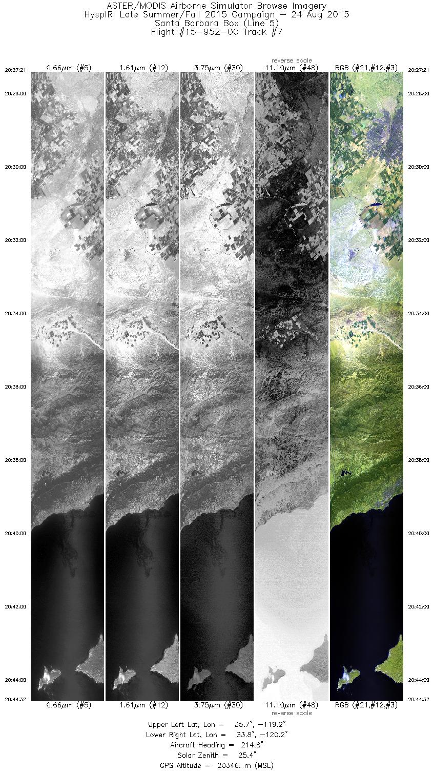
| 7 |
20:27 - 20:44 |
214.3 |
35.581 - 33.934 |
119.008 - 120.339 |
6143 |
20351 |
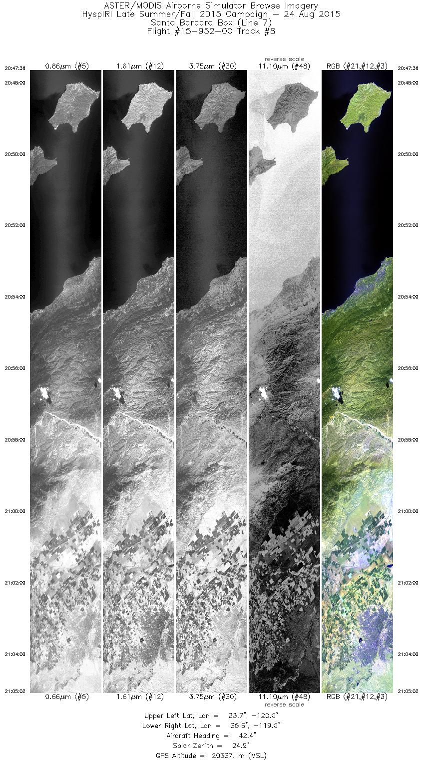
| 8 |
20:47 - 21:05 |
40.2 |
33.857 - 35.465 |
120.146 - 118.847 |
6233 |
20334 |
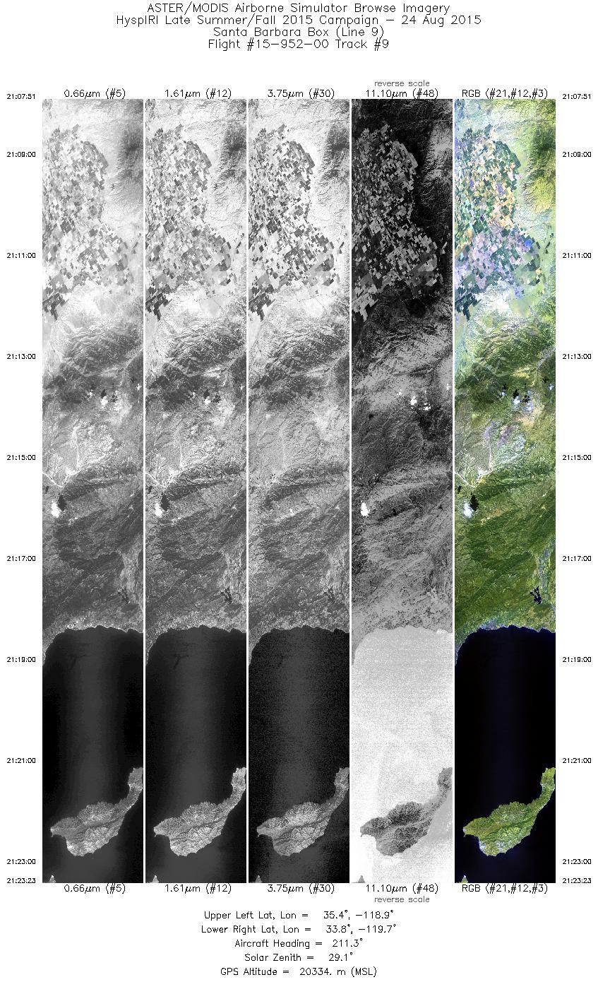
| 9 |
21:07 - 21:23 |
212.6 |
35.363 - 33.900 |
118.674 - 119.861 |
5554 |
20331 |
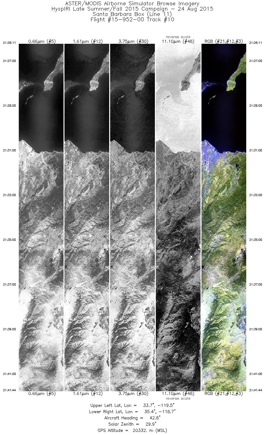
| 10 |
21:26 - 21:41 |
40.4 |
33.833 - 35.267 |
119.667 - 118.499 |
5559 |
20330 |
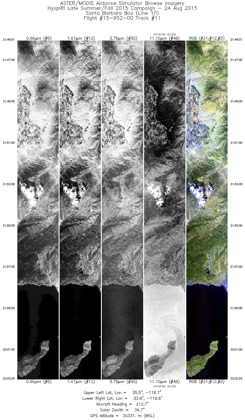
| 11 |
21:46 - 22:02 |
213.2 |
35.441 - 33.896 |
118.479 - 119.739 |
5853 |
20337 |
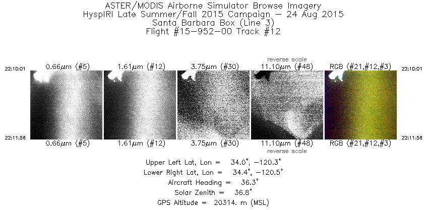
| 12 |
22:10 - 22:11 |
35.6 |
34.095 - 34.271 |
120.464 - 120.327 |
687 |
20318 |
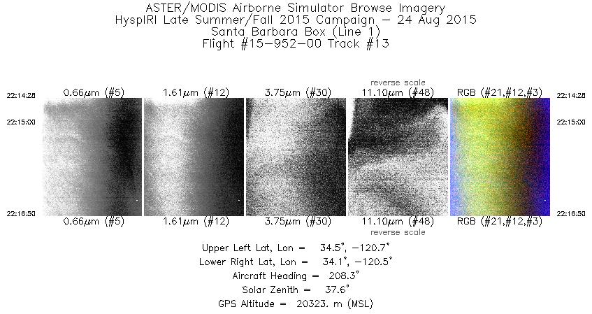
| 13 |
22:14 - 22:16 |
210.0 |
34.377 - 34.144 |
120.511 - 120.688 |
847 |
20338 |
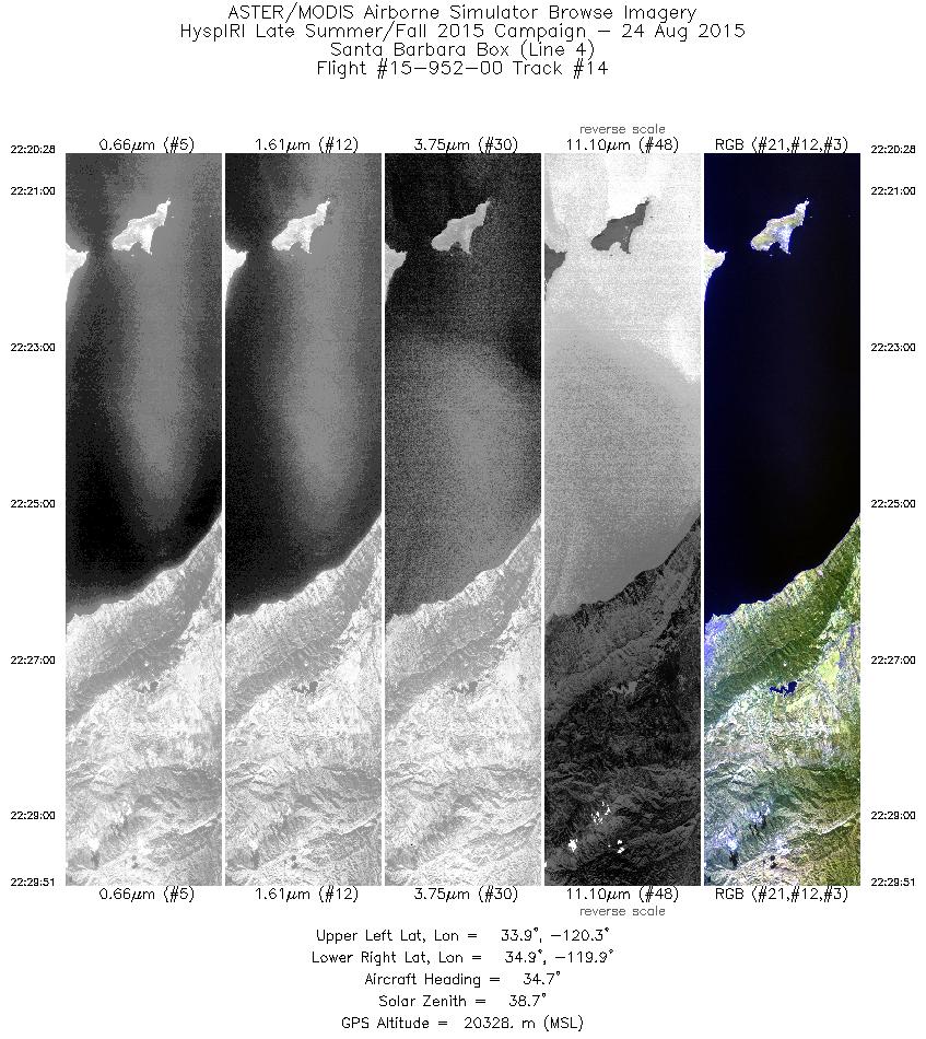
| 14 |
22:20 - 22:29 |
34.6 |
33.955 - 34.817 |
120.452 - 119.764 |
3354 |
20338 |
|


