Flight: 15-943-00
Date: May 28, 2015
Aircraft: NASA ER-2, #809
Flight Number: 15-943-00
Deployment: HyspIRI Summer 2015
Flight Location: Southern California
Principal Investigator: Rob Green / Simon Hook (JPL)
Additional Sensors: AVIRIS
|
Data Evaluation
Overall data quality is good.
All data collected @6.25Hz
|
Processing Information
Level-1B Data in HDF format is available
Flight Line Summary
Spectral Band Configuration
Spectral Response Function Table
Spectral Response Function (text)
|
Browse Imagery
Flight Tracks: 12
Scanlines: 120472
|
Browse Imagery Table
|
Click a Flight Track number to view a quicklook image
Lat/Lon ranges are for the BEG-END scanline nadir pixels
|
Flight
Track |
Time Span
(UTC) |
Heading
(Deg) |
Lat Range
(Deg N) |
Lon Range
(Deg W) |
Length
(Scanlines) |
Altitude
(Meters) |
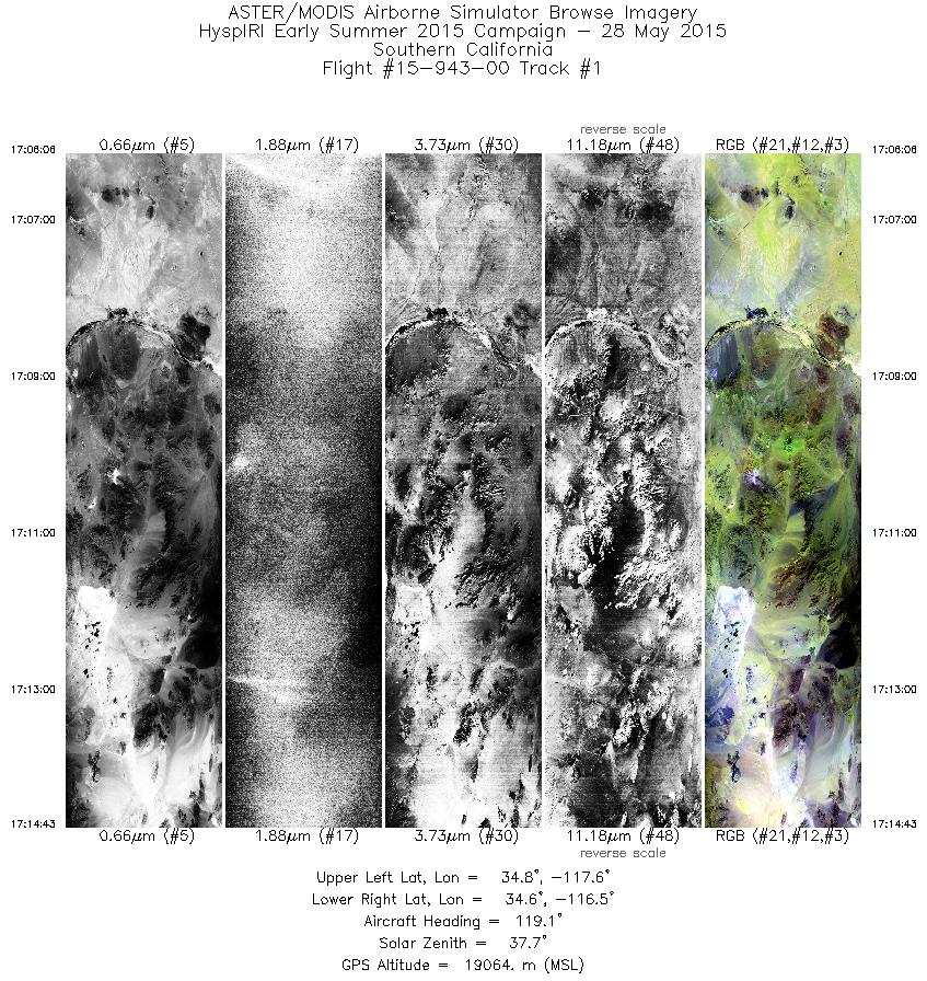
| 1 |
17:06 - 17:14 |
119.0 |
34.900 - 34.416 |
117.564 - 116.564 |
3083 |
18965 |
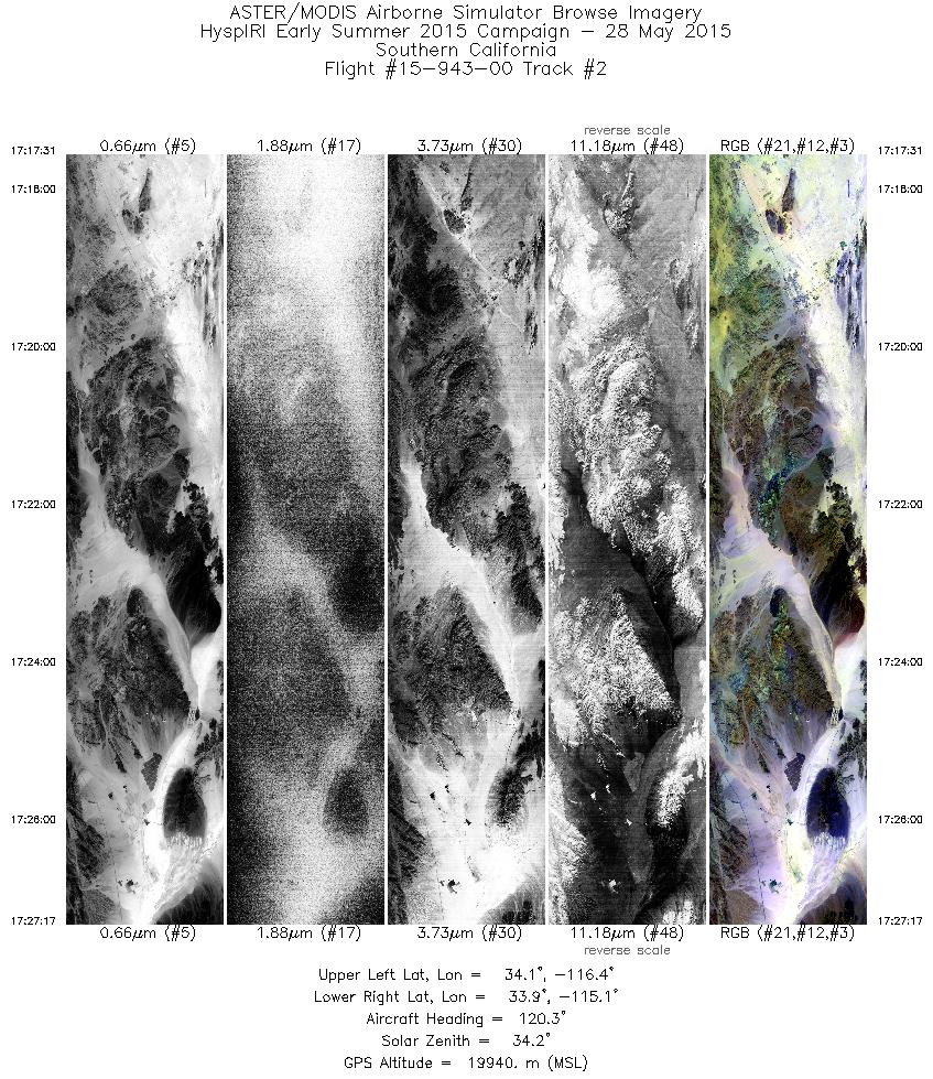
| 2 |
17:17 - 17:27 |
119.5 |
34.224 - 33.705 |
116.276 - 115.180 |
3495 |
19877 |
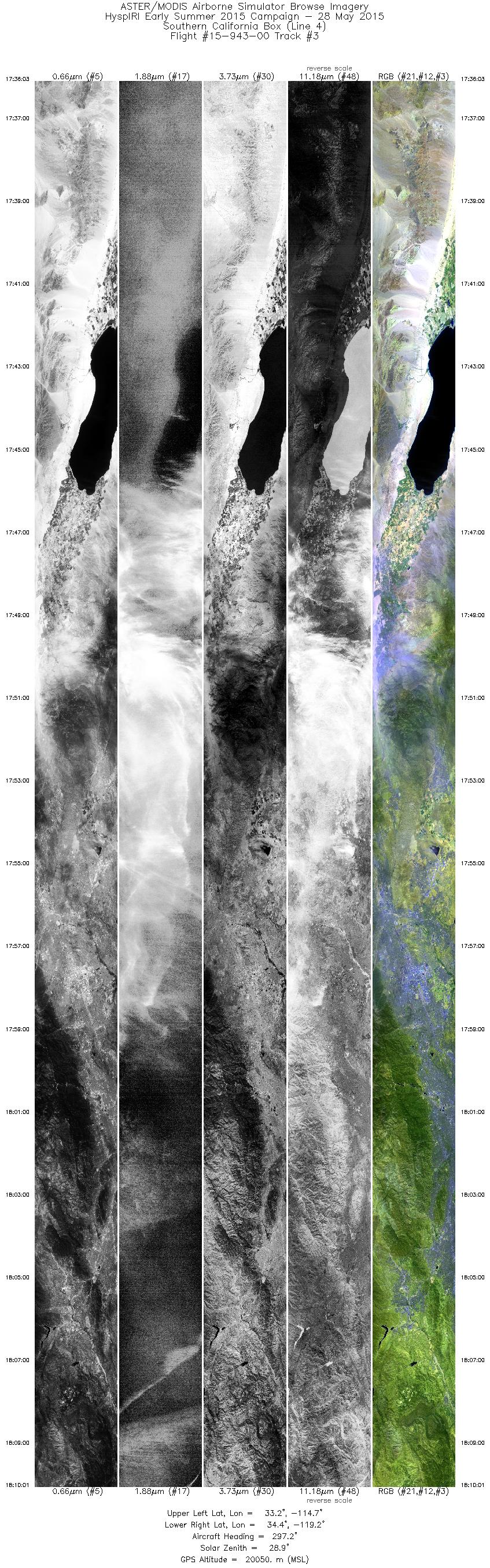
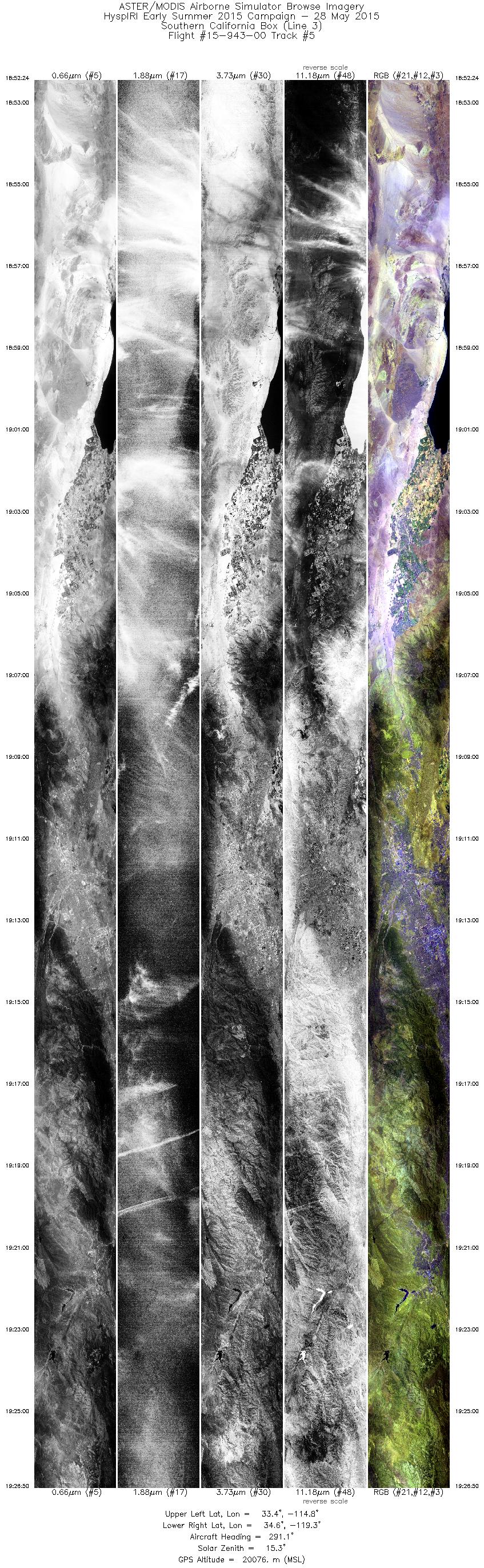
| 3 |
17:36 - 18:10 |
294.8 |
33.070 - 34.601 |
114.794 - 119.141 |
12157 |
19940 |
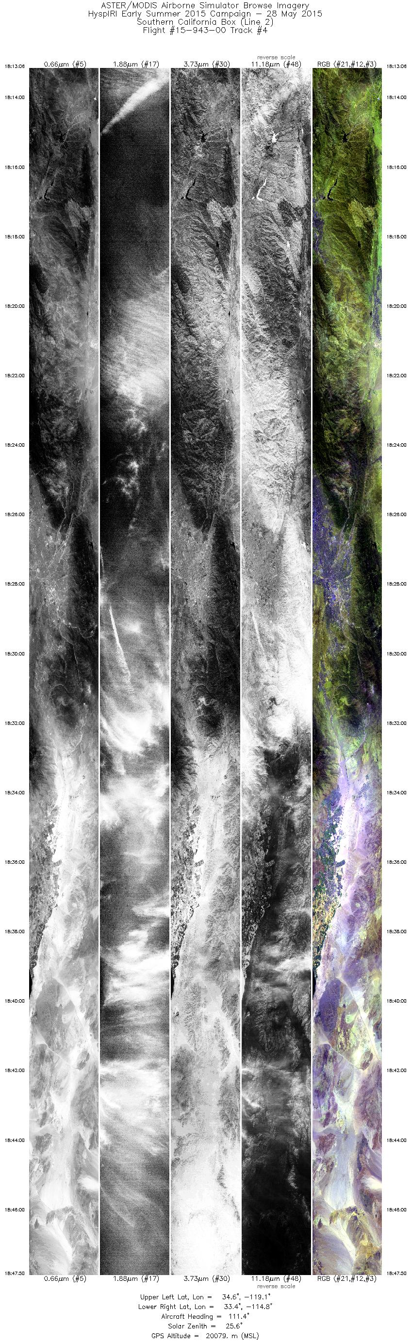
| 4 |
18:13 - 18:47 |
112.5 |
34.743 - 33.287 |
119.011 - 114.871 |
12433 |
20073 |
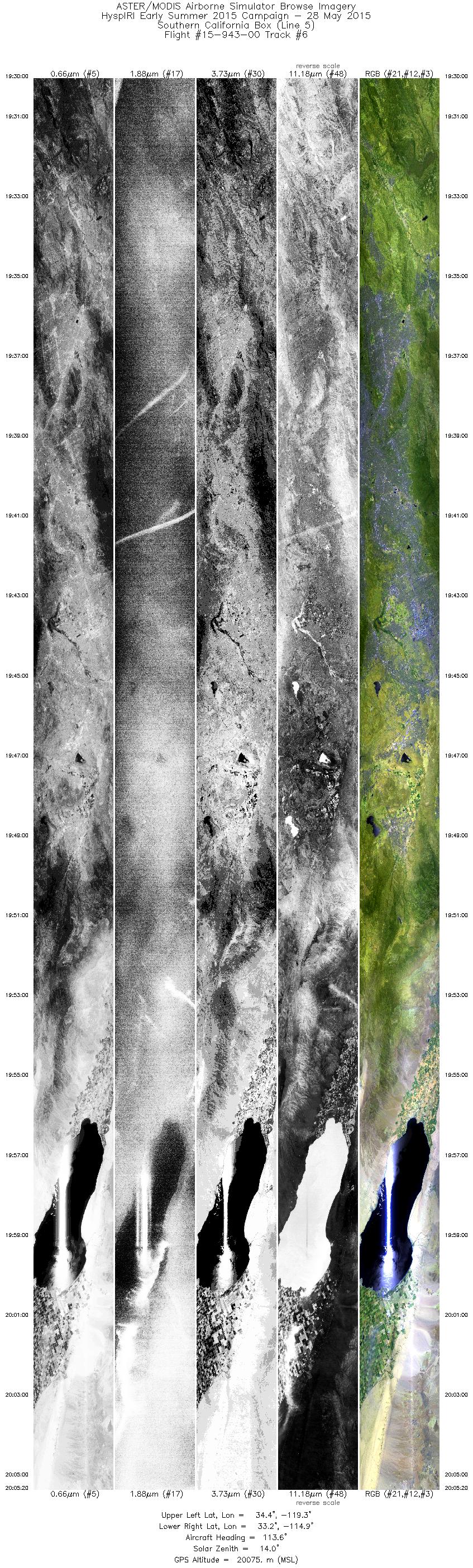
| 5 |
18:52 - 19:26 |
291.7 |
33.199 - 34.725 |
114.888 - 119.229 |
12320 |
20074 |
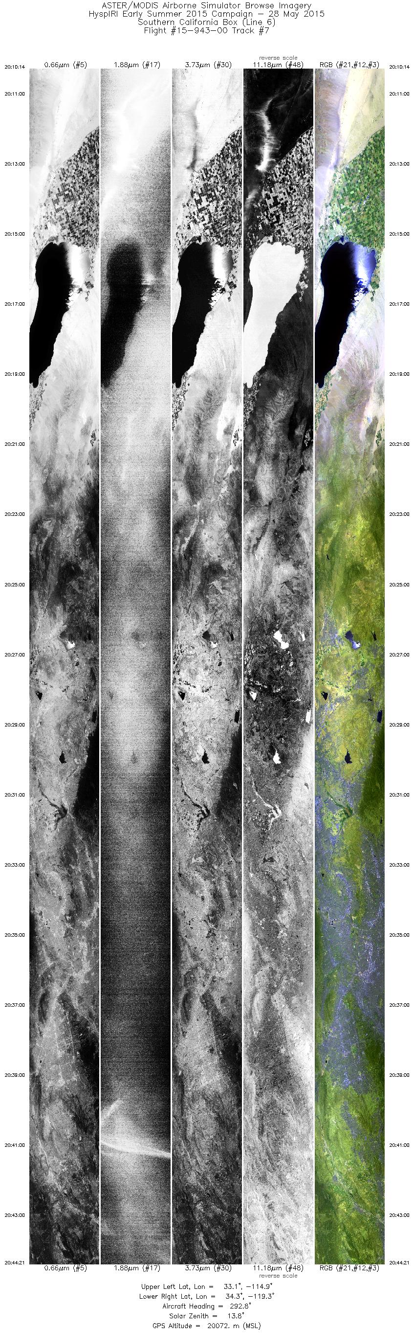
| 6 |
19:29 - 20:05 |
113.4 |
34.531 - 33.043 |
119.218 - 114.987 |
12648 |
20067 |
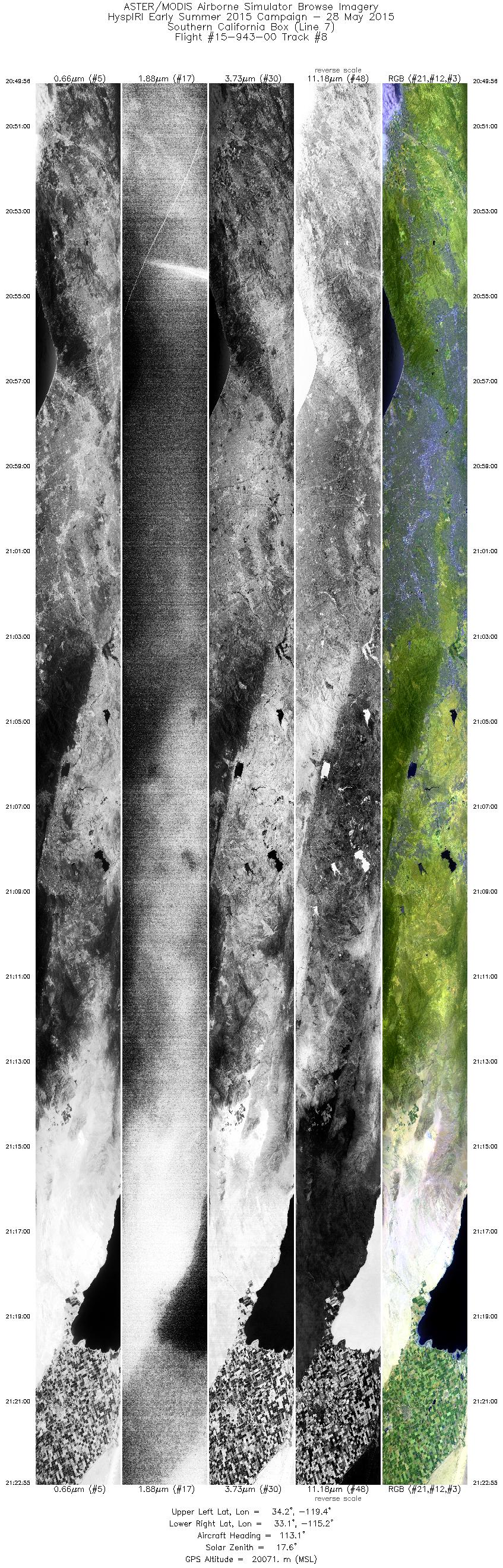
| 7 |
20:10 - 20:44 |
292.3 |
32.956 - 34.449 |
115.017 - 119.258 |
12209 |
20064 |
| 8 |
20:49 - 21:22 |
113.2 |
34.361 - 32.966 |
119.286 - 115.298 |
11797 |
20067 |
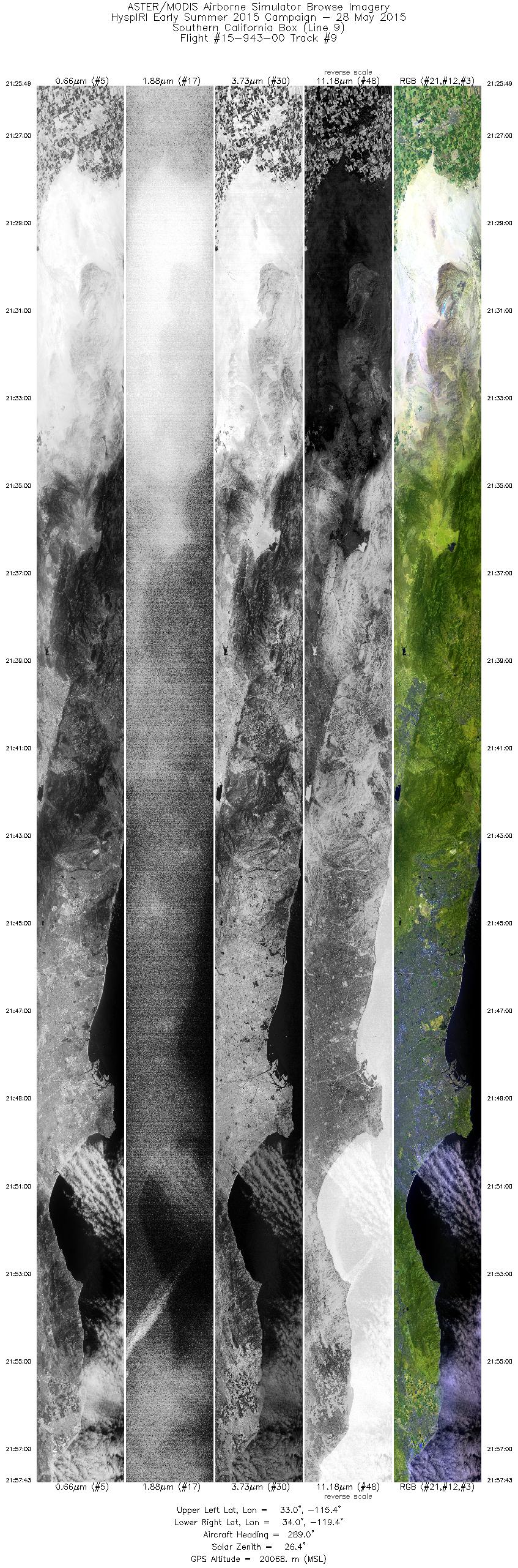
| 9 |
21:25 - 21:57 |
290.5 |
32.803 - 34.201 |
115.447 - 119.375 |
11411 |
20059 |
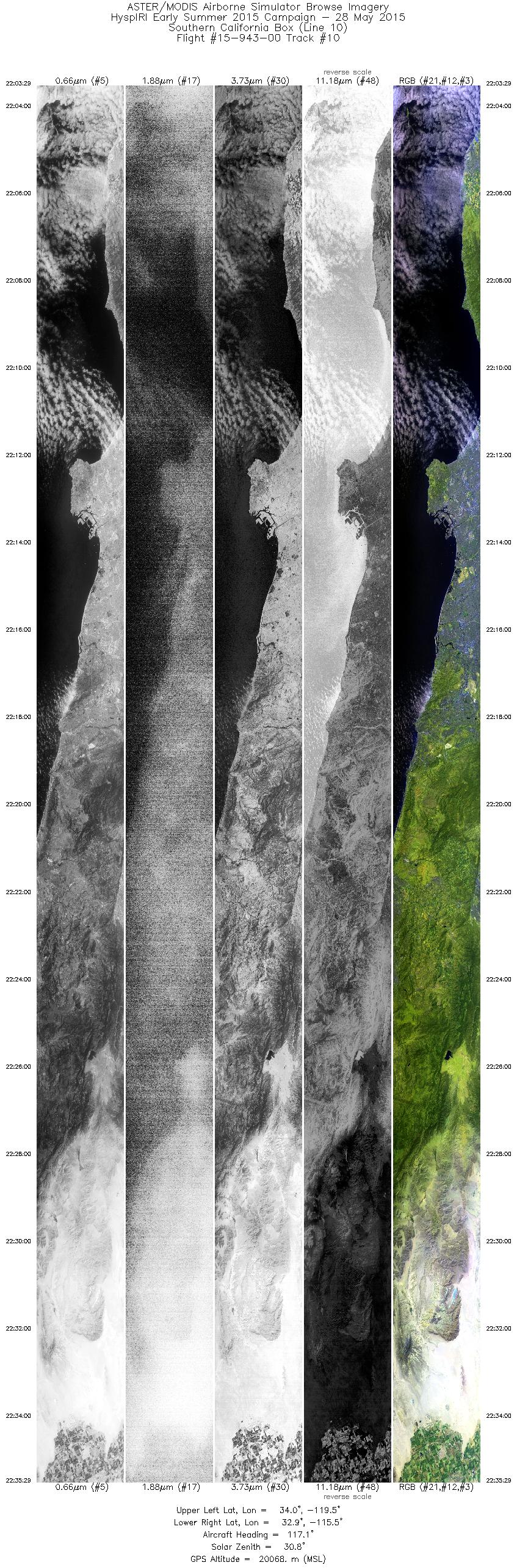
| 10 |
22:03 - 22:35 |
115.9 |
34.128 - 32.781 |
119.456 - 115.595 |
11447 |
20064 |
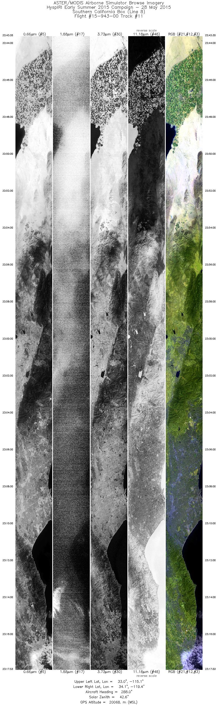
| 11 |
22:43 - 23:17 |
289.7 |
32.806 - 34.284 |
115.140 - 119.342 |
12271 |
20056 |
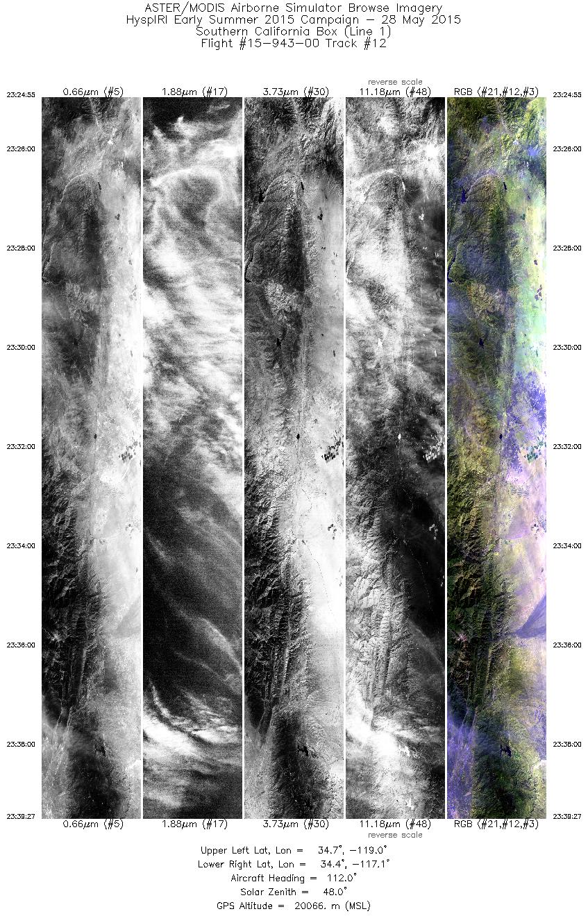
| 12 |
23:24 - 23:39 |
112.5 |
34.826 - 34.213 |
118.978 - 117.165 |
5201 |
20064 |
|


