Flight: 15-936-00
Date: April 29, 2015
Aircraft: NASA ER-2, #809
Flight Number: 15-936-00
Deployment: HyspIRI Spring 2015
Flight Location: Lake Tahoe
Principal Investigator: Rob Green / Simon Hook (JPL)
Additional Sensors: AVIRIS
|
Data Evaluation
Overall data quality is good.
All data collected @6.25Hz
|
Processing Information
Level-1B Data in HDF format is available
Flight Line Summary
Spectral Band Configuration
Spectral Response Function Table
Spectral Response Function (text)
|
Browse Imagery
Flight Tracks: 13
Scanlines: 63328
|
Browse Imagery Table
|
Click a Flight Track number to view a quicklook image
Lat/Lon ranges are for the BEG-END scanline nadir pixels
|
Flight
Track |
Time Span
(UTC) |
Heading
(Deg) |
Lat Range
(Deg N) |
Lon Range
(Deg W) |
Length
(Scanlines) |
Altitude
(Meters) |
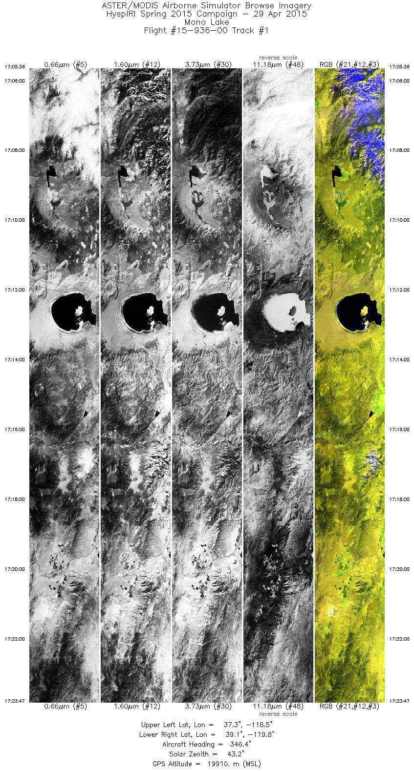
| 1 |
17:05 - 17:23 |
343.2 |
37.265 - 39.185 |
118.695 - 119.579 |
6495 |
19621 |
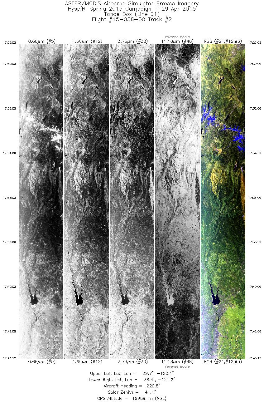
| 2 |
17:29 - 17:43 |
220.6 |
39.596 - 38.478 |
119.958 - 121.353 |
5059 |
19974 |
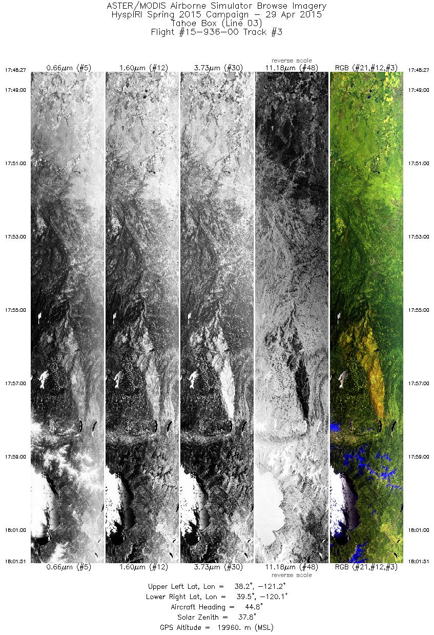
| 3 |
17:48 - 18:01 |
44.5 |
38.269 - 39.341 |
121.314 - 119.976 |
4793 |
19960 |
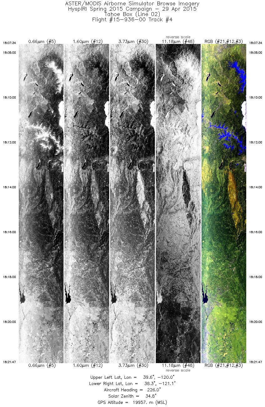
| 4 |
18:07 - 18:21 |
223.3 |
39.525 - 38.401 |
119.890 - 121.295 |
5087 |
19949 |
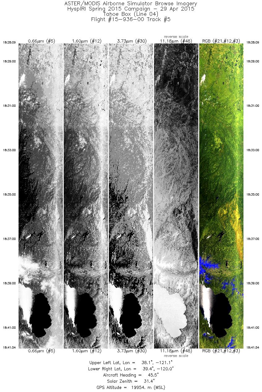
| 5 |
18:28 - 18:41 |
44.9 |
38.184 - 39.282 |
121.262 - 119.898 |
4918 |
19957 |
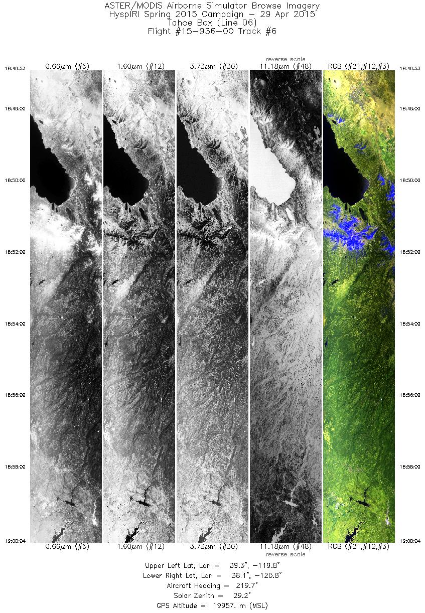
| 6 |
18:46 - 19:00 |
220.1 |
39.224 - 38.186 |
119.672 - 120.971 |
4713 |
19946 |
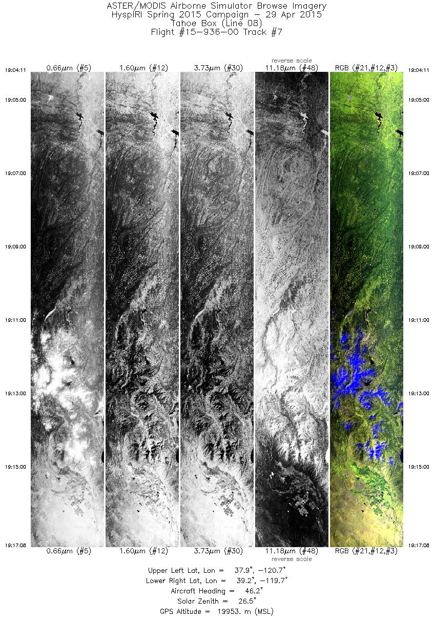
| 7 |
19:04 - 19:17 |
45.2 |
38.025 - 39.051 |
120.881 - 119.596 |
4633 |
19935 |
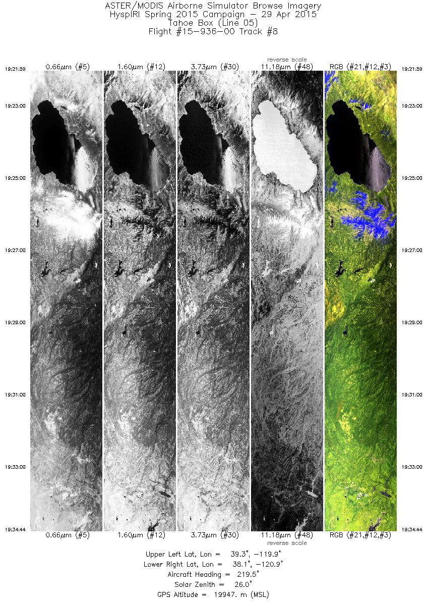
| 8 |
19:21 - 19:34 |
220.1 |
39.248 - 38.246 |
119.791 - 121.042 |
4560 |
19966 |
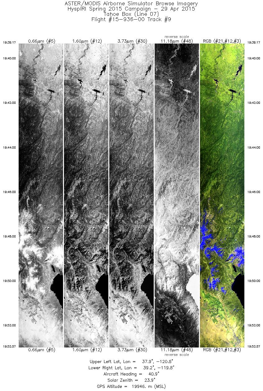
| 9 |
19:39 - 19:52 |
42.7 |
38.043 - 39.128 |
120.997 - 119.643 |
4890 |
19943 |
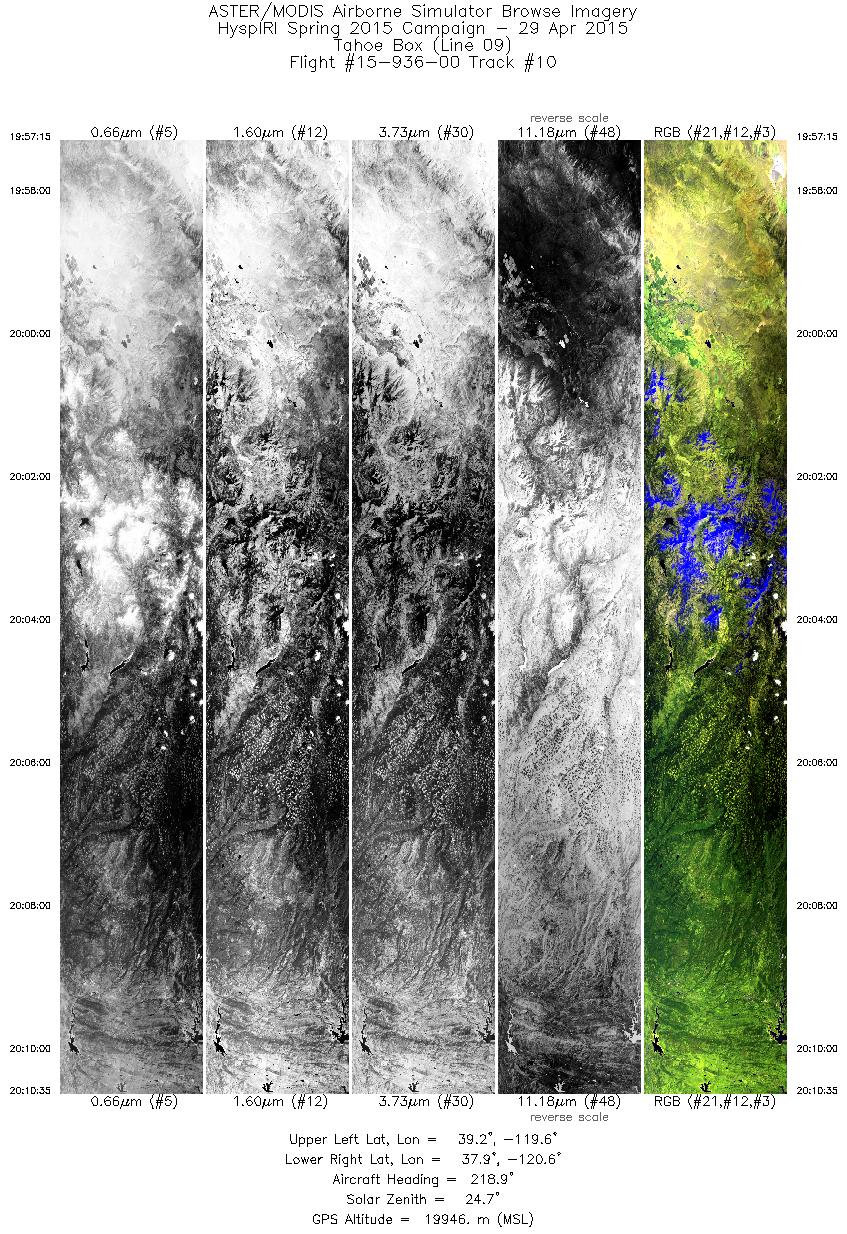
| 10 |
19:57 - 20:10 |
219.8 |
39.056 - 38.013 |
119.441 - 120.747 |
4772 |
19936 |
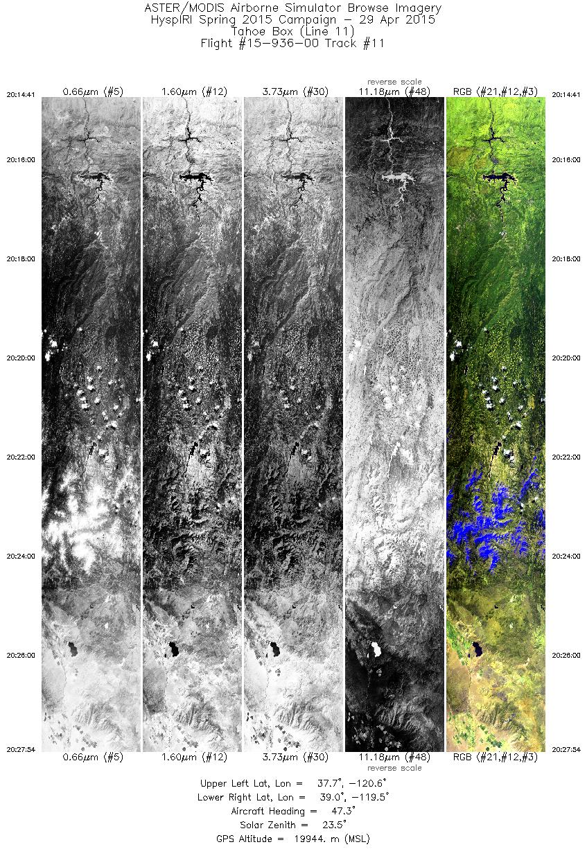
| 11 |
20:14 - 20:27 |
46.0 |
37.839 - 38.879 |
120.677 - 119.369 |
4728 |
19933 |
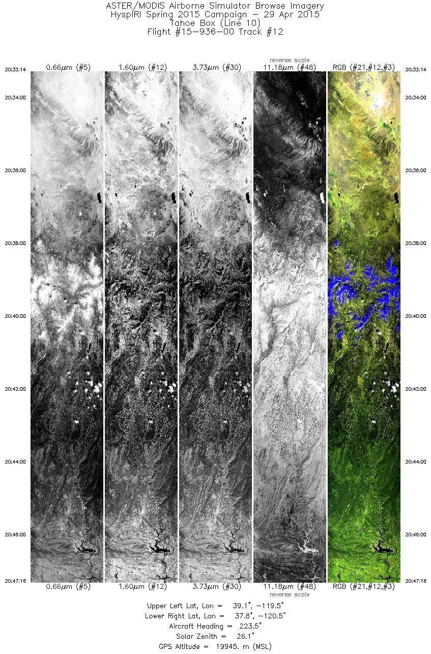
| 12 |
20:33 - 20:47 |
224.0 |
39.035 - 37.950 |
119.315 - 120.680 |
5021 |
19942 |
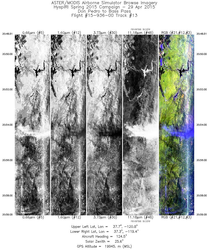
| 13 |
20:48 - 20:59 |
123.7 |
37.814 - 37.210 |
120.642 - 119.529 |
3659 |
19948 |
|


