Flight: 15-817-34
Date: June 24, 2015
Aircraft: NASA DC-8, #817
Flight Number: 15-817-34
Deployment: SARP 2015
Flight Location: Sierra Nevada Mts. (NEON Sites)
Principal Investigator: Ustin (UCD)
Additional Sensors: DMS / AVOCET / WAS / O3 / CO / UHSAS / CIMS / POLAR
|
Data Evaluation
Overall data quality is good.
All data collected @25Hz
|
Processing Information
Level-1B Data in HDF format is available
Flight Line Summary
Spectral Band Configuration
Spectral Response Function Table
Spectral Response Function (text)
|
Browse Imagery
Flight Tracks: 13
Scanlines: 43454
|
Browse Imagery Table
|
Click a Flight Track number to view a quicklook image
Lat/Lon ranges are for the BEG-END scanline nadir pixels
|
Flight
Track |
Time Span
(UTC) |
Heading
(Deg) |
Lat Range
(Deg N) |
Lon Range
(Deg W) |
Length
(Scanlines) |
Altitude
(Meters) |
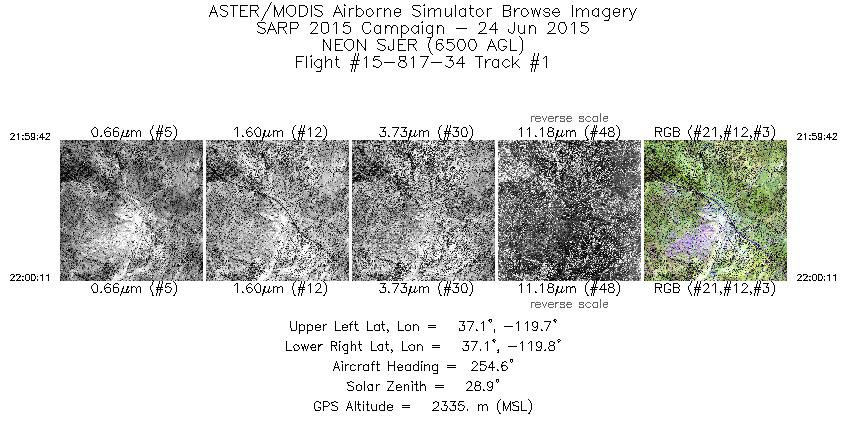
| 1 |
21:59 - 22:00 |
252.6 |
37.105 - 37.095 |
119.729 - 119.767 |
707 |
2347 |
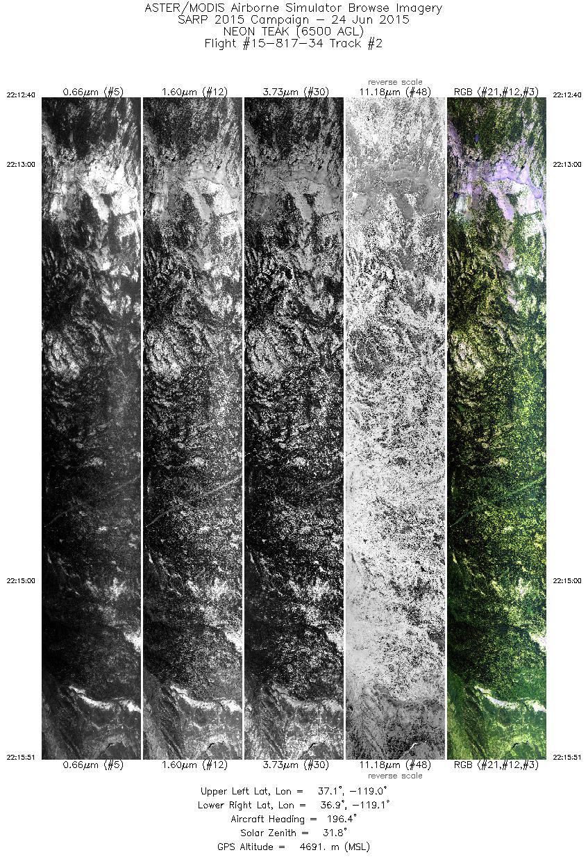
| 2 |
22:12 - 22:15 |
198.8 |
37.124 - 36.907 |
119.024 - 119.104 |
4766 |
4732 |
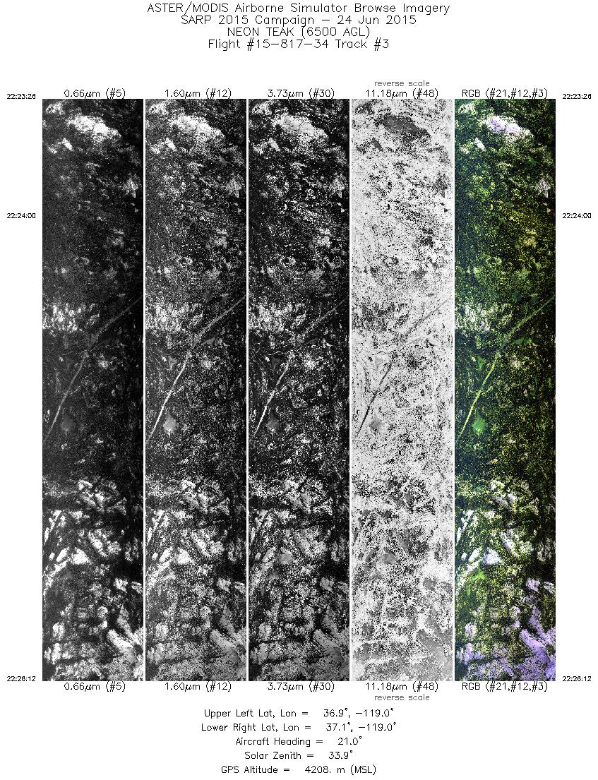
| 3 |
22:23 - 22:26 |
21.3 |
36.932 - 37.089 |
119.067 - 119.001 |
4126 |
4233 |
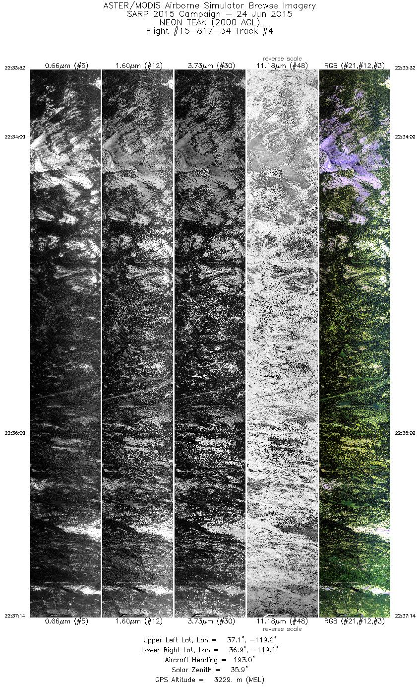
| 4 |
22:33 - 22:37 |
194.6 |
37.126 - 36.906 |
119.004 - 119.085 |
5522 |
3090 |
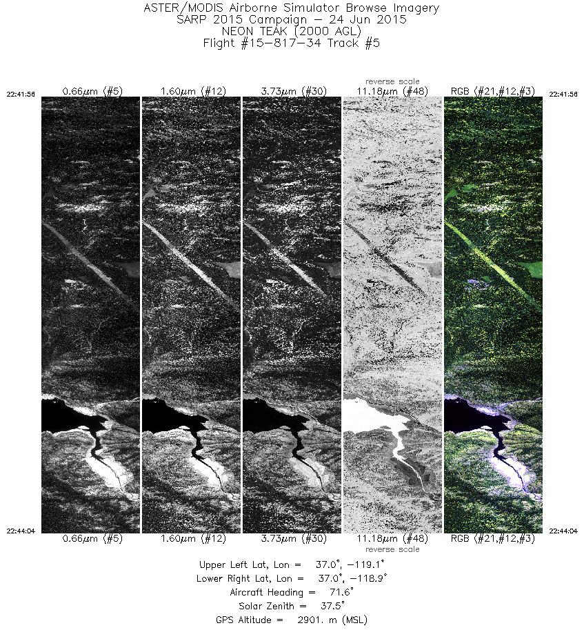
| 5 |
22:41 - 22:44 |
71.0 |
36.995 - 37.035 |
119.079 - 118.930 |
3169 |
2955 |
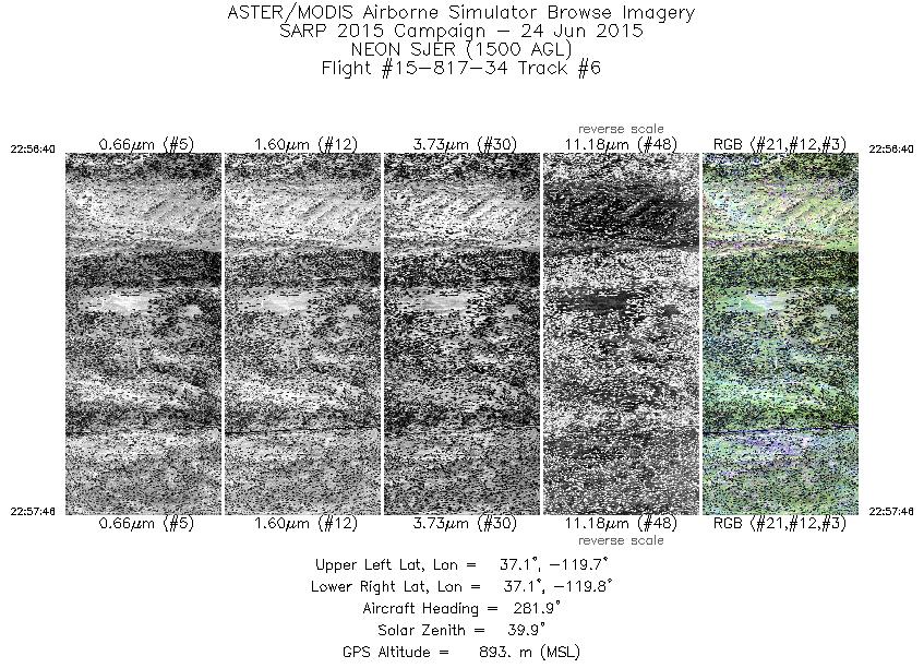
| 6 |
22:56 - 22:57 |
284.2 |
37.100 - 37.113 |
119.694 - 119.760 |
1660 |
912 |
| 7 |
23:04 - 23:05 |
89.4 |
37.106 - 37.109 |
119.751 - 119.704 |
943 |
970 |
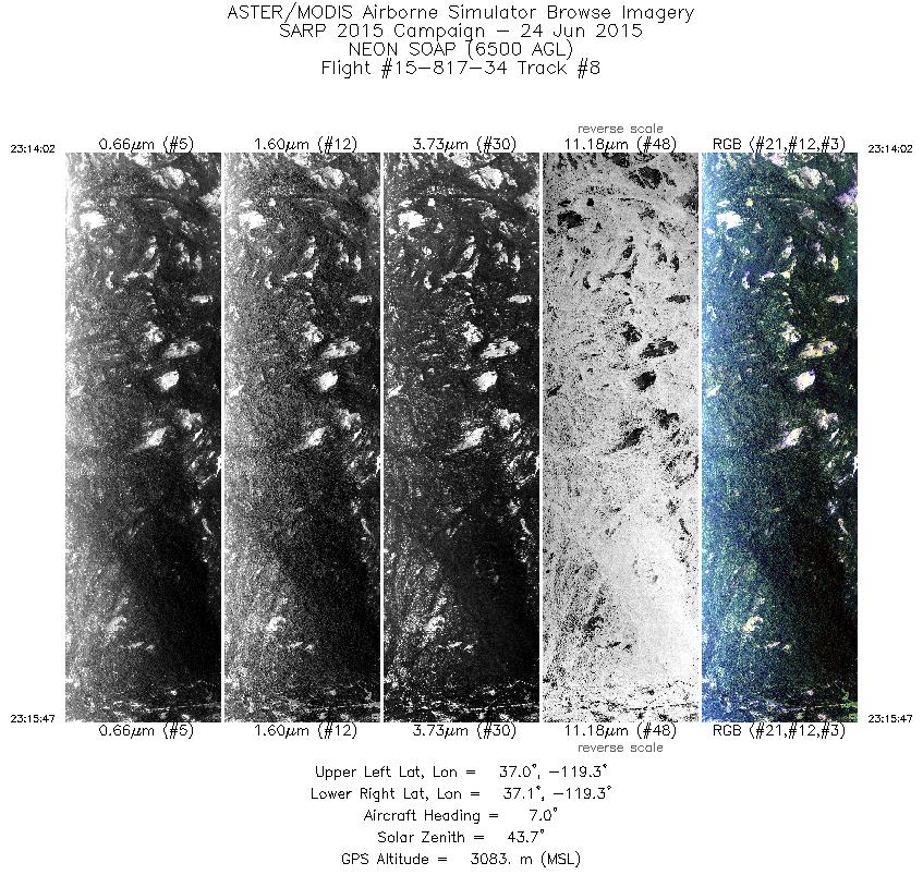
| 8 |
23:14 - 23:15 |
7.2 |
36.995 - 37.100 |
119.281 - 119.267 |
2615 |
3041 |
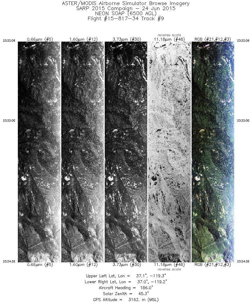
| 9 |
23:22 - 23:24 |
186.8 |
37.093 - 36.954 |
119.244 - 119.261 |
3718 |
3176 |
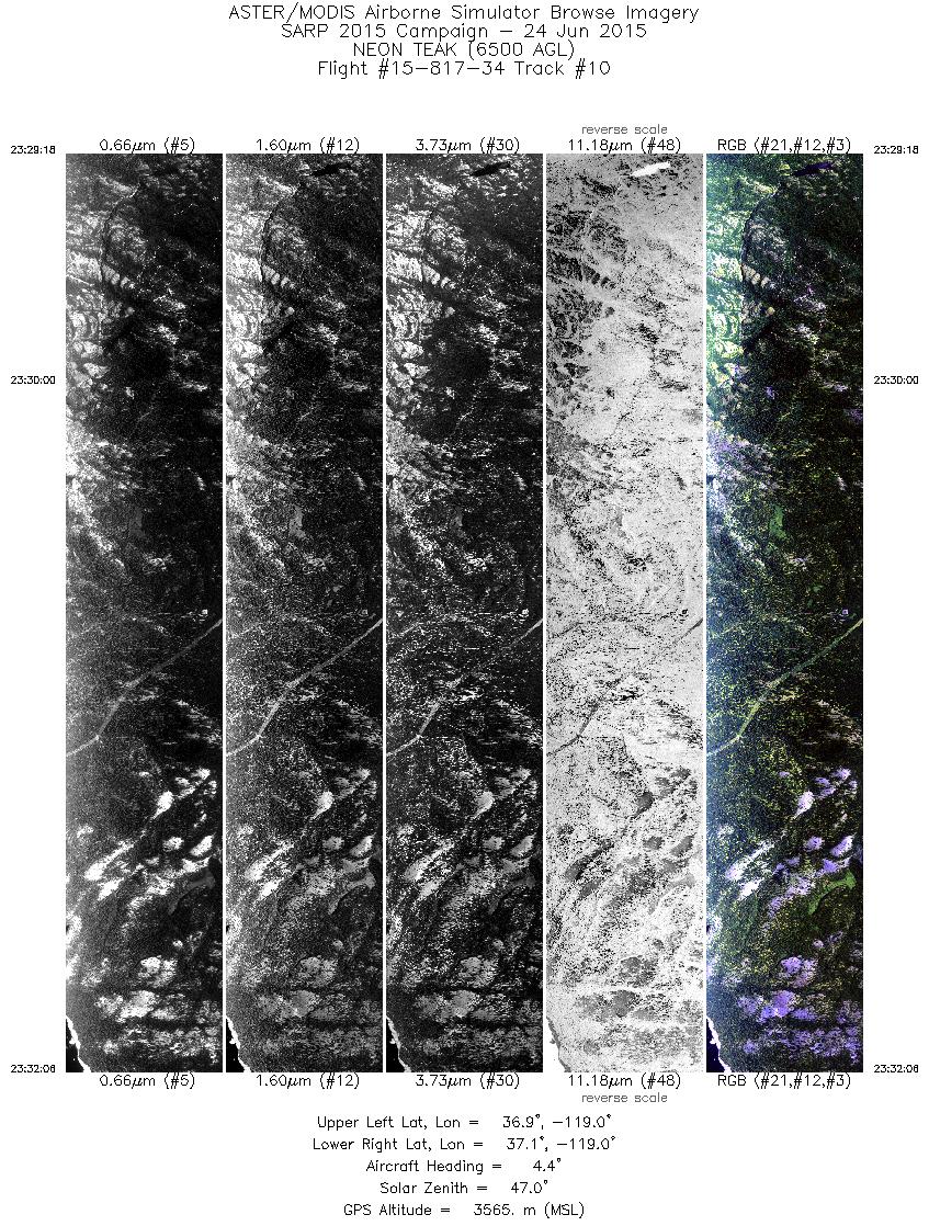
| 10 |
23:29 - 23:32 |
6.4 |
36.918 - 37.089 |
119.013 - 118.993 |
4190 |
3585 |
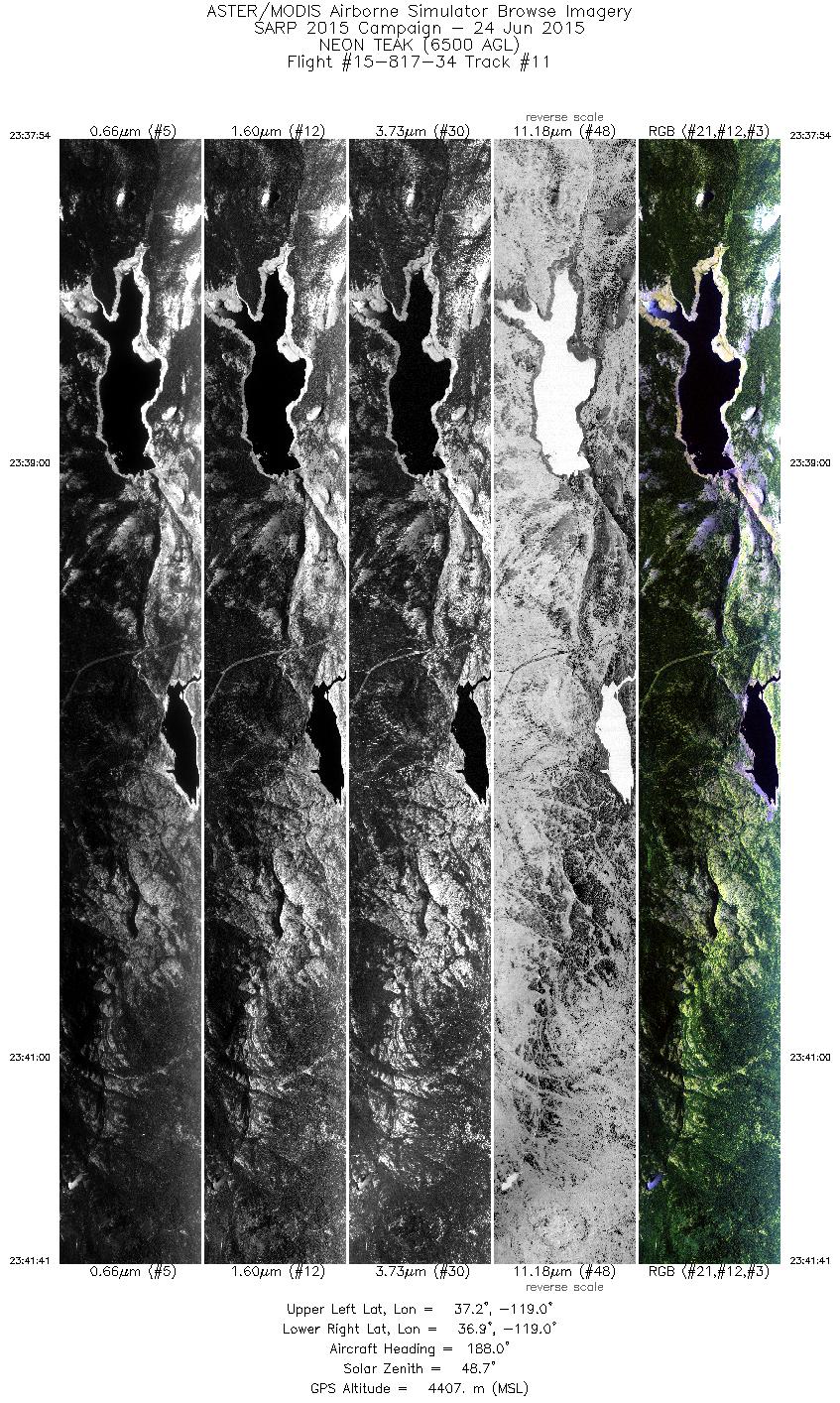
| 11 |
23:37 - 23:41 |
186.4 |
37.152 - 36.902 |
118.968 - 118.998 |
5674 |
4405 |
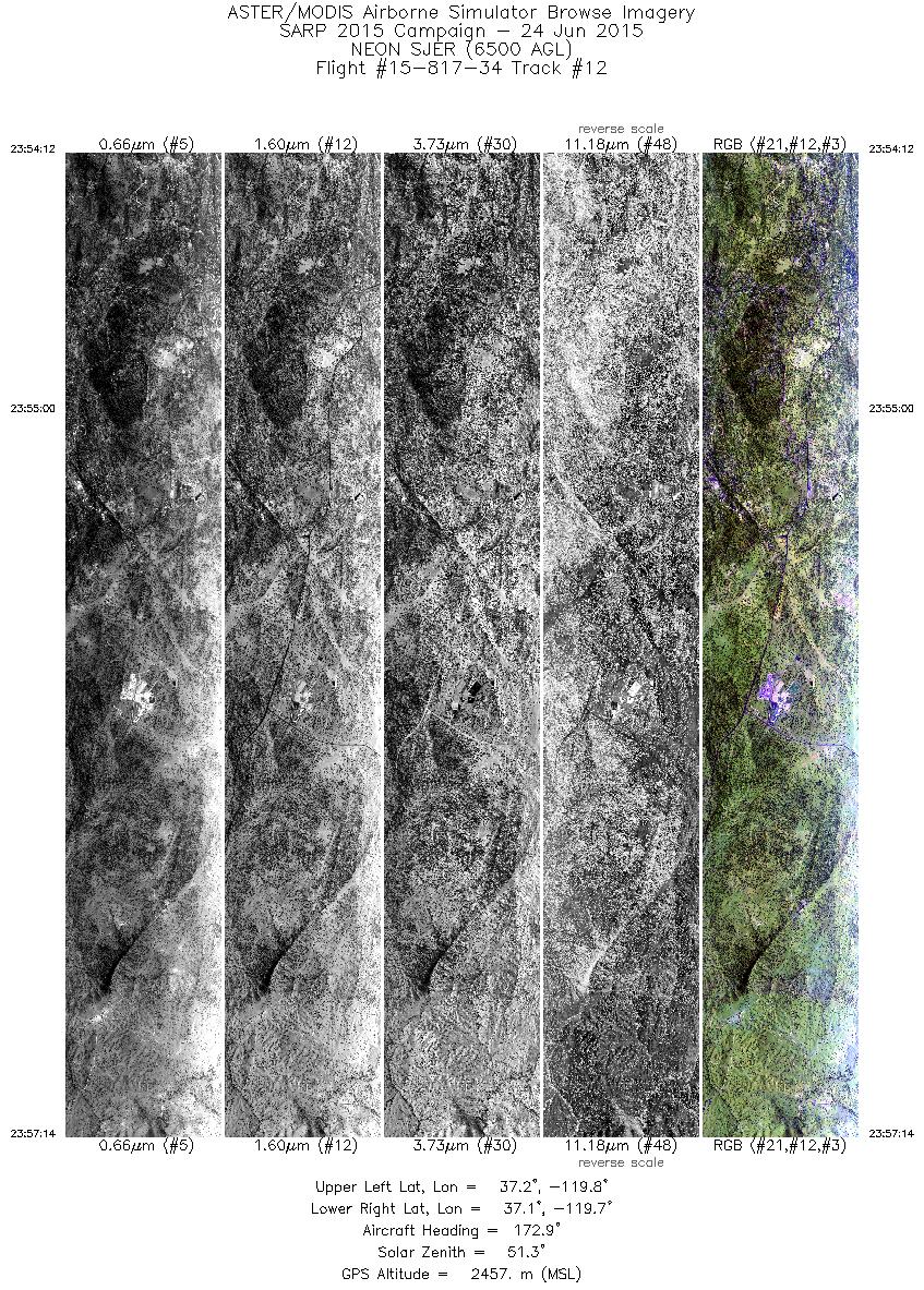
| 12 |
23:54 - 23:57 |
173.9 |
37.226 - 37.049 |
119.742 - 119.722 |
4517 |
2647 |
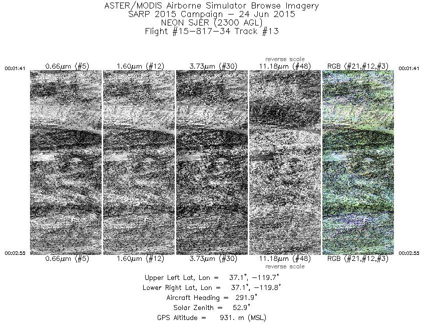
| 13 |
00:01 - 00:02 |
290.5 |
37.093 - 37.114 |
119.690 - 119.762 |
1847 |
933 |
|


