Flight: 14-637-00
Date: April 28, 2014
Aircraft: NASA ER-2, #806
Deployment: HyspIRI Early Spring 2014
Flight Location: San Francisco Bay Area, CA
Principal Investigator: Green / Hook (JPL)
Additional Sensors: AirMSPi / AVIRIS
|
Data Evaluation
Overall data quality is good.
All data collected @6.25Hz
Reprocessed with Revised Navigation Offsets
|
Processing Information
Level-1B Data in HDF format is available
Flight Line Summary
Spectral Band Configuration
Spectral Response Function Table
Spectral Response Function (text)
|
Browse Imagery
Flight Tracks: 13
Scanlines: 101597
|
Browse Imagery Table
|
Click a Flight Track number to view a quicklook image
Lat/Lon ranges are for the BEG-END scanline nadir pixels
|
Flight
Track |
Time Span
(UTC) |
Heading
(Deg) |
Lat Range
(Deg N) |
Lon Range
(Deg W) |
Length
(Scanlines) |
Altitude
(Meters) |
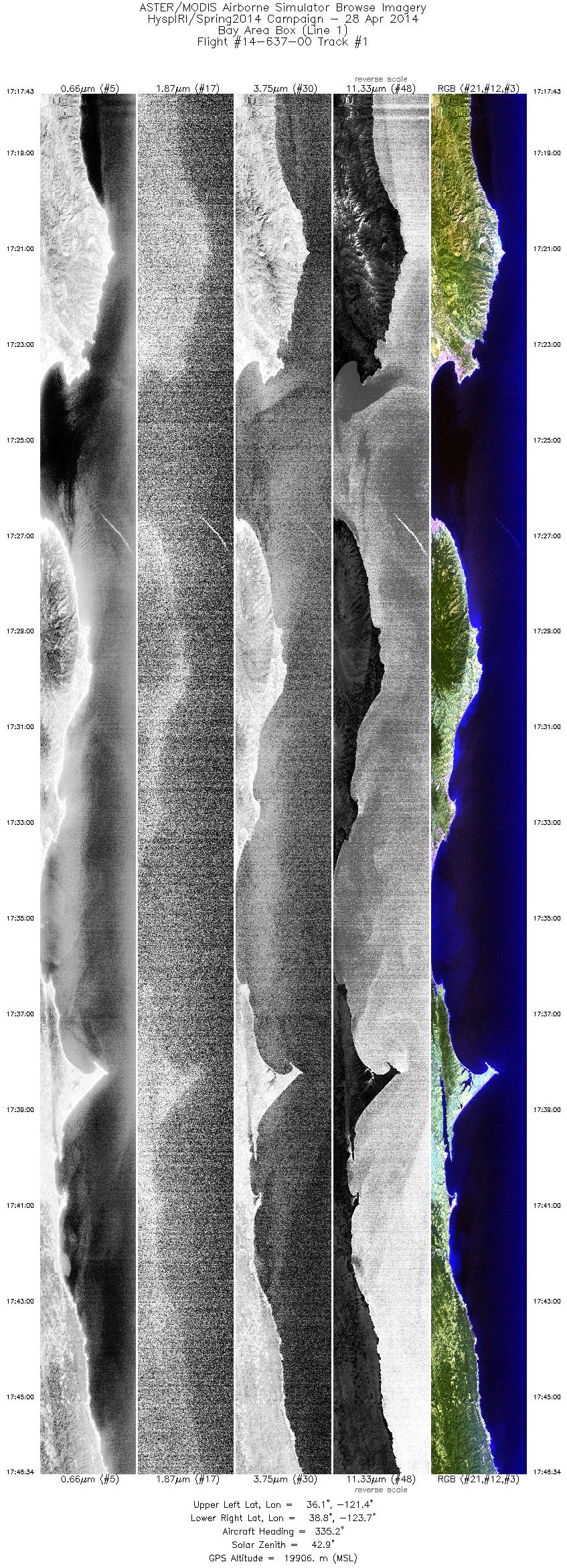
| 1 |
17:17 - 17:46 |
333.1 |
36.021 - 38.840 |
121.605 - 123.541 |
10311 |
19911 |
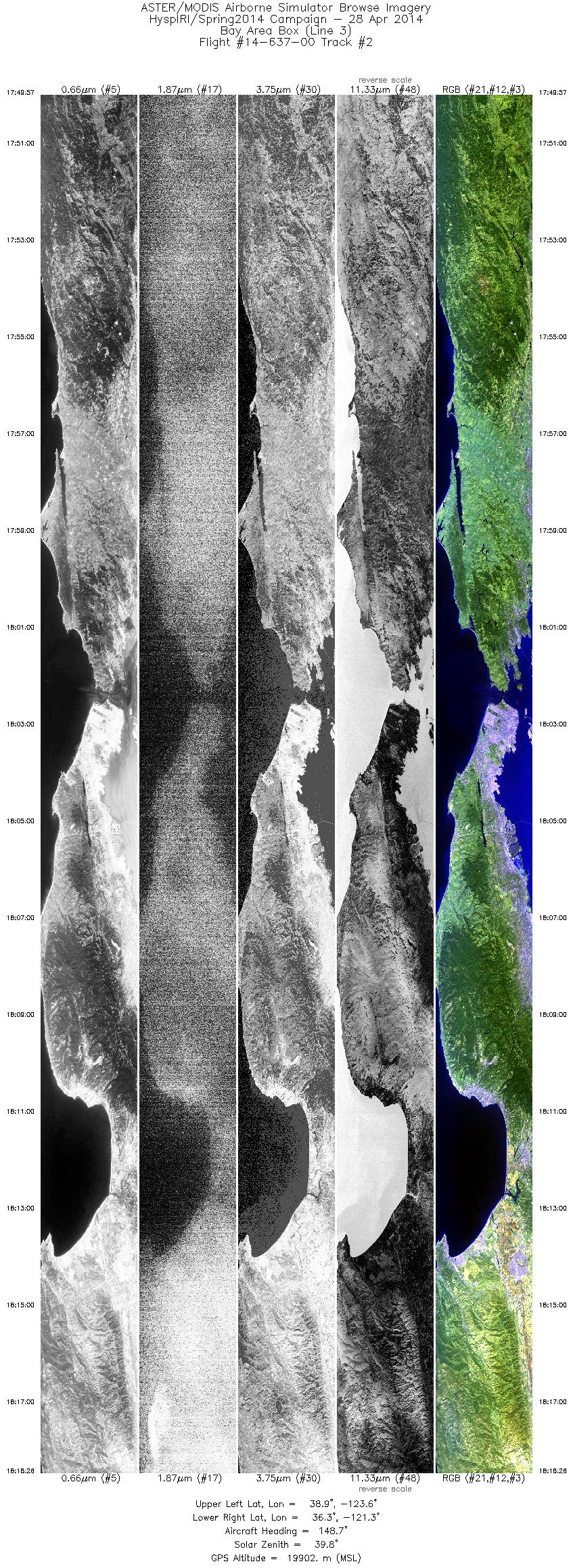
| 2 |
17:49 - 18:18 |
149.8 |
38.999 - 36.209 |
123.389 - 121.475 |
10181 |
19911 |
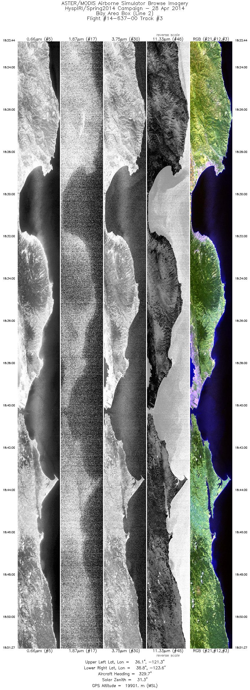
| 3 |
18:22 - 18:51 |
330.3 |
36.032 - 38.847 |
121.484 - 123.409 |
10265 |
19895 |
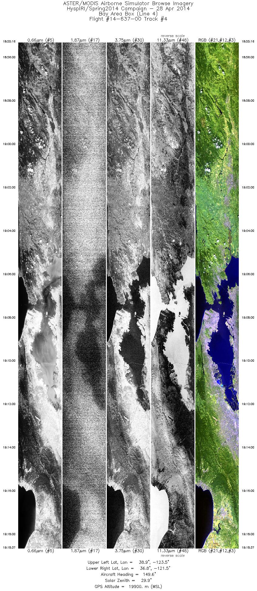
| 4 |
18:55 - 19:18 |
150.3 |
39.024 - 36.735 |
123.265 - 121.697 |
8344 |
19903 |
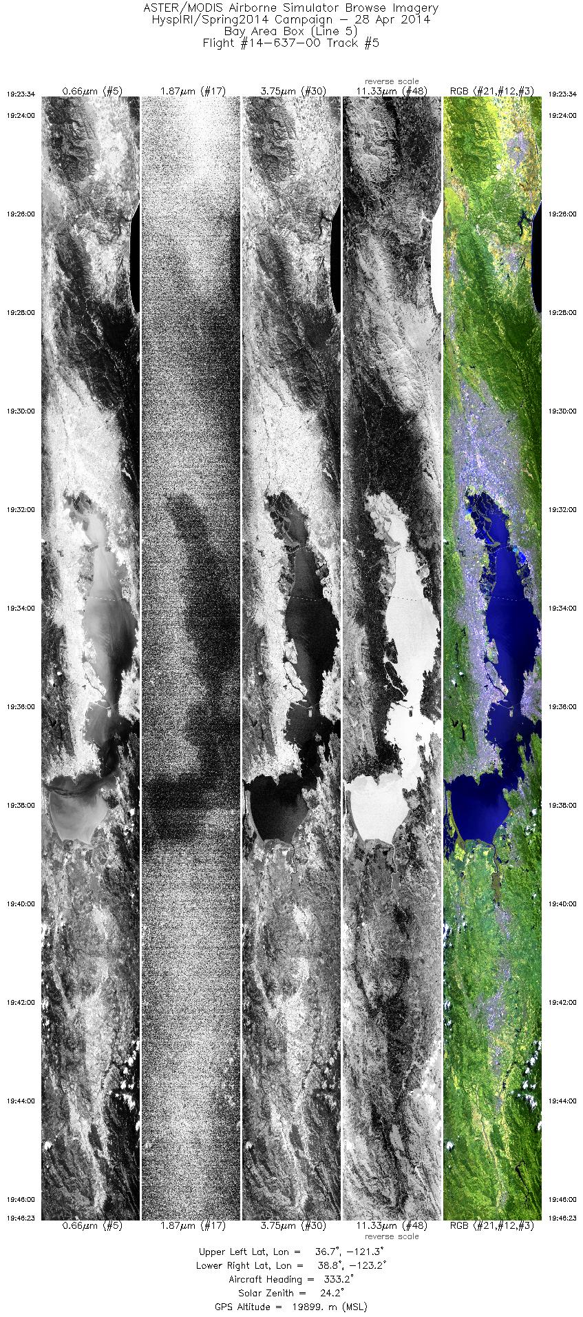
| 5 |
19:23 - 19:46 |
332.1 |
36.616 - 38.857 |
121.490 - 123.014 |
8159 |
19904 |
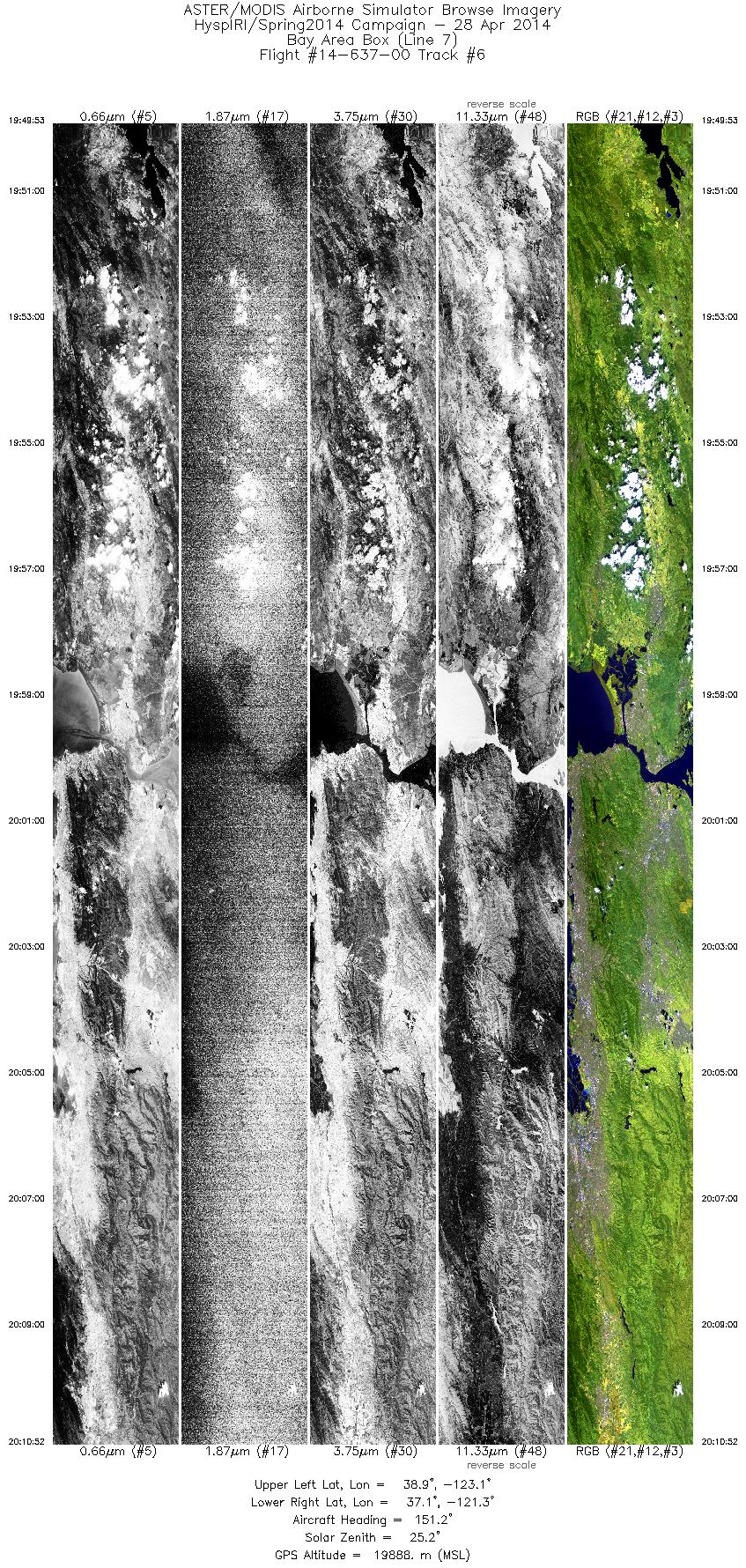
| 6 |
19:49 - 20:10 |
150.6 |
39.031 - 36.978 |
122.867 - 121.467 |
7504 |
19899 |
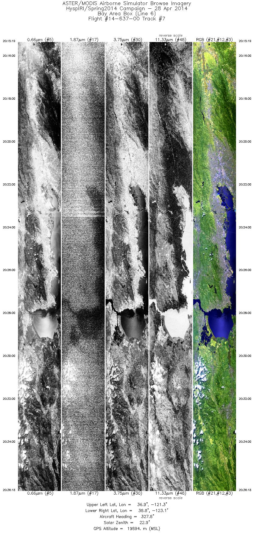
| 7 |
20:15 - 20:36 |
329.5 |
36.794 - 38.859 |
121.474 - 122.884 |
7481 |
19899 |
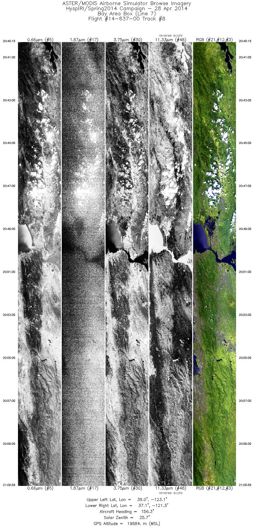
| 8 |
20:40 - 21:00 |
153.4 |
39.019 - 36.984 |
122.863 - 121.473 |
7388 |
19882 |
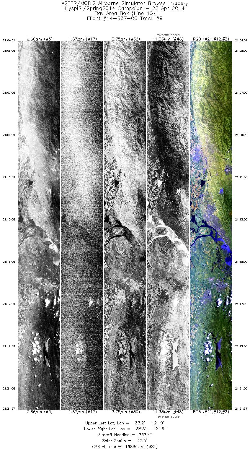
| 9 |
21:04 - 21:21 |
332.0 |
37.154 - 38.872 |
121.196 - 122.362 |
6231 |
19889 |
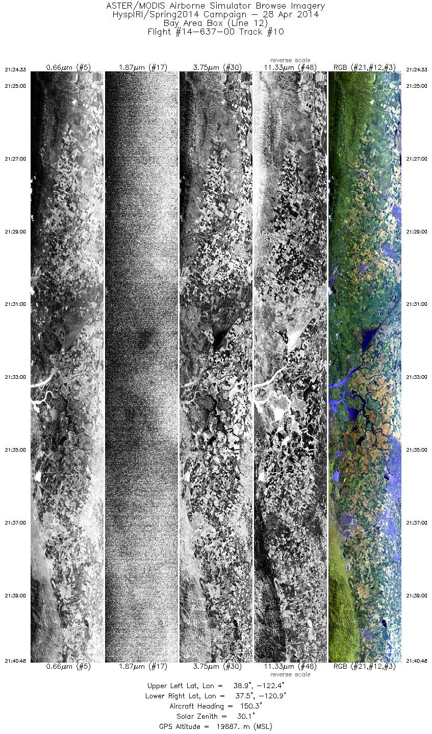
| 10 |
21:24 - 21:40 |
150.7 |
38.988 - 37.386 |
122.179 - 121.100 |
5804 |
19899 |
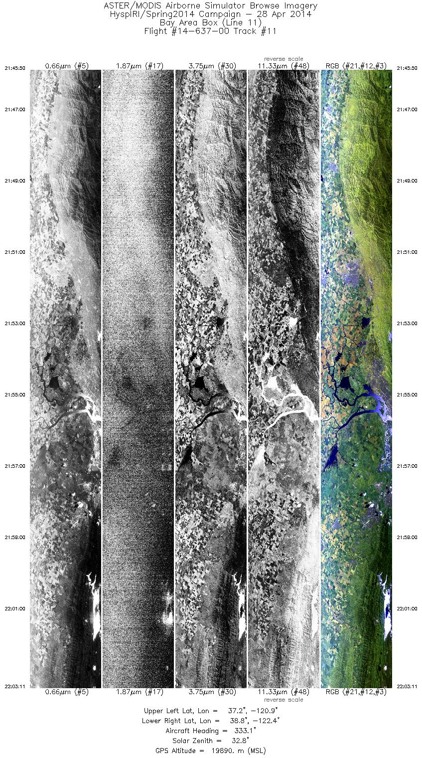
| 11 |
21:45 - 22:03 |
332.2 |
37.156 - 38.870 |
121.082 - 122.231 |
6201 |
19892 |
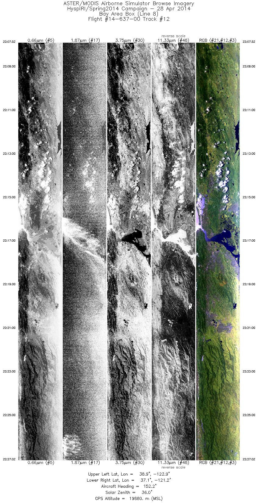
| 12 |
22:07 - 22:27 |
151.6 |
38.947 - 37.063 |
122.681 - 121.396 |
6847 |
19895 |
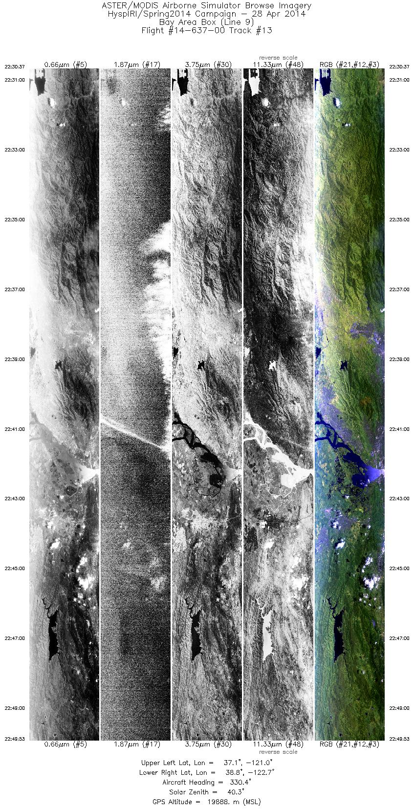
| 13 |
22:30 - 22:49 |
330.4 |
36.974 - 38.869 |
121.209 - 122.491 |
6881 |
19900 |
|


