Flight: 14-630-00
Date: April 07, 2014
Aircraft: NASA ER-2, #806
Deployment: HyspIRI Early Spring 2014
Flight Location: Yosemite N.P. / Rim Fire Scar / Soda Straw
Principal Investigator: Green / Hook (JPL)
Additional Sensors: AVIRIS / RSP
|
Data Evaluation
Overall data quality is good.
All data collected @6.25Hz
Reprocessed with Revised Navigation Offsets
|
Processing Information
Level-1B Data in HDF format is available
Flight Line Summary
Spectral Band Configuration
Spectral Response Function Table
Spectral Response Function (text)
|
Browse Imagery
Flight Tracks: 14
Scanlines: 76106
|
Browse Imagery Table
|
Click a Flight Track number to view a quicklook image
Lat/Lon ranges are for the BEG-END scanline nadir pixels
|
Flight
Track |
Time Span
(UTC) |
Heading
(Deg) |
Lat Range
(Deg N) |
Lon Range
(Deg W) |
Length
(Scanlines) |
Altitude
(Meters) |
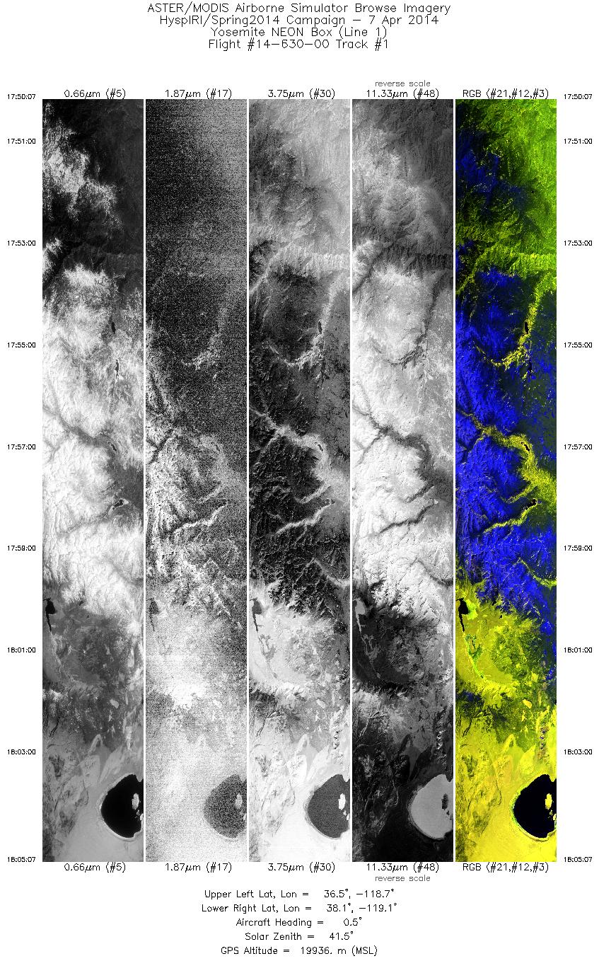
| 1 |
17:50 - 18:05 |
359.5 |
36.538 - 38.125 |
118.910 - 118.887 |
5390 |
19835 |
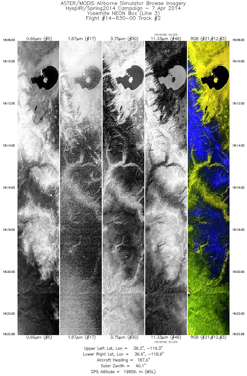
| 2 |
18:08 - 18:22 |
185.3 |
38.209 - 36.640 |
119.085 - 119.105 |
5033 |
19856 |
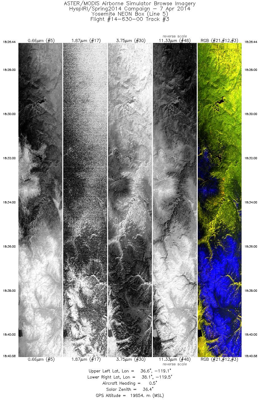
| 3 |
18:26 - 18:40 |
359.5 |
36.570 - 38.112 |
119.300 - 119.287 |
5123 |
19837 |
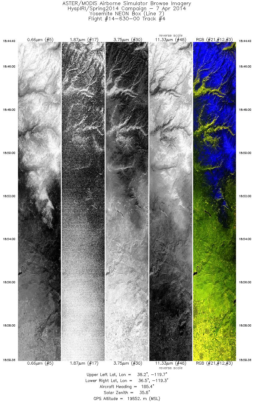
| 4 |
18:44 - 18:59 |
184.3 |
38.187 - 36.546 |
119.491 - 119.503 |
5318 |
19858 |
| 5 |
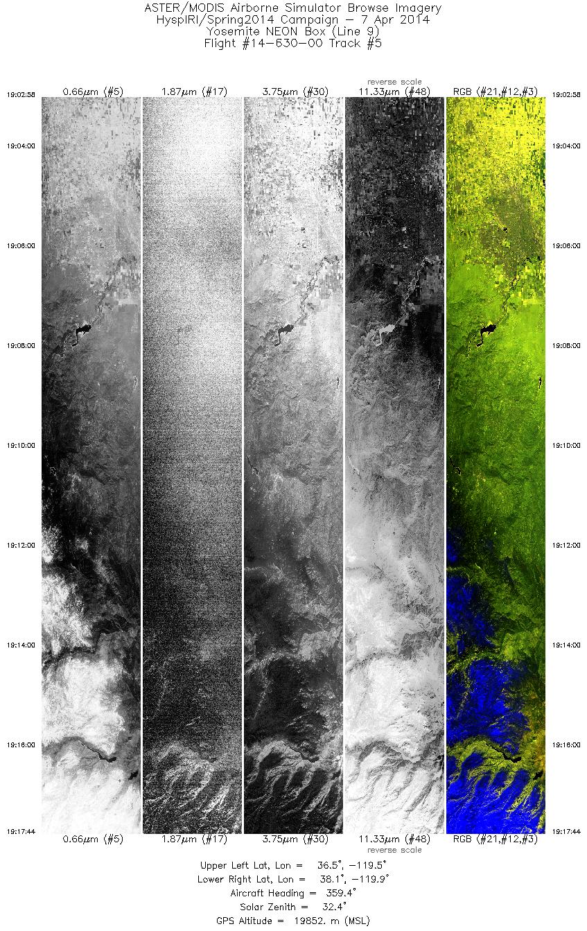
19:02 - 19:17 |
359.5 |
36.506 - 38.117 |
119.707 - 119.703 |
5315 |
19852 |
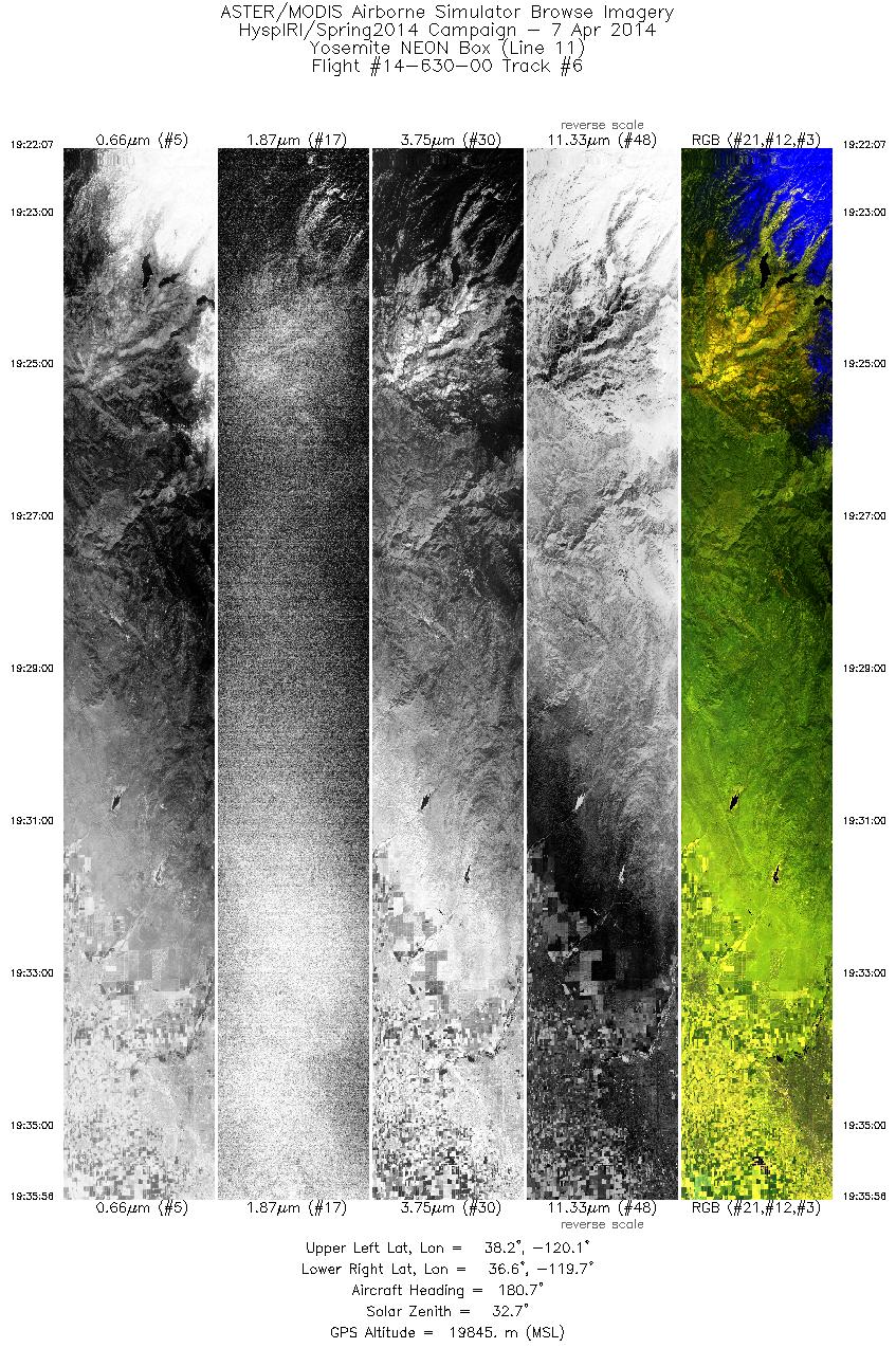
| 6 |
19:22 - 19:35 |
181.6 |
38.178 - 36.639 |
119.922 - 119.923 |
4971 |
19836 |
| 7 |
19:40 - 19:55 |
358.9 |
36.472 - 38.117 |
119.814 - 119.812 |
5430 |
19851 |
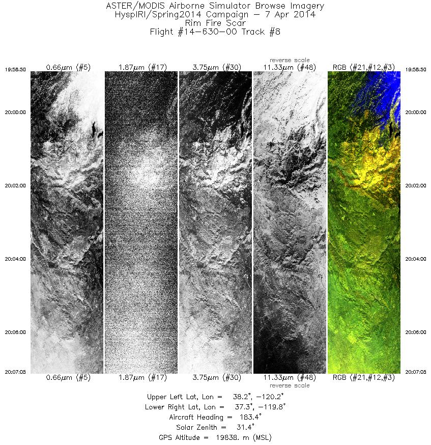
| 8 |
19:58 - 20:07 |
181.8 |
38.179 - 37.267 |
120.032 - 120.033 |
2971 |
19841 |
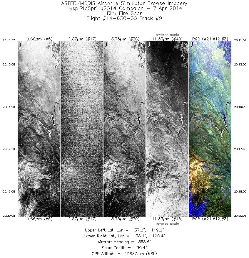
| 9 |
20:11 - 20:20 |
357.1 |
37.211 - 38.115 |
120.145 - 120.142 |
2979 |
19841 |
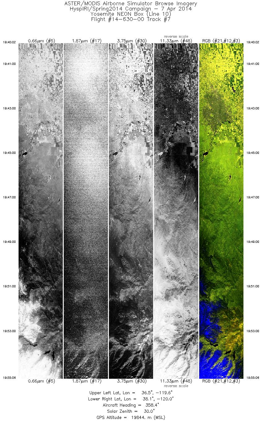
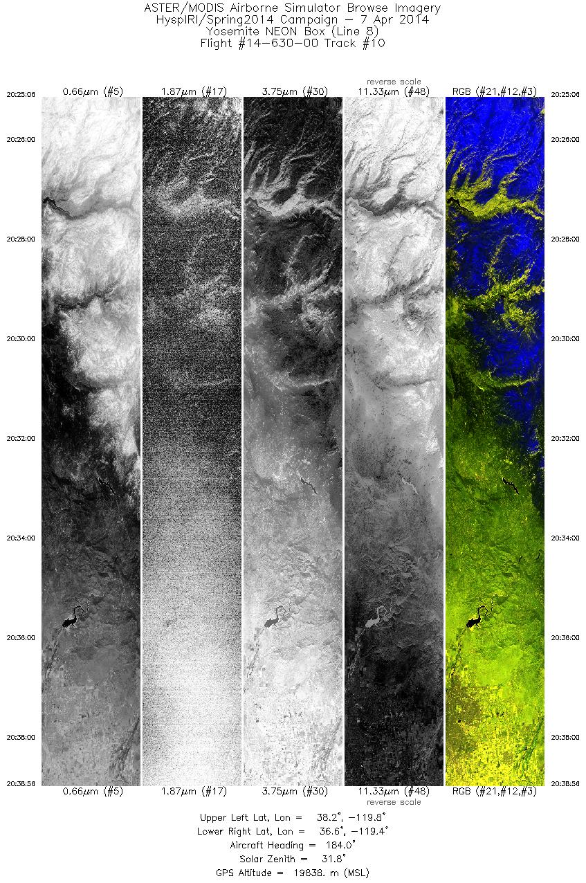
| 10 |
20:25 - 20:38 |
183.3 |
38.181 - 36.642 |
119.597 - 119.604 |
4981 |
19838 |
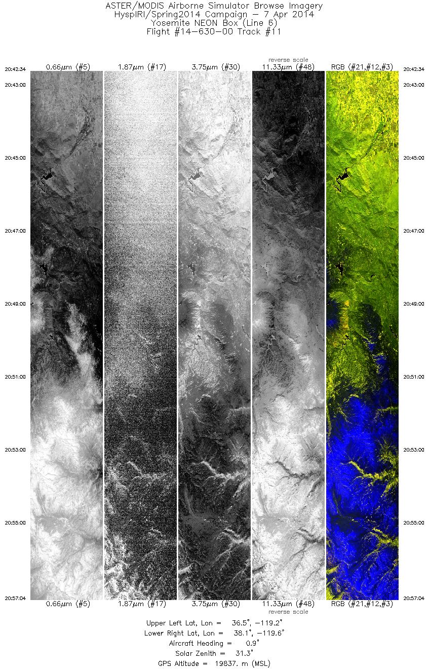
| 11 |
20:42 - 20:57 |
359.5 |
36.545 - 38.117 |
119.401 - 119.387 |
5220 |
19835 |
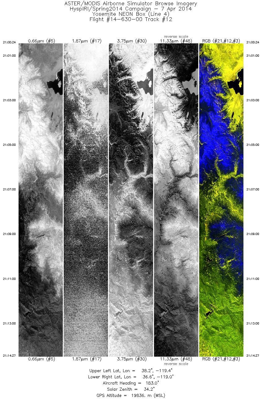
| 12 |
21:00 - 21:14 |
182.8 |
38.206 - 36.640 |
119.186 - 119.203 |
5064 |
19839 |
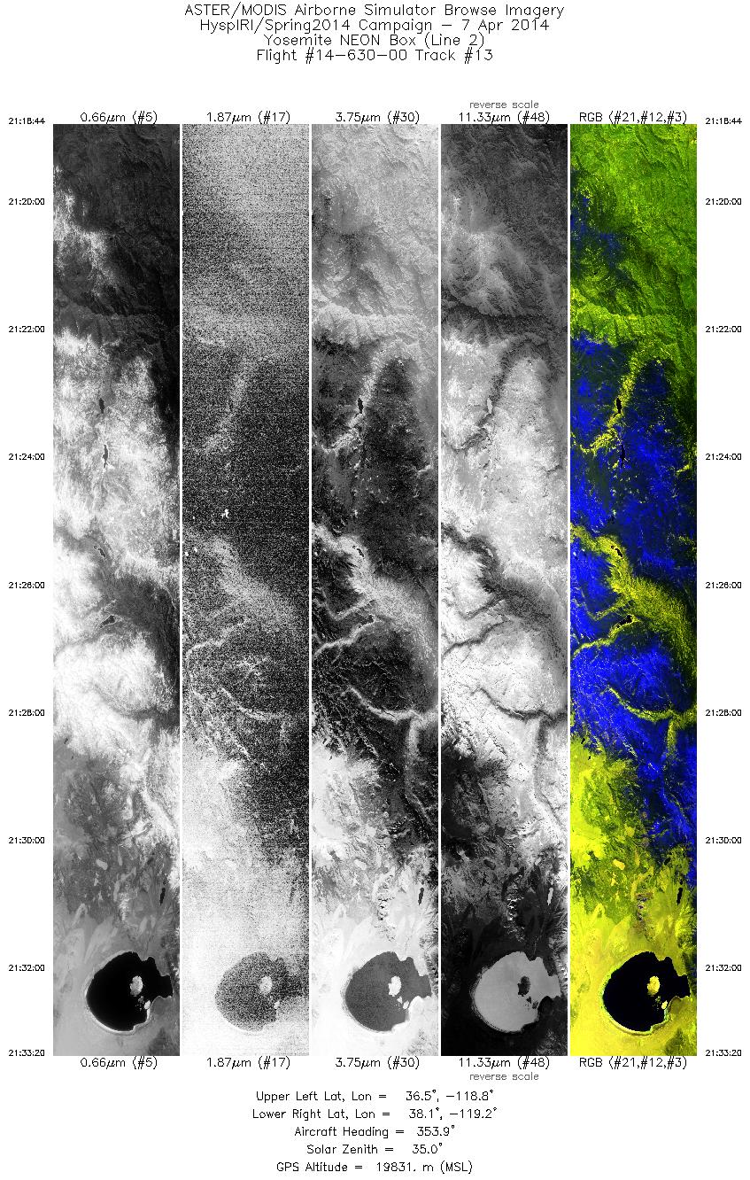
| 13 |
21:18 - 21:33 |
356.7 |
36.534 - 38.118 |
119.008 - 118.987 |
5263 |
19849 |
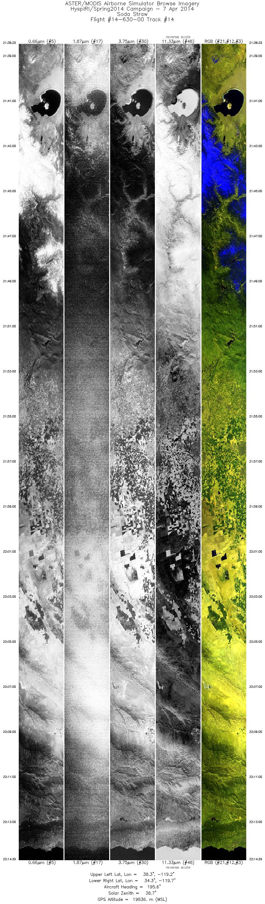
| 14 |
21:38 - 22:14 |
194.9 |
38.308 - 34.371 |
118.997 - 119.927 |
13048 |
19817 |
|


