Flight: 13-626-00
Date: June 1 2013
Aircraft: NASA ER2, #806
Deployment: SNPP Spring 2013
Flight Location: Southern California / Powerhouse Fire / Gulf of California / Pacific Ocean (night)
Principal Investigator: Larar (LRC)
Additional Sensors: SHIS / NAST-I / NAST-M
|
Data Evaluation
Overall data quality is good.
All data collected @6.25Hz
|
Processing Information
Level-1B Data in HDF format is available
Flight Line Summary
Spectral Band Configuration
Spectral Response Function Table
Spectral Response Function (text)
|
Browse Imagery
Flight Tracks: 13
Scanlines: 120065
|
Browse Imagery Table
|
Click a Flight Track number to view a quicklook image
Lat/Lon ranges are for the BEG-END scanline nadir pixels
|
Flight
Track |
Time Span
(UTC) |
Heading
(Deg) |
Lat Range
(Deg N) |
Lon Range
(Deg W) |
Length
(Scanlines) |
Altitude
(Meters) |
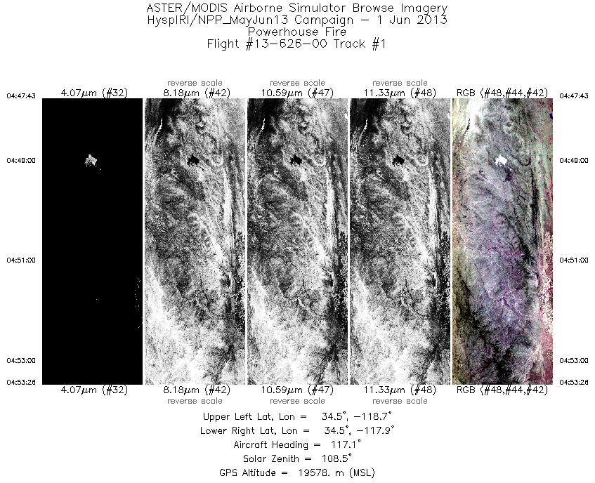
| 1 |
04:47 - 04:53 |
118.8 |
34.685 - 34.372 |
118.638 - 117.998 |
2044 |
19571 |
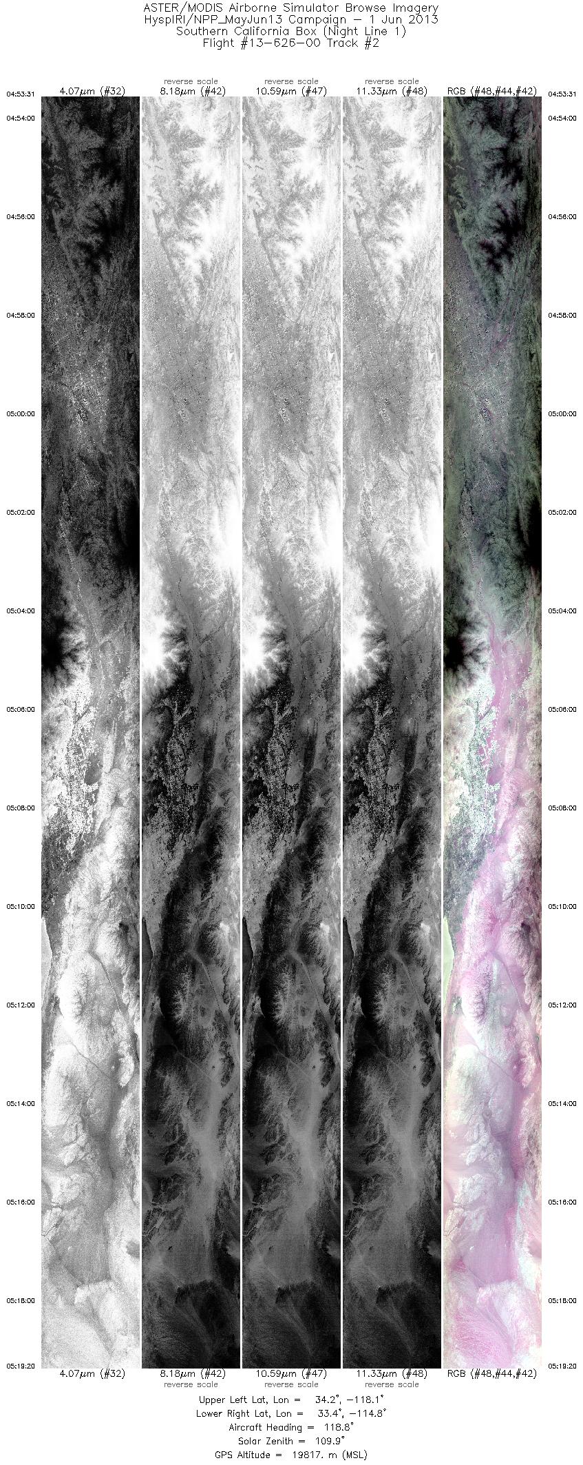
| 2 |
04:53 - 05:19 |
115.1 |
34.368 - 33.269 |
117.990 - 114.900 |
9233 |
19734 |
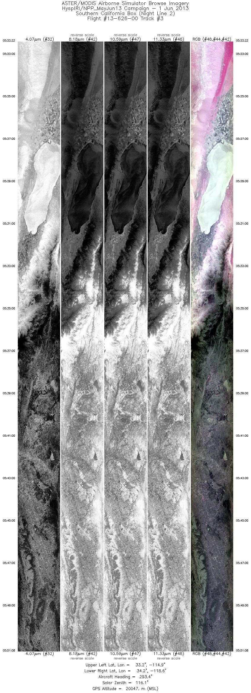
| 3 |
05:22 - 05:51 |
293.5 |
33.056 - 34.306 |
114.995 - 118.528 |
10283 |
19943 |
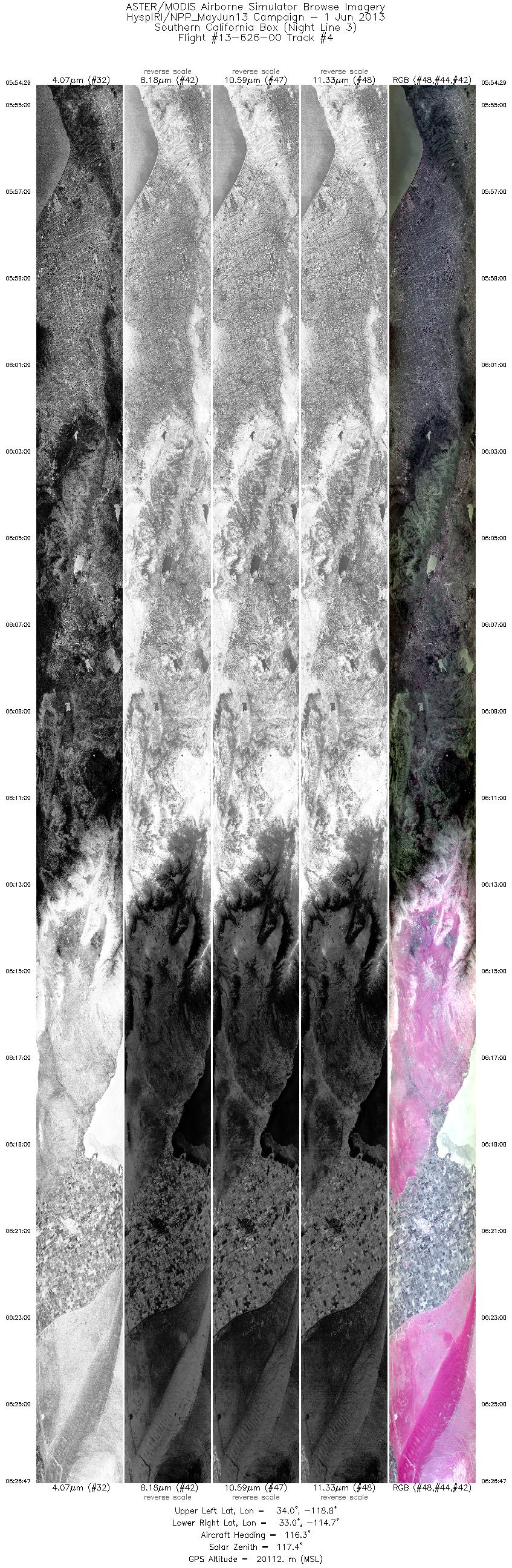
| 4 |
05:54 - 06:26 |
110.8 |
34.129 - 32.795 |
118.707 - 114.808 |
11548 |
20113 |
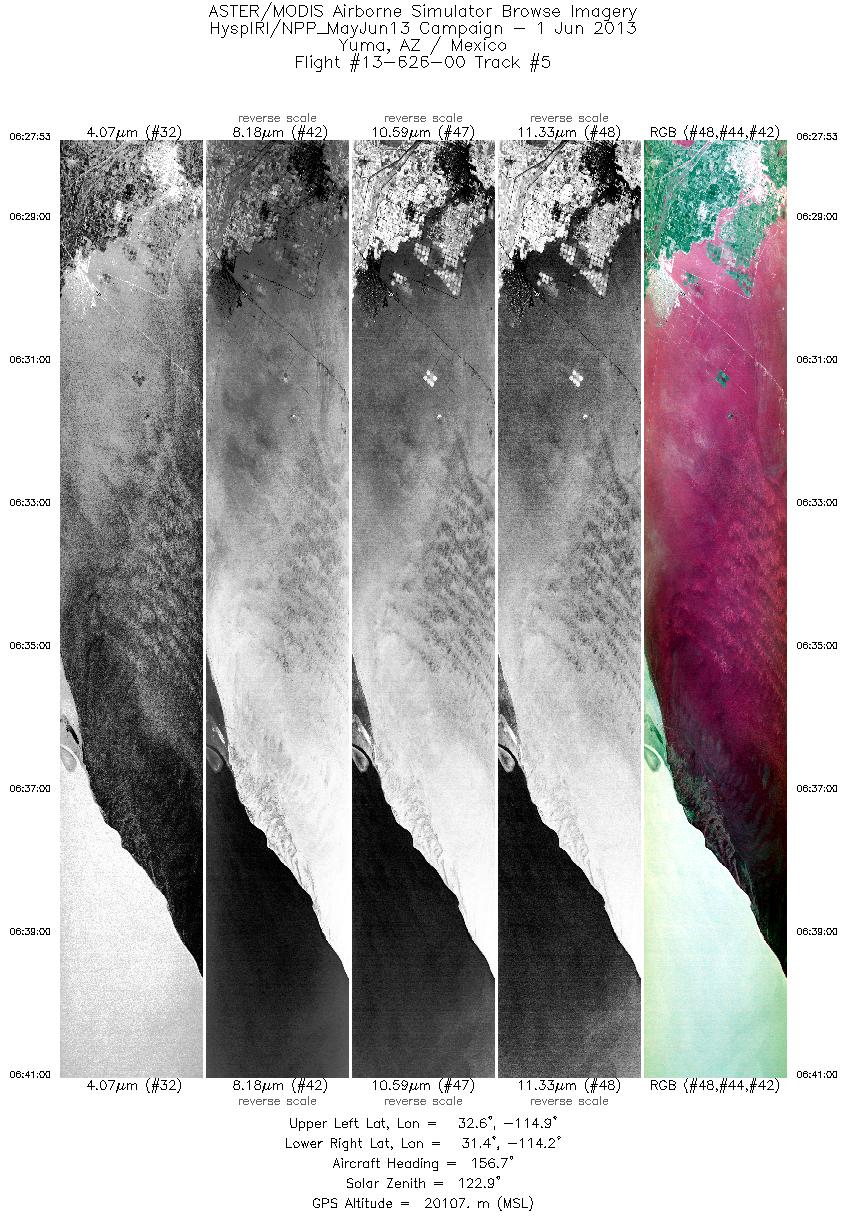
| 5 |
06:27 - 06:40 |
159.6 |
32.710 - 31.312 |
114.719 - 114.341 |
4691 |
20111 |
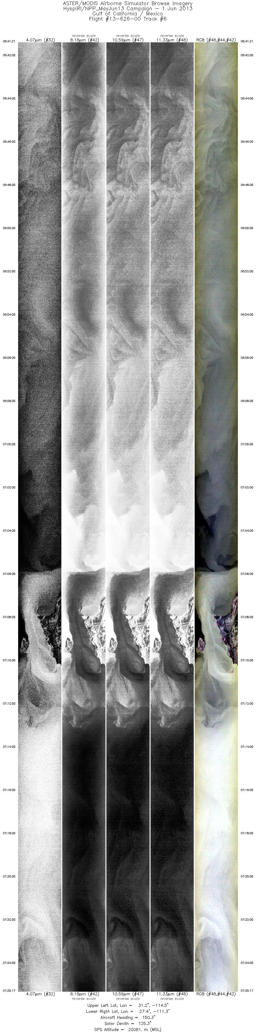
| 6 |
06:41 - 07:25 |
147.8 |
31.276 - 27.283 |
114.326 - 111.440 |
15706 |
20086 |
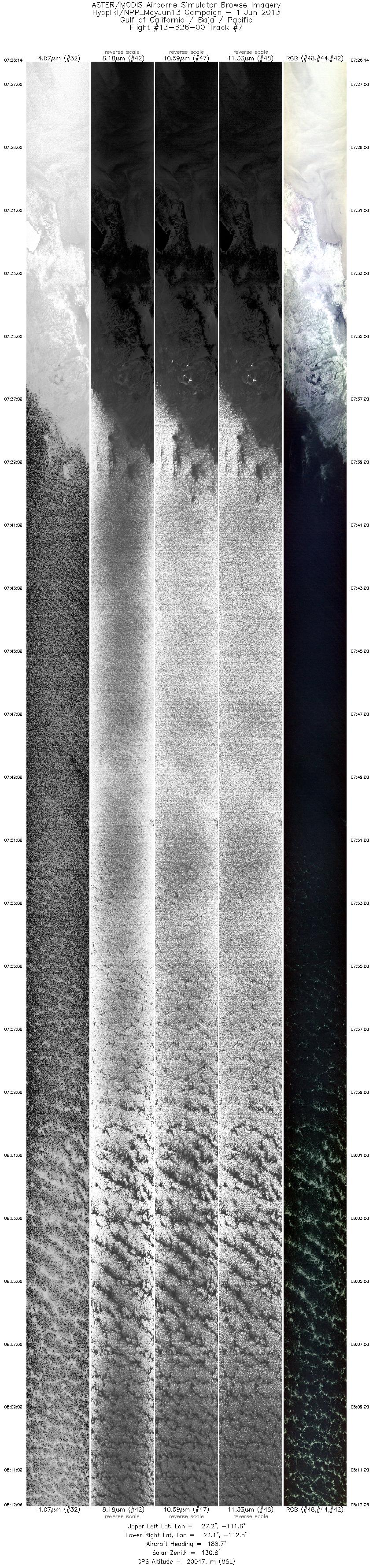
| 7 |
07:26 - 08:12 |
188.1 |
27.181 - 22.134 |
111.426 - 112.724 |
16392 |
20056 |
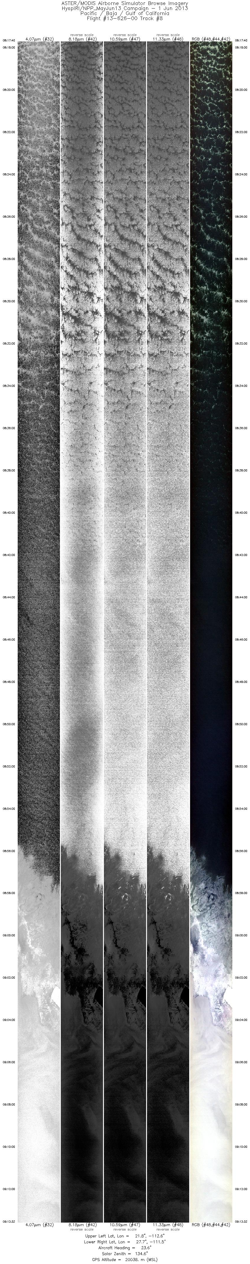
| 8 |
08:17 - 09:13 |
19.9 |
21.862 - 27.687 |
112.799 - 111.289 |
19974 |
20038 |
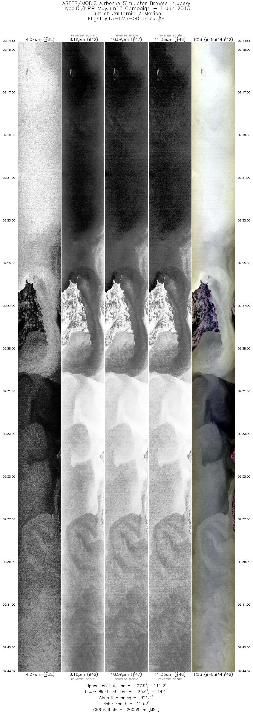
| 9 |
09:14 - 09:44 |
319.0 |
27.796 - 30.172 |
111.323 - 114.005 |
10560 |
20073 |
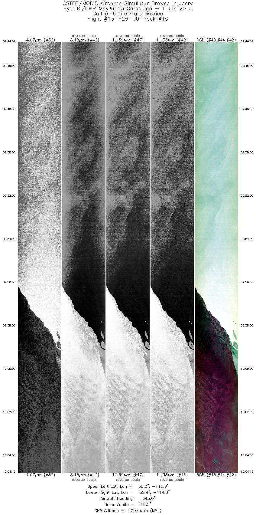
| 10 |
09:44 - 10:04 |
345.3 |
30.245 - 32.413 |
114.050 - 114.618 |
7110 |
20068 |
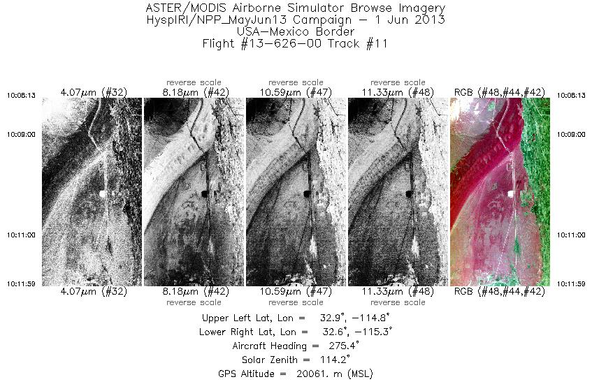
| 11 |
10:08 - 10:11 |
273.3 |
32.736 - 32.751 |
114.779 - 115.284 |
1350 |
20076 |
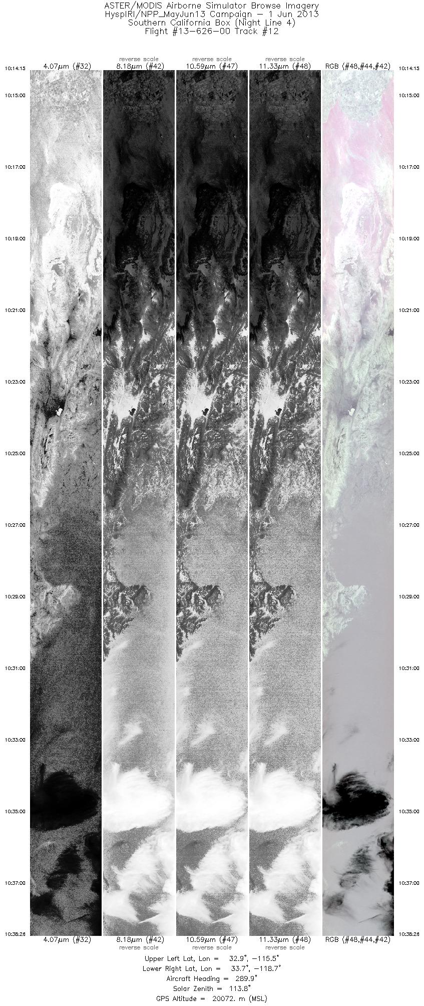
| 12 |
10:14 - 10:38 |
291.6 |
32.789 - 33.849 |
115.583 - 118.593 |
8648 |
20070 |
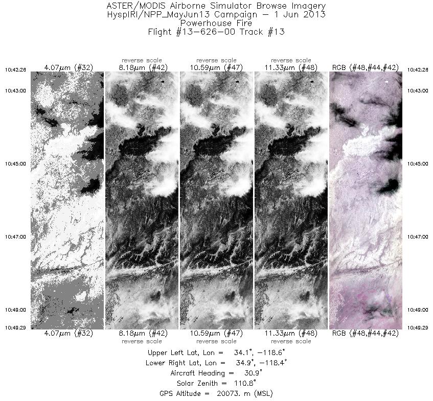
| 13 |
10:42 - 10:49 |
32.0 |
34.174 - 34.809 |
118.759 - 118.272 |
2526 |
20075 |
|


