Flight: 12-614-00
Date: November 16, 2011
Aircraft: NASA ER2, #806
Deployment: DFRC November 2011
Flight Location: Southern California
Principal Investigator: Kruse / Hook (JPL)
Additional Sensors: AVIRIS / DCS
|
Data Evaluation
Overall data quality is good; Channel 45 extremely limited.
All data collected @29K MSL
|
Processing Information
Level-1B Data in HDF format is available
Flight Line Summary
Spectral Band Configuration
Spectral Response Function Table
Spectral Response Function (text)
|
Browse Imagery
Flight Tracks: 21
Scanlines: 60821
|
Browse Imagery Table
|
Click a Flight Track number to view a quicklook image
Lat/Lon ranges are for the BEG-END scanline nadir pixels
|
Flight
Track |
Time Span
(UTC) |
Heading
(Deg) |
Lat Range
(Deg N) |
Lon Range
(Deg W) |
Length
(Scanlines) |
Altitude
(Meters) |
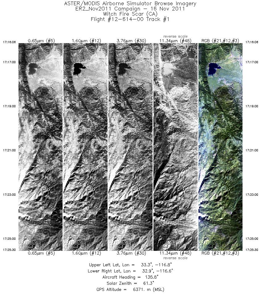
| 1 |
17:16 - 17:25 |
160.8 |
33.288 - 32.907 |
116.787 - 116.656 |
3372 |
6360 |
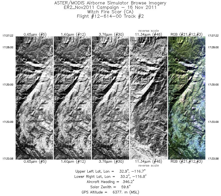
| 2 |
17:27 - 17:33 |
349.5 |
32.912 - 33.201 |
116.705 - 116.711 |
2363 |
6395 |
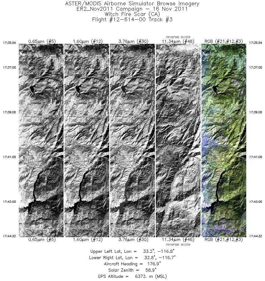
| 3 |
17:35 - 17:44 |
182.3 |
33.202 - 32.824 |
116.771 - 116.765 |
3090 |
6380 |
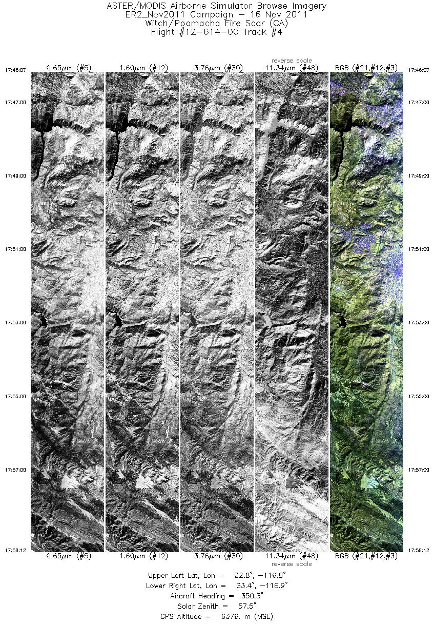
| 4 |
17:46 - 17:59 |
351.4 |
32.817 - 33.376 |
116.816 - 116.816 |
4680 |
6372 |
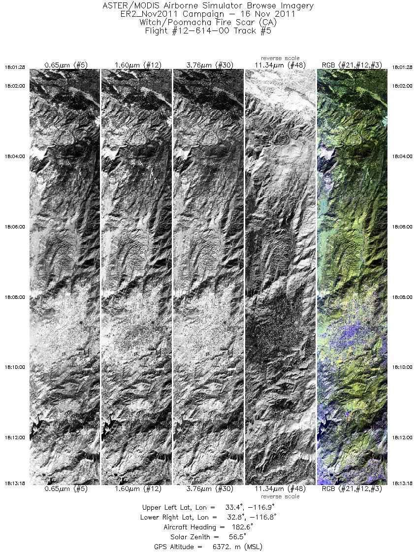
| 5 |
18:01 - 18:13 |
184.4 |
33.365 - 32.855 |
116.874 - 116.867 |
4227 |
6379 |
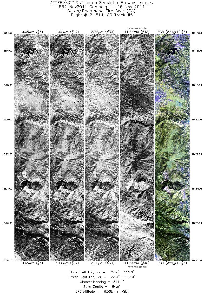
| 6 |
18:14 - 18:28 |
347.1 |
32.876 - 33.443 |
116.911 - 116.918 |
4727 |
6377 |
| 7 |
18:29 - 18:42 |
188.4 |
33.441 - 32.887 |
116.974 - 116.973 |
4497 |
6376 |
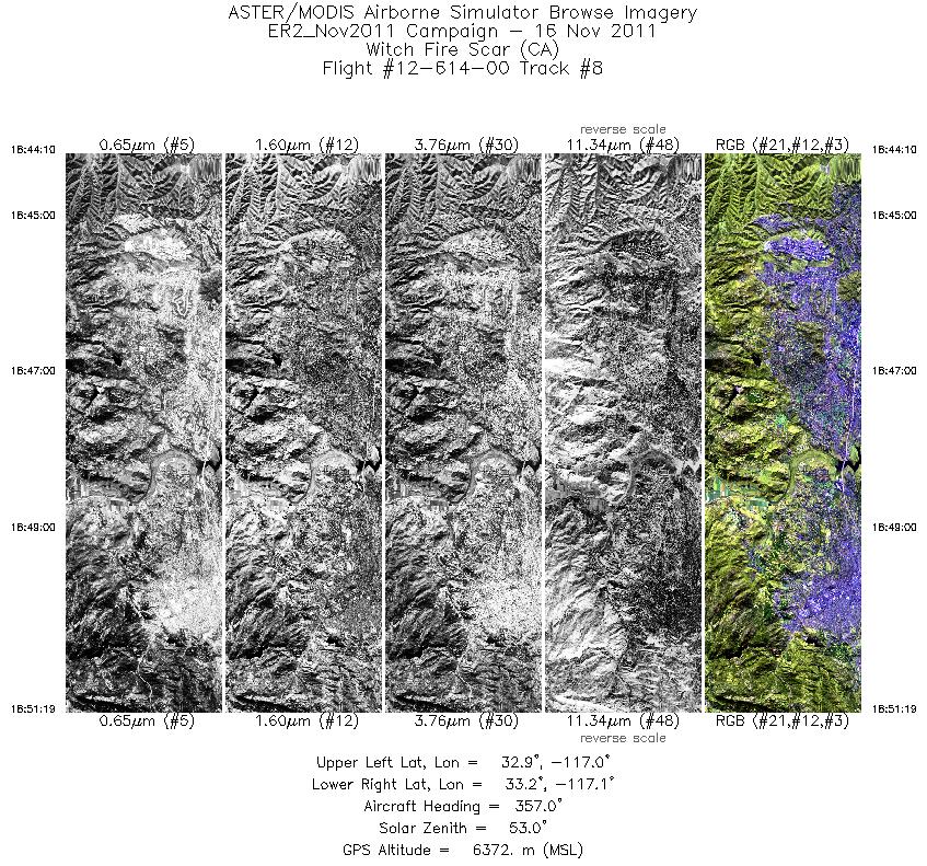
| 8 |
18:44 - 18:51 |
354.8 |
32.887 - 33.203 |
117.029 - 117.027 |
2558 |
6367 |
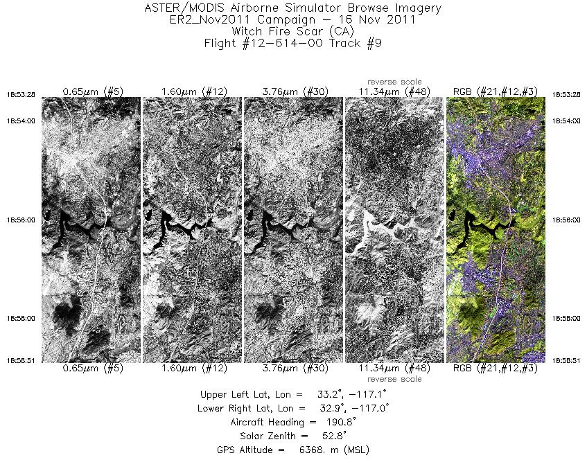
| 9 |
18:53 - 18:58 |
189.1 |
33.178 - 32.941 |
117.084 - 117.084 |
1924 |
6370 |
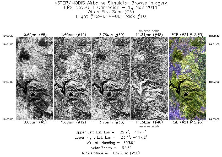
| 10 |
19:00 - 19:04 |
353.5 |
32.936 - 33.133 |
117.141 - 117.140 |
1595 |
6370 |
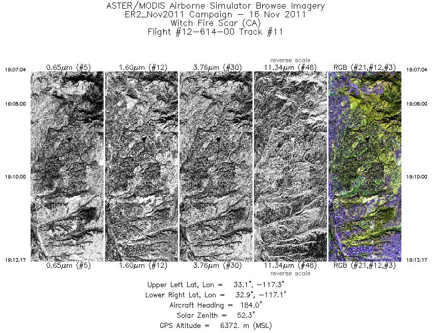
| 11 |
19:07 - 19:12 |
173.6 |
33.124 - 32.883 |
117.206 - 117.173 |
1867 |
6375 |
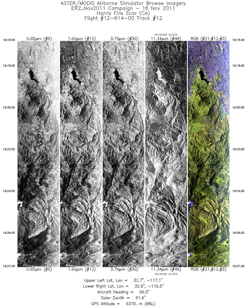
| 12 |
19:16 - 19:27 |
89.5 |
32.704 - 32.744 |
117.085 - 116.489 |
3873 |
6378 |
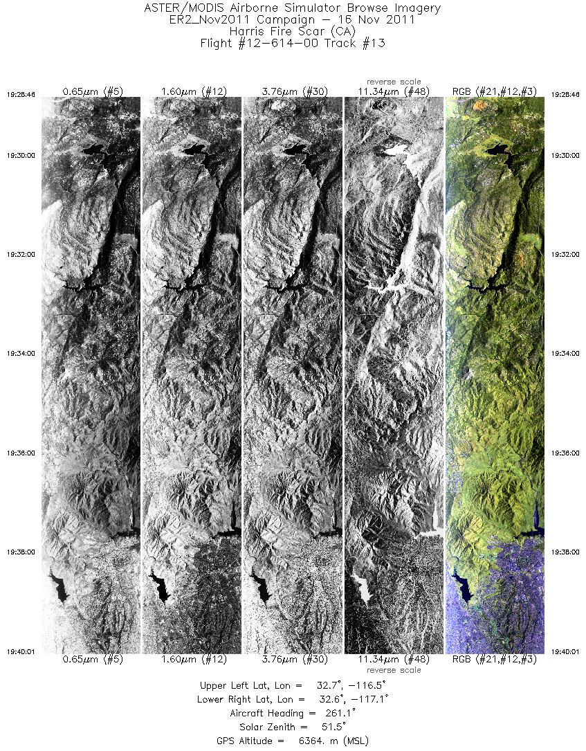
| 13 |
19:28 - 19:40 |
264.3 |
32.704 - 32.662 |
116.470 - 117.057 |
4026 |
6370 |
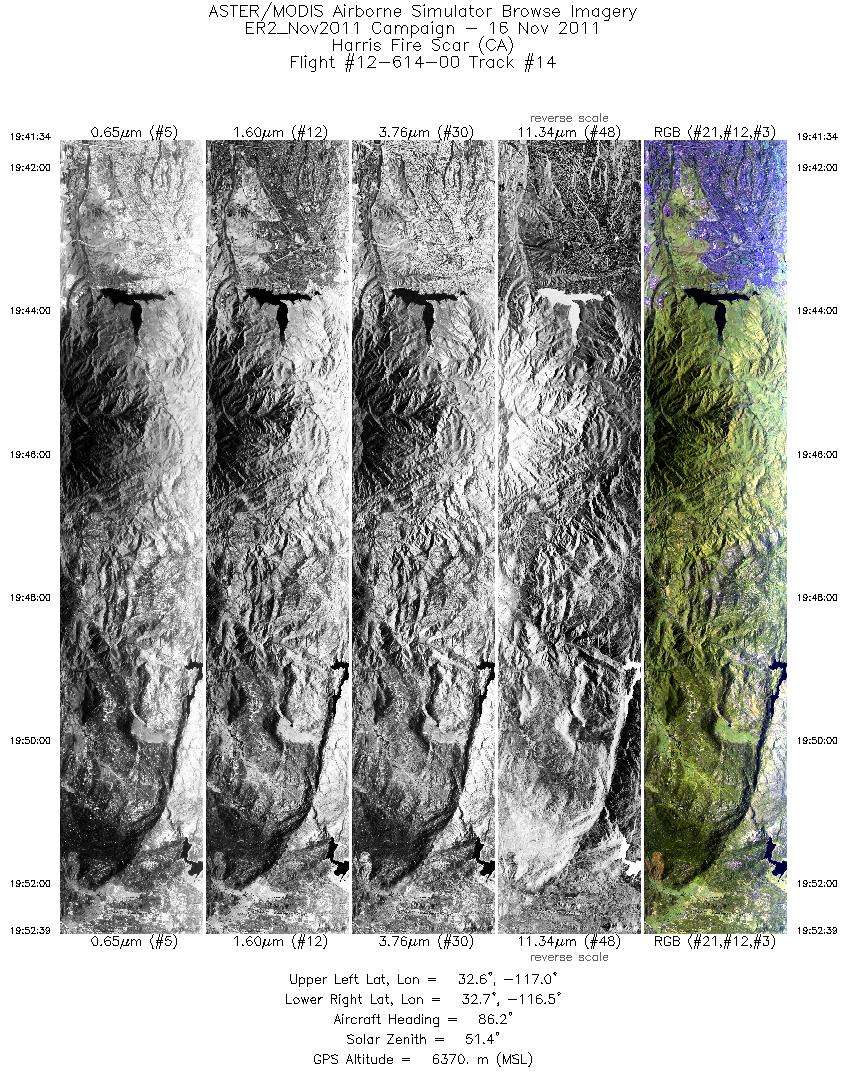
| 14 |
19:41 - 19:52 |
83.8 |
32.619 - 32.659 |
117.047 - 116.473 |
3972 |
6381 |
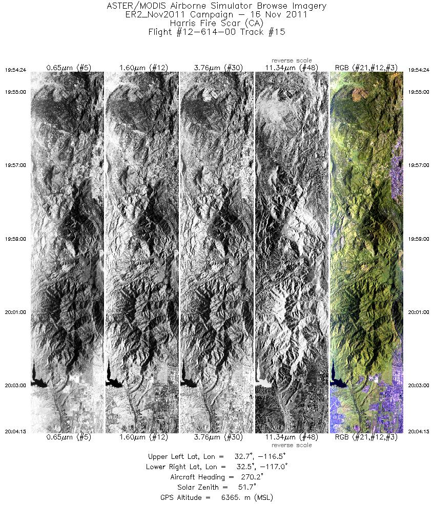
| 15 |
19:54 - 20:04 |
268.2 |
32.611 - 32.579 |
116.484 - 116.995 |
3531 |
6379 |
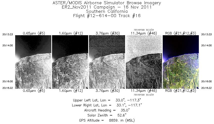
| 16 |
20:13 - 20:16 |
65.7 |
32.995 - 33.009 |
117.359 - 117.137 |
1066 |
8856 |
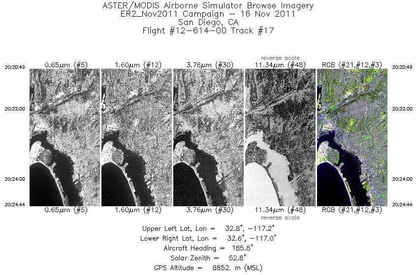
| 17 |
20:20 - 20:24 |
189.2 |
32.817 - 32.626 |
117.140 - 117.134 |
1403 |
8873 |
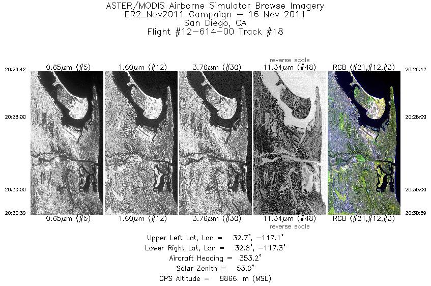
| 18 |
20:26 - 20:30 |
352.6 |
32.656 - 32.841 |
117.183 - 117.187 |
1414 |
8894 |
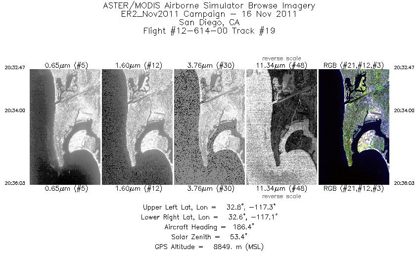
| 19 |
20:32 - 20:36 |
187.8 |
32.804 - 32.639 |
117.234 - 117.232 |
1171 |
8826 |
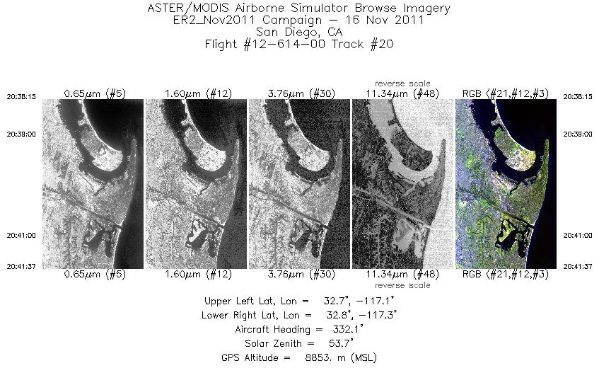
| 20 |
20:38 - 20:41 |
332.1 |
32.649 - 32.812 |
117.168 - 117.234 |
1201 |
8876 |
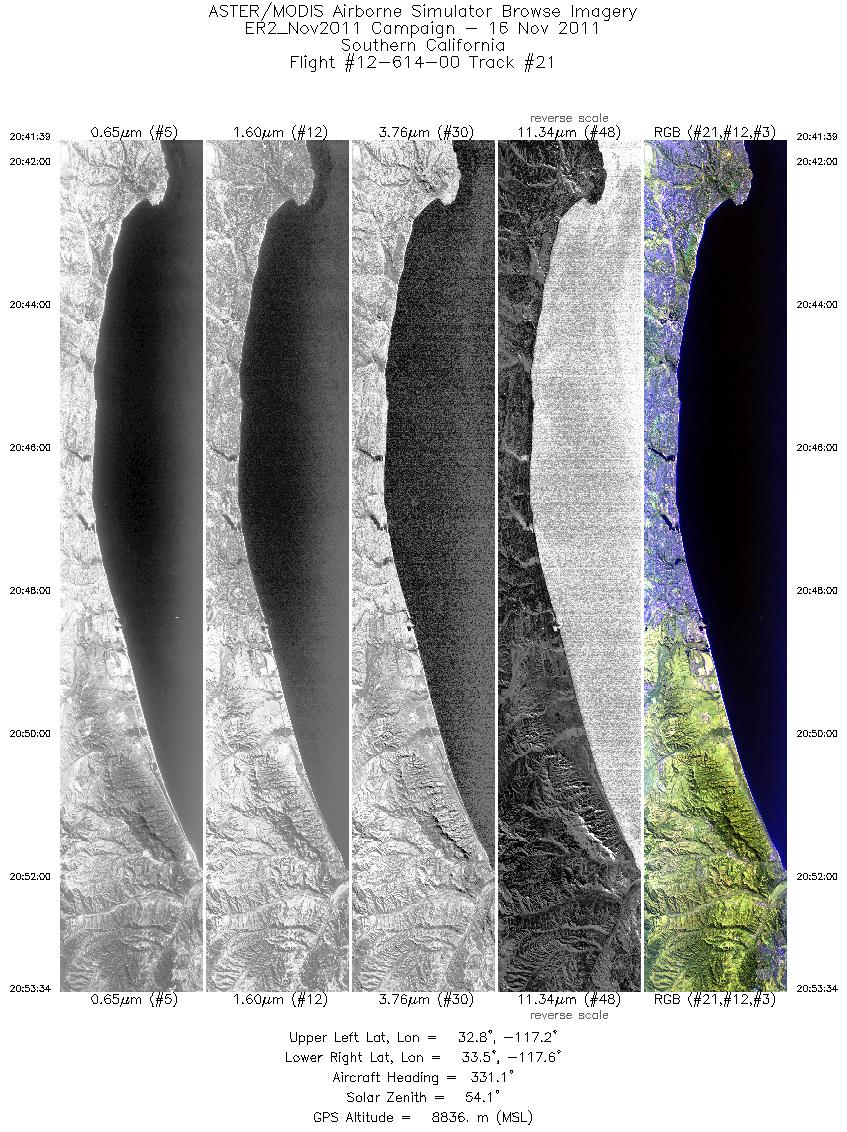
| 21 |
20:41 - 20:53 |
332.4 |
32.814 - 33.518 |
117.236 - 117.552 |
4264 |
8851 |
|


