


FLIGHT SUMMARY INFORMATION
Flight Track Map


|
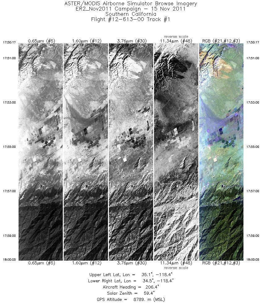
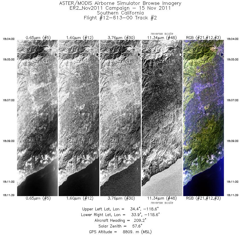
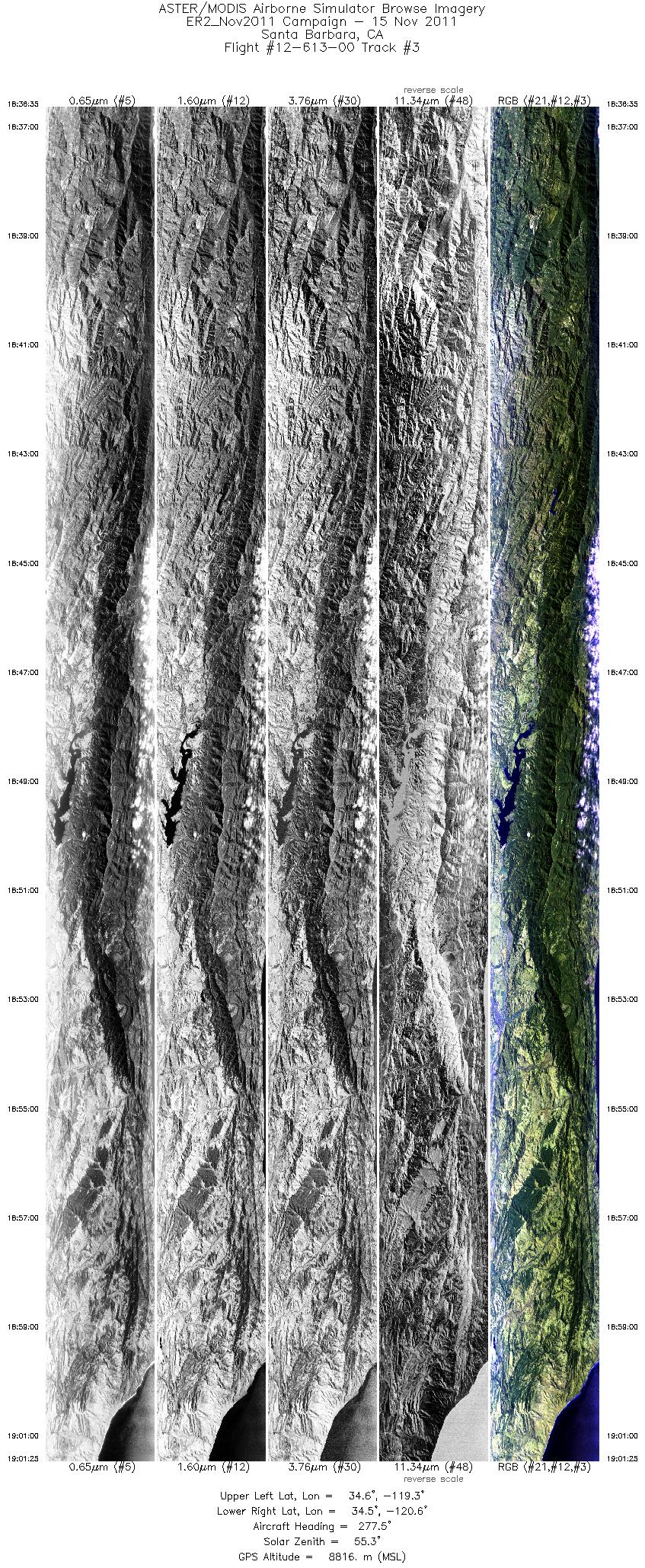
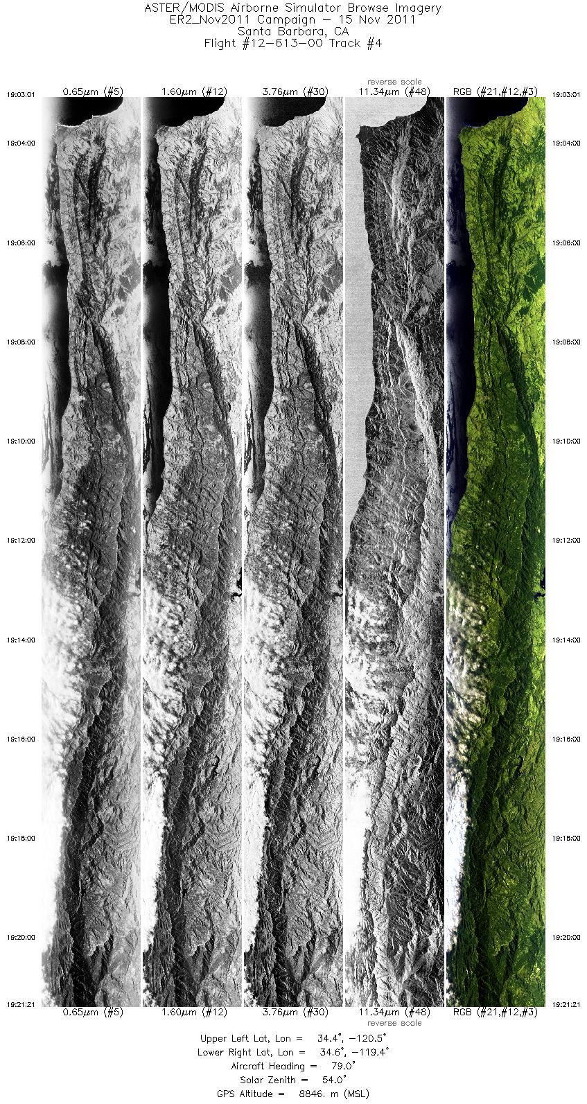
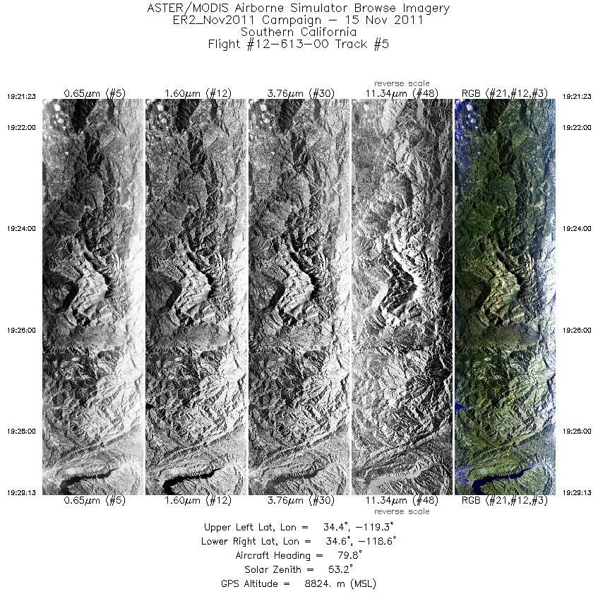
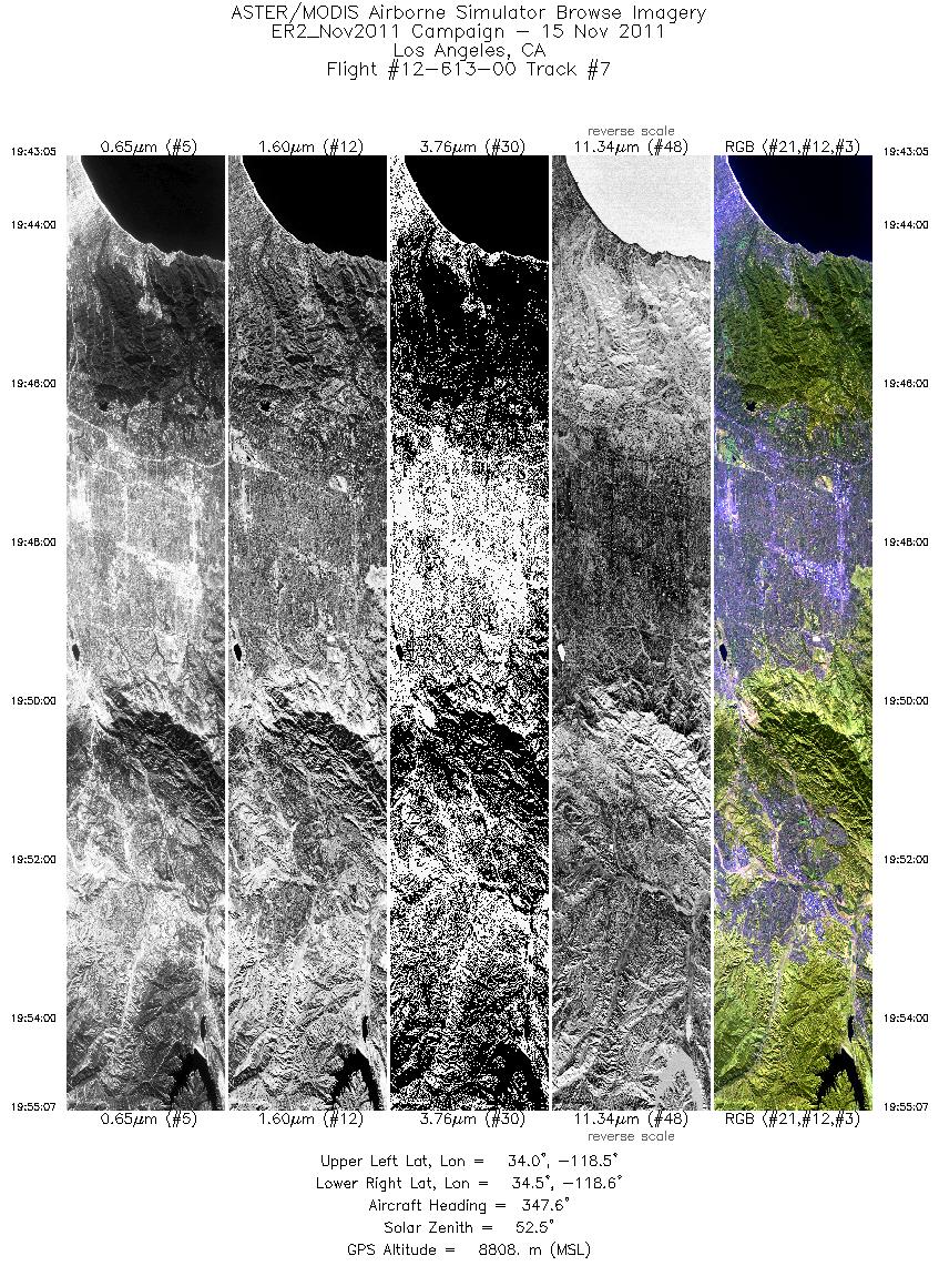
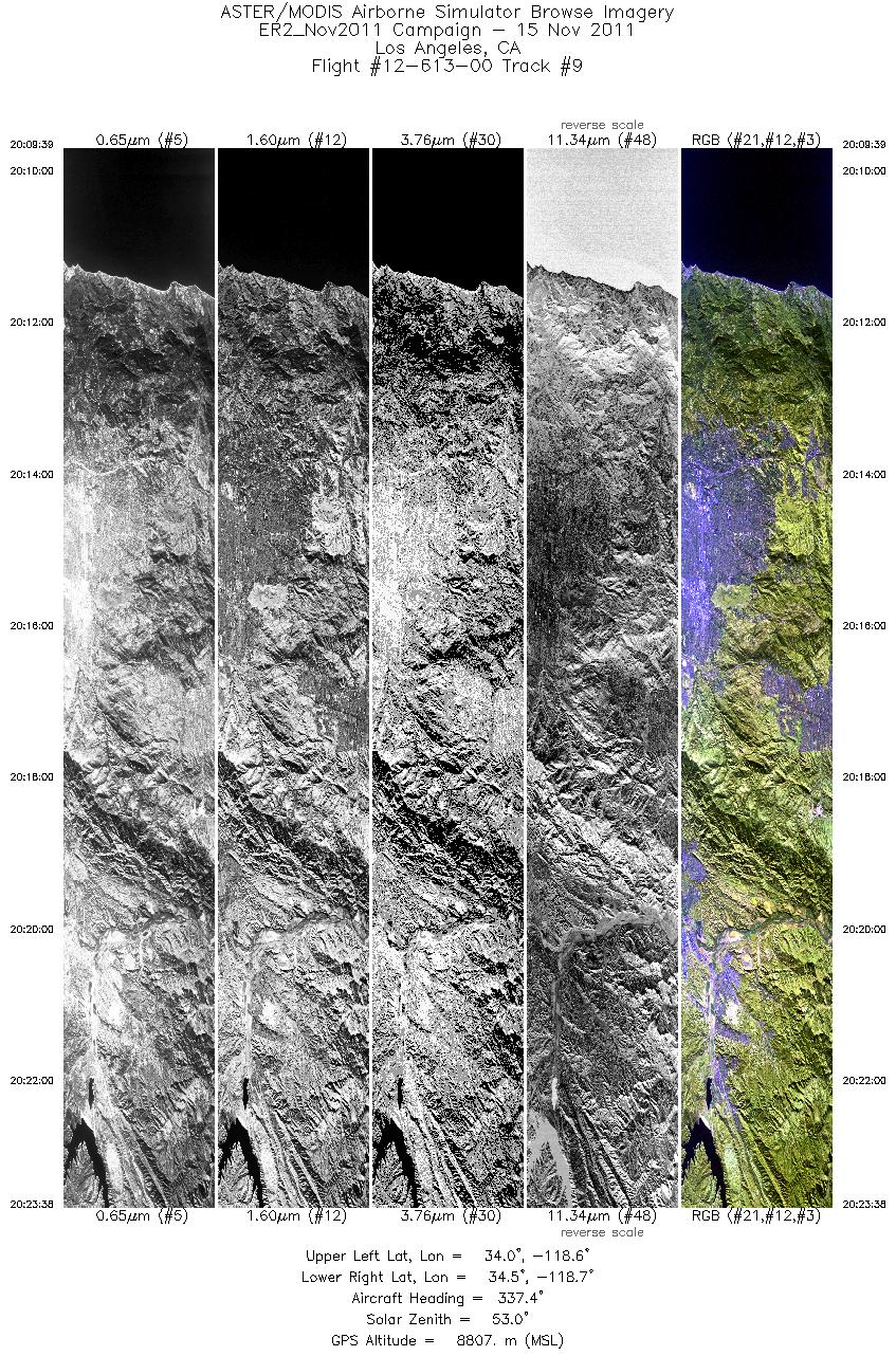
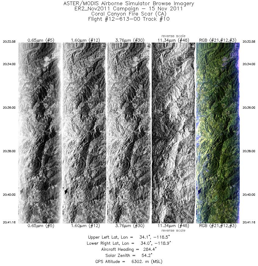
Flight: 12-613-00 Date: November 15, 2011 Aircraft: NASA ER2, #806 Deployment: DFRC November 2011 Flight Location: Southern California Principal Investigator: Roberts (UCSB), Kruse / Hook (JPL) Additional Sensors: AVIRIS / DCS |
||||||||||||||||||||||||||||||||||||||||||||||||||||||||||||||||||||||||||||||||||||||||||||||||||
|
Data Evaluation Overall data quality is good; Channel 45 is not useable. All data collected @29K MSL |
||||||||||||||||||||||||||||||||||||||||||||||||||||||||||||||||||||||||||||||||||||||||||||||||||
|
Processing Information Level-1B Data in HDF format is available Flight Line Summary Spectral Band Configuration Spectral Response Function Table Spectral Response Function (text) |
||||||||||||||||||||||||||||||||||||||||||||||||||||||||||||||||||||||||||||||||||||||||||||||||||
|
Browse Imagery Flight Tracks: 10 Scanlines: 44299 |
||||||||||||||||||||||||||||||||||||||||||||||||||||||||||||||||||||||||||||||||||||||||||||||||||
|
||||||||||||||||||||||||||||||||||||||||||||||||||||||||||||||||||||||||||||||||||||||||||||||||||


