Flight: 12-609-00
Date: November 9, 2011
Aircraft: NASA ER2, #806
Deployment: DFRC November 2011
Flight Location: Southern California
Principal Investigator: Roberts (UCSB), Hook / Kruse (JPL)
Additional Sensors: AVIRIS / DCS
|
Data Evaluation
Overall data quality is good.
Variable altitude data collection: 20-28K MSL
Issues with recorded roll values and POSAV real time solution
|
Processing Information
Level-1B Data in HDF format is available
Flight Line Summary
Spectral Band Configuration
Spectral Response Function Table
Spectral Response Function (text)
|
Browse Imagery
Flight Tracks: 23
Scanlines: 65609
|
Browse Imagery Table
|
Click a Flight Track number to view a quicklook image
Lat/Lon ranges are for the BEG-END scanline nadir pixels
|
Flight
Track |
Time Span
(UTC) |
Heading
(Deg) |
Lat Range
(Deg N) |
Lon Range
(Deg W) |
Length
(Scanlines) |
Altitude
(Meters) |
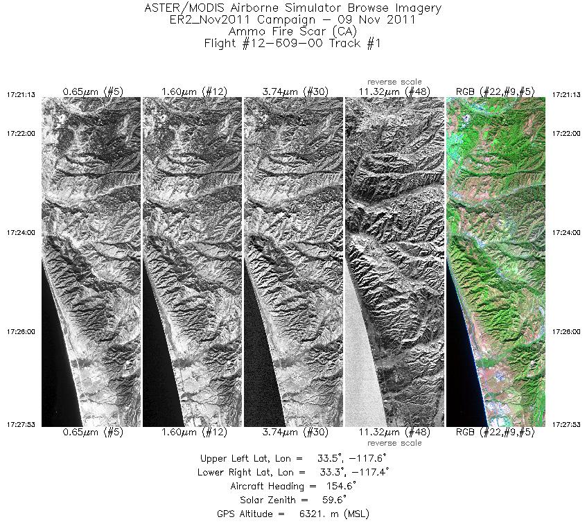
| 1 |
17:21 - 17:27 |
154.7 |
33.538 - 33.249 |
117.569 - 117.422 |
2382 |
6403 |
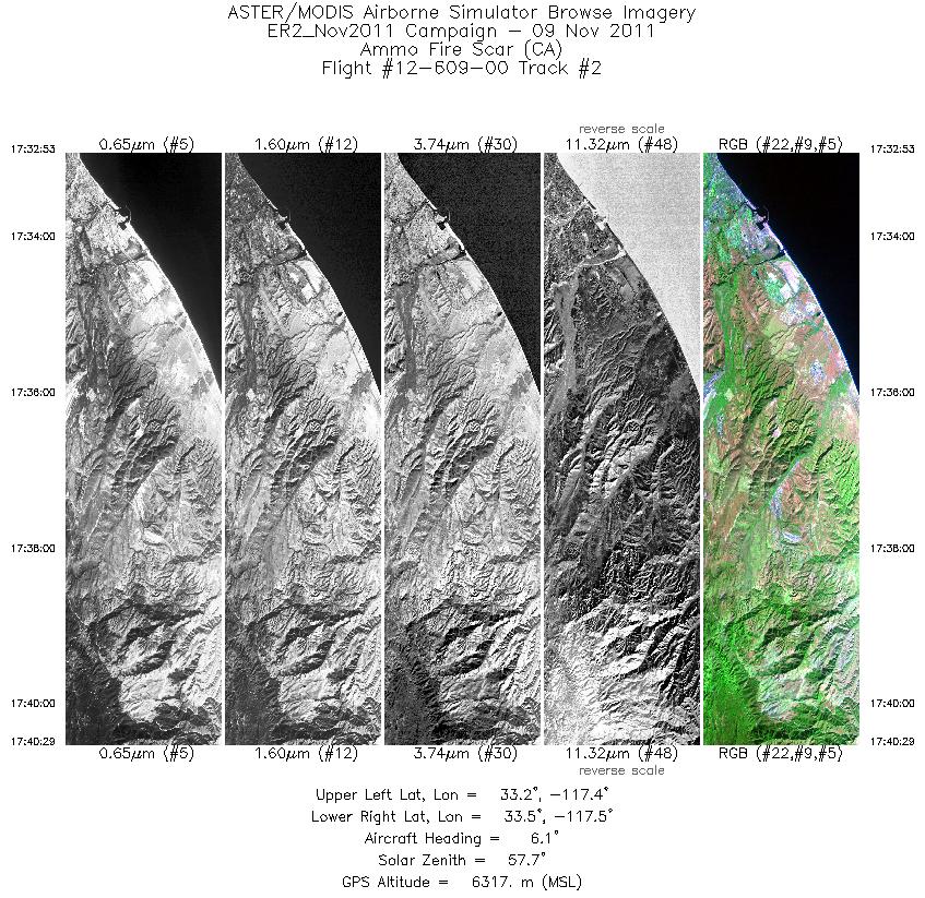
| 2 |
17:32 - 17:40 |
4.1 |
33.178 - 33.473 |
117.418 - 117.415 |
2719 |
6332 |
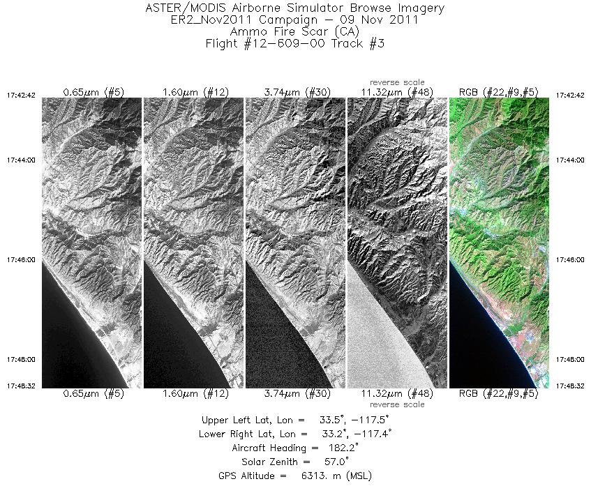
| 3 |
17:42 - 17:48 |
180.9 |
33.499 - 33.247 |
117.469 - 117.472 |
2085 |
6314 |
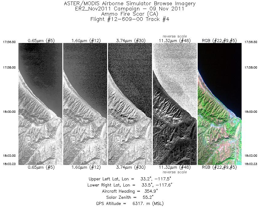
| 4 |
17:56 - 18:02 |
356.6 |
33.239 - 33.460 |
117.522 - 117.525 |
1989 |
6325 |
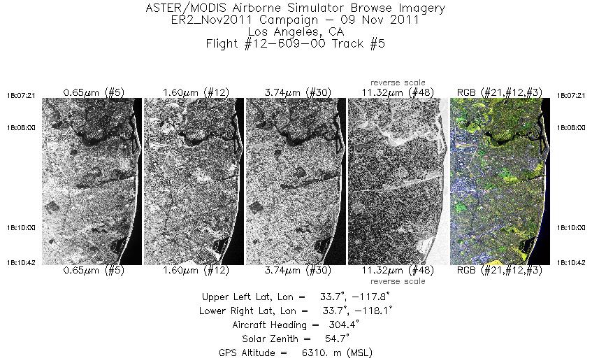
| 5 |
18:07 - 18:10 |
303.9 |
33.618 - 33.734 |
117.833 - 118.054 |
1195 |
6286 |
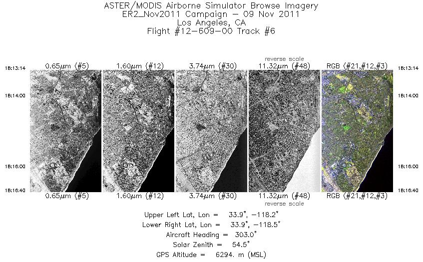
| 6 |
18:13 - 18:16 |
302.9 |
33.830 - 33.927 |
118.236 - 118.421 |
1229 |
6311 |
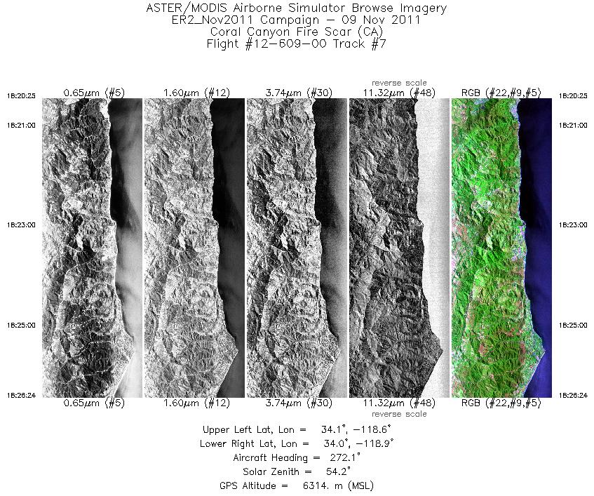
| 7 |
18:20 - 18:26 |
271.4 |
34.069 - 34.070 |
118.554 - 118.852 |
2139 |
6302 |
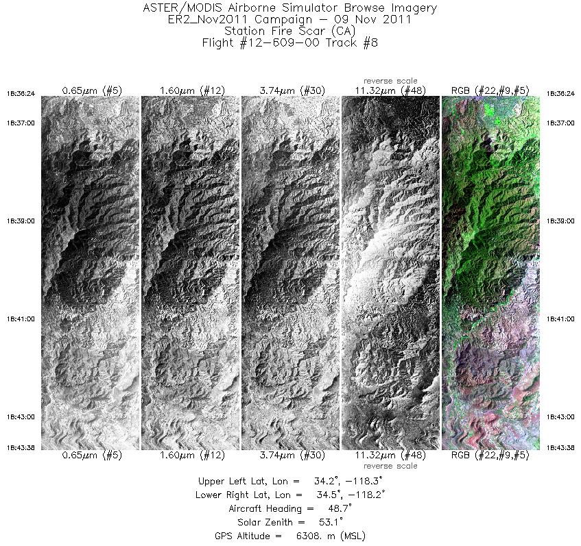
| 8 |
18:36 - 18:43 |
43.7 |
34.317 - 34.531 |
118.445 - 118.221 |
2589 |
6283 |
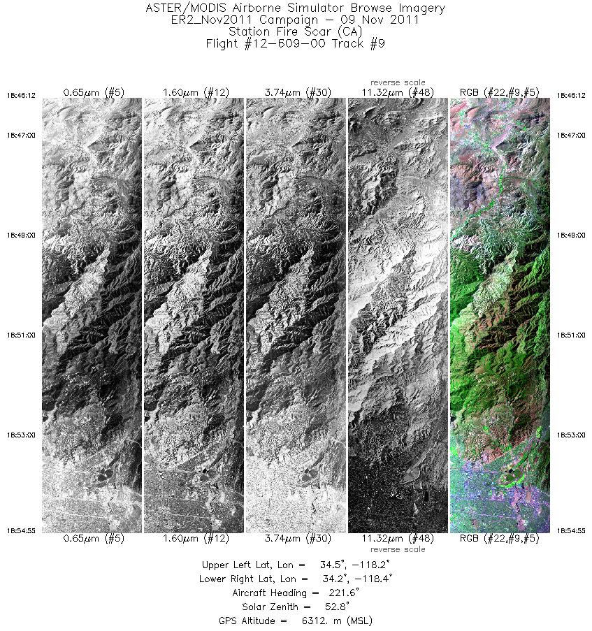
| 9 |
18:46 - 18:54 |
222.6 |
34.507 - 34.244 |
118.171 - 118.448 |
3116 |
6315 |
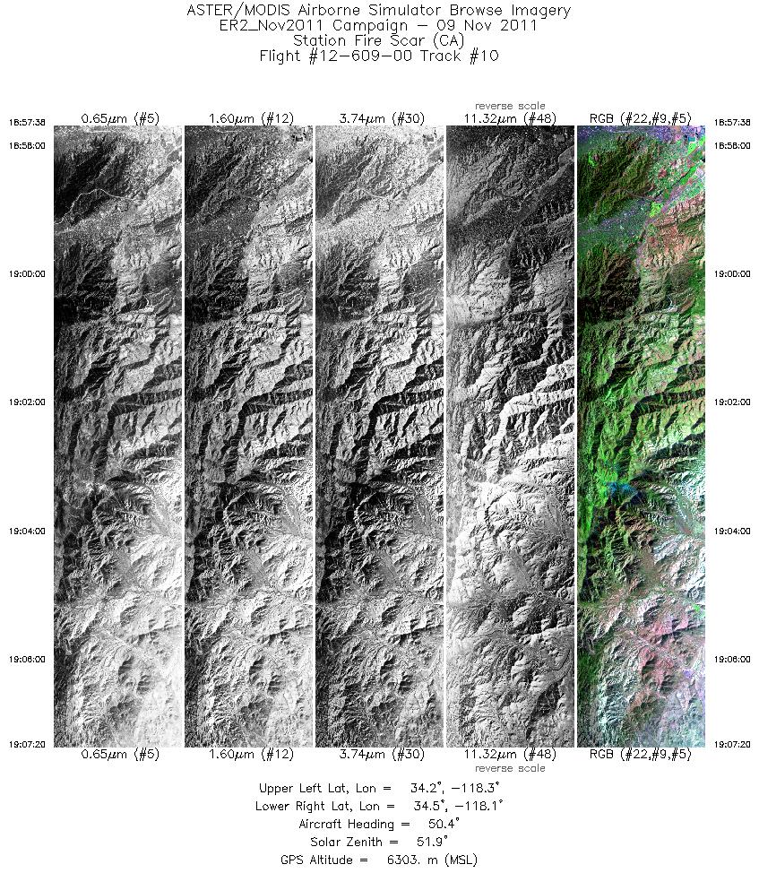
| 10 |
18:57 - 19:07 |
44.9 |
34.235 - 34.507 |
118.382 - 118.075 |
3472 |
6298 |
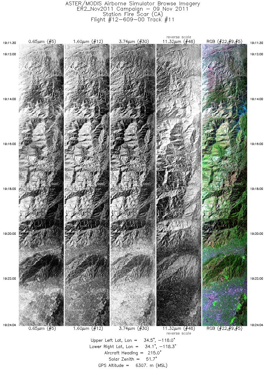
| 11 |
19:11 - 19:24 |
221.0 |
34.505 - 34.162 |
117.976 - 118.382 |
4498 |
6316 |
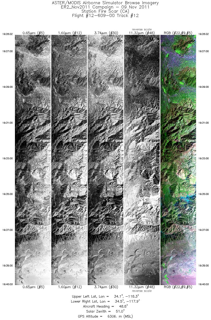
| 12 |
19:26 - 19:40 |
46.4 |
34.124 - 34.515 |
118.334 - 117.878 |
5022 |
6323 |
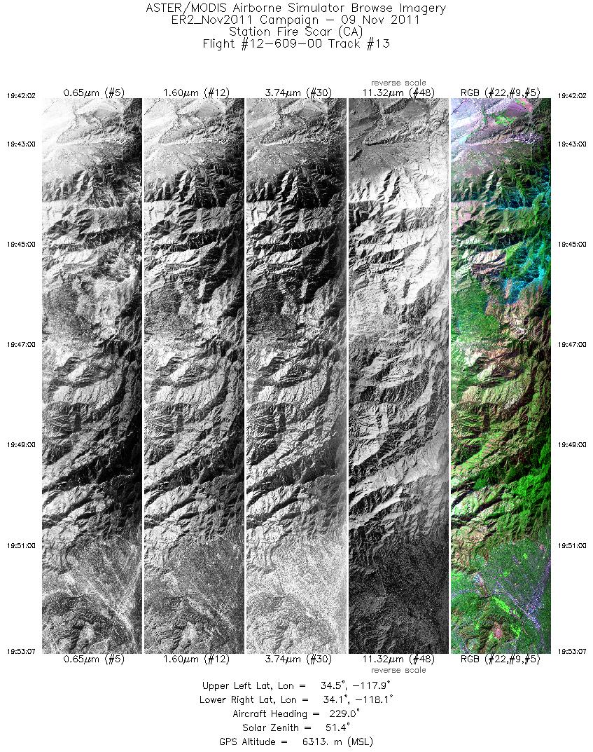
| 13 |
19:42 - 19:53 |
227.2 |
34.469 - 34.154 |
117.851 - 118.213 |
3965 |
6338 |
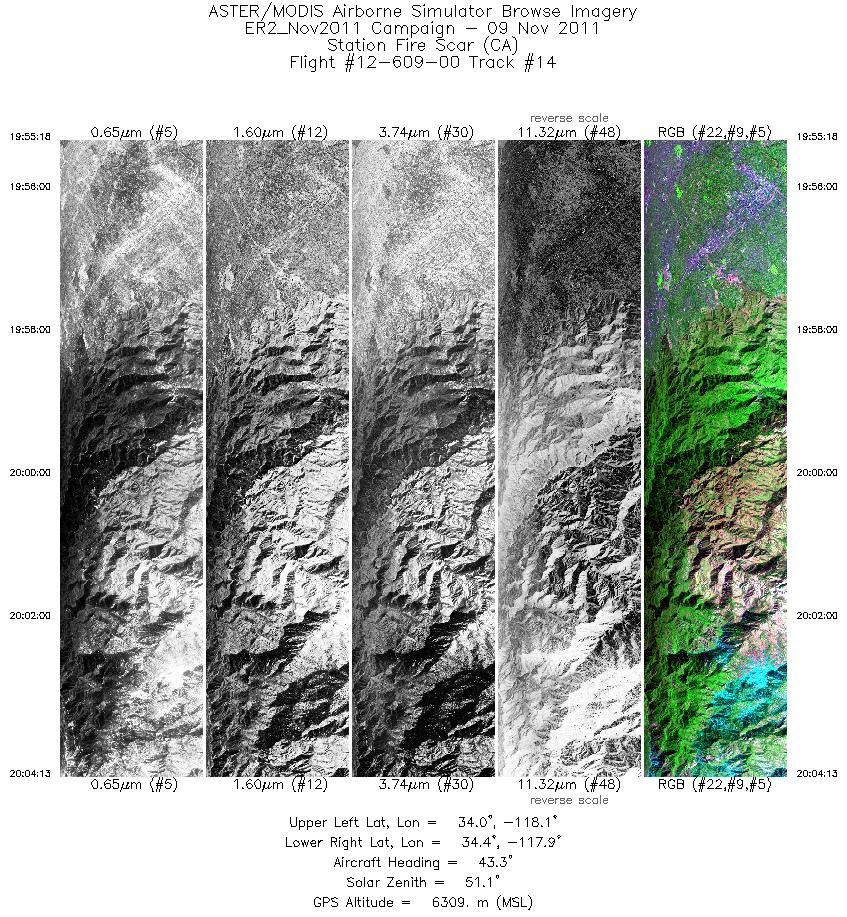
| 14 |
19:55 - 20:04 |
41.3 |
34.115 - 34.378 |
118.162 - 117.887 |
3186 |
6307 |
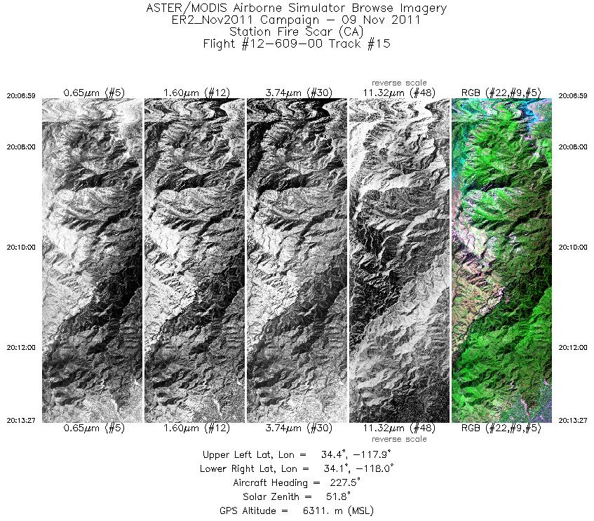
| 15 |
20:06 - 20:13 |
225.3 |
34.354 - 34.159 |
117.837 - 118.035 |
2318 |
6306 |
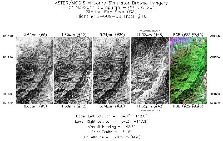
| 16 |
20:14 - 20:18 |
42.5 |
34.139 - 34.242 |
117.999 - 117.875 |
1292 |
6323 |
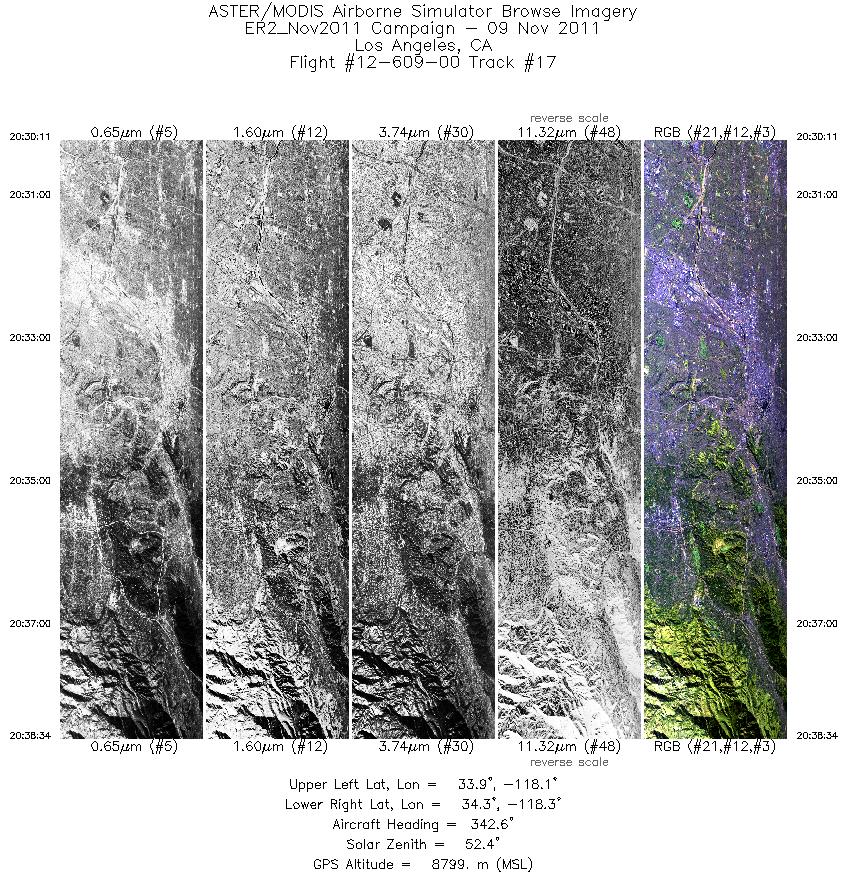
| 17 |
20:30 - 20:38 |
347.2 |
33.897 - 34.279 |
118.161 - 118.168 |
2995 |
8816 |
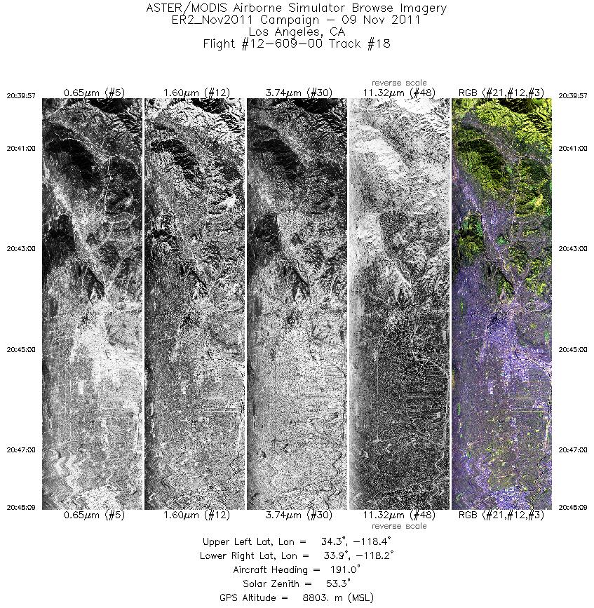
| 18 |
20:39 - 20:48 |
190.0 |
34.273 - 33.859 |
118.214 - 118.214 |
2935 |
8842 |
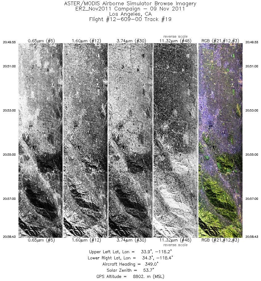
| 19 |
20:49 - 20:58 |
351.0 |
33.865 - 34.305 |
118.261 - 118.266 |
3150 |
8822 |
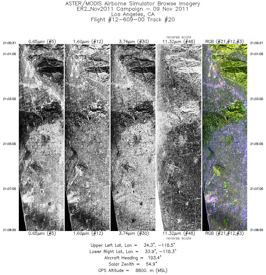
| 20 |
21:00 - 21:08 |
190.4 |
34.289 - 33.858 |
118.313 - 118.311 |
2977 |
8795 |
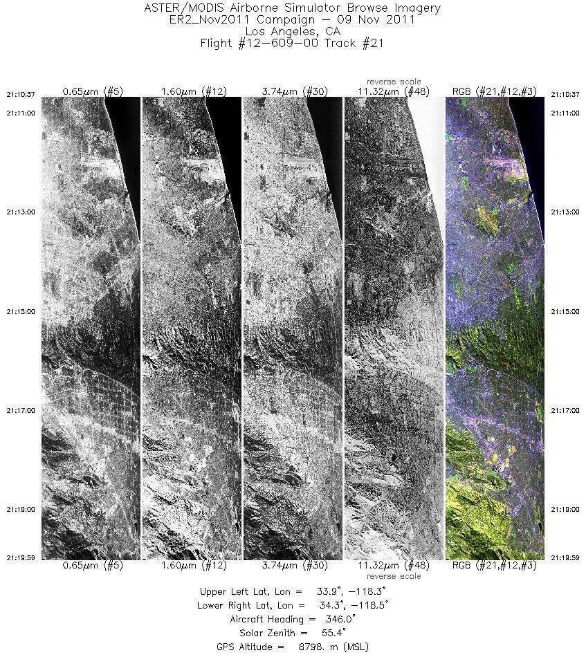
| 21 |
21:10 - 21:19 |
349.0 |
33.875 - 34.344 |
118.357 - 118.364 |
3353 |
8811 |
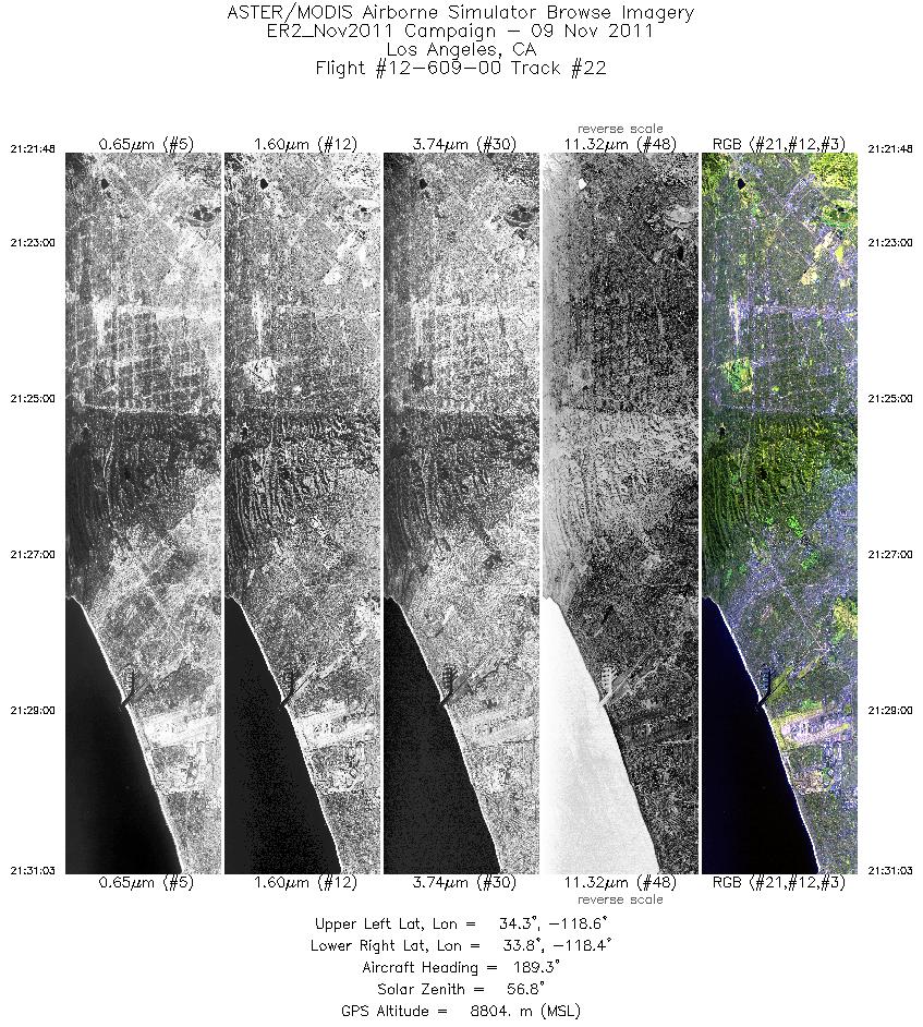
| 22 |
21:21 - 21:31 |
188.9 |
34.312 - 33.849 |
118.412 - 118.408 |
3312 |
8826 |
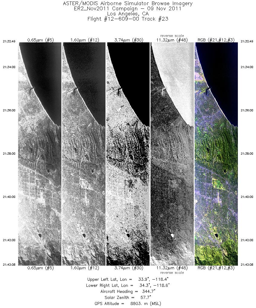
| 23 |
21:32 - 21:43 |
347.8 |
33.859 - 34.366 |
118.454 - 118.461 |
3691 |
8821 |
|


