Flight: 12-606-00
Date: November 2, 2011
Aircraft: NASA ER2, #806
Deployment: DFRC November 2011
Flight Location: California
Principal Investigator: Hook / Green (JPL), Riano (UCD)
Additional Sensors: AVIRIS / DCS
|
Data Evaluation
Overall data quality is good.
Variable altitude data collection: 20-28K MSL
|
Processing Information
Level-1B Data in HDF format is available
Flight Line Summary
Spectral Band Configuration
Spectral Response Function Table
Spectral Response Function (text)
|
Browse Imagery
Flight Tracks: 18
Scanlines: 32765
|
Browse Imagery Table
|
Click a Flight Track number to view a quicklook image
Lat/Lon ranges are for the BEG-END scanline nadir pixels
|
Flight
Track |
Time Span
(UTC) |
Heading
(Deg) |
Lat Range
(Deg N) |
Lon Range
(Deg W) |
Length
(Scanlines) |
Altitude
(Meters) |
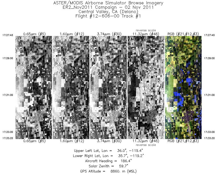
| 1 |
17:27 - 17:33 |
185.1 |
35.994 - 35.715 |
119.260 - 119.261 |
2007 |
8878 |
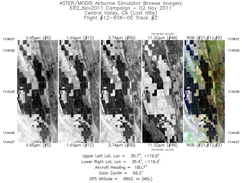
| 2 |
17:39 - 17:44 |
182.1 |
35.668 - 35.412 |
119.667 - 119.668 |
1801 |
8874 |
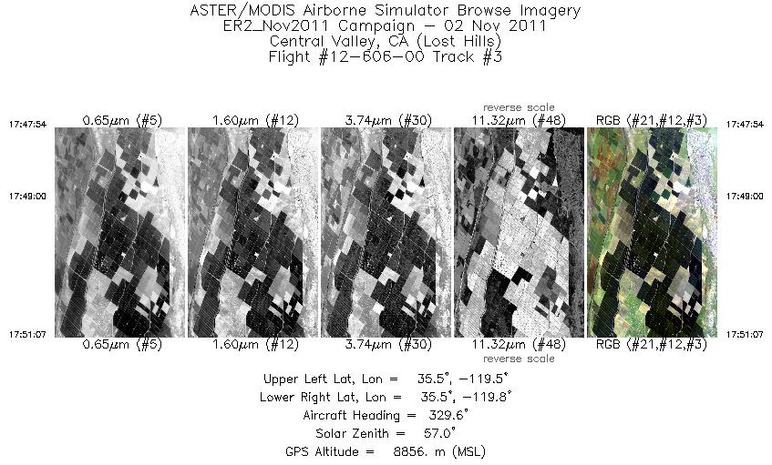
| 3 |
17:47 - 17:51 |
328.8 |
35.433 - 35.575 |
119.622 - 119.724 |
1159 |
8845 |
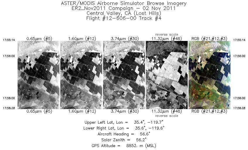
| 4 |
17:55 - 17:58 |
57.6 |
35.459 - 35.549 |
119.749 - 119.577 |
1166 |
8864 |
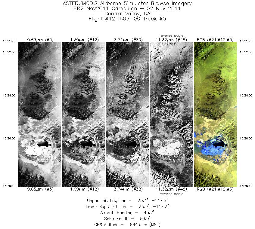
| 5 |
18:21 - 18:28 |
39.1 |
35.462 - 35.838 |
117.595 - 117.257 |
2412 |
8855 |
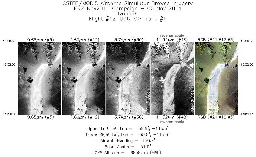
| 6 |
18:50 - 18:54 |
152.0 |
35.648 - 35.497 |
115.452 - 115.349 |
1211 |
8856 |
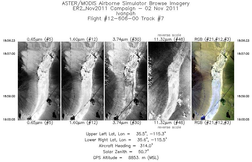
| 7 |
18:56 - 19:00 |
321.0 |
35.450 - 35.600 |
115.306 - 115.417 |
1327 |
8883 |
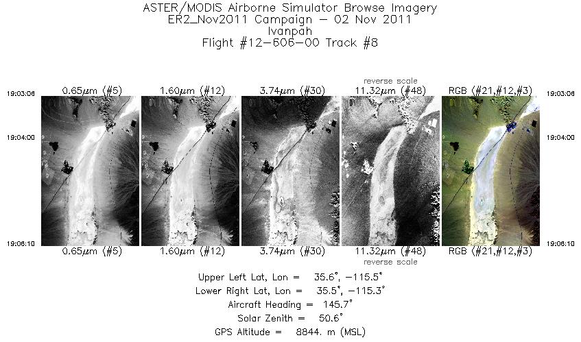
| 8 |
19:03 - 19:06 |
149.6 |
35.636 - 35.497 |
115.432 - 115.349 |
1099 |
8852 |
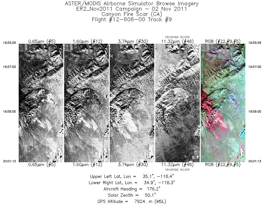
| 9 |
19:55 - 20:01 |
178.9 |
35.143 - 34.904 |
118.342 - 118.340 |
1897 |
7918 |
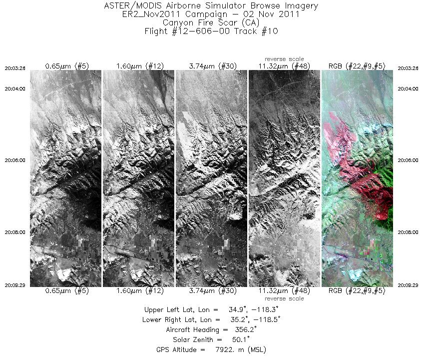
| 10 |
20:03 - 20:09 |
357.6 |
34.894 - 35.159 |
118.394 - 118.394 |
2172 |
7946 |
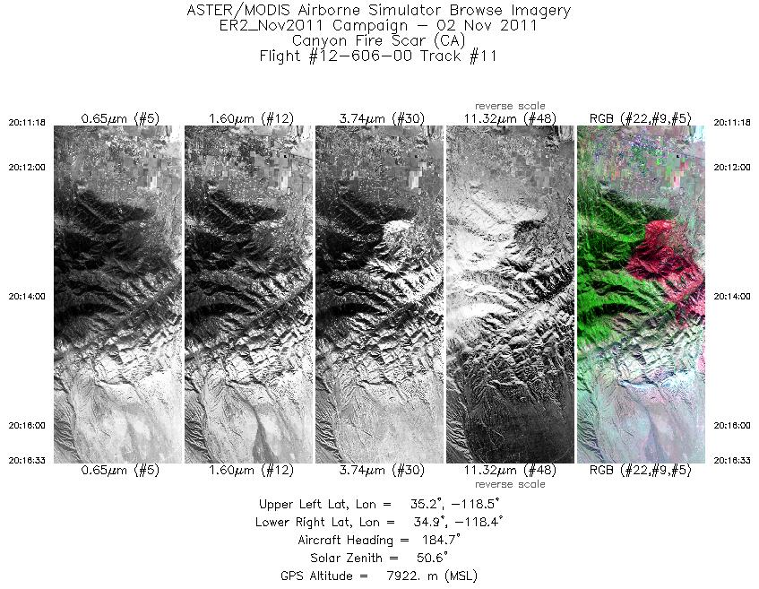
| 11 |
20:11 - 20:16 |
183.4 |
35.148 - 34.912 |
118.452 - 118.448 |
1886 |
7928 |
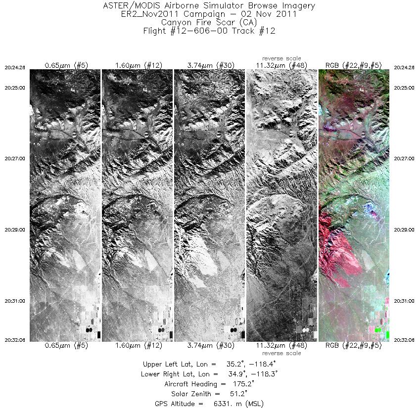
| 12 |
20:24 - 20:32 |
179.8 |
35.189 - 34.894 |
118.338 - 118.337 |
2757 |
6364 |
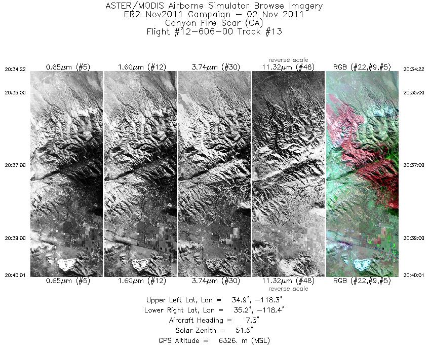
| 13 |
20:34 - 20:40 |
1.0 |
34.920 - 35.161 |
118.395 - 118.392 |
2034 |
6340 |
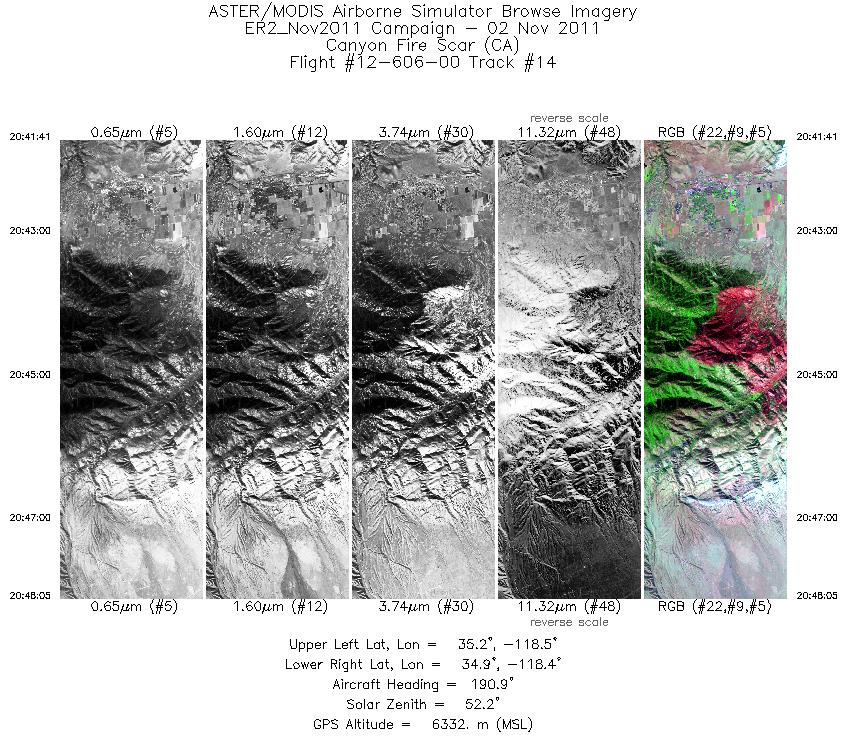
| 14 |
20:41 - 20:48 |
187.6 |
35.160 - 34.914 |
118.439 - 118.447 |
2295 |
6337 |
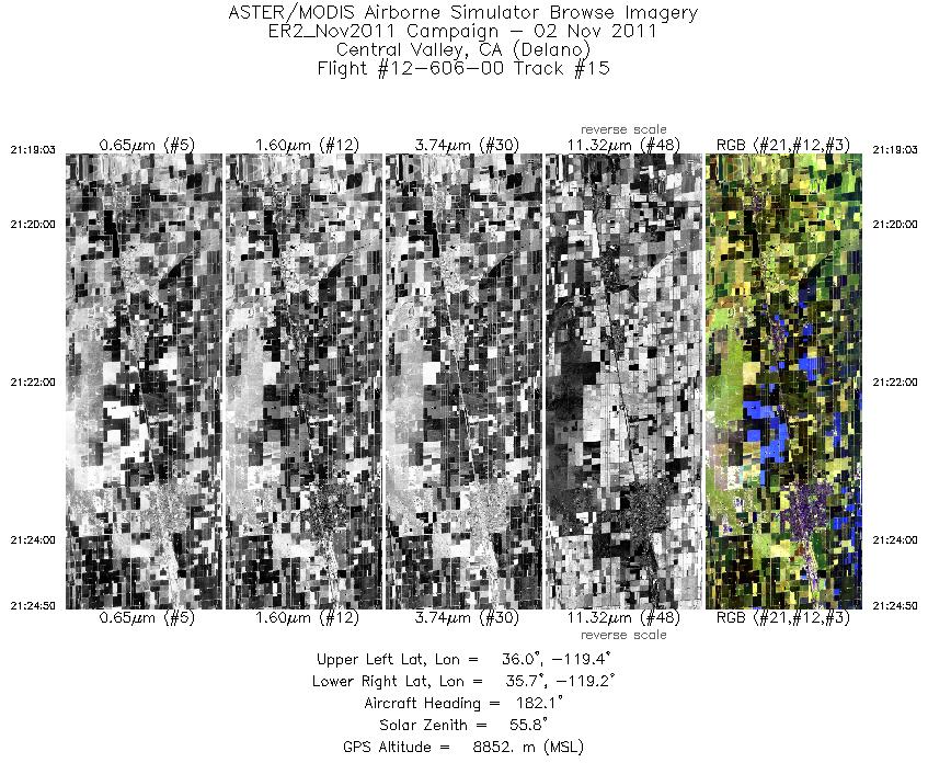
| 15 |
21:19 - 21:24 |
182.9 |
35.998 - 35.717 |
119.264 - 119.263 |
2083 |
8846 |
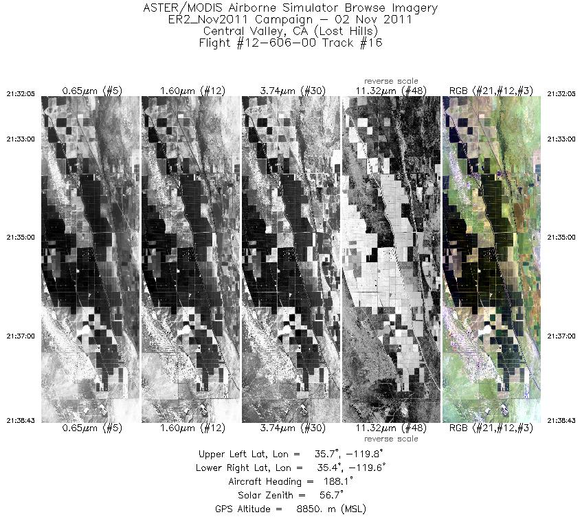
| 16 |
21:32 - 21:38 |
184.7 |
35.688 - 35.381 |
119.669 - 119.668 |
2380 |
8856 |
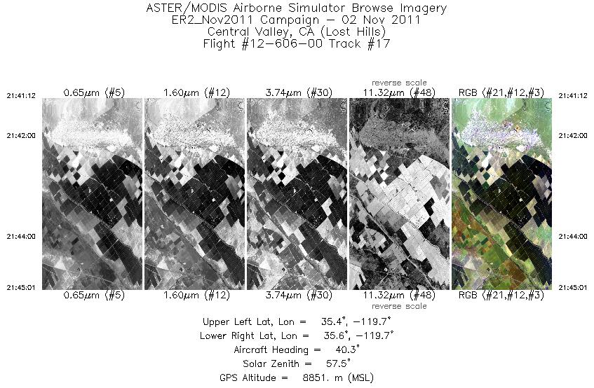
| 17 |
21:41 - 21:45 |
39.8 |
35.421 - 35.575 |
119.742 - 119.601 |
1370 |
8868 |
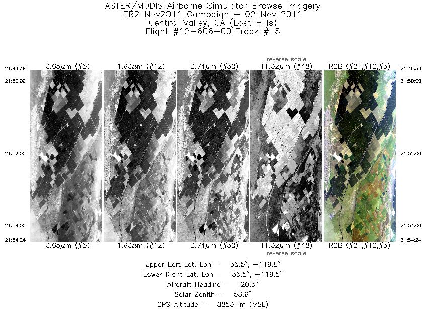
| 18 |
21:49 - 21:54 |
125.6 |
35.562 - 35.422 |
119.757 - 119.536 |
1709 |
8857 |
|


