Flight: 11-918-00
Date: May 23, 2011
Aircraft: NASA ER2, #809
Deployment: DFRC May 2011
Flight Location: White Sands, NM
Principal Investigator: Robert Iacovazzi (NOAA)
Additional Sensors: AVIRIS
|
Data Evaluation
Overall data quality is good.
|
Processing Information
Level-1B Data in HDF format is available
Flight Line Summary
Spectral Band Configuration
Spectral Response Function Table
Spectral Response Function (text)
|
Browse Imagery
Flight Tracks: 36
Scanlines: 74081
|
Browse Imagery Table
|
Click a Flight Track number to view a quicklook image
Lat/Lon ranges are for the BEG-END scanline nadir pixels
|
Flight
Track |
Time Span
(UTC) |
Heading
(Deg) |
Lat Range
(Deg N) |
Lon Range
(Deg W) |
Length
(Scanlines) |
Altitude
(Meters) |
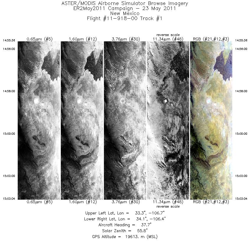
| 1 |
14:55 - 15:03 |
37.3 |
33.361 - 34.031 |
106.820 - 106.242 |
2680 |
19606 |
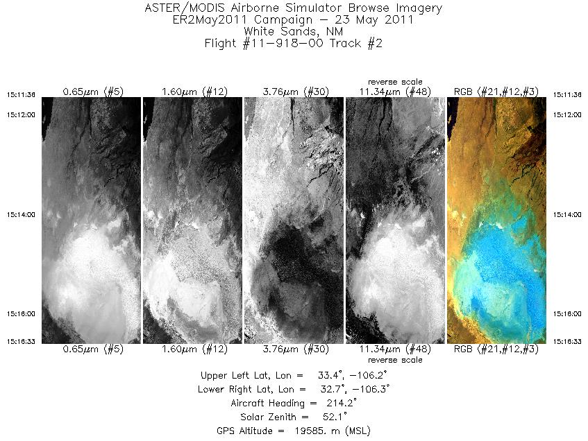
| 2 |
15:11 - 15:16 |
212.3 |
33.268 - 32.801 |
106.090 - 106.438 |
1780 |
19522 |
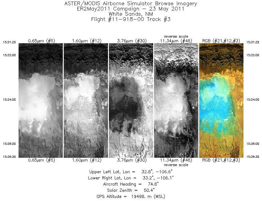
| 3 |
15:21 - 15:26 |
75.9 |
32.911 - 33.038 |
106.690 - 106.043 |
1855 |
19495 |
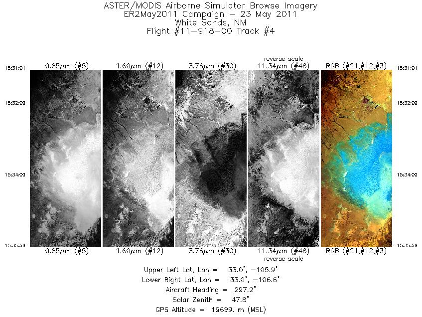
| 4 |
15:31 - 15:35 |
299.5 |
32.816 - 33.108 |
105.966 - 106.526 |
1784 |
19673 |
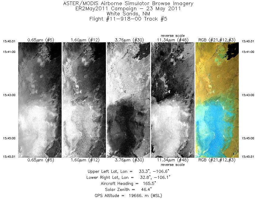
| 5 |
15:40 - 15:45 |
165.5 |
33.332 - 32.765 |
106.395 - 106.239 |
1911 |
19664 |
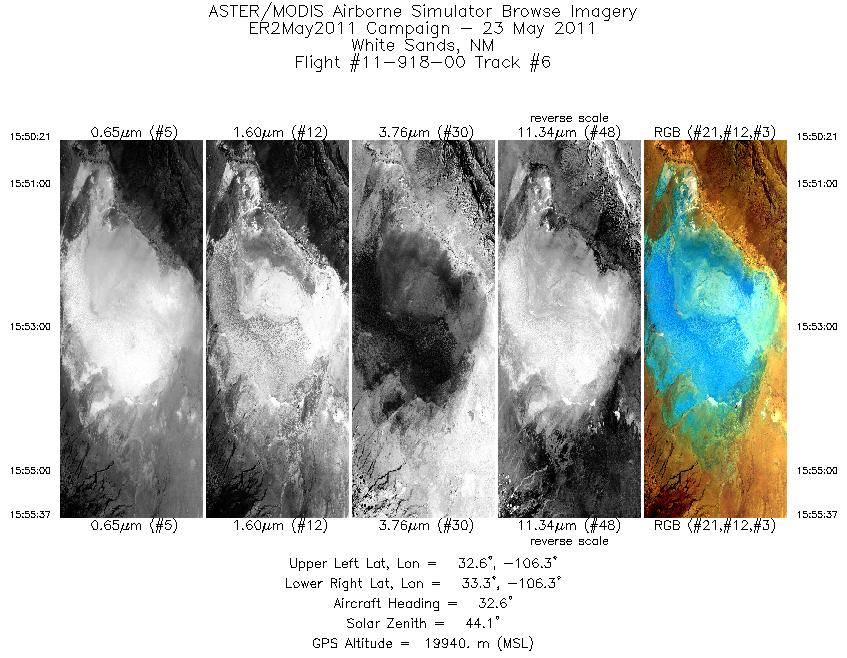
| 6 |
15:50 - 15:55 |
32.0 |
32.690 - 33.179 |
106.517 - 106.159 |
1890 |
19921 |
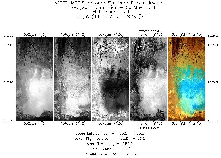
| 7 |
16:00 - 16:05 |
254.7 |
33.056 - 32.938 |
105.962 - 106.557 |
1631 |
19995 |
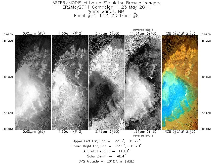
| 8 |
16:09 - 16:14 |
120.0 |
33.169 - 32.871 |
106.651 - 106.081 |
1872 |
20123 |
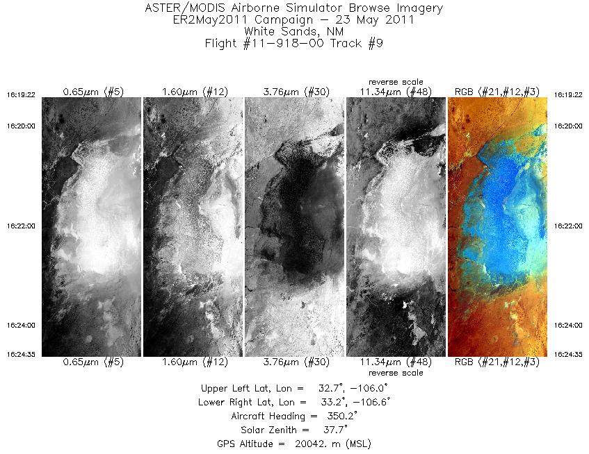
| 9 |
16:19 - 16:24 |
349.0 |
32.641 - 33.205 |
106.208 - 106.360 |
1870 |
20049 |
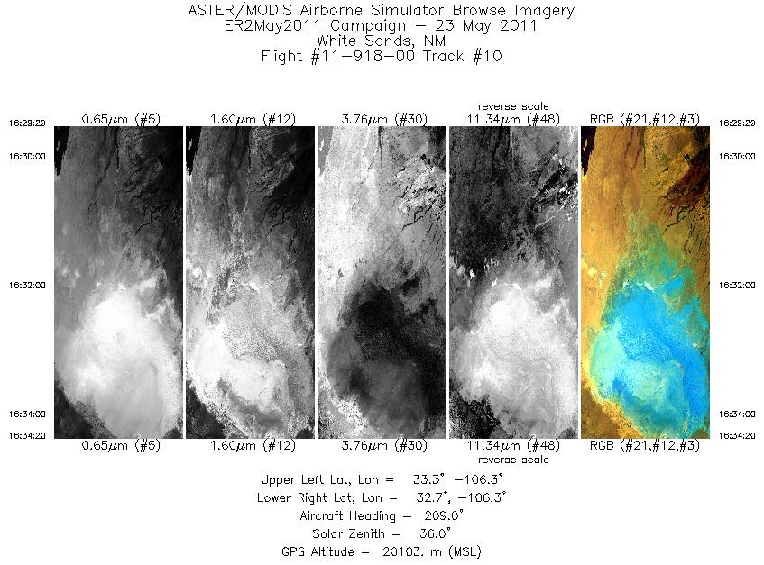
| 10 |
16:29 - 16:34 |
209.5 |
33.258 - 32.797 |
106.099 - 106.441 |
1739 |
20072 |
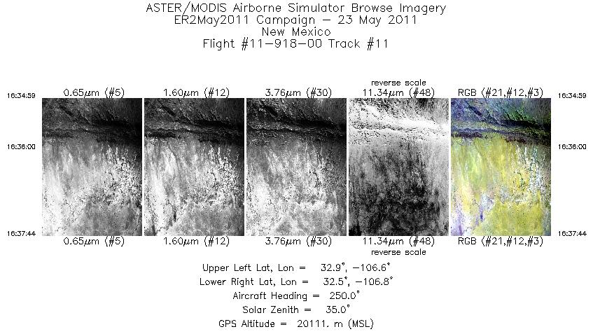
| 11 |
16:34 - 16:37 |
250.3 |
32.752 - 32.648 |
106.508 - 106.861 |
988 |
20129 |
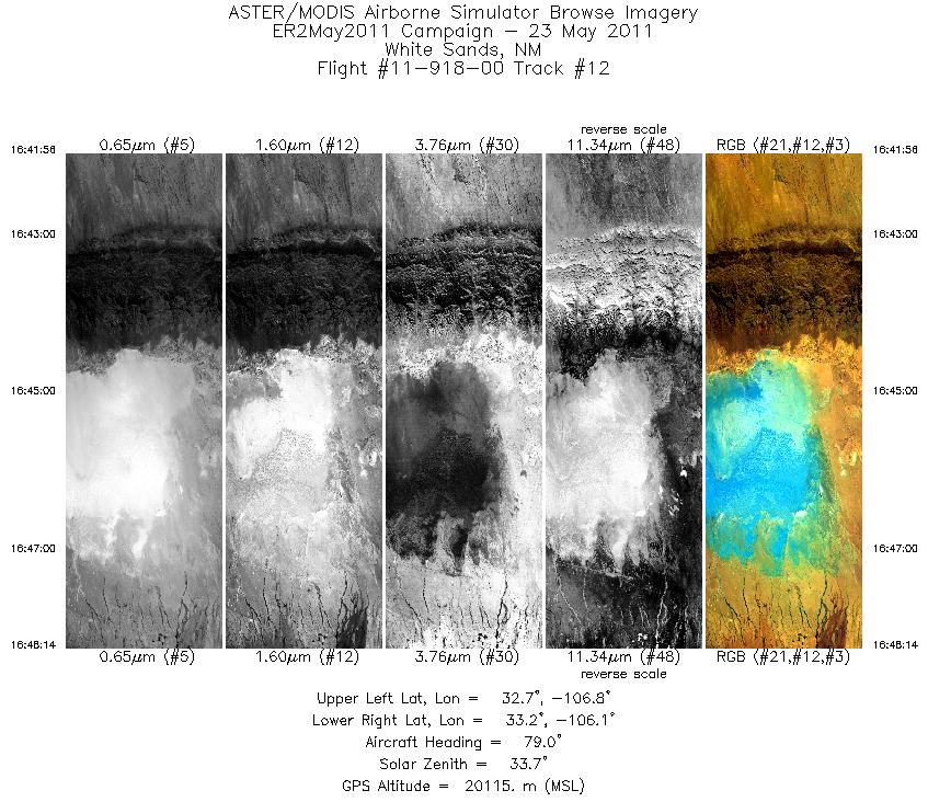
| 12 |
16:41 - 16:48 |
78.1 |
32.882 - 33.038 |
106.830 - 106.043 |
2262 |
20089 |
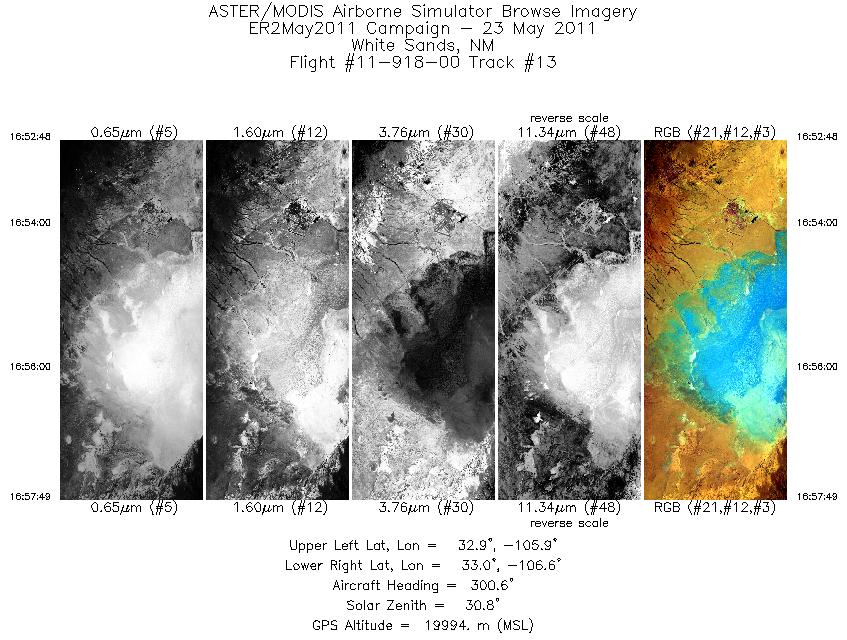
| 13 |
16:52 - 16:57 |
301.5 |
32.806 - 33.107 |
105.953 - 106.524 |
1804 |
19993 |
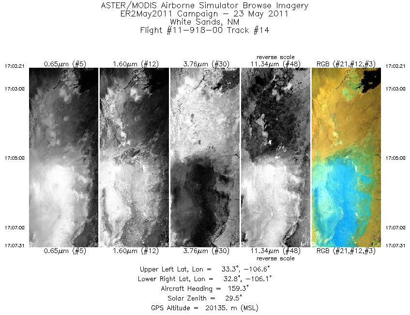
| 14 |
17:02 - 17:07 |
162.3 |
33.322 - 32.773 |
106.395 - 106.241 |
1859 |
20080 |
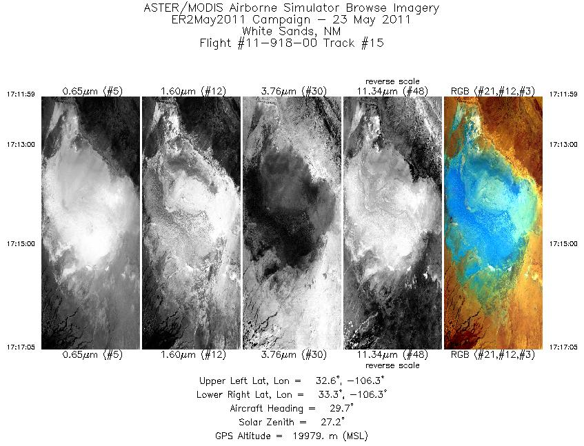
| 15 |
17:11 - 17:17 |
31.2 |
32.702 - 33.179 |
106.508 - 106.158 |
1835 |
19981 |
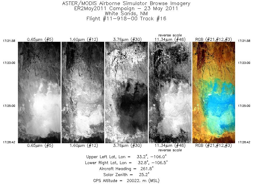
| 16 |
17:21 - 17:26 |
259.2 |
33.055 - 32.938 |
105.936 - 106.558 |
1700 |
20008 |
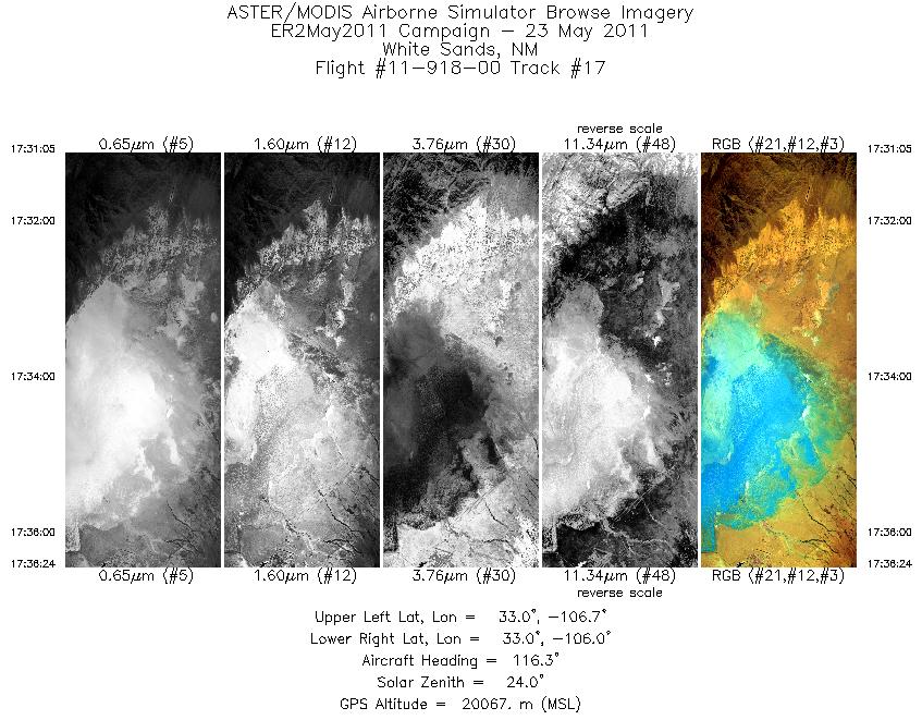
| 17 |
17:31 - 17:36 |
118.9 |
33.170 - 32.868 |
106.660 - 106.076 |
1909 |
20068 |
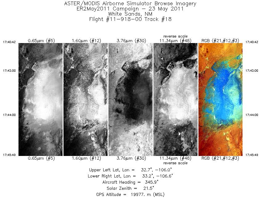
| 18 |
17:40 - 17:45 |
346.9 |
32.648 - 33.205 |
106.208 - 106.360 |
1839 |
19975 |
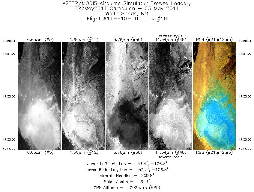
| 19 |
17:50 - 17:55 |
210.1 |
33.278 - 32.799 |
106.087 - 106.440 |
1813 |
20024 |
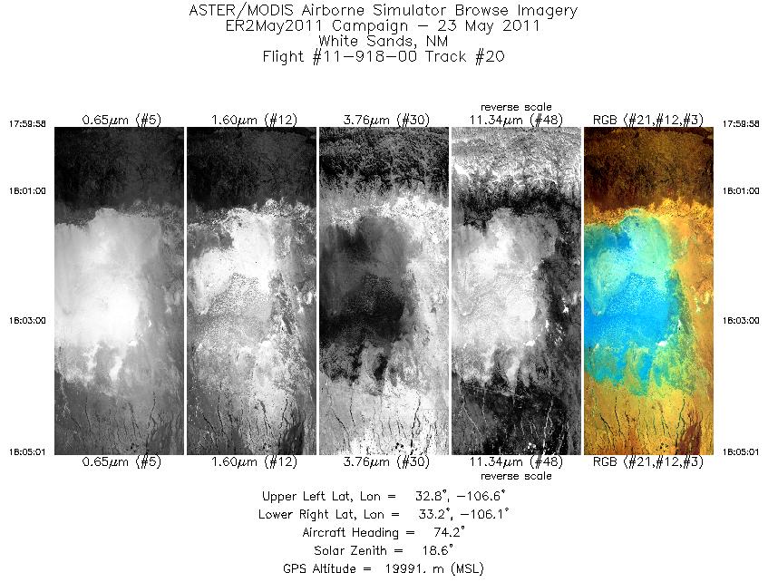
| 20 |
17:59 - 18:05 |
75.8 |
32.912 - 33.037 |
106.678 - 106.044 |
1810 |
19994 |
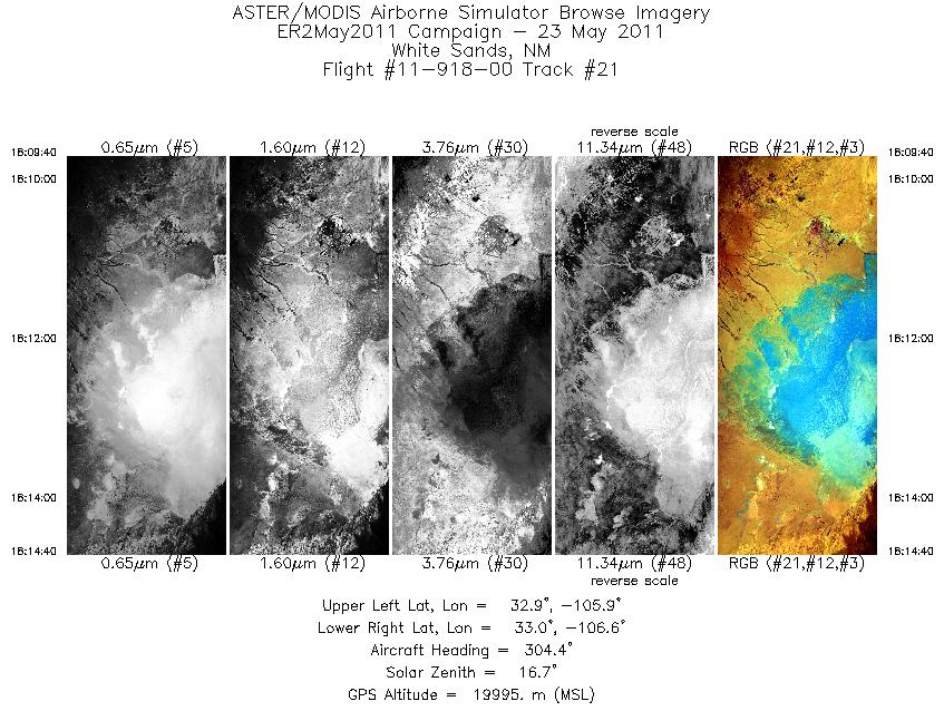
| 21 |
18:09 - 18:14 |
303.1 |
32.809 - 33.110 |
105.962 - 106.529 |
1792 |
20008 |
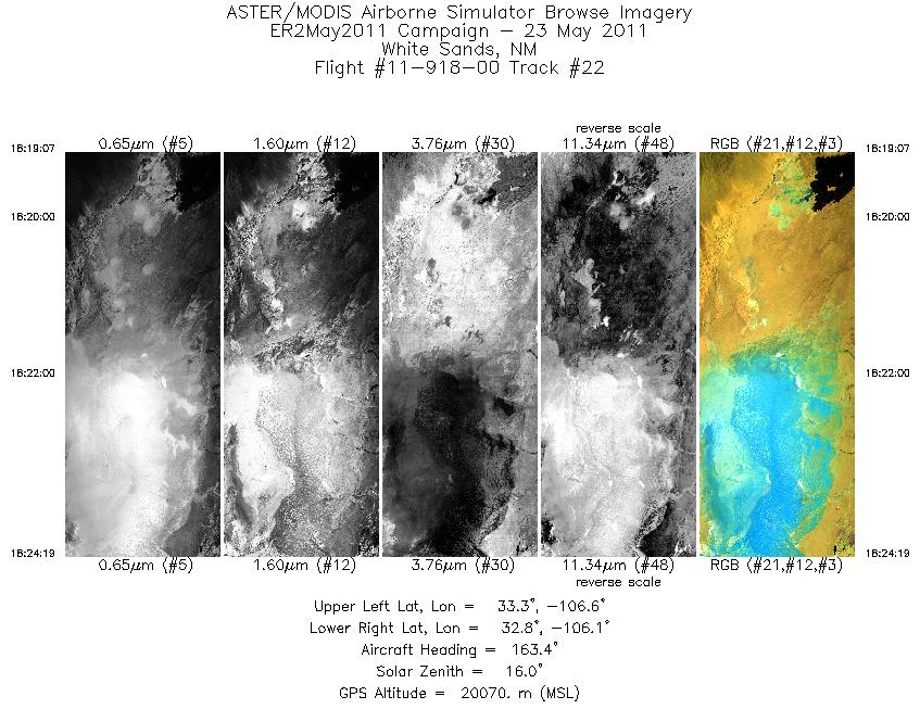
| 22 |
18:19 - 18:24 |
164.3 |
33.325 - 32.771 |
106.393 - 106.241 |
1869 |
20054 |
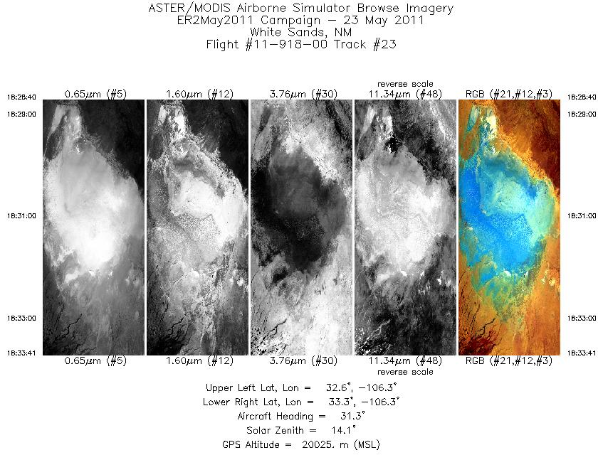
| 23 |
18:28 - 18:33 |
32.1 |
32.707 - 33.177 |
106.505 - 106.159 |
1804 |
20003 |
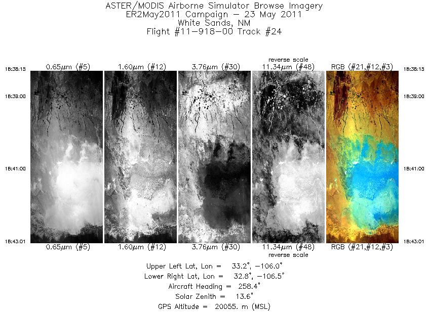
| 24 |
18:38 - 18:43 |
256.9 |
33.057 - 32.938 |
105.930 - 106.555 |
1708 |
20062 |
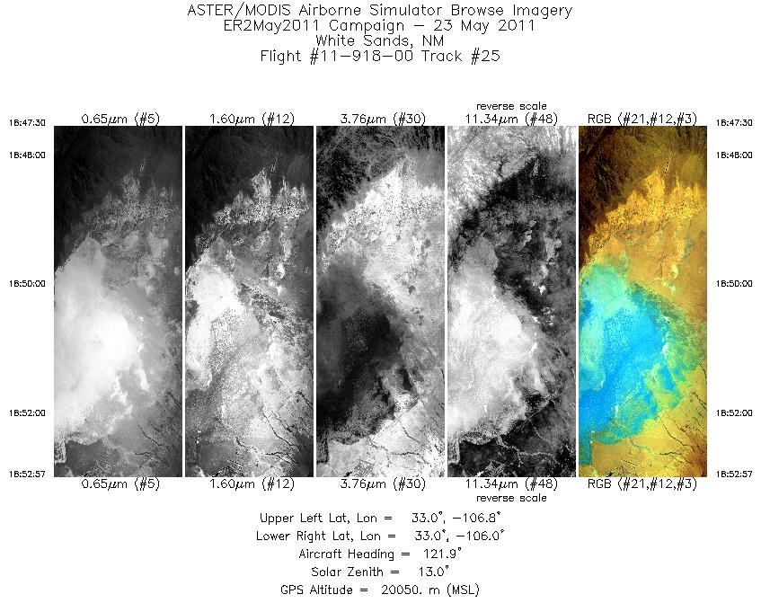
| 25 |
18:47 - 18:52 |
121.9 |
33.176 - 32.867 |
106.668 - 106.075 |
1956 |
20066 |
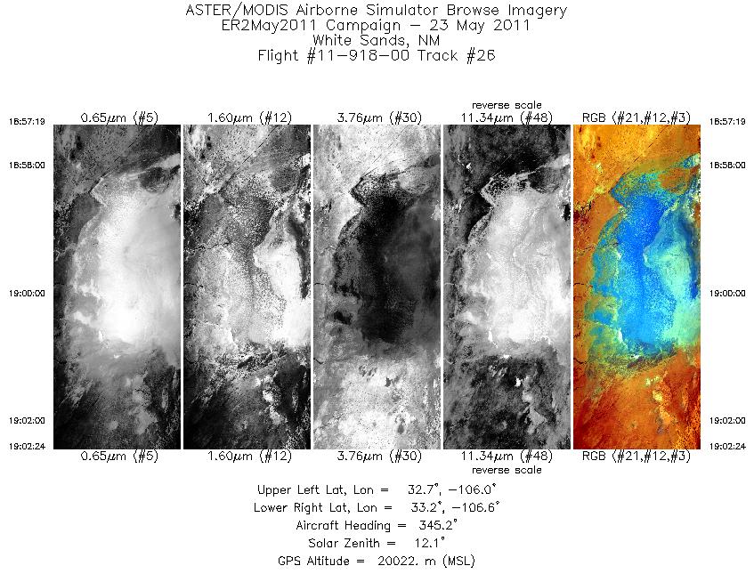
| 26 |
18:57 - 19:02 |
346.4 |
32.654 - 33.210 |
106.209 - 106.362 |
1827 |
20042 |
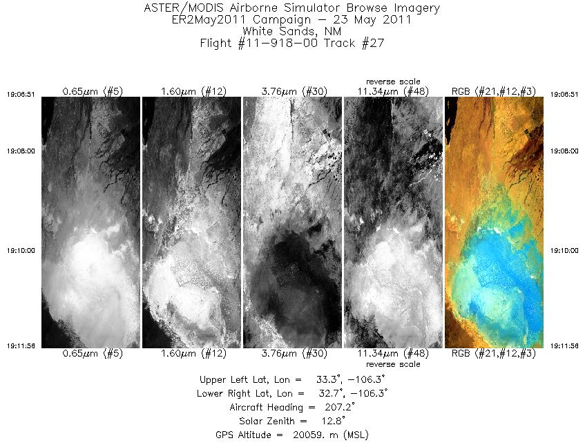
| 27 |
19:06 - 19:11 |
208.5 |
33.278 - 32.799 |
106.088 - 106.440 |
1822 |
20033 |
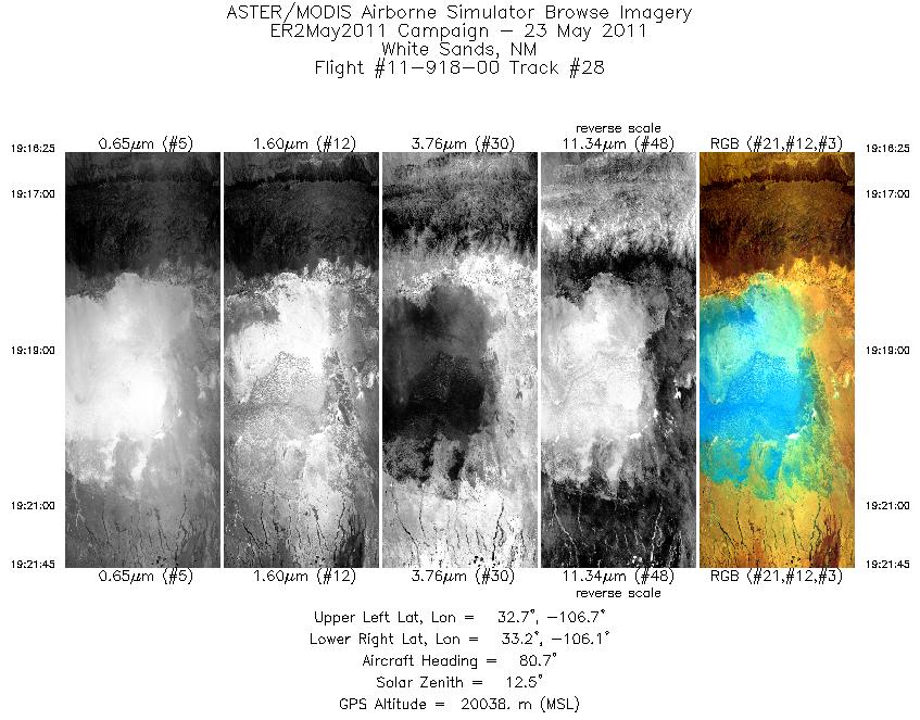
| 28 |
19:16 - 19:21 |
79.3 |
32.907 - 33.037 |
106.713 - 106.045 |
1919 |
20016 |
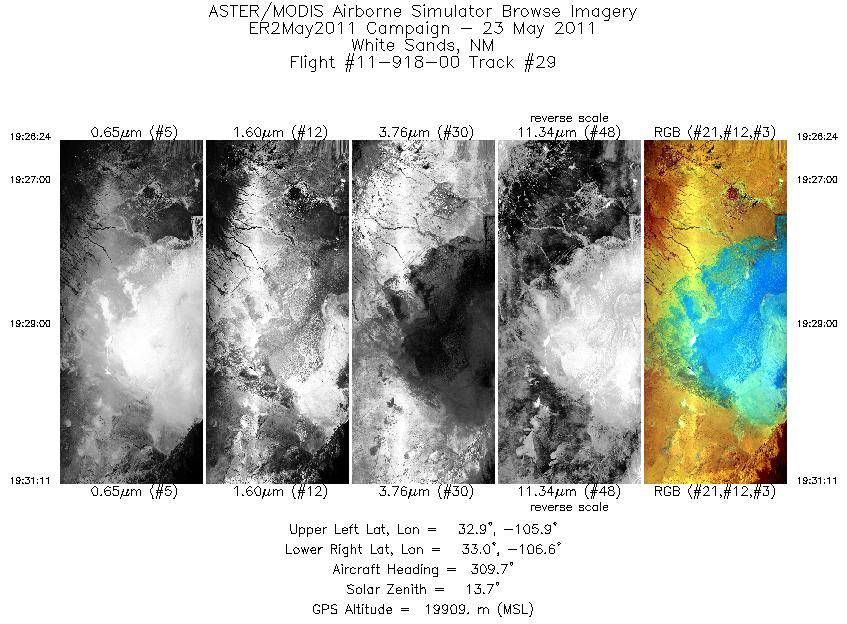
| 29 |
19:26 - 19:31 |
305.9 |
32.816 - 33.107 |
105.982 - 106.524 |
1720 |
19916 |
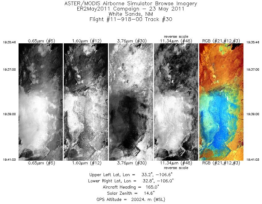
| 30 |
19:35 - 19:41 |
165.2 |
33.272 - 32.714 |
106.378 - 106.225 |
1896 |
19980 |
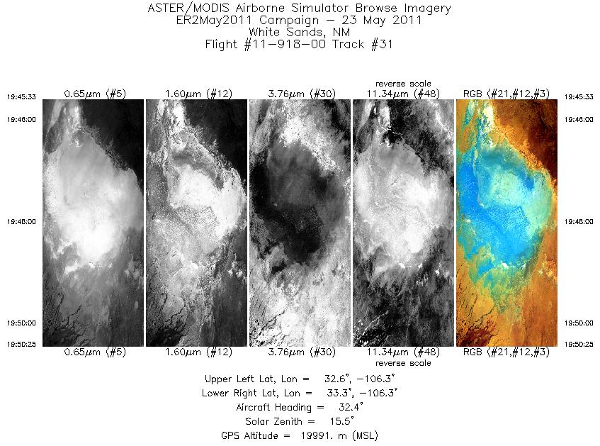
| 31 |
19:45 - 19:50 |
32.9 |
32.723 - 33.179 |
106.496 - 106.158 |
1747 |
19988 |
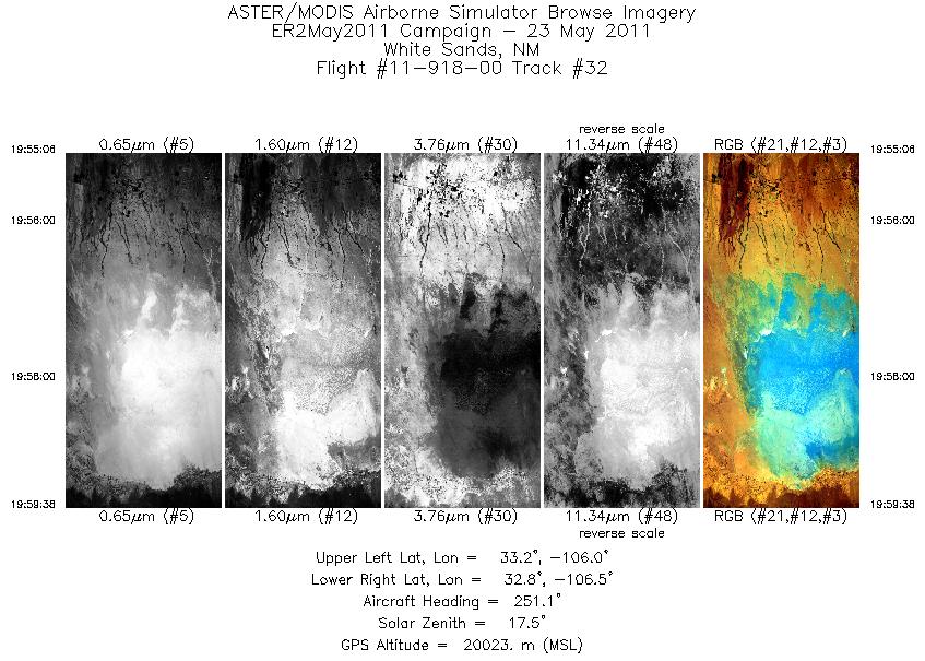
| 32 |
19:55 - 19:59 |
253.4 |
33.053 - 32.938 |
105.964 - 106.556 |
1625 |
20002 |
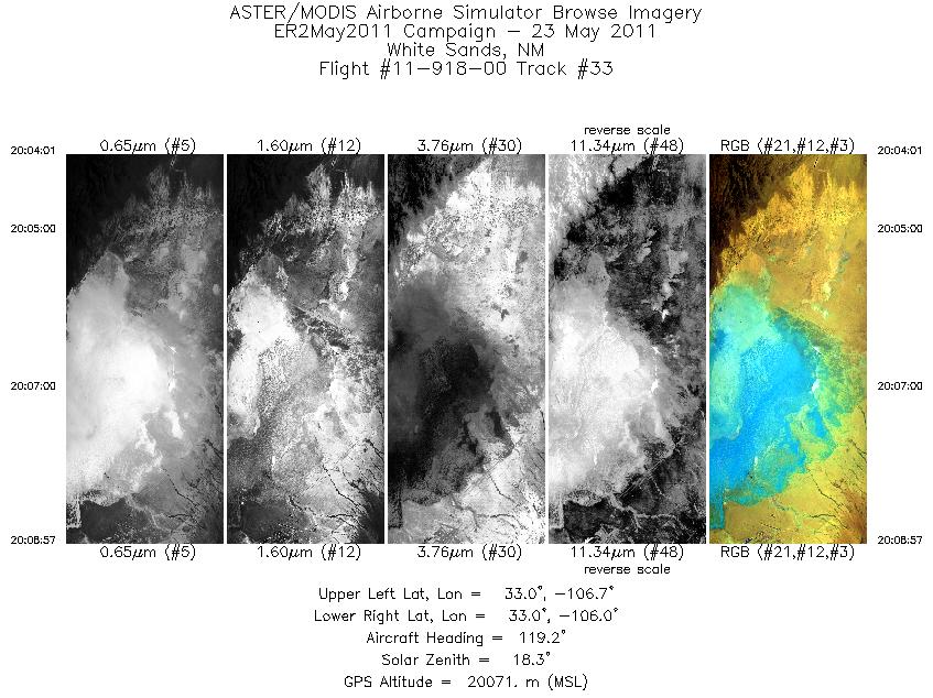
| 33 |
20:04 - 20:08 |
120.7 |
33.149 - 32.867 |
106.609 - 106.074 |
1773 |
20045 |
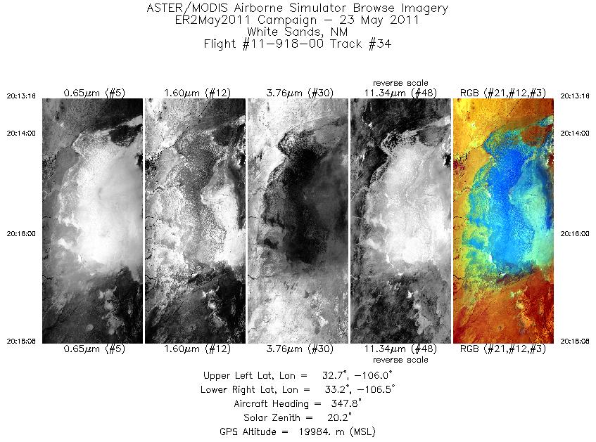
| 34 |
20:13 - 20:18 |
347.6 |
32.668 - 33.204 |
106.214 - 106.360 |
1745 |
19986 |
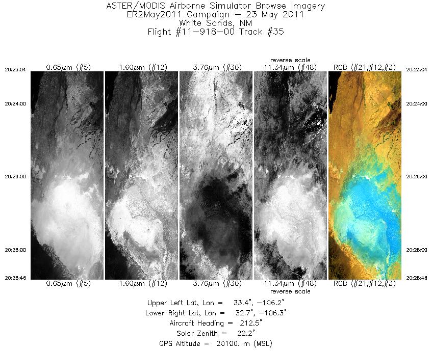
| 35 |
20:23 - 20:28 |
212.2 |
33.293 - 32.764 |
106.072 - 106.467 |
2048 |
20093 |
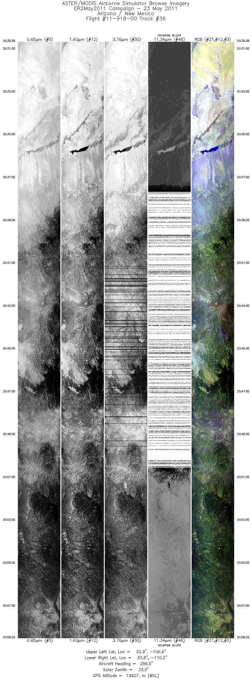
| 36 |
20:30 - 20:58 |
288.2 |
32.700 - 33.933 |
106.680 - 110.118 |
9999 |
19991 |
|


