Flight: 11-677-00
Date: August 18, 2011
Aircraft: NASA ER2, #806
Deployment: Houston 2011
Flight Location: Louisiana / Colorado
Principal Investigator: Ustin (UCD) / Green (JPL)
Additional Sensors: AVIRIS / DCS
|
Data Evaluation
Overall data quality is good.
Variable altitude data collection: 28K & 45K MSL
|
Processing Information
Level-1B Data in HDF format is available
Flight Line Summary
Spectral Band Configuration
Spectral Response Function Table
Spectral Response Function (text)
|
Browse Imagery
Flight Tracks: 13
Scanlines: 43933
|
Browse Imagery Table
|
Click a Flight Track number to view a quicklook image
Lat/Lon ranges are for the BEG-END scanline nadir pixels
|
Flight
Track |
Time Span
(UTC) |
Heading
(Deg) |
Lat Range
(Deg N) |
Lon Range
(Deg W) |
Length
(Scanlines) |
Altitude
(Meters) |
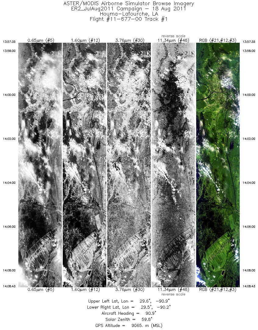
| 1 |
13:57 - 14:08 |
96.0 |
29.633 - 29.430 |
90.873 - 90.227 |
4006 |
9073 |
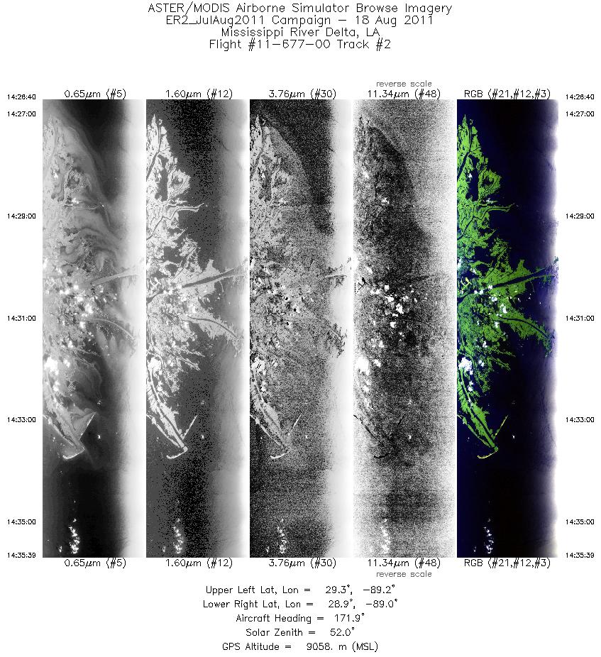
| 2 |
14:26 - 14:35 |
174.0 |
29.369 - 28.879 |
89.133 - 89.130 |
3230 |
9065 |
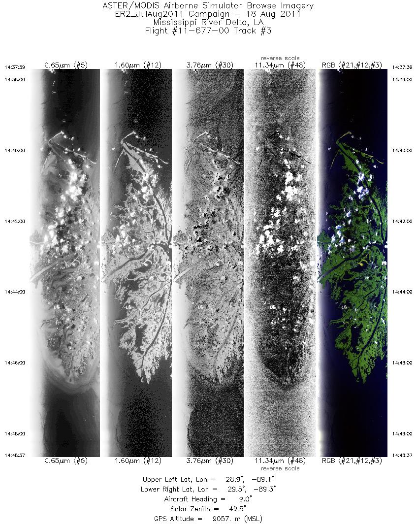
| 3 |
14:37 - 14:48 |
13.0 |
28.897 - 29.433 |
89.181 - 89.168 |
3942 |
9062 |
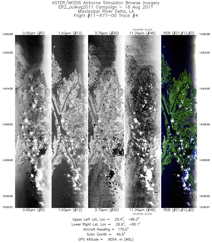
| 4 |
14:50 - 15:00 |
175.7 |
29.448 - 28.941 |
89.222 - 89.225 |
3462 |
9088 |
| 5 |
15:02 - 15:13 |
6.6 |
28.921 - 29.438 |
89.272 - 89.272 |
3707 |
9078 |
| 6 |
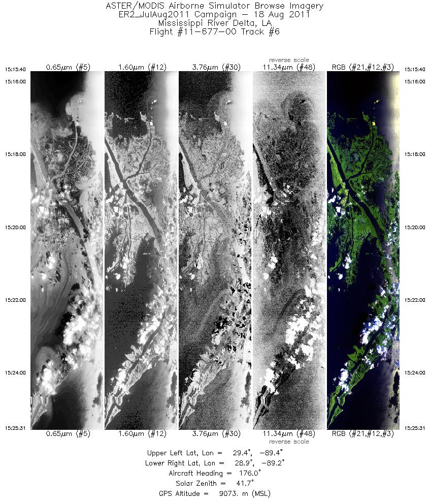
15:15 - 15:25 |
175.8 |
29.456 - 28.946 |
89.318 - 89.321 |
3534 |
9084 |
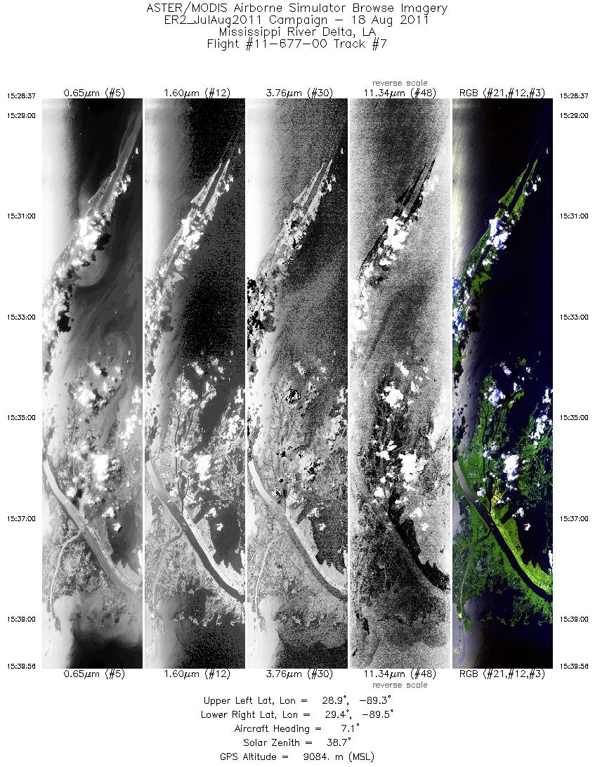
| 7 |
15:28 - 15:39 |
6.6 |
28.868 - 29.426 |
89.365 - 89.369 |
4064 |
9093 |
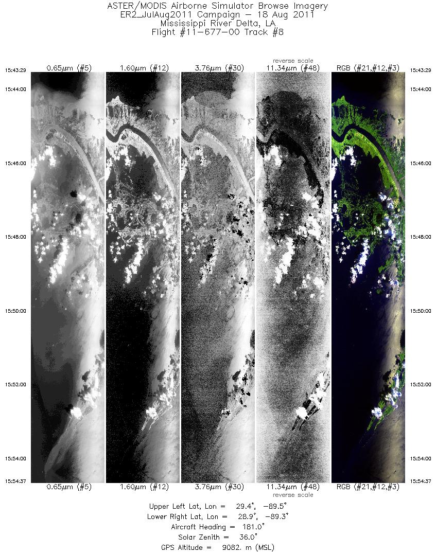
| 8 |
15:43 - 15:54 |
178.4 |
29.447 - 28.861 |
89.419 - 89.418 |
3995 |
9094 |
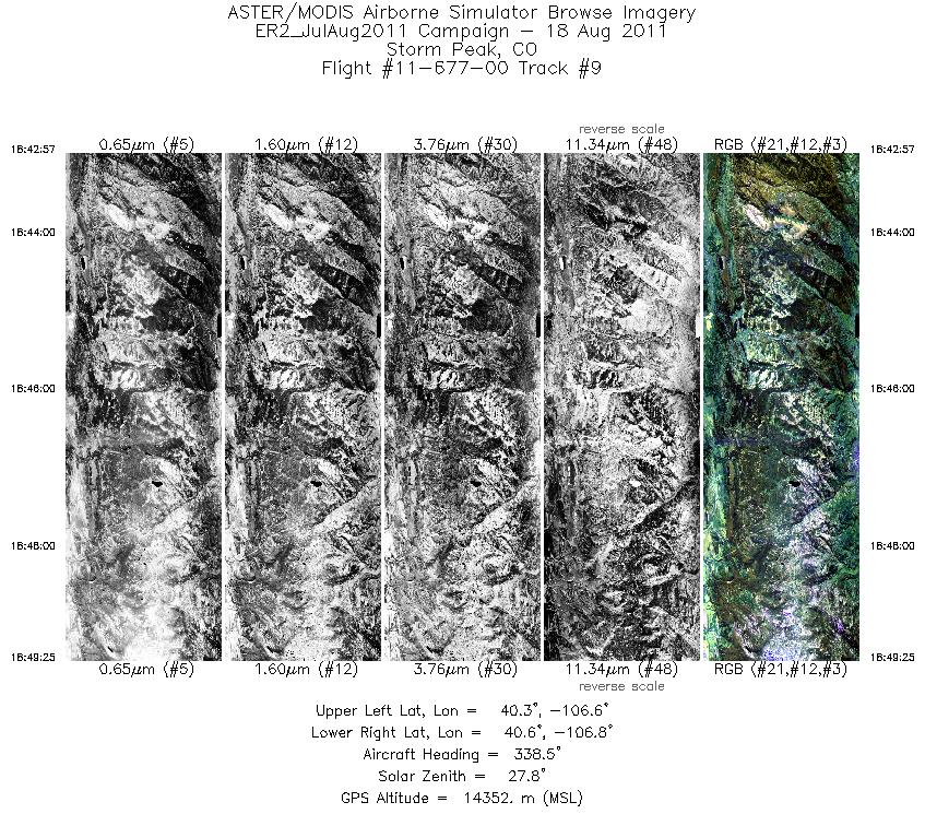
| 9 |
18:42 - 18:49 |
343.5 |
40.237 - 40.625 |
106.676 - 106.680 |
2327 |
14364 |
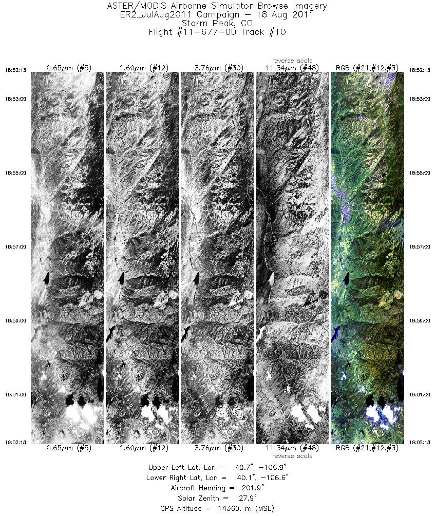
| 10 |
18:52 - 19:02 |
198.1 |
40.664 - 40.090 |
106.734 - 106.741 |
3627 |
14354 |
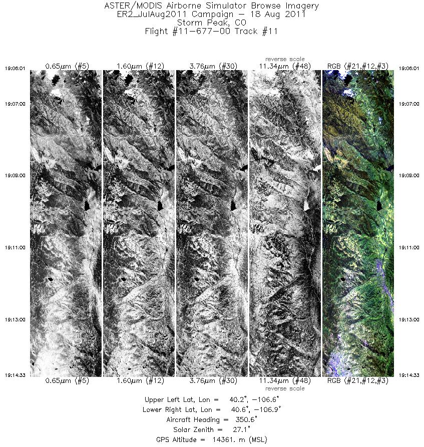
| 11 |
19:06 - 19:14 |
350.0 |
40.131 - 40.648 |
106.740 - 106.741 |
3069 |
14395 |
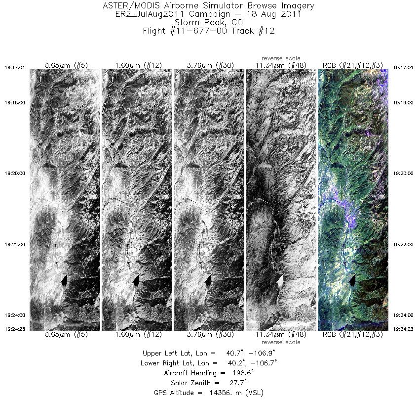
| 12 |
19:17 - 19:24 |
196.3 |
40.708 - 40.279 |
106.799 - 106.803 |
2649 |
14348 |
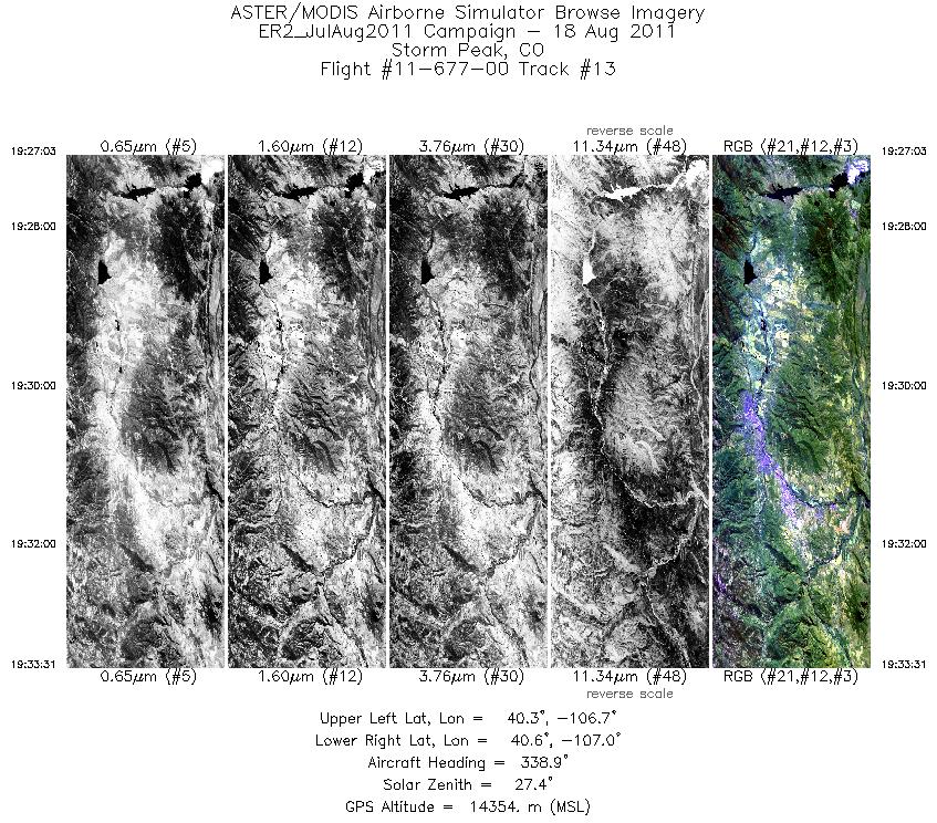
| 13 |
19:27 - 19:33 |
343.8 |
40.241 - 40.626 |
106.862 - 106.865 |
2321 |
14369 |
|


