Flight: 11-662-00
Date: July 20, 2011
Aircraft: NASA ER2, #806
Deployment: DFRC July 2011
Flight Location: Monterey County, CA
Principal Investigator: Kruse (HGI)
Additional Sensors: AVIRIS
|
Data Evaluation
Overall data quality is good.
All data collected @28K MSL
|
Processing Information
Level-1B Data in HDF format is available
Flight Line Summary
Spectral Band Configuration
Spectral Response Function Table
Spectral Response Function (text)
|
Browse Imagery
Flight Tracks: 26
Scanlines: 110428
|
Browse Imagery Table
|
Click a Flight Track number to view a quicklook image
Lat/Lon ranges are for the BEG-END scanline nadir pixels
|
Flight
Track |
Time Span
(UTC) |
Heading
(Deg) |
Lat Range
(Deg N) |
Lon Range
(Deg W) |
Length
(Scanlines) |
Altitude
(Meters) |
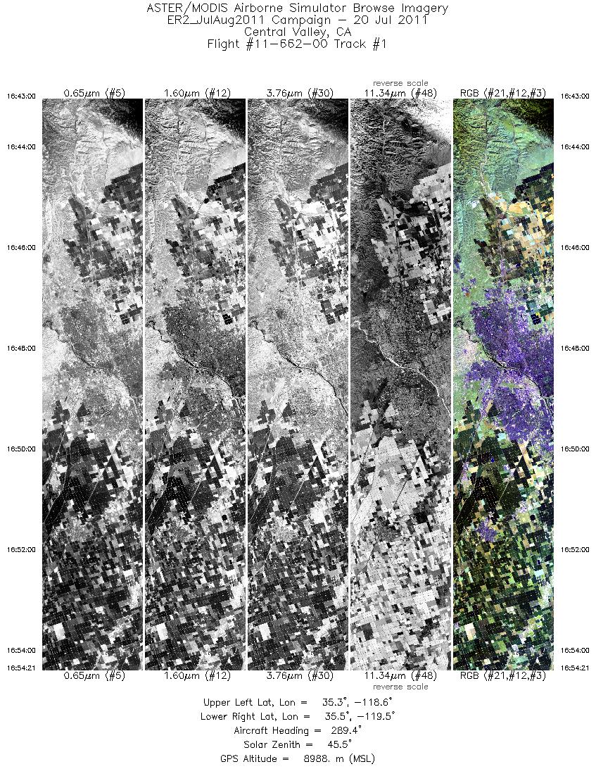
| 1 |
16:42 - 16:54 |
288.1 |
35.261 - 35.551 |
118.615 - 119.503 |
4060 |
8989 |
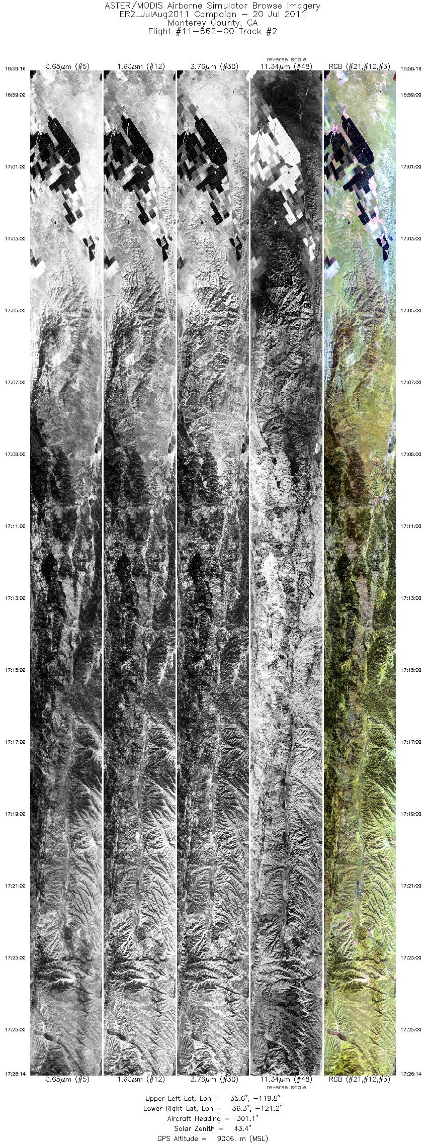
| 2 |
16:58 - 17:26 |
300.6 |
35.546 - 36.401 |
119.814 - 121.163 |
9999 |
8994 |
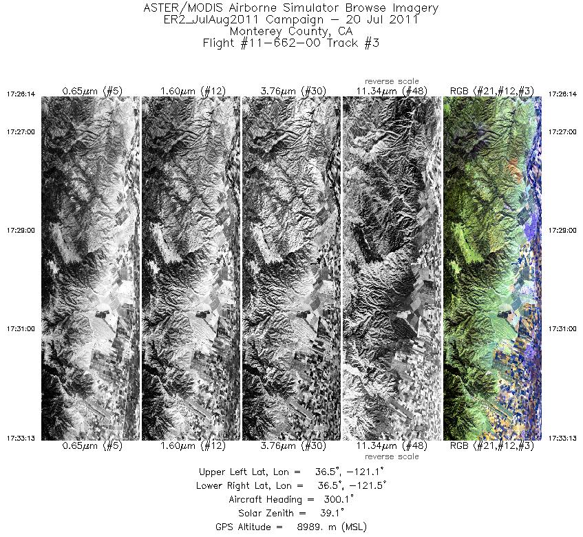
| 3 |
17:26 - 17:33 |
302.1 |
36.401 - 36.605 |
121.163 - 121.493 |
2500 |
8986 |
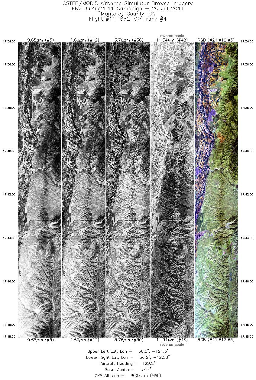
| 4 |
17:34 - 17:48 |
132.7 |
36.564 - 36.140 |
121.492 - 120.825 |
4874 |
9013 |
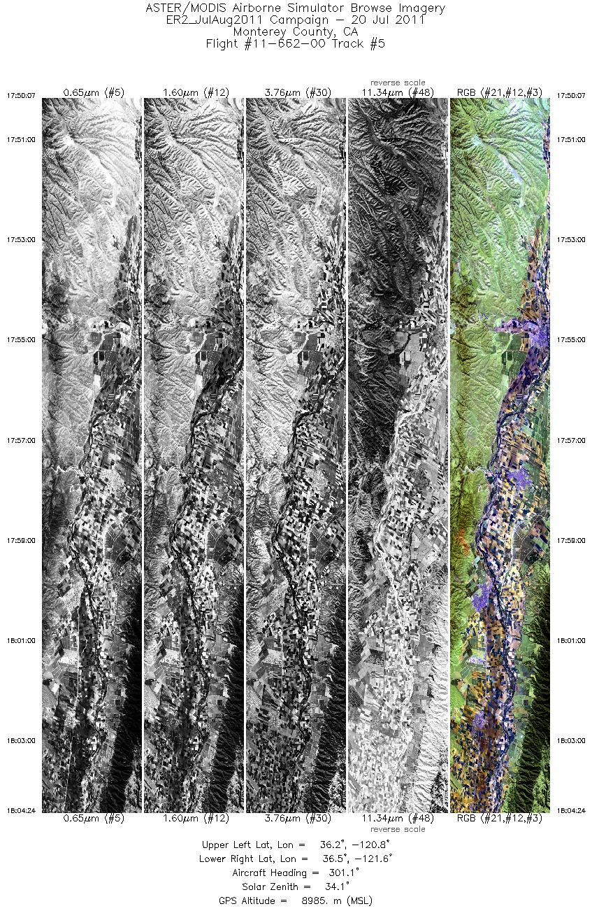
| 5 |
17:50 - 18:04 |
301.8 |
36.116 - 36.541 |
120.863 - 121.547 |
5114 |
8995 |
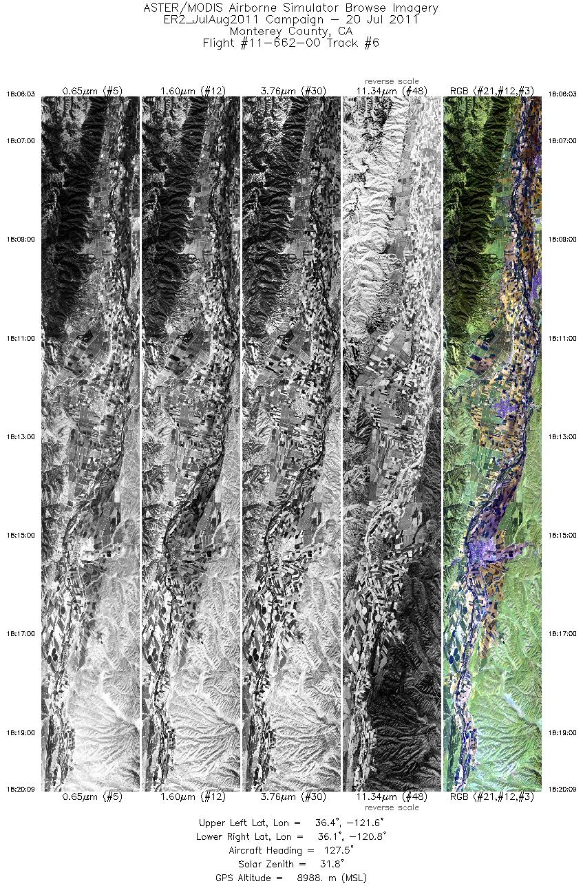
| 6 |
18:06 - 18:20 |
131.9 |
36.503 - 36.081 |
121.564 - 120.884 |
5050 |
9005 |
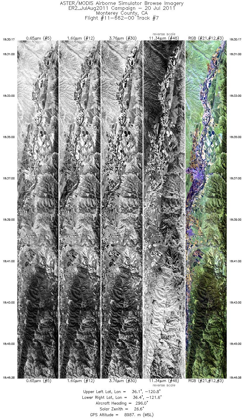
| 7 |
18:30 - 18:46 |
299.4 |
36.002 - 36.475 |
120.831 - 121.603 |
5858 |
8998 |
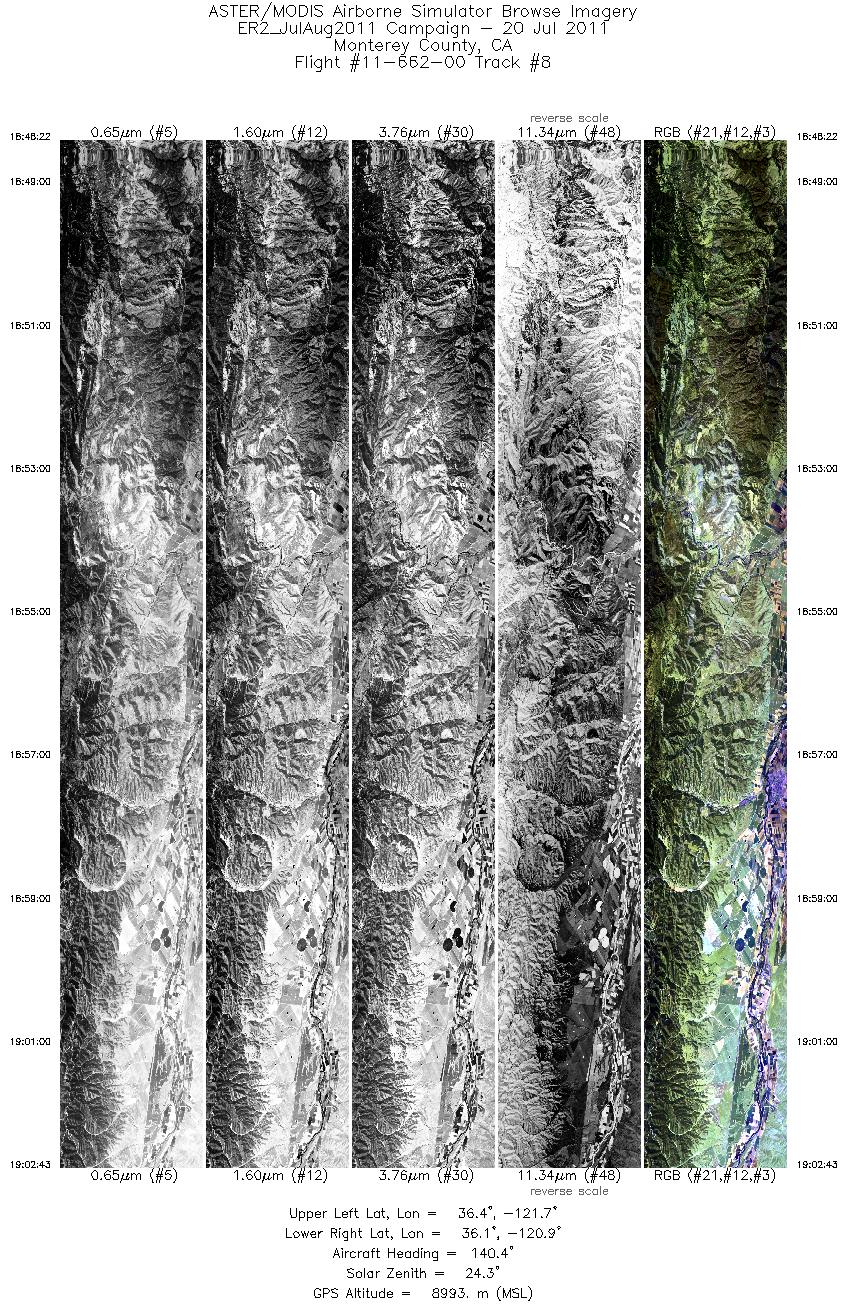
| 8 |
18:48 - 19:02 |
137.4 |
36.441 - 36.013 |
121.618 - 120.932 |
5140 |
8992 |
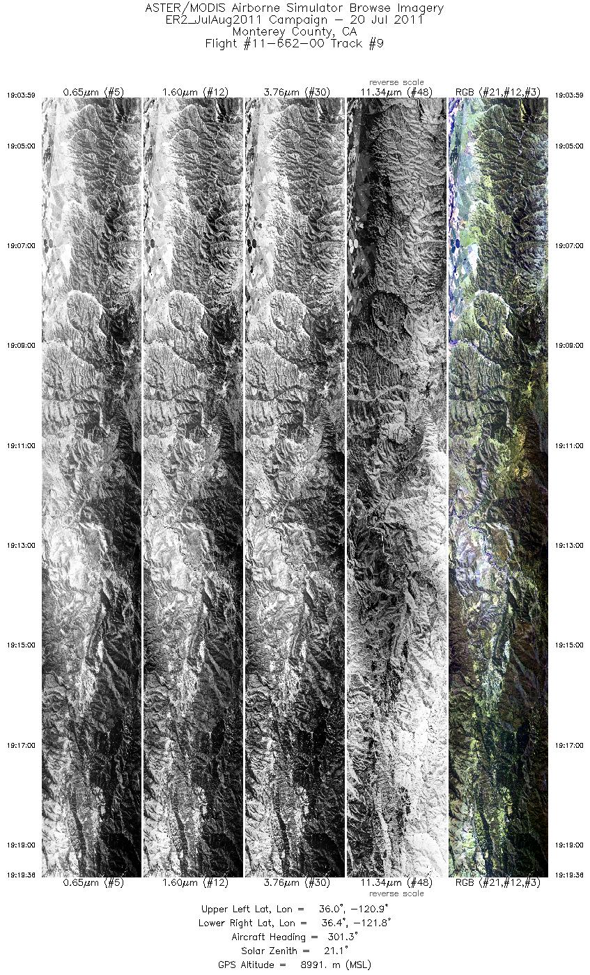
| 9 |
19:03 - 19:19 |
302.1 |
35.981 - 36.441 |
120.956 - 121.706 |
5595 |
9007 |
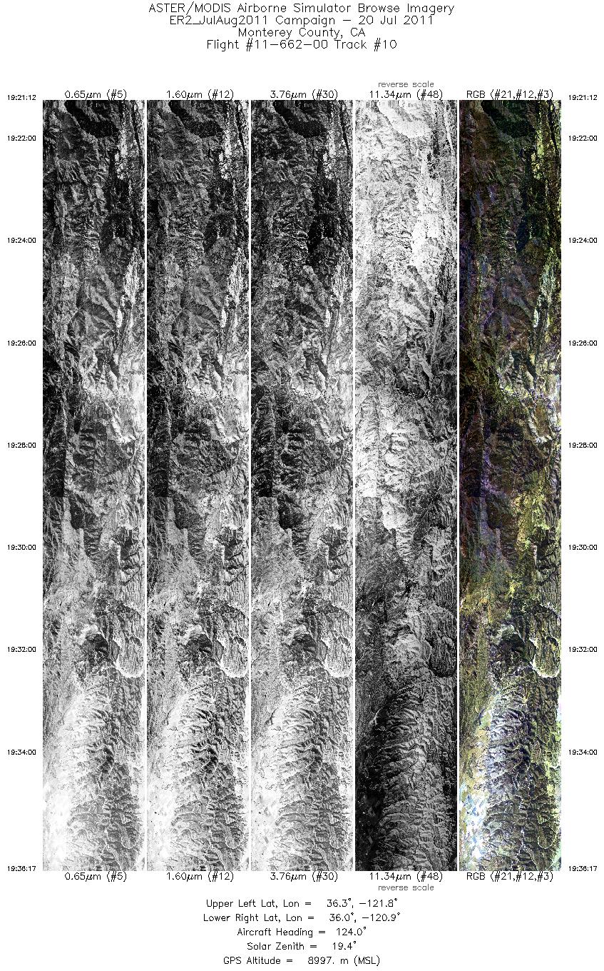
| 10 |
19:21 - 19:36 |
129.0 |
36.407 - 35.961 |
121.730 - 121.001 |
5404 |
9009 |
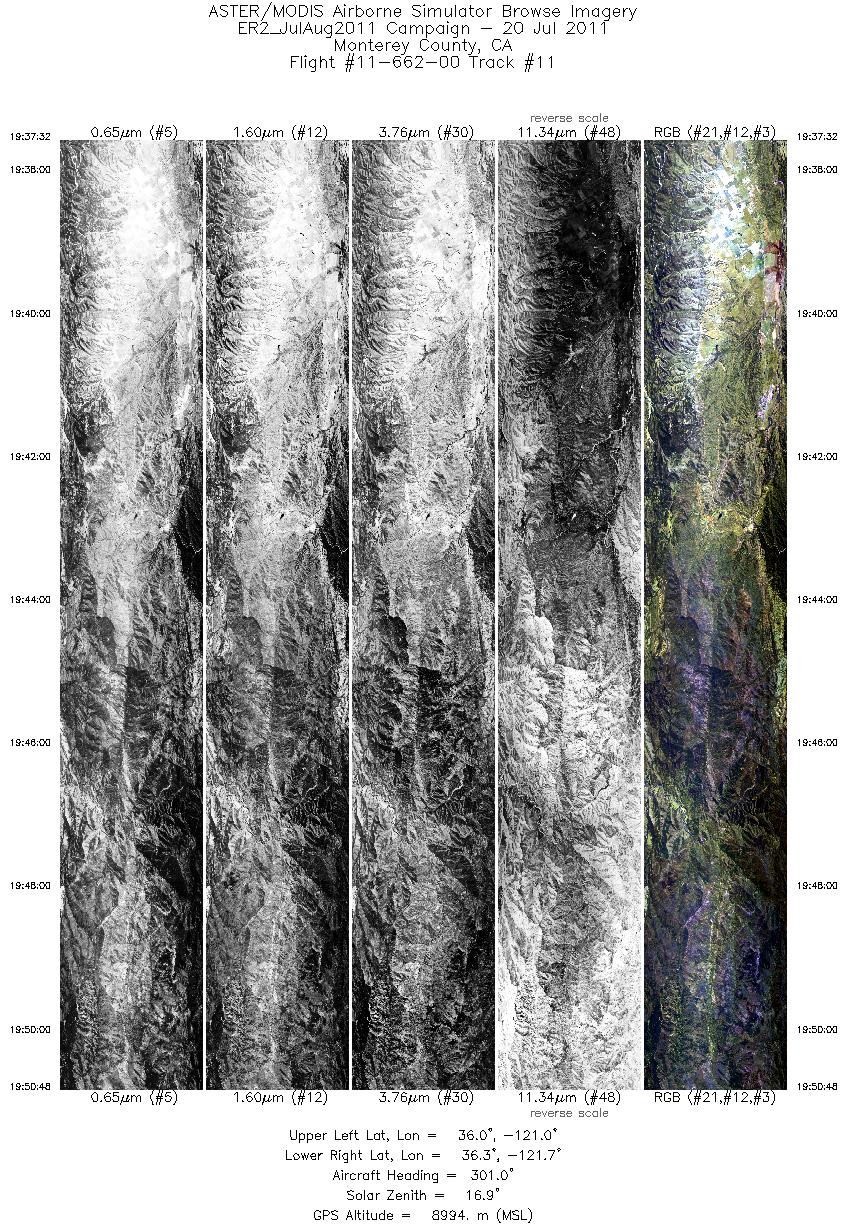
| 11 |
19:37 - 19:50 |
301.9 |
35.932 - 36.319 |
121.026 - 121.669 |
4751 |
9014 |
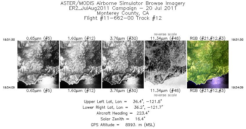
| 12 |
19:51 - 19:54 |
223.8 |
36.306 - 36.217 |
121.722 - 121.812 |
829 |
8995 |
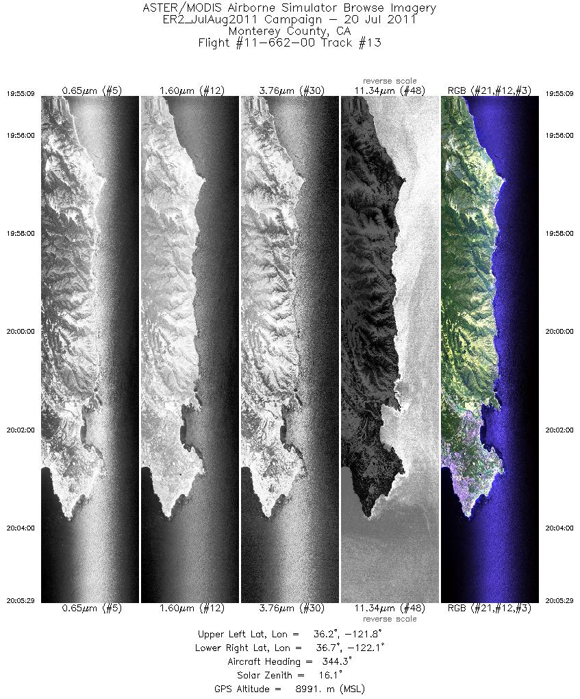
| 13 |
19:55 - 20:05 |
342.1 |
36.225 - 36.706 |
121.859 - 121.990 |
3702 |
8994 |
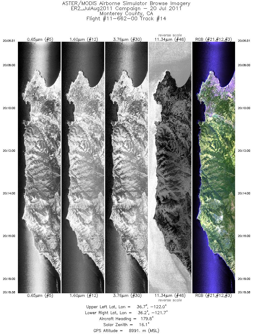
| 14 |
20:06 - 20:18 |
177.1 |
36.709 - 36.151 |
121.937 - 121.788 |
4220 |
9007 |
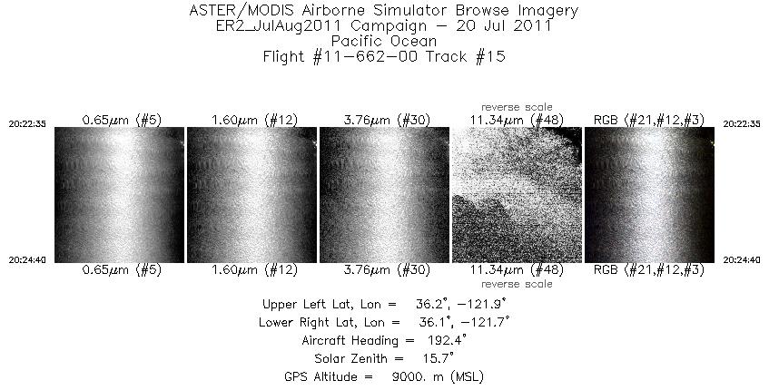
| 15 |
20:22 - 20:24 |
194.7 |
36.203 - 36.102 |
121.800 - 121.822 |
752 |
9005 |
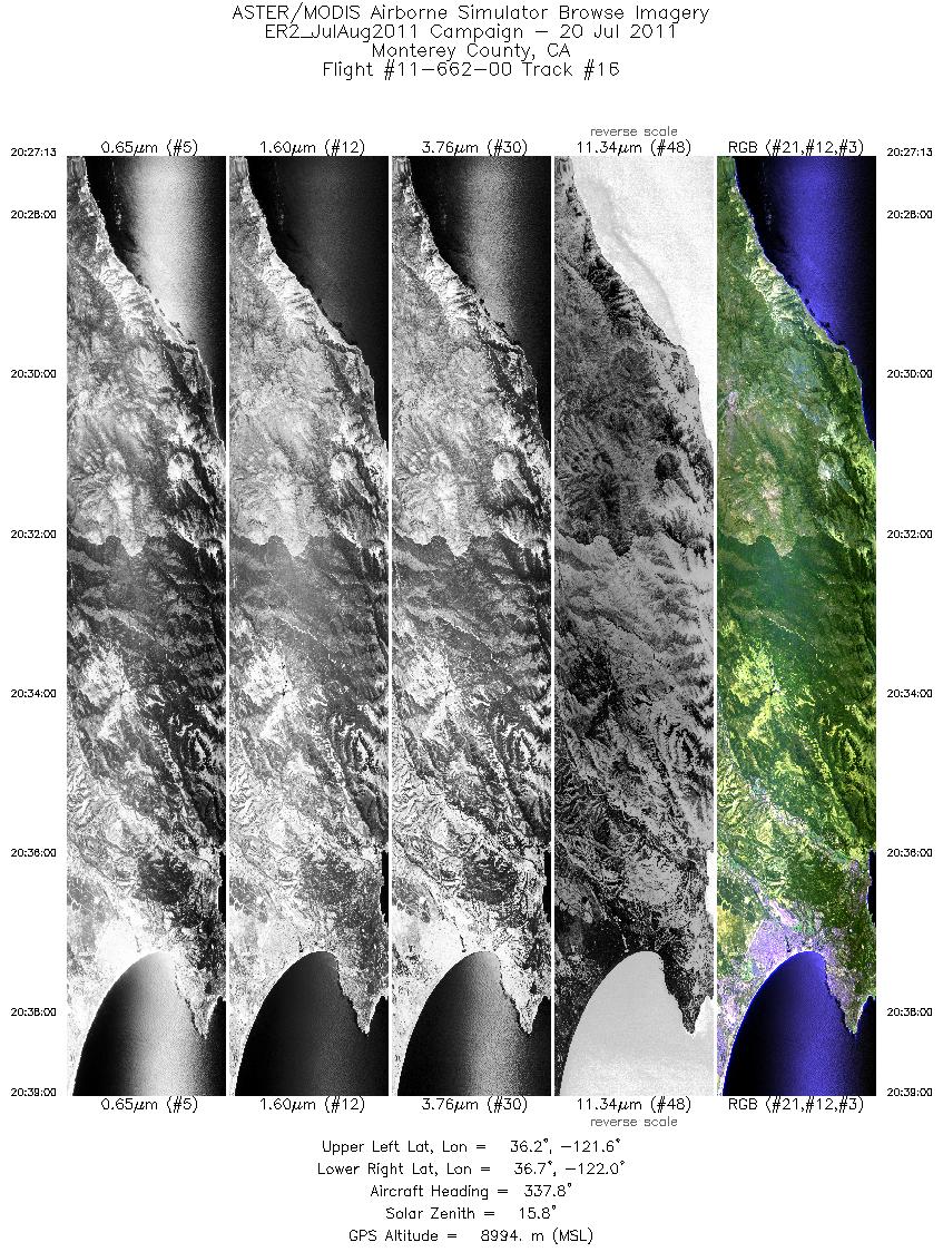
| 16 |
20:27 - 20:39 |
339.2 |
36.127 - 36.689 |
121.729 - 121.889 |
4220 |
8993 |
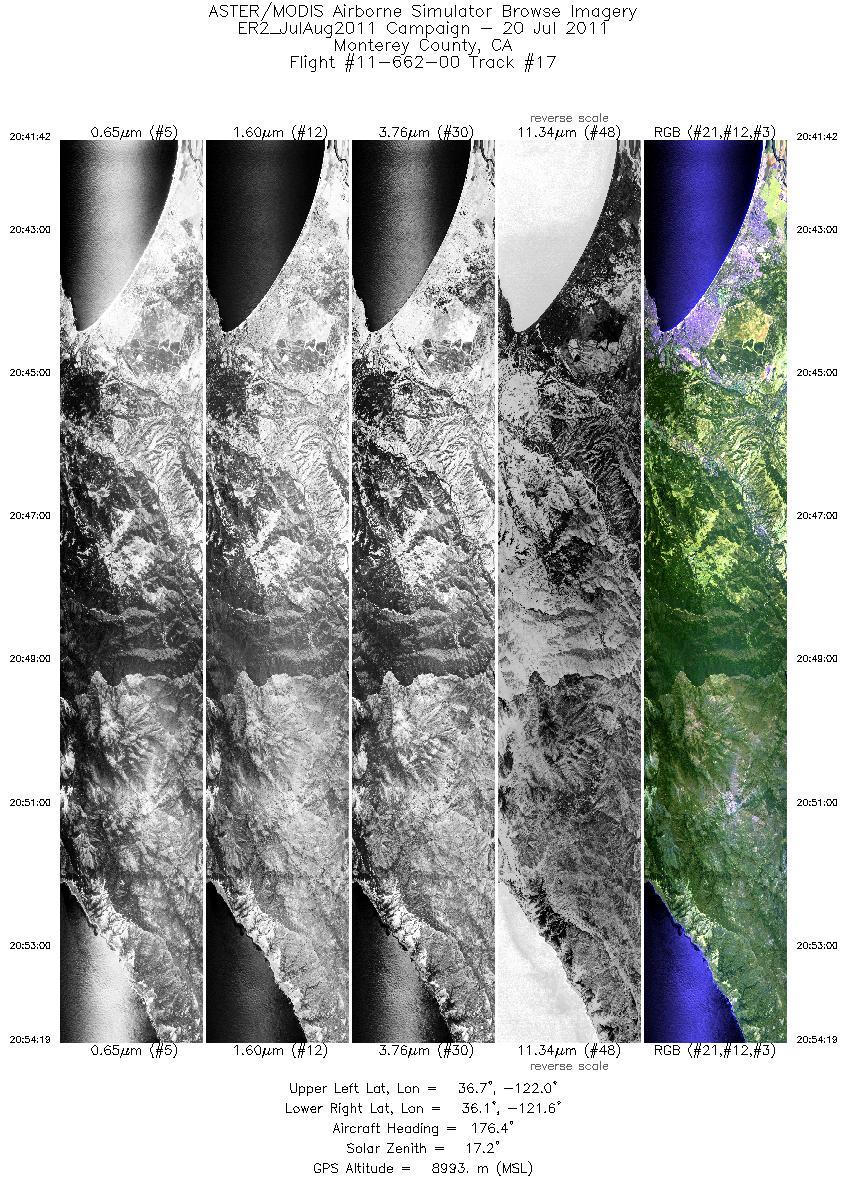
| 17 |
20:41 - 20:54 |
174.6 |
36.738 - 36.137 |
121.861 - 121.684 |
4518 |
9007 |
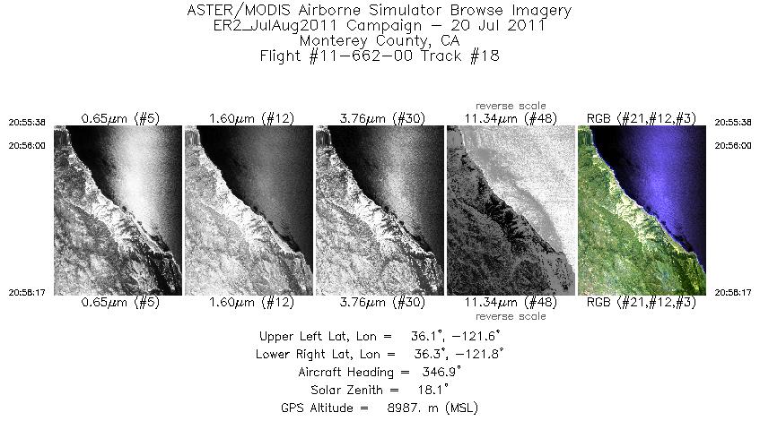
| 18 |
20:55 - 20:58 |
347.6 |
36.132 - 36.274 |
121.729 - 121.745 |
952 |
9006 |
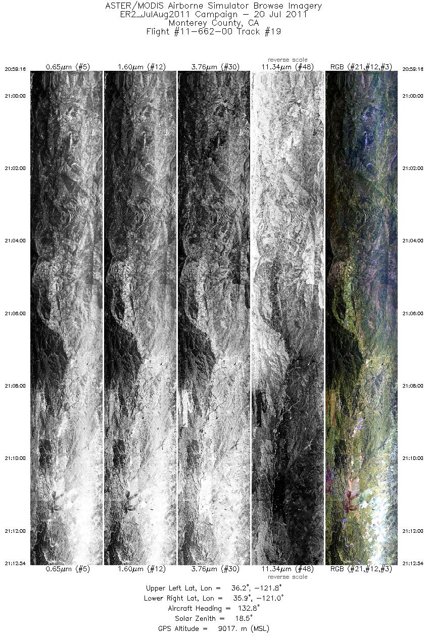
| 19 |
20:59 - 21:12 |
132.6 |
36.295 - 35.896 |
121.706 - 121.047 |
4885 |
9013 |
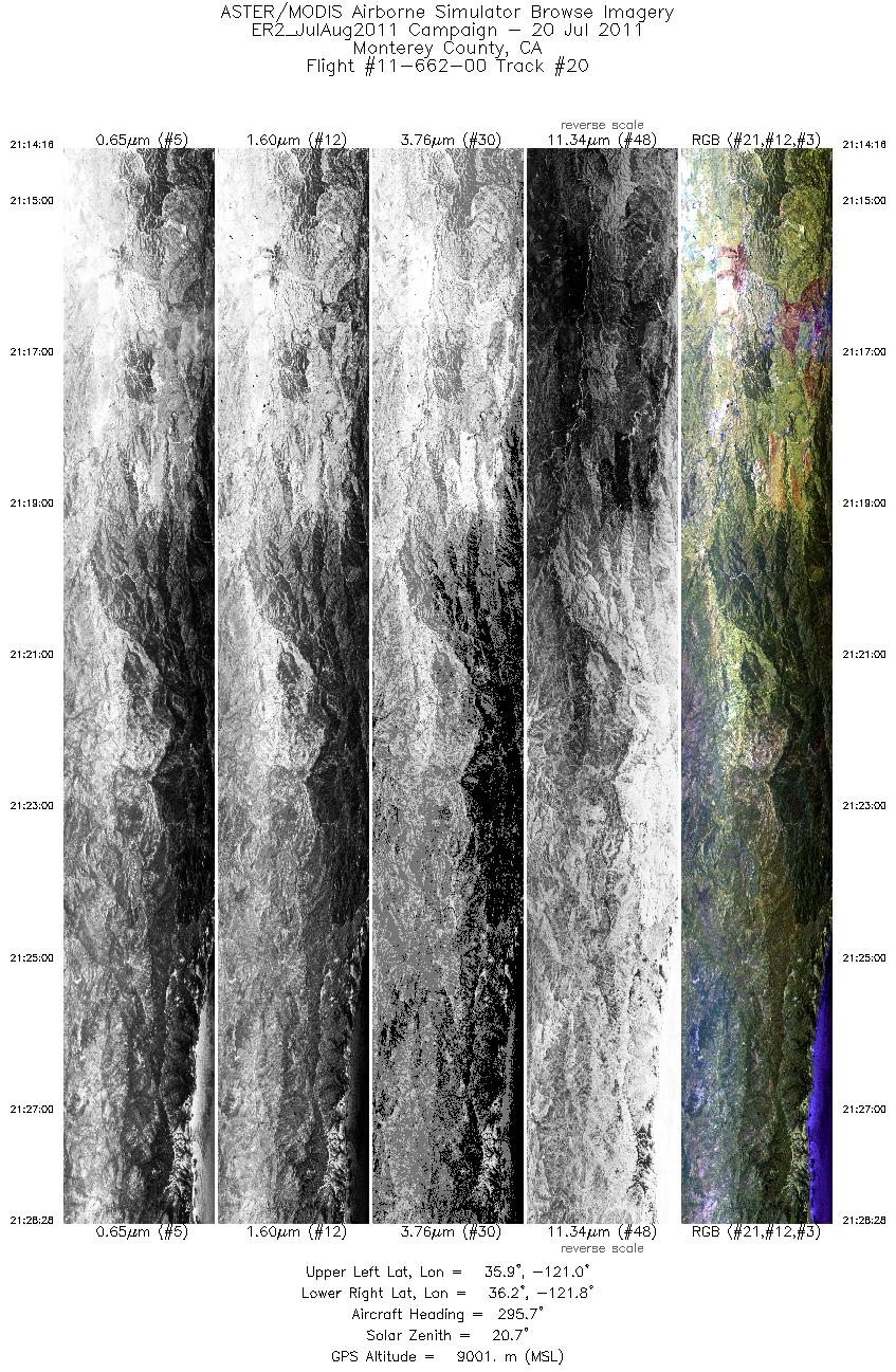
| 20 |
21:14 - 21:28 |
299.2 |
35.872 - 36.270 |
121.080 - 121.752 |
5088 |
9015 |
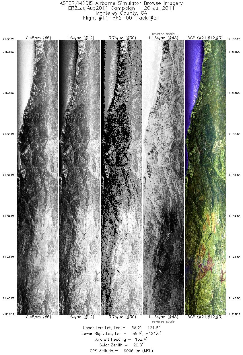
| 21 |
21:30 - 21:43 |
132.2 |
36.219 - 35.836 |
121.751 - 121.104 |
4787 |
9002 |
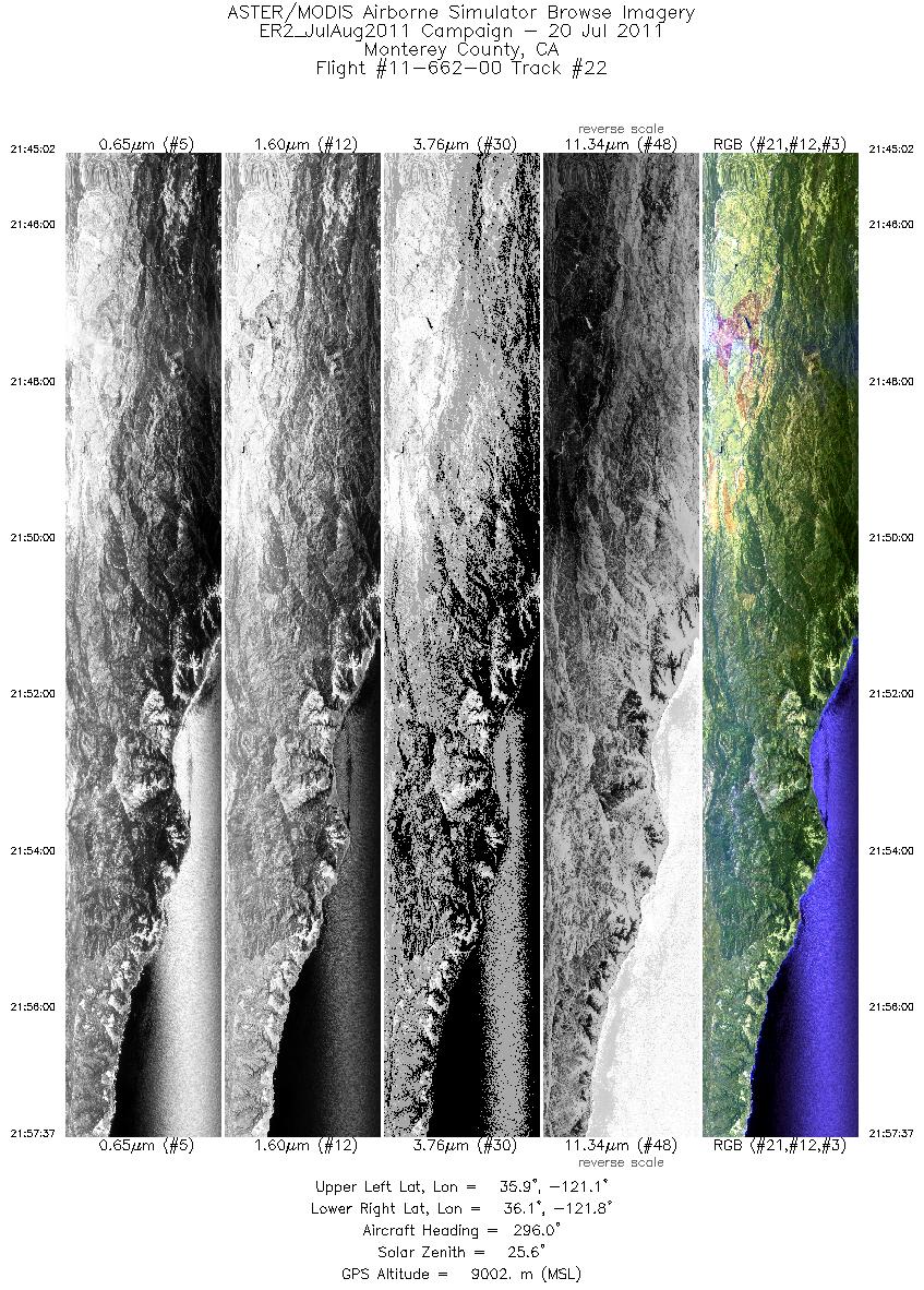
| 22 |
21:45 - 21:57 |
299.0 |
35.809 - 36.166 |
121.128 - 121.732 |
4512 |
9018 |
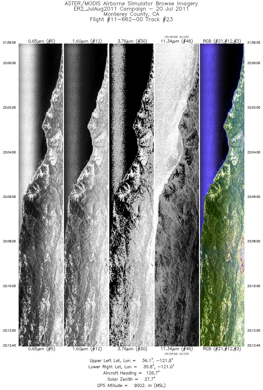
| 23 |
21:59 - 22:12 |
128.9 |
36.125 - 35.740 |
121.759 - 121.091 |
4872 |
8996 |
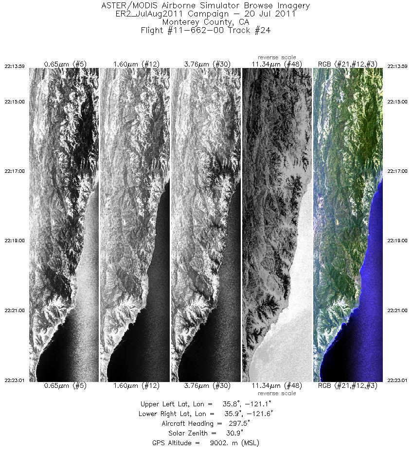
| 24 |
22:13 - 22:23 |
299.0 |
35.717 - 35.965 |
121.118 - 121.560 |
3236 |
9026 |
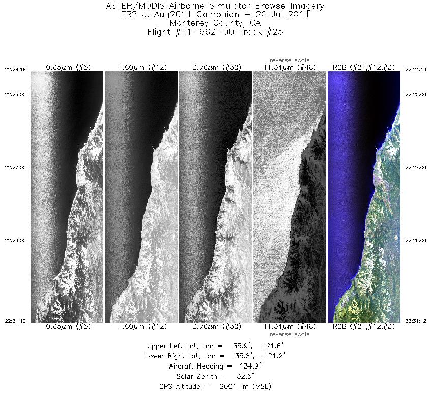
| 25 |
22:24 - 22:31 |
132.4 |
35.936 - 35.746 |
121.588 - 121.252 |
2467 |
8987 |
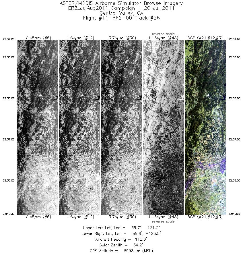
| 26 |
22:32 - 22:40 |
117.2 |
35.731 - 35.502 |
121.200 - 120.524 |
3043 |
9023 |
|


