Flight: 11-654-00
Date: June 15, 2011
Aircraft: NASA ER2, #806
Deployment: DFRC June 2011
Flight Location: Colorado / Wallow Fire, AZ
Principal Investigator: Painter (NSIDC), Myers (UCSC)
Additional Sensors: AVIRIS
|
Data Evaluation
Overall data quality is good.
|
Processing Information
Level-1B Data in HDF format is available
Flight Line Summary
Spectral Band Configuration
Spectral Response Function Table
Spectral Response Function (text)
|
Browse Imagery
Flight Tracks: 12
Scanlines: 31040
|
Browse Imagery Table
|
Click a Flight Track number to view a quicklook image
Lat/Lon ranges are for the BEG-END scanline nadir pixels
|
Flight
Track |
Time Span
(UTC) |
Heading
(Deg) |
Lat Range
(Deg N) |
Lon Range
(Deg W) |
Length
(Scanlines) |
Altitude
(Meters) |
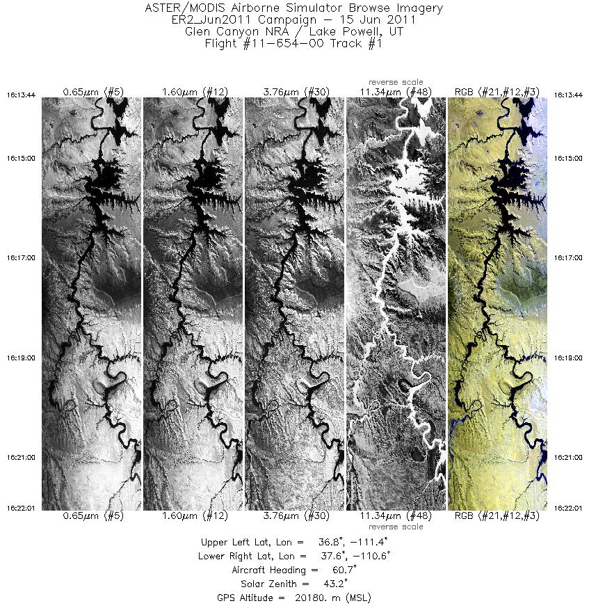
| 1 |
16:13 - 16:22 |
59.0 |
36.929 - 37.431 |
111.457 - 110.486 |
2972 |
20177 |
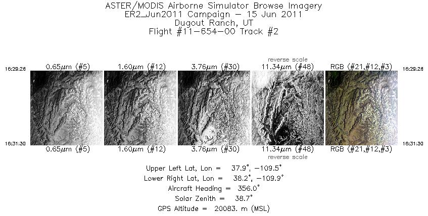
| 2 |
16:29 - 16:31 |
358.0 |
37.914 - 38.146 |
109.683 - 109.682 |
743 |
20061 |
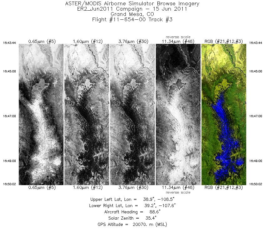
| 3 |
16:43 - 16:50 |
88.6 |
39.050 - 39.050 |
108.465 - 107.592 |
2259 |
20063 |
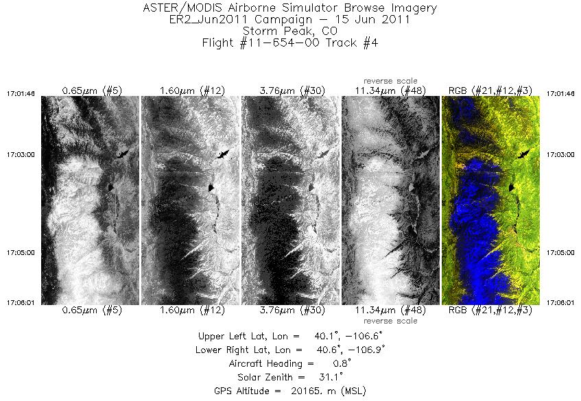
| 4 |
17:01 - 17:06 |
1.9 |
40.140 - 40.628 |
106.741 - 106.740 |
1528 |
20154 |
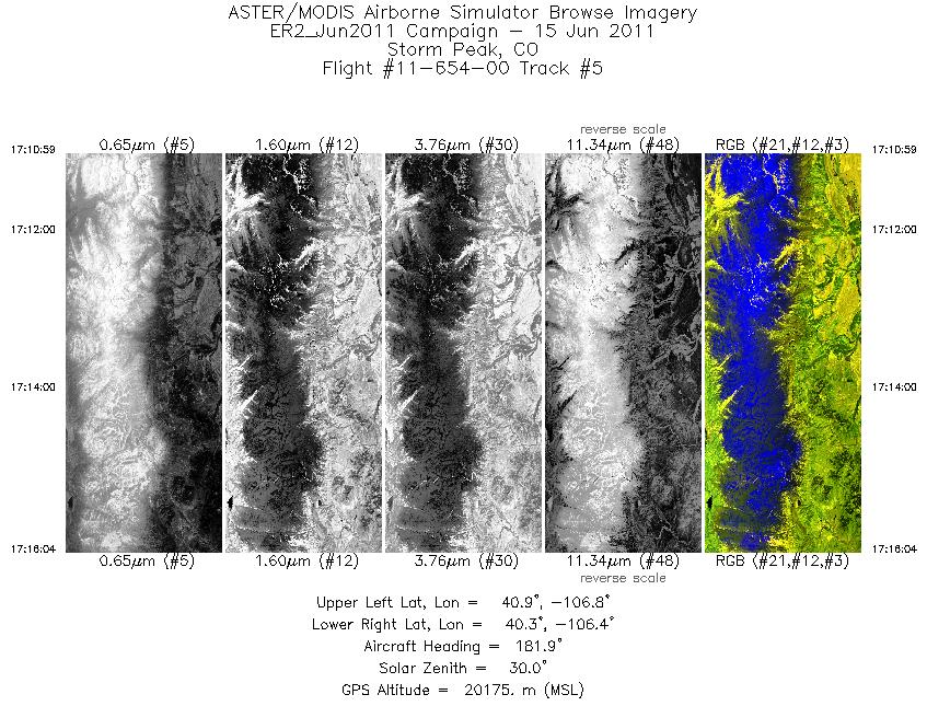
| 5 |
17:10 - 17:16 |
181.9 |
40.849 - 40.281 |
106.626 - 106.626 |
1825 |
20152 |
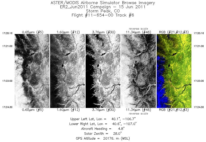
| 6 |
17:20 - 17:24 |
3.7 |
40.146 - 40.634 |
106.856 - 106.855 |
1523 |
20178 |
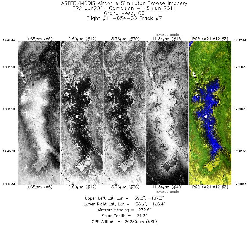
| 7 |
17:42 - 17:49 |
272.4 |
39.048 - 39.051 |
107.344 - 108.354 |
2447 |
20175 |
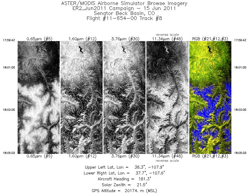
| 8 |
17:59 - 18:05 |
180.9 |
38.264 - 37.668 |
107.741 - 107.741 |
1922 |
20171 |
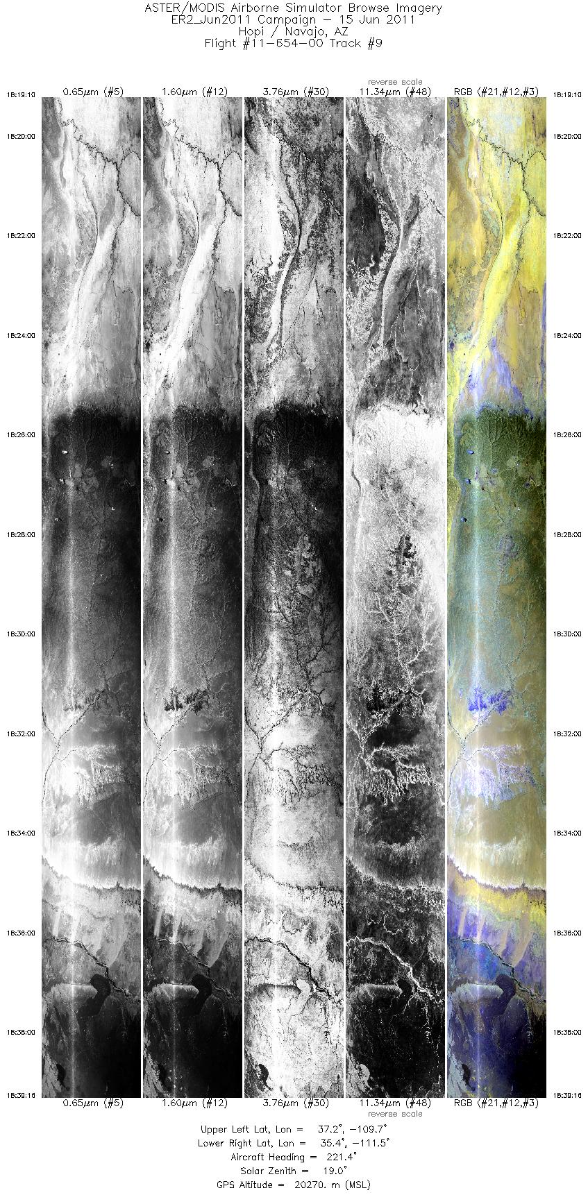
| 9 |
18:19 - 18:39 |
223.7 |
37.127 - 35.522 |
109.610 - 111.598 |
7213 |
20243 |
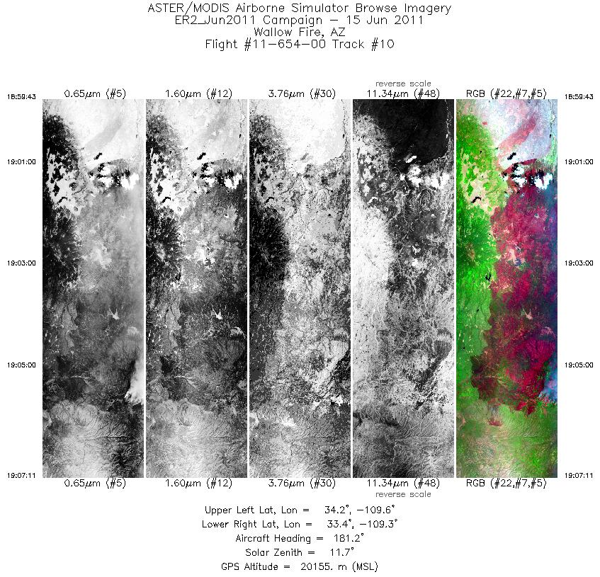
| 10 |
18:59 - 19:07 |
180.4 |
34.230 - 33.407 |
109.448 - 109.451 |
2678 |
20170 |
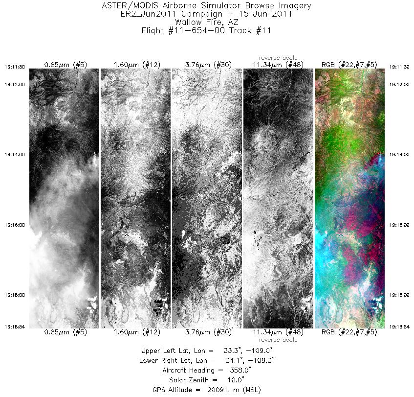
| 11 |
19:11 - 19:18 |
359.0 |
33.296 - 34.133 |
109.133 - 109.128 |
2657 |
20100 |
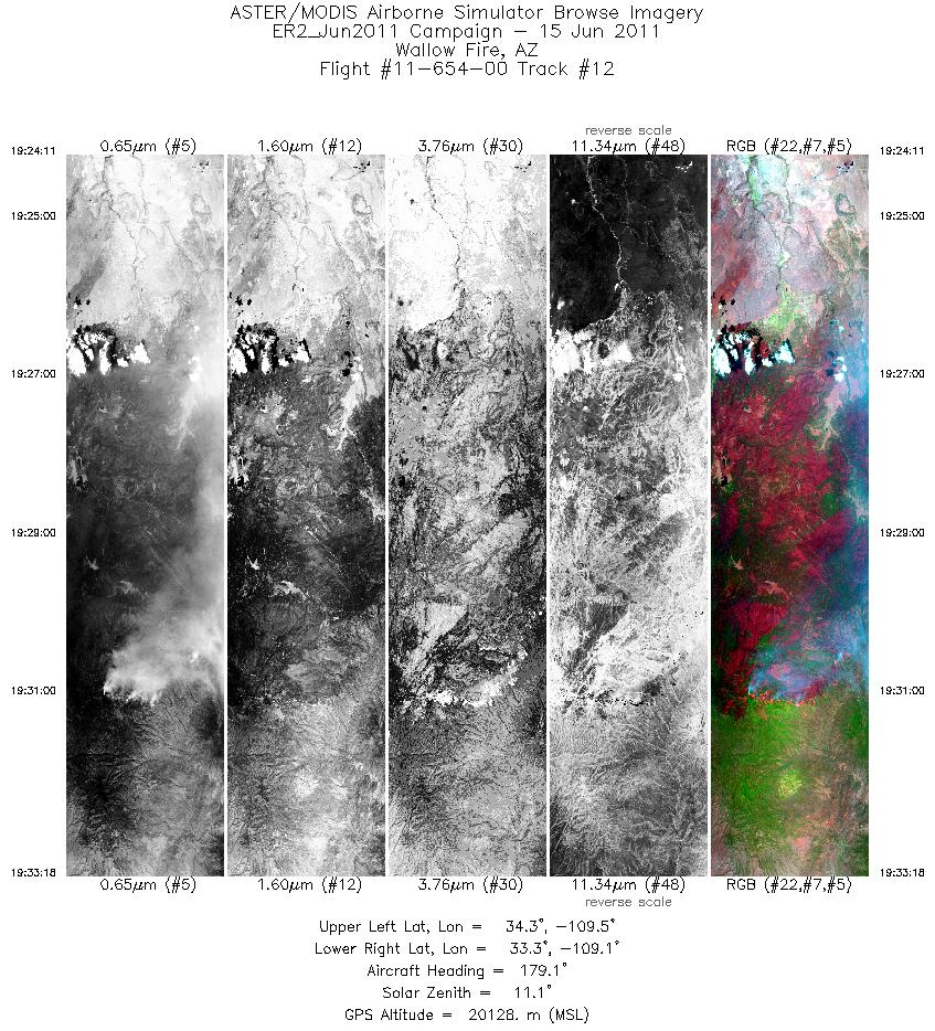
| 12 |
19:24 - 19:33 |
179.2 |
34.335 - 33.322 |
109.280 - 109.284 |
3273 |
20108 |
|


