Flight: 11-653-00
Date: June 10, 2011
Aircraft: NASA ER2, #809
Deployment: DFRC June 2011
Flight Location: Sonoran Desert (MEX)
Principal Investigator: Iacovazzi (NOAA)
Additional Sensors: AVIRIS
|
Data Evaluation
Overall data quality is good.
|
Processing Information
Level-1B Data in HDF format is available
Flight Line Summary
Spectral Band Configuration
Spectral Response Function Table
Spectral Response Function (text)
|
Browse Imagery
Flight Tracks: 44
Scanlines: 82098
|
Browse Imagery Table
|
Click a Flight Track number to view a quicklook image
Lat/Lon ranges are for the BEG-END scanline nadir pixels
|
Flight
Track |
Time Span
(UTC) |
Heading
(Deg) |
Lat Range
(Deg N) |
Lon Range
(Deg W) |
Length
(Scanlines) |
Altitude
(Meters) |
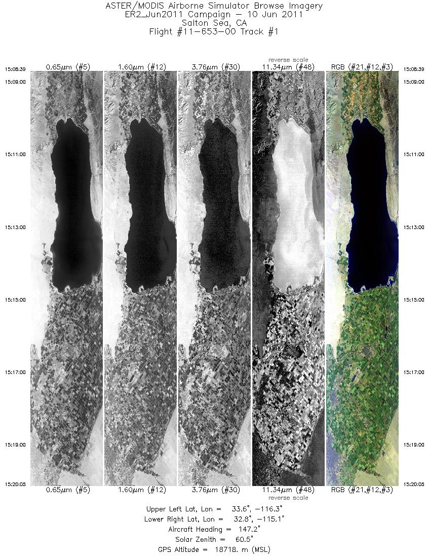
| 1 |
15:08 - 15:20 |
144.0 |
33.627 - 32.655 |
116.159 - 115.261 |
4098 |
18749 |
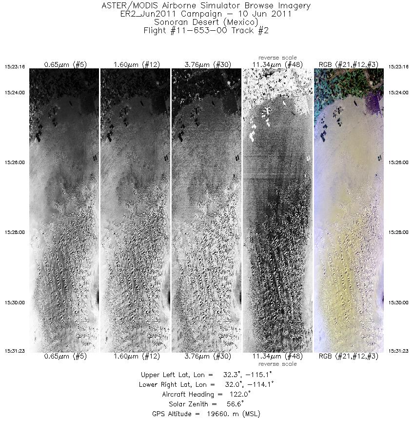
| 2 |
15:23 - 15:31 |
126.7 |
32.434 - 31.840 |
114.947 - 114.204 |
2911 |
19680 |
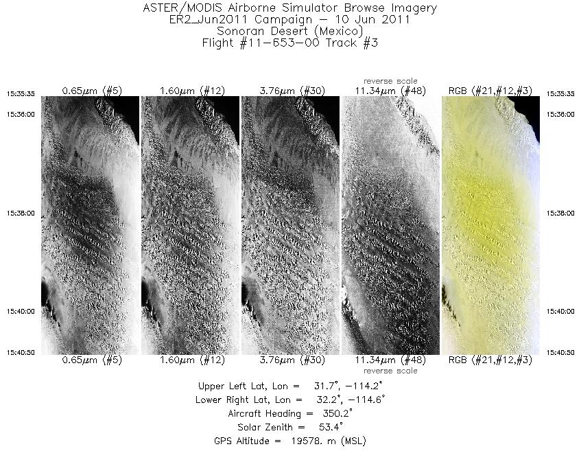
| 3 |
15:35 - 15:40 |
354.9 |
31.644 - 32.224 |
114.370 - 114.388 |
1886 |
19588 |
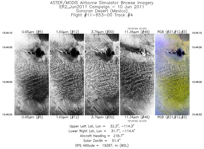
| 4 |
15:45 - 15:49 |
220.4 |
32.212 - 31.838 |
114.148 - 114.578 |
1696 |
19255 |
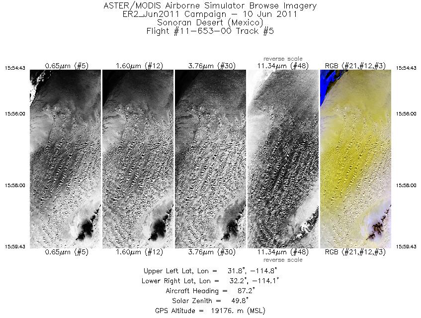
| 5 |
15:54 - 15:59 |
87.5 |
31.991 - 31.999 |
114.757 - 114.128 |
1795 |
19162 |
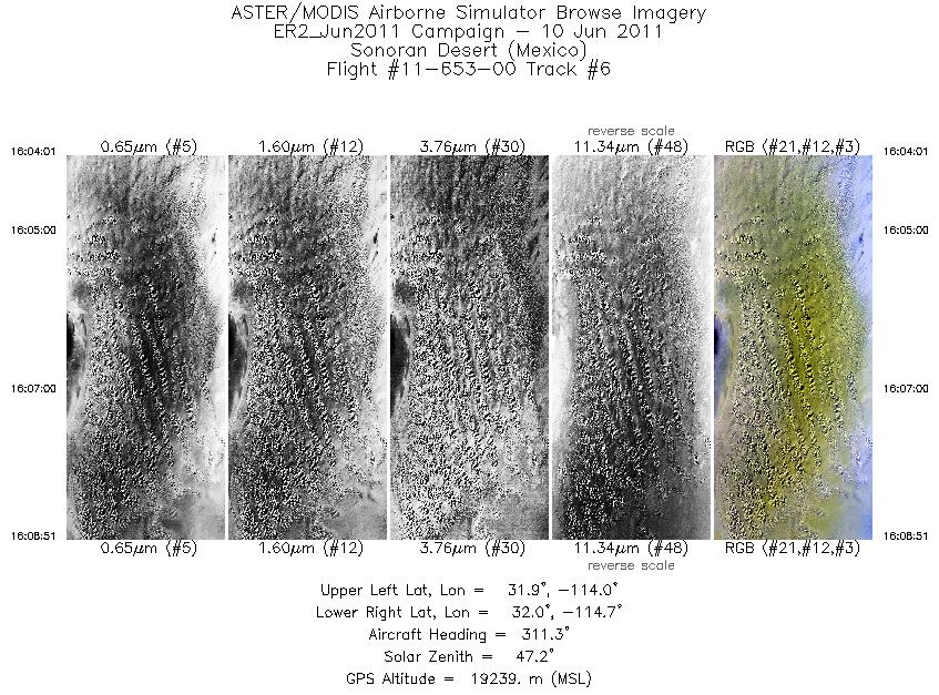
| 6 |
16:04 - 16:08 |
312.5 |
31.777 - 32.158 |
114.135 - 114.574 |
1735 |
19221 |
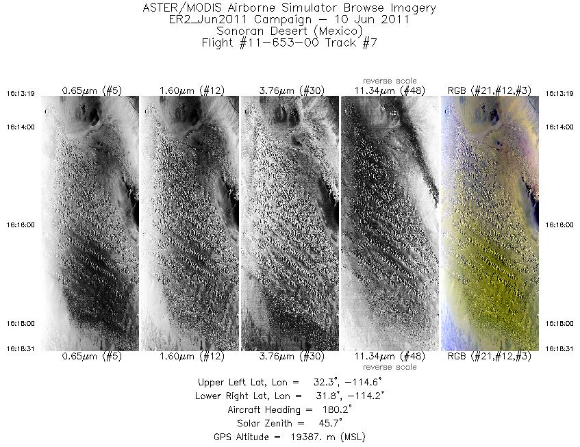
| 7 |
16:13 - 16:18 |
178.3 |
32.341 - 31.778 |
114.391 - 114.391 |
1868 |
19366 |
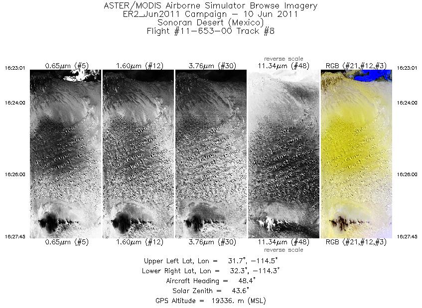
| 8 |
16:23 - 16:27 |
46.7 |
31.798 - 32.158 |
114.634 - 114.206 |
1696 |
19346 |
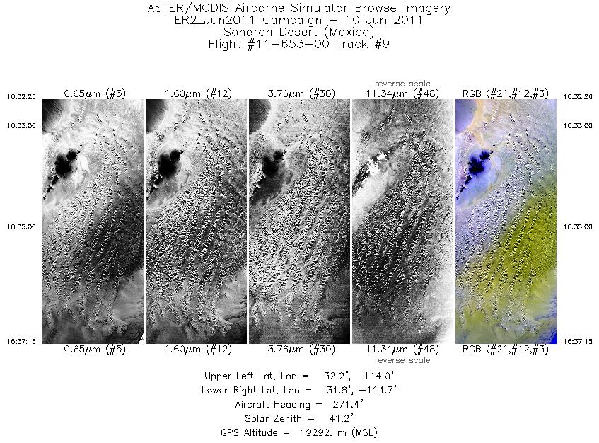
| 9 |
16:32 - 16:37 |
269.7 |
32.002 - 32.001 |
114.026 - 114.660 |
1731 |
19297 |
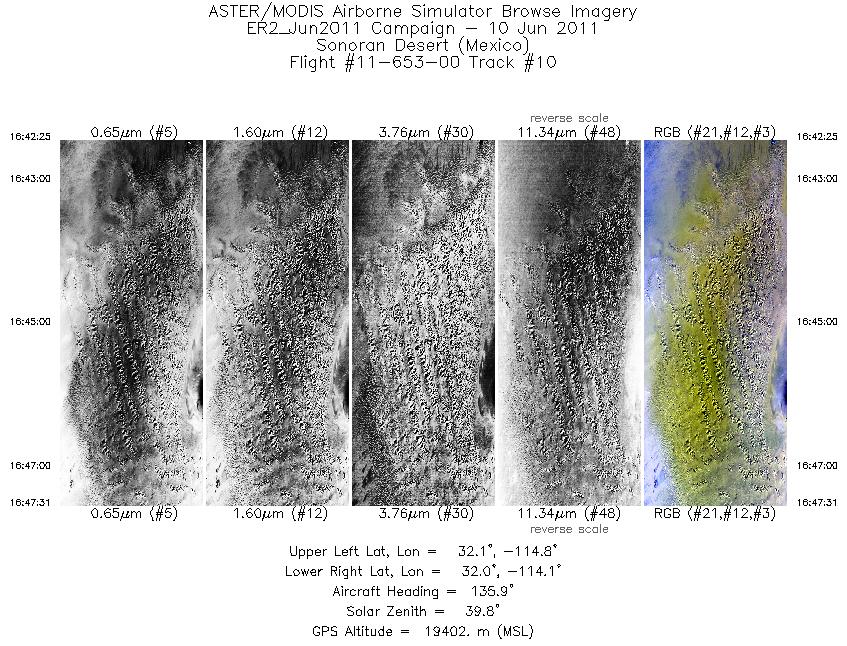
| 10 |
16:42 - 16:47 |
134.5 |
32.226 - 31.841 |
114.659 - 114.206 |
1830 |
19395 |
| 11 |
16:52 - 16:57 |
358.6 |
31.683 - 32.224 |
114.383 - 114.389 |
1741 |
19423 |
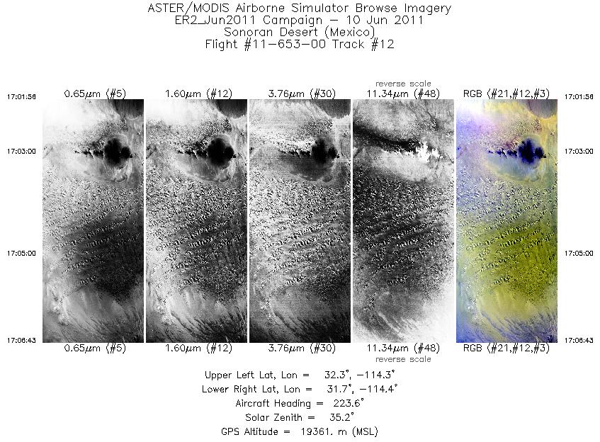
| 12 |
17:01 - 17:06 |
222.7 |
32.206 - 31.828 |
114.148 - 114.589 |
1721 |
19374 |
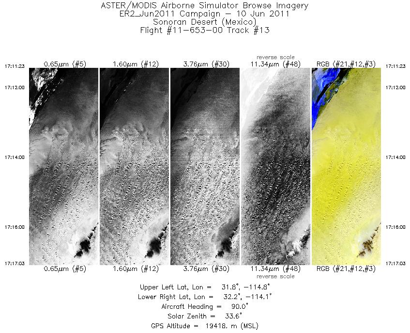
| 13 |
17:11 - 17:17 |
89.9 |
31.996 - 31.999 |
114.842 - 114.130 |
2039 |
19403 |
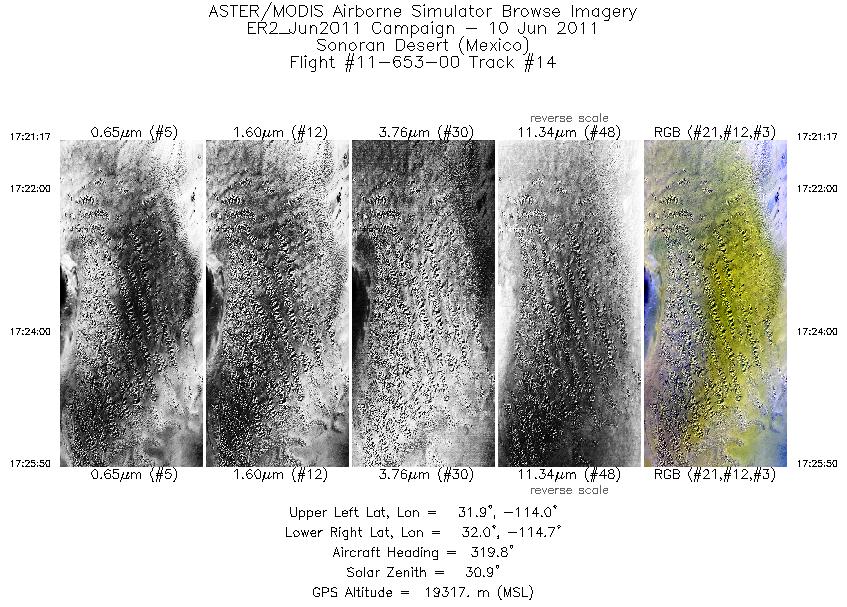
| 14 |
17:21 - 17:25 |
317.1 |
31.796 - 32.160 |
114.156 - 114.576 |
1636 |
19300 |
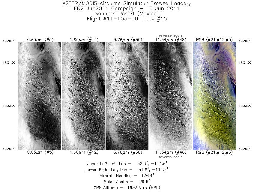
| 15 |
17:29 - 17:35 |
176.6 |
32.322 - 31.778 |
114.398 - 114.391 |
1800 |
19371 |
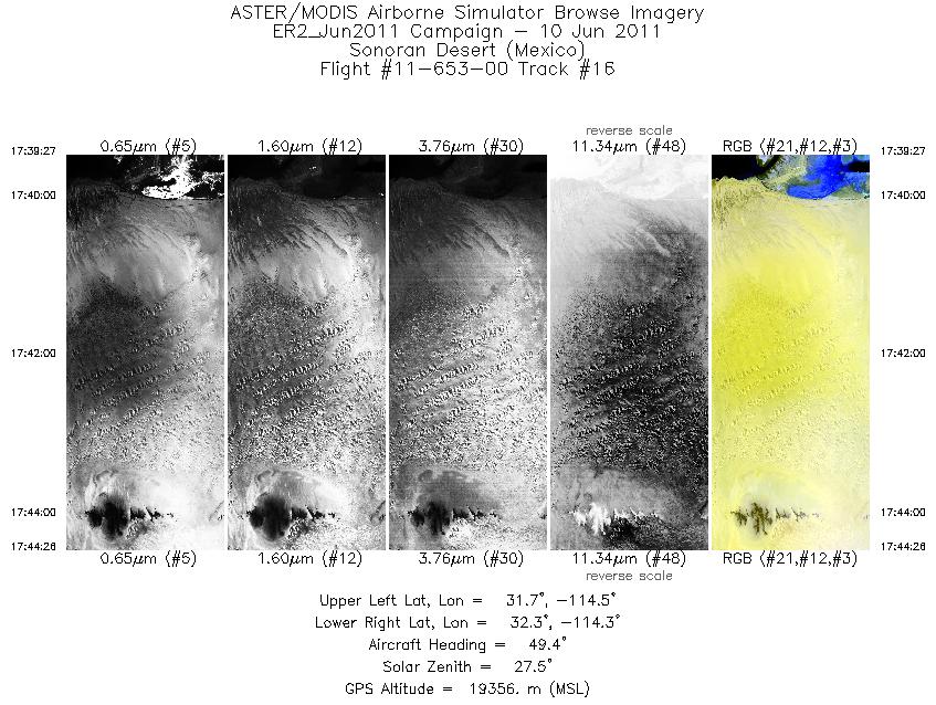
| 16 |
17:39 - 17:44 |
47.5 |
31.779 - 32.158 |
114.653 - 114.205 |
1794 |
19369 |
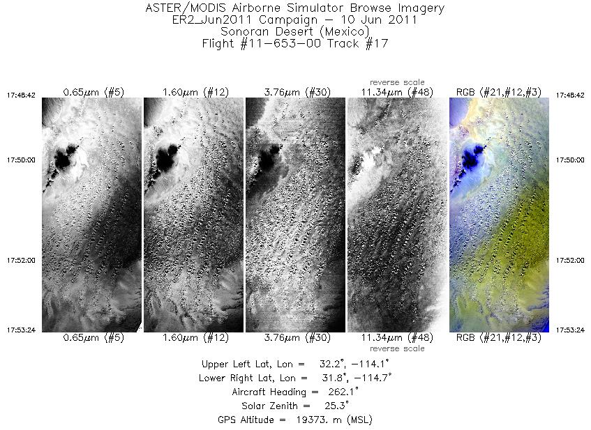
| 17 |
17:48 - 17:53 |
265.3 |
32.007 - 32.001 |
114.034 - 114.657 |
1687 |
19403 |
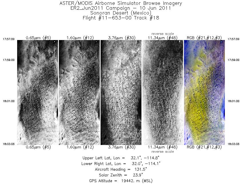
| 18 |
17:57 - 18:03 |
132.4 |
32.221 - 31.842 |
114.661 - 114.206 |
1835 |
19428 |
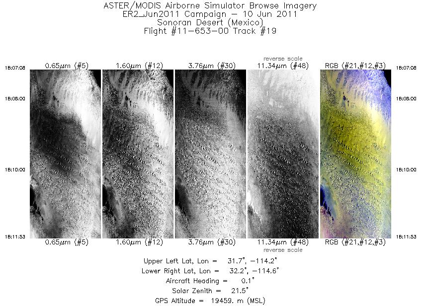
| 19 |
18:07 - 18:11 |
0.5 |
31.691 - 32.218 |
114.388 - 114.389 |
1702 |
19490 |
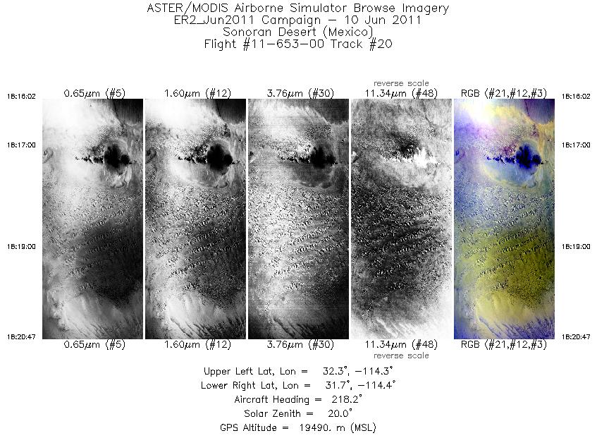
| 20 |
18:16 - 18:20 |
220.1 |
32.217 - 31.841 |
114.142 - 114.576 |
1709 |
19473 |
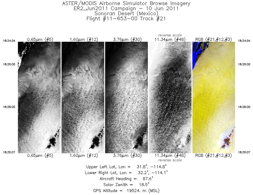
| 21 |
18:24 - 18:30 |
88.5 |
31.995 - 31.998 |
114.780 - 114.131 |
1874 |
19506 |
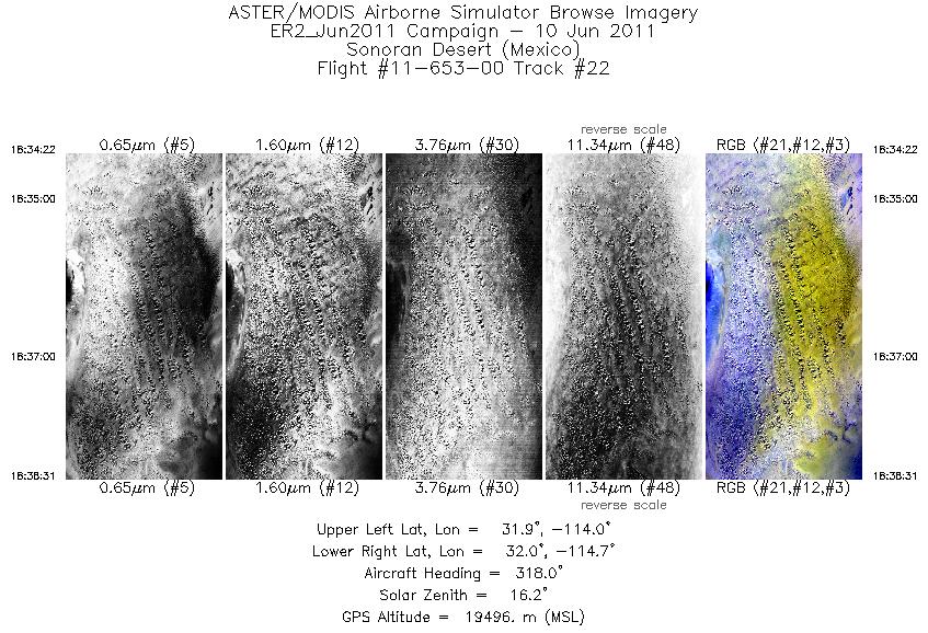
| 22 |
18:34 - 18:38 |
316.3 |
31.823 - 32.157 |
114.188 - 114.573 |
1491 |
19519 |
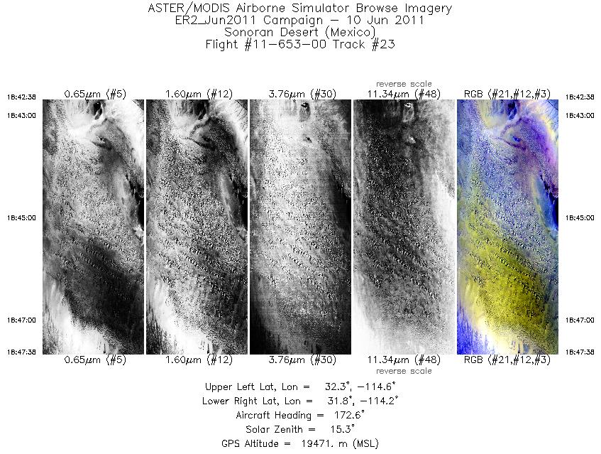
| 23 |
18:42 - 18:47 |
174.7 |
32.317 - 31.777 |
114.393 - 114.390 |
1799 |
19459 |
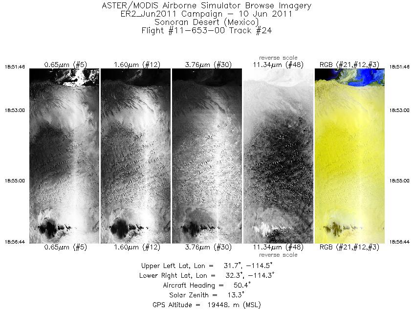
| 24 |
18:51 - 18:56 |
48.1 |
31.783 - 32.158 |
114.650 - 114.205 |
1790 |
19454 |
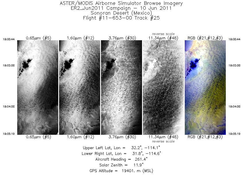
| 25 |
19:00 - 19:05 |
264.6 |
32.006 - 32.001 |
114.040 - 114.651 |
1645 |
19427 |
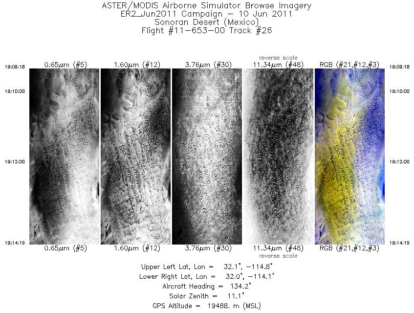
| 26 |
19:09 - 19:14 |
133.6 |
32.216 - 31.843 |
114.645 - 114.207 |
1803 |
19478 |
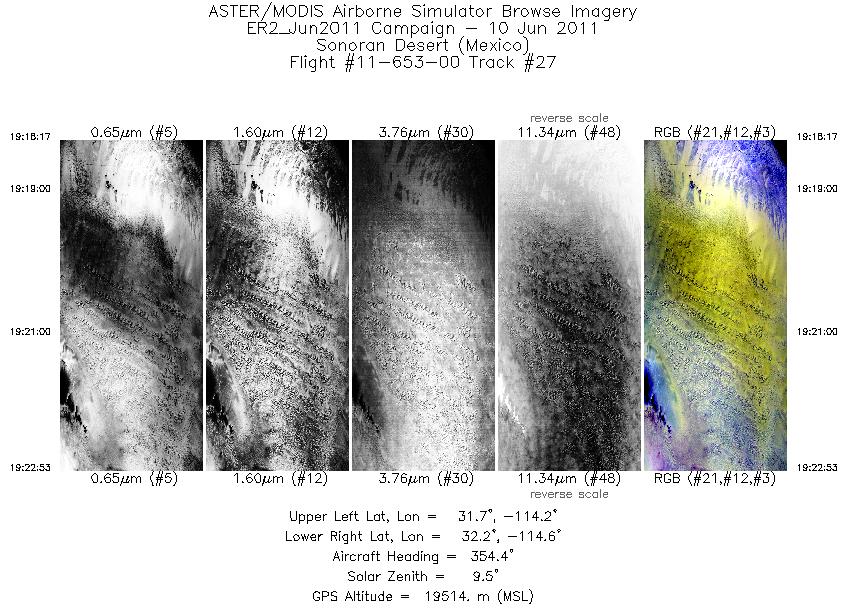
| 27 |
19:18 - 19:22 |
357.0 |
31.710 - 32.223 |
114.389 - 114.390 |
1657 |
19503 |
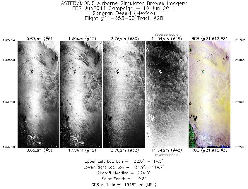
| 28 |
19:27 - 19:32 |
223.4 |
32.445 - 32.043 |
114.416 - 114.886 |
1834 |
19458 |
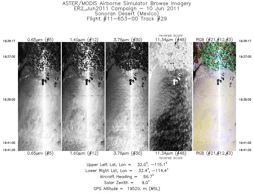
| 29 |
19:36 - 19:41 |
88.1 |
32.199 - 32.199 |
115.068 - 114.438 |
1815 |
19526 |
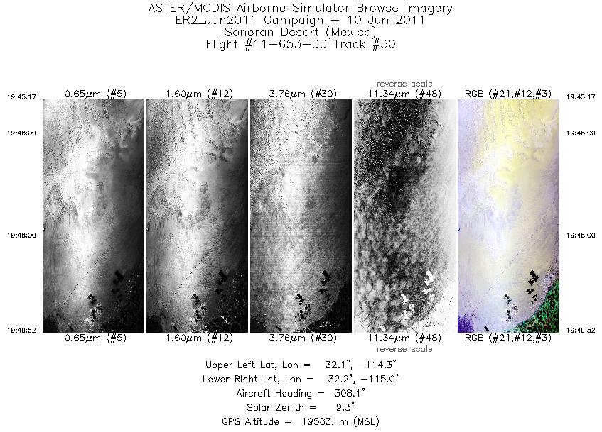
| 30 |
19:45 - 19:49 |
311.5 |
31.992 - 32.359 |
114.453 - 114.888 |
1648 |
19559 |
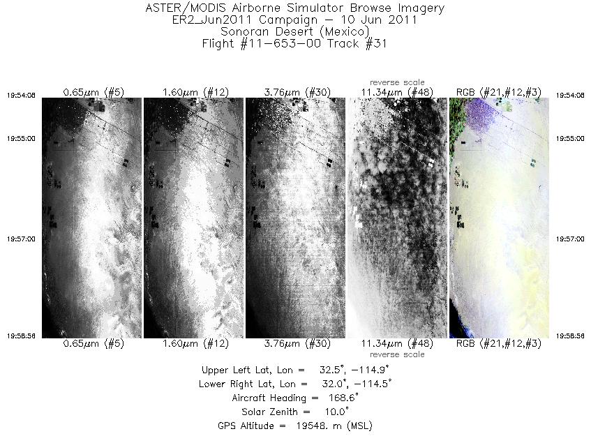
| 31 |
19:54 - 19:58 |
172.8 |
32.491 - 31.978 |
114.708 - 114.701 |
1729 |
19527 |
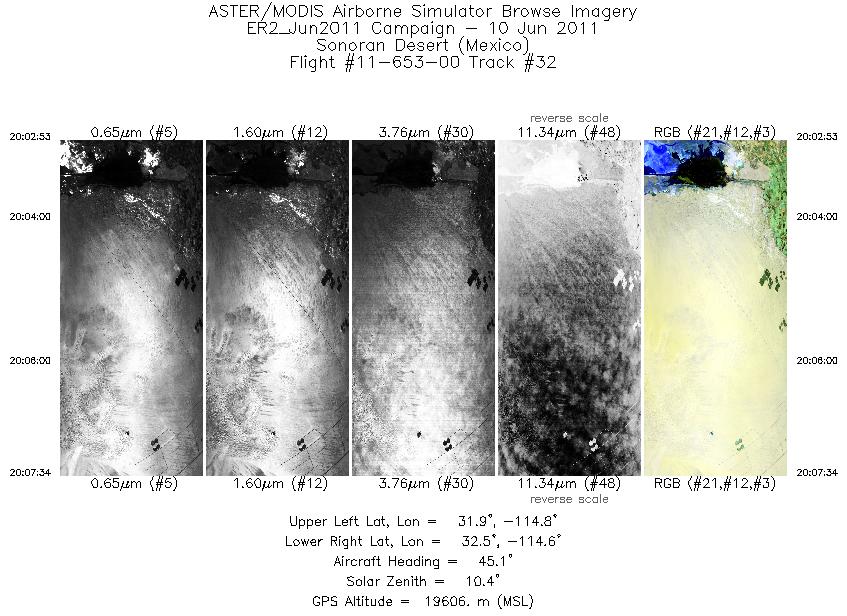
| 32 |
20:02 - 20:07 |
45.8 |
31.999 - 32.360 |
114.932 - 114.510 |
1683 |
19580 |
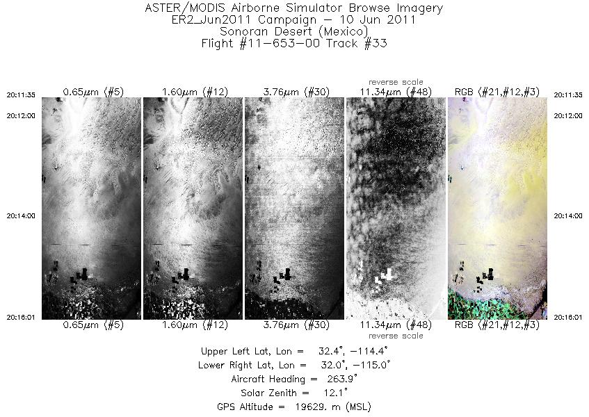
| 33 |
20:11 - 20:16 |
265.7 |
32.206 - 32.200 |
114.369 - 114.963 |
1600 |
19612 |
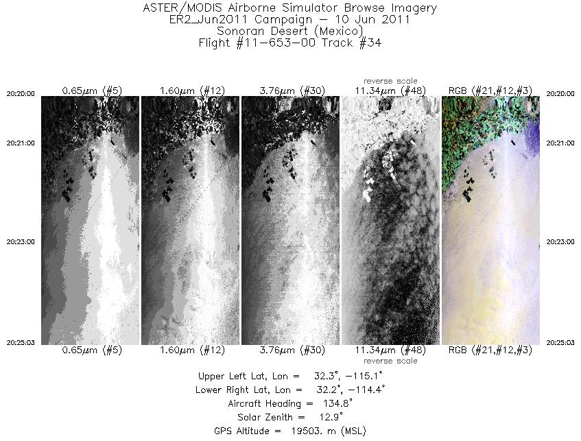
| 34 |
20:20 - 20:25 |
134.3 |
32.417 - 32.043 |
114.958 - 114.517 |
1817 |
19511 |
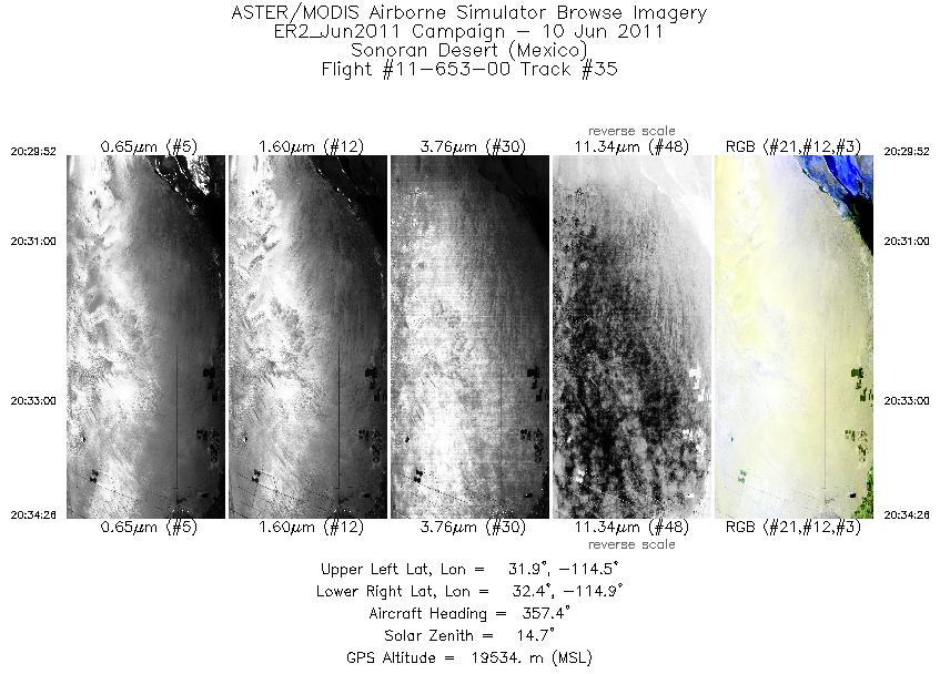
| 35 |
20:29 - 20:34 |
358.5 |
31.910 - 32.423 |
114.703 - 114.699 |
1640 |
19520 |
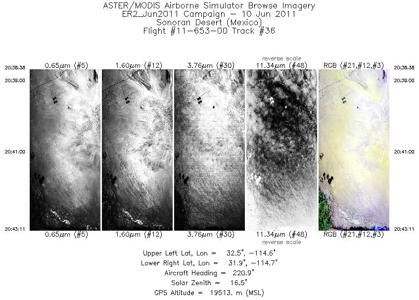
| 36 |
20:38 - 20:43 |
221.1 |
32.398 - 32.042 |
114.480 - 114.888 |
1633 |
19515 |
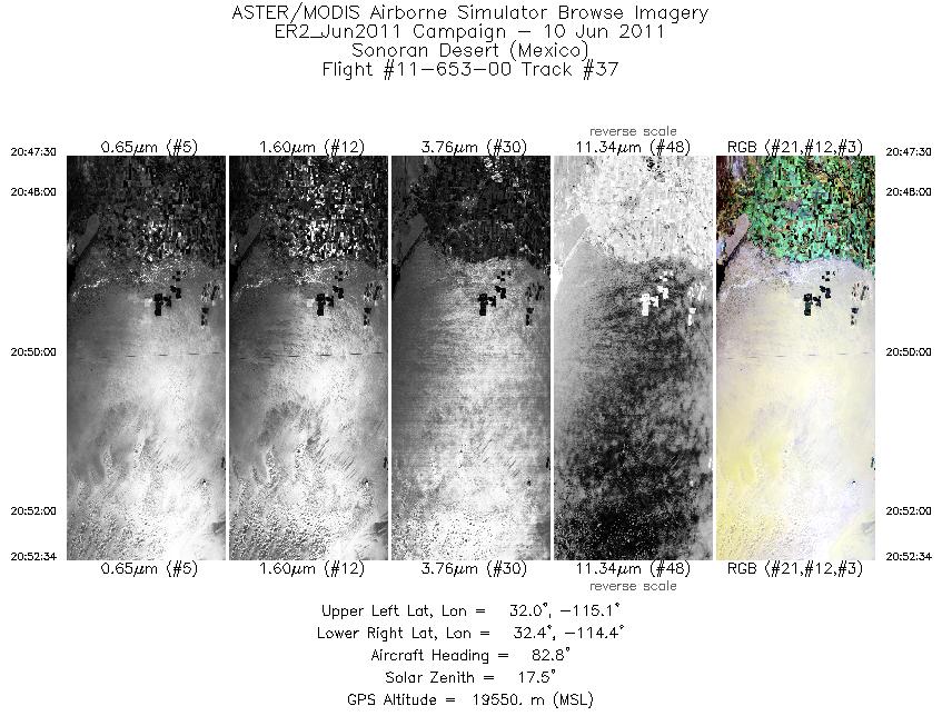
| 37 |
20:47 - 20:52 |
86.9 |
32.199 - 32.200 |
115.071 - 114.439 |
1821 |
19550 |
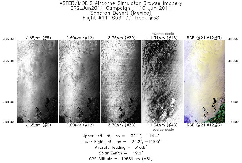
| 38 |
20:56 - 21:00 |
315.3 |
32.033 - 32.360 |
114.503 - 114.888 |
1451 |
19611 |
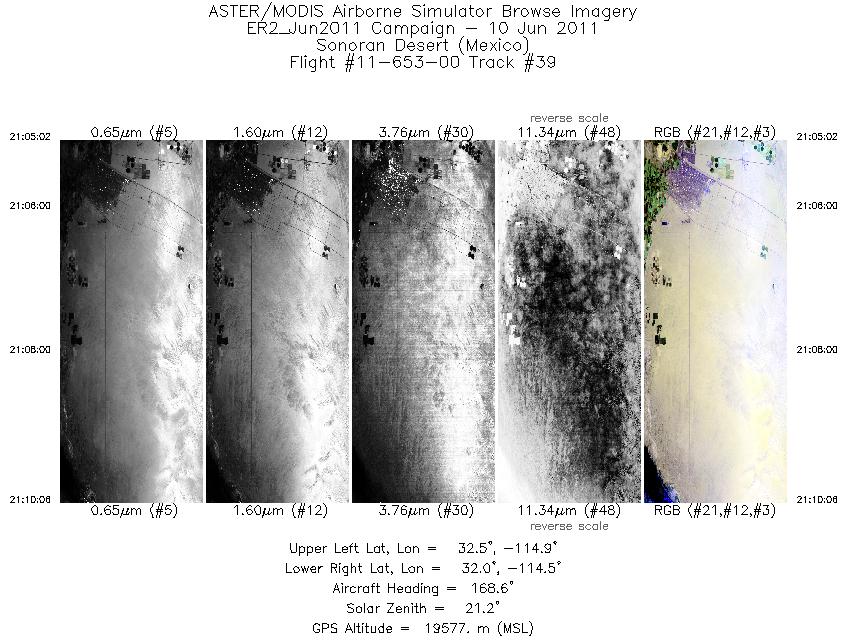
| 39 |
21:05 - 21:10 |
172.8 |
32.518 - 31.977 |
114.711 - 114.701 |
1819 |
19573 |
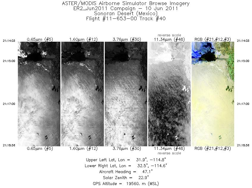
| 40 |
21:14 - 21:18 |
46.5 |
31.983 - 32.359 |
114.959 - 114.512 |
1756 |
19541 |
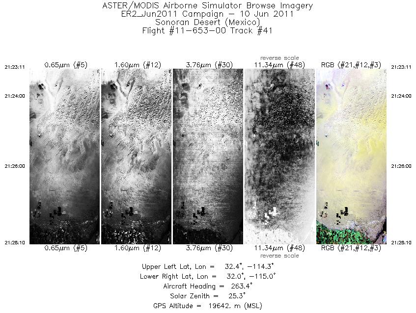
| 41 |
21:23 - 21:28 |
265.2 |
32.207 - 32.199 |
114.306 - 114.967 |
1794 |
19625 |
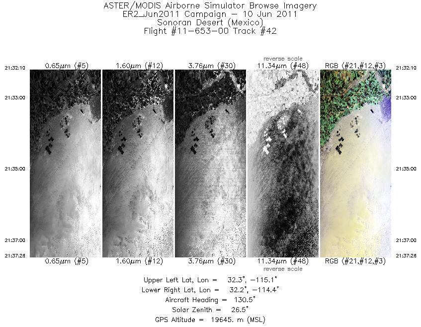
| 42 |
21:32 - 21:37 |
132.1 |
32.431 - 32.042 |
114.981 - 114.516 |
1891 |
19630 |
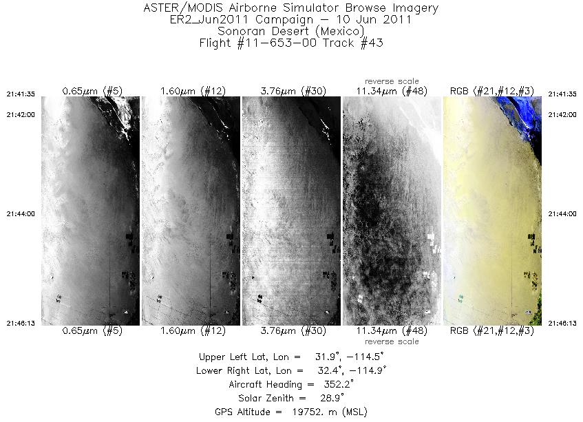
| 43 |
21:41 - 21:46 |
356.0 |
31.901 - 32.424 |
114.694 - 114.699 |
1666 |
19744 |
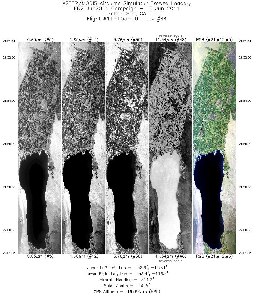
| 44 |
21:51 - 22:01 |
317.7 |
32.661 - 33.545 |
115.260 - 116.079 |
3532 |
19333 |
|


