Flight: 11-004-03
Date: July 13, 2011
Aircraft: DOE B-200 #796
Deployment: RSL July 2011
Flight Location: Phoenix, Arizona
Principal Investigator: Stefanov (ASU)
Additional Sensors: None
|
Data Evaluation
Overall data quality is good.
|
Processing Information
Level-1B Data in HDF format is available
Flight Line Summary
Spectral Band Configuration
Spectral Response Function Table
Spectral Response Function (text)
|
Browse Imagery
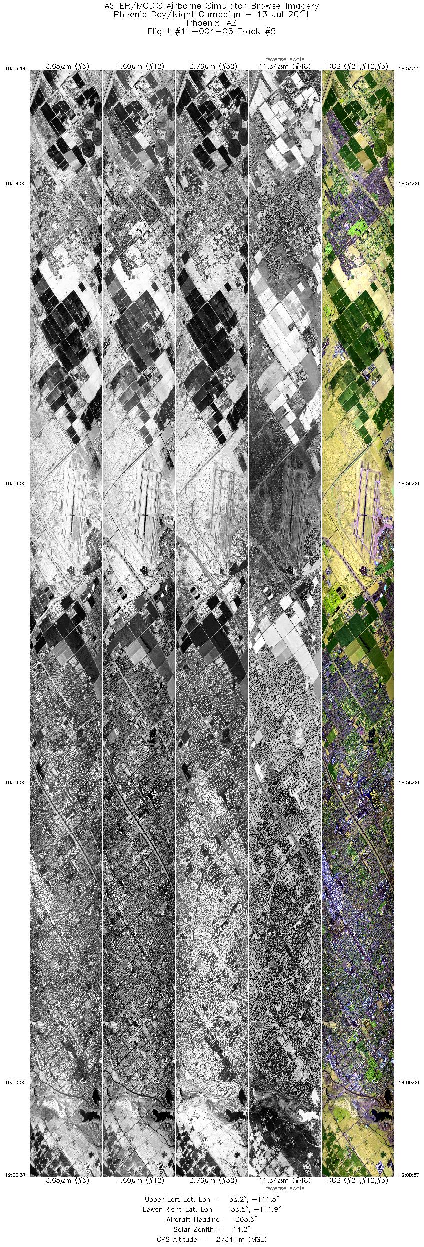
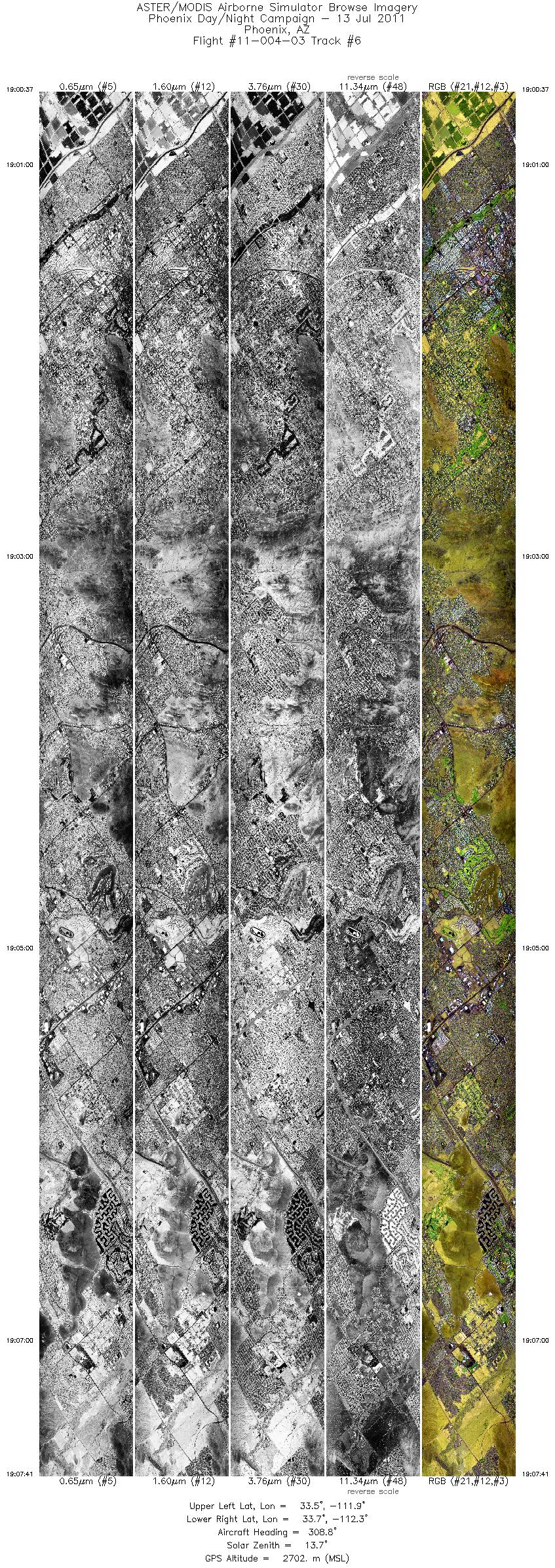
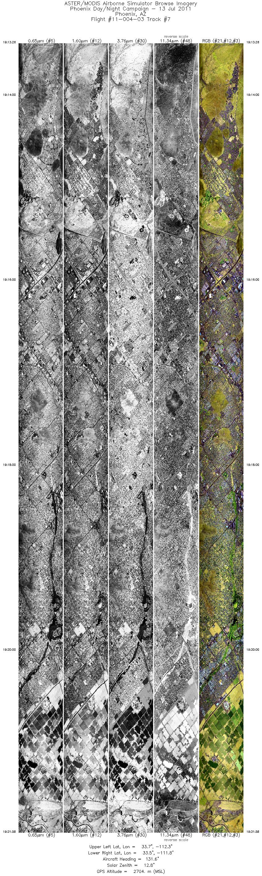
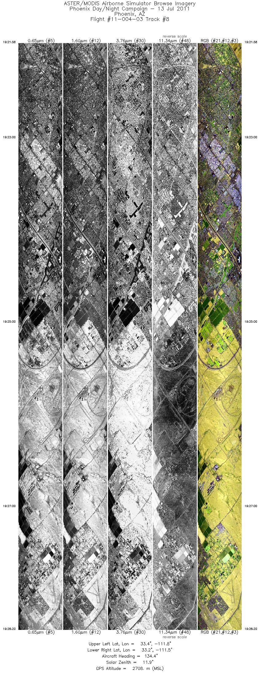
Flight Tracks: 14
Scanlines: 153246
|
Browse Imagery Table
|
Click a Flight Track number to view a quicklook image
Lat/Lon ranges are for the BEG-END scanline nadir pixels
|
Flight
Track |
Time Span
(UTC) |
Heading
(Deg) |
Lat Range
(Deg N) |
Lon Range
(Deg W) |
Length
(Scanlines) |
Altitude
(Meters) |
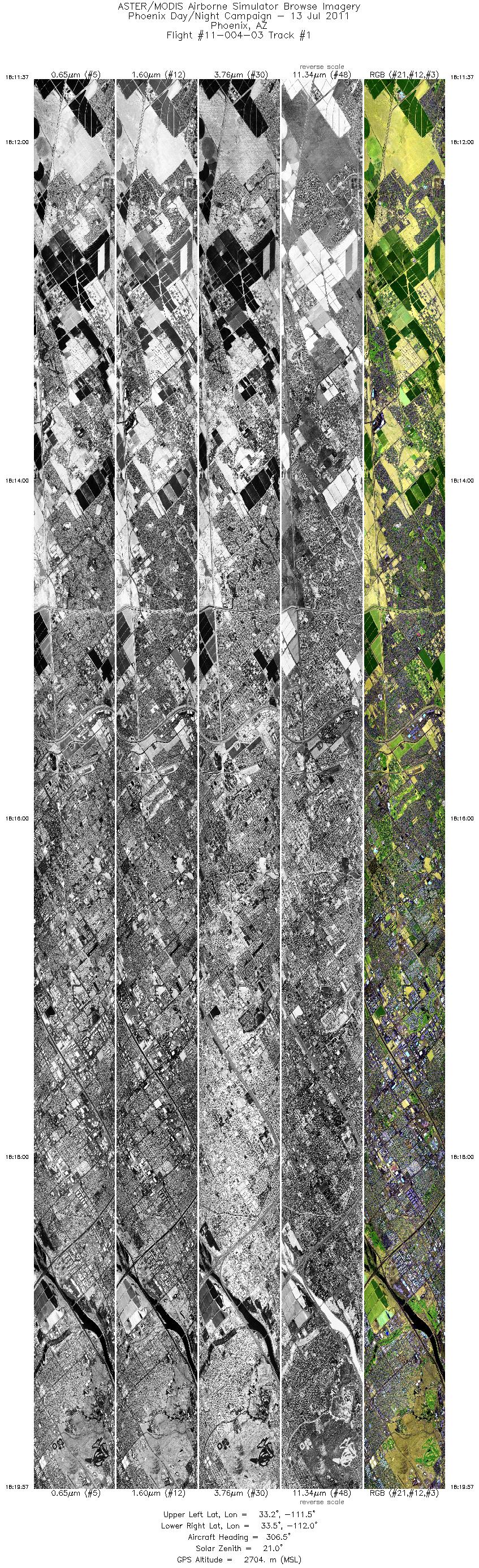
| 1 |
18:11 - 18:19 |
307.4 |
33.169 - 33.473 |
111.540 - 111.964 |
12475 |
2703 |
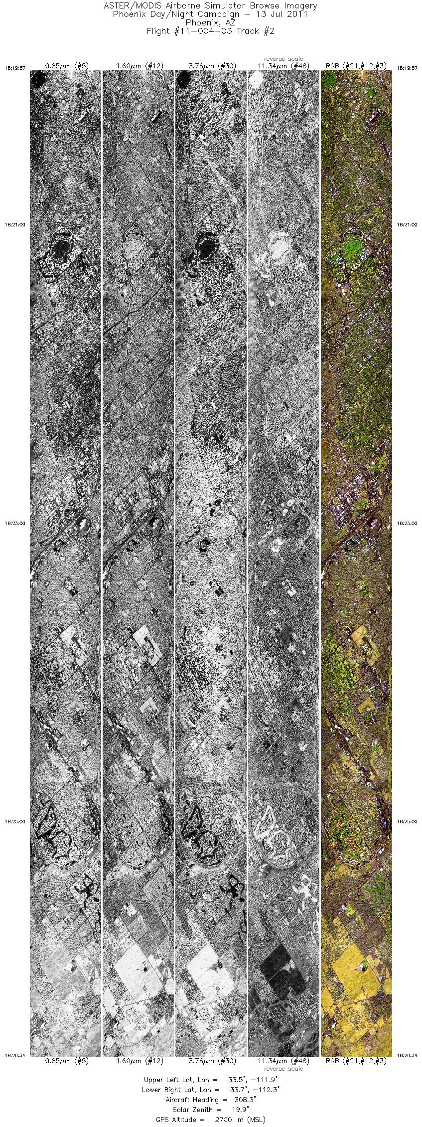
| 2 |
18:19 - 18:26 |
309.4 |
33.473 - 33.709 |
111.964 - 112.295 |
9903 |
2703 |
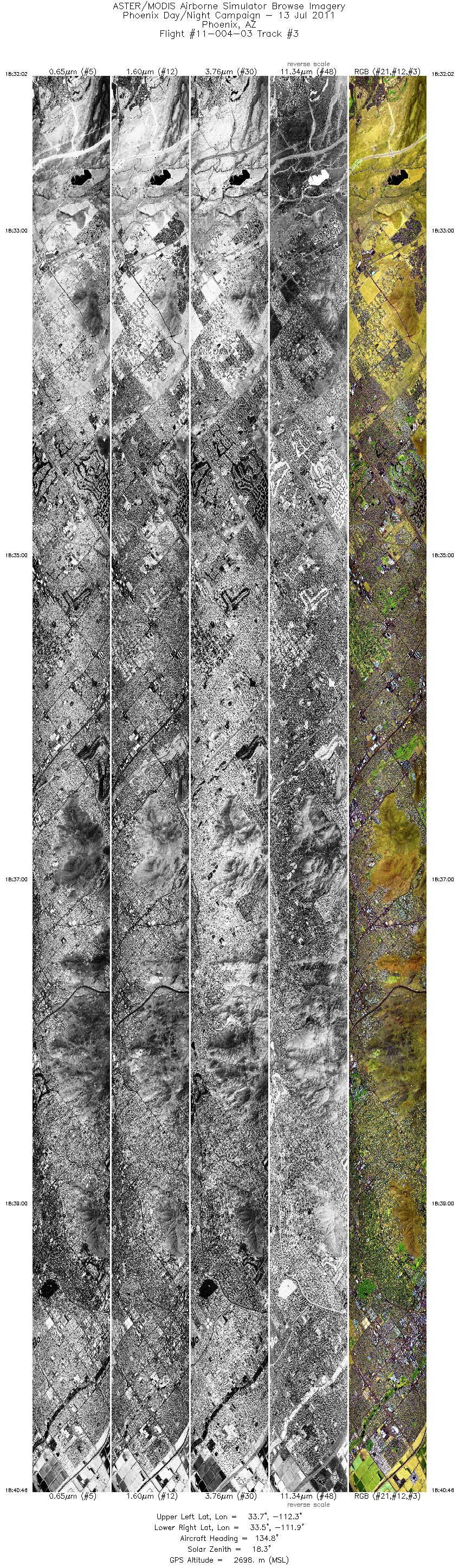
| 3 |
18:32 - 18:40 |
134.4 |
33.759 - 33.448 |
112.323 - 111.886 |
13066 |
2701 |
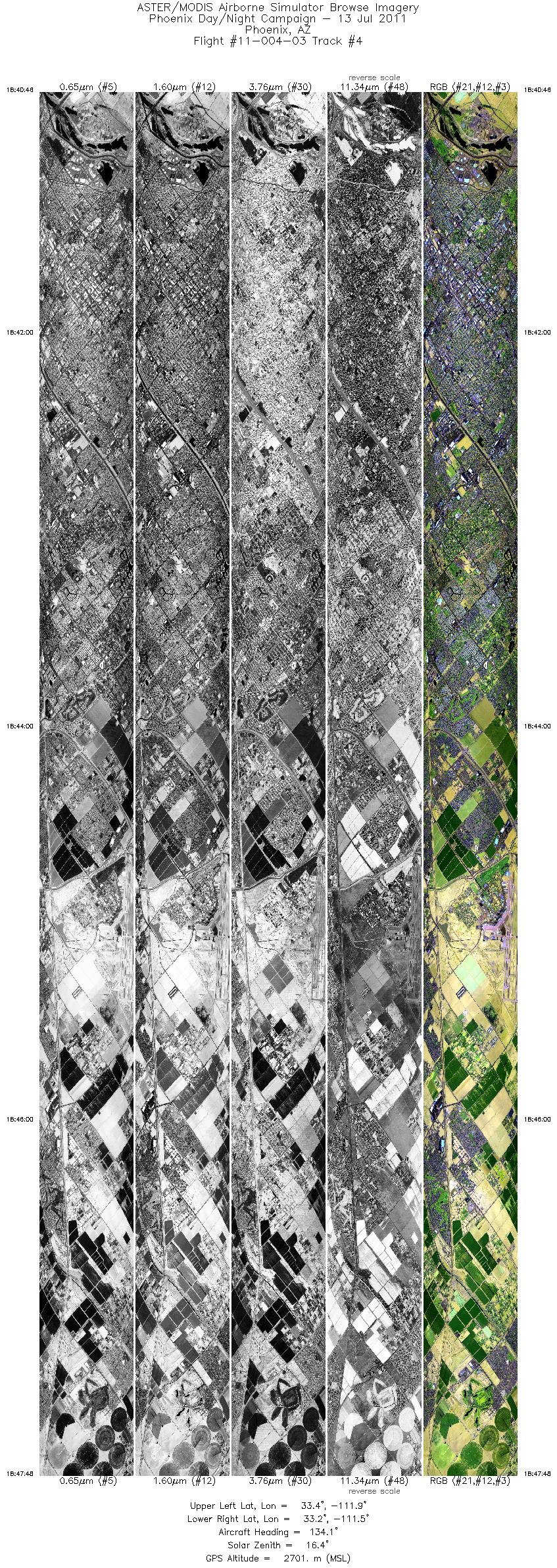
| 4 |
18:40 - 18:47 |
135.2 |
33.448 - 33.197 |
111.886 - 111.537 |
10529 |
2703 |
| 5 |
18:53 - 19:00 |
306.1 |
33.206 - 33.471 |
111.508 - 111.877 |
11056 |
2706 |
| 6 |
19:00 - 19:07 |
308.9 |
33.471 - 33.731 |
111.877 - 112.240 |
10574 |
2702 |
| 7 |
19:13 - 19:21 |
133.0 |
33.760 - 33.461 |
112.238 - 111.819 |
12774 |
2707 |
| 8 |
19:21 - 19:28 |
135.4 |
33.461 - 33.235 |
111.818 - 111.505 |
9533 |
2709 |
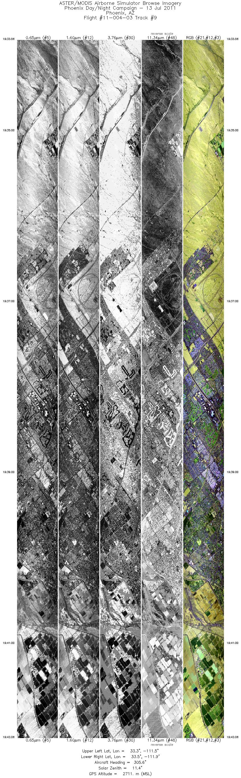
| 9 |
19:33 - 19:42 |
307.6 |
33.238 - 33.535 |
111.467 - 111.879 |
12239 |
2713 |
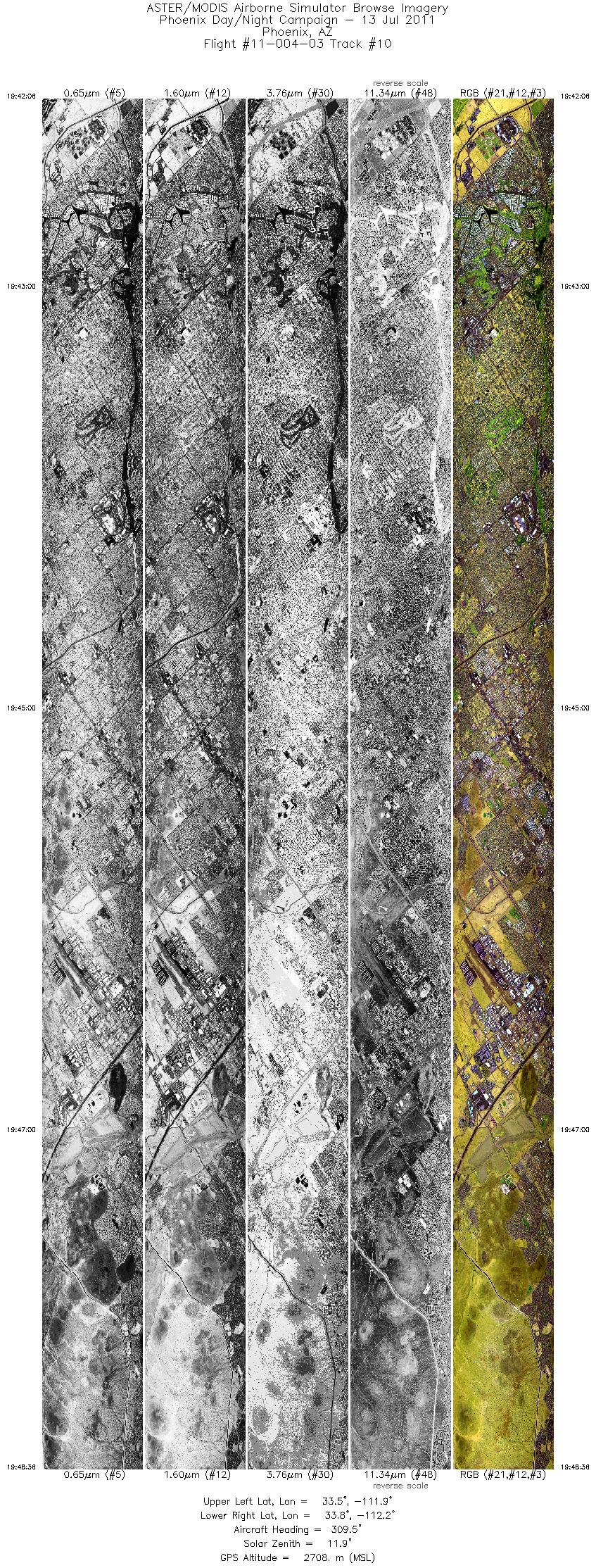
| 10 |
19:42 - 19:48 |
308.7 |
33.535 - 33.766 |
111.879 - 112.204 |
9738 |
2709 |
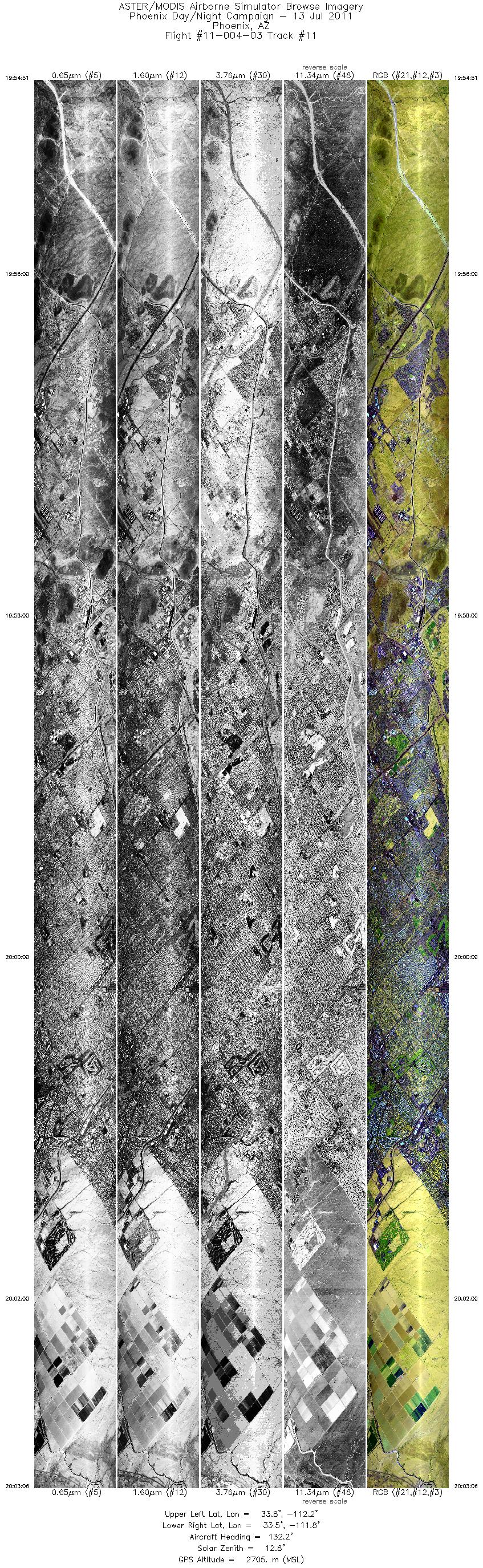
| 11 |
19:54 - 20:03 |
132.9 |
33.790 - 33.502 |
112.194 - 111.789 |
12350 |
2709 |
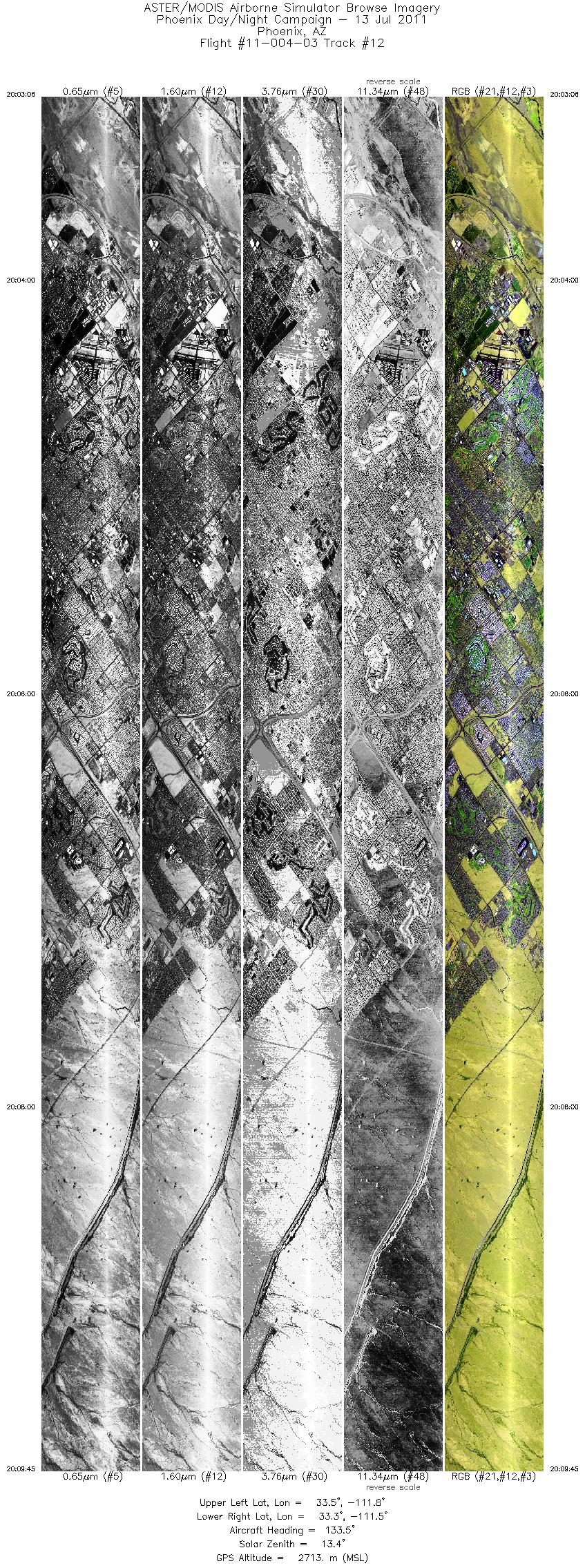
| 12 |
20:03 - 20:09 |
133.9 |
33.502 - 33.269 |
111.789 - 111.466 |
9953 |
2715 |
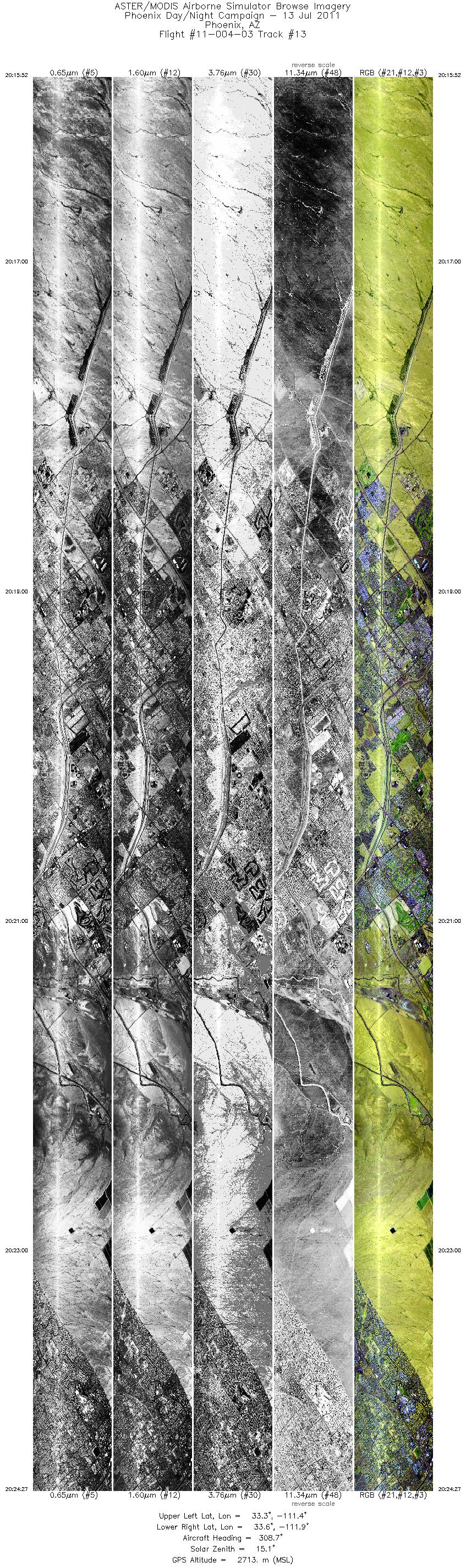
| 13 |
20:15 - 20:24 |
308.5 |
33.287 - 33.601 |
111.448 - 111.885 |
12859 |
2716 |
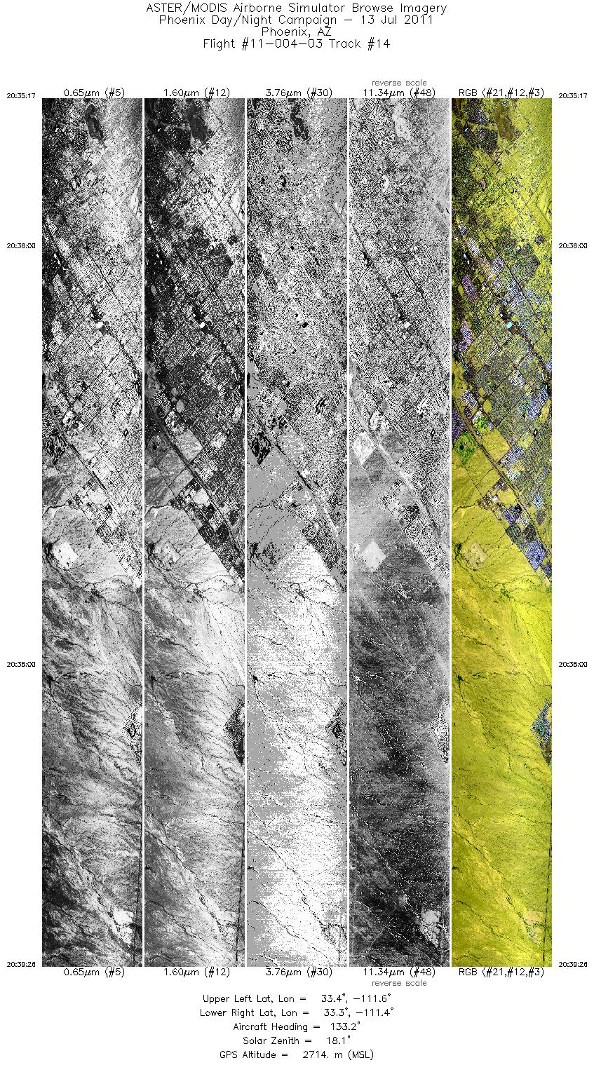
| 14 |
20:35 - 20:39 |
133.6 |
33.449 - 33.305 |
111.628 - 111.428 |
6197 |
2713 |
|


