


FLIGHT SUMMARY INFORMATION
Flight Track Map


|
Flight: 11-003-04 Date: June 28, 2011 Aircraft: NASA DC-8, #817 Deployment: SARP 2011 Flight Location: Santa Barbara, CA Principal Investigator: Kudela, Myers (UCSC) Additional Sensors: DCS / WAS |
|||||||||||||||||||||||||||||||||||
|
Data Evaluation Overall data quality is good. |
|||||||||||||||||||||||||||||||||||
|
Processing Information Level-1B Data in HDF format is available Flight Line Summary Spectral Band Configuration Spectral Response Function Table Spectral Response Function (text) |
|||||||||||||||||||||||||||||||||||
|
Browse Imagery Flight Tracks: 1 Scanlines: 11778 |
|||||||||||||||||||||||||||||||||||
|
|||||||||||||||||||||||||||||||||||

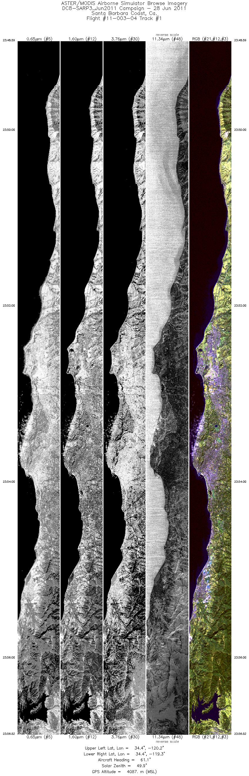
Flight 11-003-04


| Sample Imagery |
| Click image for full resolution |
|
Track #1 Santa Barbara, California |


|
|
R: 2.13µm G: 1.62µm B: 0.55µm |


