Flight: 11-002-06
Date: October 13, 2010
Aircraft: DOE B-200 #796
Deployment: RSL Oct 2010
Flight Location: Station, Roca Fires, CA (2007)
Principal Investigator: Hook (JPL)
Additional Sensors: DCS
|
Data Evaluation
Overall data quality is good.
|
Processing Information
Level-1B Data in HDF format is available
Flight Line Summary
Spectral Band Configuration
Spectral Response Function Table
Spectral Response Function (text)
|
Browse Imagery
Flight Tracks: 15
Scanlines: 141547
|
Browse Imagery Table
|
Click a Flight Track number to view a quicklook image
Lat/Lon ranges are for the BEG-END scanline nadir pixels
|
Flight
Track |
Time Span
(UTC) |
Heading
(Deg) |
Lat Range
(Deg N) |
Lon Range
(Deg W) |
Length
(Scanlines) |
Altitude
(Meters) |
| 1 |
17:45 - 17:51 |
268.2 |
34.428 - 34.429 |
117.945 - 118.288 |
8399 |
3588 |
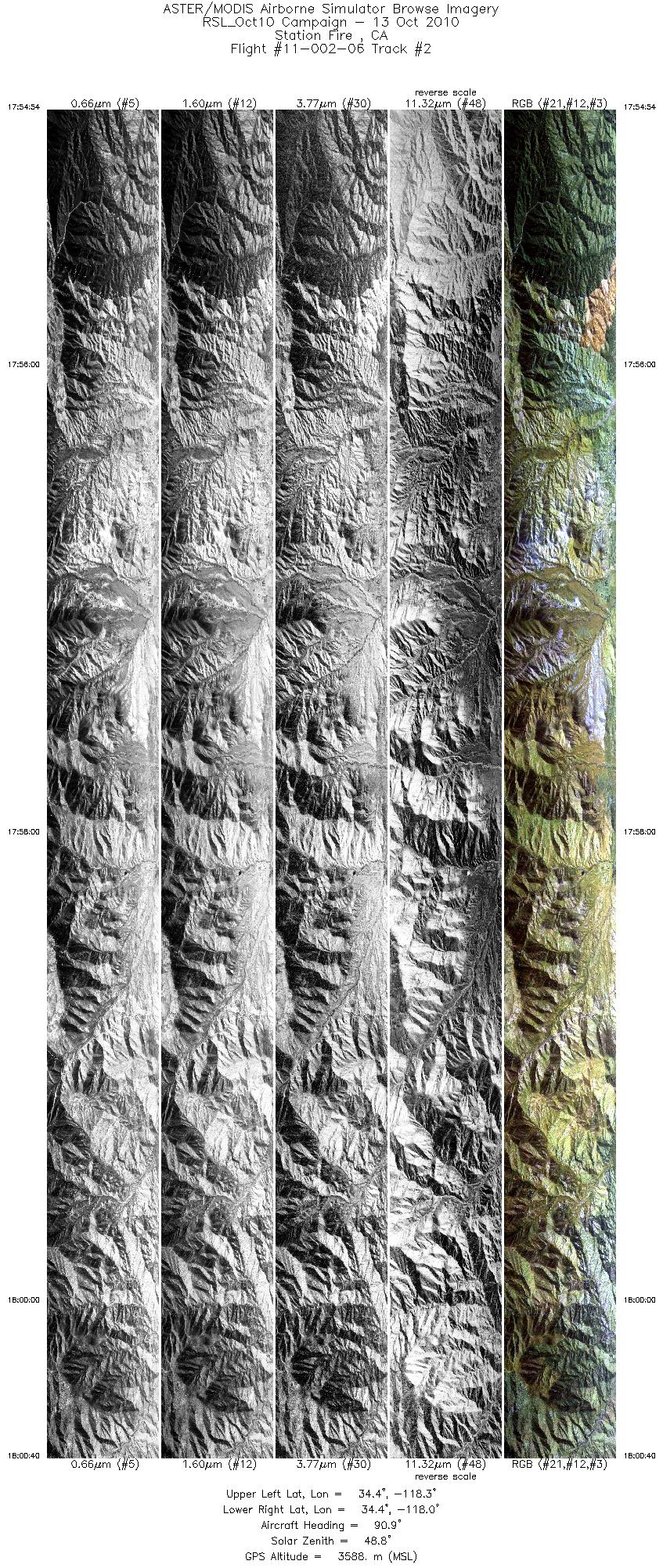
| 2 |
17:54 - 18:00 |
92.1 |
34.411 - 34.410 |
118.321 - 117.968 |
8617 |
3587 |
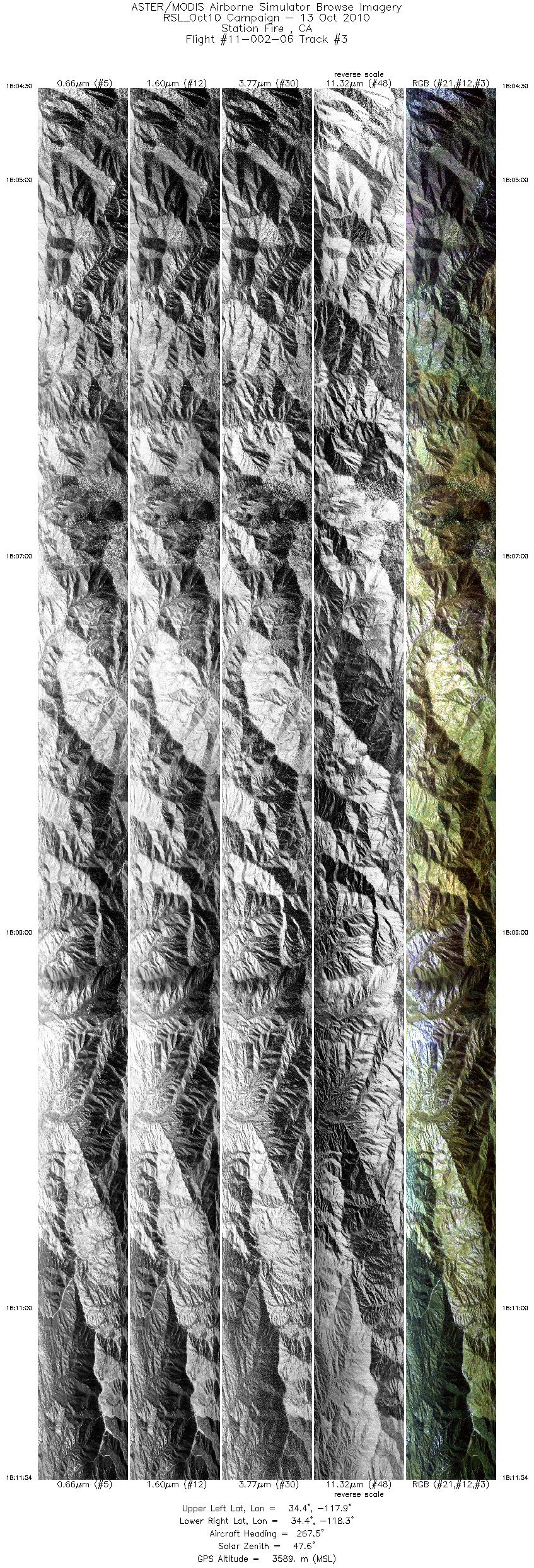
| 3 |
18:04 - 18:11 |
268.3 |
34.392 - 34.393 |
117.900 - 118.352 |
11041 |
3588 |
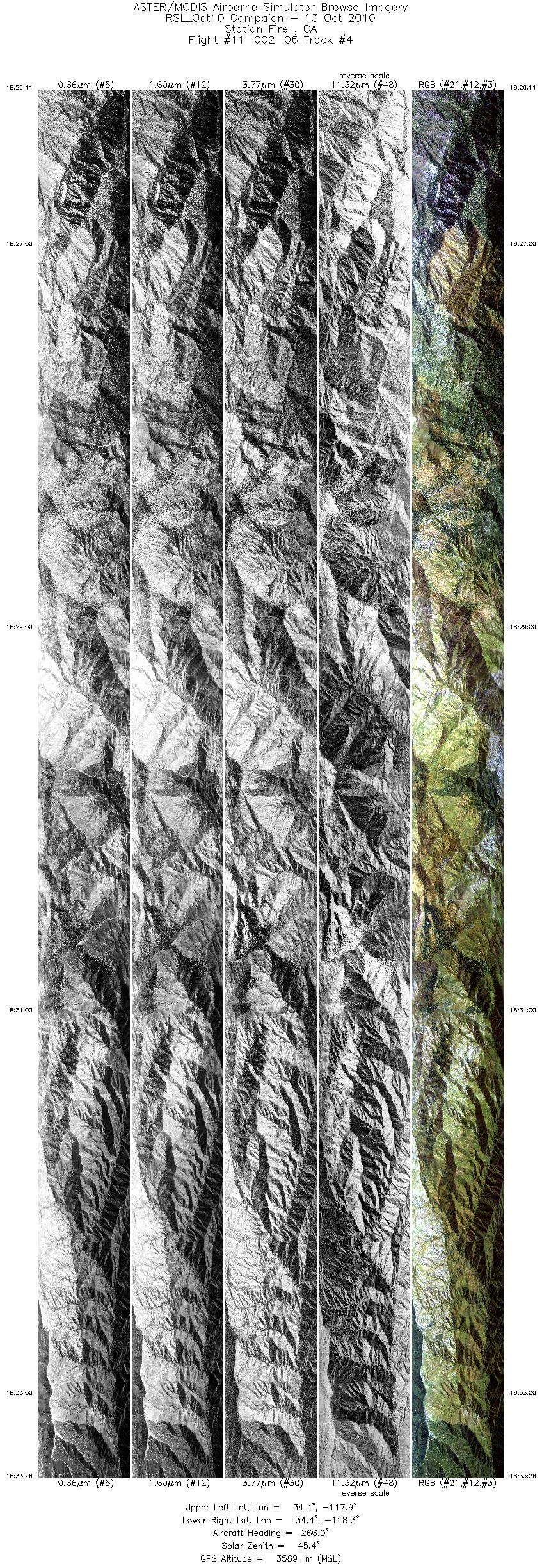
| 4 |
18:26 - 18:33 |
267.7 |
34.374 - 34.376 |
117.905 - 118.349 |
10838 |
3589 |
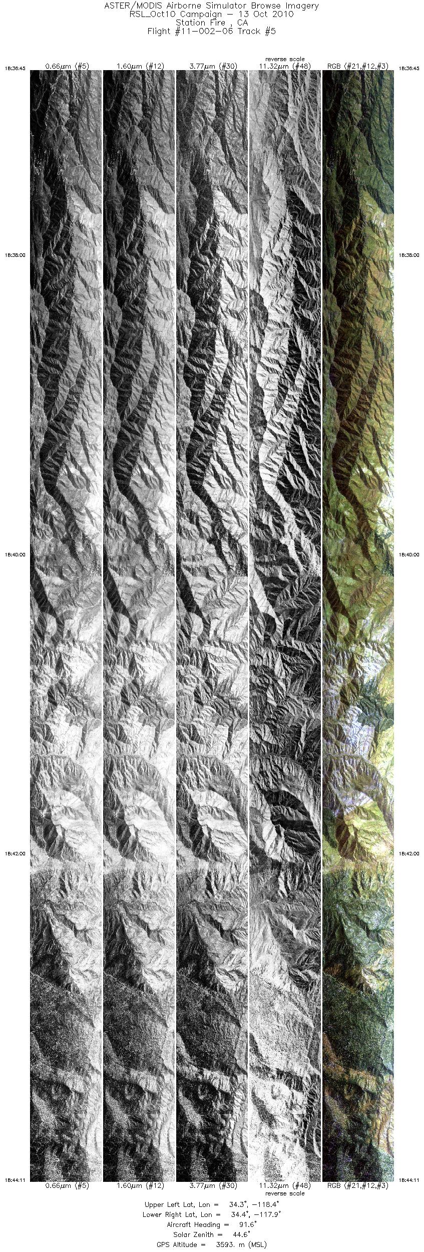
| 5 |
18:36 - 18:44 |
92.4 |
34.360 - 34.358 |
118.388 - 117.937 |
11103 |
3606 |
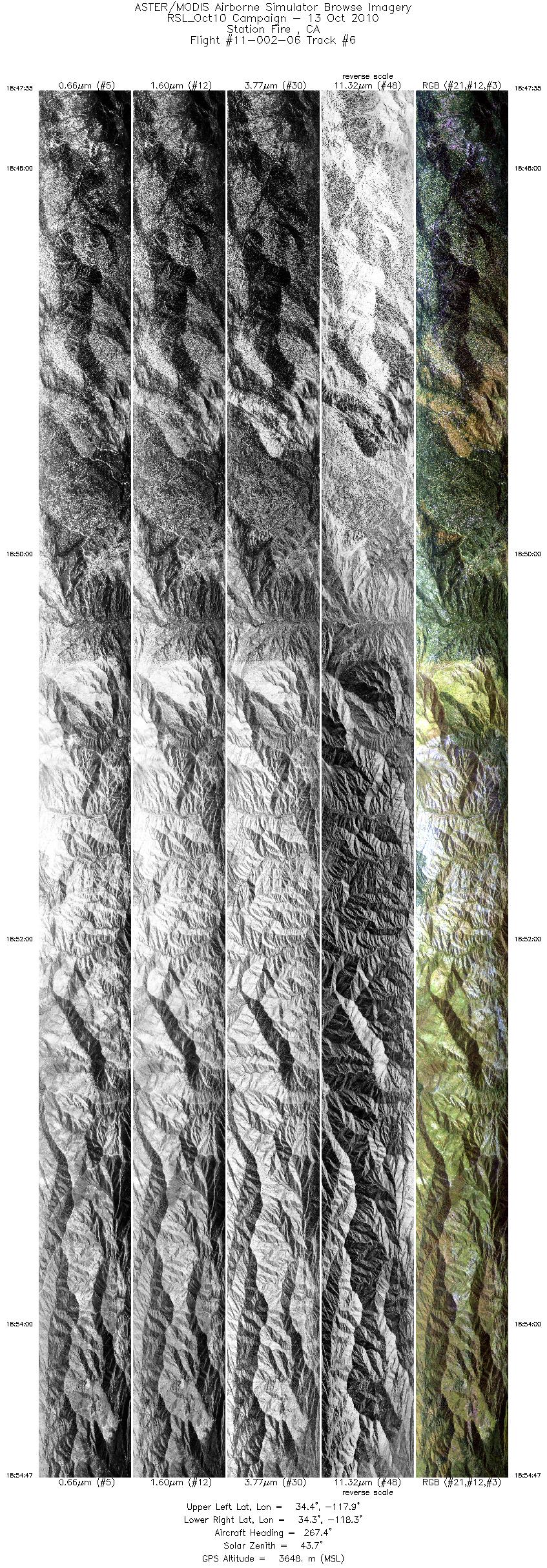
| 6 |
18:47 - 18:54 |
267.9 |
34.343 - 34.345 |
117.883 - 118.320 |
10735 |
3649 |
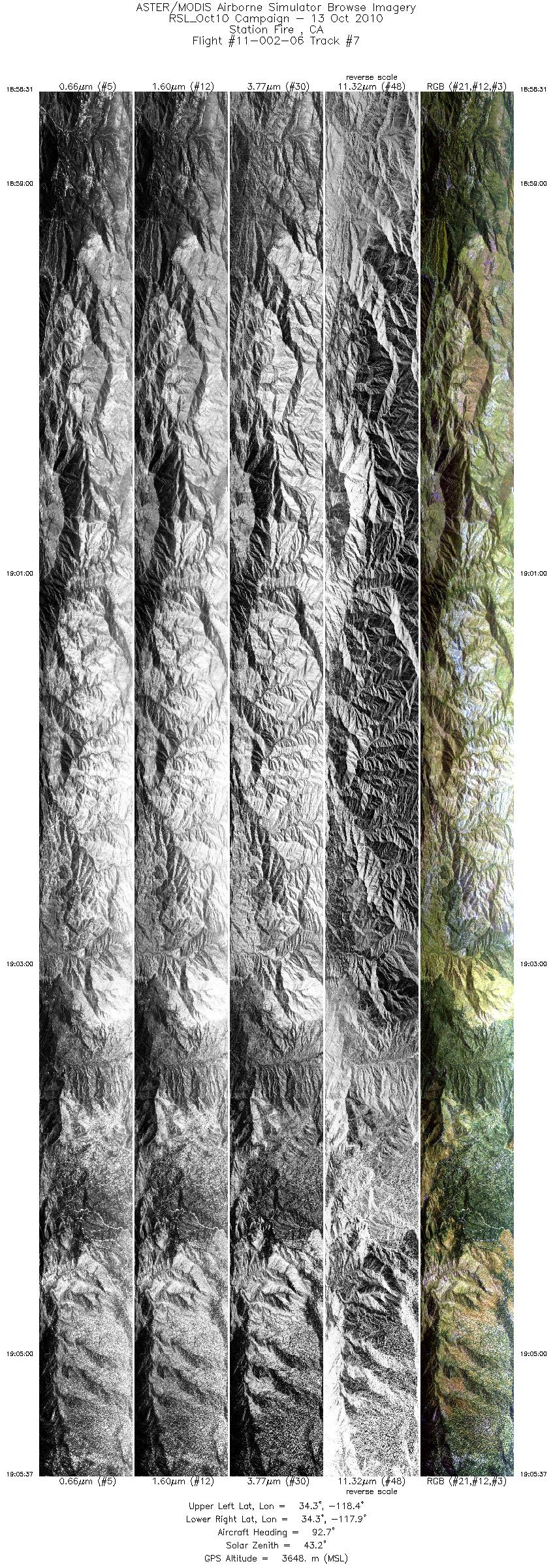
| 7 |
18:58 - 19:05 |
93.3 |
34.332 - 34.331 |
118.349 - 117.921 |
10587 |
3645 |
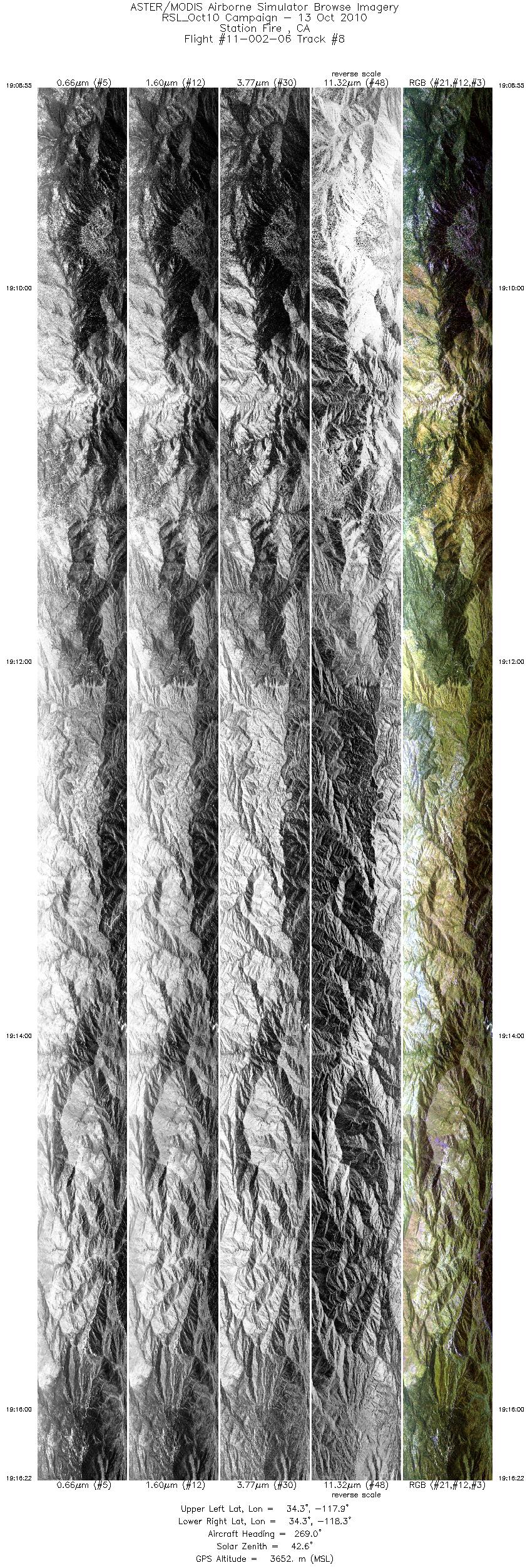
| 8 |
19:08 - 19:16 |
268.7 |
34.317 - 34.319 |
117.883 - 118.337 |
11131 |
3652 |
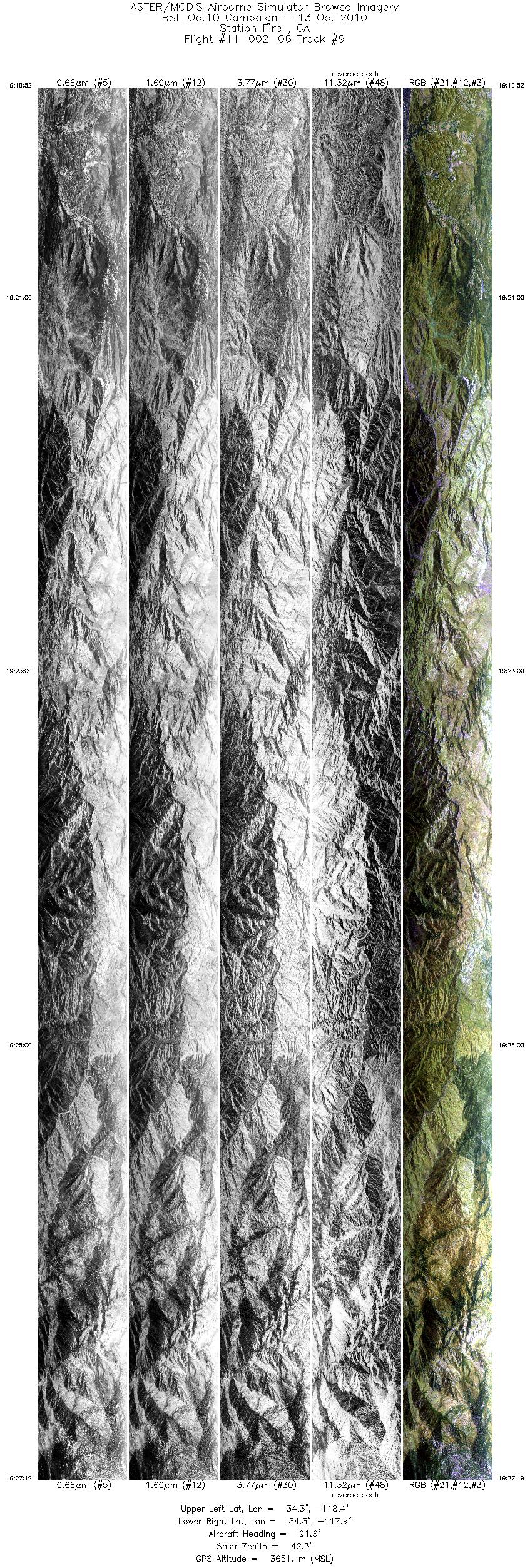
| 9 |
19:19 - 19:27 |
92.3 |
34.306 - 34.305 |
118.387 - 117.937 |
11133 |
3654 |
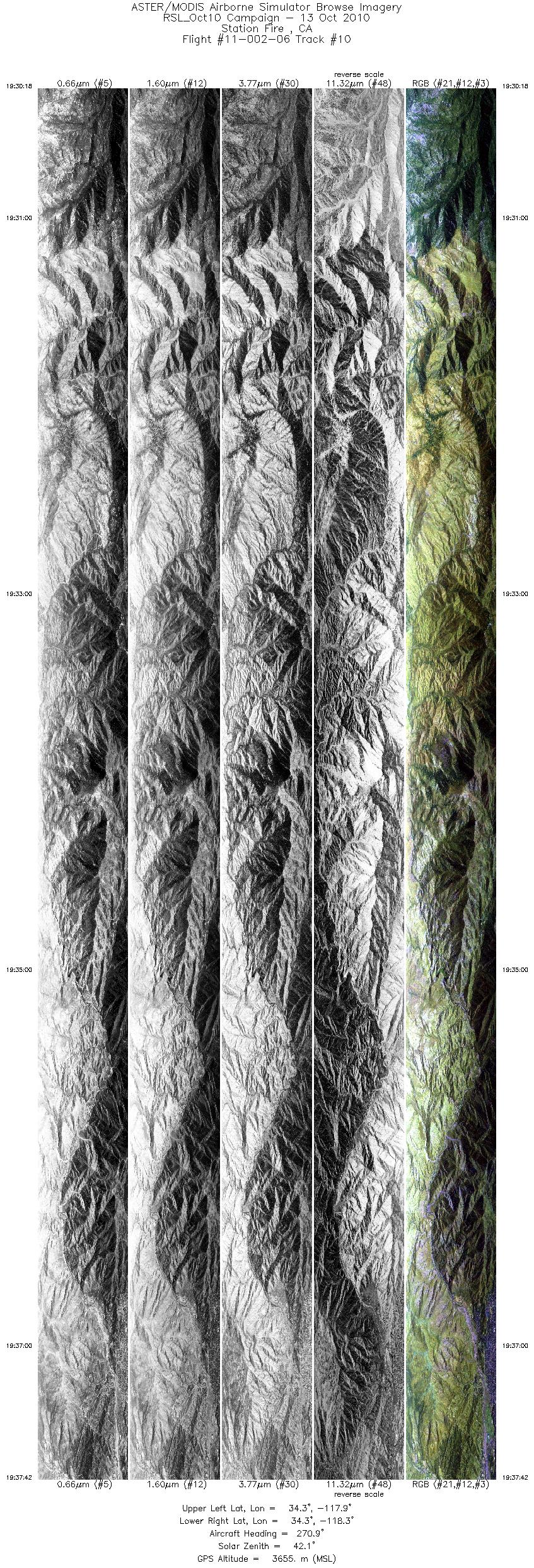
| 10 |
19:30 - 19:37 |
270.4 |
34.289 - 34.291 |
117.898 - 118.351 |
11034 |
3652 |
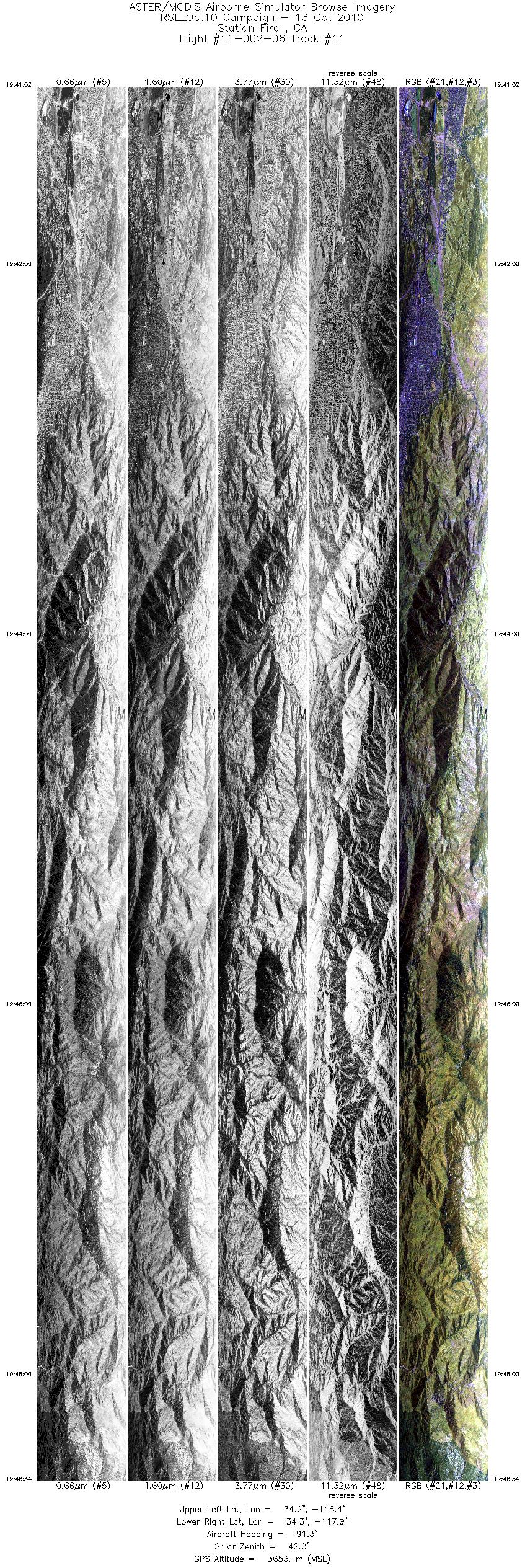
| 11 |
19:41 - 19:48 |
89.6 |
34.273 - 34.272 |
118.390 - 117.938 |
11248 |
3652 |
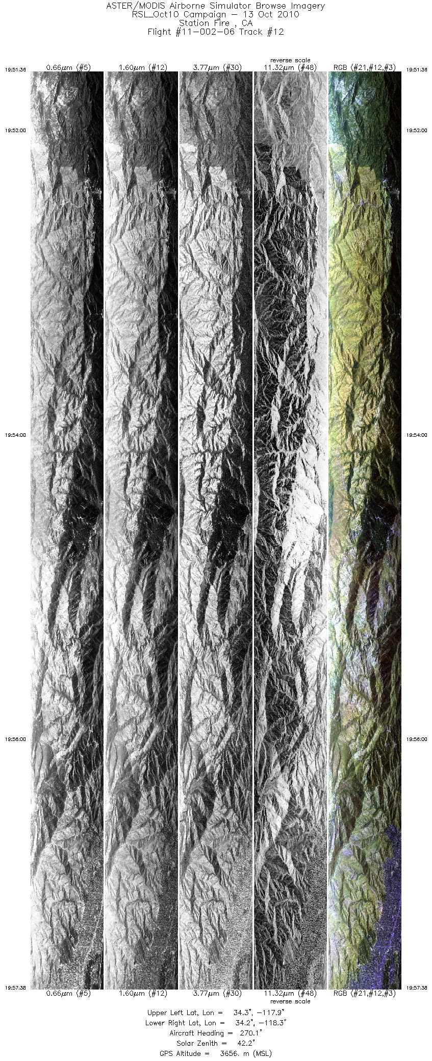
| 12 |
19:51 - 19:57 |
269.8 |
34.256 - 34.257 |
117.924 - 118.289 |
8997 |
3655 |
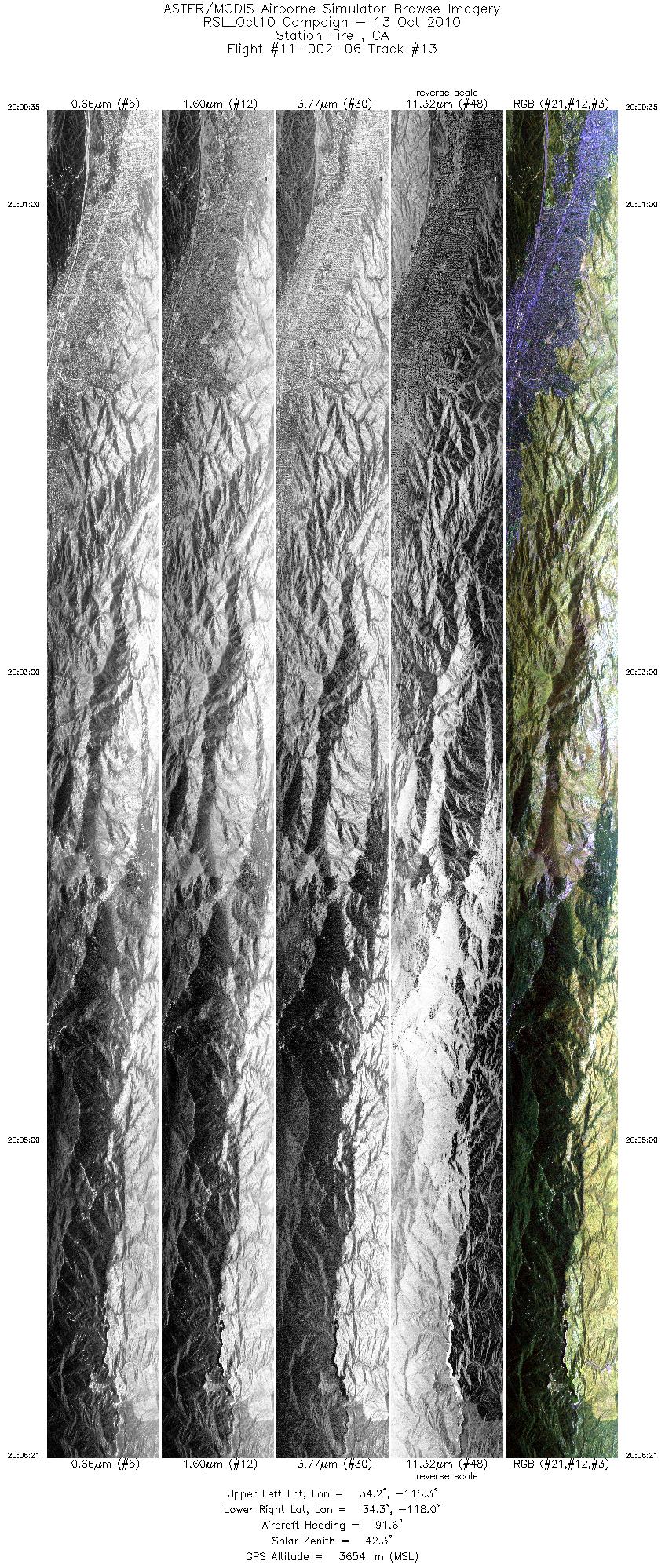
| 13 |
20:00 - 20:06 |
92.1 |
34.240 - 34.239 |
118.294 - 117.950 |
8592 |
3653 |
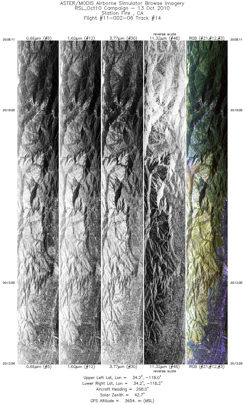
| 14 |
20:09 - 20:12 |
268.6 |
34.223 - 34.224 |
118.011 - 118.240 |
5595 |
3653 |
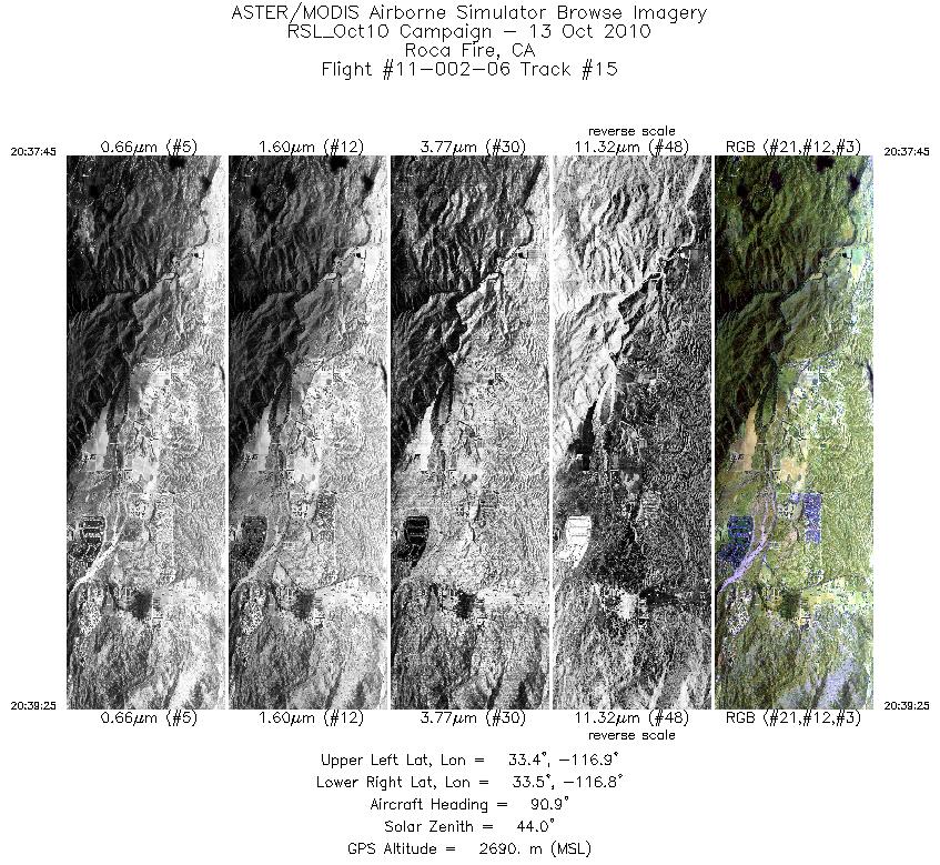
| 15 |
20:37 - 20:39 |
90.7 |
33.448 - 33.448 |
116.931 - 116.836 |
2497 |
2690 |
|


