Flight: 10-944-00
Date: August 30, 2010
Aircraft: NASA ER-2 #809
Deployment: Houston 2010
Flight Location: Texas / Gulf of Mexico
Principal Investigator: NASA Headquarters
Additional Sensors: AVIRIS / DCS
|
Data Evaluation
Overall data quality is good.
|
Processing Information
Level-1B Data in HDF format is available
Flight Line Summary
Spectral Band Configuration
Spectral Response Function Table
Spectral Response Function (text)
|
Browse Imagery
Flight Tracks: 21
Scanlines: 84699
|
Browse Imagery Table
|
Click a Flight Track number to view a quicklook image
Lat/Lon ranges are for the BEG-END scanline nadir pixels
|
Flight
Track |
Time Span
(UTC) |
Heading
(Deg) |
Lat Range
(Deg N) |
Lon Range
(Deg W) |
Length
(Scanlines) |
Altitude
(Meters) |
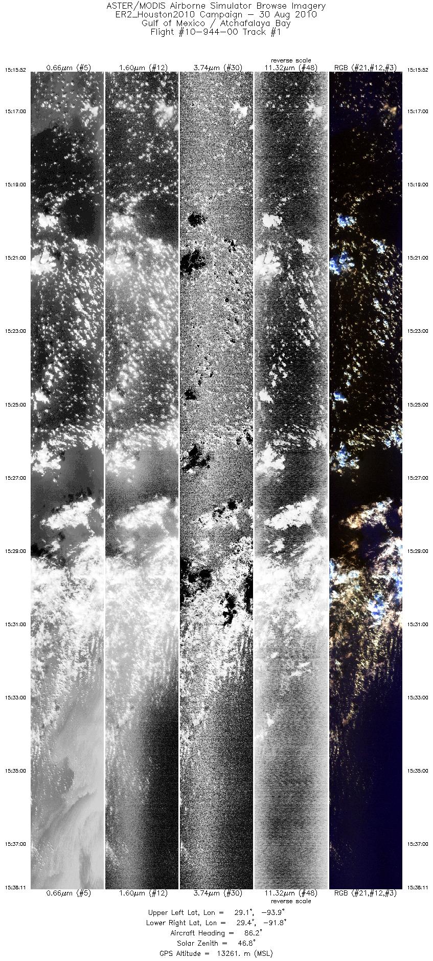
| 1 |
15:15 - 15:38 |
86.6 |
29.225 - 29.302 |
93.946 - 91.772 |
7989 |
13261 |
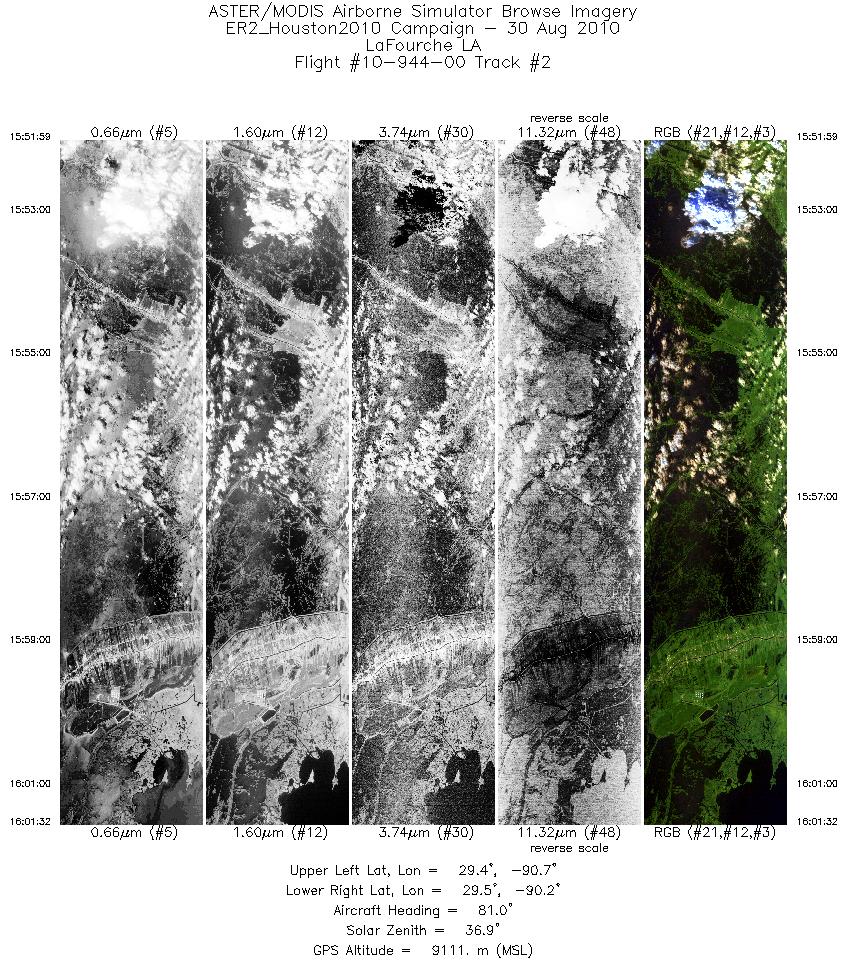
| 2 |
15:51 - 16:01 |
79.6 |
29.426 - 29.470 |
90.741 - 90.158 |
3429 |
9106 |
| 3 |
16:03 - 16:09 |
214.1 |
29.405 - 29.099 |
90.147 - 90.346 |
2357 |
9116 |
| 4 |
16:11 - 16:22 |
2.5 |
29.119 - 29.651 |
90.415 - 90.409 |
3867 |
9127 |
| 5 |
16:24 - 16:32 |
171.6 |
29.625 - 29.201 |
90.462 - 90.458 |
2799 |
9109 |
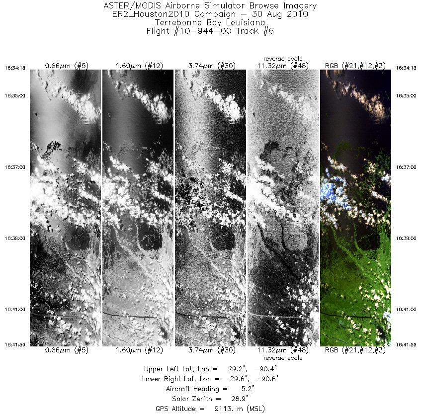
| 6 |
16:34 - 16:41 |
2.9 |
29.195 - 29.603 |
90.513 - 90.506 |
2789 |
9125 |
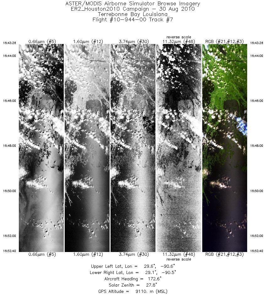
| 7 |
16:43 - 16:52 |
175.4 |
29.602 - 29.110 |
90.557 - 90.554 |
3314 |
9125 |
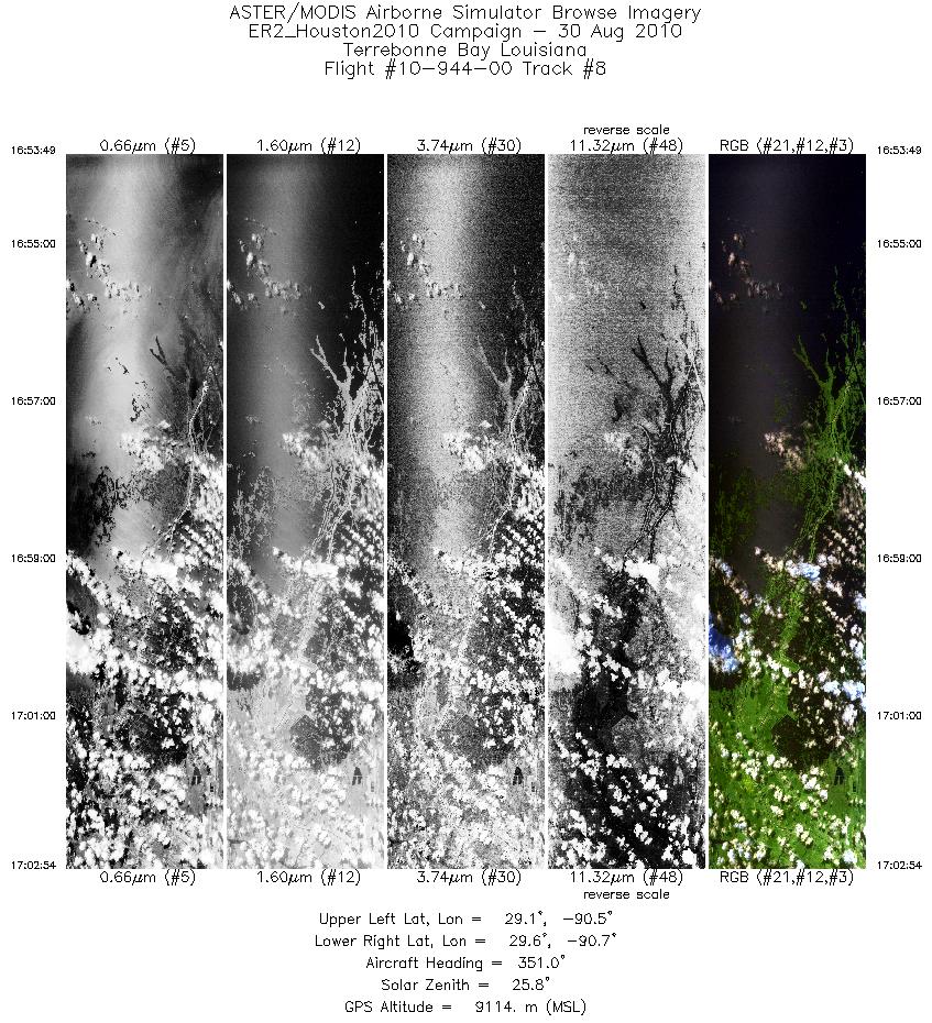
| 8 |
16:53 - 17:02 |
355.2 |
29.102 - 29.577 |
90.595 - 90.602 |
3253 |
9129 |
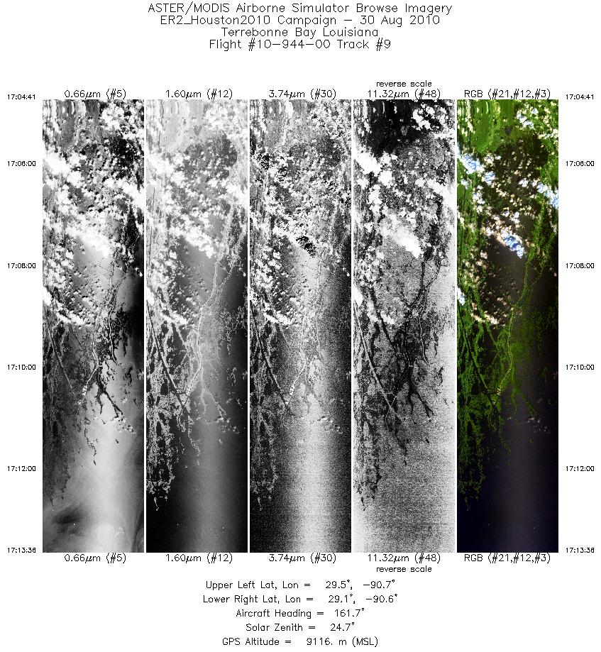
| 9 |
17:04 - 17:13 |
170.3 |
29.553 - 29.068 |
90.659 - 90.650 |
3195 |
9090 |
| 10 |
17:30 - 17:36 |
171.3 |
27.541 - 26.860 |
90.552 - 90.503 |
2206 |
18691 |
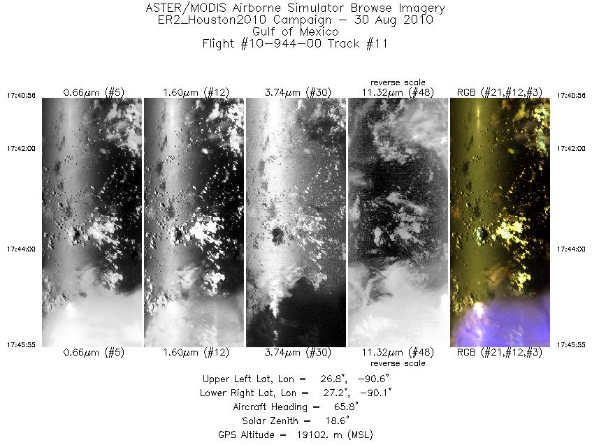
| 11 |
17:40 - 17:45 |
73.0 |
26.993 - 27.082 |
90.641 - 90.104 |
1785 |
19057 |
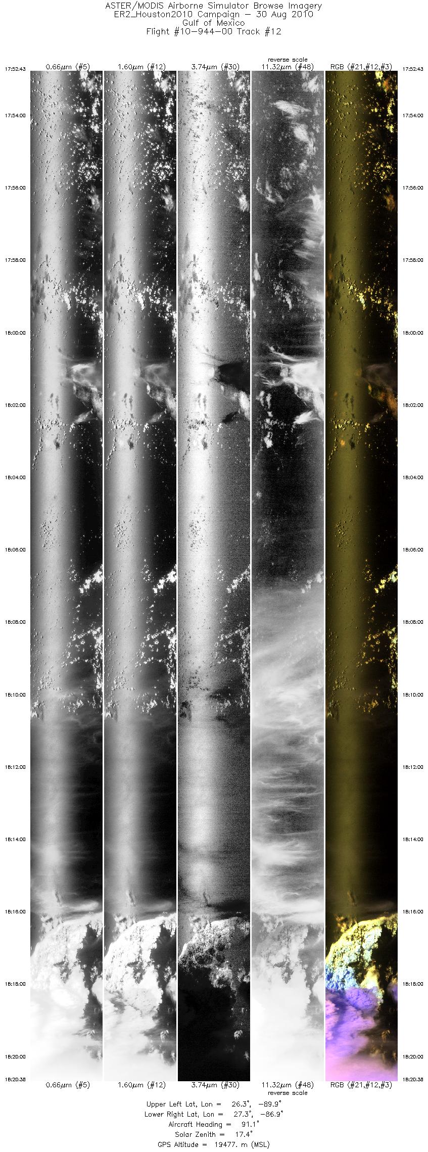
| 12 |
17:52 - 18:20 |
85.6 |
26.495 - 27.123 |
89.913 - 86.882 |
9999 |
19450 |
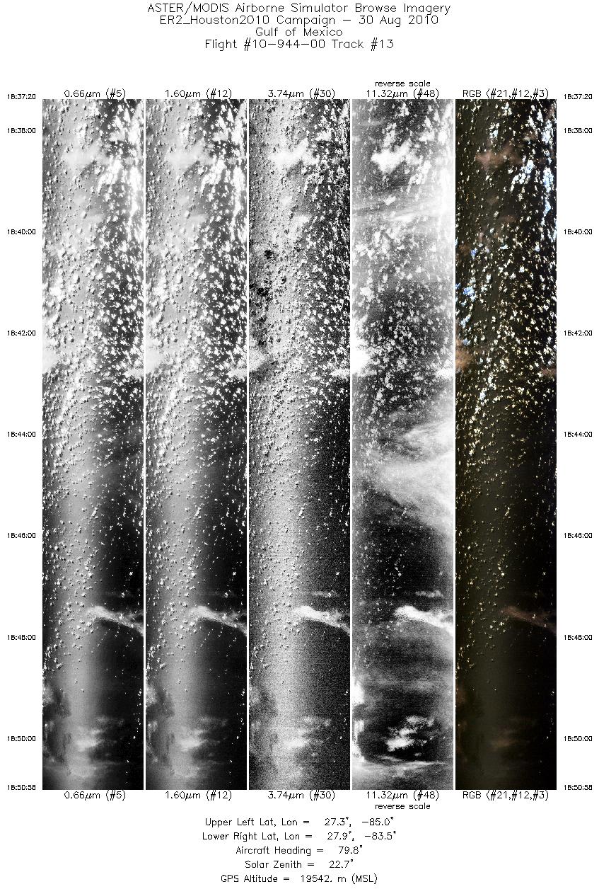
| 13 |
18:37 - 18:50 |
79.1 |
27.465 - 27.727 |
85.020 - 83.483 |
4880 |
19572 |
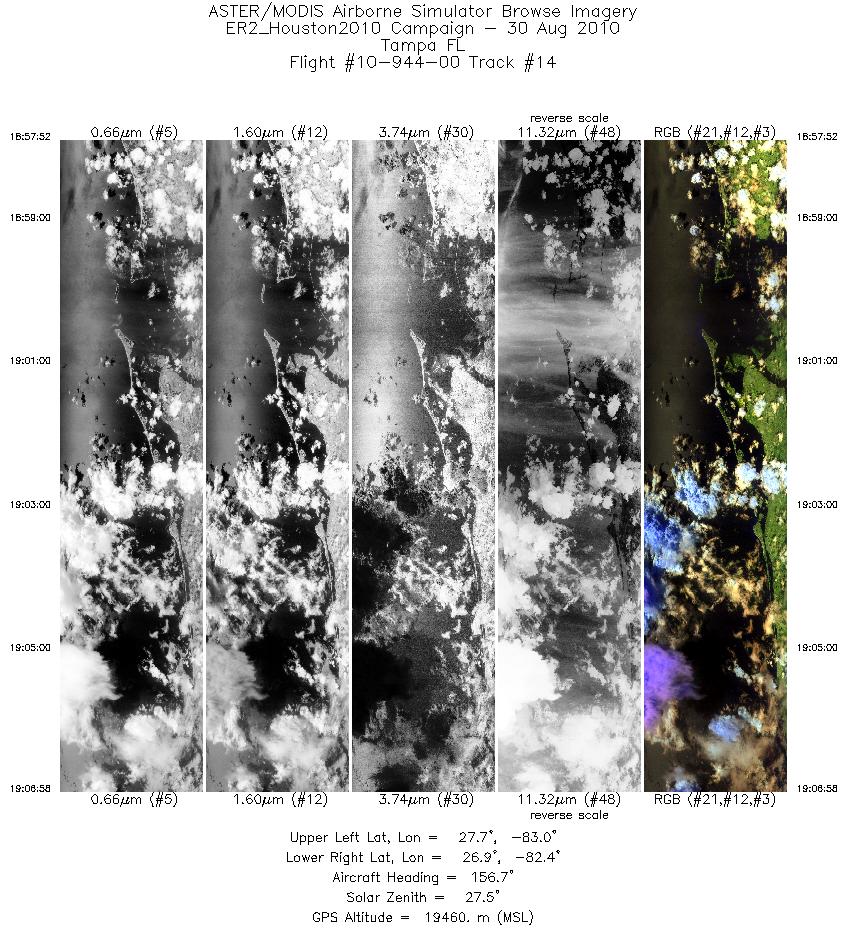
| 14 |
18:57 - 19:06 |
160.6 |
27.814 - 26.881 |
82.792 - 82.556 |
3260 |
19458 |
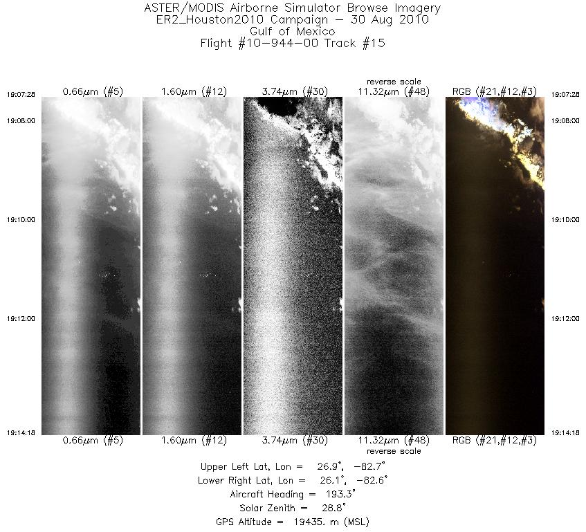
| 15 |
19:07 - 19:14 |
193.7 |
26.829 - 26.115 |
82.558 - 82.808 |
2447 |
19466 |
| 16 |
19:15 - 19:38 |
246.7 |
26.048 - 25.115 |
82.880 - 85.770 |
8494 |
19481 |
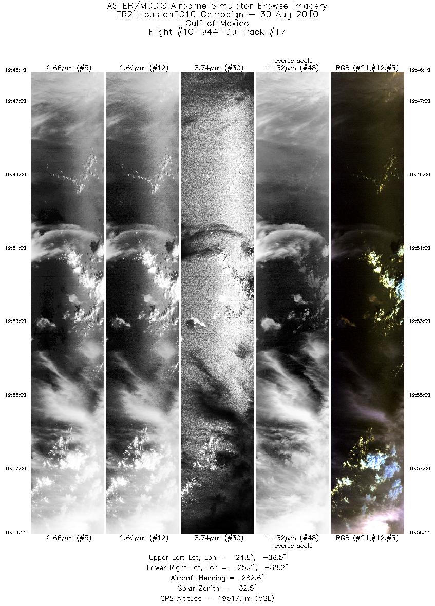
| 17 |
19:46 - 19:58 |
286.1 |
24.685 - 25.125 |
86.551 - 88.123 |
4502 |
19545 |
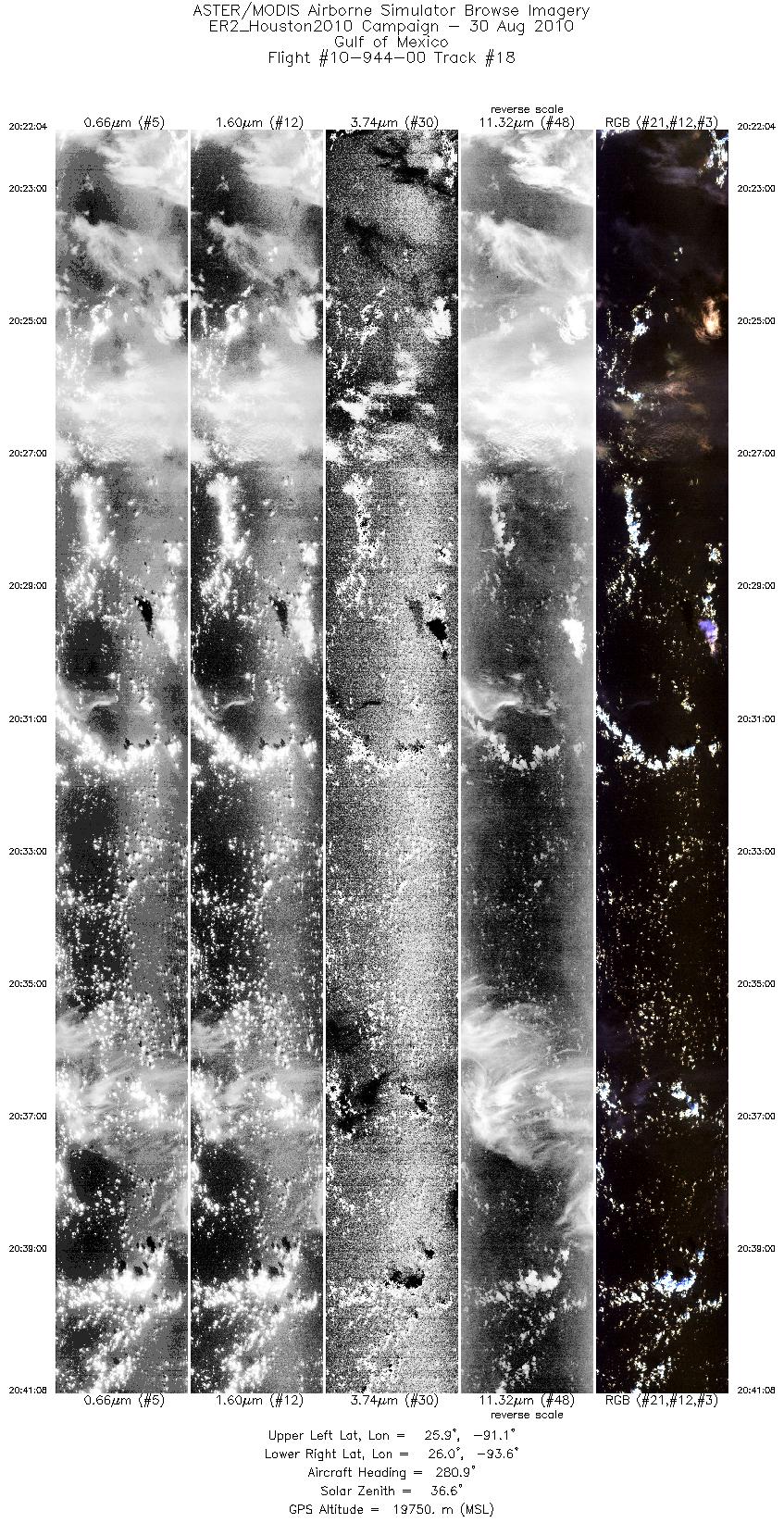
| 18 |
20:22 - 20:41 |
282.4 |
25.732 - 26.179 |
91.098 - 93.532 |
6826 |
19762 |
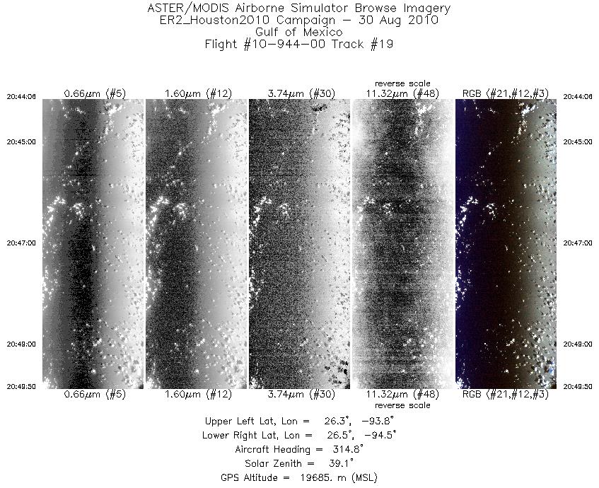
| 19 |
20:44 - 20:49 |
316.7 |
26.167 - 26.650 |
93.889 - 94.405 |
2052 |
19697 |
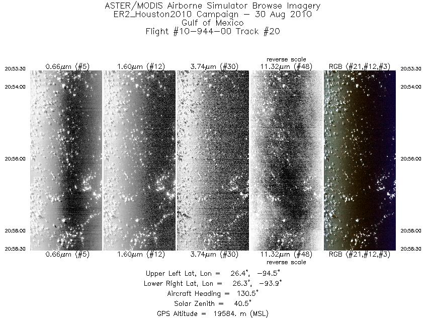
| 20 |
20:53 - 20:58 |
131.2 |
26.551 - 26.202 |
94.386 - 93.991 |
1794 |
19579 |
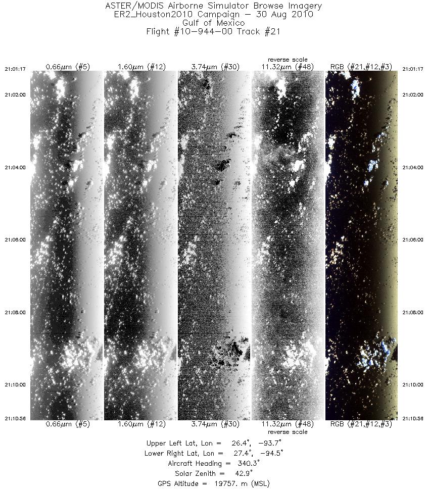
| 21 |
21:01 - 21:10 |
342.7 |
26.370 - 27.413 |
93.857 - 94.279 |
3462 |
19753 |
|


