Flight: 10-939-00
Date: August 24, 2010
Aircraft: NASA ER-2 #809
Deployment: Houston 2010
Flight Location: Louisiana / Mississippi / Gulf of Mexico
Principal Investigator: NASA Headquarters
Additional Sensors: AVIRIS / DCS
|
Data Evaluation
Overall data quality is good.
|
Processing Information
Level-1B Data in HDF format is available
Flight Line Summary
Spectral Band Configuration
Spectral Response Function Table
Spectral Response Function (text)
|
Browse Imagery
Flight Tracks: 24
Scanlines: 104634
|
Browse Imagery Table
|
Click a Flight Track number to view a quicklook image
Lat/Lon ranges are for the BEG-END scanline nadir pixels
|
Flight
Track |
Time Span
(UTC) |
Heading
(Deg) |
Lat Range
(Deg N) |
Lon Range
(Deg W) |
Length
(Scanlines) |
Altitude
(Meters) |
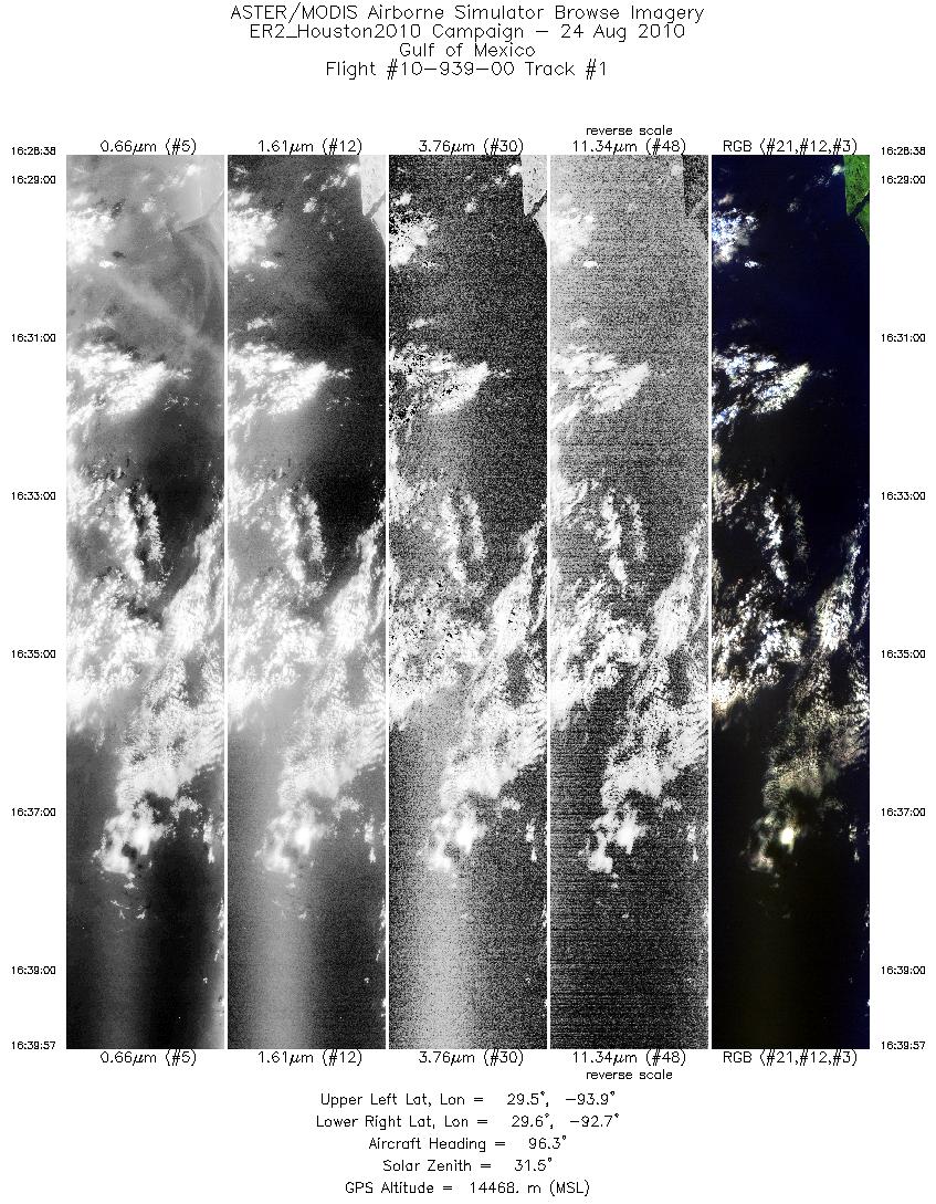
| 1 |
16:28 - 16:39 |
96.0 |
29.611 - 29.483 |
93.926 - 92.717 |
4046 |
14464 |
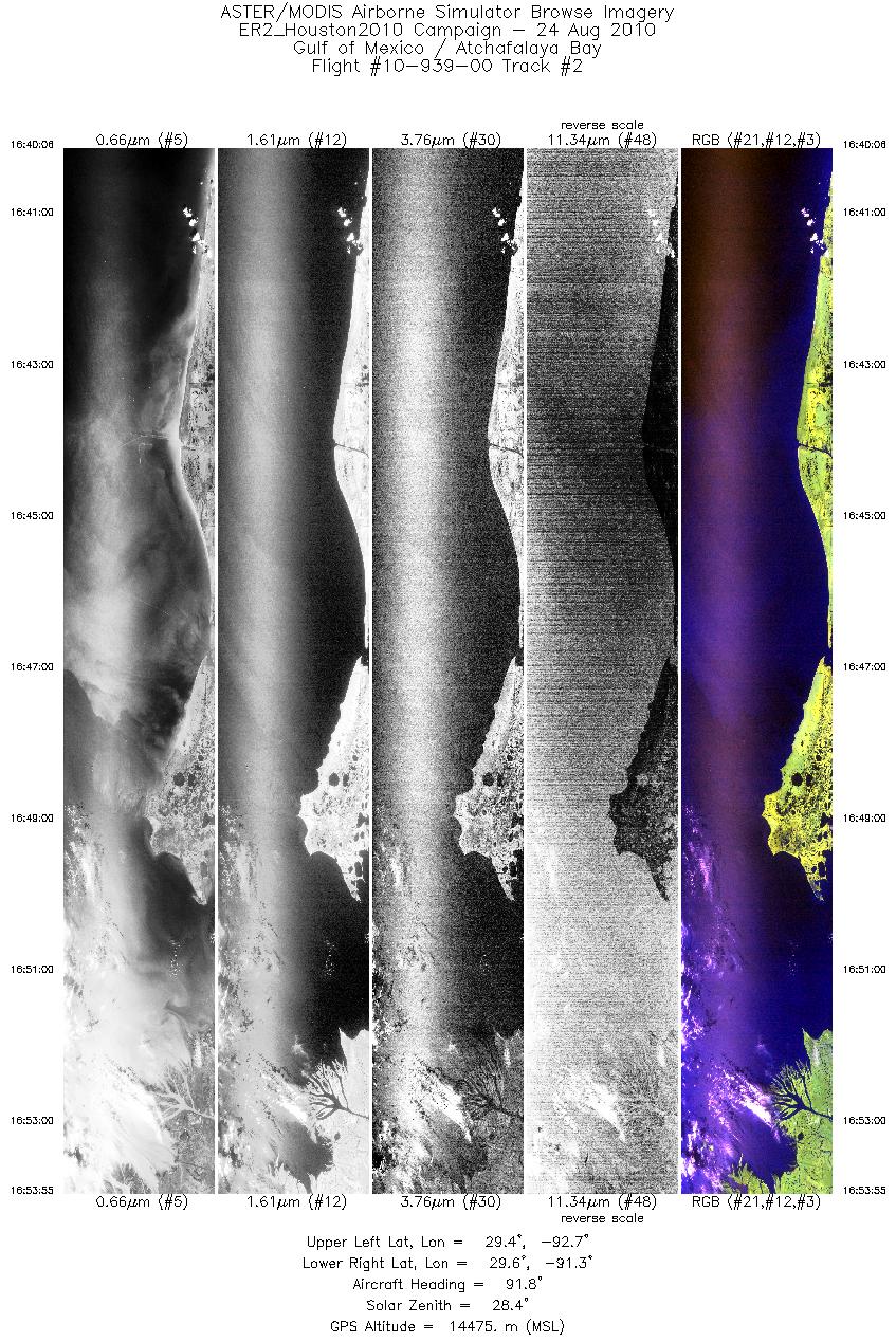
| 2 |
16:40 - 16:53 |
90.3 |
29.482 - 29.460 |
92.700 - 91.313 |
4949 |
14468 |
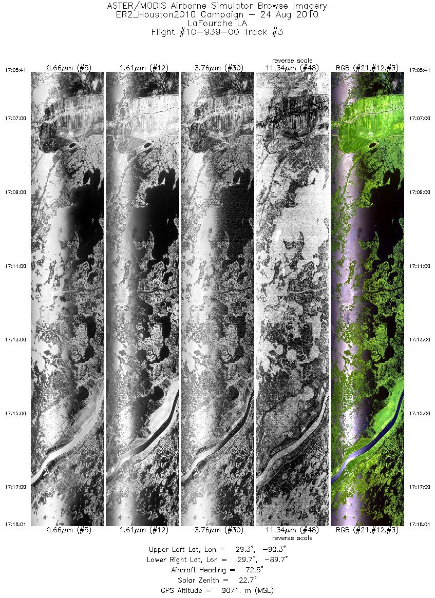
| 3 |
17:05 - 17:18 |
73.0 |
29.418 - 29.593 |
90.363 - 89.661 |
4426 |
9069 |
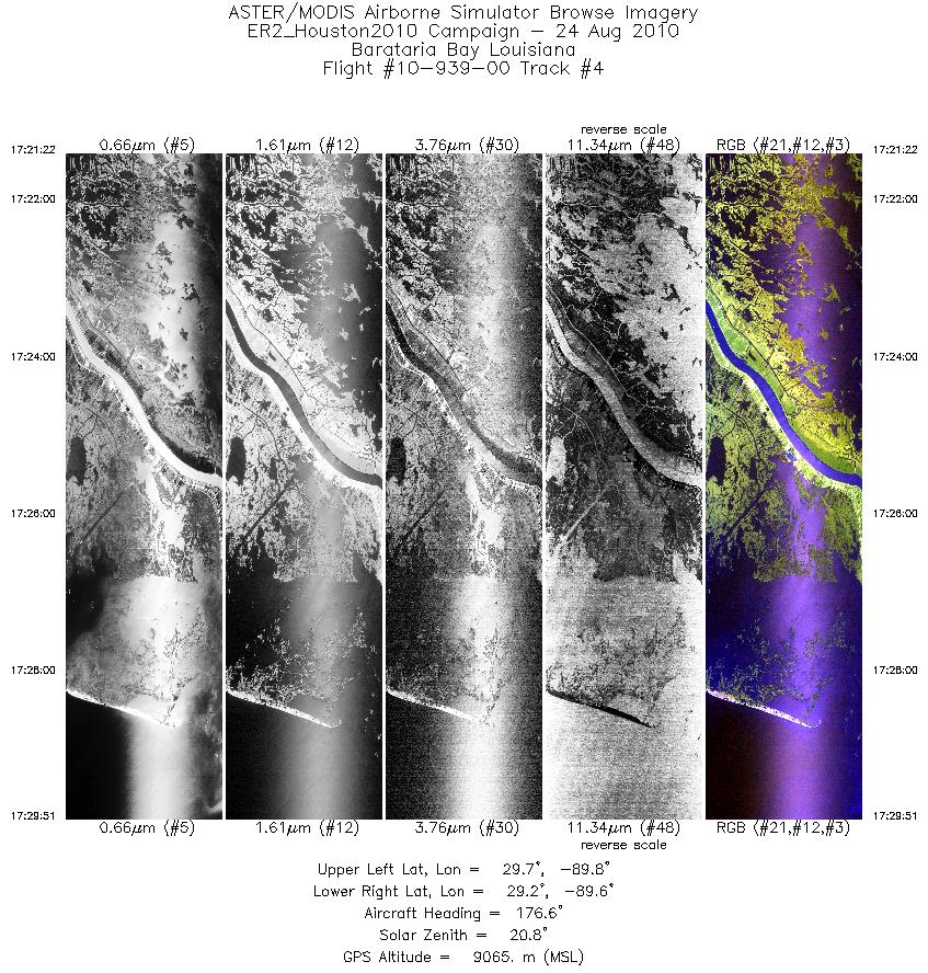
| 4 |
17:21 - 17:29 |
177.5 |
29.677 - 29.235 |
89.698 - 89.699 |
3042 |
9074 |
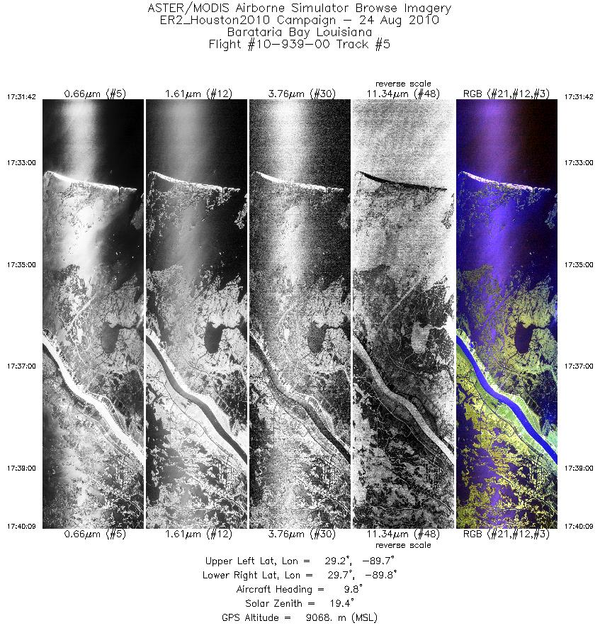
| 5 |
17:31 - 17:40 |
7.3 |
29.221 - 29.660 |
89.750 - 89.747 |
3031 |
9099 |
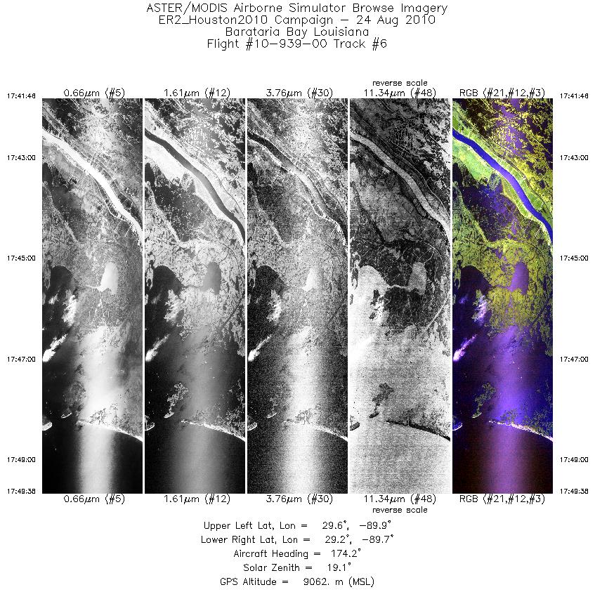
| 6 |
17:41 - 17:49 |
176.9 |
29.653 - 29.247 |
89.800 - 89.796 |
2816 |
9087 |
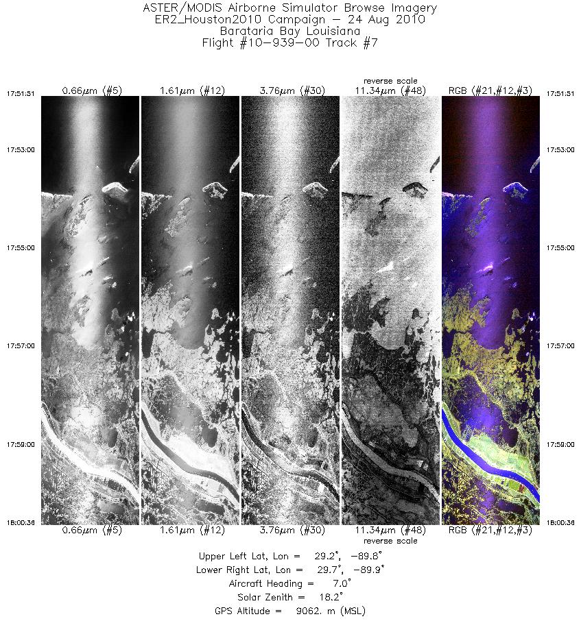
| 7 |
17:51 - 18:00 |
6.0 |
29.211 - 29.658 |
89.843 - 89.844 |
3134 |
9077 |
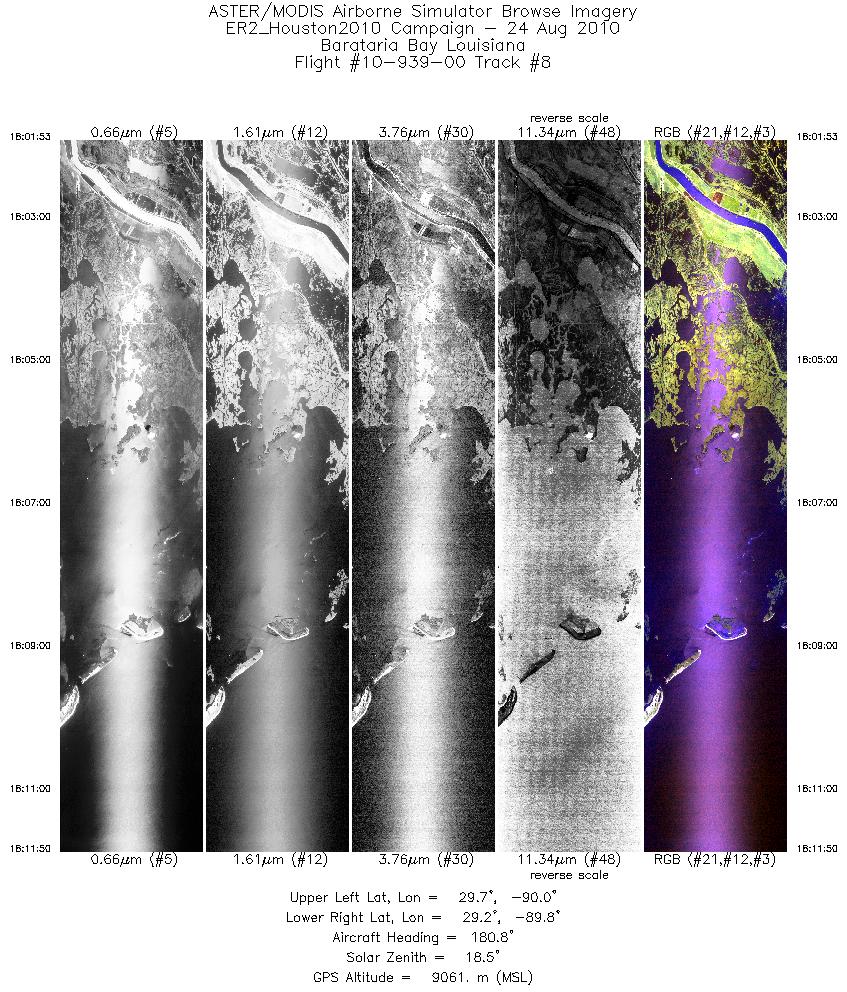
| 8 |
18:01 - 18:11 |
179.9 |
29.664 - 29.155 |
89.892 - 89.893 |
3560 |
9073 |
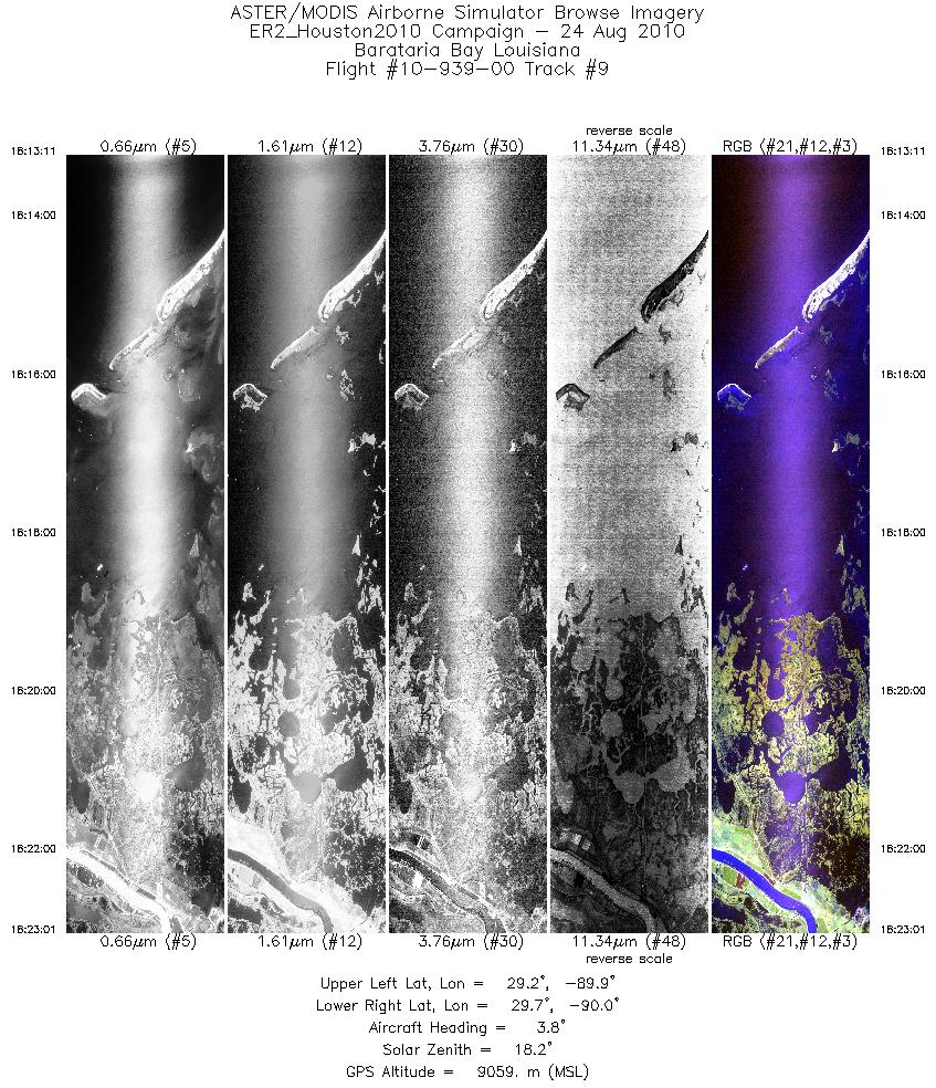
| 9 |
18:13 - 18:23 |
4.6 |
29.158 - 29.656 |
89.940 - 89.939 |
3521 |
9080 |
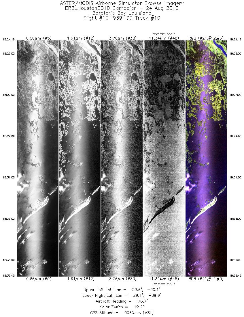
| 10 |
18:24 - 18:35 |
178.0 |
29.657 - 29.072 |
89.986 - 89.988 |
4093 |
9073 |
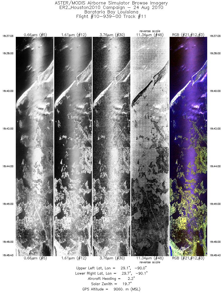
| 11 |
18:37 - 18:48 |
2.1 |
29.077 - 29.668 |
90.036 - 90.034 |
4167 |
9070 |
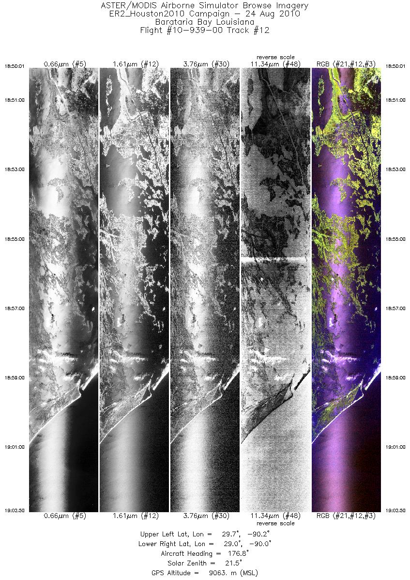
| 12 |
18:50 - 19:02 |
176.9 |
29.669 - 29.021 |
90.080 - 90.084 |
4587 |
9079 |
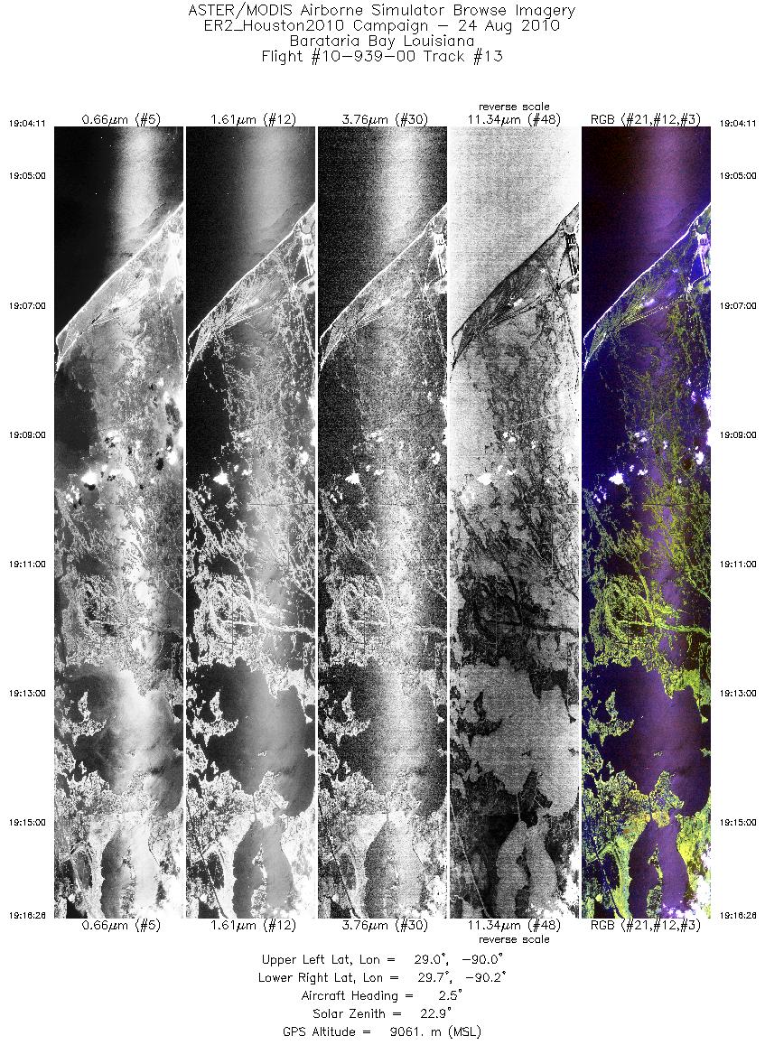
| 13 |
19:04 - 19:16 |
2.3 |
29.027 - 29.651 |
90.128 - 90.131 |
4388 |
9069 |
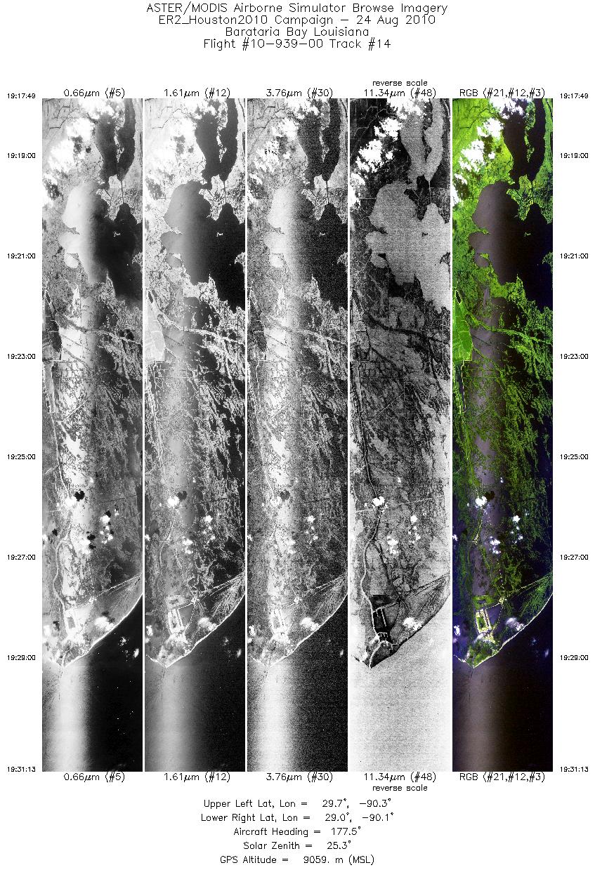
| 14 |
19:17 - 19:31 |
177.2 |
29.657 - 28.984 |
90.180 - 90.181 |
4797 |
9072 |
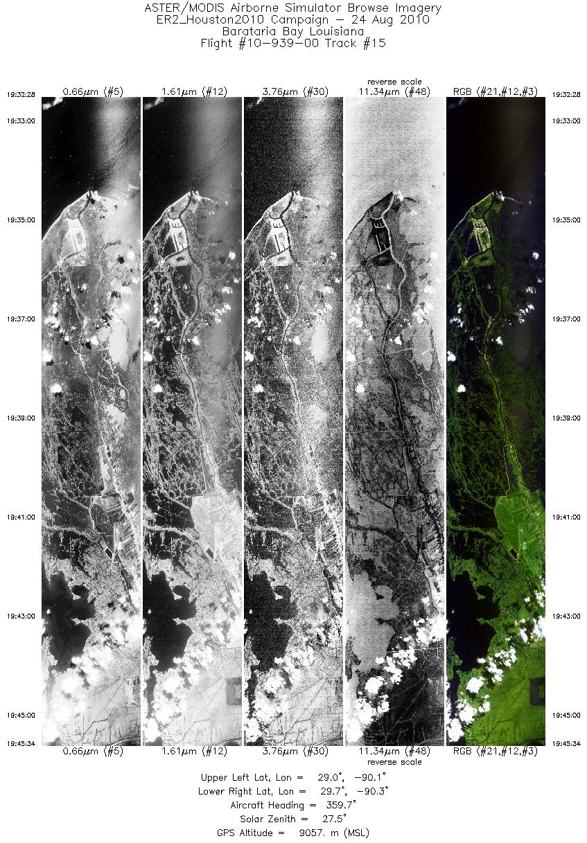
| 15 |
19:32 - 19:45 |
0.5 |
28.987 - 29.648 |
90.227 - 90.227 |
4689 |
9077 |
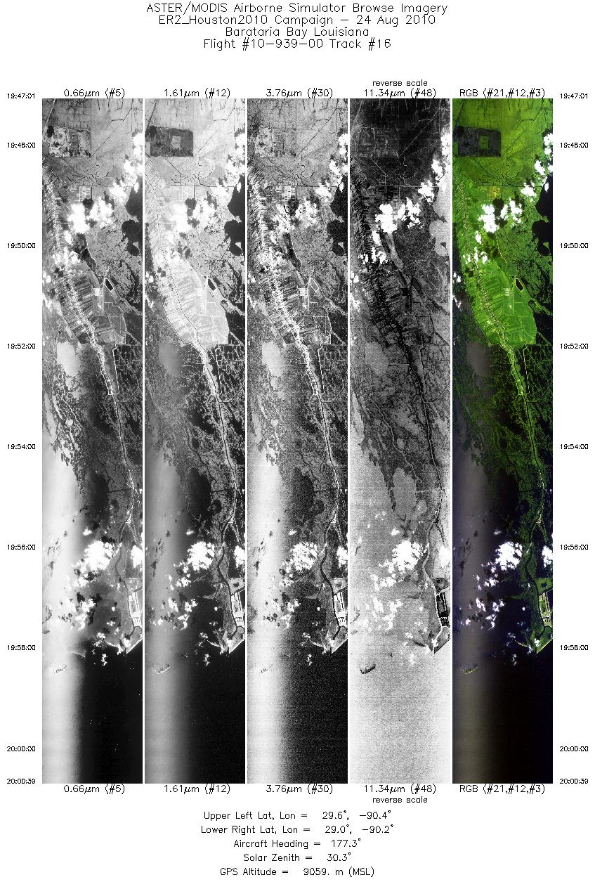
| 16 |
19:47 - 20:00 |
177.3 |
29.644 - 28.958 |
90.278 - 90.276 |
4878 |
9075 |
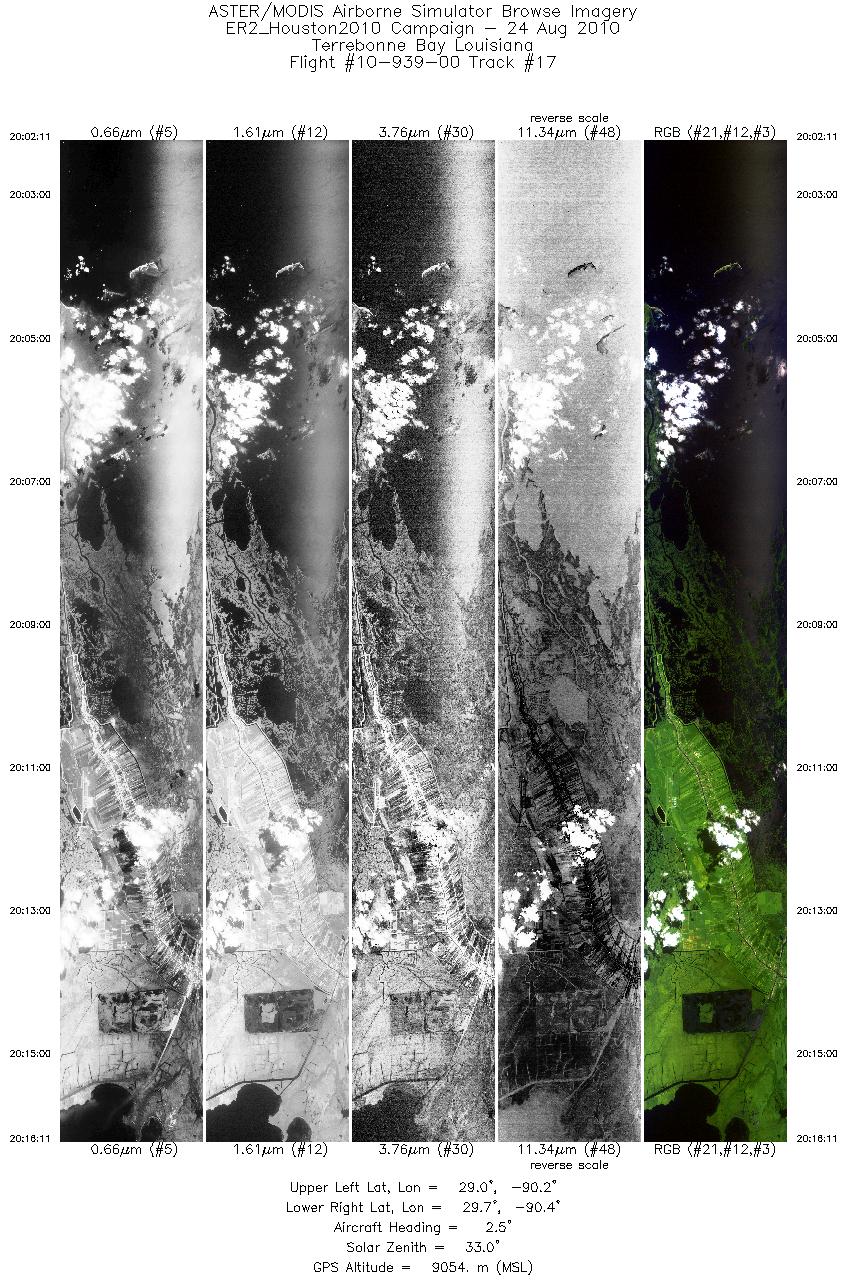
| 17 |
20:02 - 20:16 |
1.9 |
28.973 - 29.689 |
90.314 - 90.313 |
5012 |
9072 |
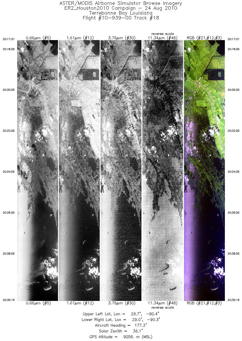
| 18 |
20:17 - 20:30 |
178.1 |
29.686 - 29.038 |
90.361 - 90.362 |
4558 |
9073 |
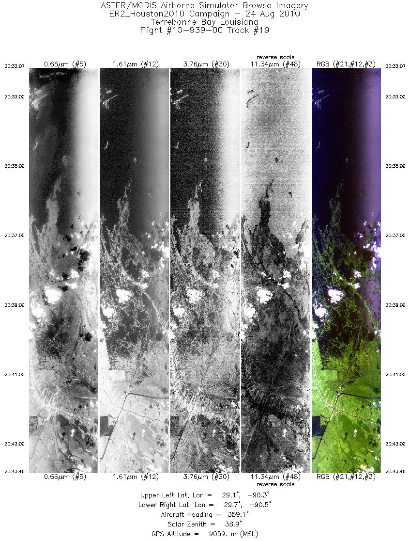
| 19 |
20:32 - 20:43 |
1.0 |
29.071 - 29.668 |
90.410 - 90.409 |
4180 |
9064 |
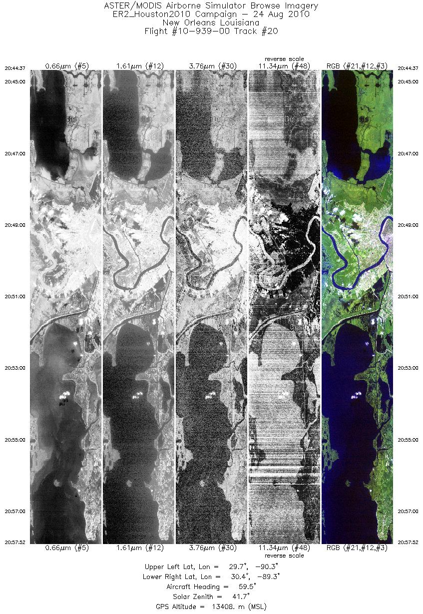
| 20 |
20:44 - 20:57 |
60.6 |
29.710 - 30.253 |
90.379 - 89.267 |
4747 |
13706 |
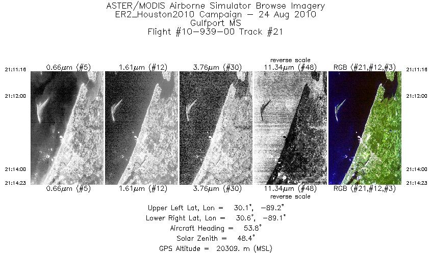
| 21 |
21:11 - 21:14 |
51.6 |
30.234 - 30.471 |
89.277 - 88.993 |
1118 |
20285 |
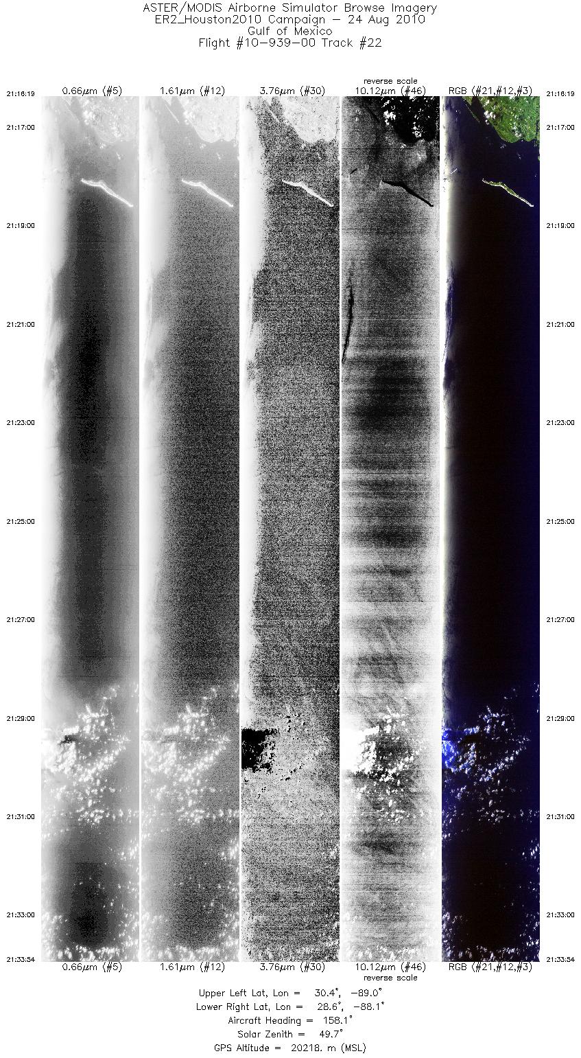
| 22 |
21:16 - 21:33 |
162.5 |
30.424 - 28.583 |
88.802 - 88.351 |
6305 |
20281 |
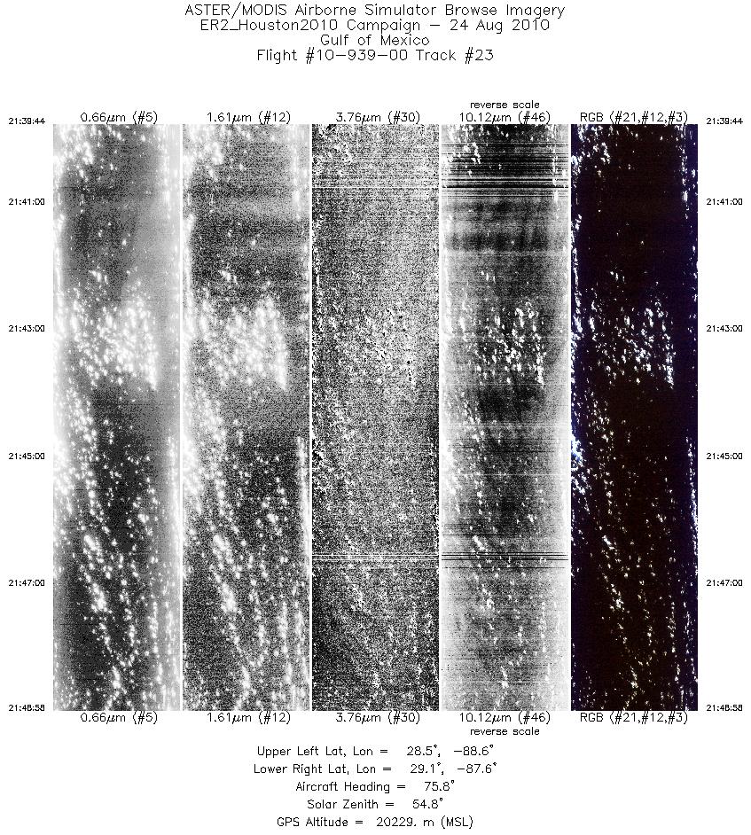
| 23 |
21:39 - 21:48 |
77.3 |
28.699 - 28.948 |
88.602 - 87.509 |
3313 |
20146 |
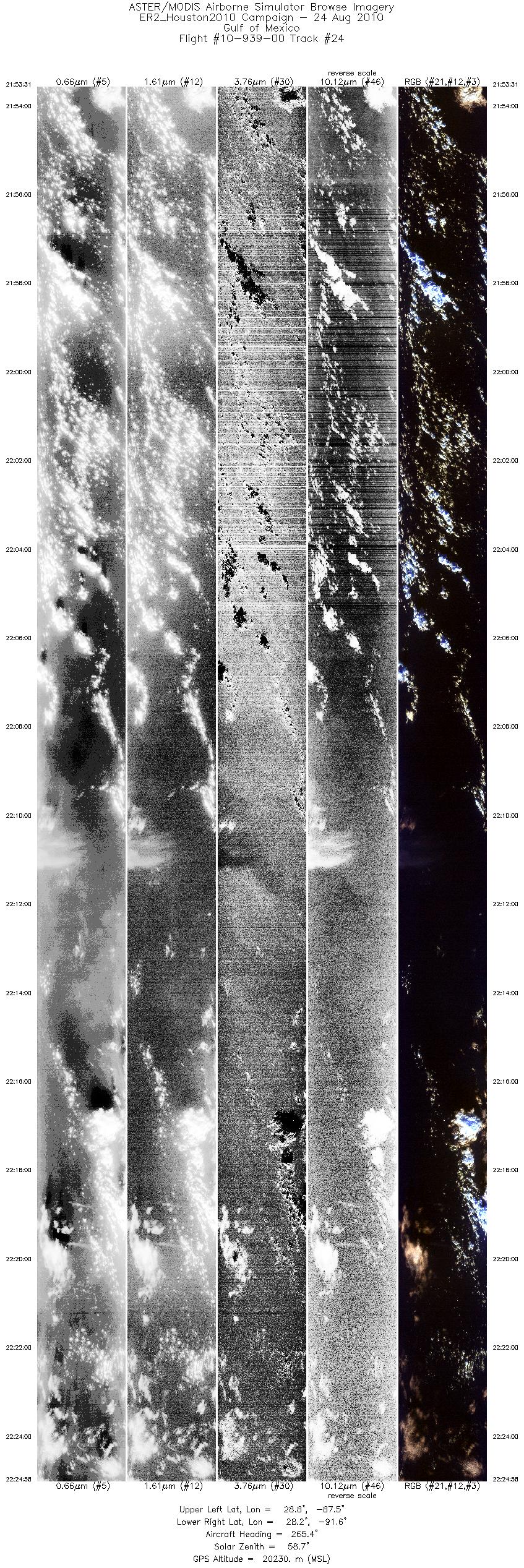
| 24 |
21:53 - 22:24 |
267.2 |
28.636 - 28.361 |
87.485 - 91.567 |
11277 |
20064 |
|


