Flight: 08-005-09
Date: August 26, 2008
Aircraft: DOE B200, #798
Deployment: RSL August 2008
Flight Location: Basin Complex Fire
Principal Investigator: Meentemeyer & Shoemaker (UNCC)
Additional Sensors: None
|
Data Evaluation
Overall data quality is good.
|
Processing Information
Level-1B Data in HDF format is available
Flight Line Summary
Spectral Band Configuration
Spectral Response Function Table
Spectral Response Function (text)
|
Browse Imagery
Flight Tracks: 13
Scanlines: 71033
|
Browse Imagery Table
|
Click a Flight Track number to view a quicklook image
Lat/Lon ranges are for the BEG-END scanline nadir pixels
|
Flight
Track |
Time Span
(UTC) |
Heading
(Deg) |
Lat Range
(Deg N) |
Lon Range
(Deg W) |
Length
(Scanlines) |
Altitude
(Meters) |
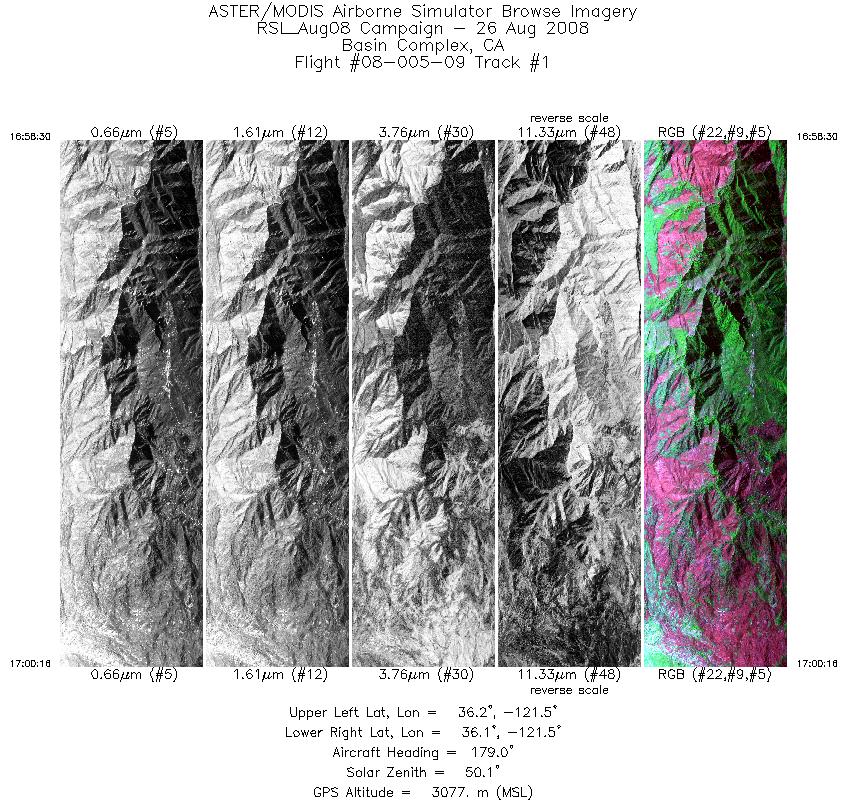
| 1 |
16:58 - 17:00 |
180.8 |
36.207 - 36.111 |
121.507 - 121.505 |
2639 |
3078 |
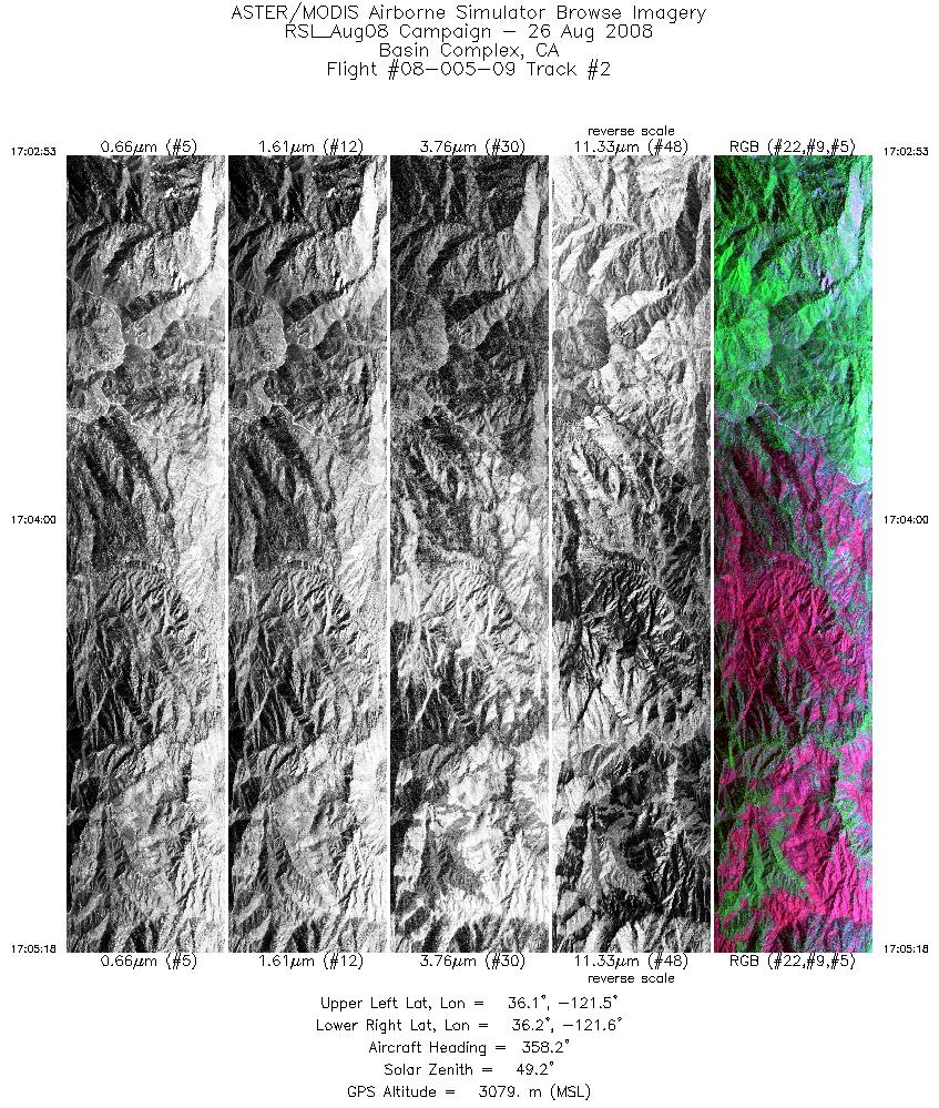
| 2 |
17:02 - 17:05 |
358.8 |
36.073 - 36.204 |
121.537 - 121.536 |
3598 |
3079 |
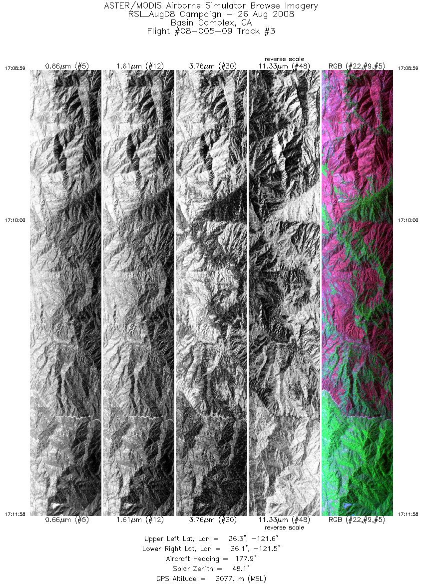
| 3 |
17:08 - 17:11 |
179.9 |
36.254 - 36.091 |
121.566 - 121.566 |
4460 |
3076 |
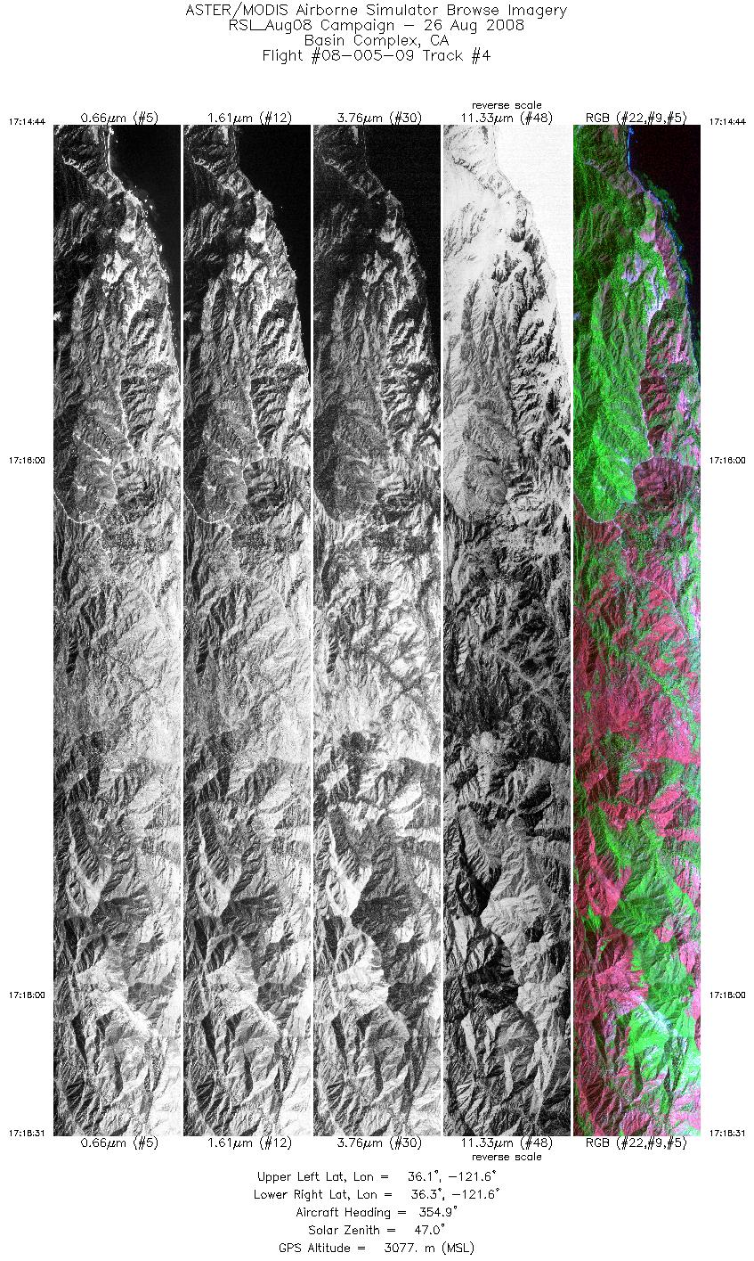
| 4 |
17:14 - 17:18 |
356.8 |
36.057 - 36.264 |
121.596 - 121.596 |
5675 |
3076 |
| 5 |
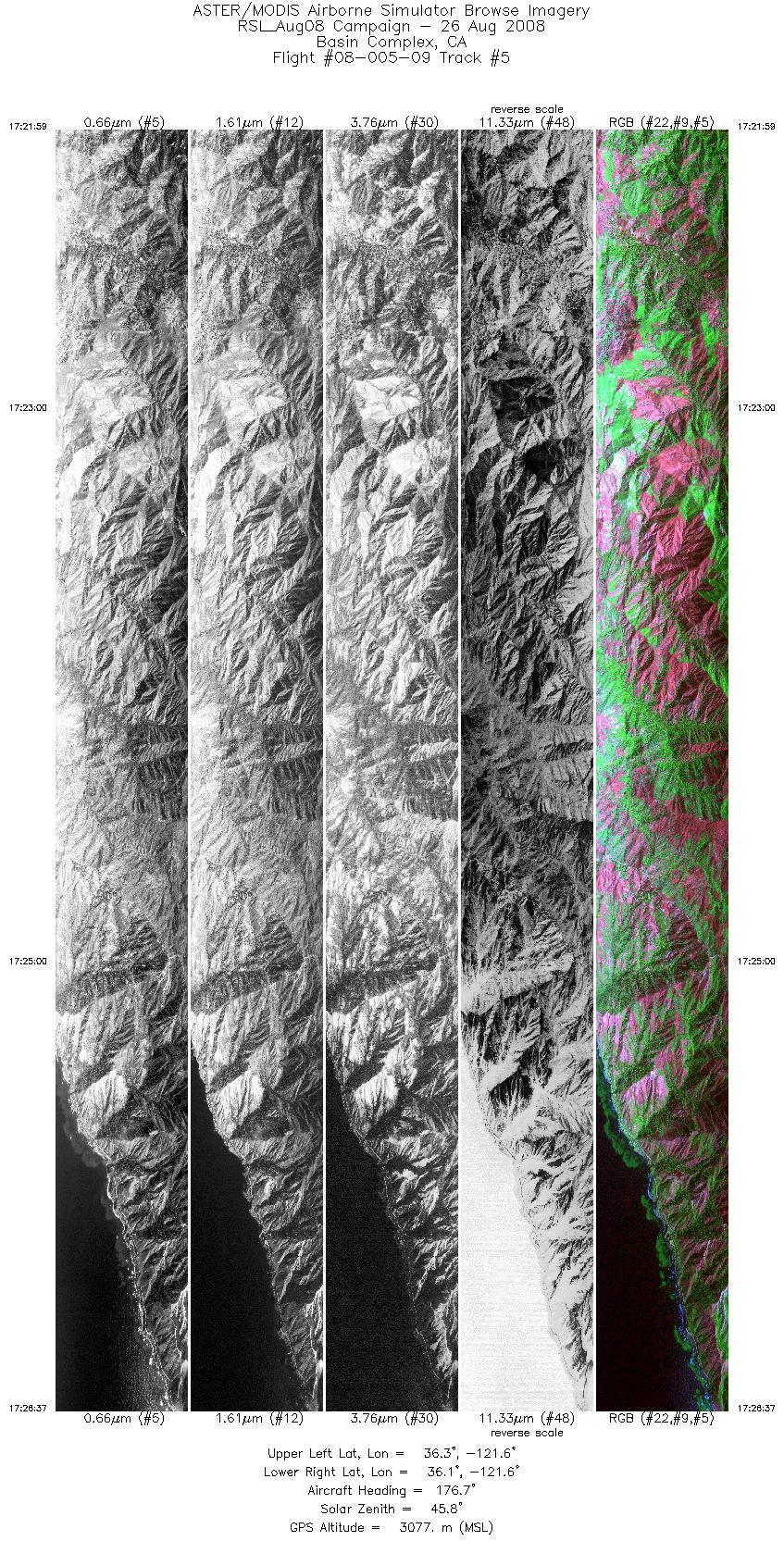
17:21 - 17:26 |
178.3 |
36.323 - 36.070 |
121.629 - 121.627 |
6925 |
3076 |
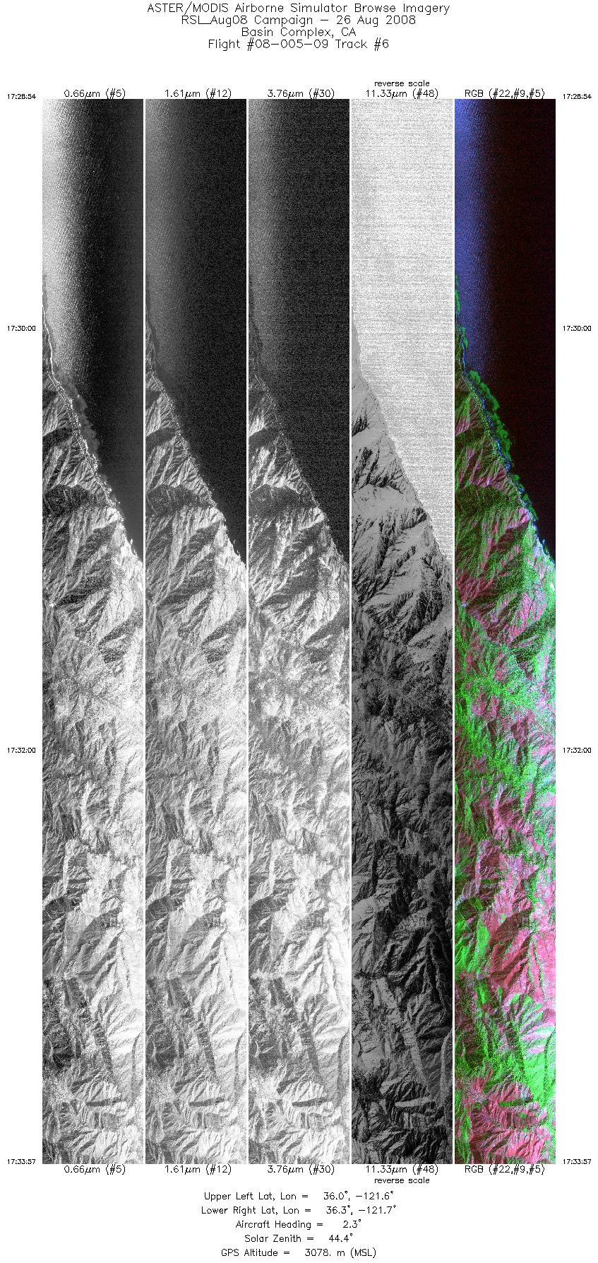
| 6 |
17:28 - 17:33 |
359.5 |
36.050 - 36.325 |
121.658 - 121.657 |
7537 |
3077 |
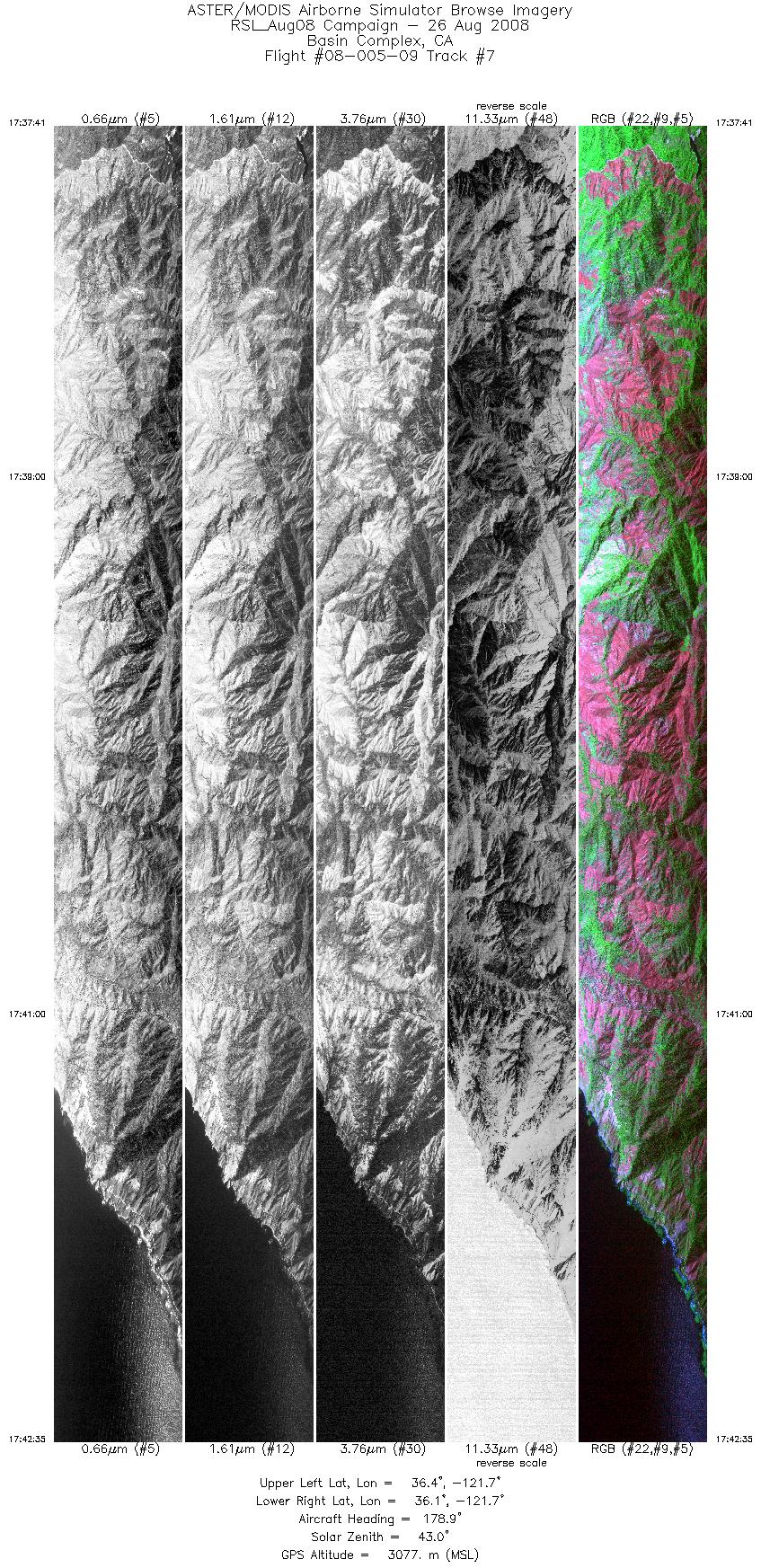
| 7 |
17:37 - 17:42 |
179.4 |
36.388 - 36.121 |
121.689 - 121.688 |
7325 |
3076 |
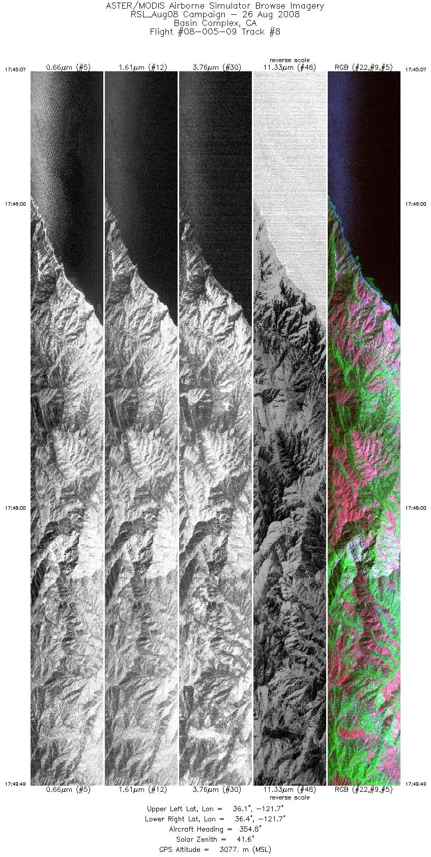
| 8 |
17:45 - 17:49 |
356.0 |
36.122 - 36.377 |
121.717 - 121.718 |
7018 |
3079 |
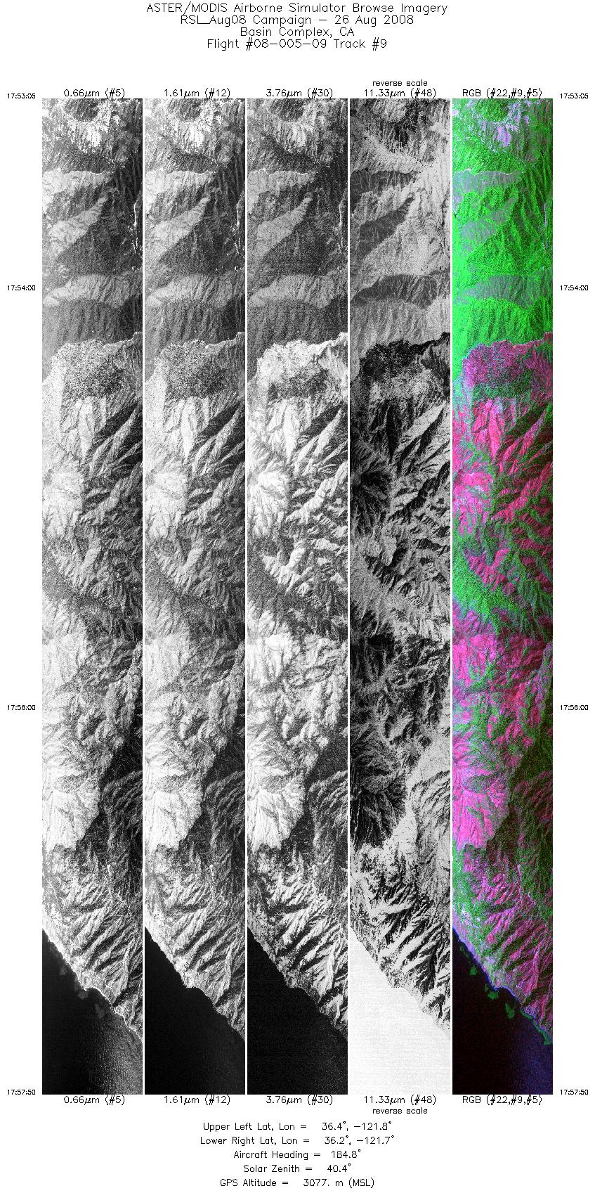
| 9 |
17:53 - 17:57 |
183.1 |
36.439 - 36.182 |
121.748 - 121.749 |
7089 |
3076 |
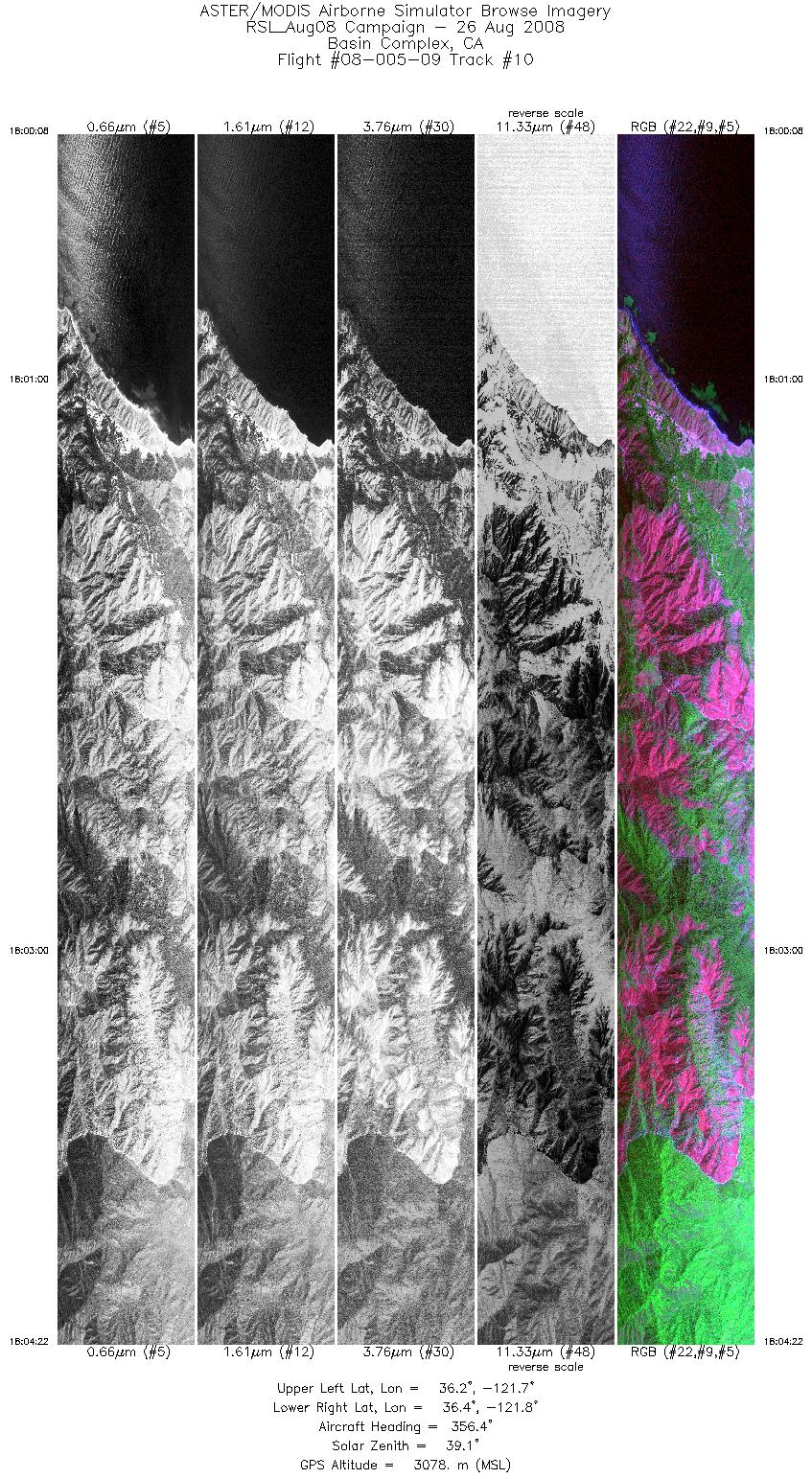
| 10 |
18:00 - 18:04 |
355.7 |
36.178 - 36.408 |
121.779 - 121.779 |
6319 |
3078 |
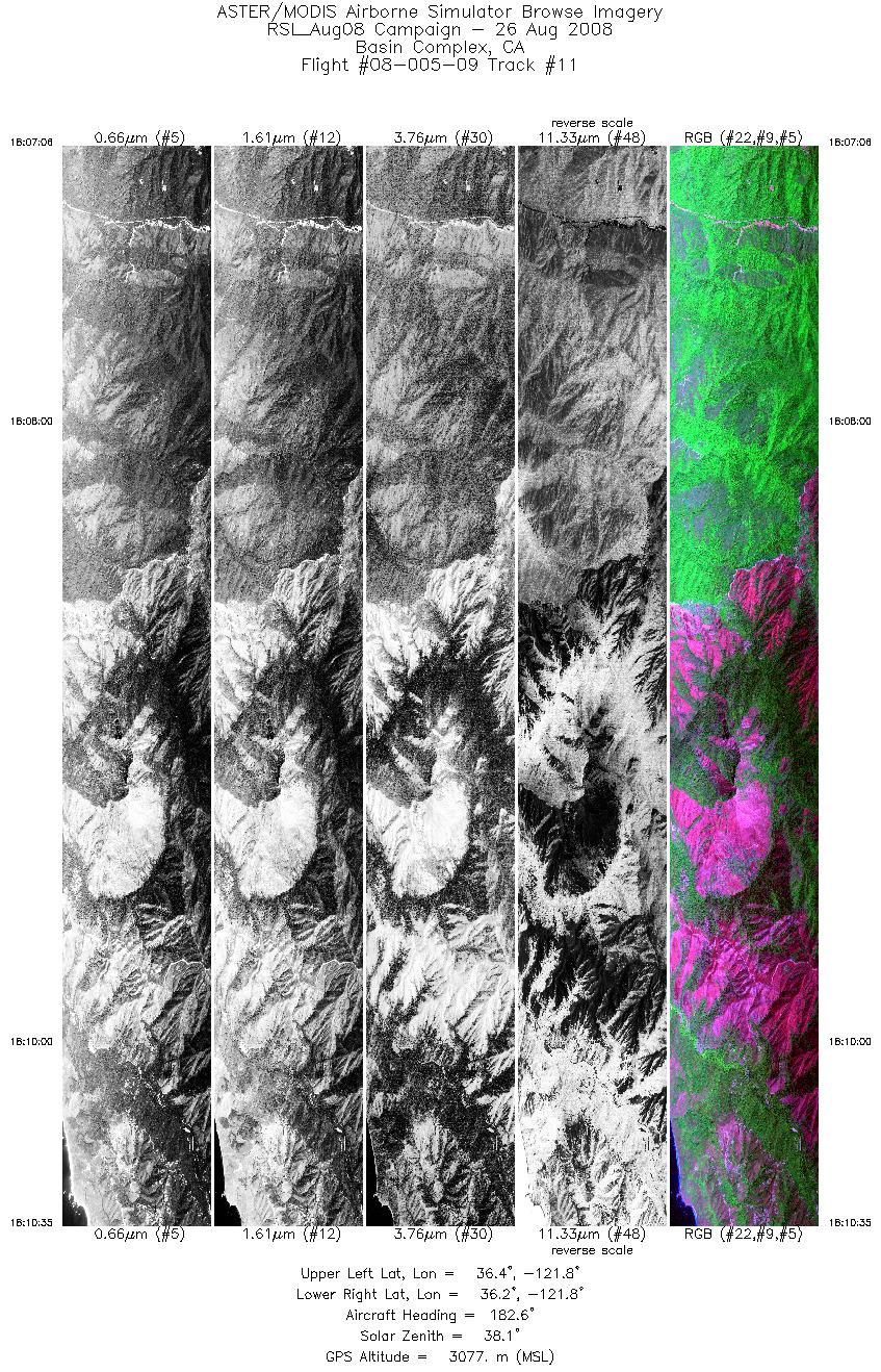
| 11 |
18:07 - 18:10 |
181.8 |
36.430 - 36.243 |
121.809 - 121.810 |
5192 |
3077 |
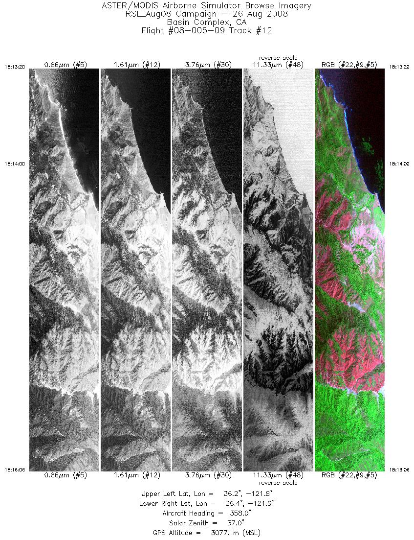
| 12 |
18:13 - 18:16 |
356.8 |
36.236 - 36.385 |
121.841 - 121.840 |
4119 |
3078 |
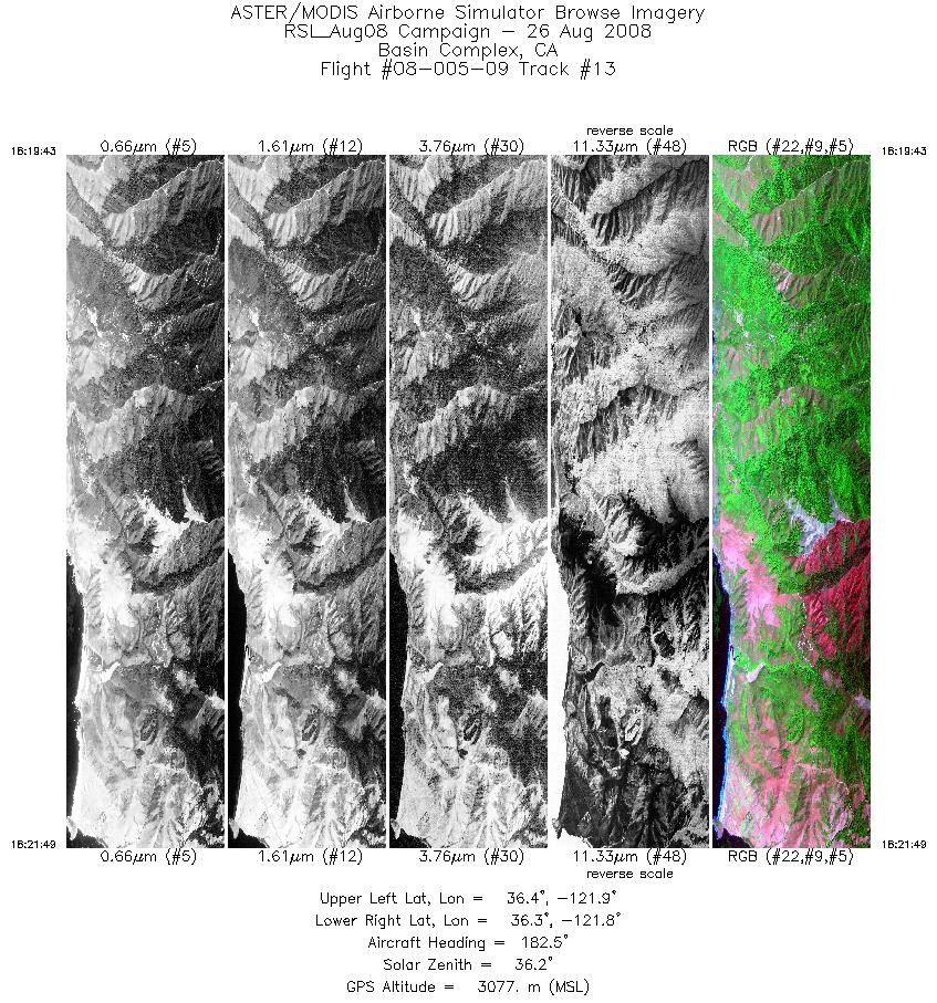
| 13 |
18:19 - 18:21 |
180.9 |
36.414 - 36.300 |
121.871 - 121.871 |
3137 |
3076 |
|


